Fig. 32
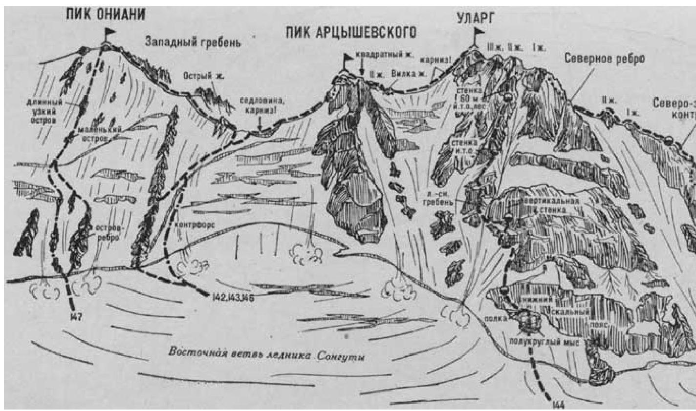
- Ularg (4358 m) via the East Ridge (combined route by Mitchell, category III, Fig. 32).
The path from the Tsейsky District base camp (group of 4–8 people) to the Artsyshevsky Peak with the initial bivouac at the Volginsky bivouac is described in route 142.
From the Artsyshevsky Peak, descend along the snowy slope of the East Ridge (cornices) to under the Kvadratny Dzhandarm.
Bypass the dzhandarm on the left along the destroyed, crumbly rocks. Behind it, exit into the couloir onto the col under the II dzhandarm and bypass it on the right with a traverse (20°) and along the snowy slope (with belay).
Further along the sharp snowy ridge (cornices), approach the dzhandarm "Vilka", pass it in the center through the fork, and descend to the col of the East Ridge.
From the col, ascend 100–120 m upwards along the narrow, sometimes steep snowy East Ridge or along its left side (cornices — piton belay). Along the heavily destroyed, simple, sometimes snow-covered rocks of the East Ridge or its left side, ascend to the summit of Ularg. From the Volginsky bivouac, it takes 5–6 hours.
Descend via the ascent route.
The duration of the route is 3 days.
Naumov A. F. Karagom, Digoria, Tsey (Central Caucasus), M., "Fizkultura i sport", 1976.