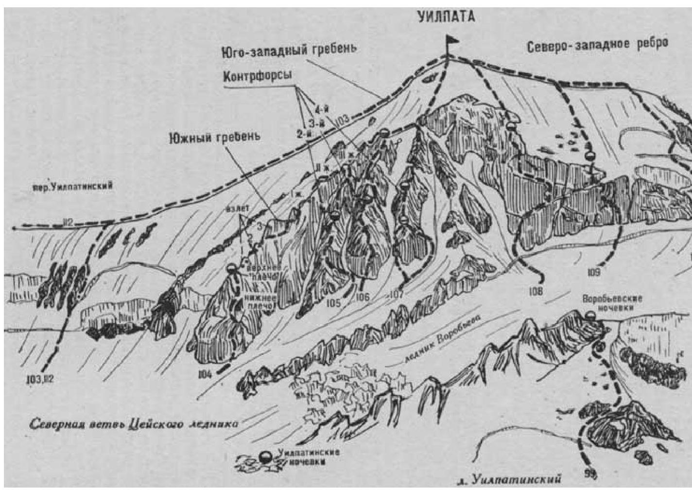
Fig. 26
- Uilpata (4668 m) via the North ridge-slope (route is ice-snow, V. Naumenko, category 4A, Fig. 26).
The path from the CSP of the Tsey region (group of 4 people) to the initial bivouac at Vorobyovskie nochevki:
- via Uilpatinsky glacier — described in route 99;
- via South and North branches of the Tsey glacier — described in routes 83 and 108.
From Vorobyovskie nochevki, turn right (when ascending from the Uilpatinsky glacier) and along Vorobyev glacier, left of the ice falls descending to the Uilpatinsky glacier, approach a steep snow slope with several rocky buttresses. The slope descends from the Songuti pass, connecting the peaks of Songuti on the right and Uilpata on the left. From the glacier, pass through the snow bridge of the bergschrund.
Further:
- pass on the left side of the steep, third couloir from Uilpata (possible rockfall);
- ascend simple and moderately difficult, heavily damaged rocks of the steep counterfort (pitched rope);
- along the ice-snow slope (possibly through a snow cornice) ascend to the Songuti pass left of the rocky gendarmes.
From Vorobyovskie nochevki — 3–4 hours.
At the pass, turn left and along the right side of its ridge (left — cornices) approach under the ice rise of the Uilpata peak. From the pass:
- straight up the steep ice slope (possible avalanches — pitched rope) to the col formed by ice falls on the left and snow-covered rocks on the right;
- overcome the col on the left side (avalanches — pitched rope);
- continue straight up the steep ice slope, bypassing small falls, to the first large crevasse;
- cross the first crevasse on a snow bridge (rope protection);
- along a more gentle ice-snow slope to the second crevasse;
- cross the second crevasse on a snow bridge;
- along the steep ice-snow slope, left of the steep ridge, ascend to the summit ridge.
On the ridge, turn left and along the snow-firn ridge (cornices) ascend to the summit of Uilpata. From the Songuti pass — 6–8 hours.
Descent via the southwest ridge (see route 103). Duration of the route — 3 days.
Naumov A. F. Karaugom, Digoriya, Tsey (Central Caucasus). M., "Fizkultura i sport", 1976.