Ascent Passport
- Ascent class — ice and snow.
- Ascent area: Caucasus, Tsey Range.
- Peak, route: Uilpata, via the left part of the southern ice slope.
- Expected category of difficulty, 3B — first ascent.
- Height difference: 900 m,
- including 500 m of wall section,
- total route length — about 800 m (wall section),
- average steepness of the route — 35°,
- steepness of the wall section — 45°.
- Number of pitons (ice): 60.
- Number of climbing hours/days: 8/1.
- Overnight stays: none.
- Leader: Sergey Vladimirovich Egorin, Candidate Master of Sports.
Participants:
- Vitaly Valentinovich Ivanov, Candidate Master of Sports
- Igor Olegovich Bondarenko, Candidate Master of Sports
- Alexander Petrovich Glazov, Candidate Master of Sports
- Alexander Pavlovich Sushko, Master of Sports
- Boris Nikolaevich Korablin, Master of Sports
- Coach: Boris Nikolaevich Korablin, Master of Sports, Honored Coach of the RSFSR.
- Departure to the route: July 23, 1995. Summit — July 23, 1995. Return — July 23, 1995.
- Organization: North Ossetian Republican Search and Rescue Service of the EMERCOM of Russia.
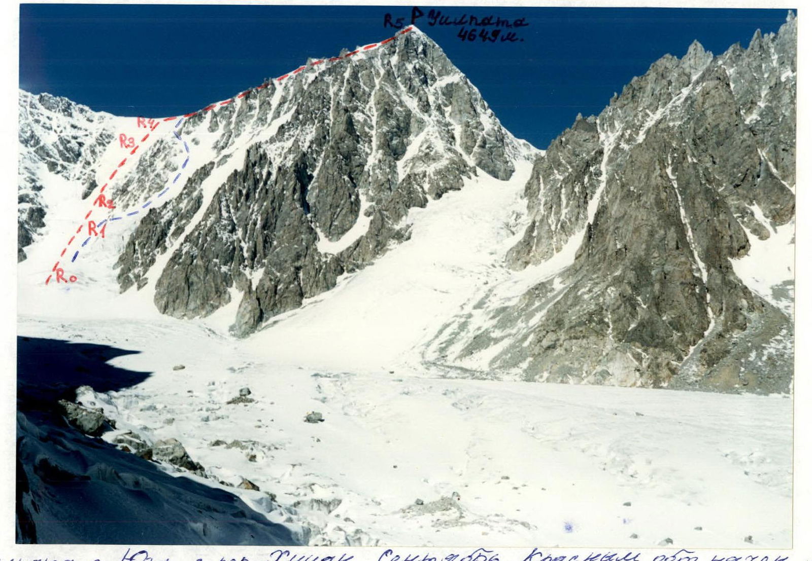 Uilpata from the South, from Khitsan Pass. September. The first ascent route is marked in red, sections 26 to 10.3 are ridge sections.
Route Description by Sections
Section R0–R1: Begin the ascent under the route, following the steep ice slope visible ahead (the main section of the route). Move up the snowy slope 20–30°, 1–2 category of difficulty.
Hazards:
- Avalanches possible on the left!
Section R1–R2: Reach the bergschrund and pass it through a snowy wall straight up (3–4 m, 4 category of difficulty). Then go straight up the snow-ice slope 2–3 category of difficulty, about 200 m, 30–35°.
Section R2–R3: Ascend the glacier, which steeply drops from the left part of the southern ice slope of Uilpata peak, staying on its right side — it's safer there. Rockfall is frequent from the slopes of TsDSA peak on the left! Section 4–5 category of difficulty, 45–50°, about 350 m.
Section R3–R4: Continue up the snow-ice slope to the saddle between TsDSA peak on the left and Uilpata peak on the right (avalanches possible). Section 2–3 category of difficulty, 30–35°. From the start of the route to the saddle — 5–6 hours.
Section R4–R5: On the saddle, turn right and ascend via the Southwest ridge (2B category of difficulty) to Uilpata peak (4649 m), bypassing difficult sections via ledges and walls 2–3 category of difficulty. From the saddle, about 1 hour.
Descent via the Southwest ridge (2B).
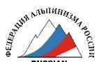
 Uilpata peak from the South. Photo from Khitsan peak. July. The first ascent route is marked.
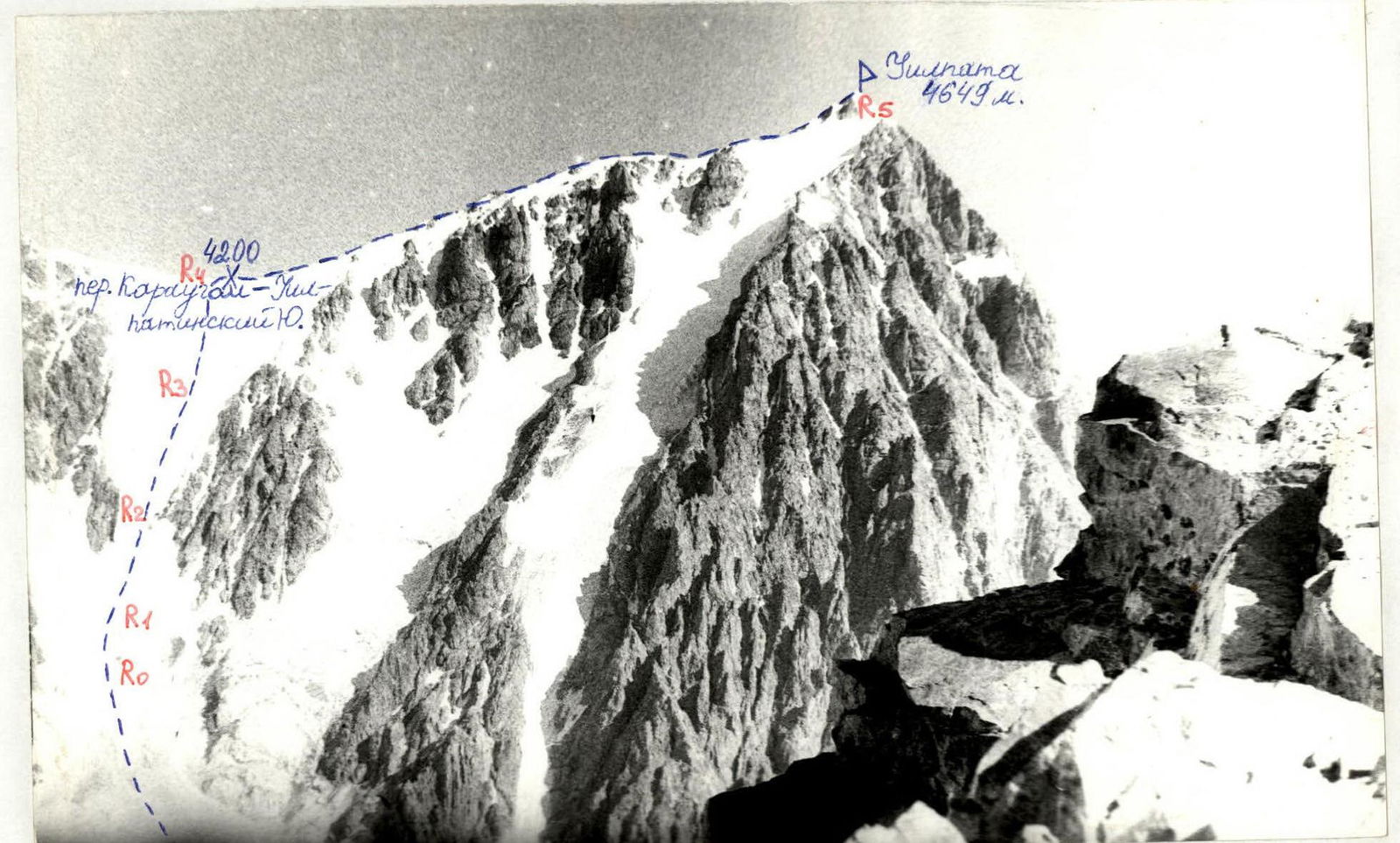
 Main part of the route, view from the South. September.
 Main part of the route, profile from the right. Photo from the Southern ridge of Uilpata peak. I. Shestipalov's route, 1B category of difficulty. September.
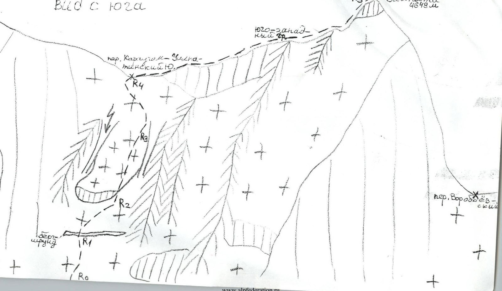 View from the South.