Oniani Peak
The peak (4200 m) is named in memory of the mountaineer Kilijbi Oniani, one of the first researchers of the area. Located in the middle part of the Tsei Ridge between the Artsyshevsky peak to the south-west and the Zolotarev peak to the north-east. The southern destroyed rocky edge of the Oniani peak turns into a short spur, limiting to the east the cirque of the Wilpatinsky glacier. The rocky platforms on the west side of the spur are named after the mountaineer Taisiya Volgina.
To the Songuti glacier from the peak descends a broken ice-and-snow slope with rare rocky outcrops, and to the south-east, to the Four glacier, towards the Tsei valley — destroyed rocky counterforts.
- Oniani Peak via Northern slope (combined route by A. Markovsky, category 3A, Fig. 32).
The path from the base camp on the Songuti river or from the CSP of the Tsei area (group of 4–12 people) to the initial bivouac on the rocky platforms under the Northern wall of the Ularg peak is described in route 144.
From the bivouac (closed crevasses) along the snow upper plateau of the Songuti glacier, approach to the left under the rocky island — the edge between two ice dumps of the Northern slope of the Oniani peak. Along the steep snowed, simple and medium-difficulty rocks of the island — edge rise to the ice-and-snow slope above the ice dumps (ice screw belay).
From here to the left — upwards (belay) along the gradually increasing steepness northern ice-and-snow slope of the Oniani peak. Overcoming along the snow bridge a wide ice crevasse, crossing almost the whole northern wall, the ascent 100–120 m along the steep ice-and-snow slope (ice screw belay) to the rocky outcrop. From it along the ice-and-snow slope approach under the long, narrow rocky outcrop under the summit rise.
Overcoming the bergshrund along the snow bridge to the left of the outcrop, go out to its left side. Further:
- Along the simple and medium-difficulty rocks of the outcrop 60–80 m straight up (piton belay).
- Further along the snow slope between two last rocky outcrops the ascent 150–200 m to the Oniani peak.
From the initial bivouac — 5–6 hours.
Descent along the ascent path or along the West Ridge (see route 116).
Duration of the route — 2–3 days.
Naumov A. F. Karaugom, Digoria, Tsei (Central Caucasus), M., «Physical culture and
sport», 1976. 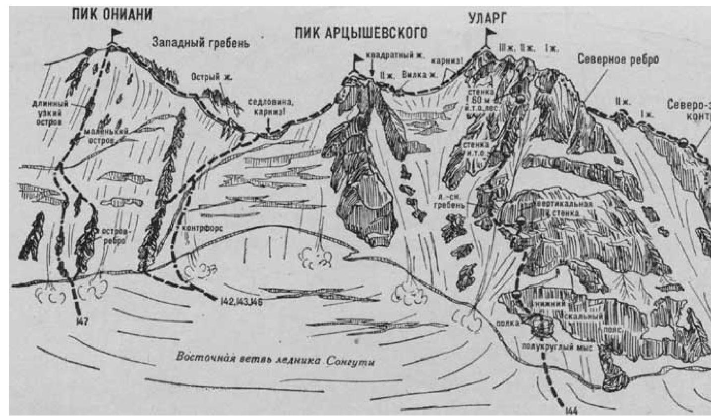
| :-- | :-- |