REPORT
On the first ascent to the peak of Kion, via the route South wall of the Eastern shoulder by the team of AK "Kaskad"
2024
I. Ascent Report
| № | 1. General Information | |
|---|---|---|
| 1.1 | Full name, sports rank of the team leader | Egorin Sergey Vladimirovich, Master of Sports. |
| 1.2 | Full name, sports rank of the participants | Puzyrev Dmitry Vyacheslavovich — 2nd sports rank, Bryukhina Anastasia Vasilievna — 2nd sports rank. |
| 1.3 | Full name of the coach | Egorin Sergey Vladimirovich |
| 1.4 | Organization | AK "Kaskad", Vladikavkaz |
| 2. Characteristics of the ascent object | ||
| 2.1 | Region | Caucasus, Rocky ridge. |
| 2.2 | Gorge | Zgid gorge, Kion massif. |
| 2.3 | Section number according to the 2013 classification table | 2.7 |
| 2.4 | Name and height of the peak | Kion, 3421 m. |
| 2.5 | Geographical coordinates of the peak (latitude/longitude), GPS | Previously determined. |
| 3. Characteristics of the route | ||
| 3.1 | Route name | Via the South wall of the Eastern shoulder |
| 3.2 | Proposed category of difficulty | 3A |
| 3.3 | Degree of route development | Variant |
| 3.4 | Nature of the route relief | Rocky |
| 3.5 | Height difference of the route | 350 m. |
| 3.6 | Route length | 1000 m. |
| 3.7 | Technical elements of the route | I category rocks — 500 m. II category rocks — 150 m. III category rocks — 200 m. IV category rocks — 140 m. V category rocks — 10 m. Movement on closed glacier — none. Rappelling (on descent) — 80 m. |
| 3.8 | Descent from the peak | Via 2A category, to the Zgid gorge. |
| 3.9 | Additional characteristics of the route | No water on the route. Snow in winter and during the off-season. |
- Characteristics of the team's actions
| 4.1 | Time of movement (team's walking hours, indicated in hours and days) | 6 hours, 1 day. |
|---|---|---|
| 4.2 | Overnights | Did not overnight. |
| 4.3 | Exit to the route | 8:00, May 1, 2024. |
| 4.4 | Reach the peak | 14:00, May 1, 2024. |
| 4.5 | Return to the road | 18:00, May 1, 2024. |
| 5. Responsible for the report | ||
| 5.1 | Full name, e-mail | Egorin S.V., es128@mail.ru |
II. Description of the Ascent
- Characteristics of the ascent object.
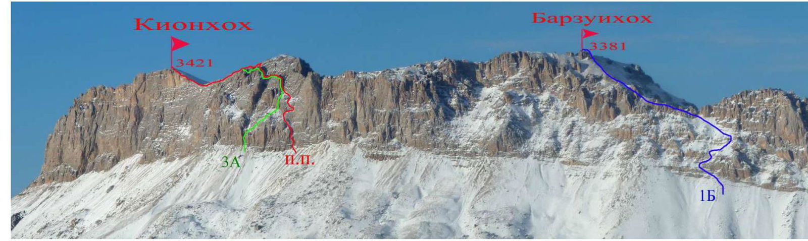
PHOTO 1. Panorama of the ascent area. February. The nearest classified routes are marked. The first ascent route is marked in red.
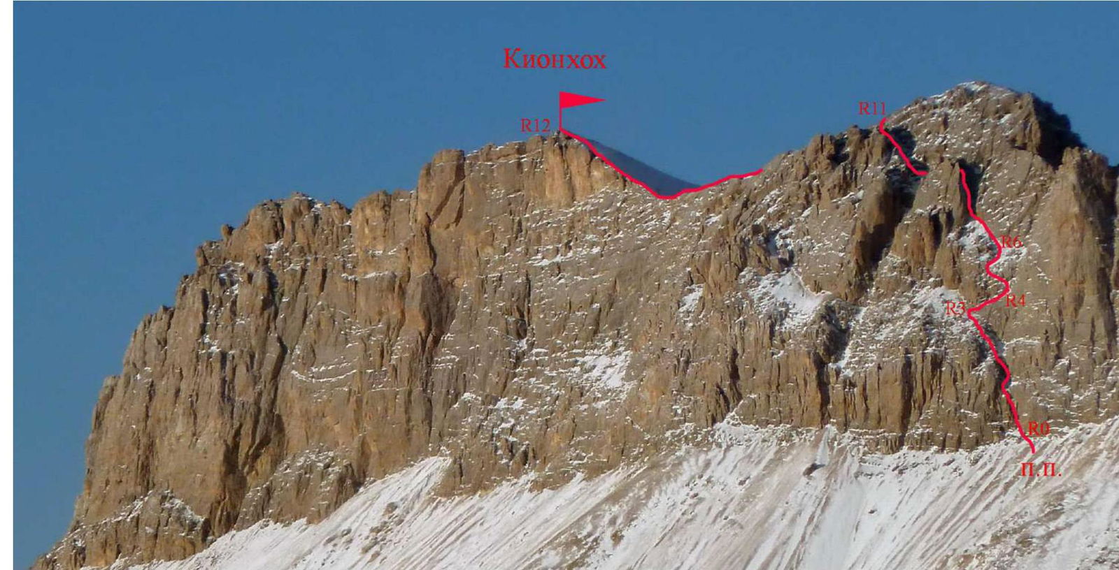
PHOTO 2. Technical photograph of the first ascent route.

PHOTO 3. Lower part of the first ascent route.
2.3. Technical characteristics of the route sections.
| Section № | Relief characteristics | Category of difficulty | Length | Type and number of pitons |
|---|---|---|---|---|
| R0–R1 | Rocky ridge | 3–5 category | 50 m. | anchor 10 pcs. |
| R1–R2 | Rocky counterforce | 2–4 category | 50 m. | anchor 8 pcs. |
| R2–R3 | Rocky-scree slope | 1–2 category | 50 m. | - |
| R3–R4 | Wall with ledges | 2–4 category | 50 m. | anchor 5 pcs. |
| R4–R5 | Wall with ledges | 2–4 category | 50 m. | anchor 8 pcs. |
| R5–R6 | Rocky-scree slope | 1–2 category | 50 m. | - |
| R6–R7 | Rocky-scree slope | 1–2 category | 80 m. | - |
| R7–R8 | Couloir with a plug | 1–4 category | 70 m. | anchor 3 pcs. |
| R8–R9 | Rocky-scree couloir | 2–3 category | 50 m. | - |
| R9–R10 | Rocky-scree couloir | 1–2 category | 100 m. | - |
| R10–R11 | Broken slabs | 3–4 category | 50 m. | anchor 3 pcs. |
| R11–R12 | Rocky-scree ridge | 1–3 category | 350 m. | - |
3. Characteristics of the team's actions
3.1. Brief description of the route passage.
Approach: from the potato fields, go left up the grassy slopes, towards the Eastern shoulder of the peak Kionkhokh (Kion). On the right part of the shoulder, a giant pillar stands out, made of reddish monolithic rocks. The route begins at the left lower part of the base of this pillar.
| Section № | Description | Photo № |
|---|---|---|
| R0–R1 | Move along the right, gray side, of a not clearly defined rocky ridge on the wall. This is the key section of the route. In the middle part, there is a 10 m section of 5th category, up to 93°. | Photo 3–6 |
| R1–R2 | From the station, along the scree couloir, approach the wall blocking the couloir. On its right part, go up to a wide rocky counterforce. Move left up along it, towards the scree terrace. | Photo 3, 7–9 |
| R2–R3 | Along the rocky-scree slope, approach the left part of the reddish monolithic rocks. Here, a system of ledges begins on the right. | Photo 10 |
| R3–R4 | Traverse right along the wall with a system of ledges. In the initial third of the section, traverse along a narrow ledge, under an overhang — a psychological spot. Move right to the gray rocks, beyond a rocky ridge not clearly visible from below. | Photo 10, 11 |
| R4–R5 | Continue left up along the wall with small ledges, to the base of a steep scree terrace. | Photo 12, 13 |
| R5–R6 | Along the scree terrace, approach the rocks. Move straight up. | |
| R6–R7 | Along the rocks, along the terrace, move left up. Gradually, the terrace narrows into a couloir. Along it, reach a large stone blocking the couloir. | Photo 14 |
| R7–R8 | Bypass the plug in the couloir on the right, along the wall with a small number of handholds. Further, straight up along the couloir, through short walls, like "ram's foreheads". Reach the shoulder of the wall. | Photo 15 |
| R8–R9 | From the shoulder, rappel west, about 15 m, to scree ledges. Further, the next couloir and exit to the shoulder are visible. | |
| R9–R10 | Under the rocks, reach the base of the scree couloir. Straight up along it to the shoulder of the wall. | Photo 16 |
| R10–R11 | From the shoulder, move right up along broken rocky slabs and a system of ledges. Organization of intermediate belay is difficult. | |
| R11–R12 | After reaching the Eastern ridge, the further path goes mainly along the ridge line, with small detours to the north. | Photo 17 |
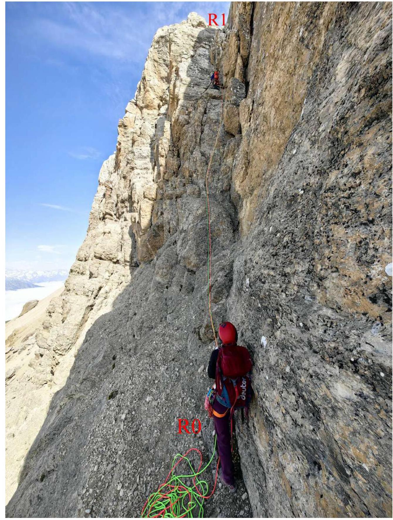
PHOTO 4. Beginning of the route passage. Organization of belay on section R0–R1.
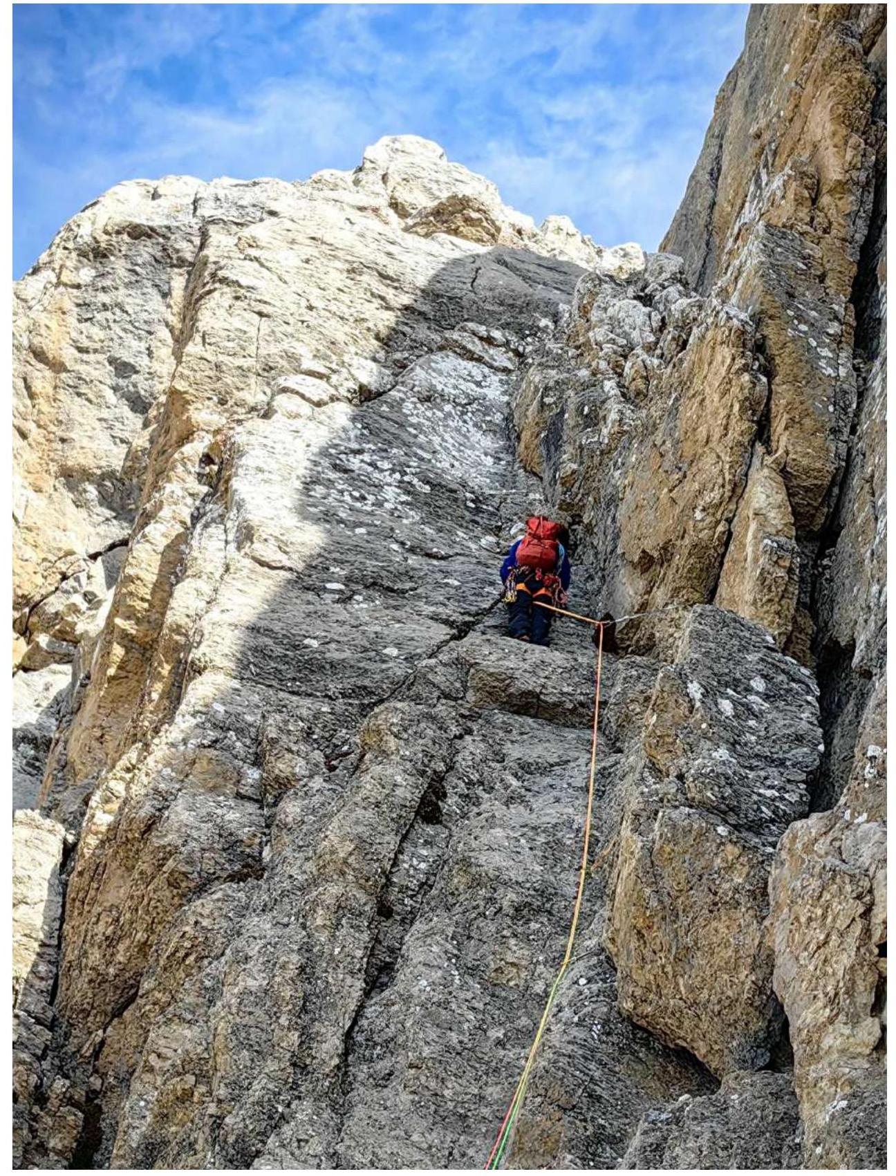
PHOTO 5. Passage of the middle part of section R0–R1.

PHOTO 6. Passage of the key section of the route.
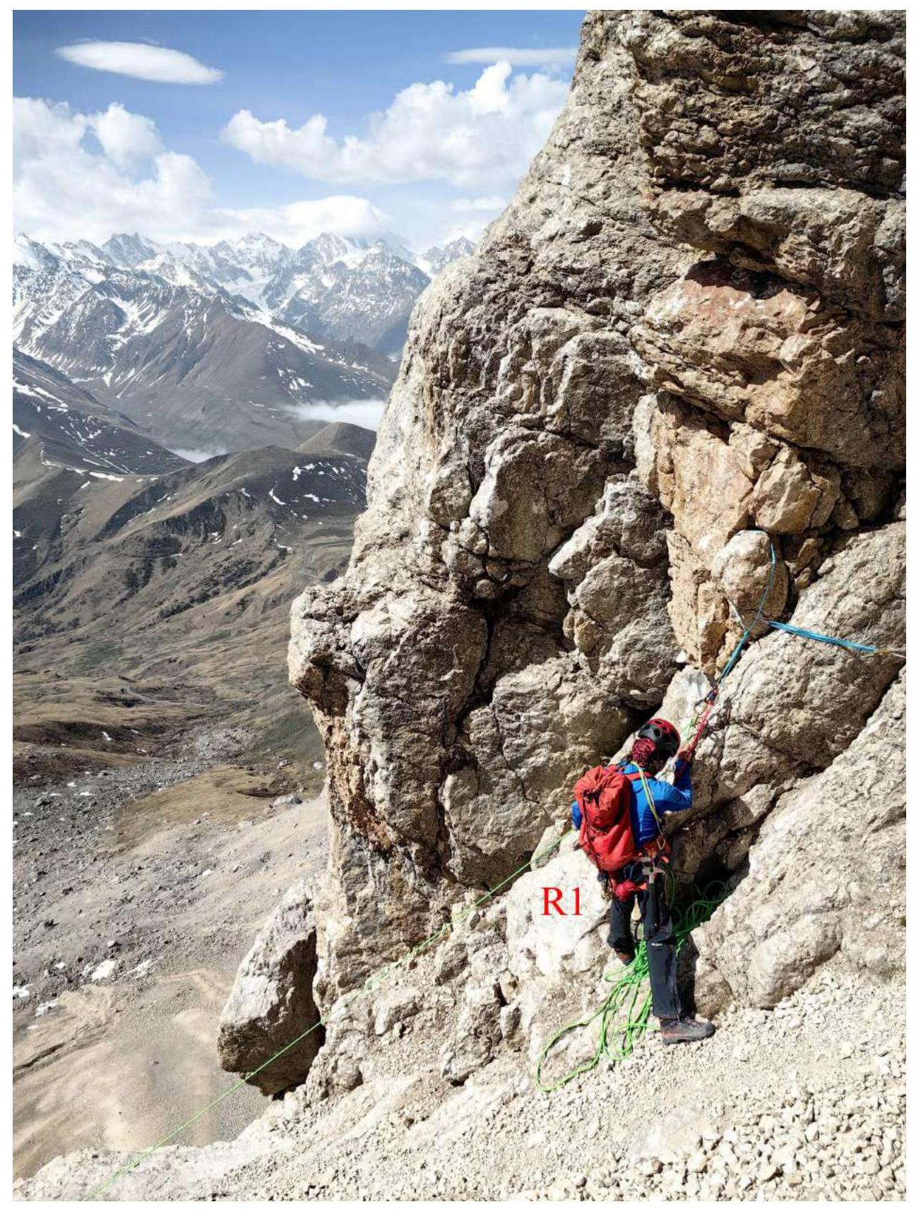
PHOTO 7. Organization of top belay for the third team member.
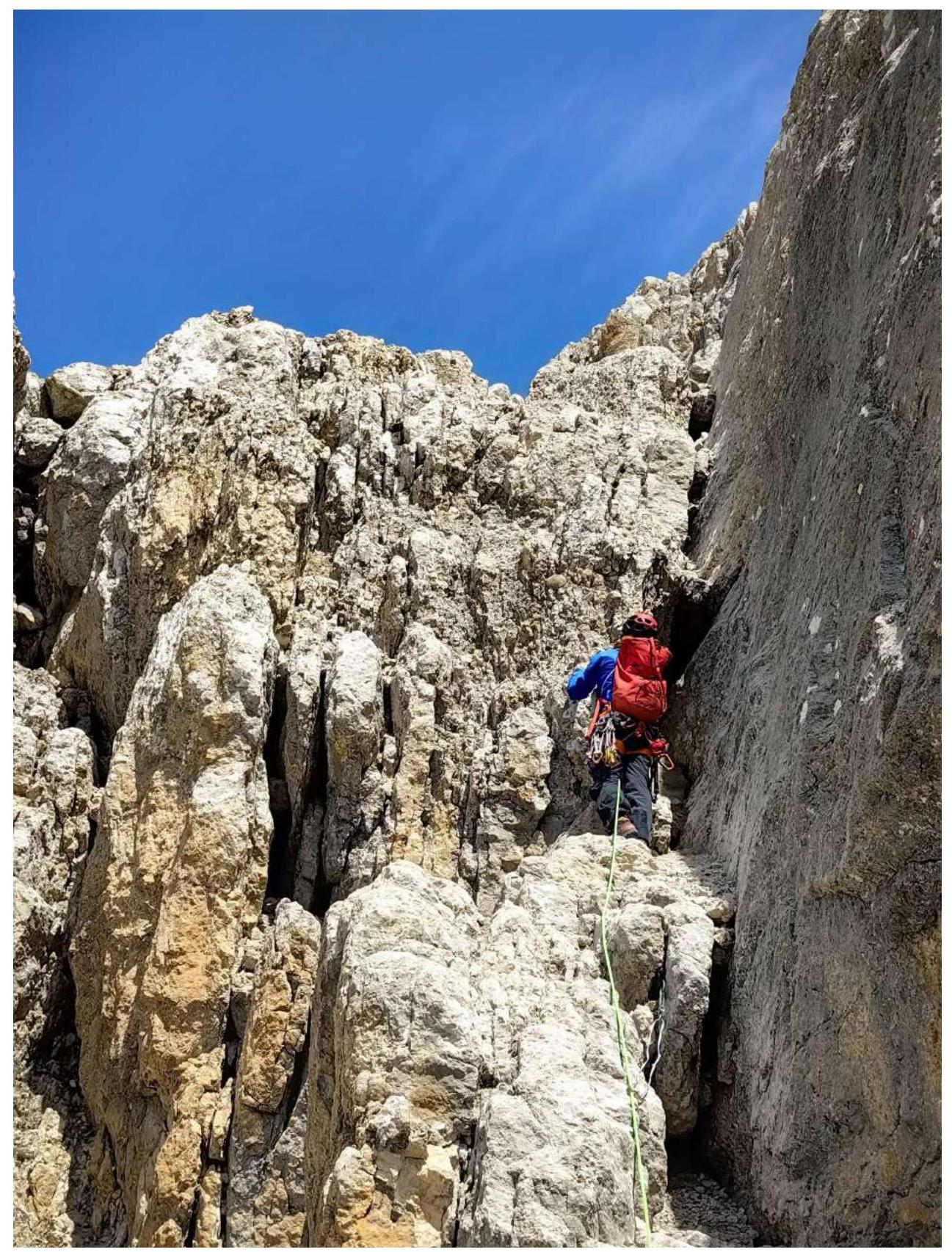
PHOTO 8. Passage of the wall blocking the couloir. Section R1–R2.
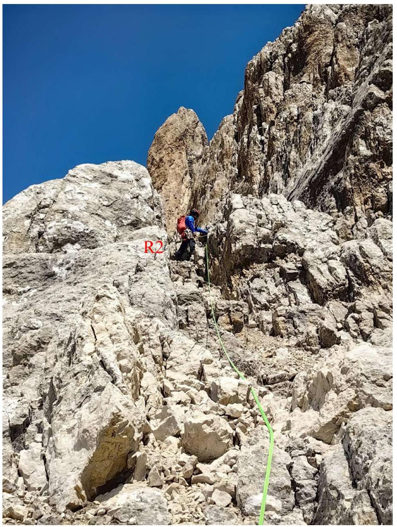
PHOTO 9. End of section R1–R2.
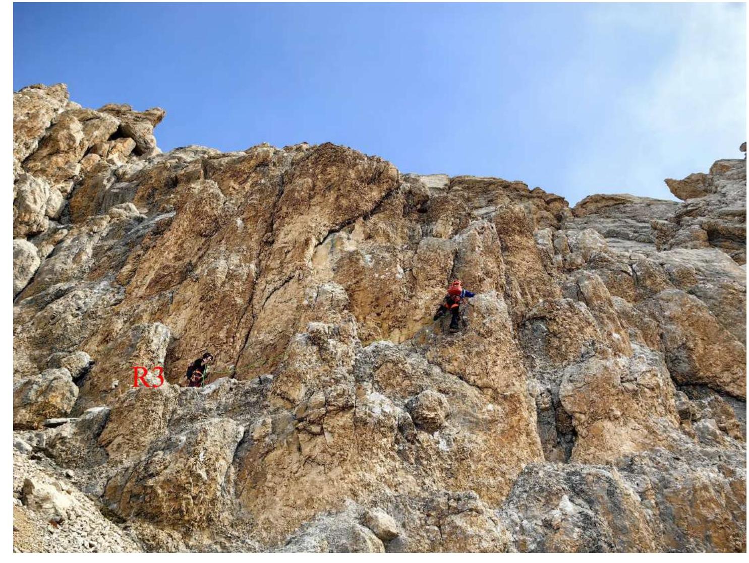
PHOTO 10. Passage of section R3–R4.
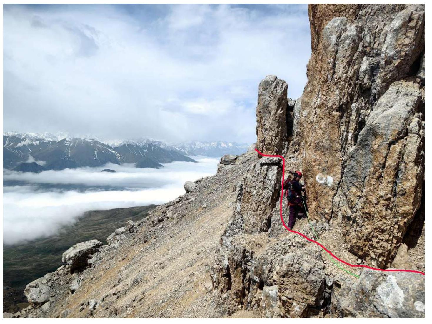
PHOTO 11. Traverse on section R3–R4.
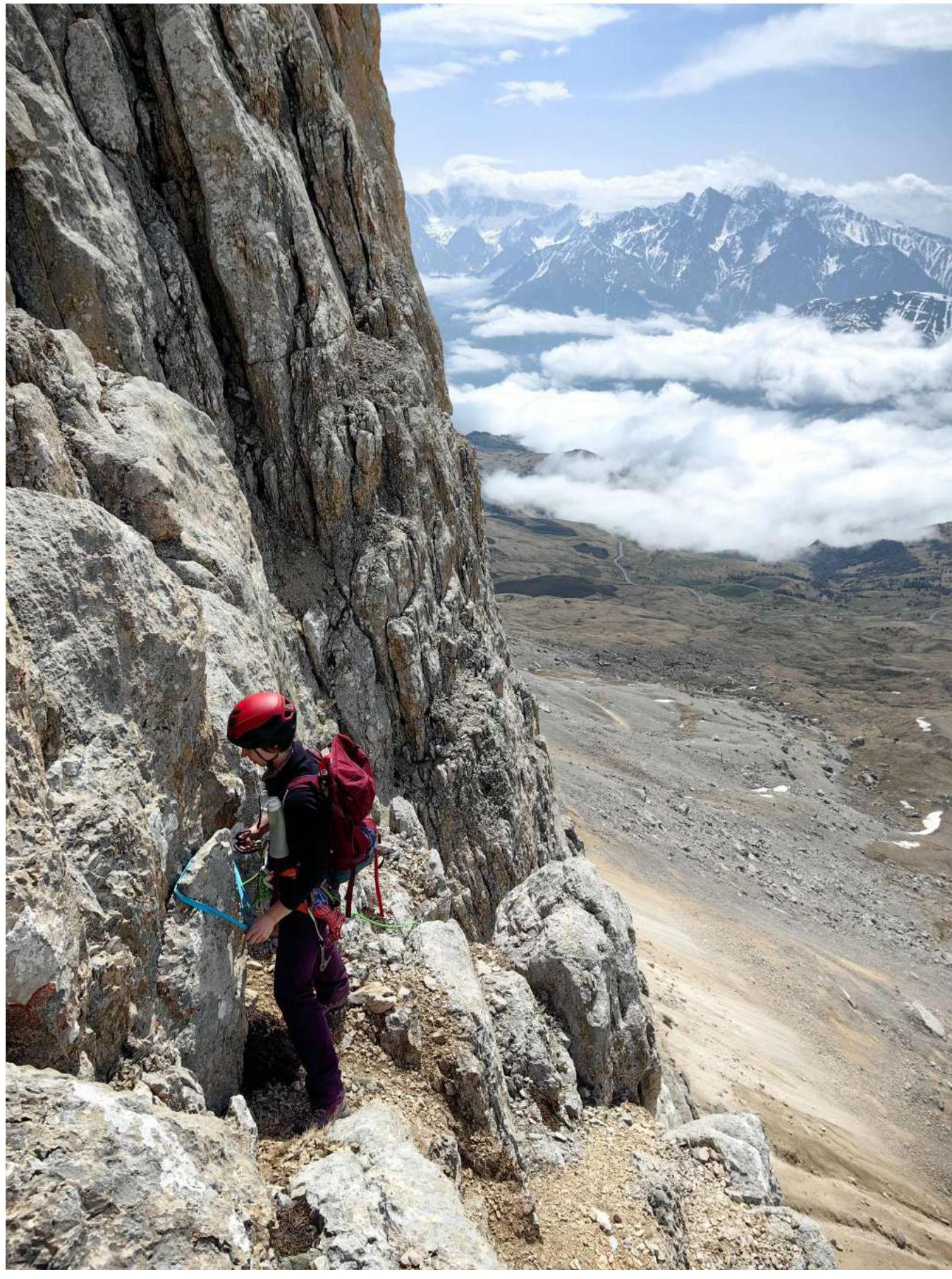
PHOTO 12. Organization of intermediate belay on a ledge. Section R4–R5.
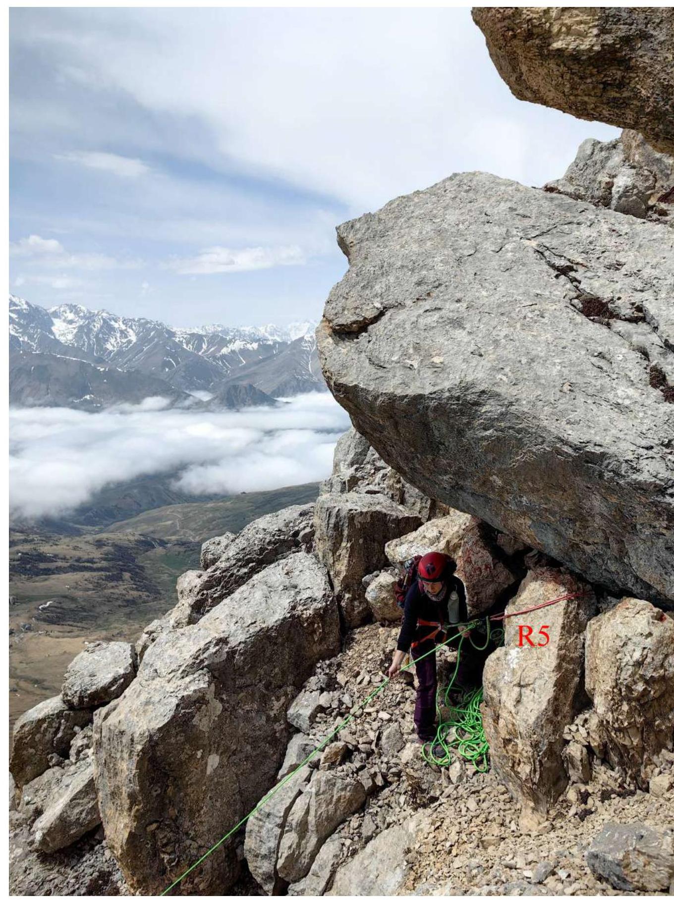
PHOTO 13. Organization of top belay for the third team member.
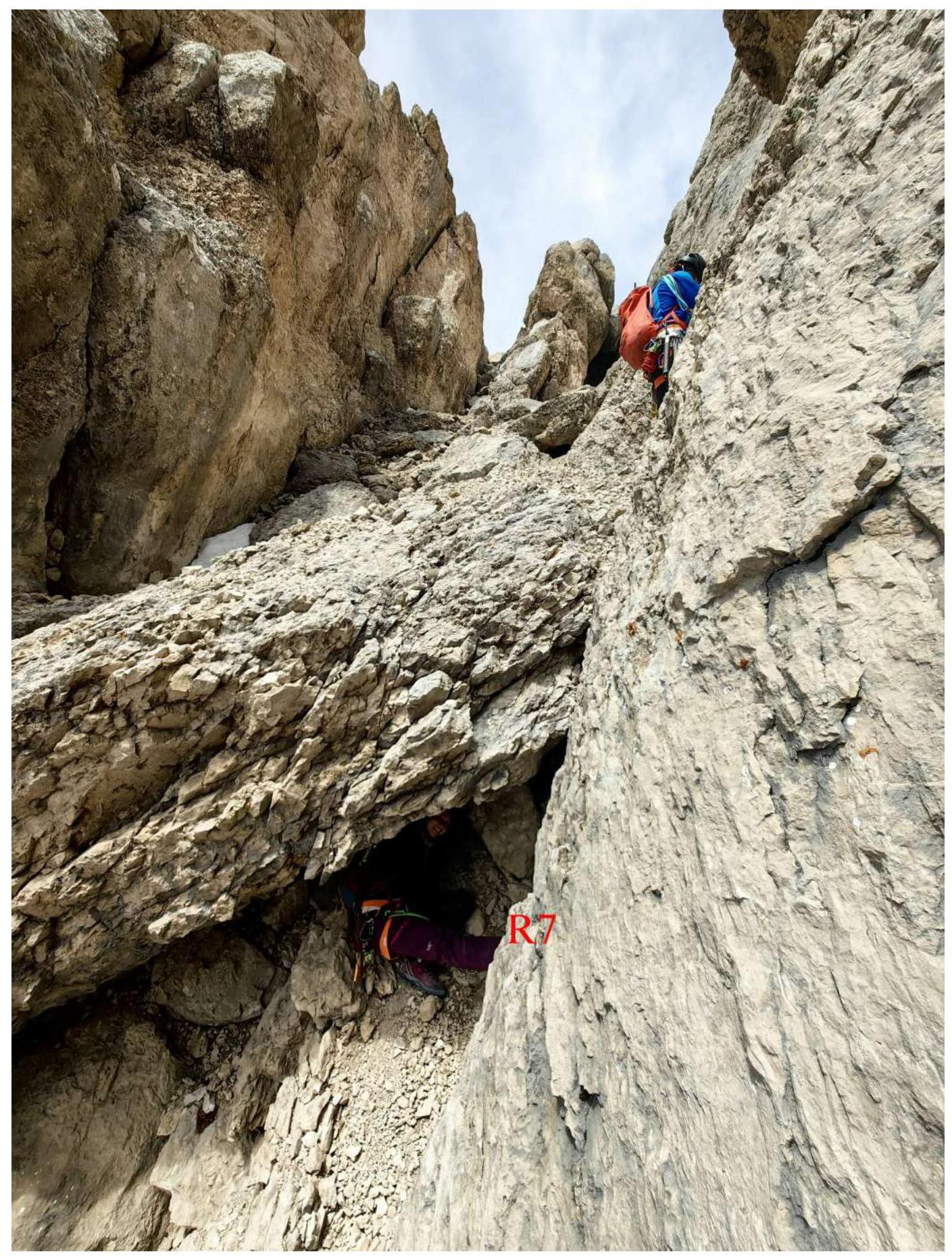
PHOTO 14. Bypass of the plug in the couloir.

PHOTO 15. Exit along the couloir to the shoulder of the wall. Section R7–R8.
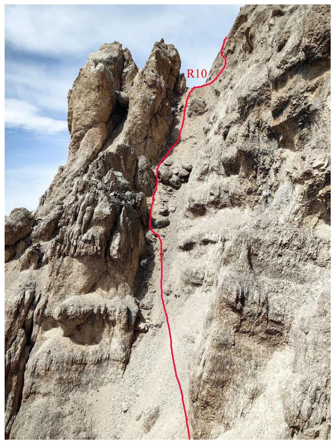
PHOTO 16. Path along the scree couloir. Section R9–R10.
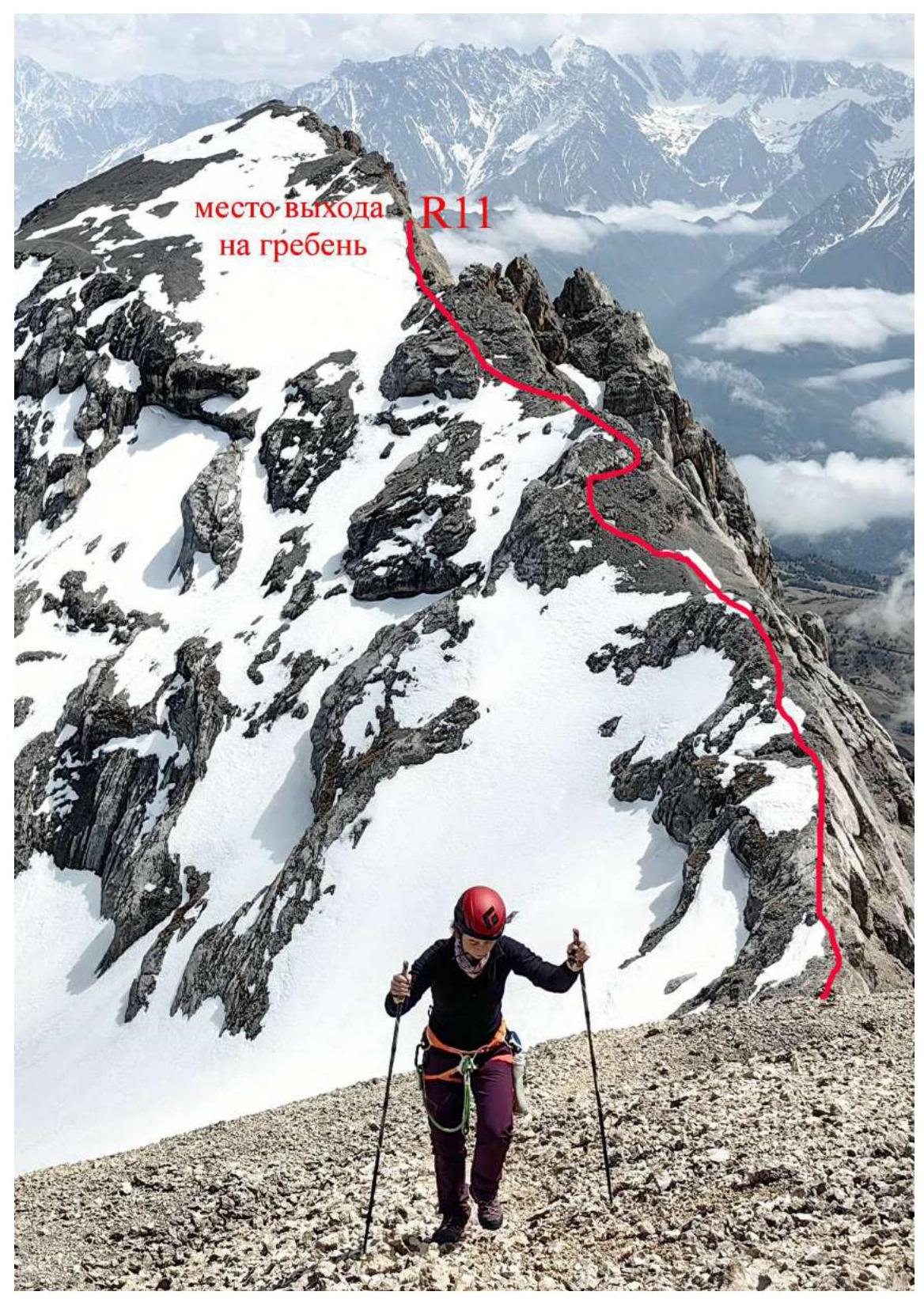
PHOTO 17. Movement along the Eastern ridge to the peak of Kion.
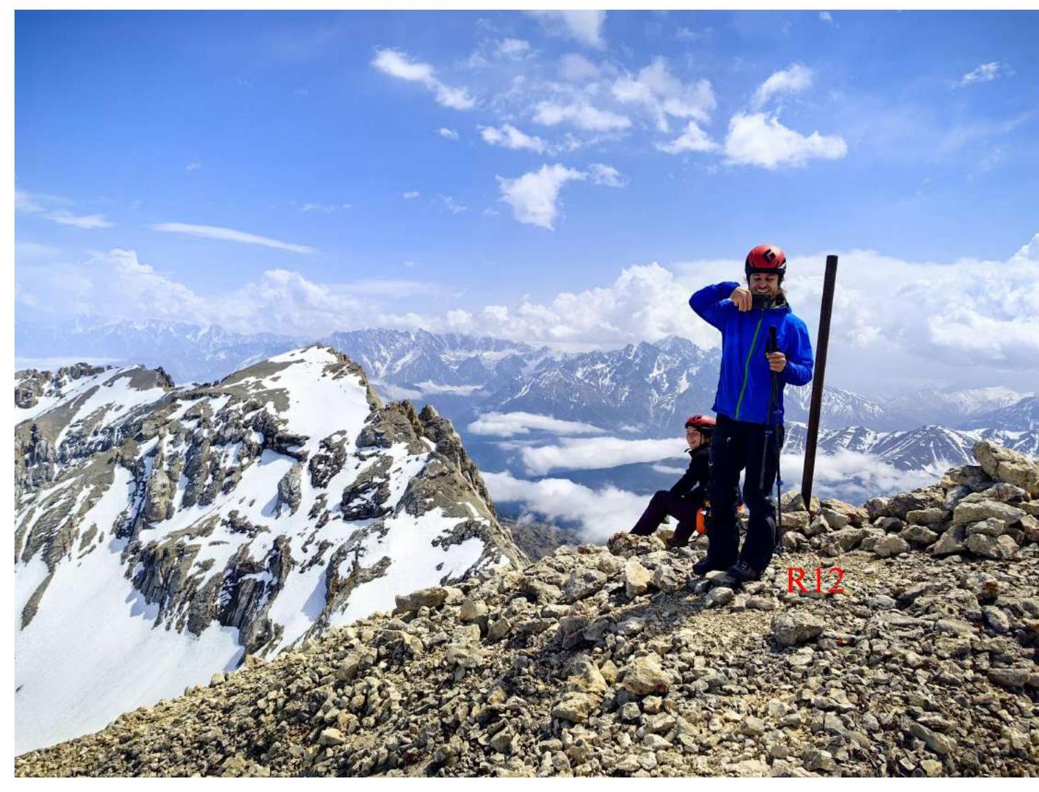
PHOTO 18. On the peak of Kion.
3.3. Assessment of the route's safety. Options for communication on the route. Recommendations for subsequent climbers.
The wall section of the route coincides by a third with Yu. Levkovsky's route from 1996. Therefore, it is recommended to put them in the same point of the Classifier.
The passed route goes through more monolithic rocks compared to the 1996 route. It has fewer traverses and is more logical.
From shoulder R10, instead of turning right to the ridge, one can turn into the next couloir along Levkovsky's group's path, but the exit to the ridge is now collapsed and consists of broken rocks.
There is some cell phone coverage ("Megafon") on the route. Descent from the peak is via route 2A, but it's safer to deviate from the ridge saddle to the south via route 1B to Barzuikhokh.
It's not recommended to send two groups simultaneously to Kion via 2A and 3A, as the wall section of 3A is located directly under the key section of route 2A, and there's a risk of dropping rocks on each other.
The orography of the route is complex, so many photographs have been added to the report to help navigate the route.