Ascent Passport
- Ascent class — rock climbing.
- Ascent area: Caucasus, Skalisty Range.
- Peak: Kion-Khokh (3421 m), via the East Ridge.
- Estimated category of difficulty — 2A, first ascent.
- Height difference: 400 m, total route length — about 2500 m. Average steepness of the route — about 20°.
- Number of pitons hammered on the route: 4.
- Number of moving hours/days: 5 hours – 1 day.
- Overnight stays: none.
- Leader: Sergey Egorin, Candidate for Master of Sports.
Team members:
- Vitaly Ivanov, Candidate for Master of Sports
- Anatoly Abisalov, 3rd sports category
- Igor Bondarenko, Candidate for Master of Sports
- Coach: Boris Korablin, Master of Sports, Honored Coach of the RSFSR.
- Departure to the route: April 20, 1996.
Reached the summit — April 20, 1996. Return — April 20, 1996.
- Organization: North Ossetian Republican Search and Rescue Service of the Ministry of Emergency Situations of Russia.
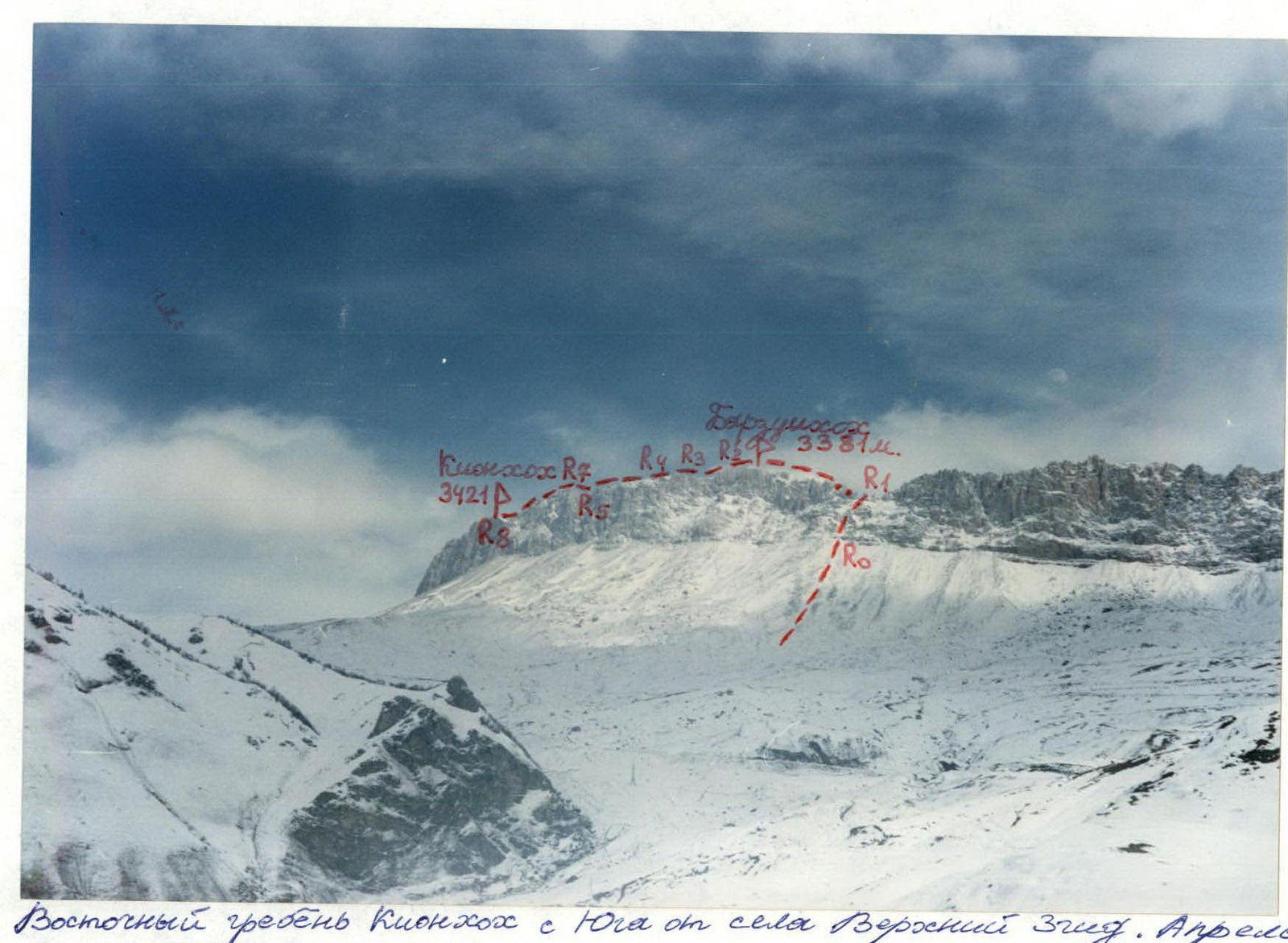
East ridge of Kion-Khokh from the South from the village of Verkhny Zgid. April.
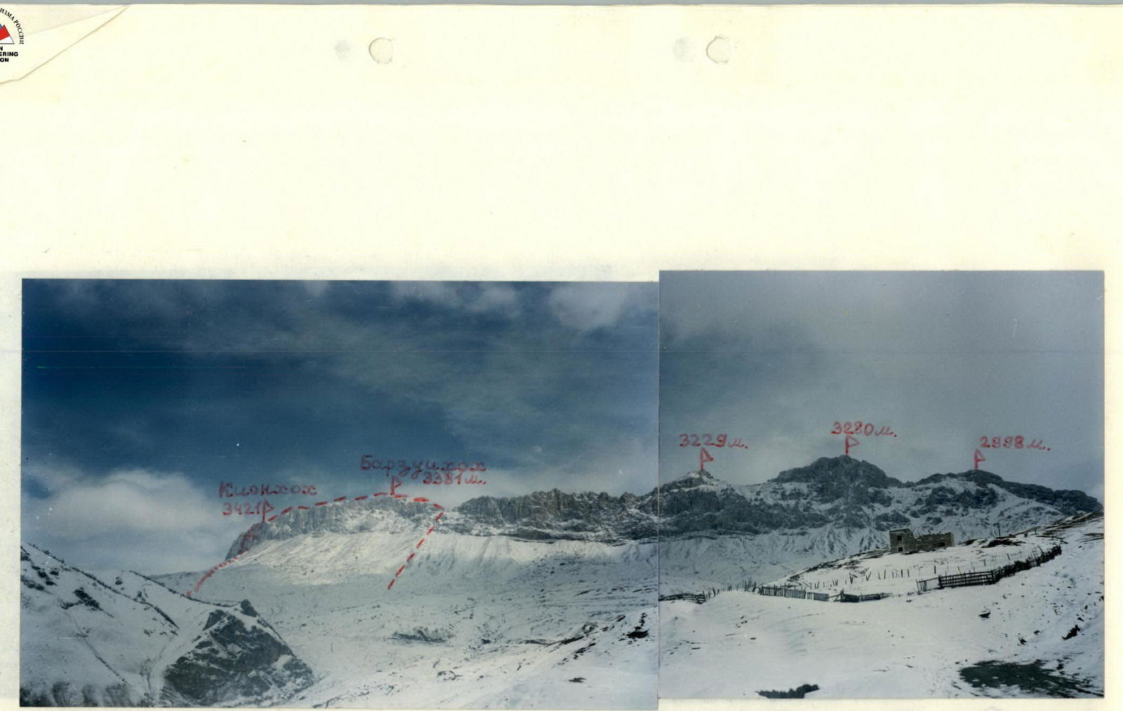
Photopanorama of the ascent area. View from the Southeast from the village of Verkhny Zgid. April. The first ascent route is marked.
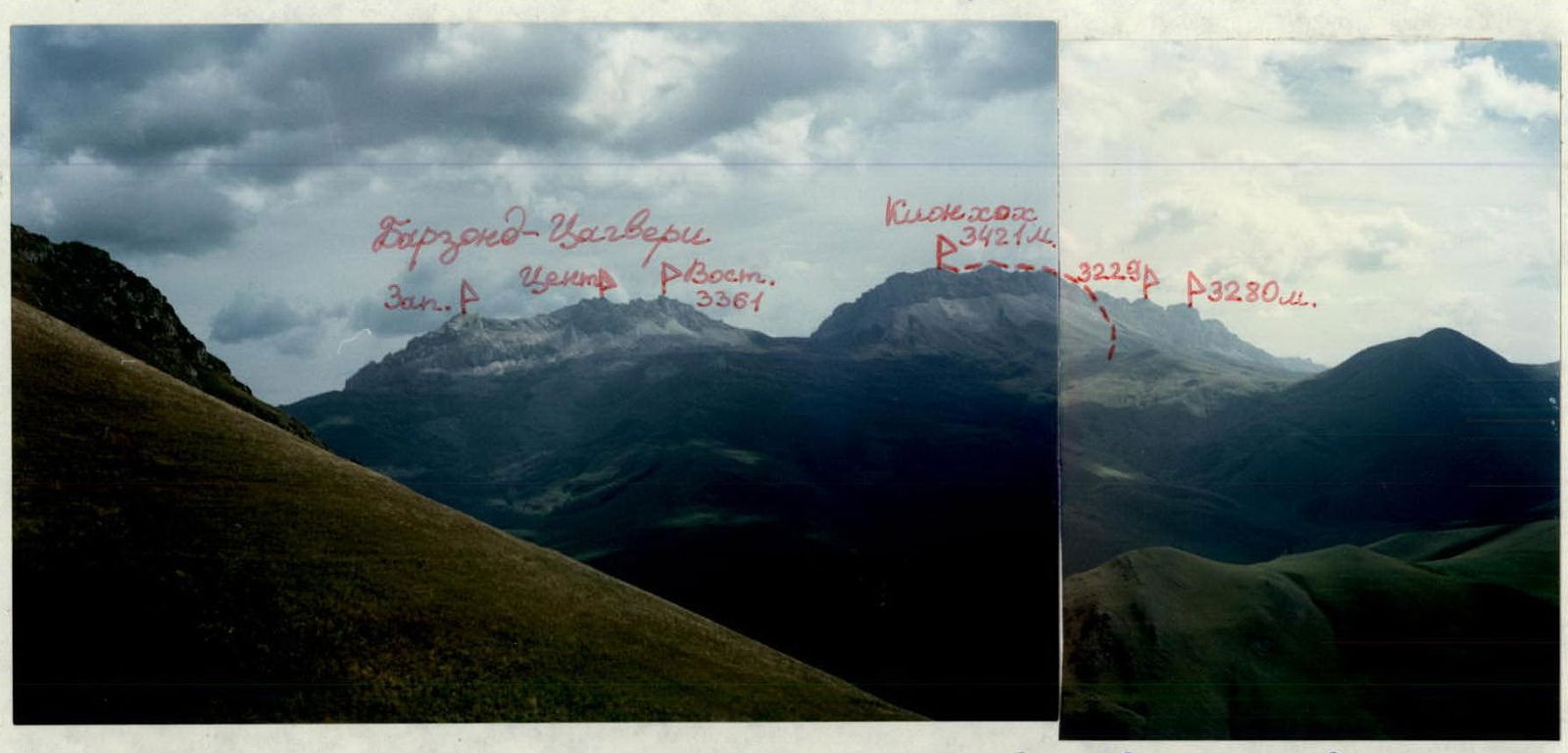
Photopanorama of the ascent area. View from the Southwest from the left side of the Sangutidon river gorge. September. The first ascent route is marked.
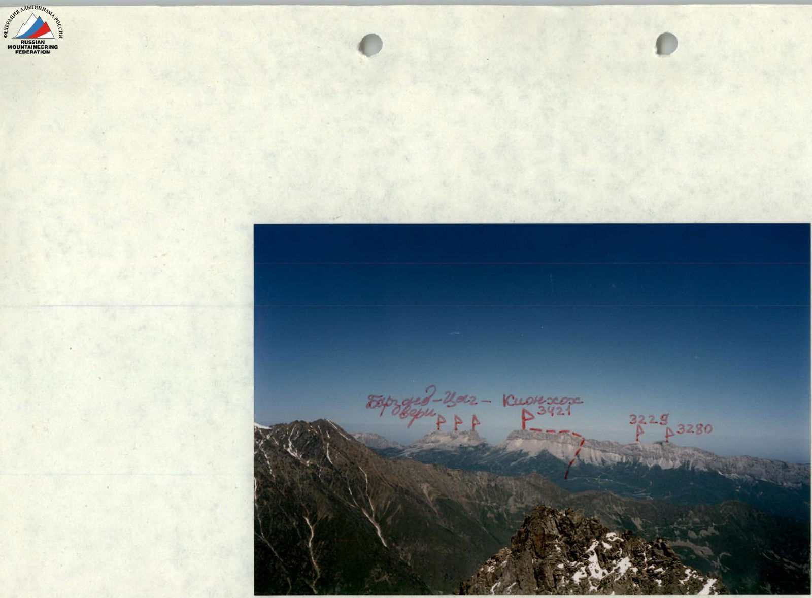
Photopanorama of the ascent area. View from the South from the peak Vizbor. July. The first ascent route is marked.
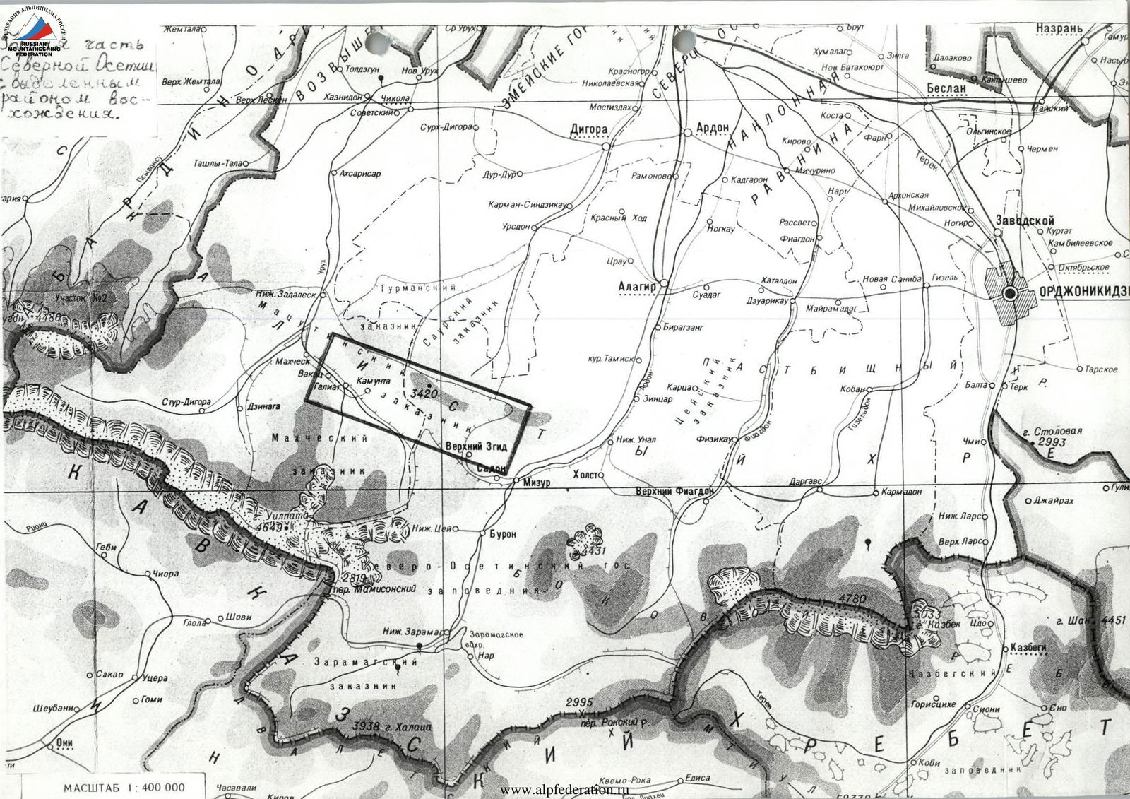
SCALE 1:400 000
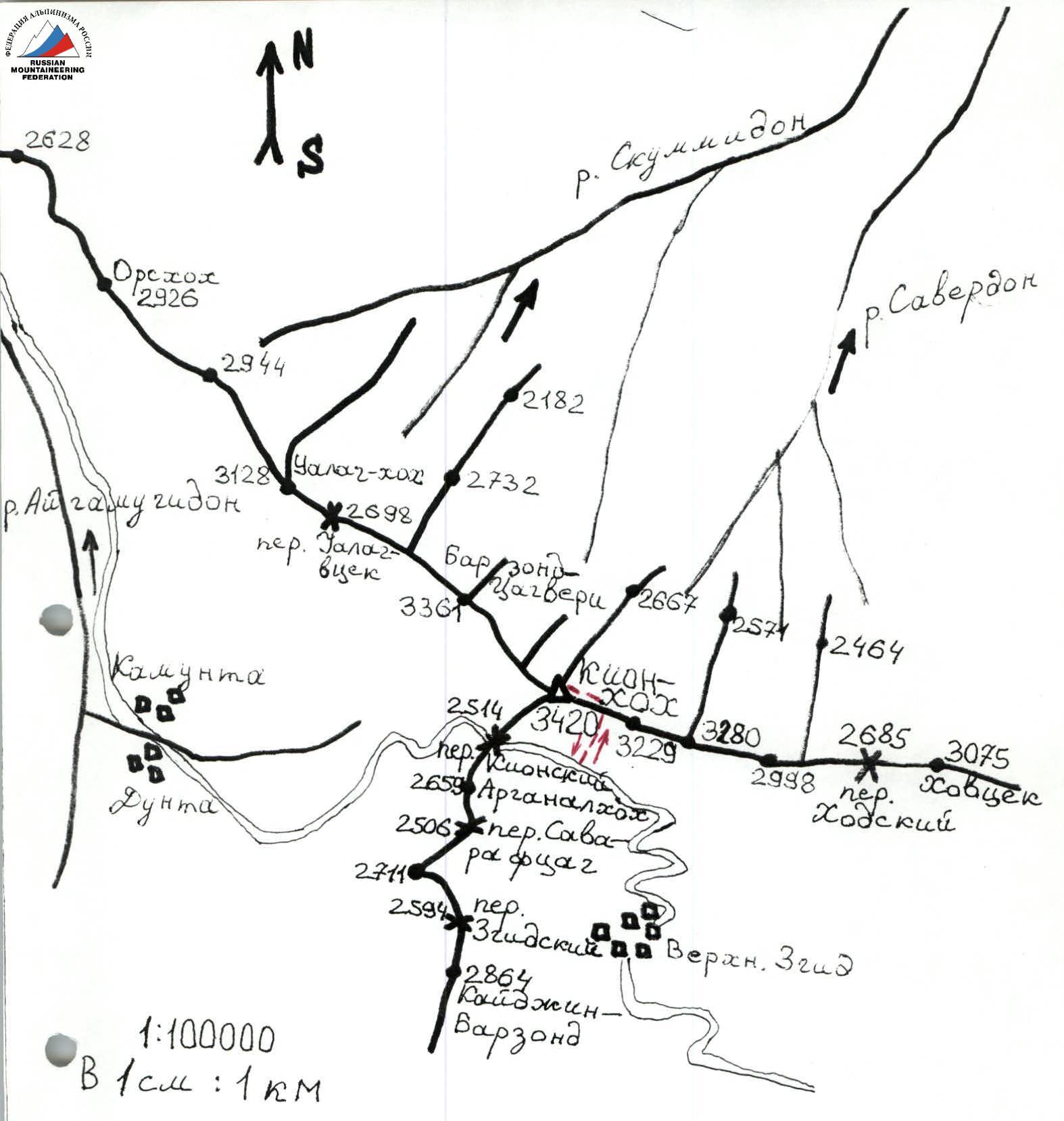
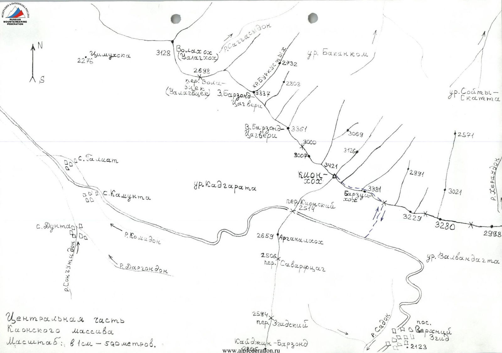
1:100 000 In 1 cm: 1 km
2571
3021 3020 2998 3021 3020 3021 3020 3021 3021 3020 3021 3021 3020 3021 3021 3021 3020 3021 3021 3020 3021 3021 3021 3021 3021 3021 3021 3021 3021 3021 3021 3021 3021 3021 3021 3021 3021 3021 3021 3021 3021 3021 3021 3021 3021 3021 3021 3021 3021 3021 3021 3021 3021 3021 3021 3021 3021 3021 3021 3021
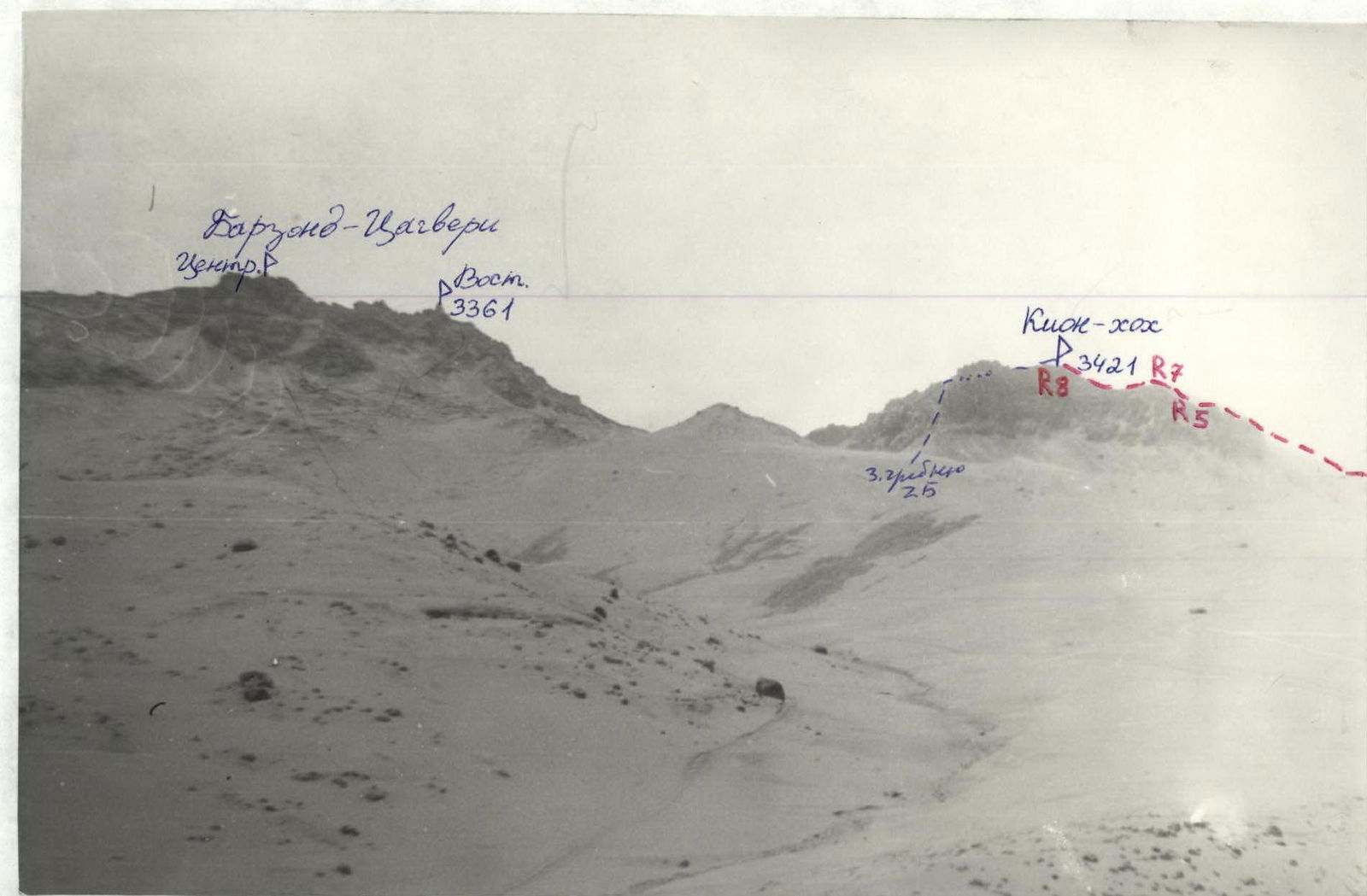
View to the Northeast from the village of Kamunta. The first ascent route is marked. April, after snowfall.

East ridge of Kion-Khokh from the South. Photo from the road to Kion Pass. April. The first ascent route is marked.
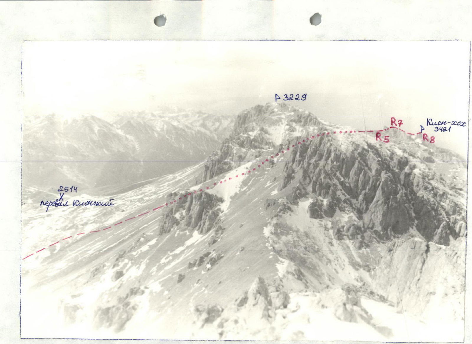
East ridge of the peak 3229 m. Photo from the peak 3280 m. February. In the background, the East ridge of Kion-Khokh (3421 m). The route along this ridge to Kion-Khokh is marked. Profile on the right.
Brief overview of the ascent area
The Kion massif is located on the territory of the Republic of North Ossetia — Alania in the Skalisty Range between the Ardon River to the East and the Urukh River to the West. In its Western and Eastern parts, the main ridge of the massif reaches heights of up to 2700–2800 m at its highest peaks. The most interesting part in terms of sports — the central part of the massif (from the peak Ualag-Khokh to the peak Khovtsek) has heights of more than 3000 m over a distance of almost 12 km. The entire massif stretches in a latitudinal direction and has a total length of about 30 km. The highest point of the Skalisty Range in this section is Kion-Khokh (3420 m).
From the Northern slopes of the massif, numerous small rivers flow, belonging to the Terek River basin; these are:
- Tsrau-Don River,
- Urs-Don River,
- Dur-Dur River,
- and many others.
The Southern slopes are drier. To the South, the Kion massif drops (especially in the central part of the massif) with destroyed walls having height differences of up to 400 m in some places. The Northern slopes are less difficult, they are scree slopes with rock outcrops, sometimes quite steep. In some places, these rocks form bastions with a height difference of up to 200 m. In general, the approaches from the North are inconvenient due to the lack of roads and trails in the forests North of the massif. Above 2500–2600 m, where the forests end, small gorges leading to the main ridge (often not reaching it) end in rock amphitheaters with extended walls.
The rocks that make up the Kion massif are of sedimentary origin — these are:
- limestones,
- dolomites,
- and marble in some places.
Therefore, the ridge of the Skalisty Range is heavily serrated and weathered here. Most often, the rock is destroyed and impassable, although sometimes you can find strong rocks suitable for climbing (mainly these are walls with non-Southern exposure). Due to the strong weathering of the rocks, there are many screes on the slopes of the massif.
Kion-Khokh is translated from Ossetian as "slab" or "loose mountain". Fossilized mollusk shells can often be found in the screes on the slopes.
Description of the approach to the route
From the city of Vladikavkaz, we reach the working village of Verkhny Zgid by bus in 2.5–3 hours. Then we move along a dirt road beyond the village to the North — this road leads through Kion Pass (2514 m) to Digoria to the villages of:
- Fasnal,
- Kamunta,
- Dunta.
We turn off the road towards the Southern walls of the Kion massif before reaching the pass (30–40 minutes by car from Verkhny Zgid or 1–1.5 hours on foot). Then we climb straight up to the North towards the couloir between the peaks Barzui-Khokh (3381 m) and the unnamed peak 3229 m. From the road, this passage in the Southern walls of the East ridge is not very pronounced, but it is the easiest exit to the ridge from the South, starting from the peak Kion-Khokh and down to the peak 3229 m.
To the left (West) of this scree passage, there are also scree couloirs between the rocks, but they do not lead to the East ridge of Kion-Khokh, but end in walls in their upper part.
From the road, we move North, first along grassy slopes, then along grass-covered screes, and reach the Southern slopes of the East ridge of Kion-Khokh, on which numerous small screes lie (1–1.5 hours from the road).
Overnight stays are possible everywhere on this last section of the path. Water is available:
- in winter — in the form of snow,
- in the off-season — separate streams of meltwater.
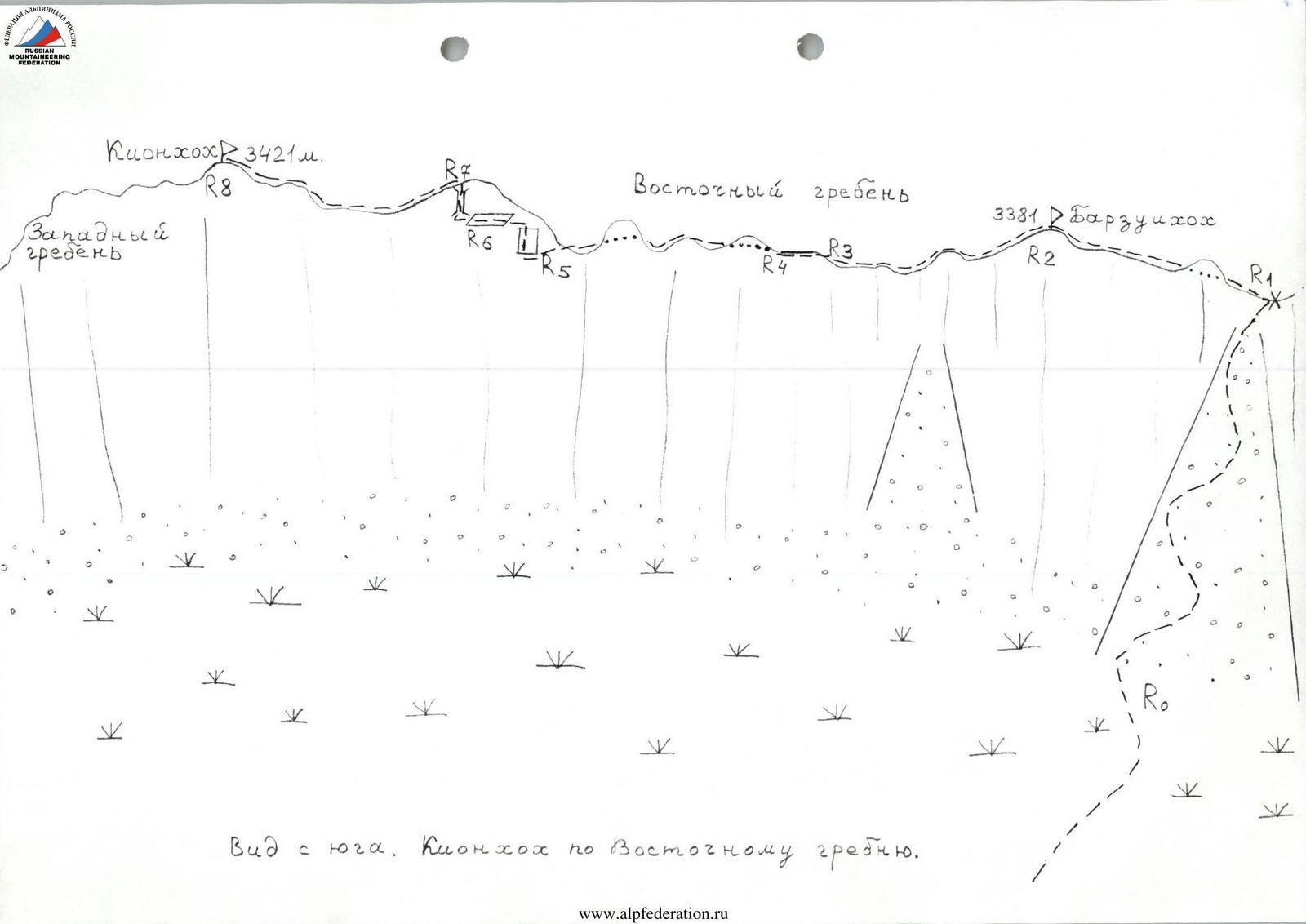
View from the South. Kion-Khokh along the East ridge.
Route description
Section R0–R1: Approaching the passage in the Southern walls of the East ridge of Kion-Khokh (3421 m), climb up along small screes, bypassing individual walls along rocks of 2–2+ category of difficulty. Many "live rocks"! Then exit to the ridge — 1.5–2 hours from the start of the ascent.
Section R1–R2: Having reached the East ridge of Kion-Khokh and Barzui-Khokh on the saddle, turn left and go West, along the Northern side of the ridge, bypassing gendarmes mainly on the right (path of 1–2 category of difficulty).
Section R2–R3: One of the next ridge ascents is likely the peak Barzui-Khokh. Since our ascent took place in fog and mostly in snowfall, there was no particular visibility. But, passing along the ridge, no summit cairn was found anywhere, most likely it simply does not exist, since the ridge is almost flat here and none of the ascents is clearly pronounced. However, according to the map, Barzui-Khokh is located here.
Further movement continues West along the ridge, bypassing the destroyed Southern walls along the Northern, mainly scree slopes (path of 1–2 category of difficulty).
Section R3–R4: Along the sharp ridge, climb 6–8 m in some places (section of 2–3+ category of difficulty — a psychologically unpleasant place).
Section R4–R5: Along the ridge of 1–2 category of difficulty to the pre-summit ascent.
Section R5–R6: Approaching the ascent along a wall of 4–5 m with Southern exposure. The wall has a small scree at the top with up to 80°; 3+–4 category of difficulty. Then move straight up along ledges (60 m, up to 2 category of difficulty).
Section R6–R7: Climb a somewhat destroyed chimney of about 8 m, 2–3 category of difficulty, 60–70°, and exit to the ascent. A cairn is built on the ascent.
Section R7–R8: Descend from the ascent along the Northern slopes of the East ridge (path of 1–2 category of difficulty), and climb to the peak Kion-Khokh (3421 m). Time to the summit:
- From the ascent — 10 minutes
- From the saddle when exiting to the ridge — about 2 hours.
Descent is along the ascent path. About 3.5 hours to the road.
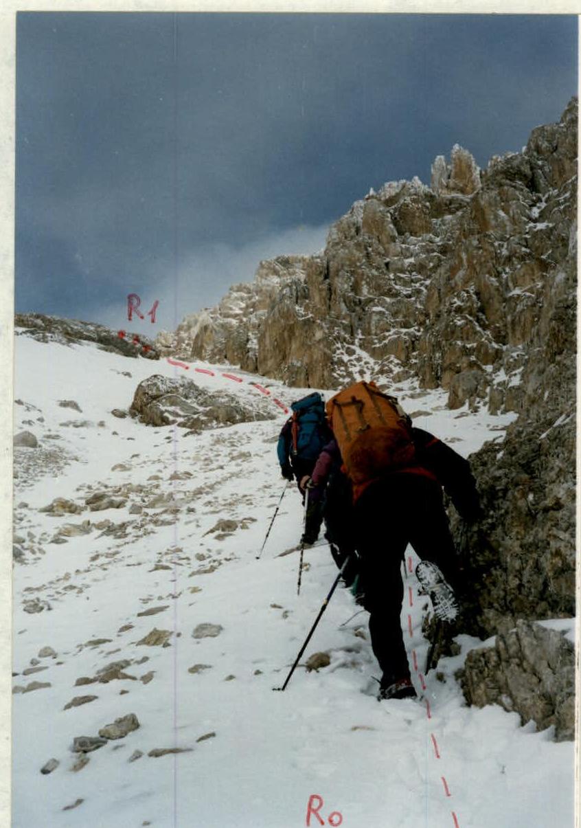
Exit from the South to the ridge. Section R0–R1.

Key section of the route R5–R7.
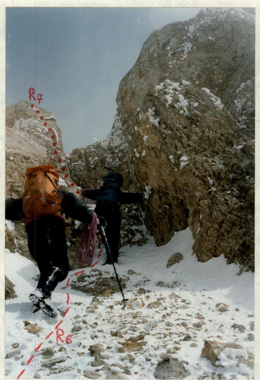
Passage of section R6–R7.
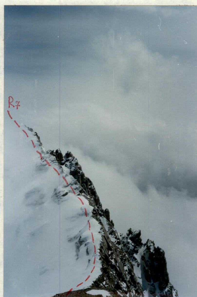
Descent from the pre-summit ascent towards the summit. Section R7–R8. Photo from the peak Kion-Khokh (3421 m).
Route recommendations
The route can be taken at almost any time of the year, even in winter, since the exit to the ridge is from the South, and snow melts very quickly on the Southern walls of the Skalisty Range even after prolonged snowfalls. In general, the climate on the Southern slopes is much drier than on the Northern slopes due to the formation of a so-called "rain shadow" zone. South of the Skalisty Range are the Sunny valleys, and the annual precipitation there is almost half that of the plain — in Vladikavkaz or Alagir.
Therefore, the route is safe from the South in terms of avalanches. From the North, on the ridge, snowboards may slide — in this regard, it is necessary to stay as close to the ridge as possible.
Additional recommendations:
- On the descent and ascent along the screes, be careful with large stones.
- On the route and below it (along the approach path), there is water (or snow) only in winter.
- On the Northern slopes of the ridge, snow can be found even in the off-season.
In general, the route is quite interesting in sports terms, as a purely rock climbing route with saturated, pleasant, and quite serious climbing for its category. It can be recommended for both training and sports ascents, especially in winter and in the off-season. Due to the low height of the summit (compared to the Lateral Range) and to make the route more interesting in sports terms, it can be recommended to classify the peaks of this area within the proposed category of difficulty, as well as the peaks of the Western Caucasus:
- Kardyvach
- Tsyndyshkhkho
i.e., from October 15 to May 15.