Fig. 28
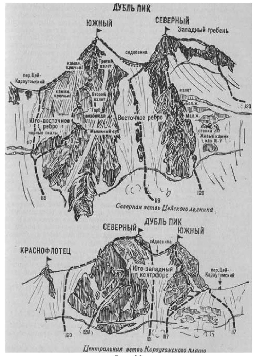
- Dubl pik Severny (4516 m) via East slope (route is combined, G. Belikova, 3B cat. dif., fig. 28).
The path from CSP of Tsey region (group of 4 people) to the initial bivouac in the upper reaches of the Severnaya branch of Tsey glacier opposite the col of Dubl pik is described in route 83.
From the bivouac, descend to the center of the ice-snow slope descending from the col between the South and North summits of Dubl pik across the glacier plateau. A large snow cornice overhangs from the col.
From the glacier:
- cross the bergschrund via a snow bridge;
- ascend a steep snow slope to the right side of a narrow, long rocky outcrop in the center of the slope.
Along a steep ice-snow slope (avalanches possible — piton protection) next to the rocks on the right side of the outcrops, ascend 300–400 m until they end.
From the end of the outcrop:
- 250–300 m left-up along the steep ice-snow ridge (piton protection) to the rocks of the East edge of the South peak;
- from here, traverse 150–200 m right-up along the ice-snow slope (avalanches — piton protection) and exit under the right side of the col, where a large snow cornice is almost absent;
- ascend to the col.
From the initial bivouac — 5–8 hours.
The ascent path from the col to the North summit of Dubl pik and descent are described in route 122. Duration of the route is 3 days.
Naumov A. F. Karaugom, Digoria, Tsey (Central Caucasus), M., "Fizkultura i sport", 1976.
