Appendix No. 2 to the Unified Requirements for the Report for Classification
REPORT ON THE ASCENT OF PIK VILSA VIA THE NORTH-WEST RIDGE ROUTE, 5A CATEGORY OF COMPLEXITY by a team from RSO-Alania from 3:00 to 5:00 September 2024
I. Ascent Passport
| 1. General Information | ||
|---|---|---|
| 1.1 | Full Name, Sports Rank of the Leader | Dzhavayev Khetag Radikovich, 2nd sports rank |
| 1.2 | Full Name, Sports Rank of Participants | Chen Maxim Garikovich, 2nd sports rank Mamitov Akhsar Alekseyevich, 2nd sports rank |
| 1.3 | Full Name of Coach | Ryzhanov Oleg Nikolayevich |
| 1.4 | Organization | AK «KASKAD» |
| 2. Characteristics of the Ascent Object | ||
| 2.1 | Region | RSO-Alania |
| 2.2 | Gorge | Skaladon Gorge, Alagirsky District |
| 2.3 | Number of Section according to the Classification Table of 2013 | 2. Caucasus; 2.7 From Gurzumets Pass to Mamisonsky Pass |
| 2.4 | Name and Height of the Summit | Pik Vilsa, 3861 m |
| 2.5 | Geographical Coordinates of the Summit (Latitude/Longitude), GPS Coordinates | 42.76006° N, 43.92171° E |
| 3. Characteristics of the Route | ||
| 3.1 | Name of the Route | Along the North-West Ridge |
| 3.2 | Proposed Category of Complexity | 5A |
| 3.3 | Degree of Route Exploration | - |
| 3.4 | Relief Characteristics of the Route | Combined |
| 3.5 | Height Difference of the Route (indicated according to altimeter or GPS data) | 800 m |
| 3.6 | Route Length (indicated in meters) | - |
| 3.7 | Technical Elements of the Route (total length of sections of various complexity categories is indicated with the character of the relief (ice-snow, rock)) | I cat. complexity rocks — 50 m. II cat. complexity rocks — 100 m. III cat. complexity rocks — 150 m. IV cat. complexity rocks — 410 m. V cat. complexity rocks — 310 m. VI cat. complexity rocks — 50 m. |
| 3.8 | Average Steepness of the Route, (°) | 70 |
| 3.9 | Average Steepness of the Main Part of the Route, (°) | 80 |
| 3.10 | Descent from the Summit | Along the 3B category complexity route in Skazdon Gorge |
| 3.11 | Additional Characteristics of the Route | Absence of water |
| 4. Characteristics of the Team's Actions | ||
| :--: | :--: | :--: |
| 4.1 | Time of Movement (team's walking hours, indicated in hours and days) | 21 hours, 3 days |
| 4.2 | Overnight Stays | 1 overnight stay before the technical part, at the fork between routes 5A and 3B; 2 overnight stay under the summit, near a snowpatch |
| 4.3 | Time of Route Preparation | - |
| 4.4 | Departure on the Route | 9:00, September 3, 2024 |
| 4.5 | Arrival at the Summit | 6:00, September 5, 2024 |
| 4.6 | Return to the Base Camp | 12:00, September 5, 2024 |
| 5. Person Responsible for the Report | ||
| 5.1 | Full Name, e-mail | Mamitov A.A., a.mamitov777@mail.ru |
II. Description of the Ascent
- Characteristics of the Ascent Object
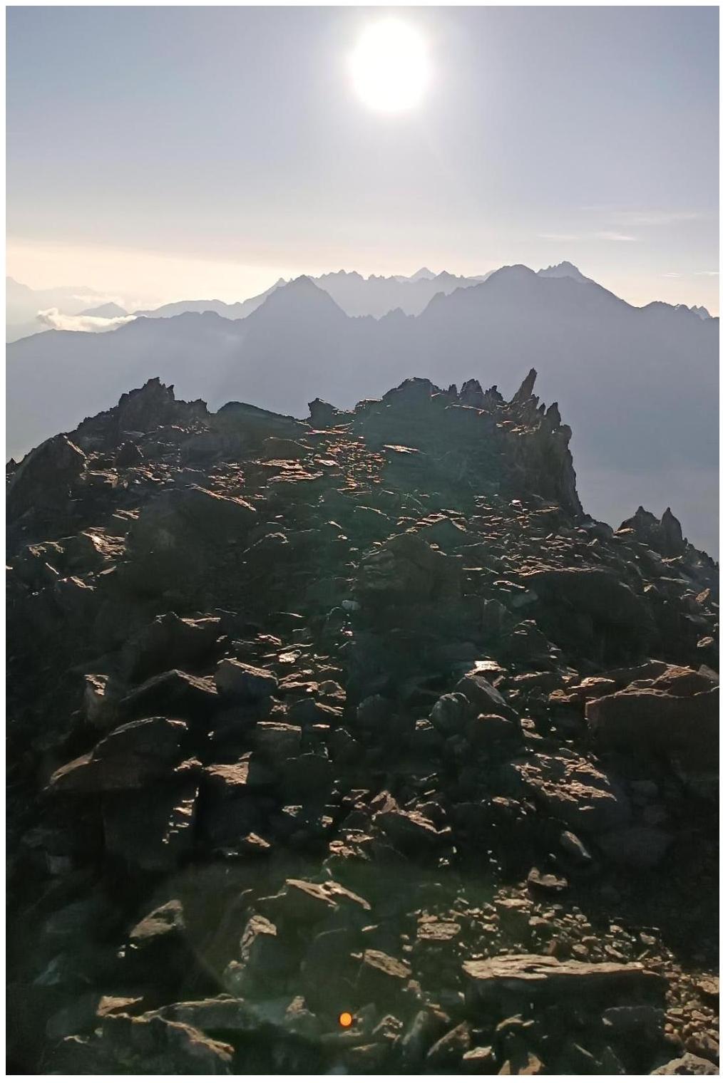
1.1. General Photo
of the summit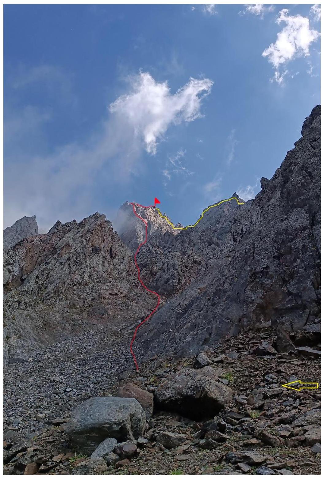
Location of the shot — the team's first overnight stay on September 3, 2024.
-
route 5A
-
route 3B 1.2. Photo of the Route Profile
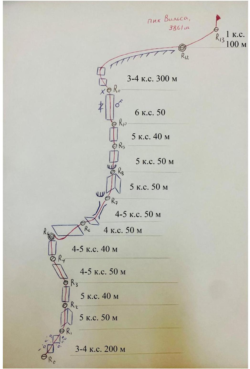
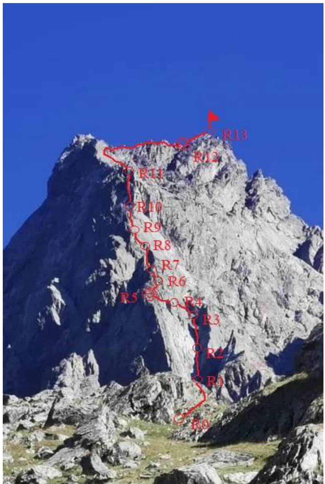 1.3.
Hand-Drawn Profile of the Route
1.3.
Hand-Drawn Profile of the Route
- Characteristics of the Route
| Section Number | Name and Number of Pitons <*(9)> | Insurance Points, Characteristics in Symbols | Route Line in UIAA Symbols | Complexity of the Section in Symbols | Length of the Section, m | Steepness | |
|---|---|---|---|---|---|---|---|
| anchors | cams | ||||||
| R0–R1 | 6⁄0 | - | 0 | III–IV | 200 | 45 | |
| R1–R2 | 9⁄0 | - | 0 | V | 50 | 80 | |
| R2–R3 | 9⁄0 | - | 0 | V | 40 | 80 | |
| R3–R4 | 6⁄0 | - | 0 | IV–V | 50 | 70 | |
| R4–R5 | 6⁄0 | - | 0 | IV–V | 40 | 70 | |
| R5–R6 | 9⁄0 | - | (3) | IV | 50 | 60 | |
| R6–R7 | 6⁄0 | 3⁄0 | 0 | (1) | IV–V | 50 | 70 |
| R7–R8 | 9⁄0 | - | 0 | V | 50 | 80 | |
| R8–R9 | 11⁄0 | - | 0 | V | 50 | 80 | |
| R9–R10 | 10⁄0 | - | 0 | V | 40 | 80 | |
| R10–R11 | 11⁄0 | - | 0 | VI | 50 | 90 | |
| R11–R12 | 6⁄0 | - | 0 | III–IV | 300 | 45 | |
| R12–R13 | - | - | (3) | I | 100 | 30 |
3. Characteristics of the Team's Actions
3.1 The team departed at 9:00 on September 3, 2024, from the parking lot near the ski resort "Skazka". Moving in the direction of the Green Hill, near the middle station of the cable car, they turned left onto an avalanche path leading to the couloir that goes to the visible trapezoidal summit of Vilsa. The team decided to ascend on the right side (by the direction of movement) of the couloir, along grassy slopes transitioning into scree. Passing by the classic overnight stays under a large boulder, the team set up a safe bivouac under a cornice at the fork between routes 5A and 3B. Water was available from a stream or snowpatch. The time from the start of movement was 4 hours.
The next bivouac was organized under the summit at 19:00 on September 4, 2024. On the third day:
- Descent from the summit via the 3B category complexity route.
- Departure to Vlad time.
| Section Number | Description | Photo Number |
|---|---|---|
| R0–R1 | Start of movement in the direction of the clearly pronounced internal angle, crossing a snowpatch at the beginning, then moving along the left (by the direction of movement) couloirs on loose rocks of medium complexity, rockfall hazard. Closer to R1, the rocks become more complex, but simultaneous movement is possible, with anchors being placed. | №1 and №2 |
| R1–R2 | Vertical ascent along the left side of the internal angle, complex climbing with a small number of holds. | №3 |
| R2–R4 | Gradually shifting to the right, back into the internal angle, to a boulder-platform. | №4 |
| R3–R4 | Moving left, along the ridge, initially easy climbing, then becoming more complex. | №5 |
| R4–R5 | Continuing to move upwards, staying on the ridge. At the end of the section, there is a suitable spot for a tent, but water is not available, requiring a rappel into the couloirs. | - |
| R5–R6 | Slightly descending, traversing to the right onto a relatively easy inclined slab, where, near the end of the rope, a station is set up. For the last participant on the traverse, there is a risk of a dangerous pendulum fall. | №6 |
| R6–R7 | Continuing to the right, around a bend, in the direction of a chimney. From this point, the key section of the route becomes visible. The chimney has good placements for cams, with a slight overhang at the top. | №7 |
| R7–R8 | Ascending along the left part of the internal angle, with an overhanging section at the end. A station can be set up either before or after it, depending on the length of the rope available for reaching the right side. | №8 |
| R8–R9 | After crossing to the right side, beyond the internal angle, moving upwards. | - |
| R9–R10 | Ascending a wall to a ledge before the key section. | - |
| R10–R11 | The key section is ascended via a crack, with tense climbing, using old pitons and a bollard at the end of the section. | №9 and №10 |
| :-- | :-- | :--: |
| R11–R12 | Initially moving slightly left along strongly fragmented rock, then transitioning to the right side and ascending rocks of medium complexity, with simultaneous movement possible and anchors being used. As the ascent progresses, reaching the ridge and moving to the right side to a depression before the summit pitch, with tense and cammed rope movement. | - |
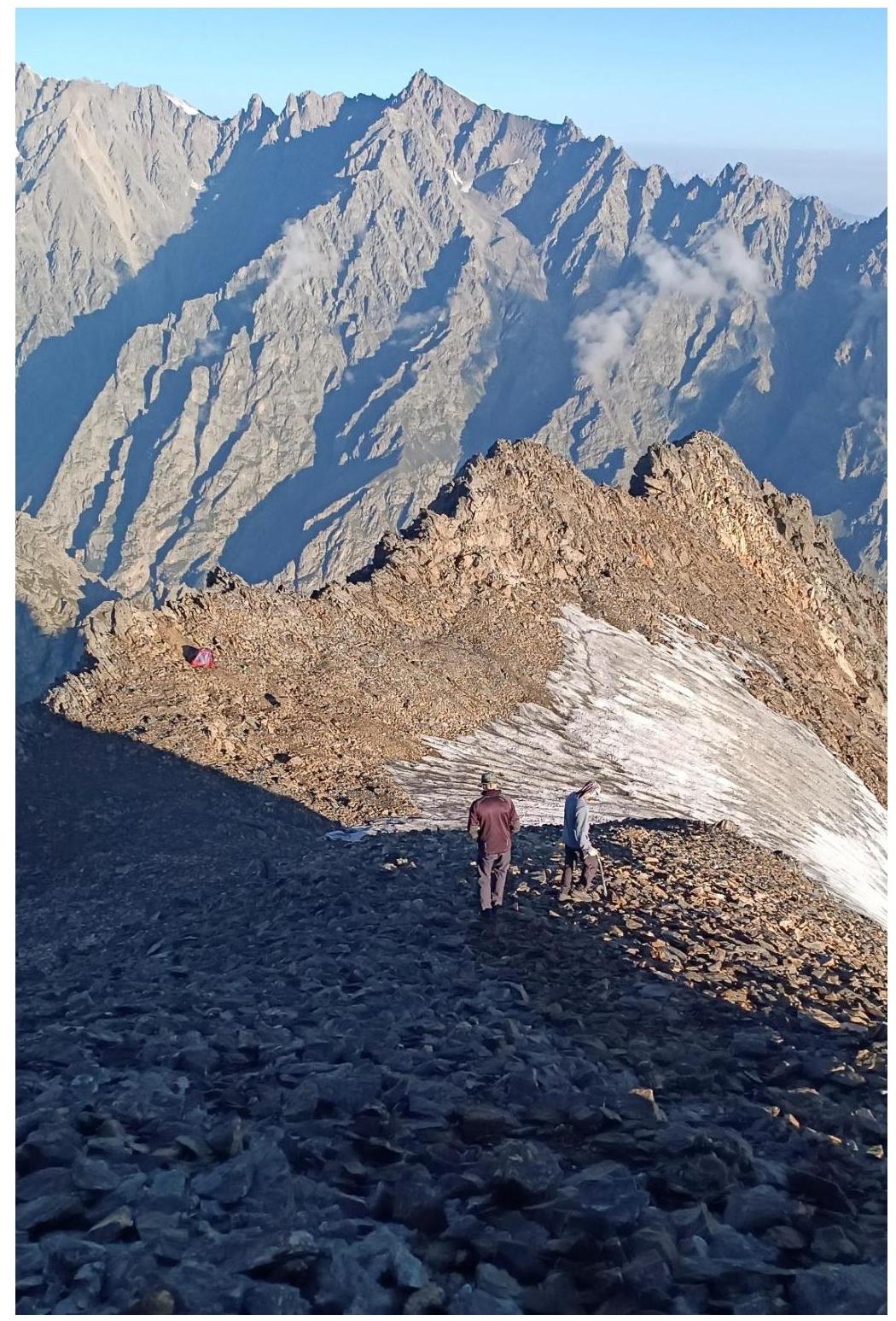
| R12–R13 | In the depression before the summit pitch, there are relatively flat areas suitable for a tent, and a nearby snowpatch for obtaining water. The summit is reached via easy scree slopes in 10 minutes. | №11 |
3.2 Photo Control Tour.
 3.3.
The route includes loose rocks, and there is a risk of being in a rockfall-prone couloir.
Conditions on the route are complicated by the following factors:
3.3.
The route includes loose rocks, and there is a risk of being in a rockfall-prone couloir.
Conditions on the route are complicated by the following factors:
- Cellular connection is partially available
- Radio communication with the rescue team at the МЧС base is constant
- Need for organizing a bivouac under the summit
- Absence of water
- Complex descent via the 3B category complexity route.
Photo №1 — Internal angle, in the direction of which it is necessary to move
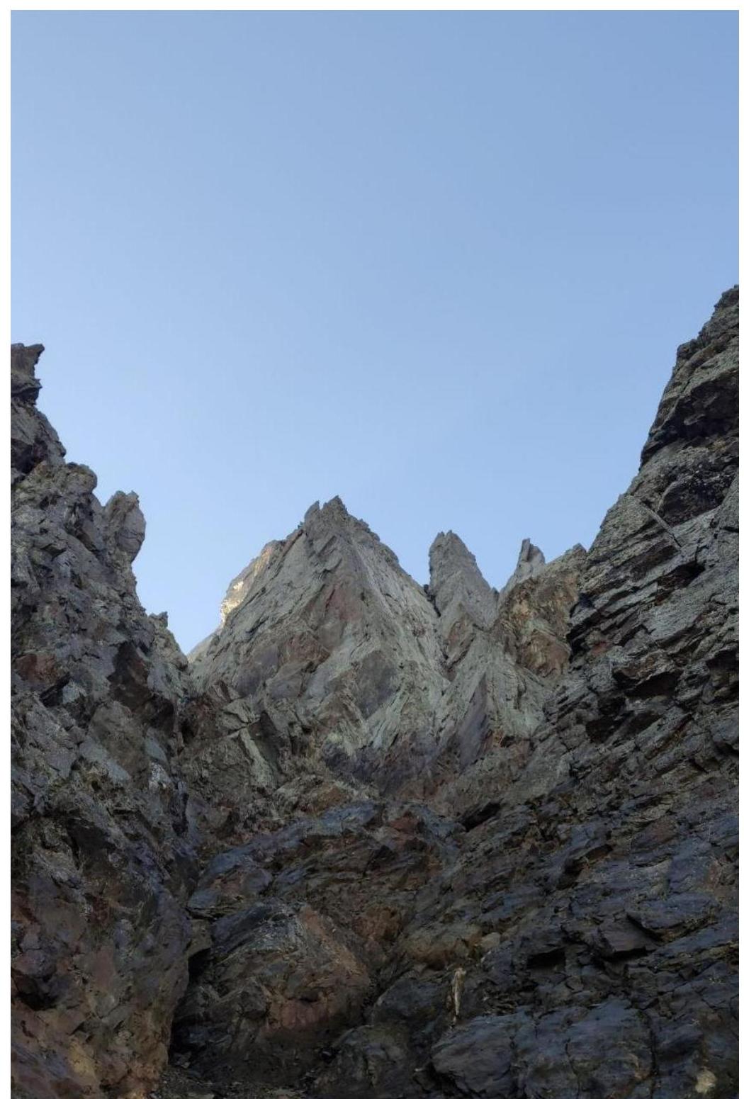
Photo №2 — View from above on section R0–R1
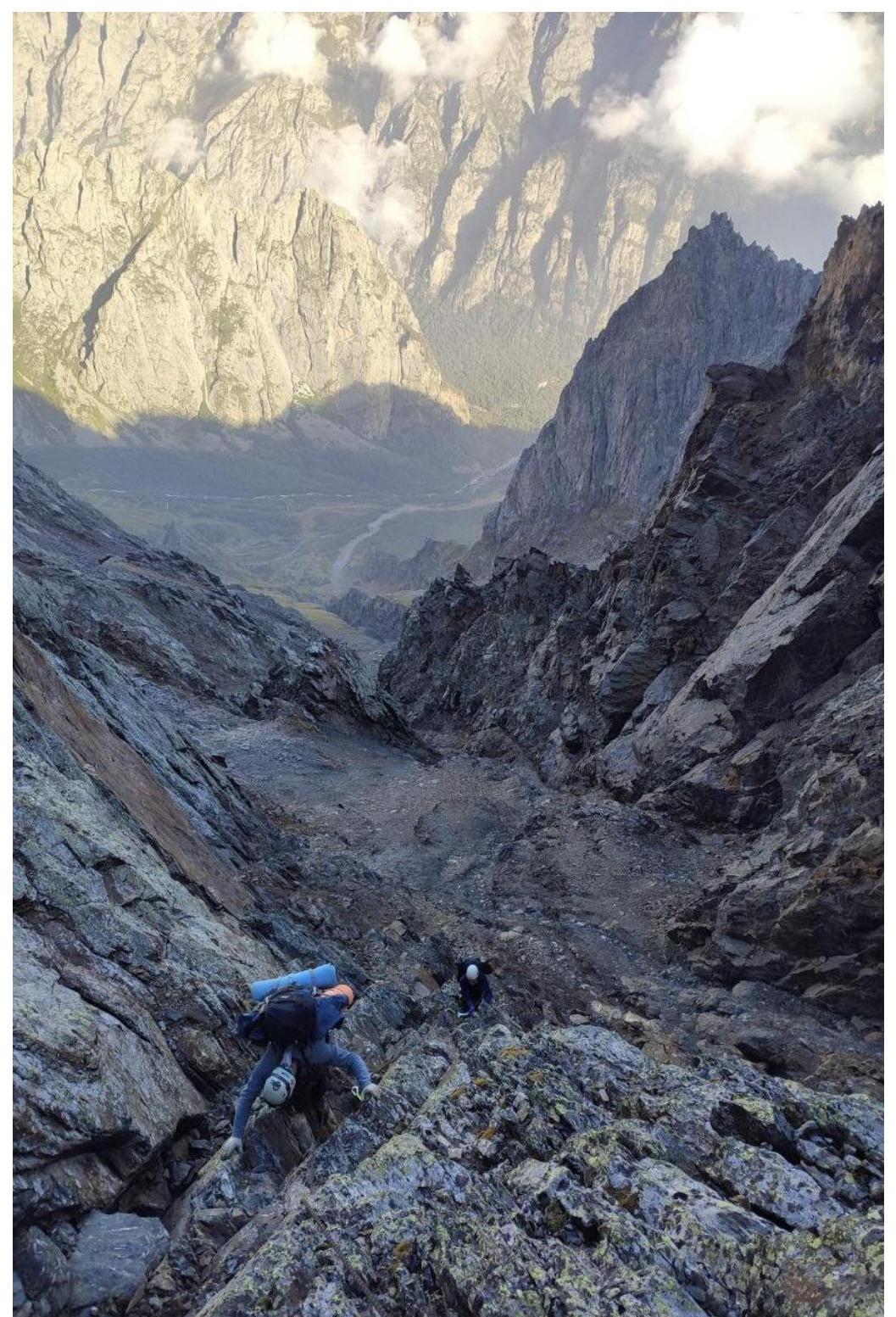
Photo №3 — View from station R1 on section R1–R2
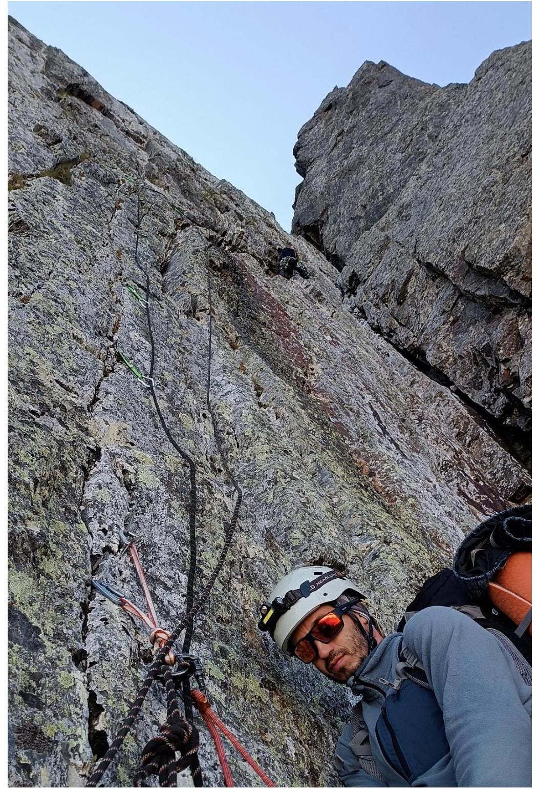
Photo №4 — View from station R3 on section R2–R3
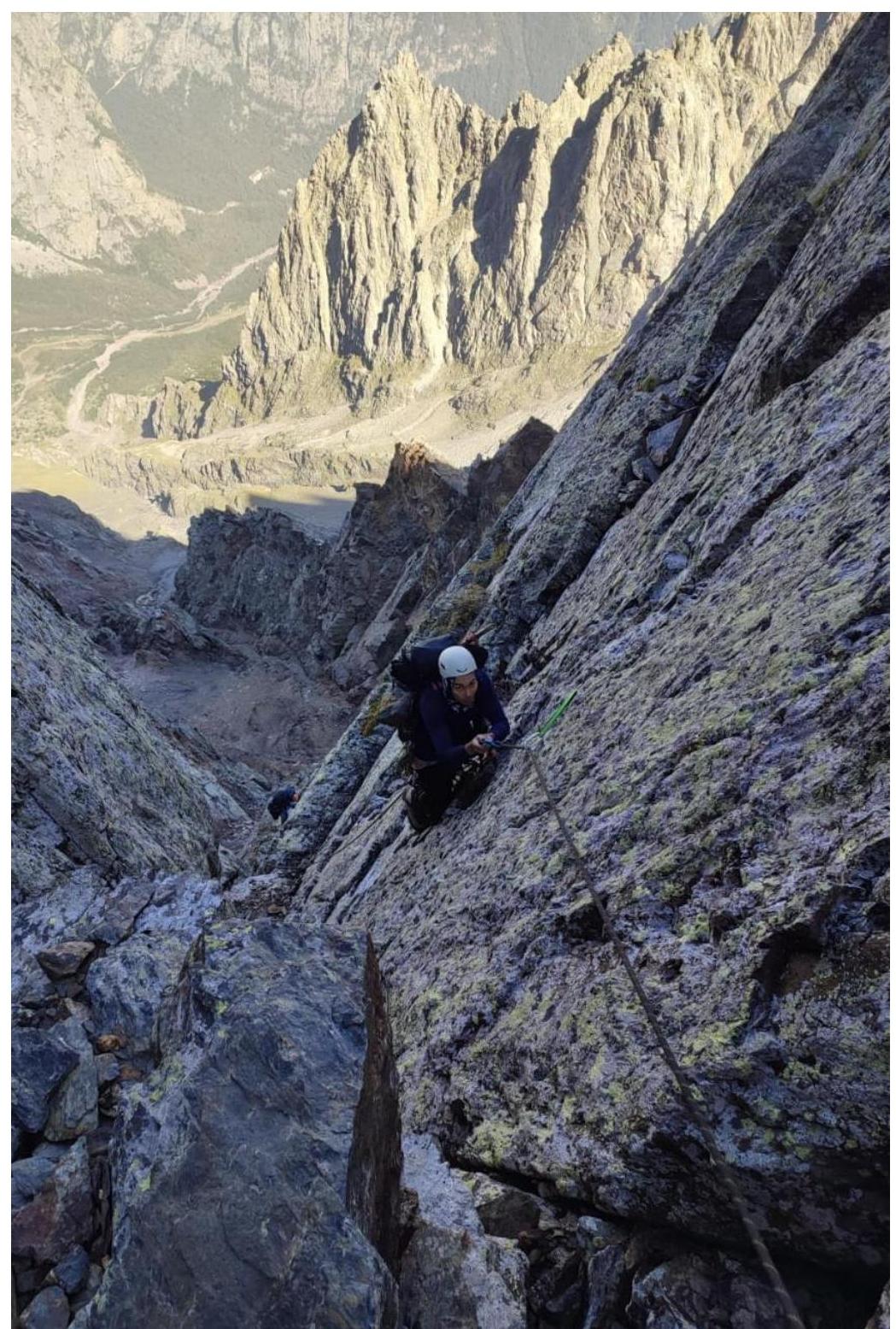
Photo №5 — View from station R4 on section R3–R4
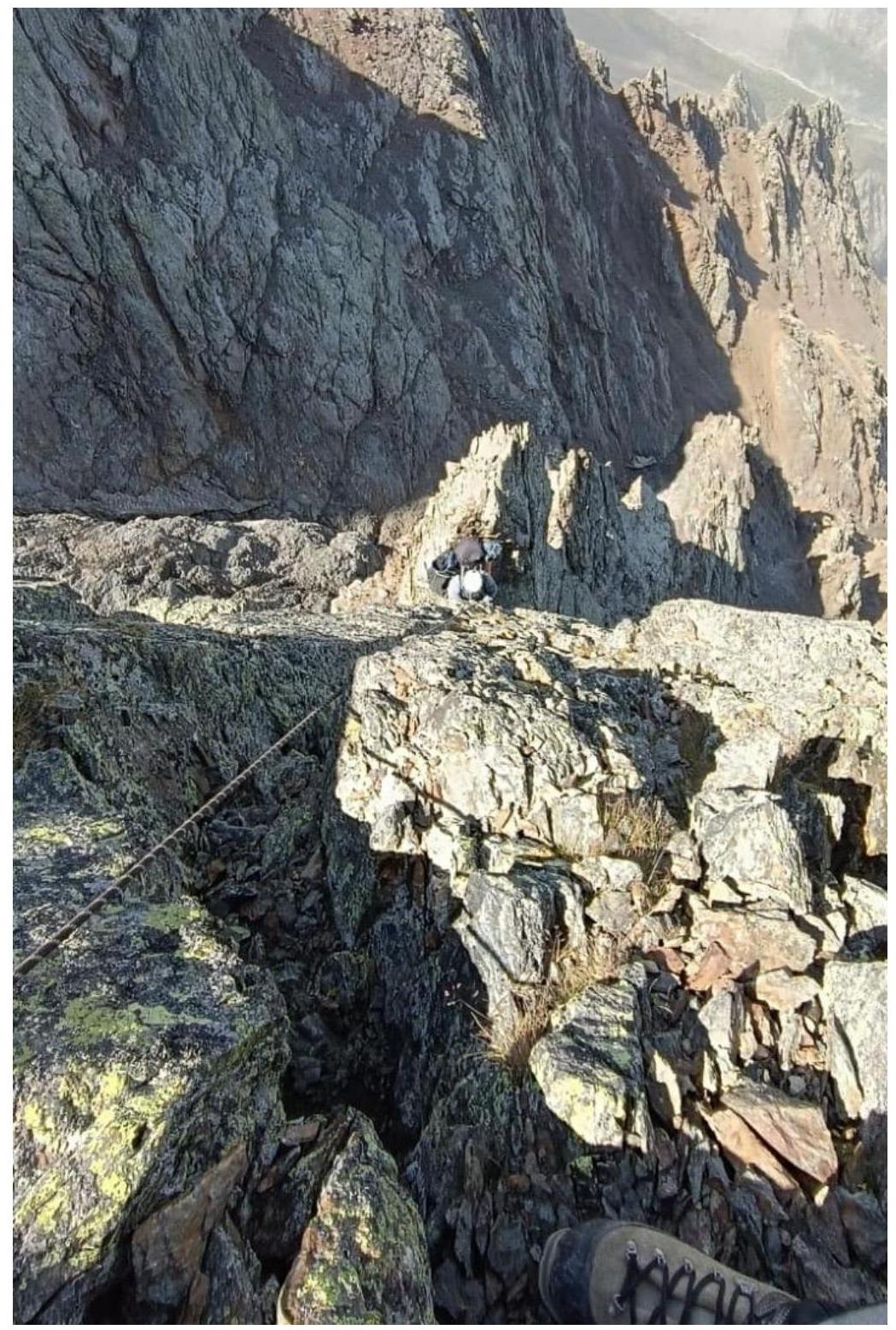
Photo №6 — View from station R6 on section R5–R6
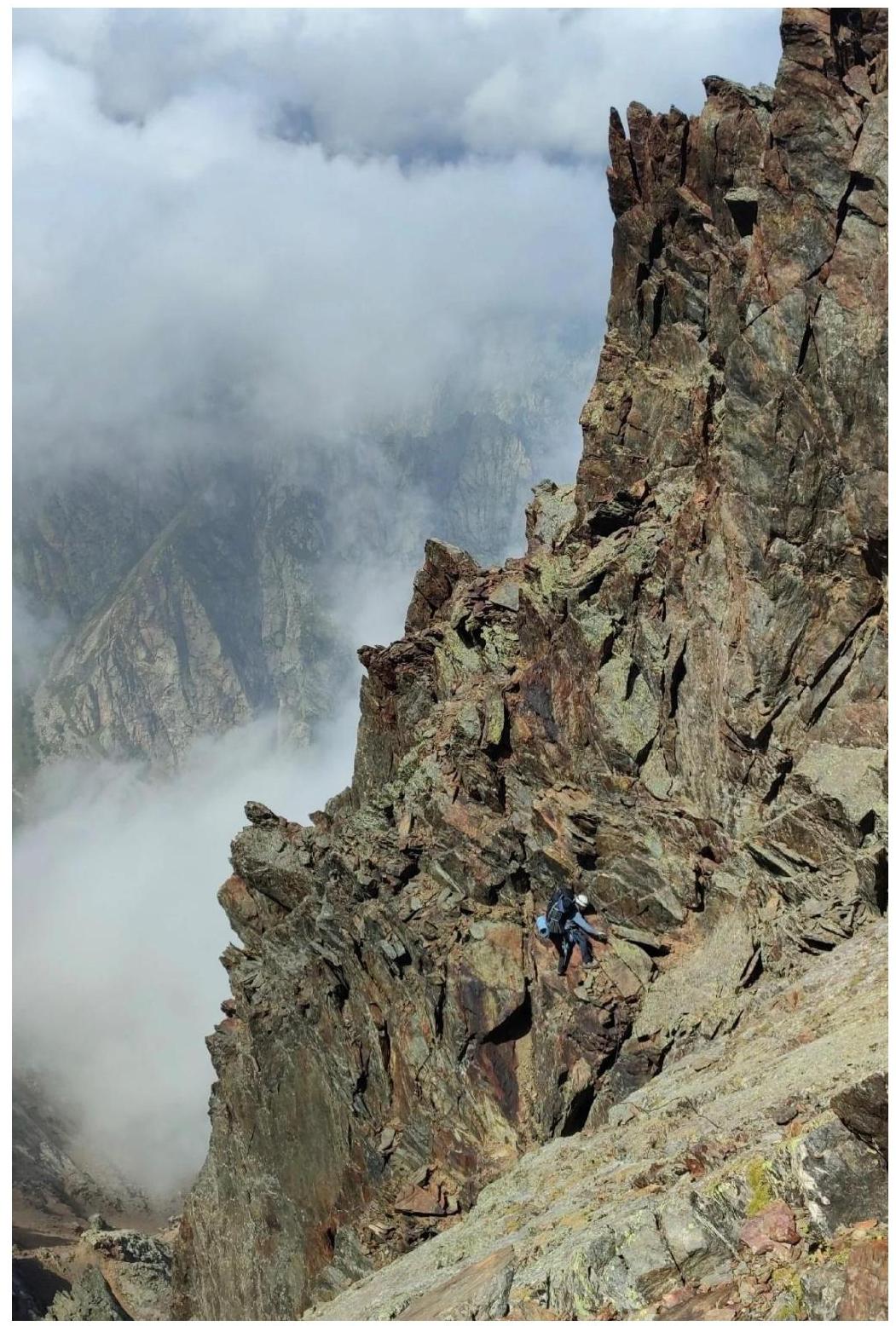
Photo №7 — View of the chimney on section R6–R7
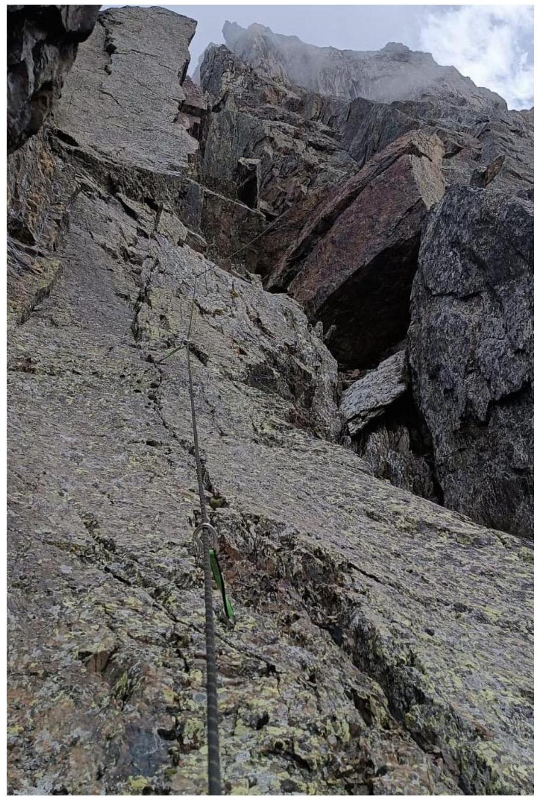
Photo №8 — View from R7 on section R7–R8
Photo №9 — View from R10 on the key section of the route
Photo №10 — View from R11 on section R10–R11
Photo №11 — Descent from summit R13 with a view of the ridge and overnight stay location