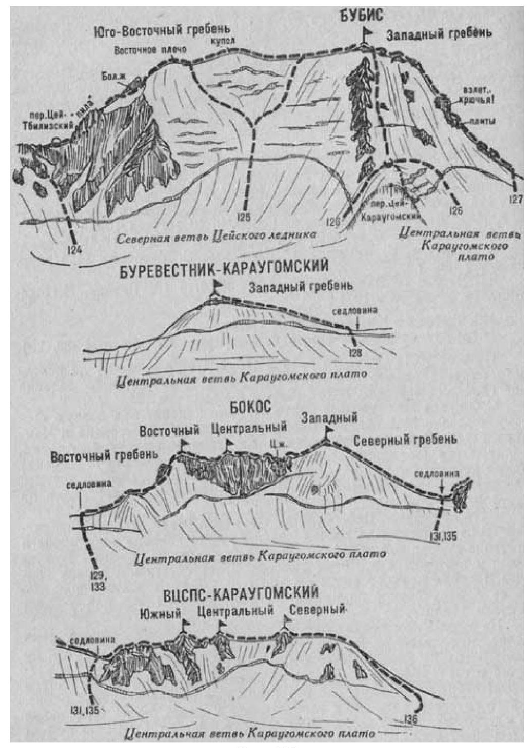
Fig. 29
- Bubis (4428 m) via the North-Eastern slope (ice and snow route, category 2B, fig. 29).
The path from the CSP of the Tsey region (group of 4-20 people) to the initial bivouac on the upper plateau of the Northern branch of the Tsey glacier is described in route 83.
From the bivouac (closed crevices) approach the middle of the north-eastern ice and snow slope of Bubis along the glacier. From the glacier, overcoming the bergschrund using a snow bridge, ascend the occasionally steep ice and snow slope (many open and closed crevices) between two groups of ice falls located to the left and right of the middle part of the slope, in the direction of the saddle of the massif between the summit of Bubis on the right and a snow dome on the left - until reaching the main ridge of the summit. Depending on the condition of the slope, it is possible to ascend to the main ridge of the summit to the left of the snow dome.
On the south-eastern ridge of the summit, turn right and ascend along a simple, gently sloping, wide, occasionally narrow, long ice and snow ridge (cornices), then along simple, ruined rocks to the summit of Bubis.
Duration:
- From the initial bivouac on the plateau: 4-6 hours.
Descent is via the ascent route.
Features:
- In the second half of the day, the likelihood of avalanches is highest.
Route duration: 2-3 days.
Naumov A. F. Karaugom, Digoria, Tsey (Central Caucasus), M., "Fizkultura i sport", 1976.