REPORT ON THE FIRST ASCENT TO THE SUMMIT MULDZUGI–BARZOND (3064 m) VIA ROUTE 3A cat. diff. BY TEAM MAK "FRILINE" AND RSAO "FEDERATION OF ALPINISM OF VOLGOGRAD REGION–SCHOOL OF ALPINISM" ON NOVEMBER 4, 2022
Pyatigorsk. I. Ascent Passport
- General Information
1.1 Team Leader: Popov M.L., CMS 1.2 Participant: Morozov I.M., 2nd sports category 1.3 Coach: Motienko N.I. 1.4 Organization: MAK "Frilain"; RSAO "Federation of Alpinism of Volgograd Region–School of Alpinism"
- Characteristics of the Ascent Object
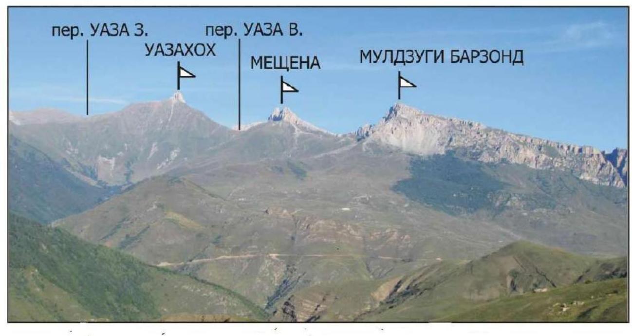
2.1 Caucasus. Rocky Ridge. Digoria 2.2 Uruh gorge 2.3 From Gezevtsék pass to Gurdzivtsék pass 2.4 Muldzugi–Barzond (3064 m)
- Route Characteristics:
3.1 Via Western Ridge 3.2 Proposed category: 3A cat. diff. 3.3 First ascent 3.4 Rock climbing 3.5 Route height difference: 300 m 3.6 Route length: 438 m 3.7 I cat. diff. – 0 m II cat. diff. – 150 m III cat. diff. – 170 m IV cat. diff. – 118 m V cat. diff. – 0 m 3.8 Descent from the summit — to the east 3.9 Water on the route in the form of snow only in winter
- Characteristics of Team Actions:
- Time in motion: 4 hours
- Overnight stays: no
- Start of ascent: 10:00 on November 4, 2022
- Reaching the summit: 16:00 on November 4, 2022
- Return to base camp: 17:00 on November 4, 2022
- Person Responsible for the Report:
5.1 Popov Mikhail Lvovich mikl_popov@inbox.ru 8-928-265-71-30
General photo of Muldzugi–Barzond summit
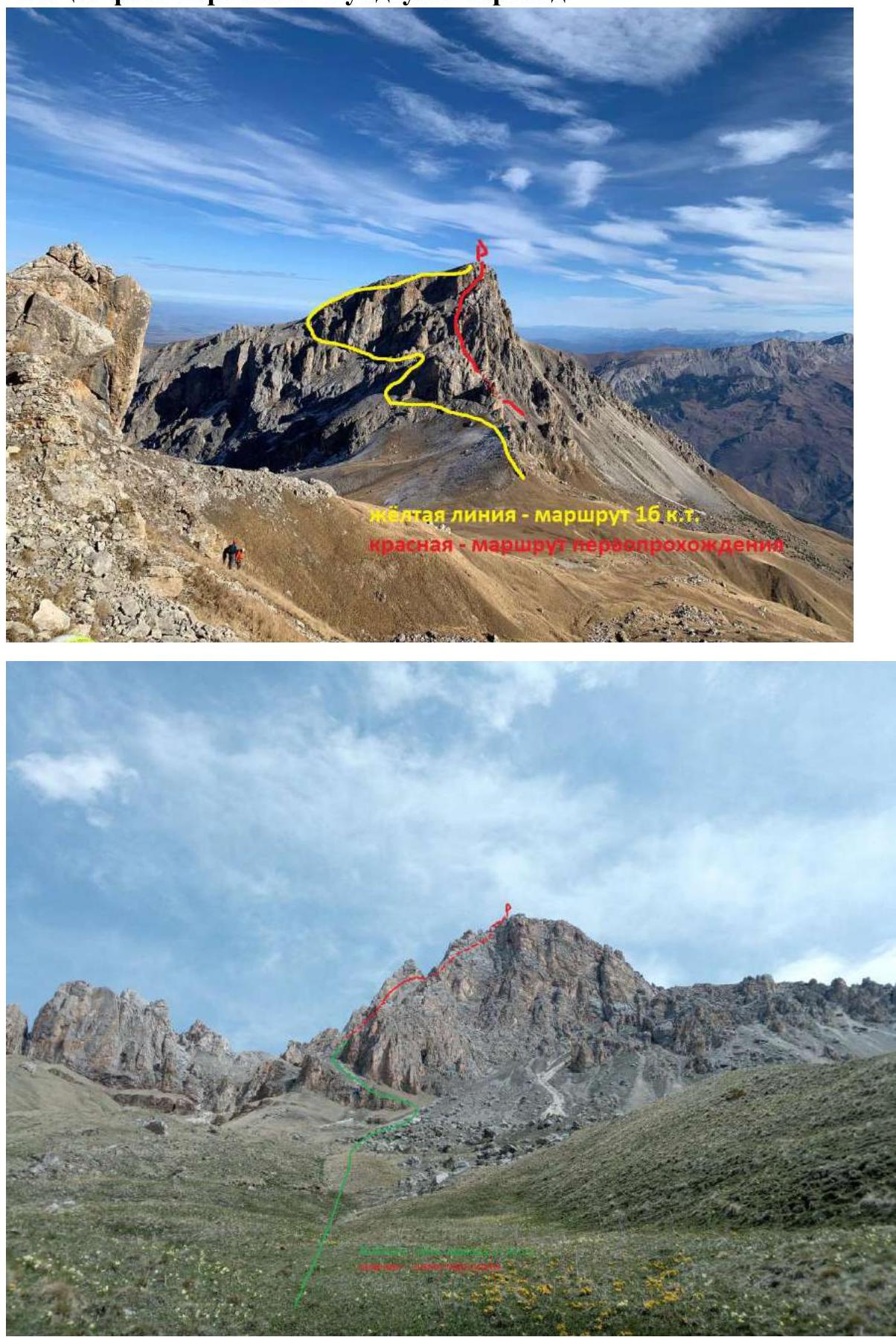
Green line — approach path from the hut
Red line — route thread
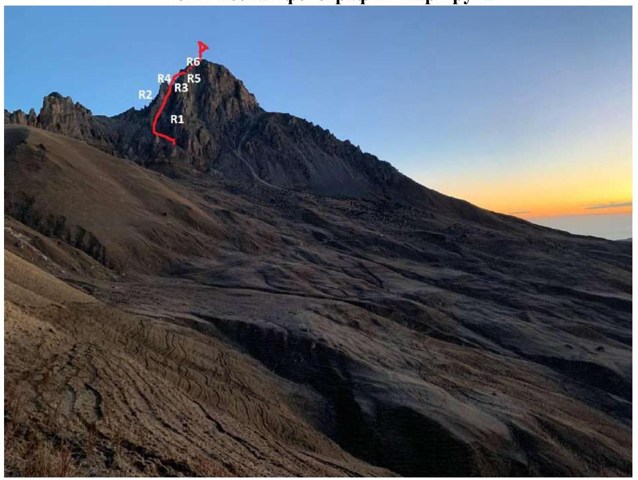
Route profile photo

Area Photopanorama
Brief Overview of the Ascent Area
Muldzugi–Barzond summit is part of the Rocky Ridge in the Greater Caucasus system (Republic of North Ossetia, Irafsky district). The path to the mountain goes through the Uruh river gorge. Turn right 2 km after Matsuta village. The road is dirt, partially in poor condition. After approximately 5 km, the road leads to a large "estate" built on the site of the ruins of Kumbulta village. There's a fork: straight — to Donifars village, left — to the summit. You can also reach this fork from Donifars, but the bridge over Uruh is in poor condition. After Kumbulta, the road is very bad, suitable only for SUVs even in summer. For those traveling in winter, it's recommended to leave the car on a gentle grassy slope just above the "estate". On foot, it takes about 1.5 hours to reach the last hut (there are 3 on the way) (in summer by car — about half an hour). The hut is located right at the foot of the mountain. In summer, there's a spring, but with low water flow, so water should be taken along. Currently, there's no issue with water as there's plenty of snow around. The hut has four beds, and there are many convenient places for tents nearby. The hut serves as a base camp. Its coordinates are 43.0112° N, 43.7169° E, elevation 2480 m. It's marked on the ViewRanger navigator at maximum scale. In Fig. 1, it's marked with an asterisk. Mobile connection (MegaFon) in the area is available but unstable. Registration with EMERCOM is done by phone: 8-928-492-09-62.
2. Route Characteristics
Technical photo of the route
Technical characteristics of route sections 3B cat. diff.
| Section # | Relief Characteristics | Category of Difficulty | Length, m | Type, Number of Pits |
|---|---|---|---|---|
| R0–R1 | Scree, rock shelf | 2+; 3 | 100; 20 | 2 |
| R1–R2 | Monolithic chimney, monolithic shelf, wall | 4; 4+ | 40; 40 | 8 |
| R2–R3 | Rock shelf, wall | 3; 4+ | 10; 8 | 2 |
| R3–R4 | Monolithic walls and rock shelves | 4; 3 | 30; 30 | 4 |
| R4–R5 | Scree, rock wall | 2+; 3 | 50; 30 | 3 |
| R5–R6 | Destroyed rock wall | 3+ | 40 | 4 |
| R6–R7 | Ridge and destroyed couloir | 3 | 40 | 3 |
3. Characteristics of Team Actions
| Section # | Description | Photo # |
|---|---|---|
| R0–R1 | 100 m before the pass, turn right and along the western ridge on the right side up and left 50 m; 30° 2+. Scree slope turns into rocks. Through a system of walls and shelves — 40 m; 2+ 40°. Then 20 m 3 50°. We enter a wide couloir between the western and southwestern ridges. Through it 10 m 2 to a chimney crossing the wall of the western ridge from left to right upwards. | 1; 2 |
| R1–R2 | Through the chimney with plugs; 65° 4. The first plug is passed head-on 4 m 4+ 90°. The second — along the right wall 6 m 80° 4+. The chimney rests on a difficult destroyed wall 4+ 5 m. After it, there's a convenient shelf for a station. Total to the shelf is 60 m. From the shelf, through a difficult sloping monolithic shelf crossing the wall to the right upwards 20 m 4+ 40° (psychological shelf). | 3; 4; 5 |
| R2–R3 | The shelf ends with a simple descent down 10 m; 30° 3. The descent rests against a rock wall 8 m 85° 4+. | 6 |
| R3–R4 | Through a system of monolithic walls and shelves up and to the right 30 m; 50° 4 to exit onto the ridge. Along it 30 m 3 to a saddle merging the western and southwestern ridges. | 7 |
| R4–R5 | From the saddle to the right upwards through a scree slope 35° 2+ towards a large rock amphitheater. Screes are interspersed with two rock walls 45° 3 30 m. The scree rests against a monolithic wall. The entire section is 80 m. | 8 |
| R5–R6 | Through the wall 60° 3+ initially monolithic, then destroyed 40 m to exit onto the ridge. | 9 |
| R6–R7 | Along the ridge, we approach the pre-summit tower. Through a heavily destroyed couloir, we ascend to the summit. The entire section is 40 m, 60°, 3. | 10 |
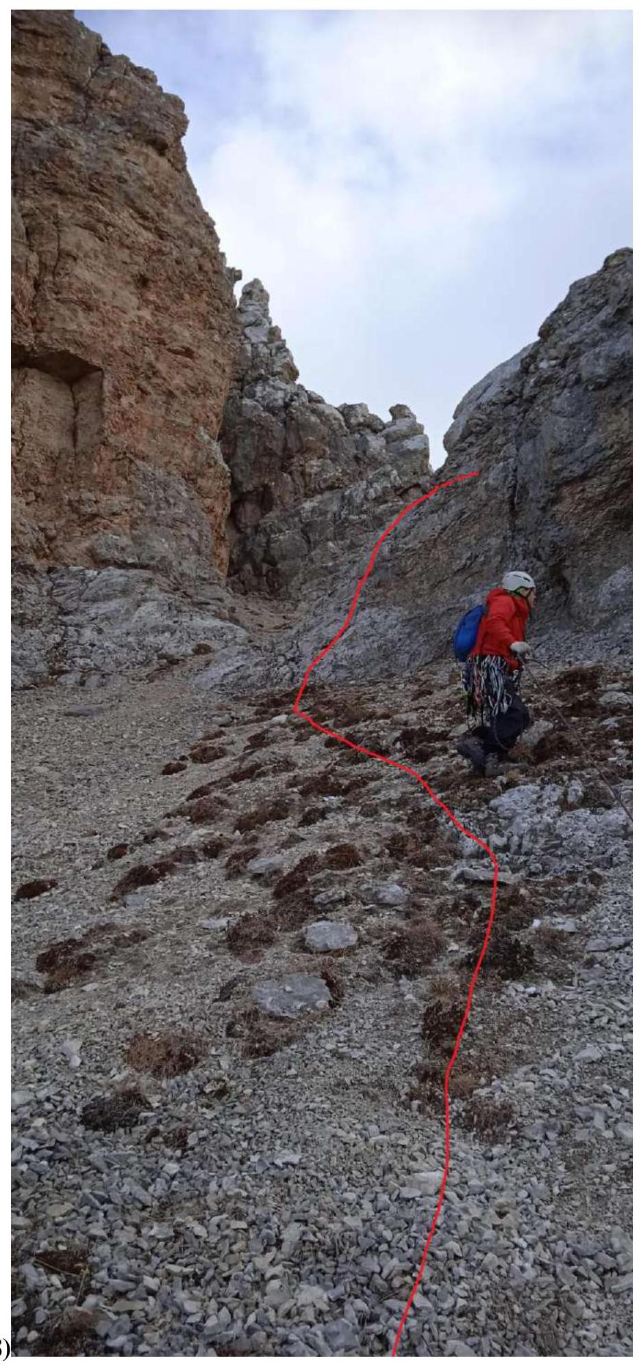
Start of 3B cat. diff. route to Muldzugi–Barzond summit. R0–R1 (Fig. 1; 2)
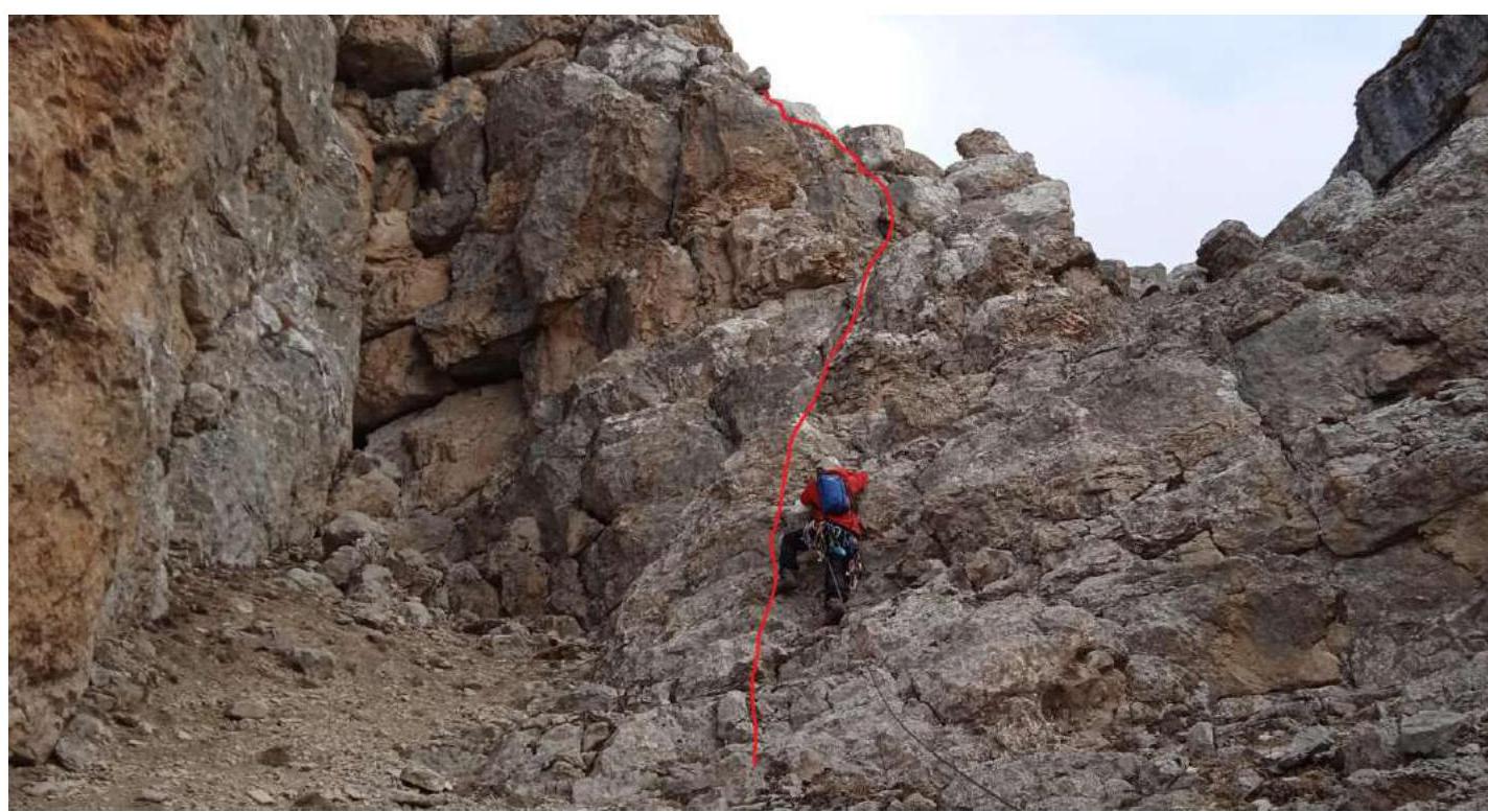
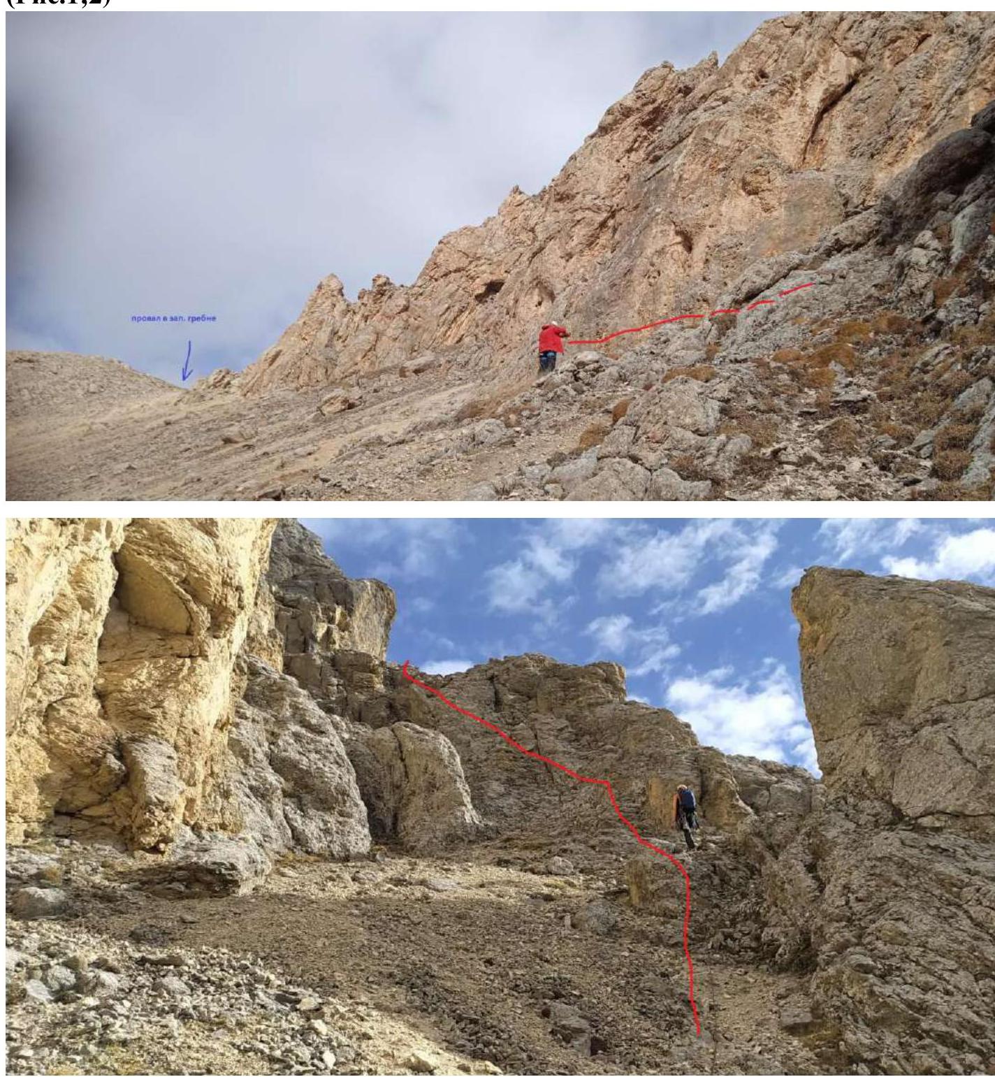 R1–R2 (Fig. 3; 4; 5)
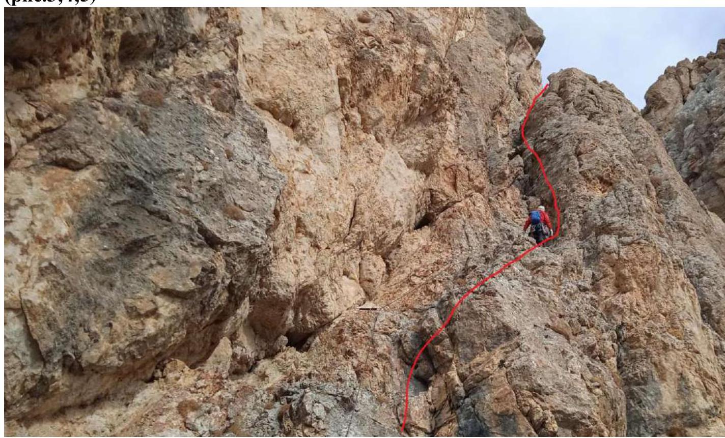

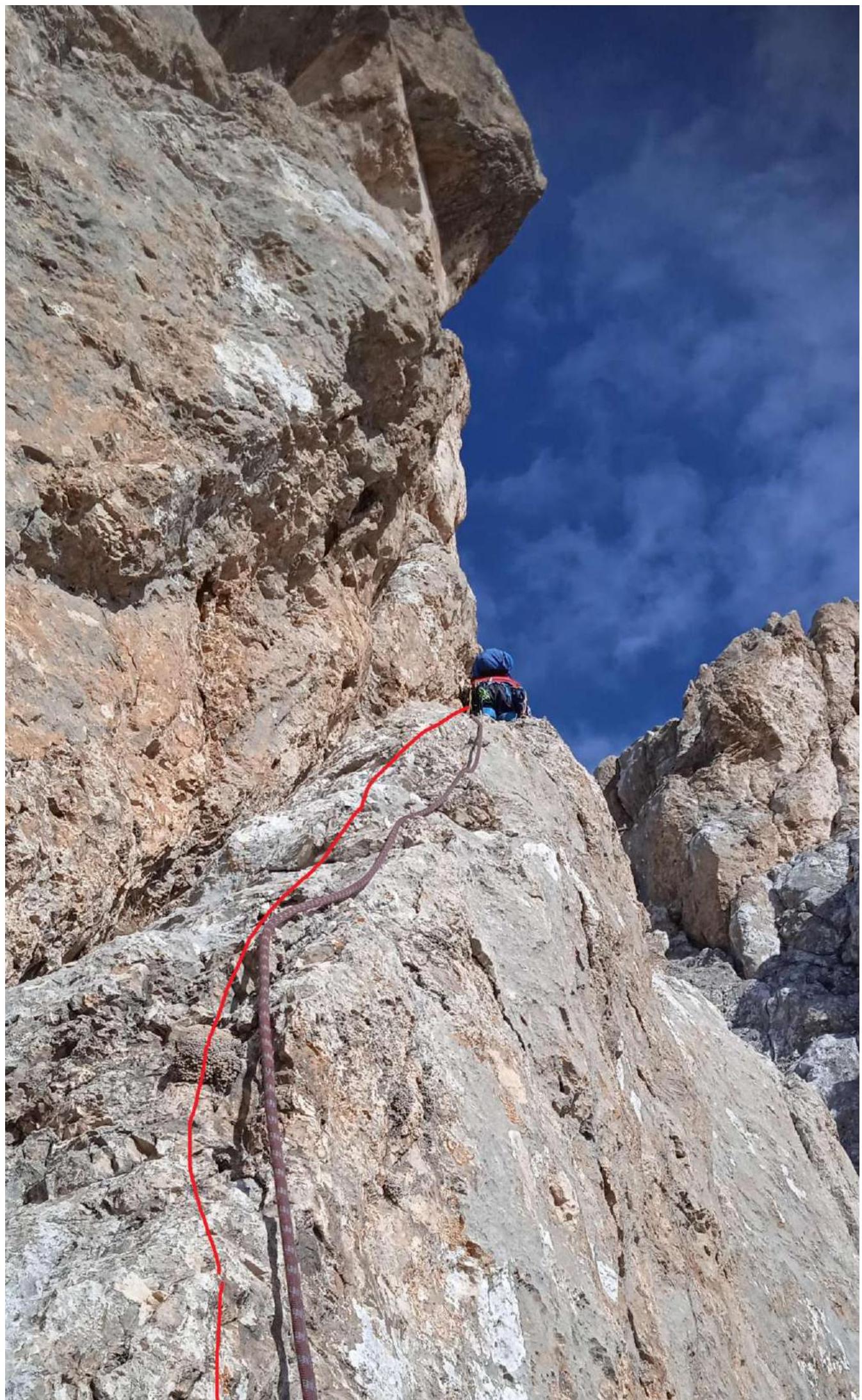
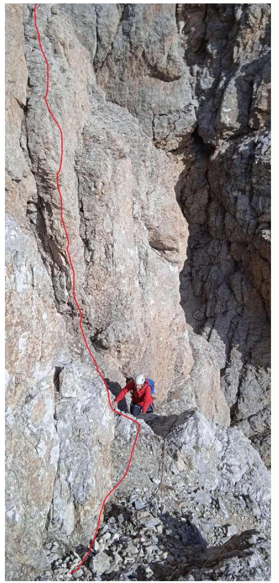
Fig. 6 R2–R3
 R3–R4 (Fig. 7)
R4–R5 (Fig. 8)
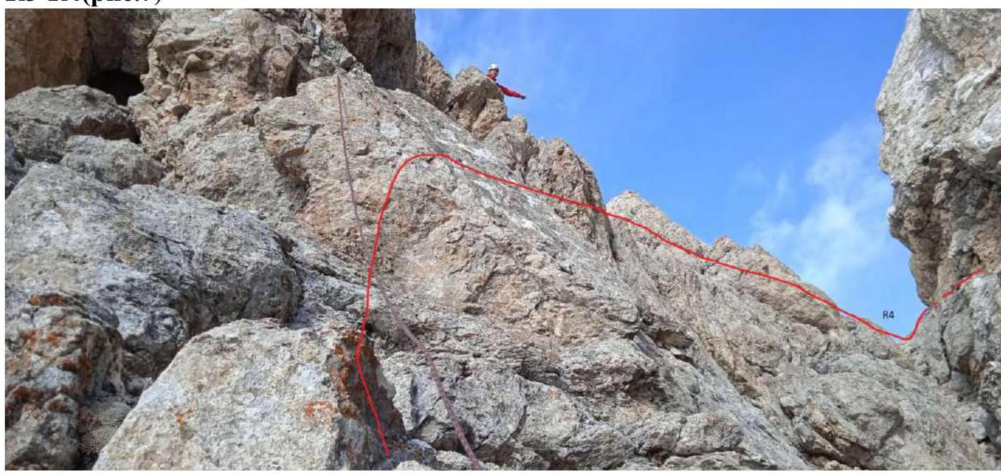
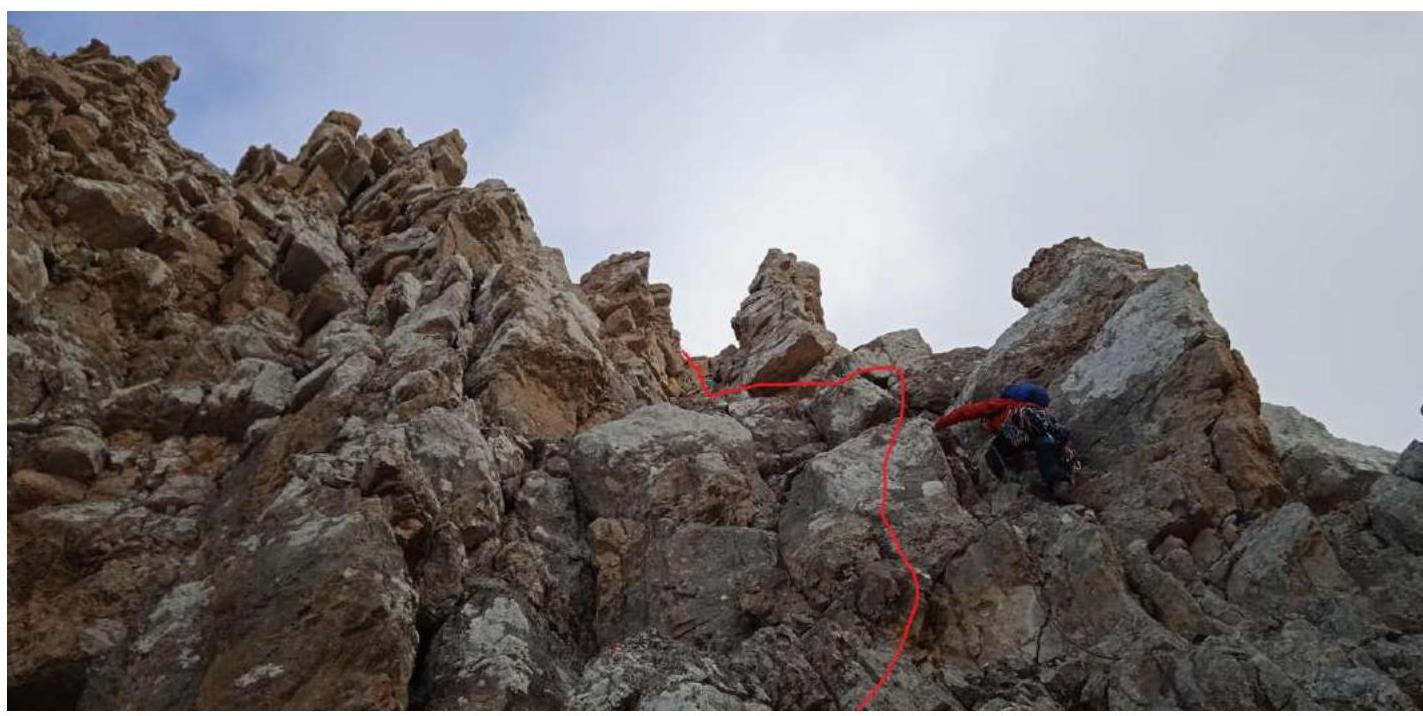
R6–R7 (Fig. 10)
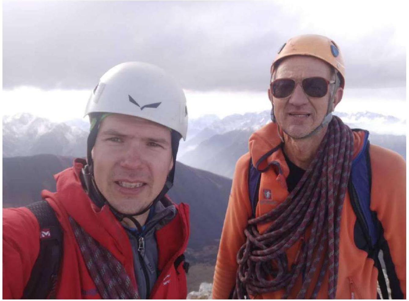
Summit (Fig. 11)
Conclusions and Recommendations
The route is logical and safe. It corresponds to the stated category of difficulty. It's comparable to routes on Dashtsar summit 3A cat. diff. and 3B cat. diff.; Tbau 3A cat. diff. and 3B cat. diff. It's suitable for inter-season ascents. In this area, there are routes from 1B cat. diff. to 4A cat. diff., but 3A cat. diff. routes are absent. It's recommended for educational and sports ascents by a group of 2–4 people.