REPORT
ON THE FIRST ASCENT TO THE SUMMIT MULDZUGI — BARZOND (3064 m) VIA THE ROUTE CATEGORY IIIB BY THE FRI-LINE CLUB TEAM May 18, 2019
Pyatigorsk
I. Ascent Passport
1. General Information
1.1 Team Leader: Popov M.L. Candidate Master of Sports 1.2 Participant: Donskov V.G. 2nd sports category 1.3 Coach: Motienko N.I. 1.4 Organization: FRI-LINE mountaineering club
2. Characteristics of the Ascent Object
2.1 Caucasus. Rocky ridge. Digoria 2.2 Uruh valley 2.3 From Gezevtshek pass to Gurdzyvtshek pass 2.4 Muldzugi — Barzond (3064 m)
3. Route Characteristics:
3.1 Through the center of the South face 3.2 Proposed category IIIB 3.3 First ascent 3.4 Rock climbing 3.5 Route elevation gain 330 m 3.6 Route length 384 m 3.7 Category I — 60 m Category II — 85 m Category III — 100 m Category IV — 94 m Category V — 45 m
3.8 Descent from the summit — eastwards towards the category IIB route 3.9 Water on the route in the form of snow only in winter
4. Team Actions Characteristics:
- Total time in motion 6 hours
- No overnight stay
- Departure for the route 10:00 May 18, 2019
- Reaching the summit 16:00 May 18, 2019
- Return to base camp 17:00 May 18, 2019
5. Report Responsible:
5.1 Popov Mikhail Lvovich mikl_popov@inbox.ru 8-928-265-71-30
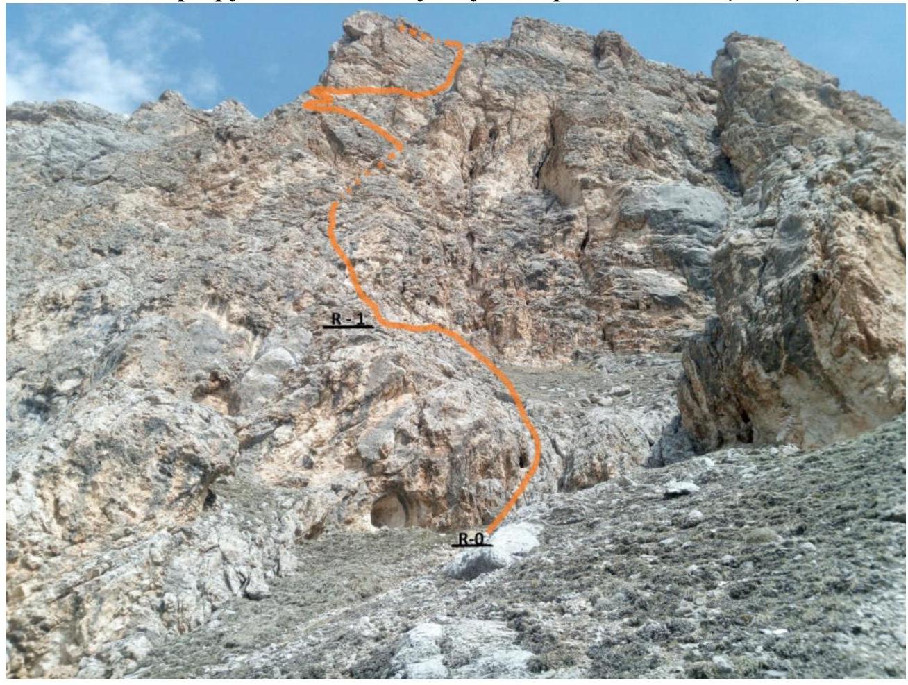
General photo of the summit
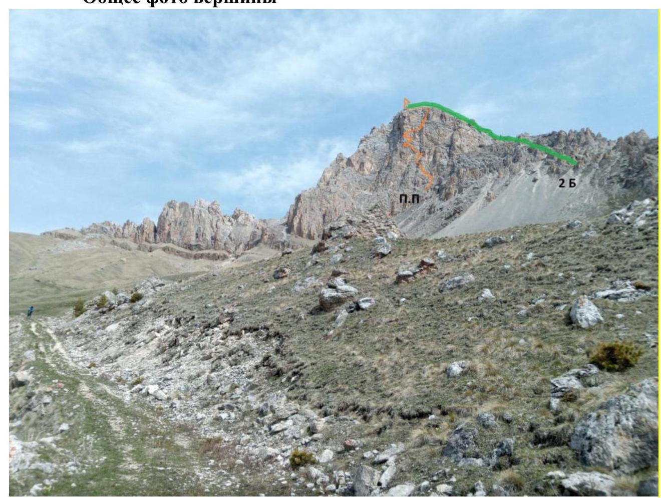 Orange line — team ascent route
Green line — category IIB route
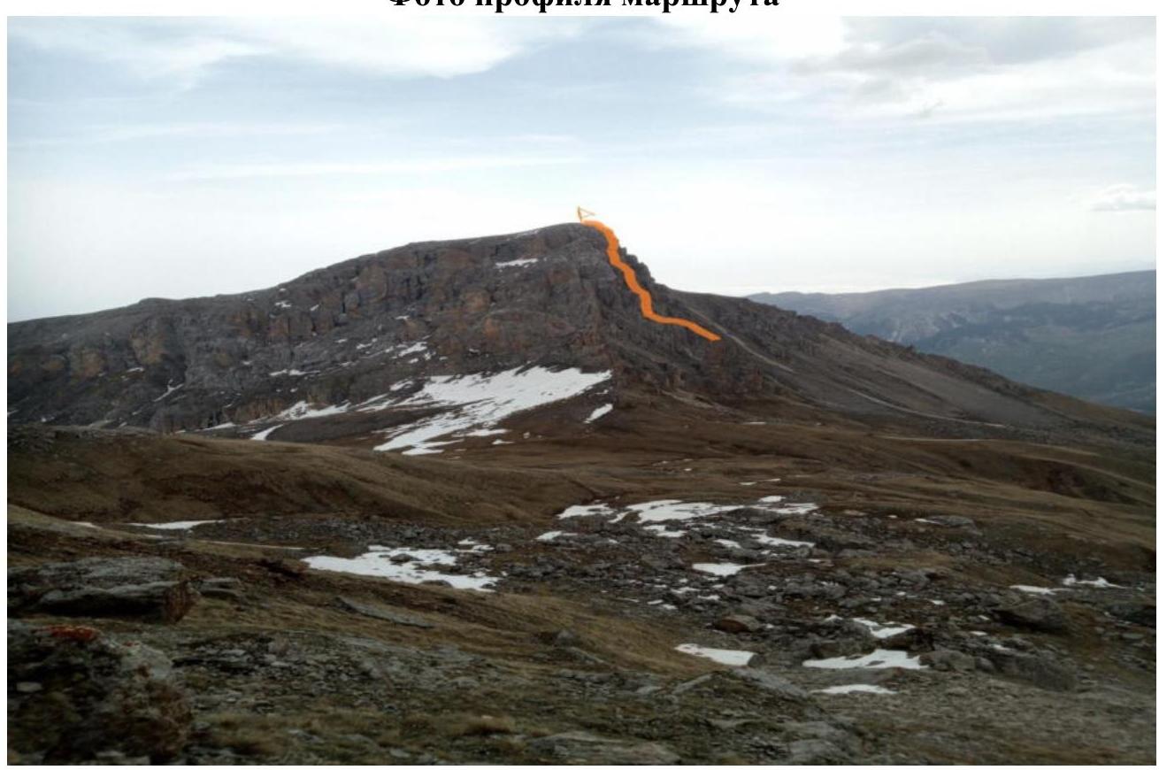
Orange line — team ascent route
Green line — category IIB route
Route profile photo
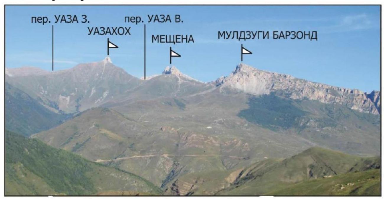
Area photopanorama
Brief Overview of the Ascent Area
The summit Muldzugi — Barzond is part of the Rocky ridge in the Greater Caucasus system (Republic of North Ossetia, Irafsky district).
The path to the mountain goes through the Uruh river valley:
- Turn right 2 km after Matsuta village.
- The road is dirt, partially in poor condition.
- After approximately 5 km, the road leads to a large "estate" built on the site of the Kumulta village ruins.
- There is a fork: straight to Donifars village, left to the summit.
- This fork can also be reached from Donifars, but the bridge over Uruh is in poor condition.
- After Kumulta, the road is very poor, only suitable for 4WD vehicles, even in summer.
For those traveling in winter:
- It is recommended to leave the car on a gentle grassy slope just above the "estate".
- Walking from there to the last кош (there are 3 on the way) takes about 2 hours (in summer by car — about half an hour).
The кош is located directly at the foot of the mountain:
- There is a spring in summer, but with low flow — water should be taken along.
- Currently, there were no issues with water, with plenty of snow around.
- The кош has four beds, and there are many convenient places for tents nearby.
- The кош serves as the base camp.
- Its coordinates: 43.0112 N, 43.7169 E, elevation 2480 m.
- Marked on the ViewRanger navigator at maximum scale.
- Marked with an asterisk on Fig. 1.
Additional information:
- Mobile connection (Megafon) in the area is available but unstable.
- EMERCOM registration by phone: 8-928-492-09-62.
2. Route Characteristics
Technical photo of the route
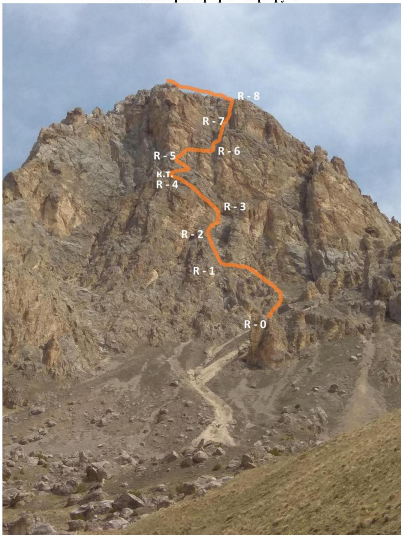
Technical characteristics of the category IIIB route sections.
| Section | Relief characteristics | Difficulty category | Length, m | Type and number of anchors |
|---|---|---|---|---|
| R0–R1 | Scree, grassy ledge | 2+ | 60 m | 0 |
| R1–R2 | Wall | 4; 3 | 20 m; 25 m | 4 |
| R2–R3 | Scree terrace and rock wall | 2; 3 | 25 m; 10 m | 2 |
| R3–R4 | Overhanging wall and wall with ledges | 5+; 3+ | 5 m; 40 m | 4 |
| R4–R5 | Crack and steep rock ledge | 4; 3 | 4 m; 25 m | 2 |
| R5–R6 | Broken wall | 5 | 40 m | 7 |
| R6–R7 | Wide internal angle | 4; 4+ | 30 m; 10 m | 5 |
| R7–R8 | Wide internal angle | 4 | 30 m | 3 |
| R8–R9 | Flat ridge | 1 | 70 m | 0 |
3. Team Actions Characteristics
| Section | Description | Photo number |
|---|---|---|
| R0–R1 | From a small grotto, up and left 50 m; 45° 2+ through simple rocks and grassy slope. The grassy slope turns into a horizontal rock ledge on the left — 10 m; 2+. | 1 |
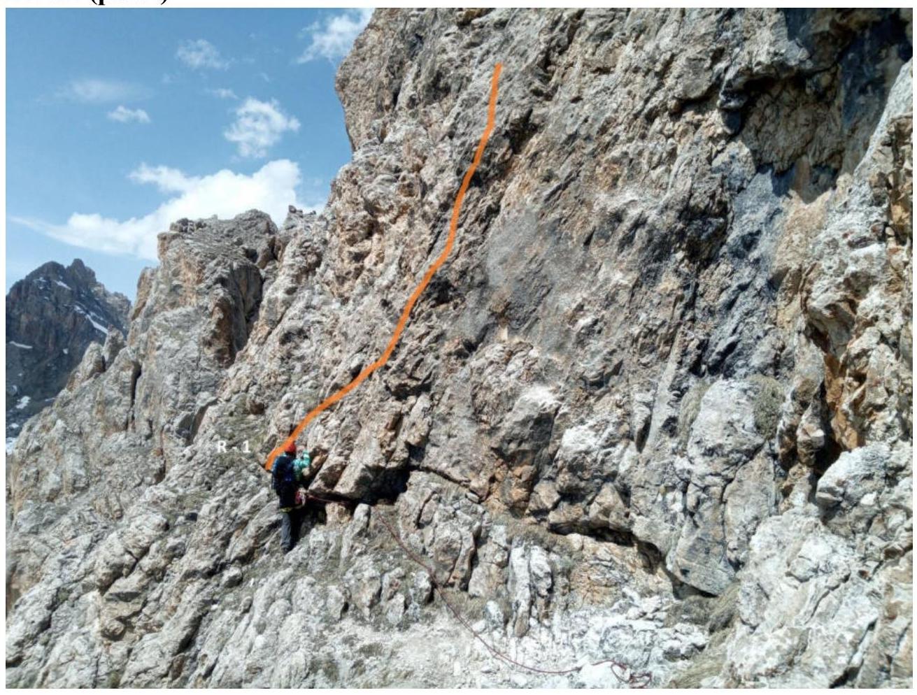
| R1–R2 | From the left part of the ledge, up a small ridge 20 m, 60° 4. Then the ridge becomes gentler — 25 m; 30° 3 to a large scree terrace going up to the right. | 2 |
| R2–R3 | Along the terrace 25 m; 20° 2 and turn 90° left into a small rock circus 10 m; 30° 3. | 3 |
| R3–R4 | In the left part of the circus, 5 m overhanging wall 5+; 95° and from it up and right, a wall with ledges 40 m; 50° 3+ to a small horizontal ledge. Control point. | 4 |
| R4–R5 | In the right corner of the ledge — a crack. Along it 4 m; 4; to the next steep 35° rock ledge going up to the right 25 m; 3. | 5; 8 |
| R5–R6 | From the edge of the ledge to the right, a red, broken, vertical wall begins. Through it, at an angle of 45° to the right and up, a difficult narrow ledge 25 m; 45° 5. Ends with a wall. Along it, a difficult traverse to the right 3 m and up 7 m 5. The wall leads to a large horizontal ledge 5 m. The entire section is 40 m. | 6; 8 |
| R6–R7 | Along a large internal angle 70° 4; 4+ 40 m to a small ledge. | 7 |
| R7–R8 | Further along the internal angle to the ridge. 70° 30 m. 4. | 9 |
| R8–R9 | Along the ridge to the left — 70 m to the summit. 20° 1. |
Start of the category IIIB route to the summit Muldzugi — Barzond.
- R0–R1 (Fig. 1)
- R1–R2 (Fig. 2)
R2–R3 (Fig. 3)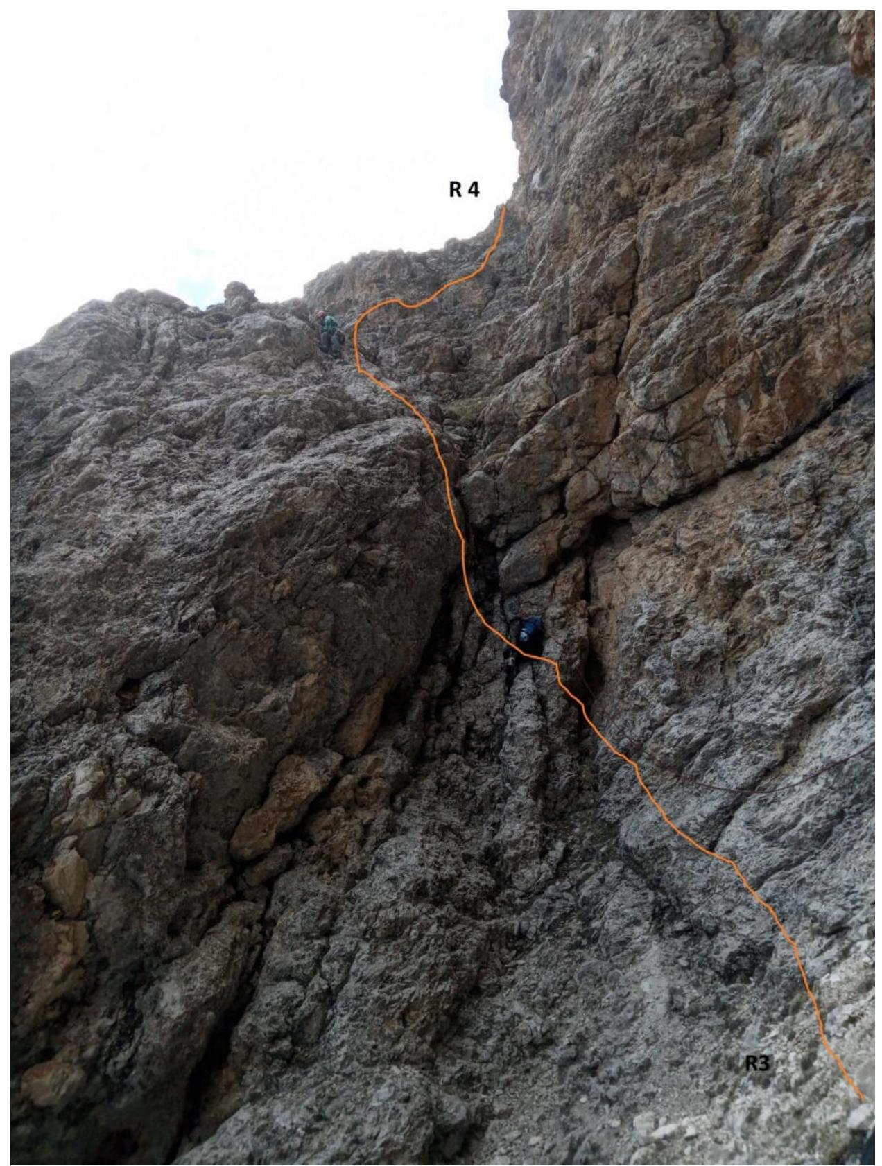
R3–R4 (Fig. 4)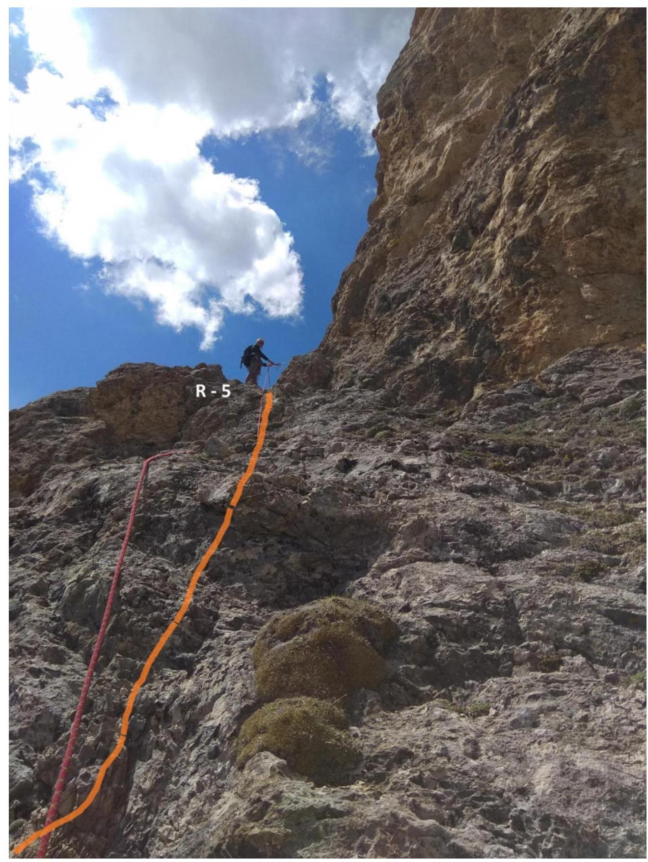
R4–R5 (Fig. 5), R5–R6 (Fig. 6)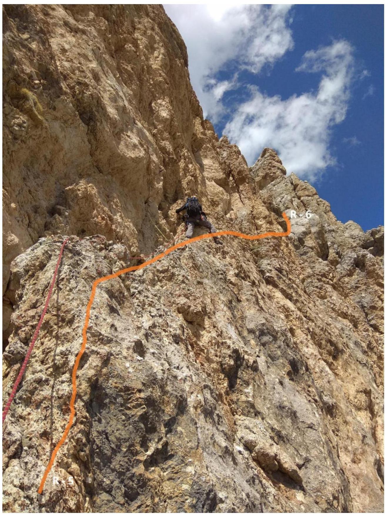 R6–R7; R7–R8 (Fig. 7)
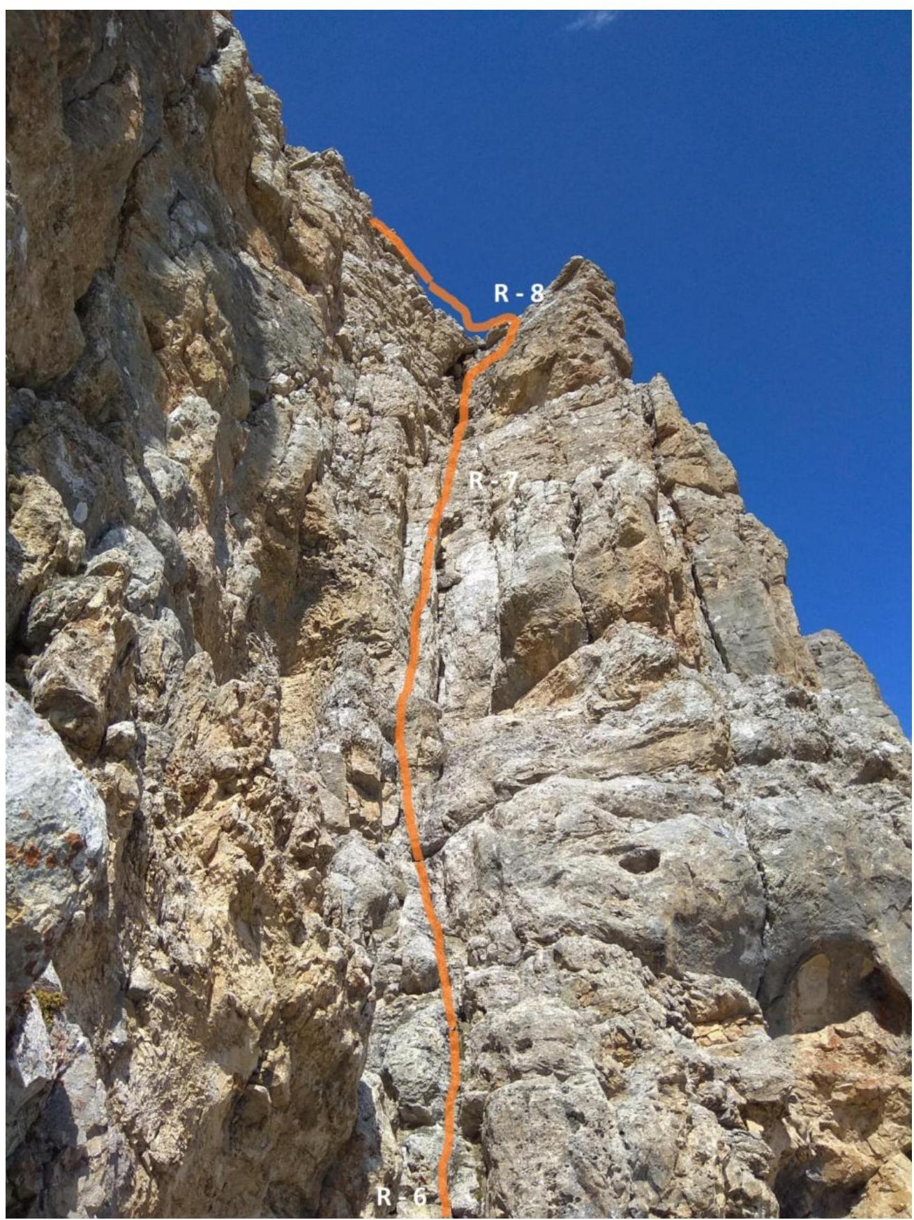 Control point — sections R4–R6 (Fig. 8)
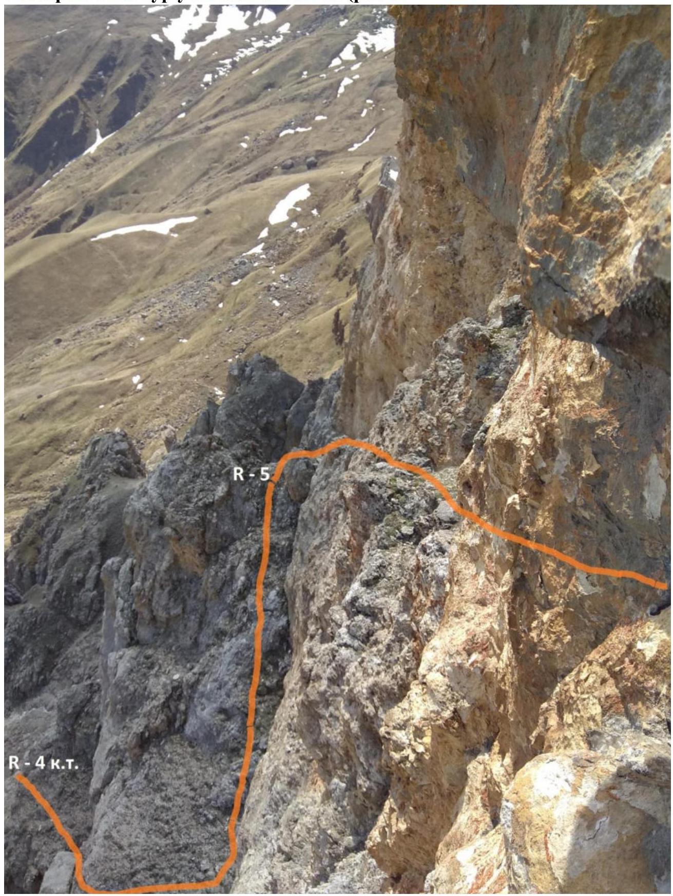
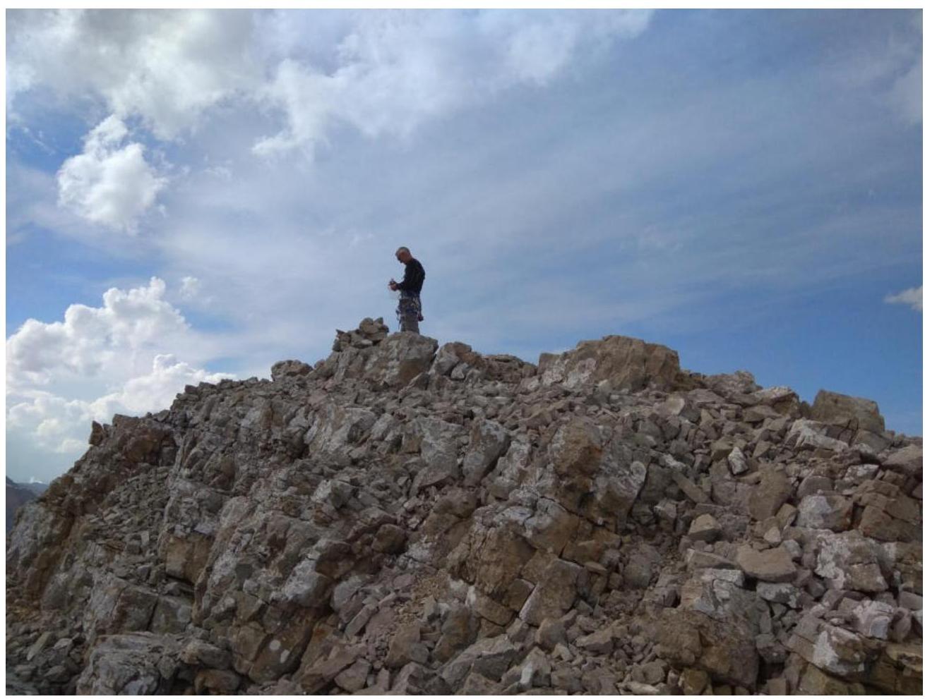 R8–R9 — Summit (Fig. 9)
Conclusions and Recommendations
The route is logical and safe. Corresponds to the stated difficulty category. Comparable to the routes on Dashtsar category IIIB; Tbau category IIIB. Suitable for inter-season ascents. In this area, there are routes from category IB to IVA, but there is a lack of category III routes. Recommended for training and sports ascents by a group of 2–4 people.