Ascent Passport
- Ascent category: rock climbing
- Ascent area: Caucasus; 2, 6; Sugansky Ridge.
- Peak, route: p. 3670 (3670 m) from the East via the couloir.
- Estimated difficulty category: 2B.
- Route characteristics:
elevation gain — 550 m. route length — 750 m. length of sections:
- 4th difficulty category — 10 m.
- 3rd difficulty category — 20 m.
- 2nd difficulty category — 115 m.
- 2nd difficulty category — 100 m.
average steepness of the main part of the route — 50°. 6. Number of pitons hammered: 2 pcs. 7. Number of walking hours/days — 5–6 hours. 8. Number of overnight stays — 1 at a bivouac. 9. Leader: Levkovsky Yu. V. — CMS.
Participants:
- Leontyeva A. S. — 1st sports category
- Preval A. S. — 2nd category
- Coach: Levkovsky Yu. V. — CMS.
- Departure to the route: August 2, 2003.
Return to the bivouac: August 2, 2003.
- Organization: AUSB "Digoria".
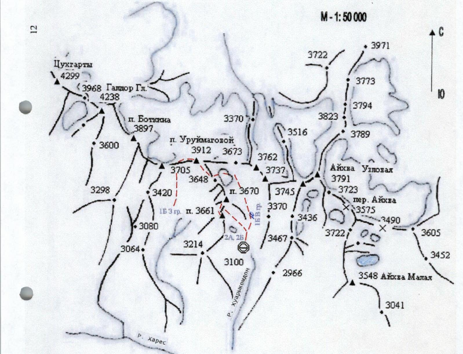
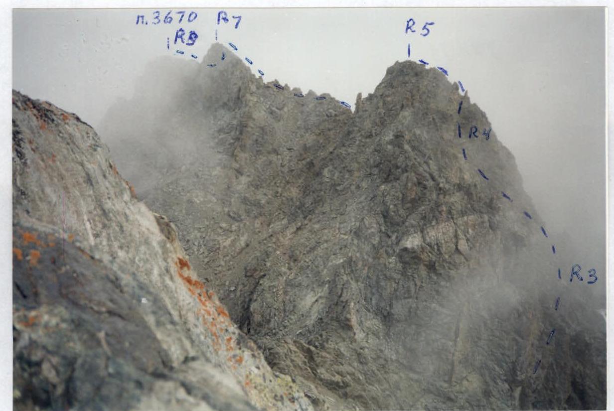
Area diagram: Galdor Gl. – Aykhaa Uzlовая.
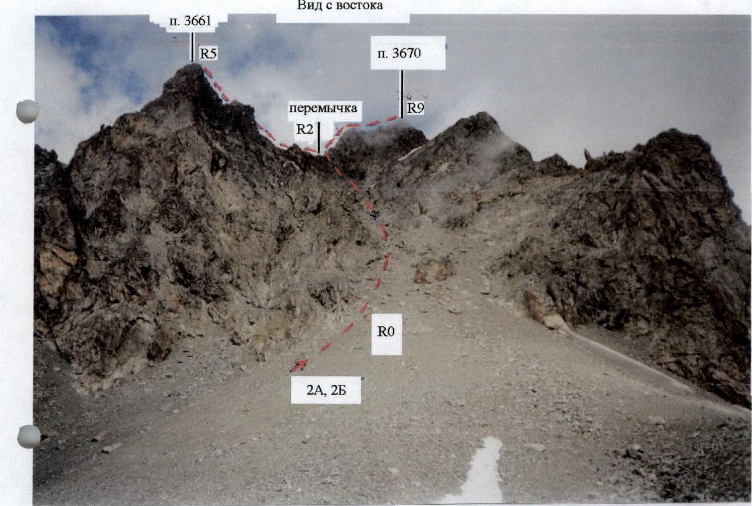
Taken from the cirque (3300 m).

UIAA Scheme
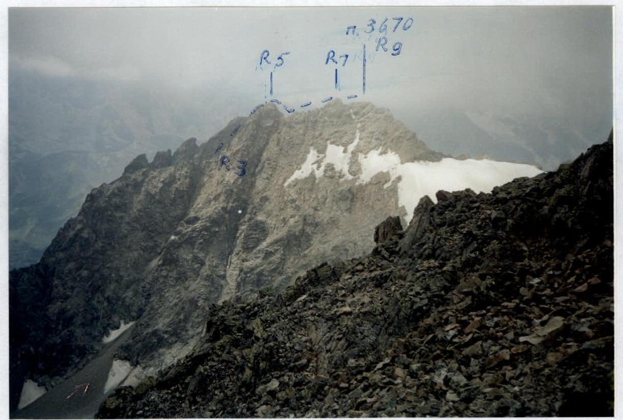
R0–R1 – 500 m; 40–45° – scree couloir. R1–R2 – 2nd difficulty category; 50 m; 50–45° – ruined rocks. R2–R3 – 2nd difficulty category; 15 m; 15° – rock shelf. R3–R4 – 4th difficulty category; 10 m; 60° – wall. R4–R5 – 2nd difficulty category; 20 m; 45° – rock-scree couloir. R5–R6 – 3rd difficulty category; 20 m; 50° – wall. R6–R7 – 2nd difficulty category; 50 m; 45° – rocks. R7–R8 – 2nd difficulty category; 50 m; 45° – ruined rock shelves. R8–R9 – 2nd difficulty category; 70 m; 50–25° – ridge rocks, ridge.
Route Description
From the overnight stay, ascend steep moraine hills in the cirque, staying on the left part, towards the beginning of the wide scree couloir between peaks 3661 m and 3670 m — 1.5 hours. Then the path goes under the cliffs along the left (as you move) side of the couloir to its middle part. Then, transition to the central part, ascend the steep small and medium scree with large stones and, 50 m before reaching the saddle, move right into a small convenient niche for belaying, located between the wall and a large stone broken off from it. Further:
- Ascend straight up 50 m on steep ruined rocks to the saddle.
- Belay through outcrops, via ferrata.
Turn right and bypass the gendarme on the right (as you move). Then ascend left — up the steep wall of the inner corner, then move right — up the steep narrow couloir with live scree to a small saddle (good spot for belaying). Up 10 m on rocks to the ridge.
Further:
- Up 10 m on rocks to the ridge.
- Bypass the gendarme on the right with a descent of 10 m and again ascend left — up to the ridge, moving along it for 15 m.
- Ascend the wall 10 m, then via simple ruined rocks — exit to the sub-summit.
Descend from the sub-summit on the left side along steep ruined rock shelves under the southern side of the ridge, then ascend right up to the ridge. Move up along the ridge rocks, then along the wall 50 m and again, already along the simple ridge — exit to the summit. From the overnight stay — 5–6 hours.
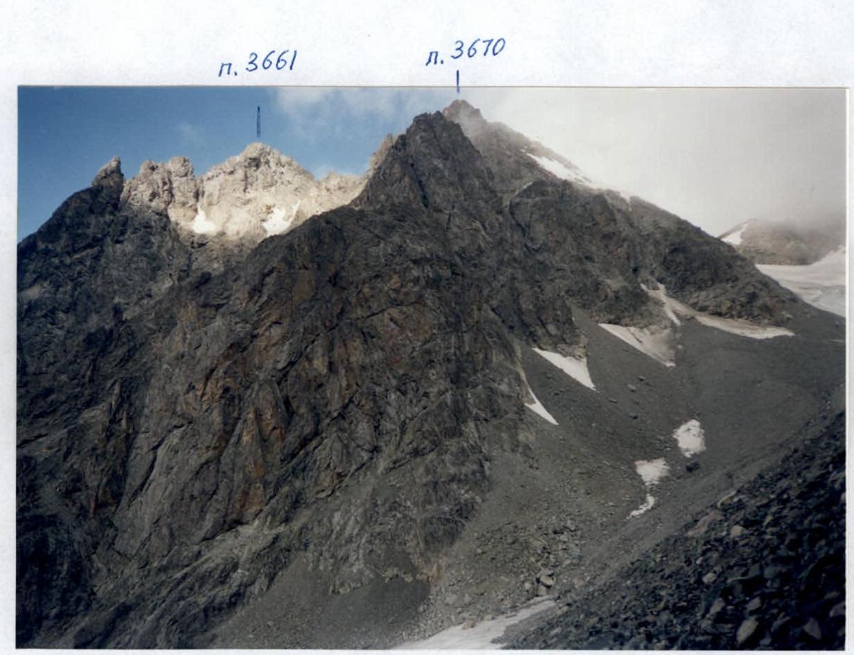
Taken from 3500 m.
Taken from 3550 m.
Taken from the summit of p. 3661.


