To the Alpine Federation of Russia.
The Classification Commission of the FAR of Alania sends a report on the first ascent made by the climbers of the Mountain Club of SKGMI "Krokus" from Vladikavkaz on peak 3661 (3661 m) via the South wall on August 1, 2012.
The route was preliminarily assessed as category 3A.
Report
On the first ascent to peak 3661 (3661 m) via the South wall, approximately category 3A, made by the climbers of the Mountain Club of SKGMI "Krokus" from Vladikavkaz on August 1, 2012.
Under the leadership of Yuri Vasilyevich Levkovsky.
address: 362035, Alania, Vladikavkaz, pr. Kosta — 273/69, uvl53@yandex.ru
Ascent Passport
- Ascent type: rock
- Ascent area: Caucasus, Sugansky ridge, 2,6
- Peak, route: peak 3661 (3661 m), South wall.
- Expected category: 3A rock, first ascent
- Route characteristics:
Height difference — about 350 m. Route length — 550–600 m. Length of sections: 3rd category — 200 m, 4th category — 80 m, average steepness of the main part of the route — 45–50°
- Belaying through rock formations, rock pitons
- Number of climbing hours/days — 7/1
- Number of nights: 2 — at a bivouac
- Leader: Yu. V. Levkovsky — Candidate Master of Sports
Participants:
- Dyakonov B. V.
- Kesaev A. V.
- Feofanova E. V.
- Coach: Levkovsky Yuri Vasilyevich, Candidate Master of Sports
- Departure to the route from the bivouac: August 1, 2012
Return to the bivouac: August 1, 2012
- Organization: Mountain Club SKGMI
"Krokus"
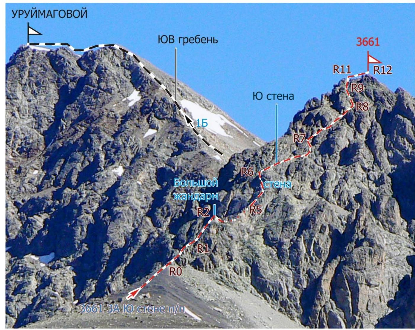
Route to peak 3661 via the South wall, first ascent
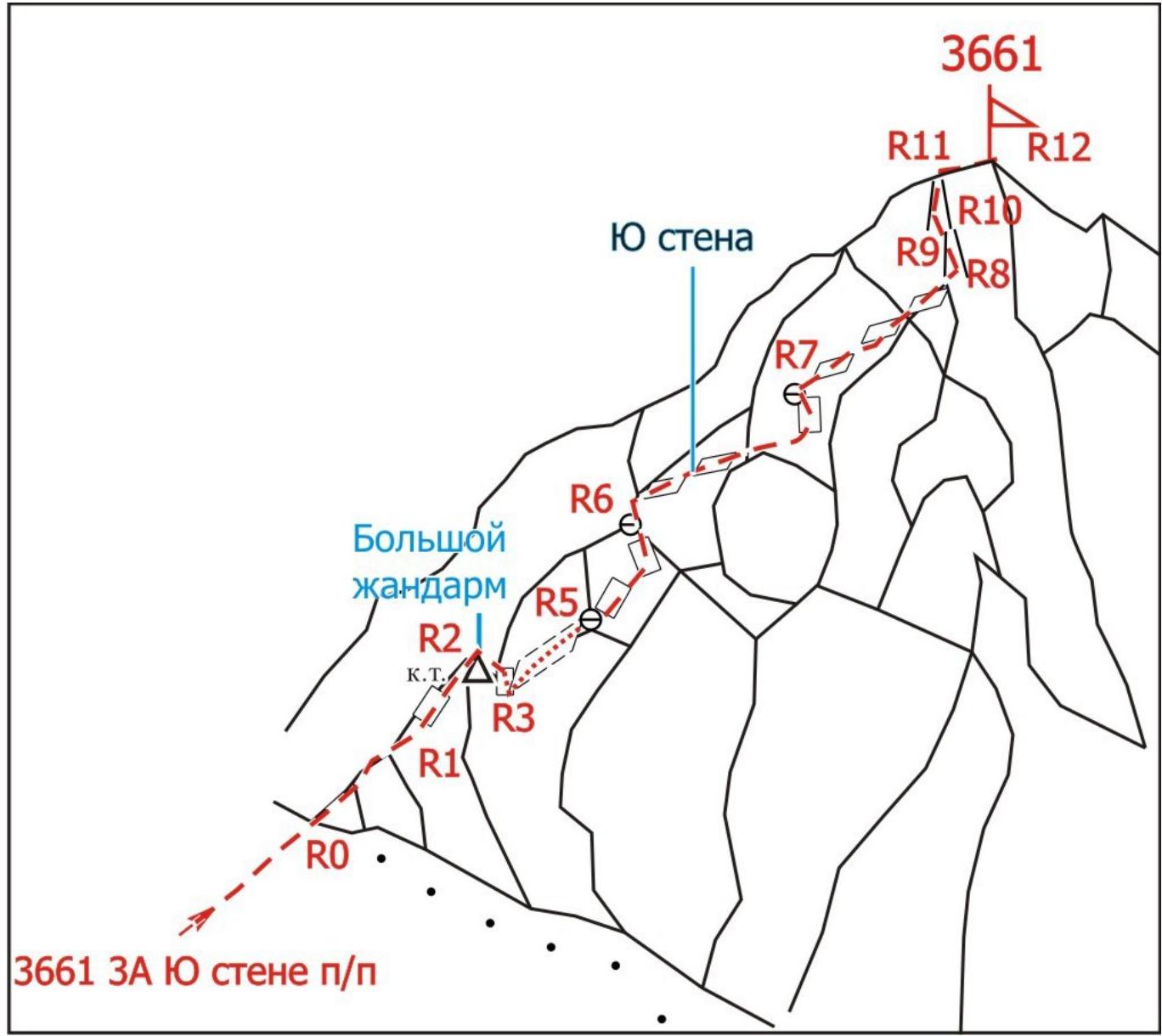
Route diagram in the UIAA scheme to peak 3661 via the South wall, first ascent
State as of 1963
Brief overview of the ascent area, history of peak exploration
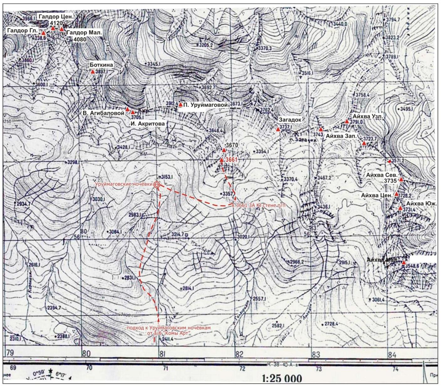
Peak 3661 (3661 m) is located in the eastern part of the Sugansky ridge in Western Digoria, in the southern spur of peak Uruimagovoy.
- To the north, the peak is bounded by a narrow ridge, separating it from peak 3670.
- To the south, a wide rock wall descends from the peak.
- To the east, peaks 3661 and 3670 are separated by a wide scree couloir.
The massif of the peak is composed of destroyed granites.
On peak 3661, a route of category 2A has been laid from the east via the couloir, by Yu. Levkovsky, 2003.
Preparation for the ascent
In preparation for the ascent, available materials were studied, the location of the peak was determined, preliminary reconnaissance and assessment of the route, approach path, and bivouac site were conducted, and the principle of ensuring radio communication was established. It was determined that:
- Radio communication is effective with the AUSB "Komy-Art";
- There is no mobile communication on the route with the region.
Approach description
The bivouac is located at the Uruimagovskie nochyovki under the southern slopes of peak Uruimagovoy.
From AUSB "Komy Art":
- Movement along the trail, then along the dirt road in the gorge of the Kharres river leads to the "Zhemchuzhina" waterfall — 1 hour.
- From the waterfall, we ascend to the right up the dirt road to the farm — 1 hour (height — 2200 m).
- Passing the descent to the river Aykhvandon on the left, bypassing the farm on the right, we exit onto a clearly visible trail on the slope, 100 meters above the farm.
- Turning left, we move along the trail traversing the grassy slope, leading through 1 hour to the river flowing from under the southern slopes of peak Uruimagovoy.
- We cross the river via stones, ascend to the right up the wide steep grassy ridge above the river to the flattening of the ridge before the rock-scree ascent — 1–1.5 hours.
- Traversing to the right along the grassy slope, we approach the river, which we cross via stones.
- We move upstream along the left bank of the river (orographic) along gentle grassy slopes, exiting into the upper part of the grassy-scree cirque — 1.5 hours.
Bivouac
- Located in the lower part of the cirque on a wide grassy area (30×50 m), protected from the wind.
- Water — from a stream.
- An alternative bivouac is possible on wide grassy areas on the other side of the stream.
- Height — 3100 m.
Total time from the settlement of AUSB "Komy Art" — 6–8 hours.
Route description
From the Uruimagovskie nochyovki, we ascend to the right up the steep grassy-scree slope to the beginning of the route, a large gendarme at the lower end of the South wall of peak 3661 — 3300 m, 1.5 hours.
Section R0–R1. We approach the wall of the large gendarme via несложным скалам (1+ category, 45°, 40 m).
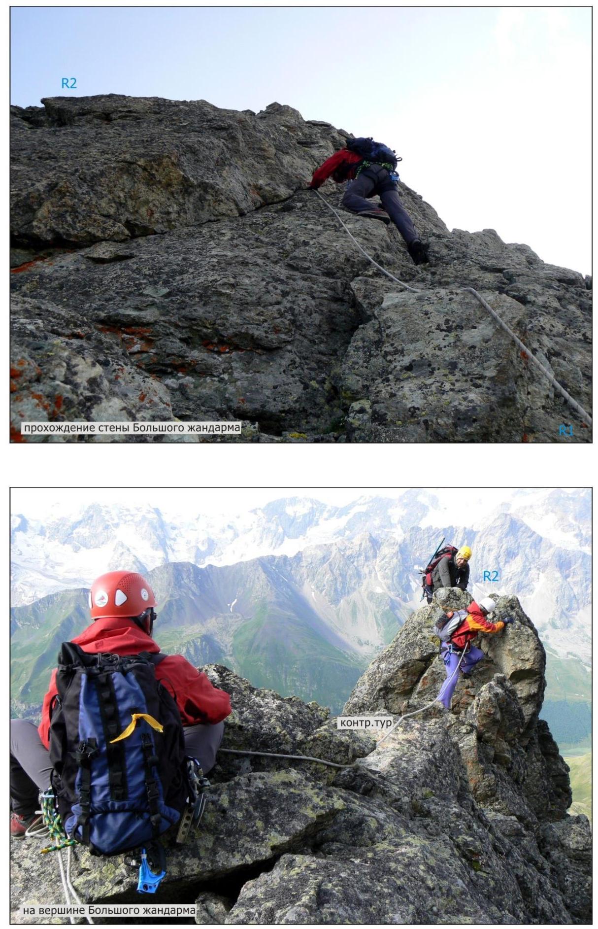
Section R1–R2. Overcoming the wall of the large gendarme, we exit onto the top of the gendarme, contour (4 category, 50°, 40 m).
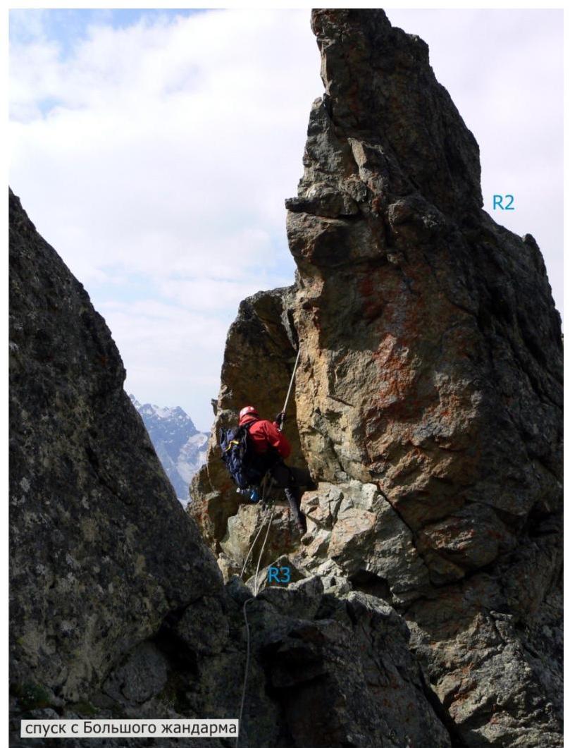
Section R2–R3. From the large gendarme, we descend to the right down the steep wall (5 m, rappel) onto a rock shelf, along which we move to the left onto a rock saddle (5 m, convenient belay spot).
Section R3–R4. From the saddle, we move to the right along a wide rock shelf towards the rocks of the ridge (2 category, 30°, 20 m).
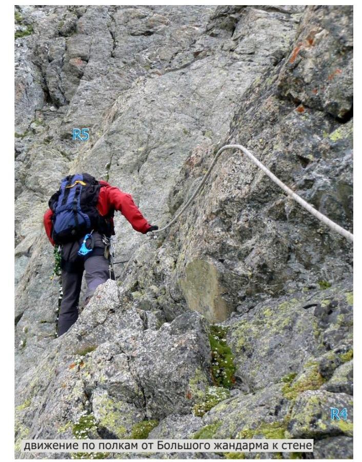
Section R4–R5. Movement along the rocks on the left side of the ridge leads to the beginning of the South wall of peak 3661 (3 category, 45°, 50 m).
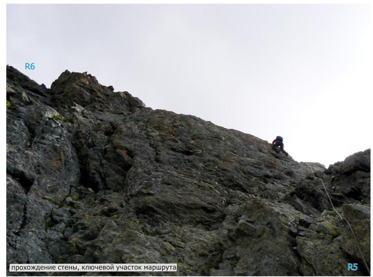
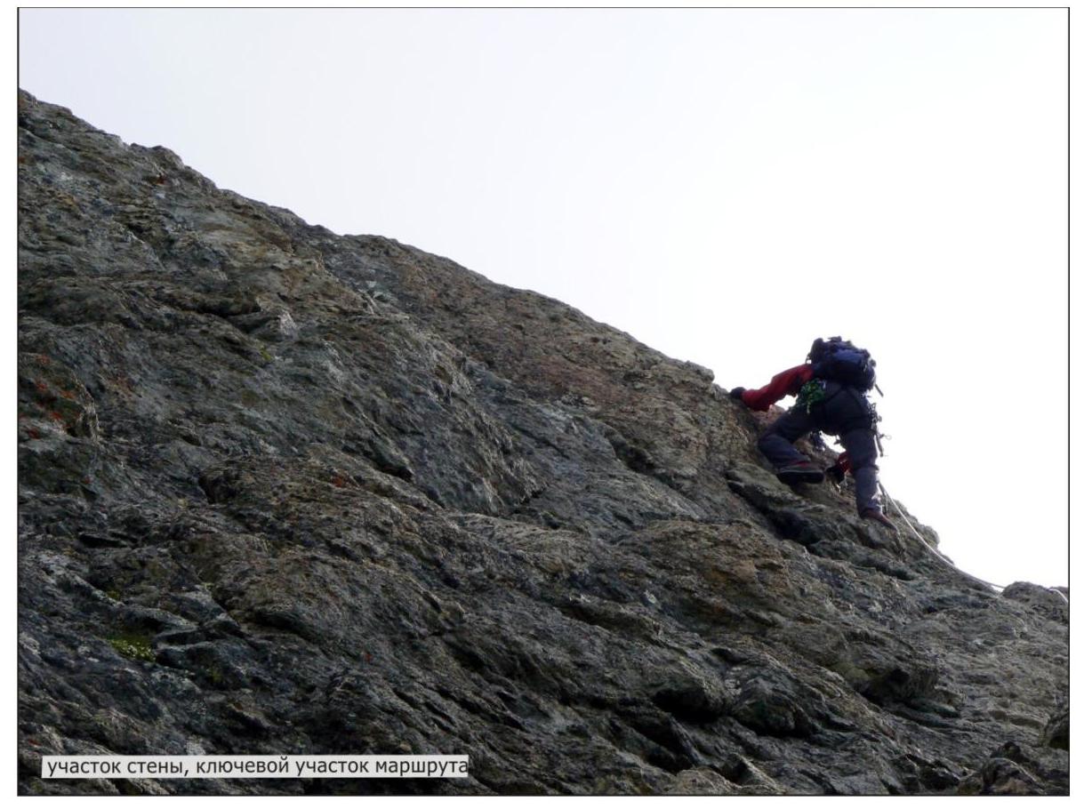
Section R5–R6. Up the wall, first to the right and up, then to the left and up, exiting onto a wide rock shelf, a convenient belay spot:
- 4+ category
- 60°
- 40 m (key section of the route).
Section R6–R7. From the shelf, we move to the right and up along rocks of medium difficulty, then to the left and up along rocks onto a rock-scree shelf, a convenient belay spot:
- 3 category
- 45°
- 50 m.
Section R7–R8. From the shelf, we move along rock shelves towards the beginning of the rock couloir (2+ category, 40°, 80–100 m).
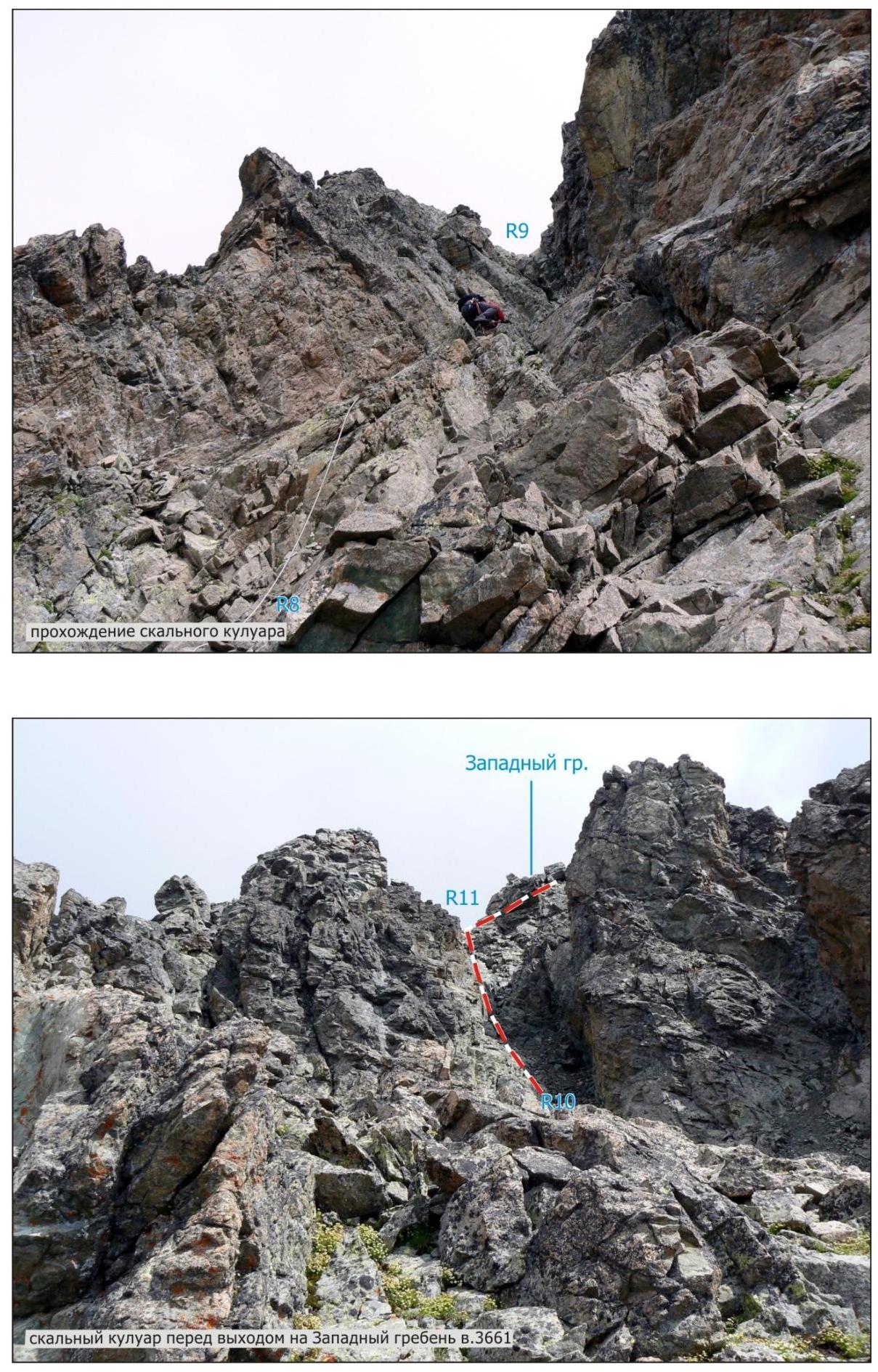
Section R8–R9. Up the rock couloir, exiting onto a rock shelf (3+ category, 50°, 50 m).
Section R9–R10. To the right along a simple rock shelf towards the beginning of the rock couloir (1 category, 25°, 29 m).
Section R10–R11. Up the rock couloir, exiting onto a rock saddle in the West ridge of peak 3661 (3+ category, 50°, 50 m).
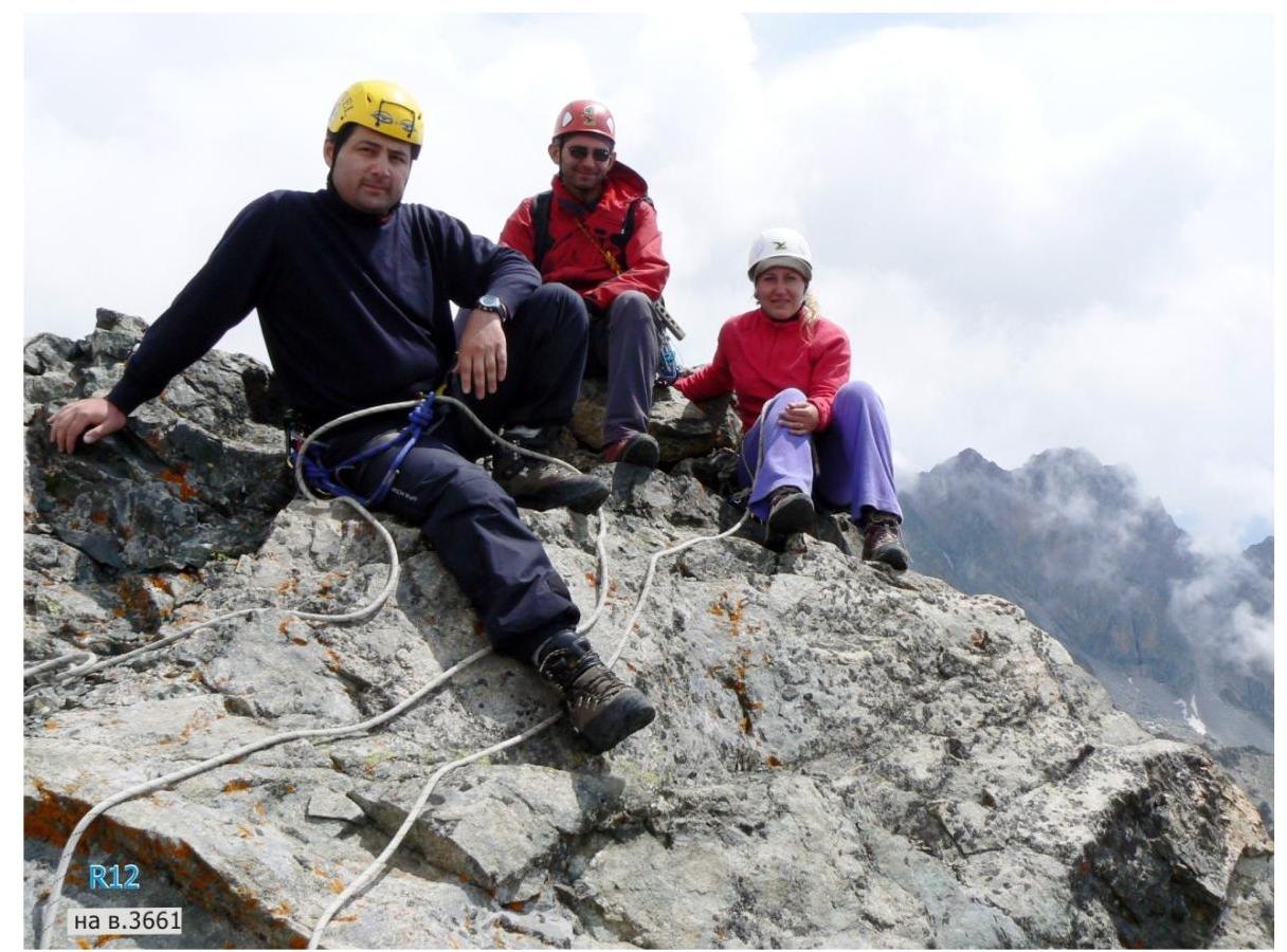
Section R11–R12. Turning to the right, we move along the rocks on the right side of the ridge towards the summit (2 category, 45°, 20 m).
From the Uruimagovskie nochyovki — 6–7 hours.
Recommendations
The route is logical, objectively safe, and passable at any time of the year. Belaying on the route is through rock formations and rock pitons. Recommended for training groups.
Descent from the summit follows the route of category 2A. Exiting from the couloir separating peaks 3661 and 3670, turning to the right, bypassing the massif of peak 3661, under the rocks, we ascend along the steep scree slope south of the South wall onto the grassy-scree ridge, from which we descend to the Uruimagovskie nochyovki. Descent time — 2.5–3 hours.
The approach to the beginning of the route is also possible from the bivouac located at the nochyovki under the pass of Zagadok.img-3.jpeg
Peaks of the eastern part of the Sugansky ridge from the south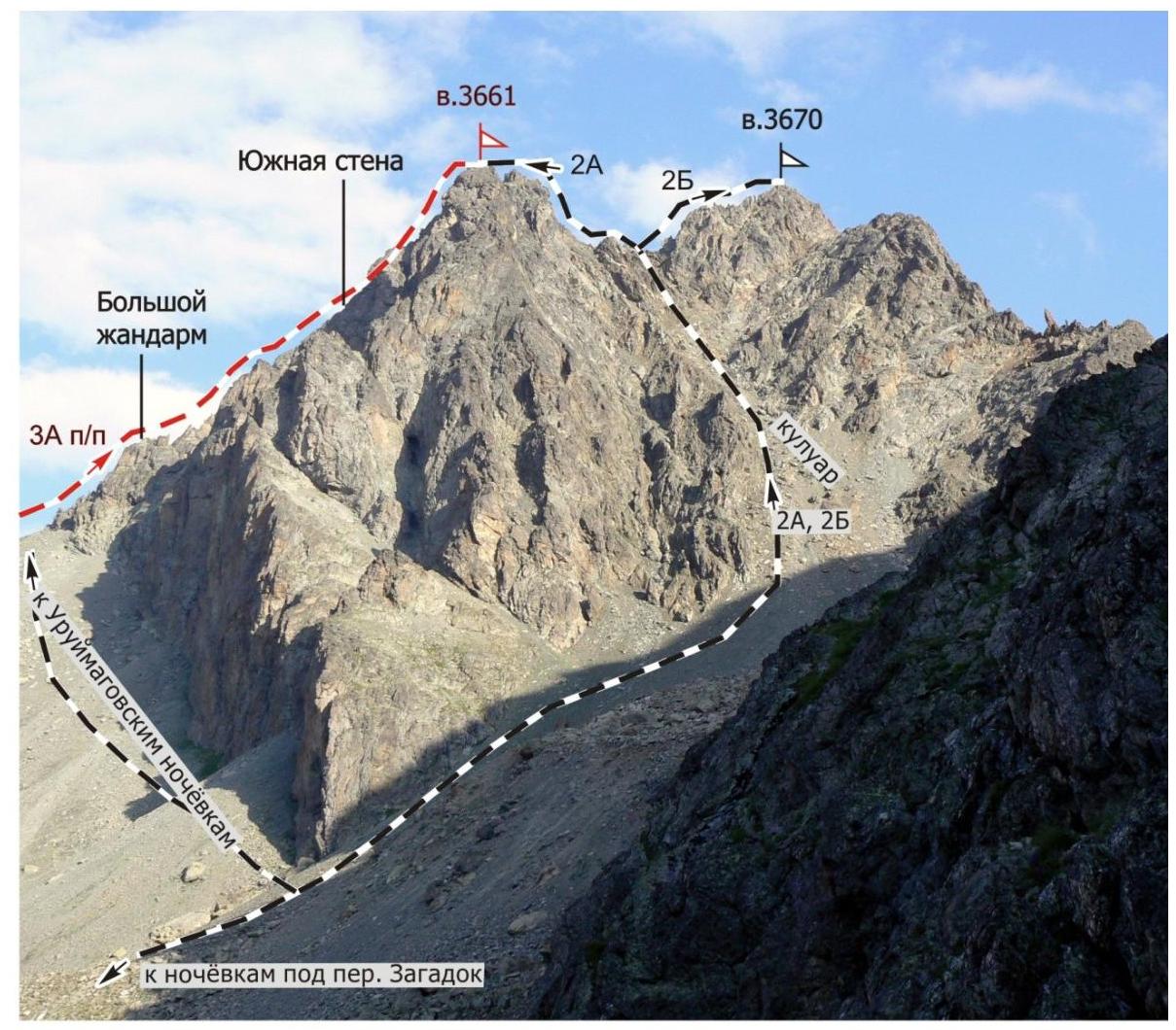
Peaks 3661, 3670 from the east (taken from a height of 3300 m)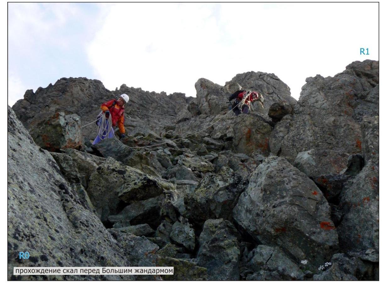 ■
■
 ■
■
 R6
R6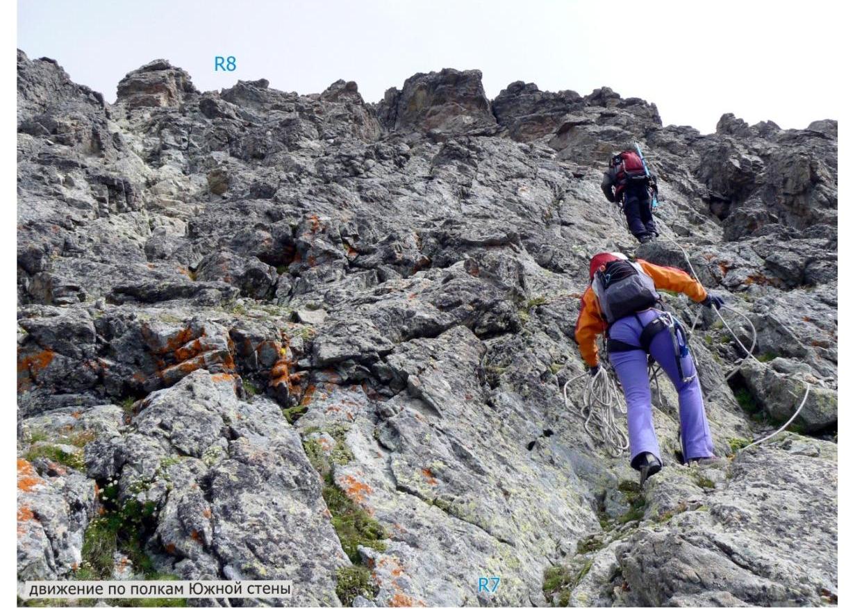 movement along the shelves
- of the South wall
Footnotes
-
rock couloir before exiting onto the West ridge of peak 3661 ↩