Ascent Passport
- Caucasus, Digoria, Chirh ridge, section number 2.6.
- 300 years of St. Petersburg — 3505 m; via the North ridge.
- Proposed 1B cat. dif.; first ascent.
- Route character — rocky.
- Route height difference — 700 m (from the base of the ridge). Length of the key part of the route — 50 m (from the exit point to the North ridge, from point R1). Length of sections with 4 cat. dif. — 2 m. Steepness of the main part of the route — 70°. Average steepness of the entire route is about 30°.
- Pitons left on the route — none. Total used on the route: pitons — 1; chock stones — 5.
- Team's travel hours — 6 h; days — 1.
First group (May 21)
- Leader: Egorin Sergey Vladimirovich — Master of Sports Participants: Gagiev Vilyam Taymurazovich — 1st sports category; Zhirnov Dmitry Nikolaevich — 2nd sports category.
Second group (May 22): O. Ryzhanov — Candidate Master of Sports; A. Gorbunov — 2nd sports category; and representatives of the FA St. Petersburg: D. Trofimov; O. Koltunov; S. Ipatov; A. Batulov — all 2nd sports category.
-
Coaches: Egorin S.V. — Vladikavkaz; Kapitanov O.V. — St. Petersburg.
-
Approach: May 20 and May 21, 2003. Summit (1st and 2nd groups): May 21 and May 22, 2003. Return: May 22 and May 23, 2003.
-
Organization: FA RSO-A and FA St. Petersburg.
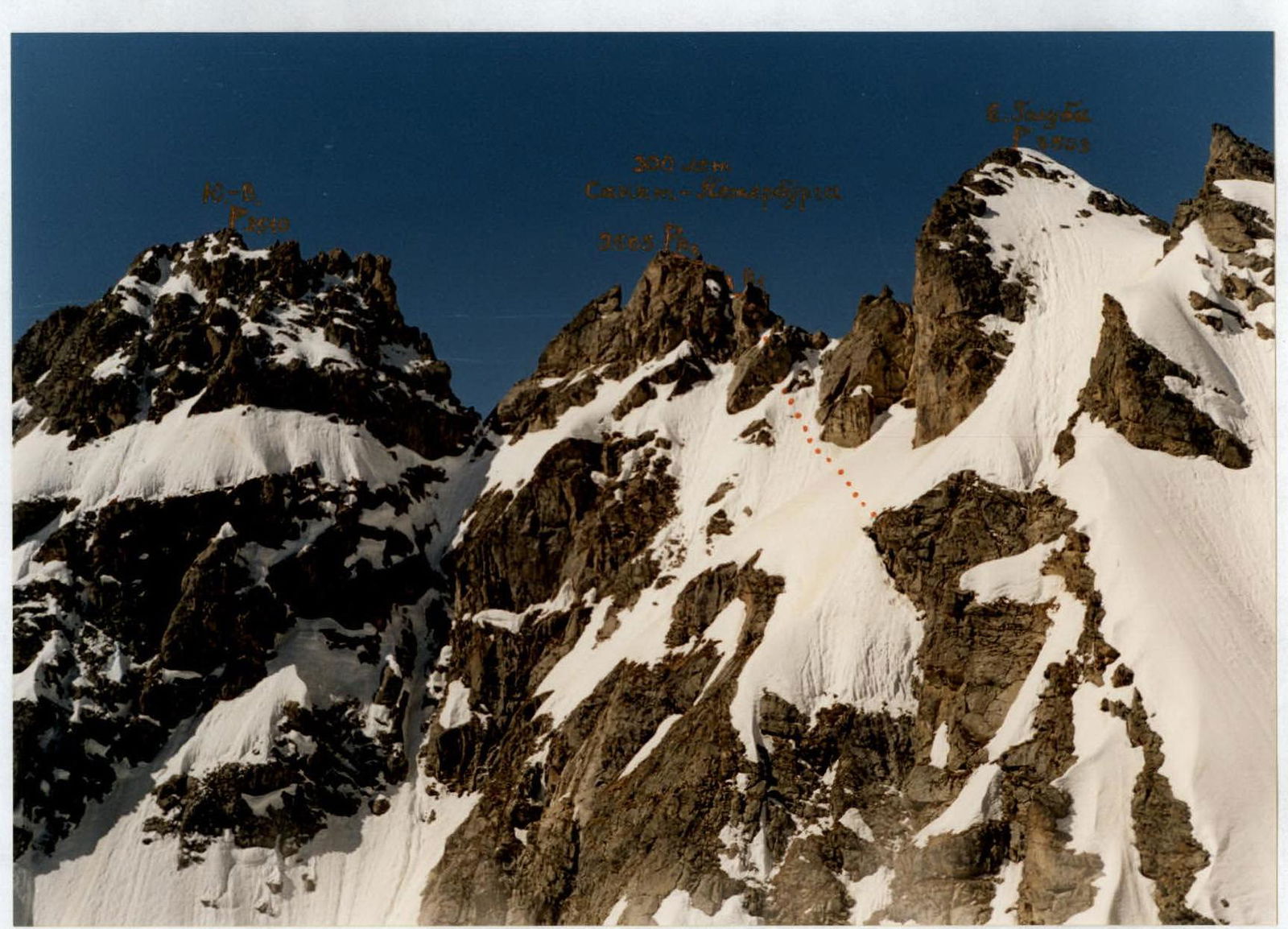
View of the North ridge of peak 300 years of St. Petersburg from the North-East. The first ascent route is marked.
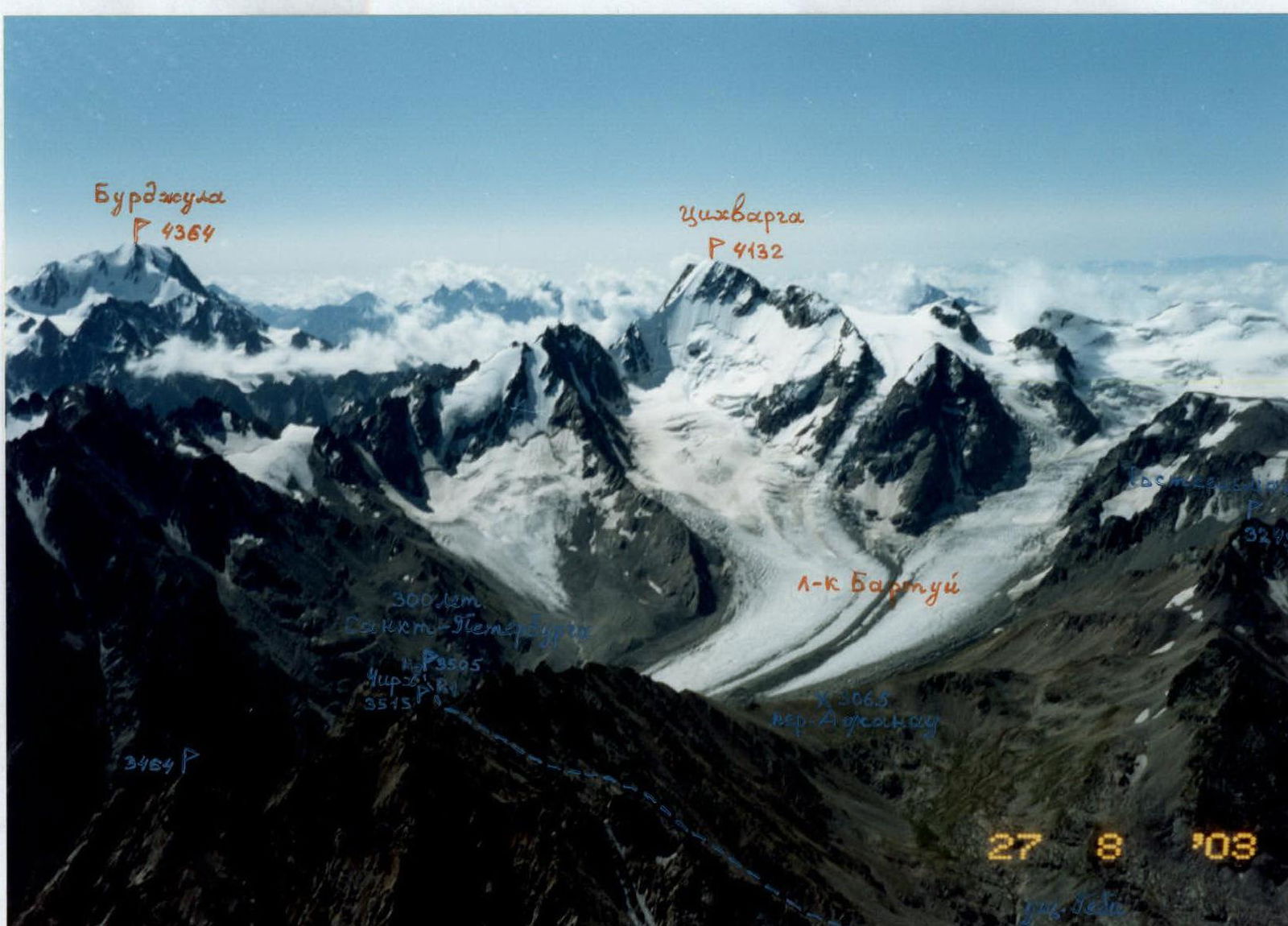
View of the ascent area from the North. Photo from a helicopter. The ascent route is marked, with an option to exit to the North ridge from the West, from the Gebi gorge. The peaks of G.K.H. are labeled.
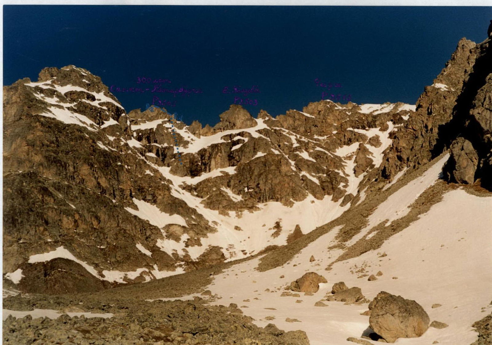
View from the East at the central part of the Chirh ridge. The ascent route is marked. Photo from overnight stays, from the scree cirque.