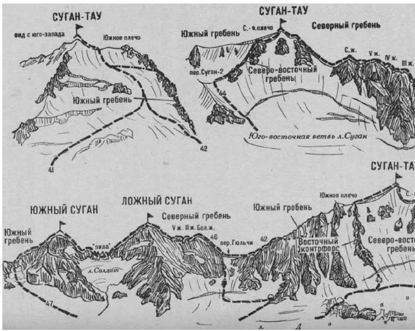
Fig. 12
- Sugantau via the South Ridge (combined route, category 2B difficulty, Fig. 12).
The path from the "Nakhashbita" meadow (group of 4-20 people) to the Gulchi pass with a bivouac on the pass or on the rocky platforms of the Eastern counterfort of the South Ridge of Sugantau peak, under the right side of the Gulchi pass, is described in route 46.
At the pass, turn right and ascend along the edge of snow and rocks along the left side of the South Ridge of Sugantau peak, then up a steep 80-90-meter ice-and-snow slope (pitched protection).
Beyond the ascent:
- along the sharp snowy South Ridge,
- then along a small rocky outcrop, exit left onto the upper snow plateau of the southwestern slope of the peak.
The upper plateau can also be reached from the left of the South Ridge, via an ice-and-snow slope with a 60-80-meter ice-and-snow ascent (pitched protection).
On the right side of the gentle snowy slope of the plateau (closed crevasses), staying close to the South Ridge, approach the summit ascent.
From the plateau:
- overcome two ice crevasses via snow bridges (protection)
- Ascend a steep 80-100-meter ice-and-snow ascent onto the broad summit ridge with large snow cornices to the northeast.
Here, turn left and along the left side of the broad, gentle 80-100-meter snowy South Ridge (right - large cornices) approach the dome of the summit. From here, after overcoming a small ice crevasse:
- Ascend 50-60 meters up a short ice-and-snow ascent to the summit of Sugantau.
Upon reaching the plateau, one can:
- Cross it to the left (closed crevasses).
- Overcome the bergschrund.
- Ascend the steep ice-and-snow slope (protection) to Sugantau.
From the Gulchi pass - 3.5-4 hours. Descent - via the ascent route.
Naumov A. F. Karaugom, Digoria, Tsey (Central Caucasus), M., "Fizkultura i Sport", 1976.