Ascent Passport
- Digoria, Rocky Range, Classification section number — 2.6.
- Muldzugi-Barzond (3064 m); from the West via the Northern ridge.
- Proposed category: 1B; first ascent.
- The route is of a rocky nature.
- Height difference of the route — 350 m.
Route length is about 900 m. Average steepness:
- main part of the route: up to 60°.
- entire route: 30°.
- Insurance on the route is provided by rock formations.
- Climbing hours: 4; days: 1.
- Leader: Egorin Sergey Vladimirovich — Master of Sports
Participants:
- Abramov Andrey Yurievich — badge holder
- Rodin Alexander Vladimirovich — 2nd sports category
- Zhirnov Dmitry Nikolaevich — 2nd sports category
-
Coach: Egorin Sergey Vladimirovich — Master of Sports
-
Departure to the route: October 21, 2003.
Reached the summit: October 21, 2003. Returned to Base Camp: October 21, 2003.
- Organization: North Ossetian Republican Search and Rescue Service of the Ministry of Emergency Situations of Russia.
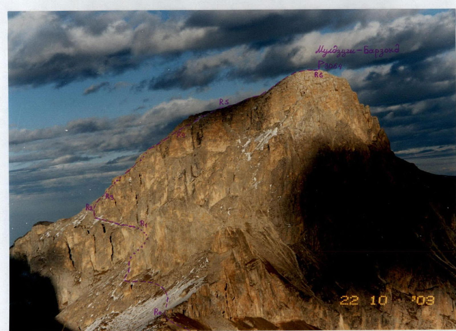
Muldzugi-Barzond (3064 m) from the West. The first ascent route from the West via the Northern ridge is marked. October.

Photopanorama of the area. View from the Southeast, from the approaches. February. Classified routes to the peaks of the area are marked.
- Route to peak 1
- Route to peak 2
- Route to peak 3
- Route to peak 4
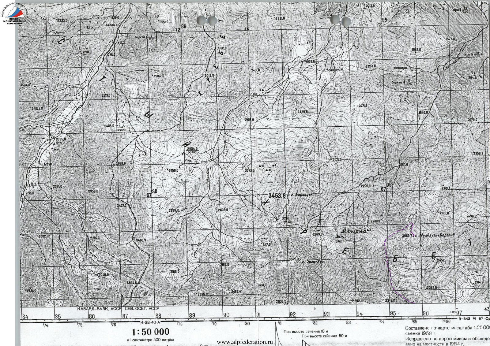
1:50 000
1 cm = 500 m
Brief Overview of the Climbing Area
The ascent took place in Digoria, in the Rocky Range. This rarely visited part of the Rocky Range in North Ossetia is located between the valleys of the Haznydon and Urukh rivers.
The highest point in this area is the peak Uazakhoh (3529 m) — it is also the highest peak in the Rocky Range within North Ossetia. The characteristic tower of Uazakhoh is easily recognizable from everywhere — both from the foothill plains and from the peaks of Digoria.
The peak itself is a remnant tower. Its base is on a granite foundation — four ridges radiate from the Uazakhoh tower in a star shape. The wall height on the tower is 100–150 m.
Our first visit to this area was made in May 1996. At that time, an ascent was made to Uazakhoh from the Northwest — category 1B. On the descent after the ascent, a small glacier under the slopes of Uazakhoh was noticed.
This is the only glacier on the slopes of the Rocky Range in North Ossetia — a remnant of past glaciation. Its traces are still visible on the northern slopes of the peaks — rounded boulders, still unovergrown moraines.
The peaks of Meshchana West-Center-East (3167 m – 3130 m) are also remnants composed of sedimentary rocks. But here all three towers stand in one ridge, and the wall height difference is 230–270 m. From a sporting point of view, these peaks are the most interesting in this area — routes from 2 to 4 categories are possible. They are composed of sedimentary rocks — dolomites and limestones, but the rocks are strong. There are practically no scree slopes under the peaks of Meshchana.
The other peaks, Borhokh (3454 m) (“Yellow Mountain”) and Muldzugi-Barzond (3064 m), also deserve attention.
- Borhokh has the longest approaches, the rocks there are more destroyed, but interesting routes can be passed.
- Muldzugi-Barzond (“Ant Mountain” in Ossetian) looks like a regular dome from the South, resembling an anthill in shape.
- The approaches to Muldzugi-Barzond from Donifars are the shortest.
- To the South, Muldzugi-Barzond drops off with a rock wall about 300 m high.
- The slopes to the North are more gentle.
- Further to the East, opposite the village of Donifars, the Rocky Range drops off to the South with rock bastions with a height difference of up to 400 m.
The climate of the area is typical for the southern slopes of the Rocky Range, with about 400 mm of precipitation per year. While on the plain in Chikola, there is about 900 mm. Most precipitation falls in the summer. In winter, on the southern slopes of the Rocky Range:
- there may be a long absence of snow cover;
- falling snow gradually melts or is blown away by the wind.
In February 2000, a first ascent was made to Meshchana East (3130 m) via the wall of the Southern edge. Now it is a classified route of category 4A. From the summit, the group descended along the Southern slope with rappels on rock belts. In October 2003, an ascent was made to Meshchana East via the Southern slope for the first time. At the same time, a first ascent was made to Meshchana Center (3150 m) via the Western ridge from the South.
The exploration of Muldzugi-Barzond (3064 m) began in May 2002. Then a route was made through the right part of the Southern wall, category 2B.
In October 2003, a first ascent was made:
- via the Northern ridge of the peak, with an exit to it from the West.
The ridge and wall routes in the Uazakhoh area are still waiting for their first ascenders.
Description of the Approach to the Route
From Vladikavkaz through the village of Chikola to the turn towards Donifars by car or bus is about 100 km. From the fork, a dirt road begins. From the turn, walk along this road (or by car) towards the village of Donifars — the only inhabited village in the climbing area. Passing through Donifars, continue uphill along the road towards the visible peak Uazakhoh (3529 m). The path goes west through numerous ascents and serpentines along grassy slopes. Passing by a shepherd's hut, reach the old geological mine along the road. You can drive to the shepherd's hut by a high-clearance vehicle from May to October.
The height here is 2300 m, and it takes about 6–7 hours to reach this place from the turn towards Donifars on the Chikola-Dzinaga highway.
Water:
- In springs on the southern slopes
- Or snow from November to May
To the north, the peak Muldzugi-Barzond (3064 m) is visible.
Route Description
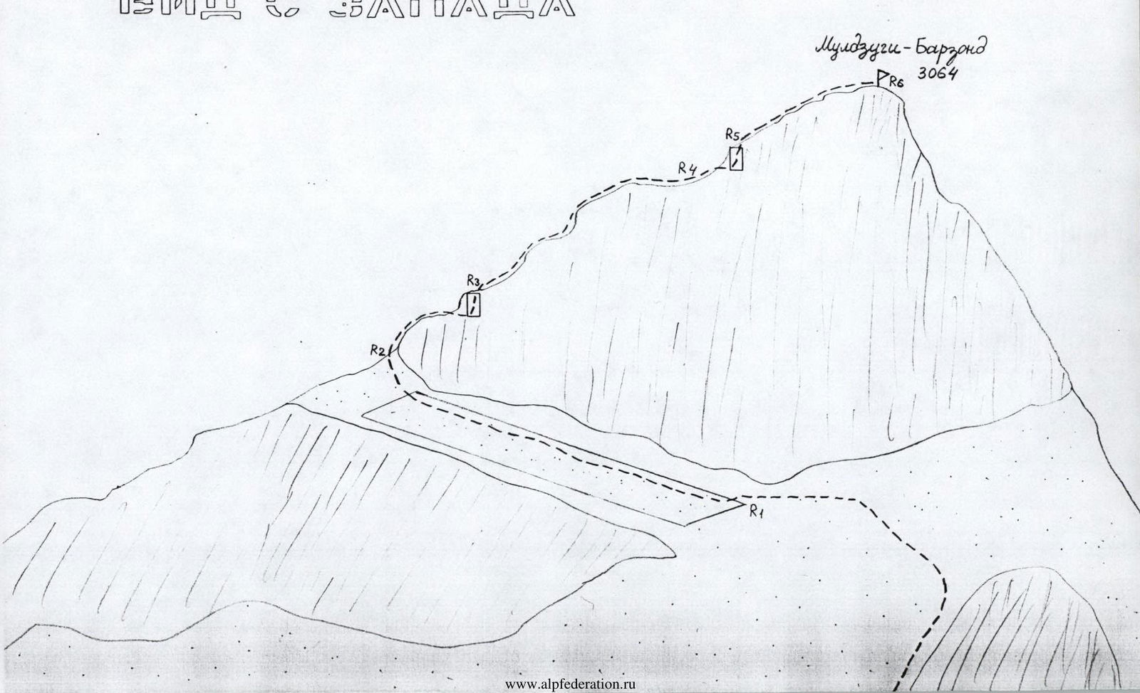
From the base camp, located near the shepherd's hut or near the old geological mine, head north. Climb up the grassy slopes towards the saddle between the peaks Meshchana to the left and Muldzugi-Barzond to the right. Reaching the pass, turn right.
R0–R1: From the pass, bypass the first Big gendarme on the left — along the northern slopes of the Western ridge. Behind the gendarme, head towards the beginning of the scree shelf on the Western slope of the Northern ridge of Muldzugi-Barzond. The entire section is about 300 m; category 1, местами 2.
R1–R2: Along the scree shelf, going up to the left, reach the Northern ridge. At the end of the section, there are rocks of category 2. The entire section is about 200 m, category 1.
R2–R3: Along the ridge, approach the lower rock belt, and pass it through rocks of category 3, 8 m. The entire section is 50 m.
R3–R4: Further along the Northern ridge, go up, bypassing rock outcrops along shelves. The section is category 1, местами 2; about 150 m.
R4–R5: Approaching the upper rock belt, move to the right and pass it through a wall of category 2–3, 7 m.
R5–R6: Further along the scree Northern ridge, ascend to the peak Muldzugi-Barzond (3064 m). Another 150 m.
The summit is a good panoramic point. Visible are:
- Sugansky Range
- Tseisky Range
- Karaugom plateau.
Descent is made along the ascent route.
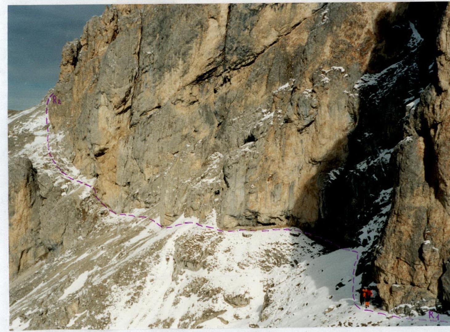
Traversing the Western slope of the Northern ridge. Section R1–R2.

Passing the lower rock belt. Beginning of section R2–R3.
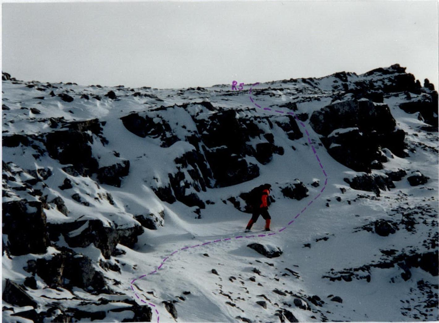
Passing the upper rock belt. Upper part of section R4–R5.
Conclusions and Recommendations for the Route
The route is recommended for training groups, as well as for training — for sports groups. Due to its predominantly ridge nature, the route is objectively safe. In unfavorable snow conditions, there may be significant snow cover on the rocks on sections with a Northern exposure.
In terms of the number and difficulty of key sections, the route corresponds to the proposed category, and is the easiest path to this peak (descent route).
The ascent to this peak continues the exploration of a new interesting area, where year-round ascents can be made, and which is a good training base before heading to the high-altitude zone. It is recommended to take ropes 50 m long on the route. Due to the block structure of the rocks, which have many wide cracks, it is necessary to have a set of protection gear:
- hexes
- stoppers
- friends
- etc.