Ascent Passport
- Ascent class: rock.
- Ascent area: Caucasus, l. Bartuy valley, 2.6.
- Peak, route: Kushdarh (3672 m), from the south.
- Estimated category of difficulty: 2B rock, semi-unknown
- Route characteristics:
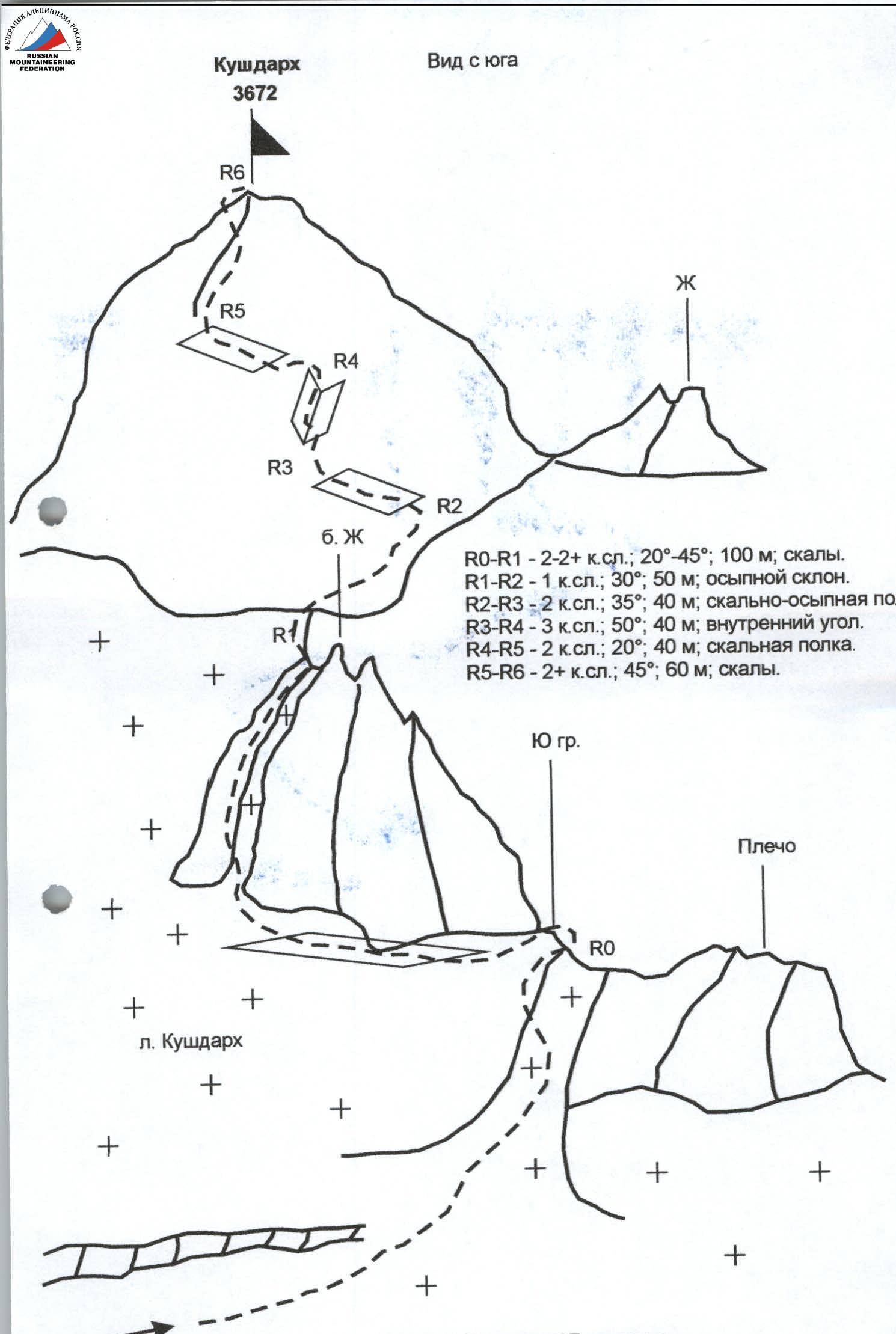
Height difference — about 150 m. Route length — 350 m. Length of sections: 3rd category of difficulty — 40 m, 2nd category of difficulty — 240 m. Average steepness of the main part of the route — 50 °
- Pitons hammered: 2 on the wall, 2 loops left on descent.
- Number of climbing hours/days — 7/1
- Number of overnight stays: 2 — at a bivouac.
- Leader: Yu. V. Levkovsky — Candidate for Master of Sports
Participants: Dorozhkin G. V. — 1st sports category, Soboleva N. S. — Zn., Lyubchinskaya L. M. — Zn., Prevysh A. S. — 2nd sports category
- Coach: Levkovsky Yuri Vasilievich, Candidate for Master of Sports.
- Exit to the route from the bivouac: August 8, 2005.
Return to the bivouac: August 8, 2005.
- Organization: AUSV "Digoria".
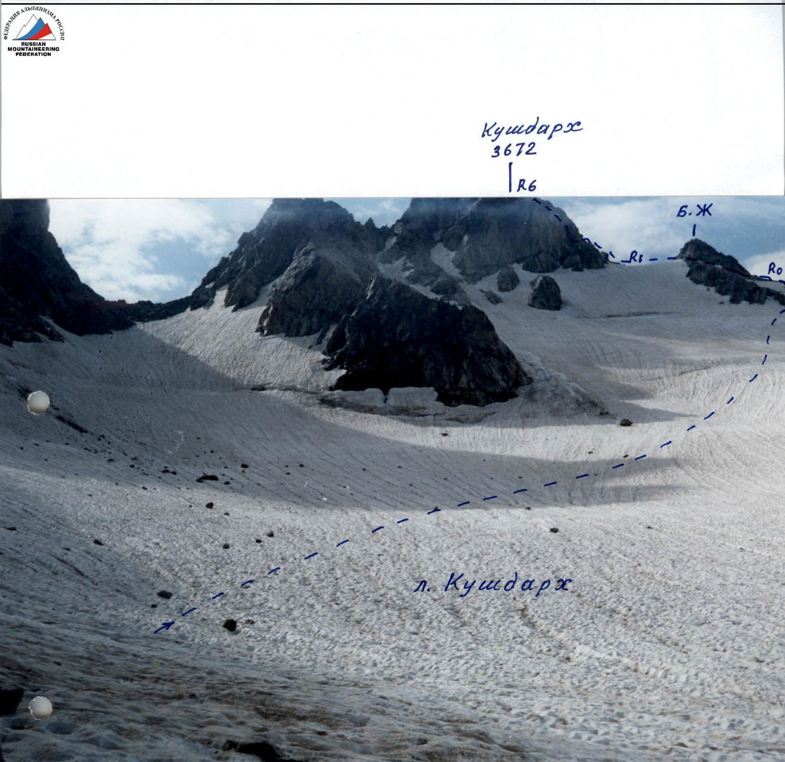
View from the west. Taken from v. Abduramanova (3250)
View from the south.
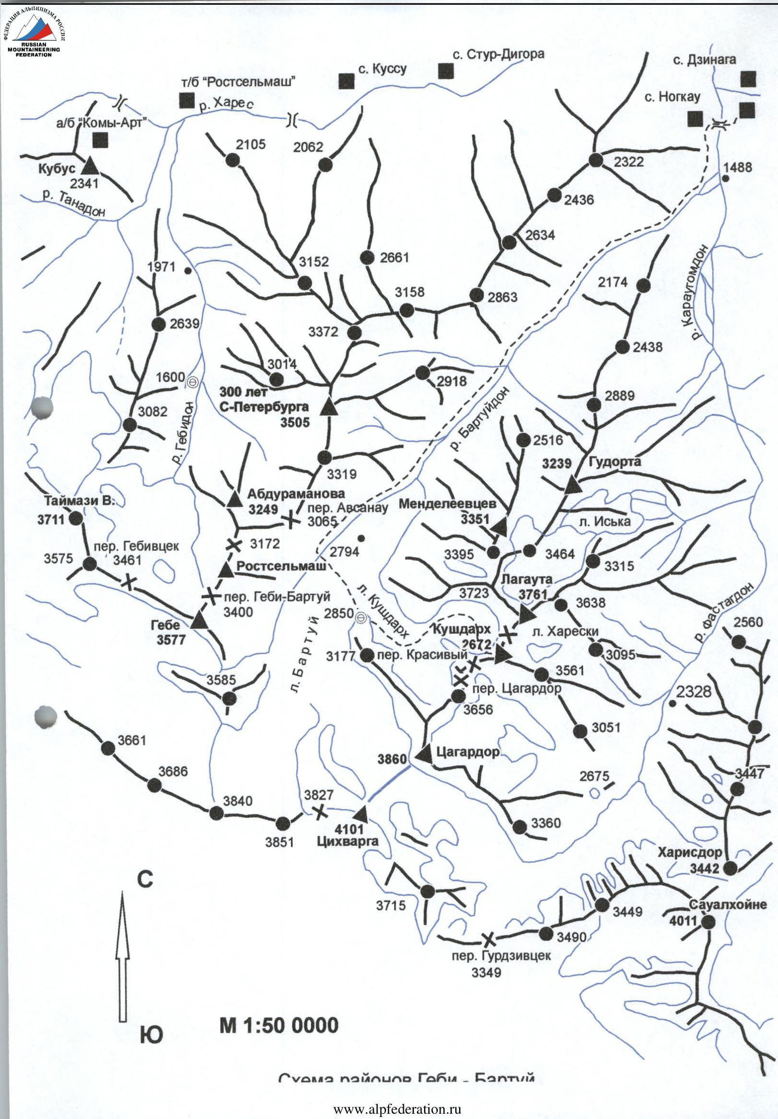 Fig. v. Kushdarh; 2B rock; from the south
Route Description
The approach to the route starts from overnight stays located on the right-bank moraine of l. Bartuy. From the lake, having ascended to the right onto the moraine ridge that bounds l. Zapadny Tsagardor on the right, movement proceeds along its ridge towards the snowfield lying under the western slopes of Tsagardor.
Having ascended 150–200 m up a gentle snowfield, one should:
- traverse left along the extended snowy slope above the ice outcrops in the direction of l. Kushdarh.
The ascent to the beginning of the glacier cirque from the east passes along a steep talus slope along the left or right bank of the stream flowing from under l. Kushdarh.
Further, the path goes up along a gentle glacier covered with snow and then left by a traverse in the passage between the open ice. Having circumvented the icy slope from below, movement continues straight up, leaving the destroyed rock walls of Lagauta to the left. The bergschrund in the middle part of the glacier is crossed over one of the snow bridges and further ascent is made to the right up a steep snowy slope (45 °) with an exit to a wide snowy saddle at the end of the South ridge of v. Kushdarh. From the bivouac 3–4 hours.
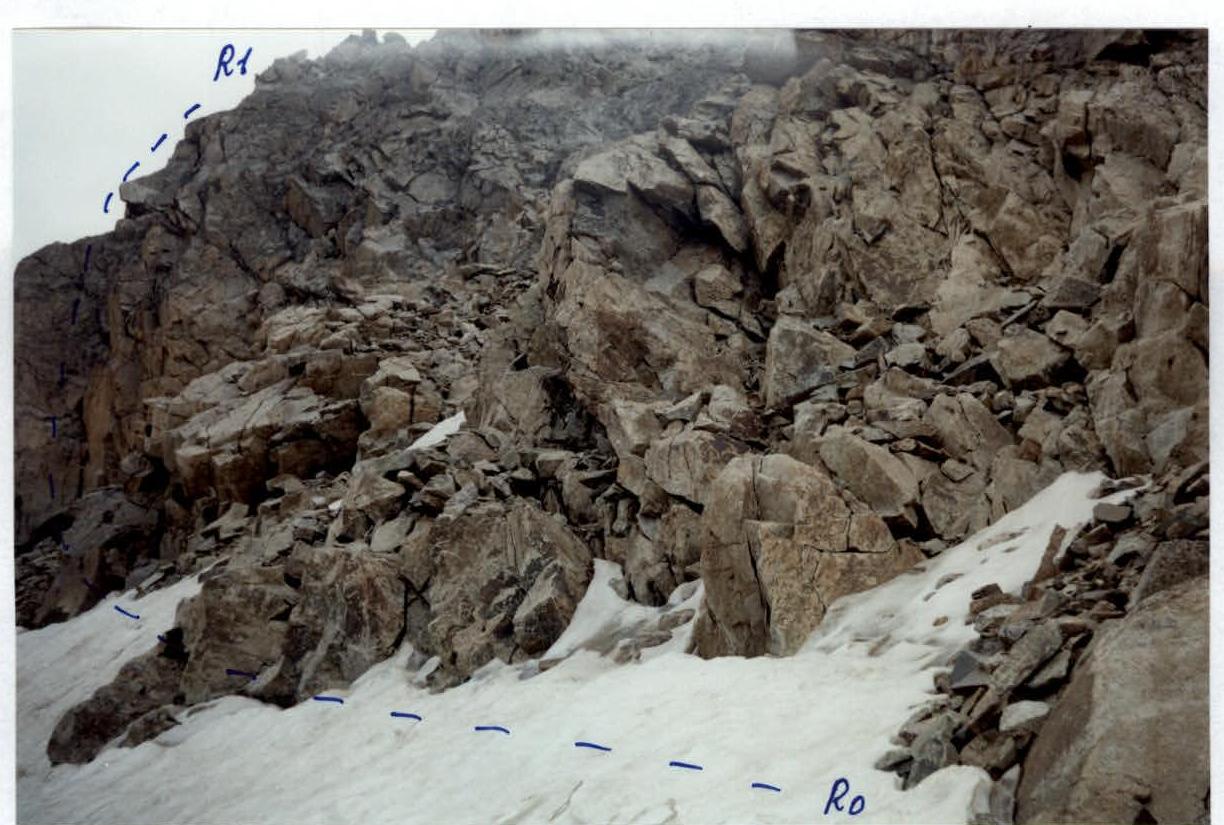
The large gendarme in the South ridge is bypassed on the left along simple destroyed rocks with an ascent behind it to the right up steep destroyed rocks onto a wide snow-talus saddle above the gendarme. From the saddle, the ascent leads:
- along the talus slope under a wide wall.
Movement at the beginning of the wall passes:
- left up along a rocky-talus ledge,
- then steeply to the right up along an internal angle leading to a narrow saddle.
From the saddle:
- left up along a gentle wide rocky ledge,
- further up along steep rocks of the wall to the summit.
From the start of the route on the South ridge 2–3 hours.
Brief overview of the ascent area, peak
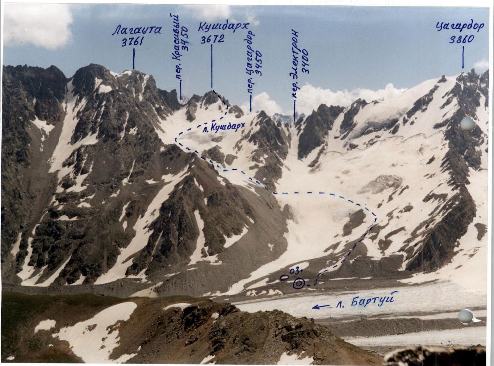
The peak Kushdarh (3672 m) is located in the area of l. Bartuy valley, in the Tsagardor ridge. From the south, the peak is bounded by the Tsagardor pass (3450 m), behind which the v. Tsagardor massif begins. To the north, it is separated from v. Lagauta (3761 m) — per. Krasivый (3450 m). To the west, a large l. Kushdarh adjoins the massif, connecting in its lower part with l. Bartuy, to the east lies a small dying l. Hareski, which is bounded by the gorge of the r. Fastagdon.
The peak massif is composed of destroyed schists and granites. The peak is named after the same-named glacier.
Description of the approach
The approach to overnight stays located on the right-bank moraine of l. Bartuy, near the lake, starts from the village of Dzinaga. Having passed the village, turning to the right, one should cross r. Karaugom over a stationary bridge in front of the village of Nogkau. Further movement goes along a trail along the river, which after 20 minutes, steeply turning to the right up, leads to the upper trail leading from the village of Nogkau to the gorge of r. Bartuydon.
Now the trail gently stretches along grassy slopes high above the river, gradually turning to the right into the gorge. After 1 hour of movement, the trail descends to a stream near r. Bartuydon. Having crossed the stream over stones, movement continues along the trail going through the forest along the left bank of the river. After 30 minutes, the trail steeply descends to the river before the fallen trunks of pine trees and disappears in its bed among the stones.
The path passes along small and medium stones on the left side of the riverbed, after 30 minutes leaving a steep talus slope to the right. After another 1.5 hours, a wide gully-gorge with a stream flowing along its bottom becomes visible on the right. Having passed the gully, after 1.5 hours, one approaches the second identical gully descending from above on the right. The forest ends and the tongue of l. Bartuy is already visible ahead.
The exit to the glacier is blocked by "sheep's foreheads", which are circumvented:
- in the presence of snow — on the left,
- in the absence of snow — on the right along a steep talus slope.
From the village 6–7 hours.
In its lower and middle parts, the glacier is gentle, closed, safe, covered with moraines and stones. The path goes along the glacier, then along its left-bank moraine, along the ridge of which a trail is laid. After 1–1.5 hours, having approached the lake Maskutitsad, one should cross to the right side of l. Bartuy and ascend along the moraines to the lake, near which convenient areas for overnight stays are located. Height above sea level: 2850 m. From the village of Dzinaga: 9–10 hours.
Kushdarh 3672. L. Kushdarh. F. 2.
South wall of v. Kushdarh. F. 4.
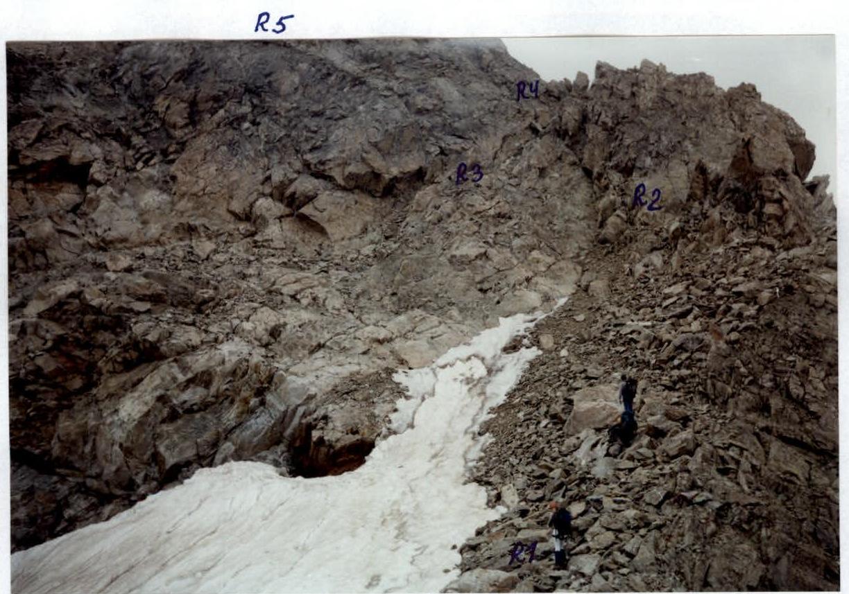
Bypass of the Big gendarme. F. 3.