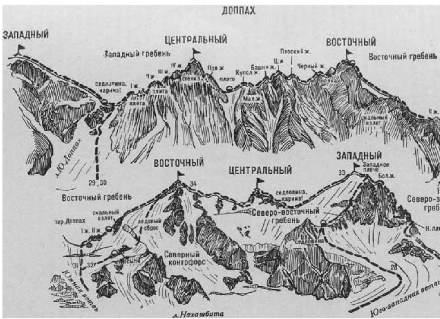
Fig. 8
- Tsentralnyi Doppakh via West Ridge (I. Suzhaev's combined route, category 4B, Fig. 8).
The path from the "Nakhashbita" meadow (group of 4–8 people) to the initial bivouac on a snowy site under the East Ridge of West Doppakh is described in route 29. From the site, cross the col (cornice) along the snowy ridge, then approach the base of the first rocky ascent of the West Ridge of Tsentralnyi Doppakh along the steep snowy ridge.
Further:
- Ascend the 6–8-meter icy slab of the ascent (piton belay);
- Bypass the overhanging rocks on the right;
- Ascend an 8-meter slab-like, above-average-difficulty rock corner with few footholds (piton belay) to the West Ridge.
Along the heavily cut, destroyed, and snow-covered, average-difficulty 120–150-meter West Ridge, approach the first "gendarme". Ascend the 18–20-meter wall of average difficulty to reach the gendarme. Descend left from the gendarme. Then, traverse the steep rocks on the left side (belays) to bypass two needle-like gendarmes and rejoin the West Ridge. Continuing along the West Ridge:
- Bypass a smooth slab — a gendarme — via a 4–5-meter traverse on the left;
- Continue along the snow-covered, heavily destroyed steep rocks of the West Ridge ascent;
- Approach the second gendarme.
Ascend the second gendarme via simple rocks on the West Ridge, then descend 30 meters along the gently sloping ridge. Approach the wall of the third gendarme via a sharp saddle. Ascend the third gendarme via a 20-meter internal corner of above-average difficulty, then via difficult rocks on the right side (piton belay), and descend via a simple 15-meter ridge.
Further:
- Approach the fourth gendarme,
- Bypass it on the right via a 15-meter traverse along rocks of above-average difficulty with a cleft (piton belay) to a couloir connecting the fourth gendarme to the summit of Tsentralnyi Doppakh.
Traverse the couloir for 12 meters along smooth rocks (possible rockfall, piton belay), then ascend steep, smooth rocks on the right side of the couloir, followed by an 8-meter wall (key section of the route, piton belay) to a ledge on the right. Traverse the ledge for 30 meters to the right to bypass the ascent, then ascend a 12-meter vertical internal corner of above-average difficulty to reach the West Ridge of the summit tower. Follow the sharp ridge to reach Tsentralnyi Doppakh. The duration from the bivouac on the col is 6–8 hours.
Descend via the ascent route. It is recommended to descend from the col early in the morning due to possible rockfall in the couloir.
Route duration:
- 3 days.
Naumov A. F. Karagom, Digoria, Tsey (Tsentralnyi Kavkaz), M., "Fizkultura i sport", 1976.