Fig. 7
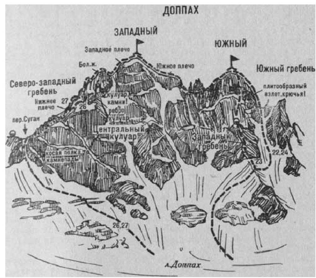
- Doppakh Western peak via the Southern ridge (a combined route by L. Artsyshevskaya, category 4A, Fig. 7).
The path from the "Nakhashbita" meadow (a group of 4–6 people) to the summit of Yuzhny Doppakh is described in route 22.
From the summit, descend along the simple snow-covered Northern ridge in the direction of Zapadny Doppakh to two rocky gendarmes. Bypass the gendarmes (belay on a rope):
- to the right — along a steep snow-ice slope,
- to the left — along the rocky ledges of the wall (“loose” rocks)
with an exit behind them onto the ridge saddle. From the saddle, climb 70–80 m (belay on a rope) along the steep, above-average difficulty, rocky Southern ridge of Zapadny Doppakh summit. The ridge gradually becomes less steep, ending with a 10–12-meter rocky ascent to the Southern shoulder. The ascent is overcome head-on along the rocks of above-average difficulty (belay on a rope). From Yuzhny Doppakh, 3–5 hours.
Further, along the simple rocks of the Southern ridge, exit onto a gentle snow-ice slope and climb to the summit of Zapadny Doppakh. From the Southern shoulder, about 1 hour. Descent along the Eastern ridge with a bivouac on a small snowy summit plateau or near the saddle (see route 29). The duration of the route is 2–3 days.
Naumov A. F. Karaugom, Digoria, Tsey (Central Caucasus), M., “Fizkultura i sport”, 1976.