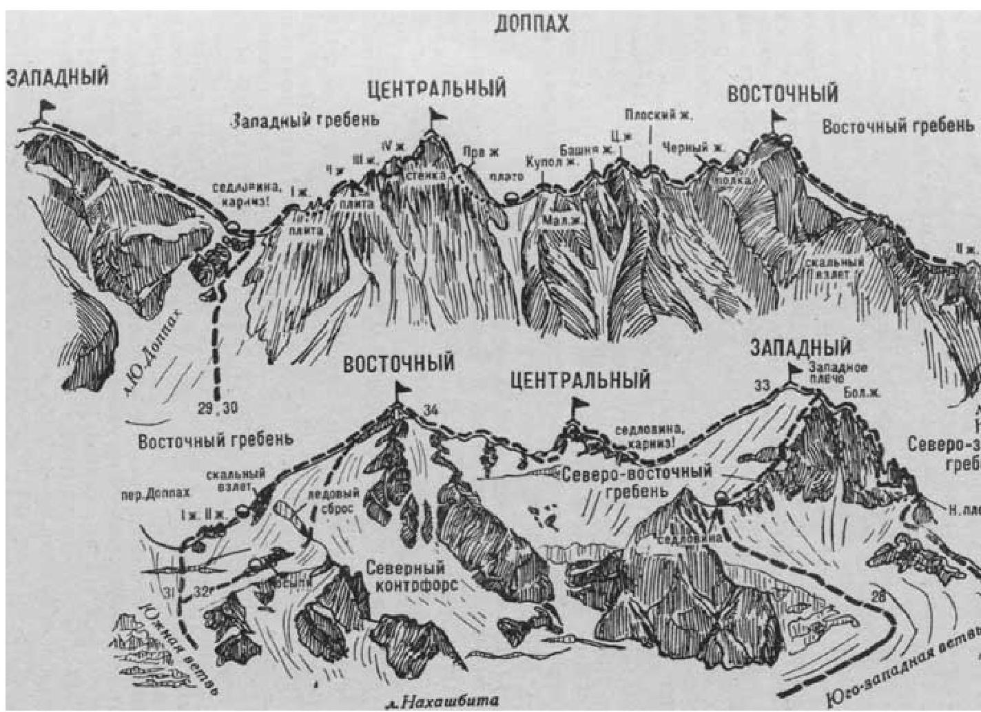
Fig. 8
- Doppakh Western from the south via the couloir and the Eastern ridge (A. Uvarov’s combined route, difficulty category 3B, fig. 8).
From the “Nakhashbita” meadow (group of 4–8 people) upwards to the left (to the north-west) along the grassy slopes and morenes to the tongue of the South Doppakh glacier. From the morena (security) up a steep icy slope to the South Doppakh glacier and along it upwards.
A small glacier fall in the middle part of the glacier — pass through the center. Behind the glacier fall, ascend along the gently sloping glacier (covered crevasses), then, overcoming two bergschrunds, along a steep icy-snow slope (piton security) move to the right side of the lowest rock triangular island on the left side of the couloir leading to the massif’s saddle.
Circumvent the rock island to the right and along a steep narrowing icy-snow couloir (rockfall possible, piton security) ascend to the sharp snow (big cornice) saddle of the massif between the Western and Central Doppakh summits. On the saddle, turn left and reach a snow platform below the Eastern ridge of the Western Doppakh. On the platform, set up a bivouac. From the “Nakhashbita” meadow, 6–8 hours.
From the platform:
- a steep ascent along a 60–80-meter icy-snow slope on the right side of the Eastern ridge (piton security);
- then, along the right side of a 180–200-meter simple snow ridge, ascend to a small snow plateau;
- from it, overcoming a snow crevasse along a gently sloping 120–150-meter snow ridge — to the summit of Western Doppakh.
From the saddle, 2–3 hours. The path from the saddle to the summit is avalanche-hazardous.
Descent along the ascent path. From the saddle, due to a possible rockfall in the couloir, departure early in the morning.
Duration of the route:
- 2–3 days.
Naumov A. F. Karaugom, Digoria, Tsey (Central Caucasus), M., “Fiskultura i sport”, 1976.