Gülchi
The Gülchi massif (4477 m) consists of the peaks Gülchi and Rtsyvashki. It is located in the western part of the Sugansky Ridge, between the peak of SuganTau (located east of the Rtsyvashki pass, to which the Southeast ridge of Gülchi descends) and the peak of Komsomol Ukrainy (to which the North ridge of Rtsyvashki approaches).
From under the wall of the Southwest shoulder of Gülchi in the Akhsu gorge depart:
- Southwest ridge with the peak Akhsu,
- from the East shoulder to the East Rtsyvashki glacier descends a steep rocky edge.
Between the southeast and south ridges of Gülchi lies the Akhsu glacier, feeding the Akhsu river, and in a small corrie under the southern slopes of the peak Akhsu - a small glacier Maly Akhsu, the flow of which is a tributary of the Akhsu river.
From the summit tower of Gülchi to the northwest departs a practically uninterrupted ice-covered ridge of the main massif Gülchi, ending with a small two-humped peak Rtsyvashki.
Beyond Rtsyvashki, the ridge of the massif:
- turns north,
- descends to the ice saddle,
- beyond which in the Sugansky Ridge rises a rocky pyramid of the peak Komsomola Ukrainy.
Into a wide valley, to the confluence of Karasu and Dykhsu, from the peak Rtsyvashki descends a long southwest ridge with numerous jandarms, separating the Gülchi glacier from the Maly Gülchi glacier, lying under the southeastern slopes of the massif.
East of Rtsyvashki, a rocky ridge divides the Rtsyvashki glacier into eastern and western branches.
Glacier nourishment:
- Eastern ice-snow slopes of the Gülchi massif nourish the eastern branch of the Rtsyvashki glacier
- Northwest ice-snow slopes of Rtsyvashki nourish the Gülchi glacier, the flow of which flows into the Cherek-Balkarsky.
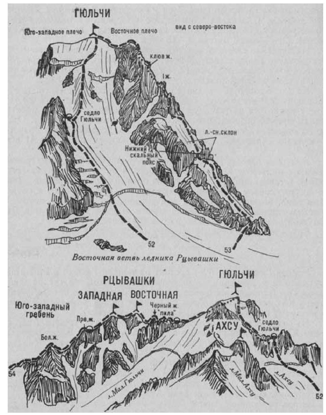
Fig. 14
- Gülchi via the East slope (route is ice-snow, L. Gasparotto, 3A category of complexity, fig. 14).
From the initial bivouac on the moraines of the right bank of the Rtsyvashki river, near the tongue of the East Rtsyvashki glacier (group of 4–8 people), ascend the gorge to the end of the moraine. There, exit to the right onto the East Rtsyvashki glacier and approach the steep ice-snow slope descending onto the East Rtsyvashki glacier from the peak Gülchi and the Gülchi saddle, located in the southeast ridge, between the ice-snow summit ascent and its first large jandarm.
From the glacier, having overcome the bergschrund, ascend the steep ice-snow slope (avalanches possible) under the right side of the Big jandarm of the Southeast ridge of the peak Gülchi, to the right of which is the Gülchi saddle. Further, along the steep ice-snow slope (avalanches possible) to the right of the jandarm rocks, small crevices, and ice falls - ascent 400–500 m straight up. Having passed under the 35-meter ice ascent (cascade belay), ascend to the Gülchi saddle - a saddle-shaped Southeast ridge of the peak.
From the initial bivouac under the Rtsyvashki glacier: 6–7 hours.
Naumov A. F. Karaugom, Digoriya, Tsey (Central Caucasus), M., "Fizkultura i sport", 1976.
