Ascent Passport
- Caucasus, Sugan Range, classification section number – 2.6.
- Aikhva North (3735 m); via the West face. (“dollar”).
- Proposed category: 3A; first ascent.
- Route character — rock.
- Route height difference – 355 m (by GPS). Route length – 715 m. Steepness of key sections – up to 93°. Length of sections with 5th category difficulty – 2 m.
- Hooks left on the route – none.
- Climbing hours – 6; days – 1.
- Leader: Egorin S.V. – Master of Sports Participants: Ustinov A.N. – 2nd sports category
- Coach: Egorin S.V.
- Departure to the route – 8:00; July 25, 2005. Reached the summit – 14:00; July 25, 2005.
- Organization: AUSB “Digoria”.
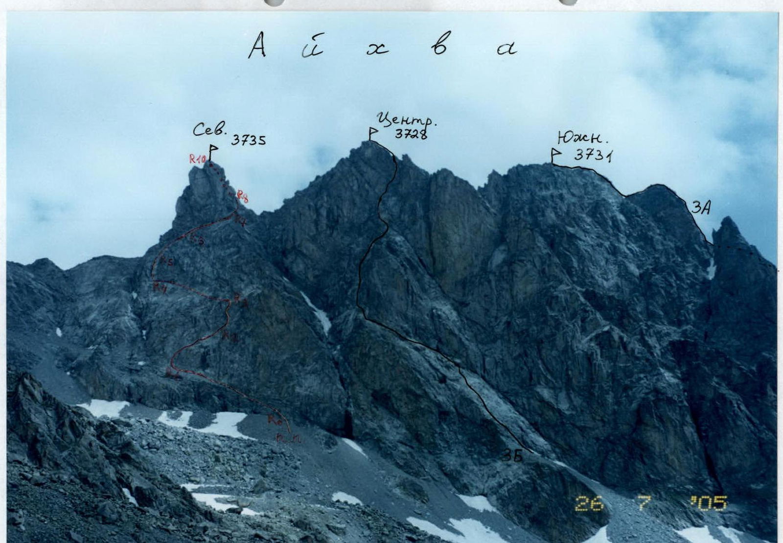
Aikhva spur from the West. July. Classified routes are marked in black. Red marks the first ascent route on Aikhva North via the West face.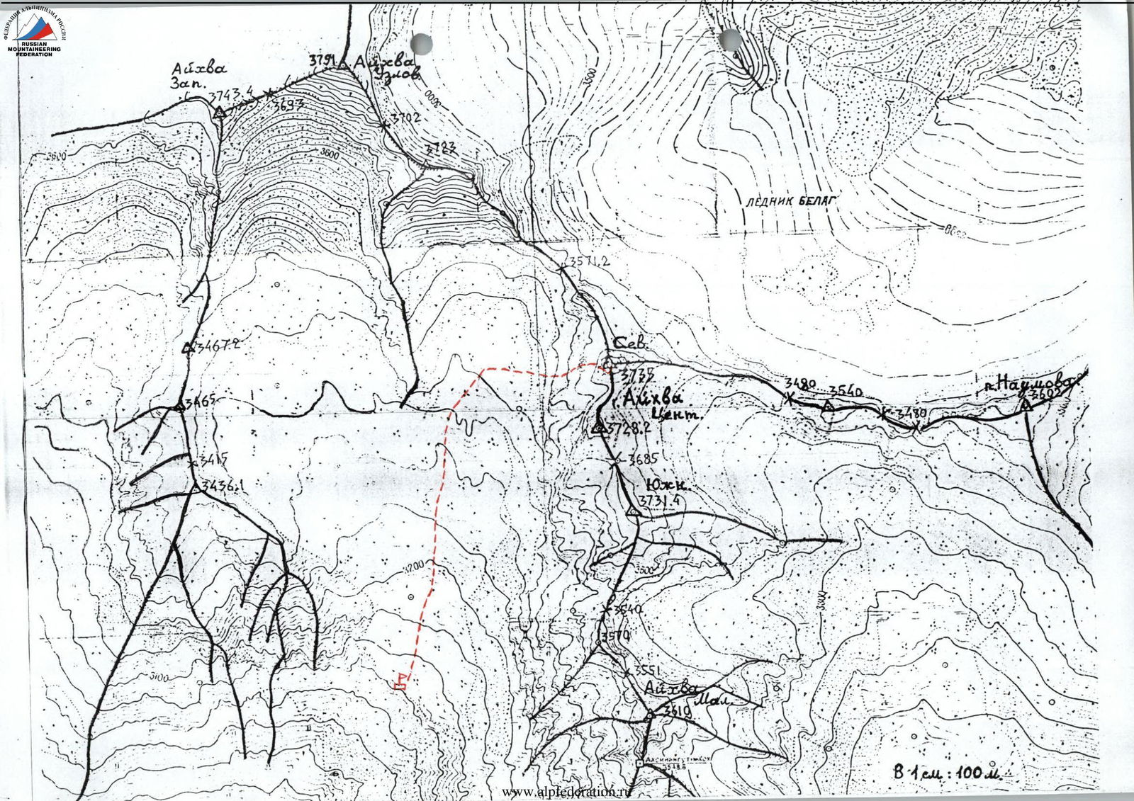
Description of the approach to the route (to the Western Aikhva cirque).
From the “Digoria” alpine camp (now the “Komy-Art” sports and recreation camp) ascend along the road up the Khares gorge to the waterfall — about an hour. The waterfall near the road is the Aikhvadon river, flowing out of the Western Aikhva cirque, which is located west of the Southern (Aikhva) spur of the Sugan Range.
Bypass the waterfall along the road and above it, cross the Aikhvadon to the right bank of the river. Continue ascending towards the visible massif of Aikhva. Initially, walk through meadows, then reach the right grassy ridge and follow it until it flattens into a wide, almost even, grassy valley – another 1.5 hours (altitude about 2700 m).
Then:
- head straight up along the river to a steep moraine ascent;
- follow the trail straight up, and to the right of the “ram’s foreheads”, where there is water, reach the camping sites — another approximately 1.5 hours.
The altitude here is 3100 m, and the Aikhva massif is clearly visible ahead. The ascent from the alpine camp is about 1300 m.

Aikhva North from the West. The first ascent route on the West face is marked.
Route description
From the upper Aikhva campsites, ascend towards the summit of Aikhva North. Head into the right cirque under the Western walls of the Aikhva spur. The path goes through moraine boulders, and in the first half of the summer, through snowfields. After an hour, opposite the tower of Aikhva North (the one farthest from the campsites), turn right. The right lower part of the West face of Aikhva North has the appearance of a rusty triangle. Head towards the center of the base of this triangle.
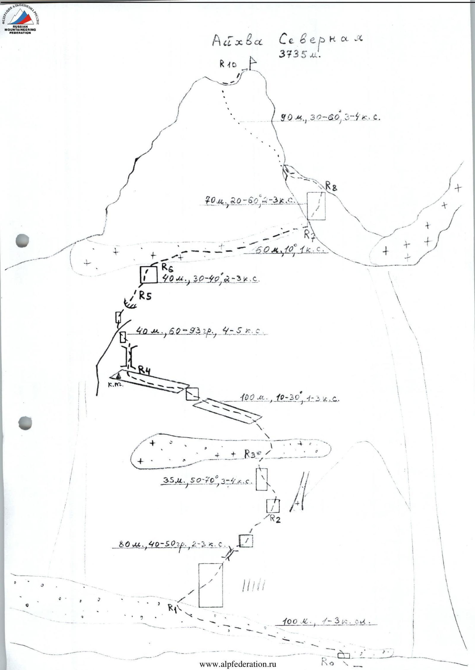
Section R0–R1: From under the center of the triangle’s base, reach a scree shelf via a 10 m wall of 3rd category difficulty. Traverse left along the shelf (1st category difficulty) for about 100 m.
Section R1–R2: Bypass the rusty steep rocks on the left, then ascend right up through a system of shelves and vaguely defined internal corners. After passing a scree shelf, ascend right up under overhanging rocks. Section is about 80 m; 40–50°; 2–3 category difficulty.
Section R2–R3: Before reaching the base of a steep snow-scree couloir-chimney, begin ascending straight up towards the visible tower of Aikhva North against the sky. The path goes up the wall to the left of black streaks, exiting onto a scree shelf. Section is about 35 m:
- Rocks 3–3+ category difficulty.
- Upon exiting onto the shelf, there is a 4th category difficulty wall.
- Entire section is 50–70°
Section R3–R4:
- Along the scree shelf, about 100 m; 1–2 category difficulty, ascend left up under the rocks.
- The shelf is narrow in places; in the middle part, there is a 10 m section of 3rd category difficulty.
- Follow the shelf under steep rocks until it ends.
- Under the wall, there is a control cairn.
Section R4–R5: About 5 m before the end of the shelf, ascend straight up through an inclined chimney-cleft. Chimney is 4th category difficulty; 60–70°, 15 m.
After this:
- move left around the wall’s edge (partner is out of sight),
- approach the wall under an internal corner, the middle part of which is 93°, 2 m, 5th category difficulty (key section).
Then, exit onto rocks of 3rd category difficulty; 50°. Entire section is about 40 m.
Section R5–R6–R7: Continue straight up the rocks, then right up onto a snow-scree shelf. Follow the base of the tower right along the shelf to the shoulder. Entire section is about 100 m; 30–40°; 2–3 category difficulty.
Section R7–R8: From the shoulder, begin bypassing the tower of Aikhva North from the South.
- First, descend 40 m along the shelf, crossing a chimney-couloir that ascends;
- Then, ascend straight up the wall, bypassing complex sections via shelves, to reach the ridge.
Shelf is 1–2 category difficulty. Wall is 30 m; 50–60°; 3–3+ category difficulty.
Section R8–R9: On the ridge, turn left. Initially, follow the ridge line, then on its left side, enter a chimney-couloir. From it, exit right back onto the ridge.
- Section is 30 m
- 40–60°
- 3–4 category difficulty
Section R9–R10: Ascend left up along the ridge towards the summit. In the middle of the section, move along its left (southern) side. At the end, again follow the ridge line to ascend to the summit of Aikhva North.
- Entire section is about 60 m
- Angle of inclination: 30–40°
- Category difficulty: 3–3+
- Time from the start of the wall to the summit is about 6 hours
The summit is an excellent panoramic point.
Descent is via a route of 2B category difficulty (study its description in advance).
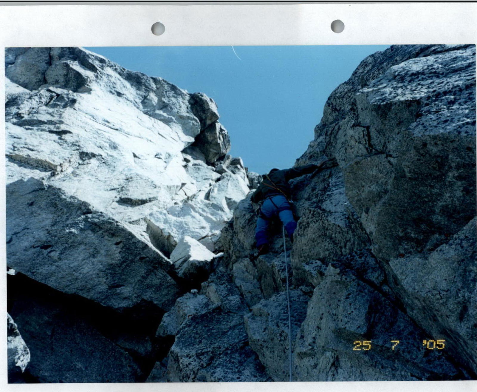
 Passing the upper part of section R2–R3.
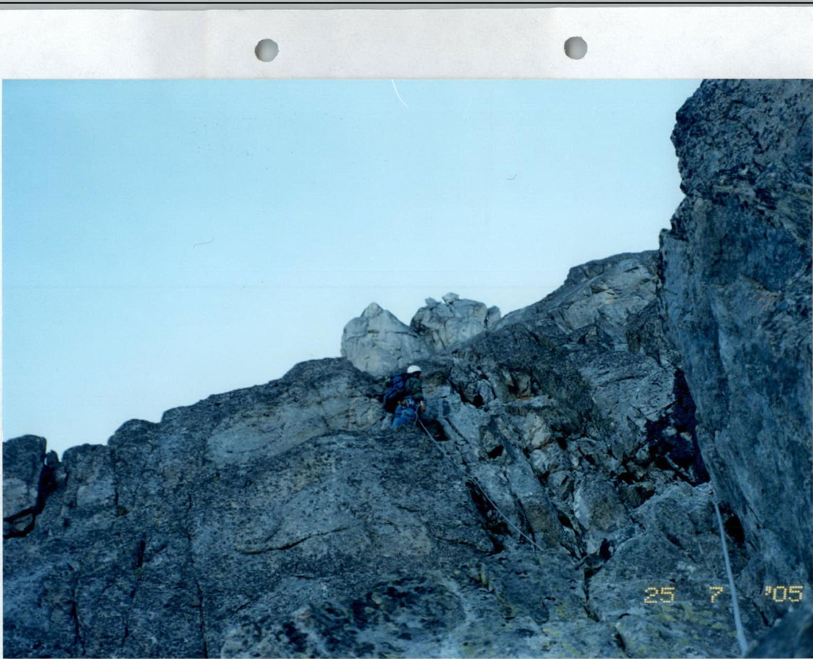 Start of section R4–R5.
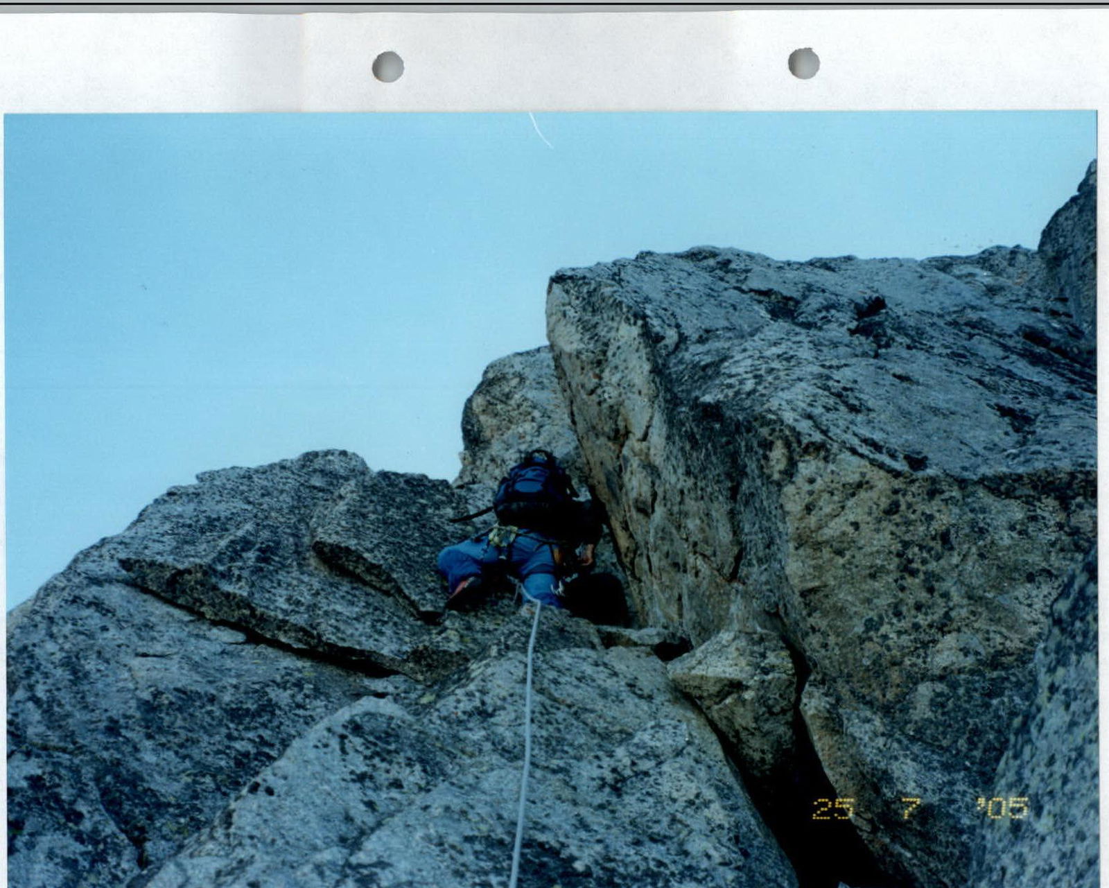 Upper part of section R7–R8.
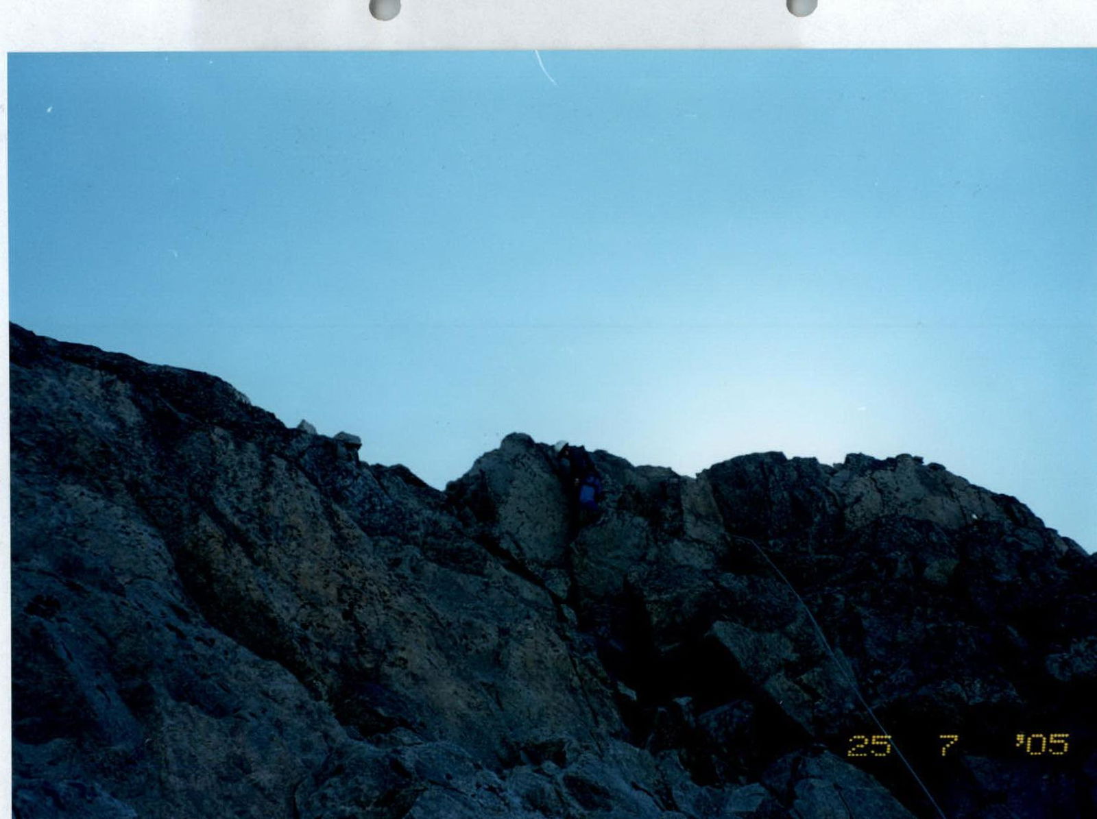 Passing the middle part of section R8–R9.