- Climbing category: rock.
- Region: Caucasus, 2.6, Sugansky Ridge.
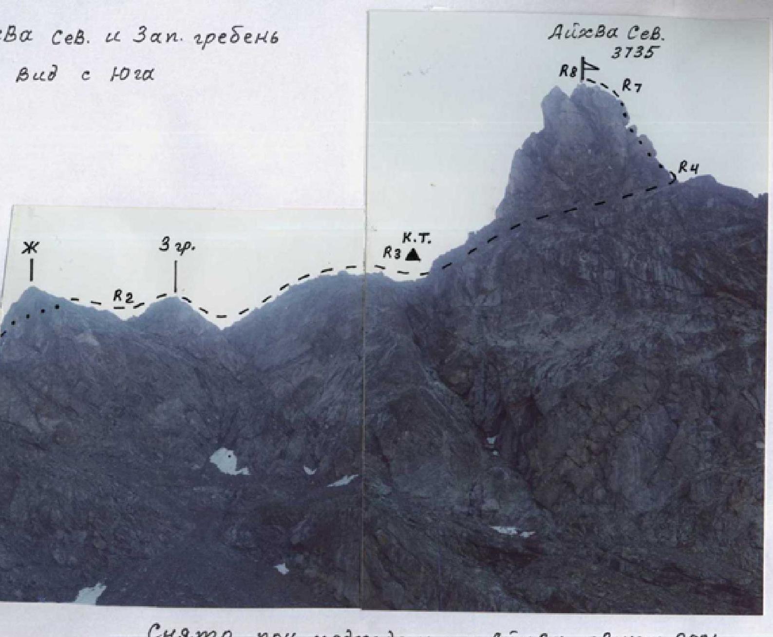
- Peak, route: Aikhva Severnaia, 3735 m, via West ridge and inner corner.
- Estimated category: 3A rock, first ascent.
- Route characteristics:
elevation gain — 600 m, route length — 550 m, section lengths:
- 4th category — 35 m
- 3rd category — 70 m
- 2nd category — 240 m, average steepness of main route part — 50°, total route — 45°
- Pitons driven: rock — 4 — on the tower. Remaining protection via ledges.
- Time taken/hiking days — 5/1.
- Number of nights stayed — 1 — at a bivouac.
- Leader: Levkovsky Yu.V. — Candidate Master of Sports
- Bessarab A.V. — 3rd sports category
- Gorbunov A.I. — 2nd sports category
- Gorbunov A.A. — 3rd sports category
- Slivko A.M. — 3rd sports category
- Urtaeva S.A. — 3rd sports category
- Tsalikov B.M. — 3rd sports category
- Coach: Levkovsky Yuri Vasilievich — Candidate Master of Sports.
- Route start: August 5, 2001. Return to bivouac: August 5, 2001.
- Organization: Mountaineering Federation of North Ossetia-Alania.
Bud S 102a – Sanada

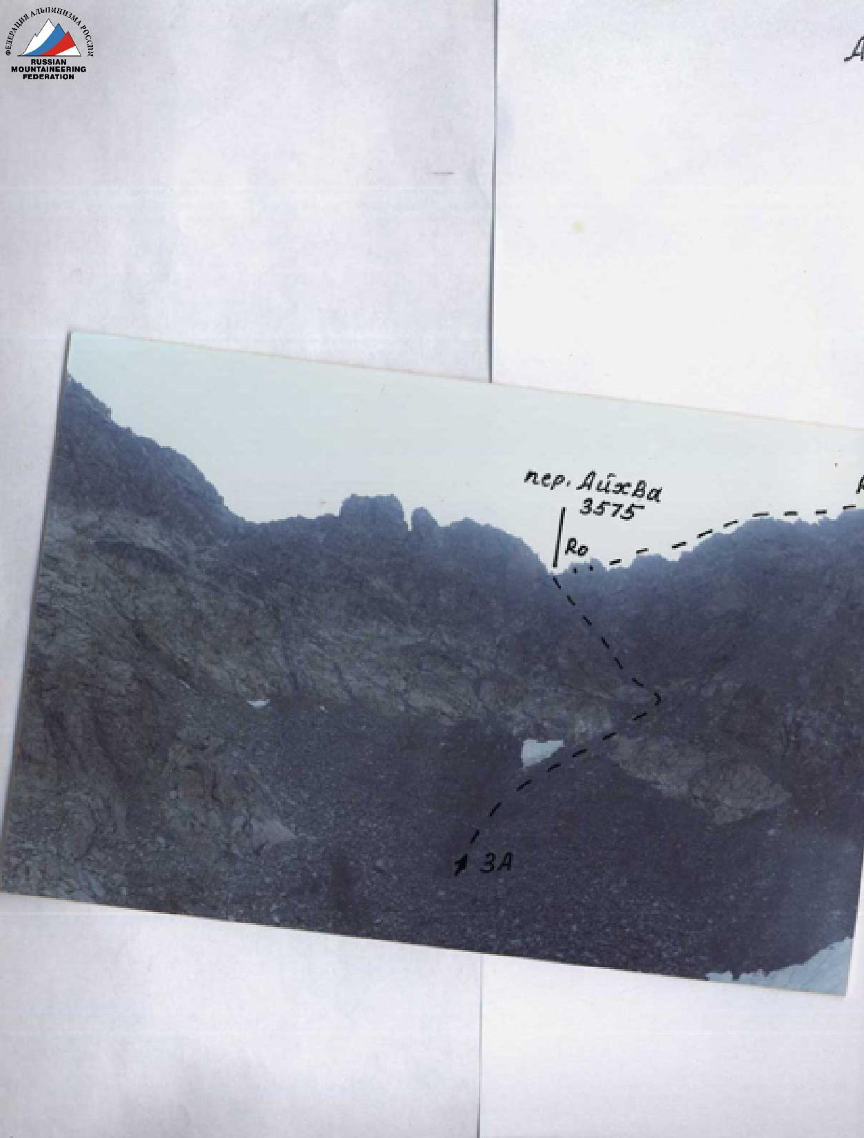
Panorama of the Southern spur of Aikhva node. Photographed while approaching the bivouac in the circus. August 2001.
pr. — subpeak
2А – Aikhva M, South ridge. – A. Zaidler, 1917
2Б – Aikhva M, North ridge, first ascent – Yu. Levkovsky, 01
3А – Aikhva South, from the south – Yu. Levkovsky, 00
3А – Aikhva North, 3rd ridge and inner corner, first ascent – Yu. Levkovsky, 01

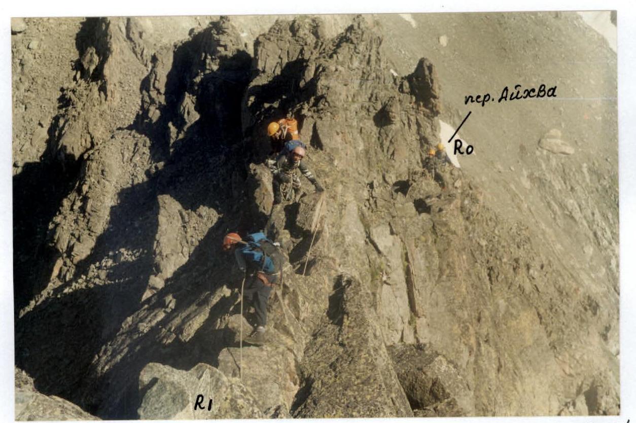
R0–R1 — 2, 45°, 150 m, ridge rocks
R1–R2 — 3, 50–40°, 60 m, wall, ledge
R3–R4 — 1, 20°, 10 m, ridge
R3–R4 — 1, 35°, 100 m, scree ledge
R4–R5 — 4, 60°, 35 m, wall
R5–R6 — 4, 55°, 35 m, wall
R6–R7 — 3, 55°, 35 m, rocks
R7–R8 — 2, 45°, 40 m, ridge rocks

- Aikhva Uzlovaya, 1B, 3rd ridge
- Aikhva Severnaia, 3A first ascent, 3rd ridge and Inner corner
- Aikhva Yuzhnaia, 3A, from the south
- Aikhva Malaia, 2B first traverse, North ridge.
Route description
From the bivouac in the lower part of the western circus, move north along the Southern spur via moraine hills to Aikhva pass, located between Aikhva Uzlovaya and Aikhva Severnaia peaks. After 1.5 hours, ascend to the pass via fine steep scree with outcrops of broken rocks. The pass ridge is narrow.
Turn right and move along the rocks of the western ridge for 150–200 m. Bypass the rising gendarme on the left — up the rocks and ledge of average difficulty. Continue along the easy ridge to the summit tower, with a cairn in the depression near a large rock.
Bypass the summit tower on the right via a long scree ledge to a large inner corner cutting through the tower from top to bottom. Steep exposure.
Ascend the rocks, short walls of the inner corner for 120 m to reach the Eastern ridge, with piton protection and via ledges. Turn left and ascend to the summit via ridge rocks for 50 m.
From the bivouac, 5–6 hours. Descent via the ascent route with:
- 3–4 rappels on the summit tower.
Start of the route: Aikhva North, 3rd ridge and Inner corner, 3A, first ascent, August 2001
y₂-K R0–R1
Aikhva Severnaia and West ridge View from the south
Photographed while approaching Aikhva pass, August 2001