
Ascent Passport
- Caucasus, Sugan Range, Classification section number — 2.6.
- Aikhva Western (3743 m); via the South Ridge.
- Proposed category 2B; first ascent.
- Route character — rocky.
- Route elevation gain — 330 m (by GPS). Route length approximately 700 m. Steepness of key sections — up to 80°.
- Pitons left on the route — none.
- Duration — 5 hours; days — 1.
- Leader: Egorin S.V. — Master of Sports Participants: Kuracheva E.S. — 2nd sports category
- Coach: Egorin S.V.
- Departure to the route — 11:00; July 11, 2005. Reached the summit — 16:00; July 11, 2005.
- Organization: AUSB "Digoria".
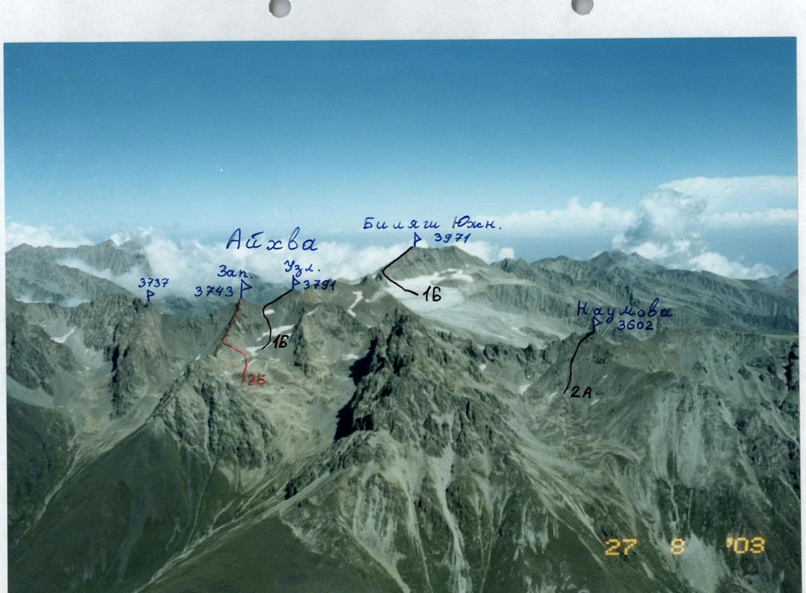
View of part of the Sugan Range from the South. Photo taken from a helicopter. Classified routes are marked in black. The first ascent route is marked in red.
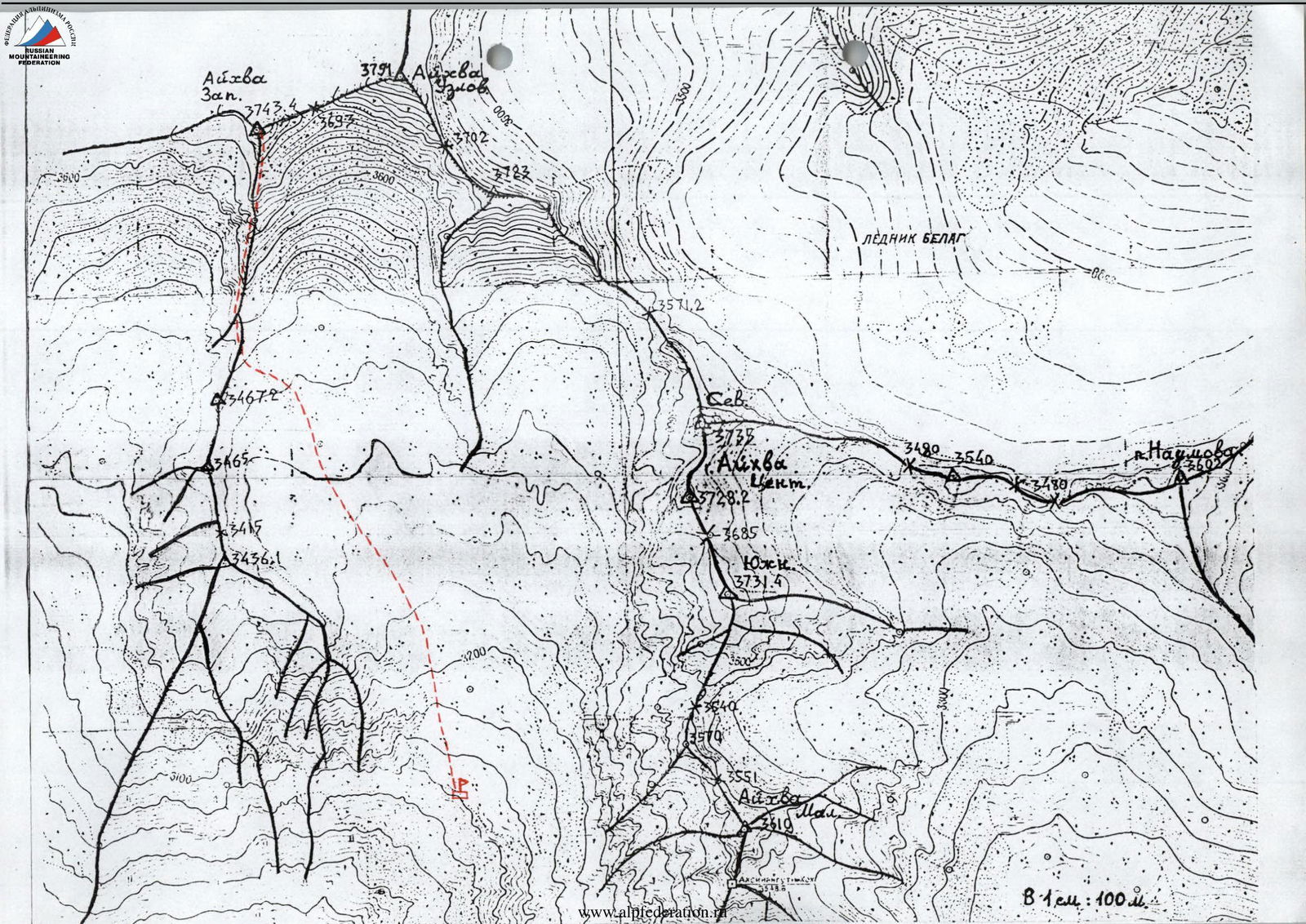
Description of the approach to the route (to the Western Aikhvinsky Cirque)
From the "Digoria" alpine camp (now the "Komy-Art" sports and recreation camp), ascend along the road up the Khares gorge to the waterfall for about an hour. The waterfall near the road is the Aikhvadon River, which flows out of the Western Aikhvinsky Cirque, located west of the Southern (Aikhvinsky) spur of the Sugan Range.
Bypass the waterfall on the road and cross the Aikhvadon River to the right bank. Continue ascending towards the visible Aikhva massif. Initially, walk through meadows, then reach the right grassy ridge and follow it until it levels out into a wide, almost flat, grassy valley — another 1.5 hours (altitude around 2700 m).
Then:
- Proceed straight up along the river to a steep moraine ascent.
- Follow the trail straight up, and to the right of the 'ram's foreheads', where there is water, reach the camping areas — another approximately 1.5 hours.
The altitude here is 3100 m, and the Aikhva massif is clearly visible ahead. The ascent from the alpine camp is around 1300 m.
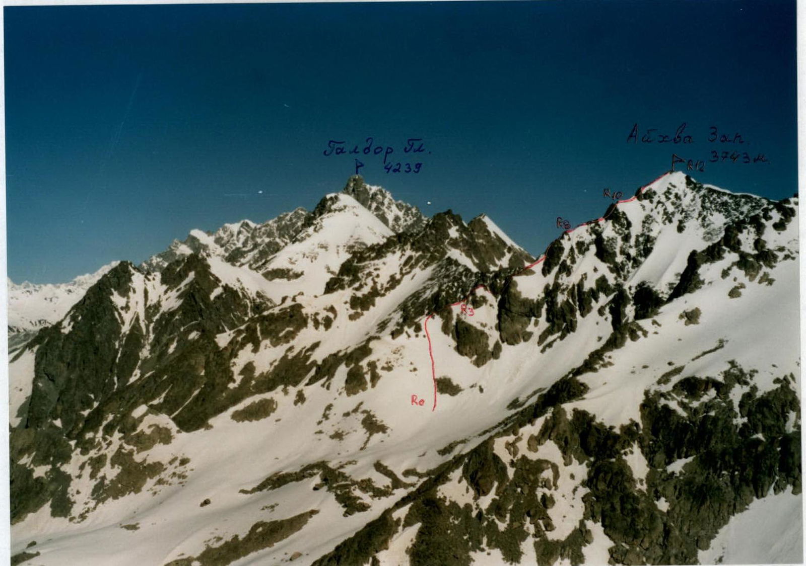
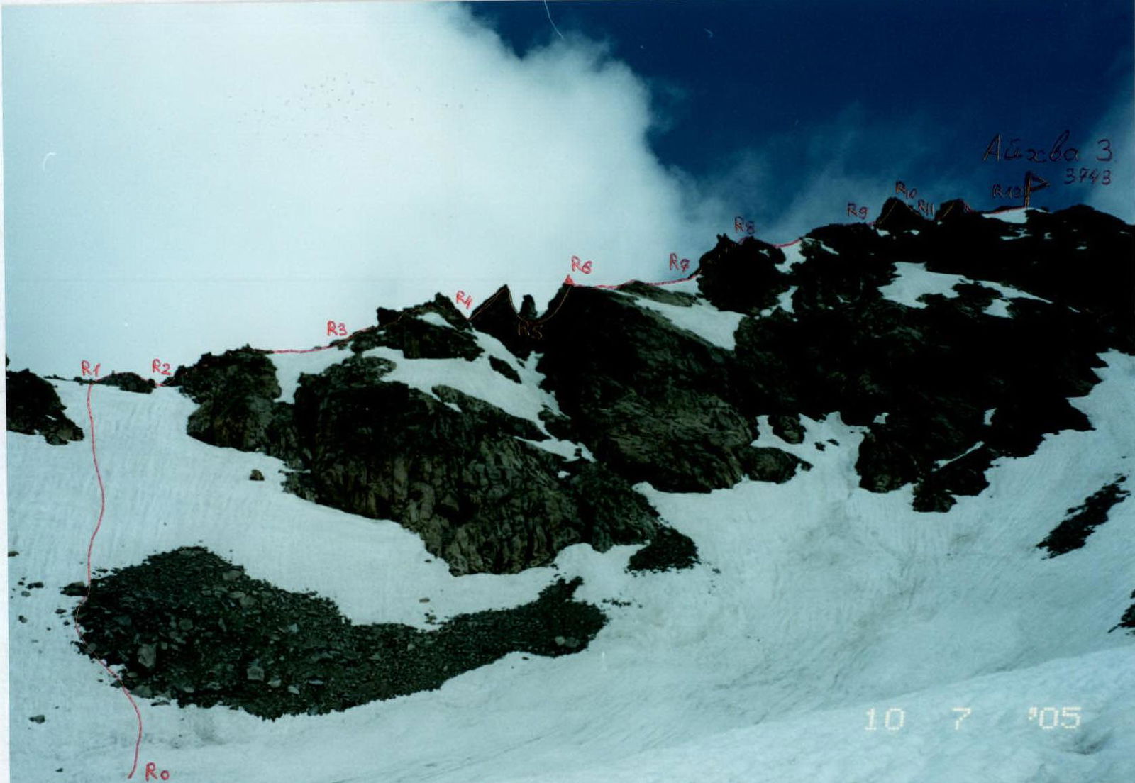
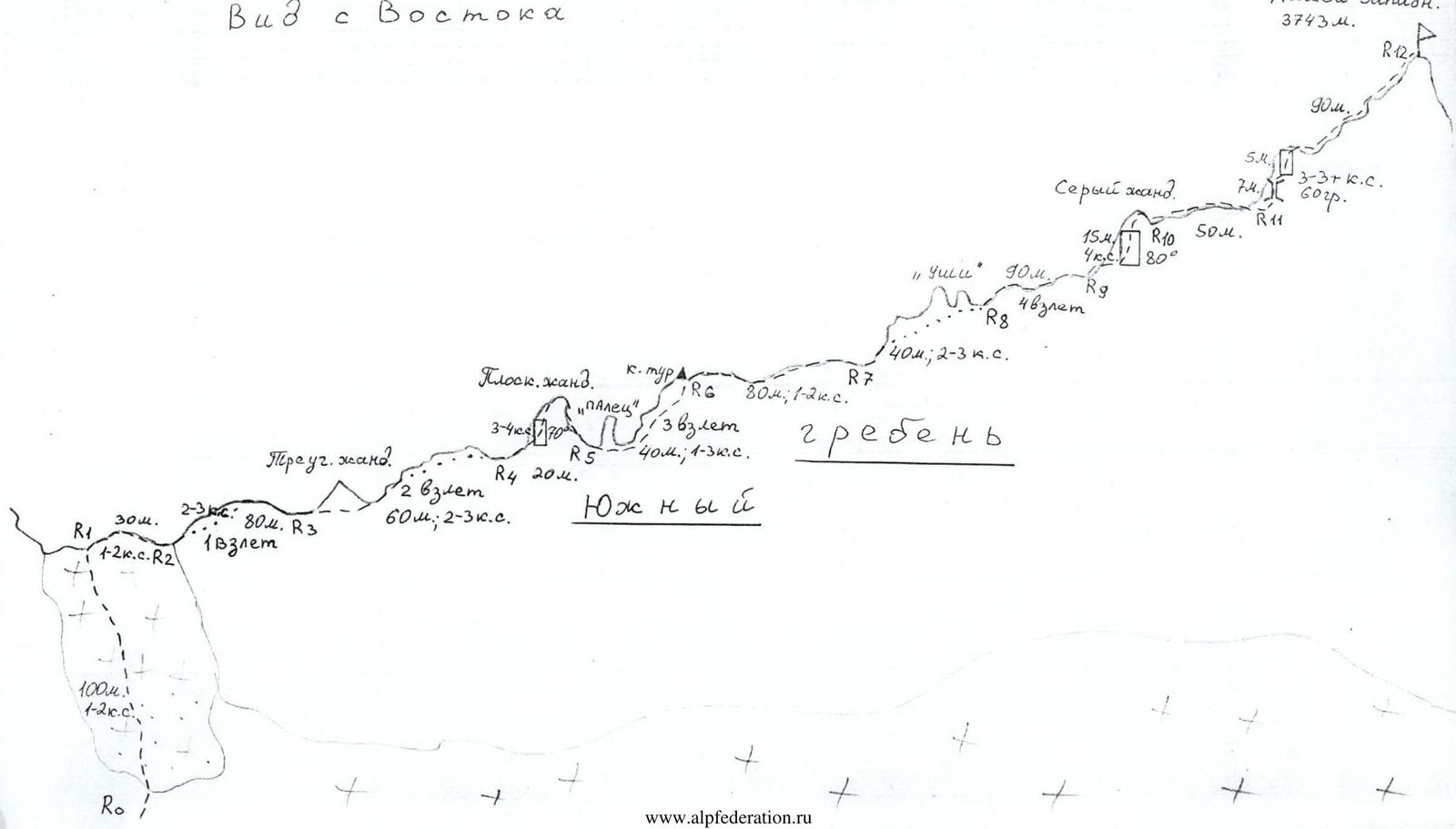
The South Ridge of Aikhva Western from the East. The first ascent route is marked.
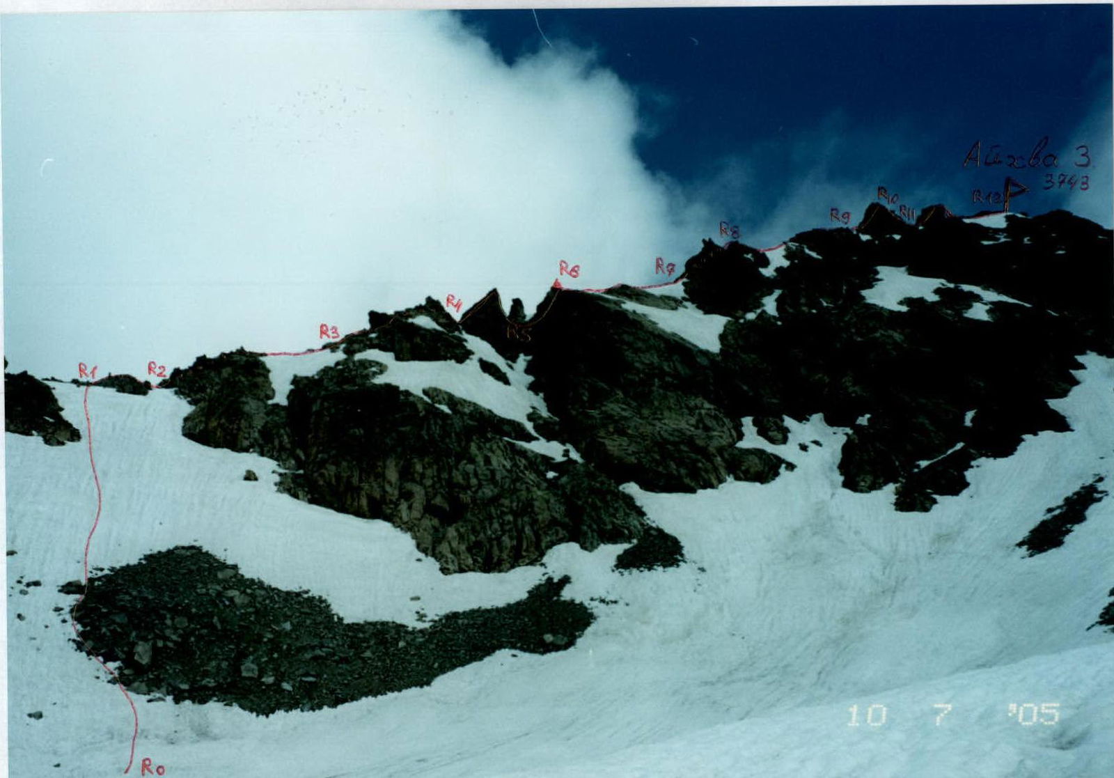
First ascent route along the South Ridge of Aikhva Western.
Route Description
From the upper Aikhvinsky camping areas, ascend leftwards towards the broad triangular summit of Aikhva Western (located in the northwest "corner" of the massif). To the right of the summit (i.e., to the east), the Svetlov Pass saddle is visible. The path from the camps initially goes through moraine hills, sometimes (in the first half of summer) through snowfields. After about an hour of walking, we reach the penultimate cirque before Svetlov Pass. From here, looking west, a snow-scree slope is visible to the left of the rock walls, leading to the South Ridge of Aikhva Western summit.
Section R0–R1: Ascend the snow-scree slope 100 m; 20–30°; 1–2 (crampons may be necessary at the beginning of the season), reach the South Ridge.
Section R1–R2: Follow the ridge line to approach the first ascent: 30 m; 1–2; up to 30°.
Section R2–R3: Bypass the first ridge ascent on the left via ledges, with walls between them, for 40 m; 2–3; up to 50°, then return to the ridge. Then, traverse another 40 m along the easy ridge and approach the Triangular Gendarme.
Section R3–R4: Bypass the Gendarme on the right, the second ridge ascent on the left, and reach the saddle before the Flat Gendarme. The entire section is 60 m; 2–3; 30–40°.
Section R4–R5: Ascend the left part of the Flat Gendarme (slabs 3–4 — a psychological section — belay!) to reach its summit. Then, descend straight down 10 m, 2–3 under the Finger Gendarme. The entire section is 20 m; up to 70°.
Section R5–R6: Bypass the Finger Gendarme on the right via ledges and ascend the right part of the ridge to the top of the Third Ascent. Here is a control cairn. The entire section is 40 m; 1–3; 20–40°.
Section R6–R7: Continue straight along the ridge 1–2; 80 m; approach the Ears Gendarme. (From point R0, it is easily recognizable by its characteristic shape).
Section R7–R8: Bypass the Ears Gendarme on the left via rocks 2–3; 40–70°. After 40 m, reach the ridge behind it.
Section R8–R9: Proceed straight along the ridge, through the Fourth Ascent 2, and approach the Grey Gendarme. The entire section is about 90 m; 10–30°.
Section R9–R10: Ascend straight up the wall 3–4 to reach the summit of the Grey Gendarme. The entire section is 20 m; 60–80°.
Section R10–R11: Proceed straight along the ridge 1–2; 50 m; approach the Pre-Summit Gendarme with a chimney.
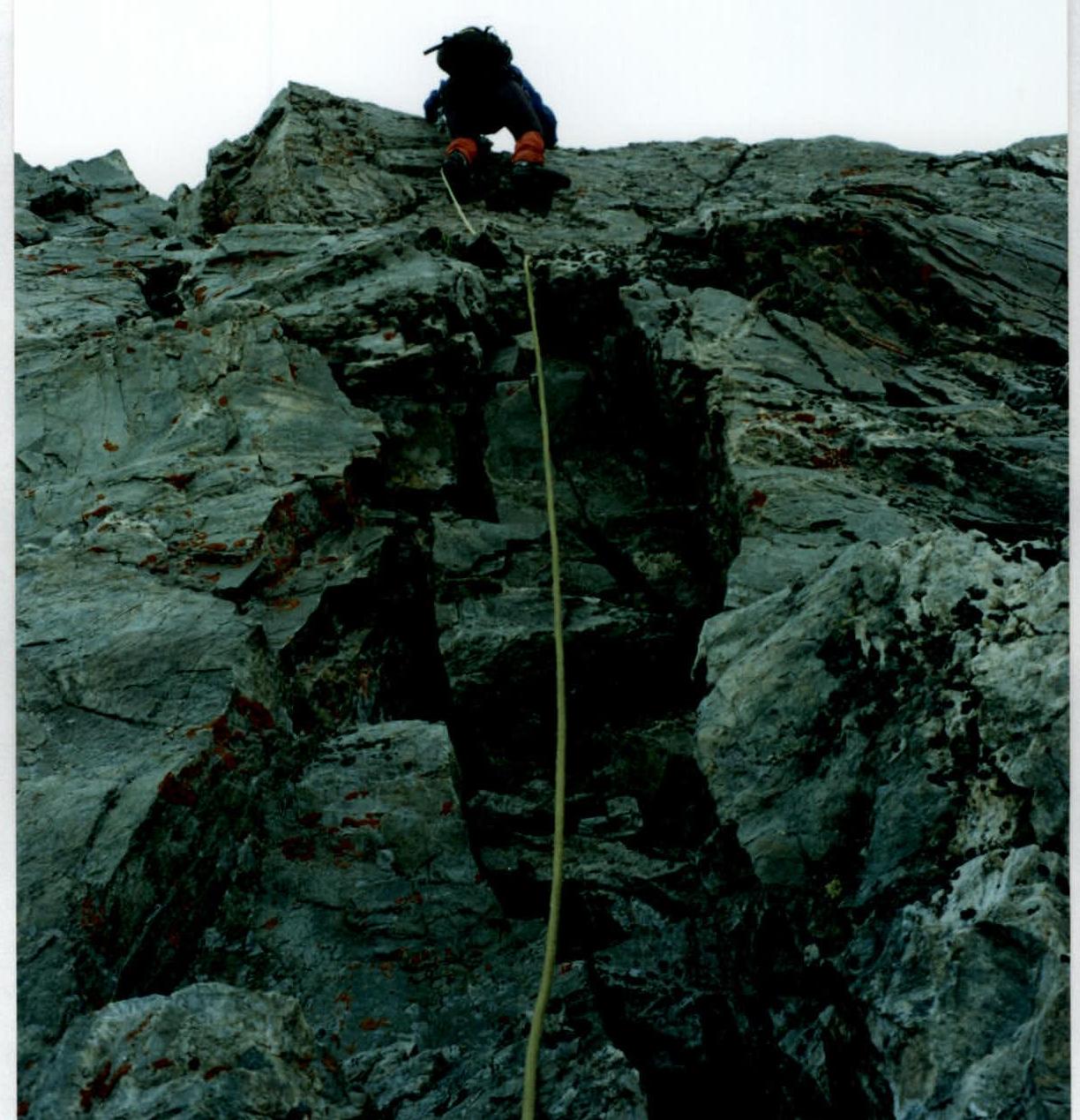
Section R11–R12: Ascend the chimney 3; 70 m; 60°. Then, ascend the wall 5 m; 3; 60° to reach the summit ridge. Along it, on snow, sometimes on rocks 1–2, reach the summit of Aikhva Western (3743 m). The entire section is about 90 m.
From the start of the route to the summit is about 5 hours. In the 2005 season, the route was repeated three times by different groups, but by training detachments, and the time taken was from 6 to 8 hours.
Descent from the summit:
- Along the East Ridge (category 1A) to Svetlov Pass
- Then southwards to the camping areas.
Conclusions and Recommendations for the Route
The route corresponds to the stated category. Completing the route develops skills for ridge routes. Belaying on the route is primarily through rock formations. Recommended for training groups as a good training route.
At the beginning of the season, for a training detachment, the following may be necessary:
- Crampons when exiting to the ridge (hard snow),
- and possibly on the descent.
View from the East
First ascent route along the South Ridge of Aikhva Western.
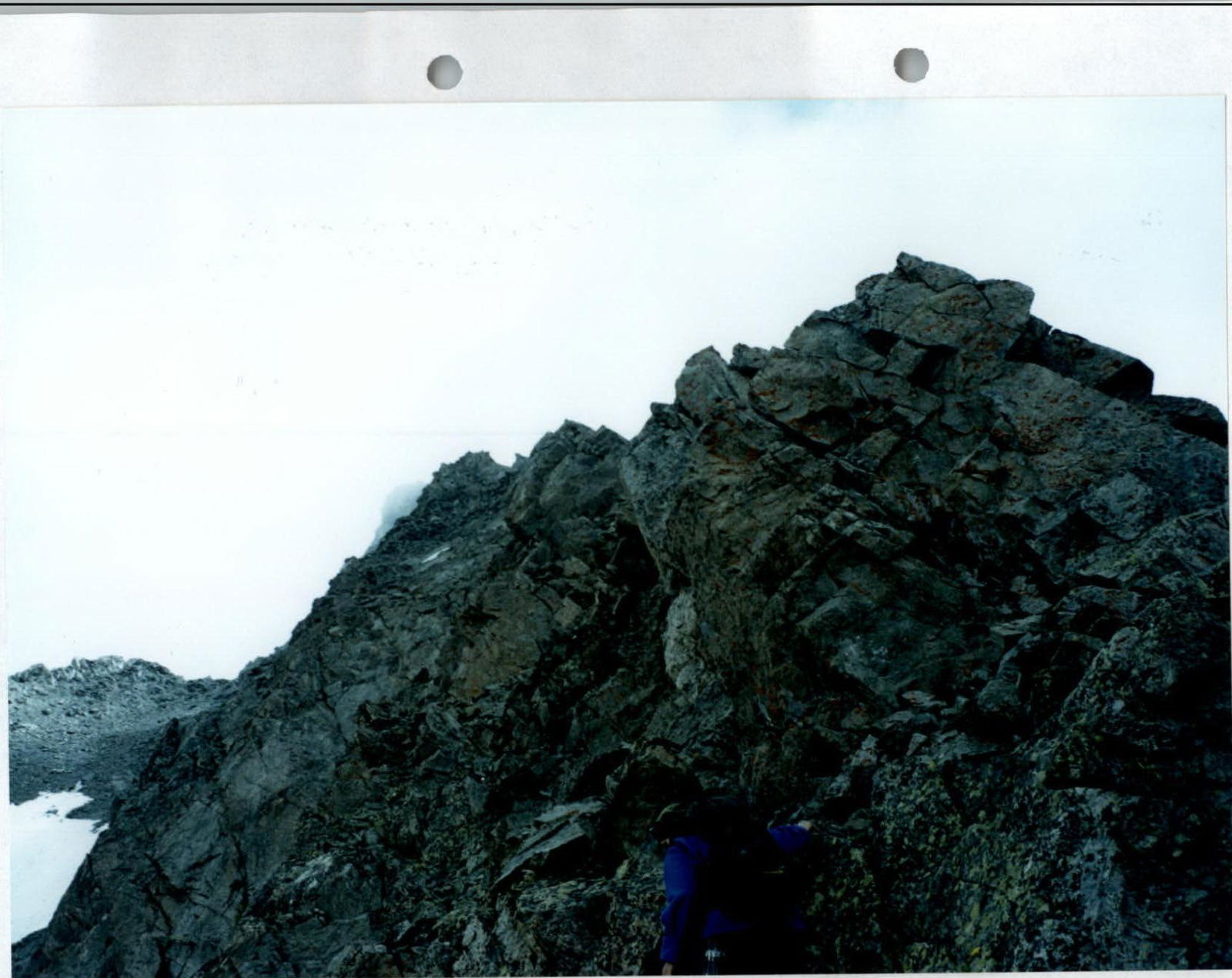
Start of the route. Section R2–R3.
Passing section R9–R10.
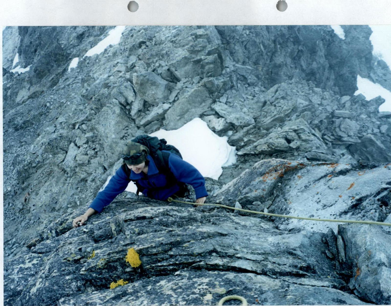
Passing the wall above the chimney. Section R11–R12.