
Russian Championship in Alpinism 2020. Class of Altitudinal-Technical Ascents.
Report on the Traverse of Krumkol (4688 m) – Dykhtau Gl. (5205 m), via Route 6B cat. dif. by the Combined Team of Voronezh Region and Moscow Region for the Period from July 15 to July 22, 2020
I. Ascent Passport
| 1. General Information | ||
|---|---|---|
| 1.1 | Full Name, Sports Rank of the Leader | Dmitrienko E. V., MS |
| 1.2 | Full Name, Sports Rank of Participants | Susloparov P. A., CMS, Maximov D. S., CMS, Vasiliev I. V., CMS |
| 1.3 | Full Name of Coach | Bolkovoy E. V. |
| 1.4 | Organization | Alpinism Federation of Moscow Region |
| 2. Characteristics of the Ascent Object | ||
| 2.1 | Region | Central Caucasus |
| 2.2 | Valley | Kundryum–Mizhyrgi |
| 2.3 | Section Number according to the Classification Table of 2017 | 255 |
| 2.4 | Name and Height of the Summit | Krumkol, 4688 m – East Mizhirgi, 4927 m – West Mizhirgi, 5025 m – Borovikova Peak, 4888 m – Pushkin Peak, 5100 m – East Dykhtau, 5180 m – Main Dykhtau, 5205 m. |
| 2.5 | Geographical Coordinates of the Summit (latitude/longitude), GPS Coordinates | Krumkol 43.04112, 43.18776, E. Mizhirgi 43.043319, 43.153344, W. Mizhirgi 43.04357, 43.14978, Borovikova Peak 43.04663, 43.14623, Pushkin Peak 43.044444, 43.148333, E. Dykhtau 43.051336, 43.132419, Main Dykhtau 43.05321, 43.13176 |
| 3. Characteristics of the Route | ||
| 3.1 | Name of the Route | Traverse Krumkol–Dykhtau Main |
| 3.2 | Category of Difficulty | 6B |
| 3.3 | Degree of Route Exploration | First Ascent (in this combination, the route has not been completed before) |
| 3.4 | Nature of the Route Terrain | Combined |
| 3.5 | Height Difference of the Route (data from altimeter or GPS) | 2077 |
| 3.6 | Length of the Route (in meters) | About 7 km |
| 3.7 | Technical Elements of the Route (total length of sections of varying difficulty with indication of terrain type (ice-snow, rock)) | IV–600 m, V–2000 m, VI–70 m |
| 3.8 | Average Steepness of the Wall Section of the Route | 65° |
| 3.9 | Descent from the Summit | Via Route 4B Dykhtau by N. ridge |
| 3.10 | Additional Characteristics of the Route | The route is very long, starts with a technically difficult section (6A), and most of the route is above 4000–4500 m. Due to warming, there is a high risk of rockfall on the wall sections. |
| 4. Characteristics of Team Actions | ||
| 4.1 | Time of Movement (team's working hours) | 68 h |
| 4.2 | Overnight Stays | July 15 – semi-sitting overnight stay July 16 – lying in a tent July 17 – lying in a tent July 18 – lying in a tent July 19 – lying in a tent July 20 – lying in a tent July 21 – lying in a tent July 22 – lying in a tent at VCSPC overnight stays |
| 4.3 | Time Spent on Route Preparation | No preparation was conducted |
| 4.4 | Time of Reaching the Summits | July 17, 2020, at 9:30 – Krumkol July 19, 2020, at 19:10 – East Mizhirgi July 20, 2020, at 12:05 – West Mizhirgi July 20, 2020, at 16:30 – Borovikova Peak July 21, 2020, at 07:22 – Pushkin Peak July 22, 2020, at 14:10 – East Dykhtau July 22, 2020, at 16:10 – Main Dykhtau |
| 5. Characteristics of Weather Conditions | ||
| 5 | July 15 – variable cloudiness, good weather. July 16 – clear, good weather. July 17 – snow, fog, very strong gusts of wind. July 18 – wet snow, weather clearing. July 19 – good weather, windy. July 20 – good weather. July 21 – dense fog, lack of visibility, very strong wind with ice pellets and snow. July 22 – variable weather, clear. | |
| 6. Person Responsible for the Report | ||
| 6.1 | Full Name, e-mail | Maximov D. S., deltoro87@mail.ru |
II. Description of the Ascent
2. Characteristics of the Ascent Object
The traverse of the northern massif of Koshtan – Dykhtau 6A was first completed on August 15, 1949, by a team led by Vitaly Abalakov — a Soviet mountaineer, Honored Master of Alpinism (1934), Honored Master of Sports (1941), Honored Coach of the USSR (1961), and design engineer.
There have been few subsequent ascents:
- In the next 10 years, only one team completed the full traverse – in 2010 (led by Litovchenko A.P.)
- Many teams attempted the route but had to abandon it.
This indicates the challenging nature of the task.
The Krumkol–Dykhtau traverse route was included in the classifier in 2017 and had not been completed since then, making it an interesting challenge for the team. The Krumkol–Dykhtau traverse has attracted many strong mountaineers. However, teams that attempted it ended up completing the ascent and descending. The Krumkol–Dykhtau route has a category of difficulty 6B.
The traverse begins with 6A on Krumkol via Timofeev's route, and most of the route is above 4000–4500 m. The team worked without using any pre-placed anchors or supplies and carried everything necessary throughout the route. The entire route took 8 days, from July 15 to July 22, 2020.
2.1. Map of the Ascent Area

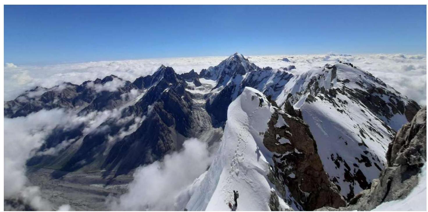
2.2. General Photo of the Route
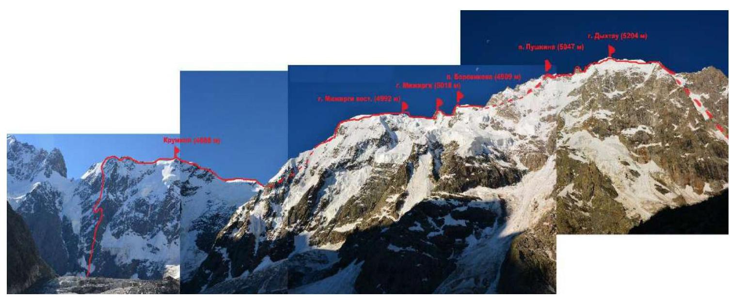
2.3. Photos of the Route
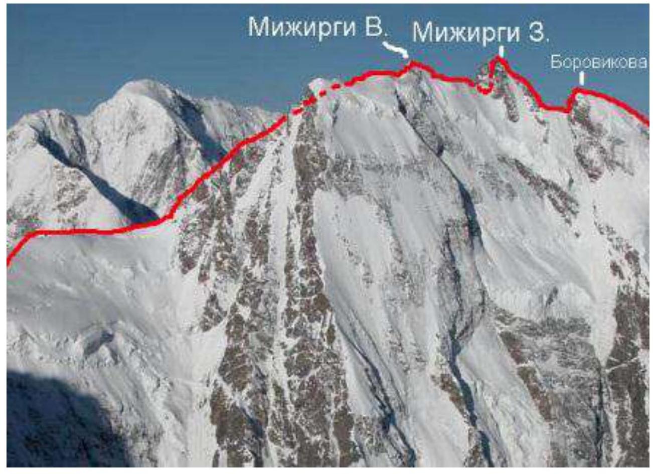
Krumkol and the ridge towards W. Mizhirgi
Ascent line to East Mizhirgi
From Mizhirgi to Borovikova Peak
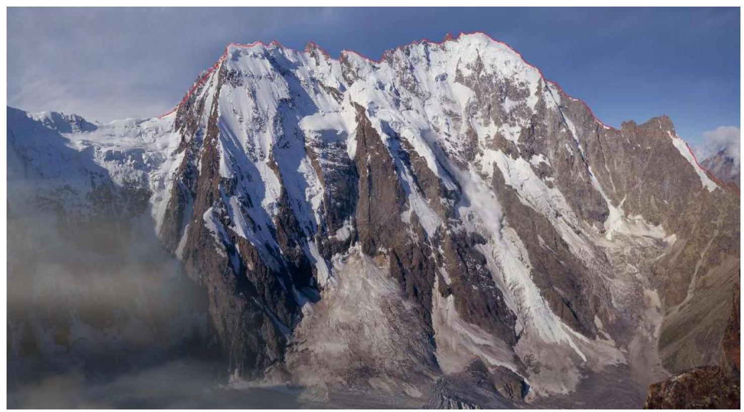
From Mizhirgi to Dykhtau
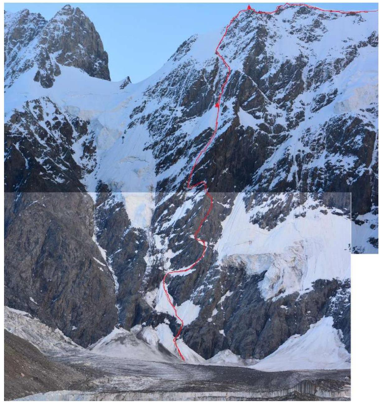
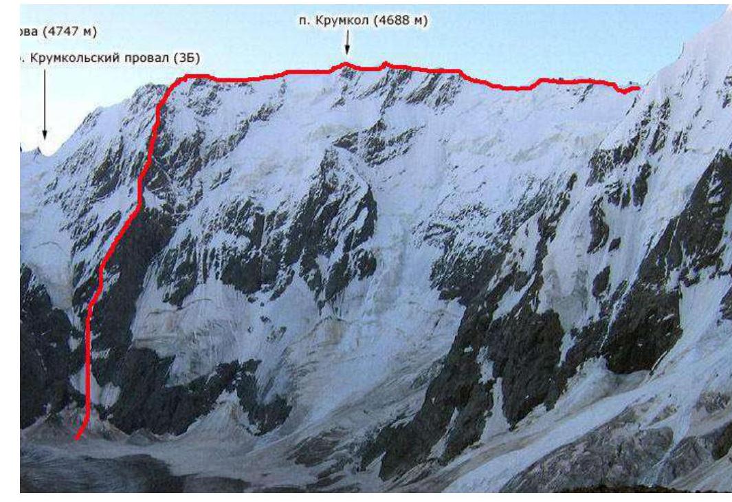
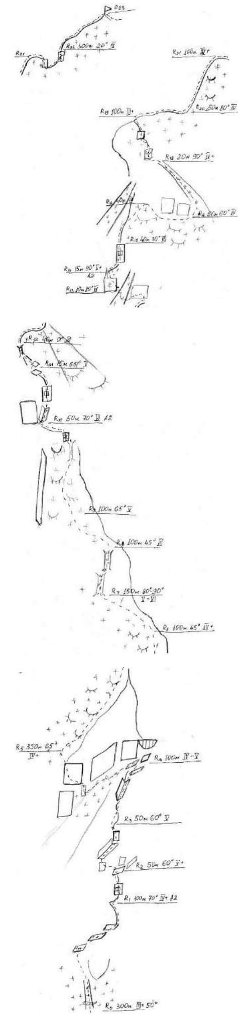
2.3. Route (Schematic)
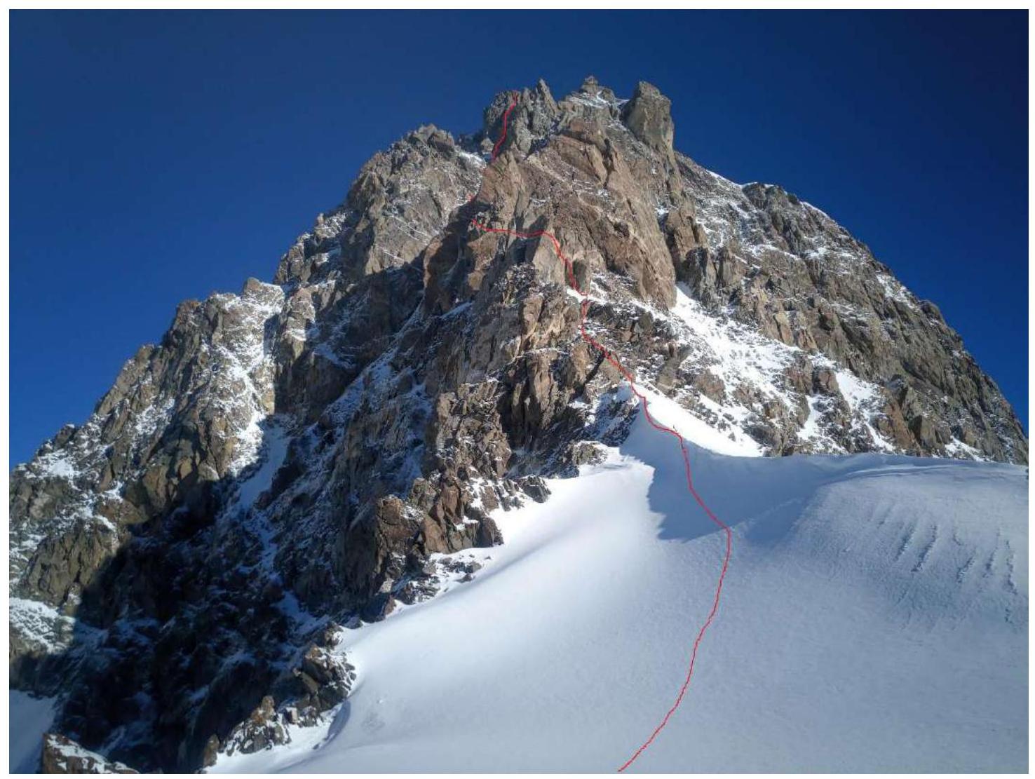
2.3.1. Schematic of the Krumkol 6A Section
2.3.2. Krumkol–Passage of Memory Section follows the ridge with gendarmes about 30 m high each. Between the gendarmes, movement is along the sharp ridge, sometimes up, sometimes down.
2.3.3. Passage of Memory–East Mizhirgi Section.
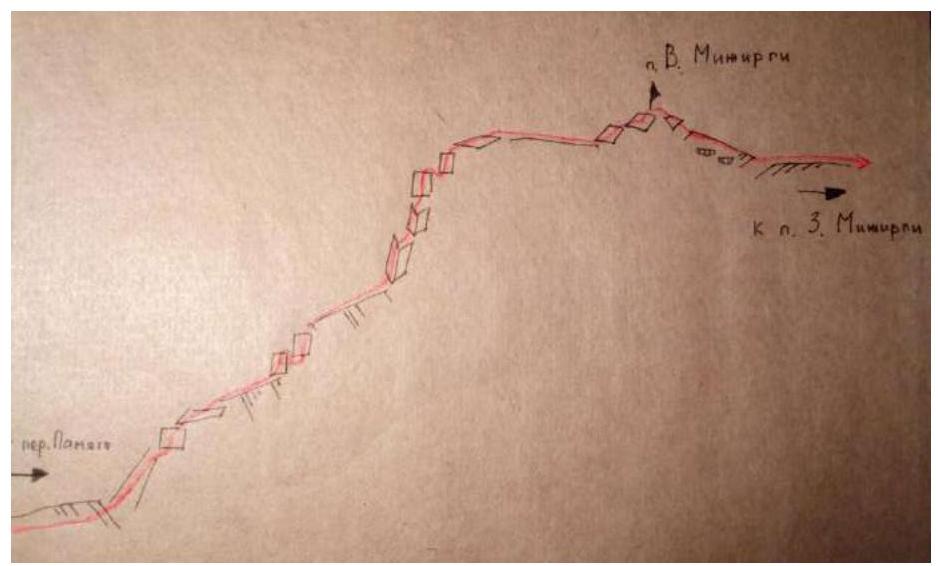
2.3.4. East Mizhirgi–Borovikova Peak Section.
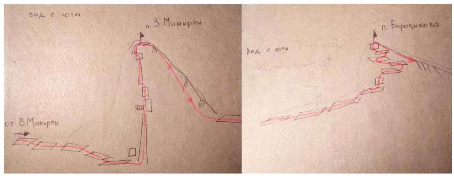
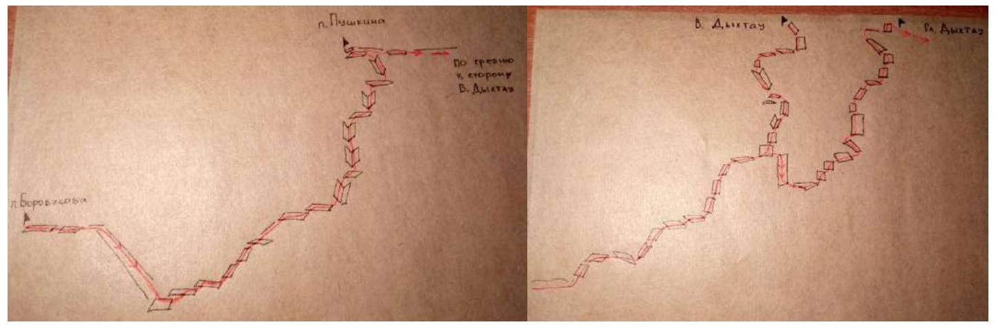
2.3.5. Borovikova Peak–Dykhtau Section.
III. Team Actions
| Date | Team Actions | Photo Number |
|---|---|---|
| 15.07.2020 | The route begins with 6A on Krumkol via the south ridge (Timofeev's route). Started the route at 00:30 for safety reasons — lower temperature, fewer rockfalls. Climbed onto the right snow cone and traversed 30 m of rock under a waterfall. Vasiliev Ivan led. Followed the description until reaching the overnight stay location. Very little snow and ice on the wall, snow was slushy. Reached the overnight stay location at 15:00. Climbed onto ice and set up a semi-sitting overnight stay at 18:30, carving a shelf in the ice. Weather was good throughout the day. | Photo #1, Photo #2 |
| 16.07.2020 | Started the route at 07:30. Ice was deep under the snow, 40–100 cm, had to dig to place anchors. Worked in turns. Weather was also good. Reached the ridge and set up an overnight stay at 18:00. | Photo #3, Photo #4 |
| 17.07.2020 | Began movement at 06:00 along the ridge towards Krumkol summit, replaced the note. Then climbed along the ridge to Mizhirgi summit. Trapped, hung ropes, and pulled through — a well-coordinated team effort. Weather brought snow, fog, and strong gusts of wind. Set up an overnight stay before the Mizhirgi ridge around 18:00. | Photo #5, Photo #6, Photo #7 |
| 18.07.2020 | All rocks were covered with fresh wet snow from the night, no possibility to start moving, waited until afternoon. From 15:00, Vasiliev hung all 4 available ropes. Weather was good. Overnight stay at the same location. | Photo #8 |
| 19.07.2020 | Continued working on Mizhirgi from 09:00, very rockfall-prone. Vasiliev continued to lead. Crossed East Mizhirgi and set up an overnight stay at 18:15. Weather was good throughout the day. Despite the altitude, high humidity and very wet snow persisted, boots and clothing did not dry out. | Photo #9, Photo #10, Photo #11 |
| 20.07.2020 | Worked on the route from 05:40, climbed to West Mizhirgi, organized descent, and proceeded to Borovikova Peak via a relatively easy passage. Dmitrienko led. Weather was good. Set up an overnight stay immediately after Borovikova Peak around 17:50. | Photo #12, Photo #13, Photo #14, Photo #15 |
| 21.07.2020 | The entire day was overcast, and the weather worsened in the second half of the day: strong wind with snow pellets, dense fog, very cold. Closer to evening, climbed to Pushkin Peak. Could not find the note in bad weather and strong wind. Set up an overnight stay between Dykhtau and Pushkin Peak at 18:30, under the protection of a gendarme. | Photo #16, Photo #17 |
| 22.07.2020 | Weather was good. Started at 07:00. Found and replaced the note in the cairn on Pushkin Peak. Then moved along relatively easy rocks towards Dykhtau. Led alternately by Dmitrienko and Vasiliev. Initially climbed to the saddle between Main and East Dykhtau. Then retraced steps to the traverse and climbed to East Dykhtau via ice-covered rocks, descended back to the saddle, and reached Main Dykhtau. Did not find a note, left their own. Descended from the summit to VCSPC overnight stays via Route 4B from Main Dykhtau before nightfall. | Photo #18, Photo #19, Photo #20, Photo #21 |
On July 23, 2020, the entire team was already at the AB “Bezengi” and arrived by lunchtime.
Photos from the Route
Photo #1. July 15, 2020.
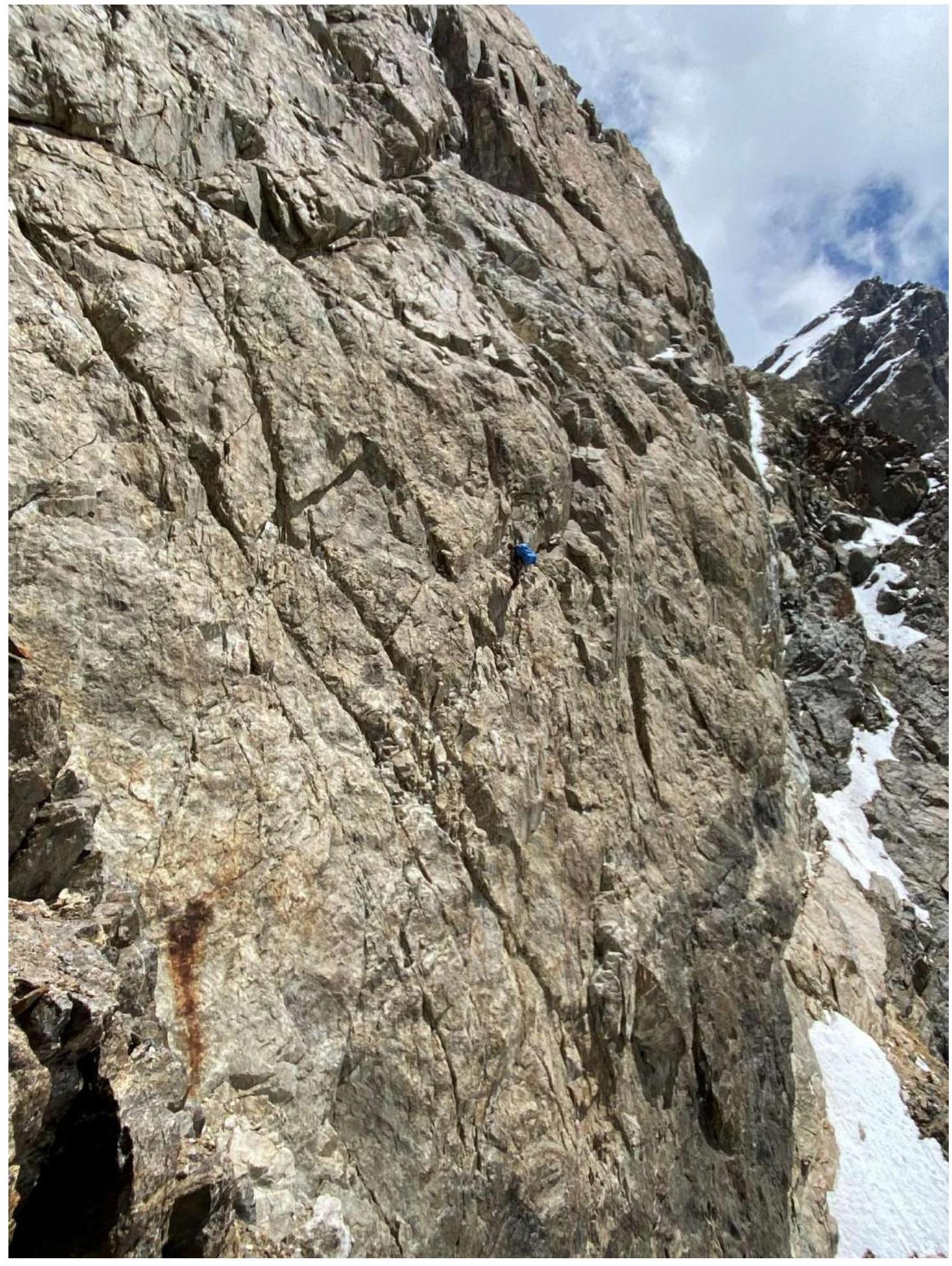
Photo #2. July 15, 2020. 5 ropes to overnight stay.
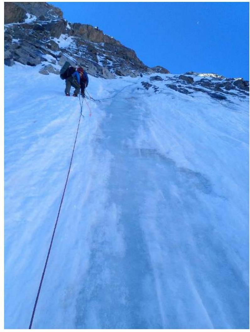
Photo #3. July 16, 2020. Above the ice “snot”.
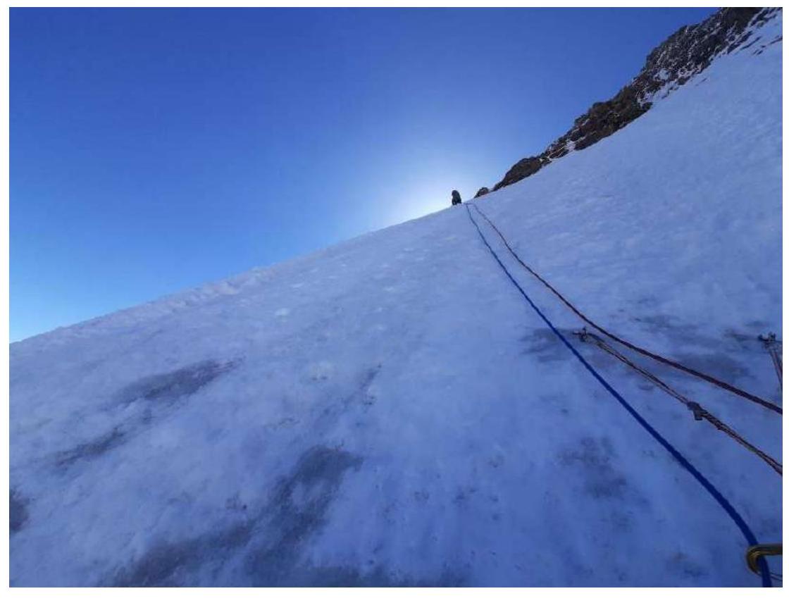
Photo #4. July 16, 2020.
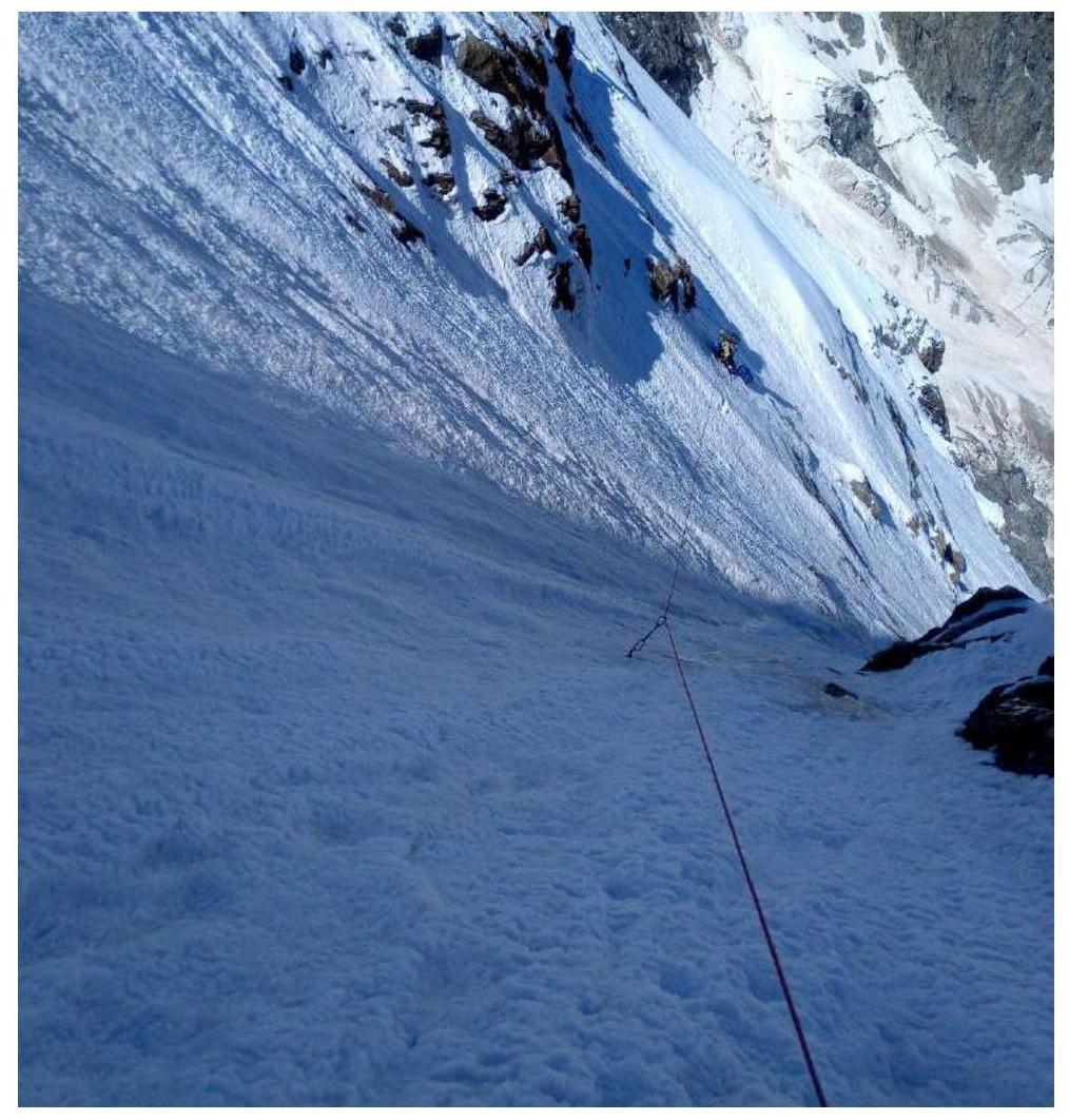
Photo #5. July 17, 2020. Krumkol gendarmes.
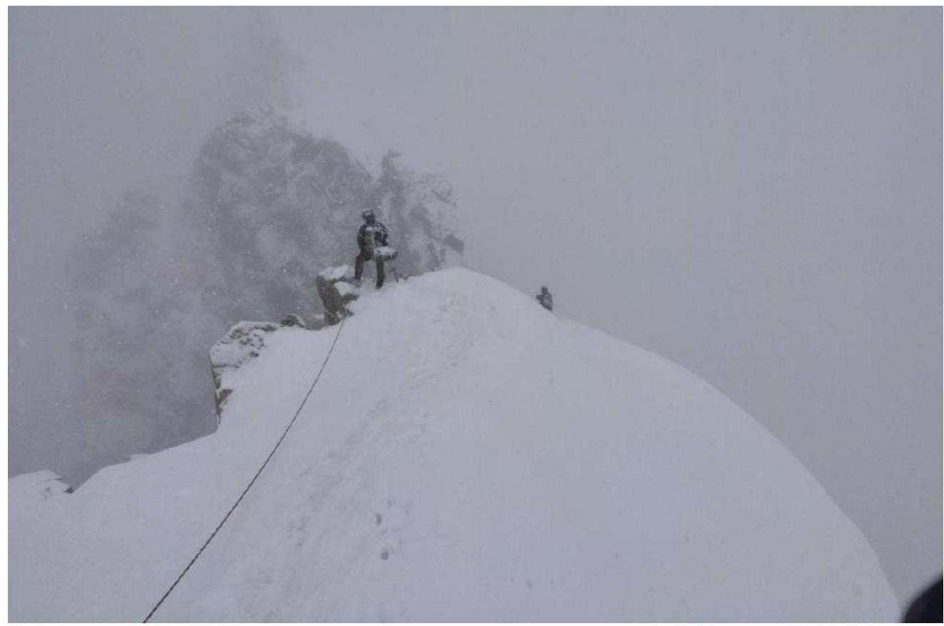
Photo #6. July 17, 2020.
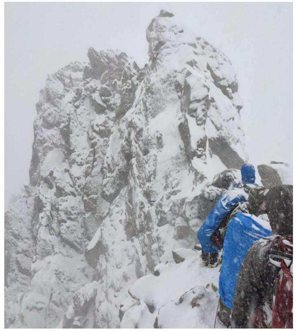
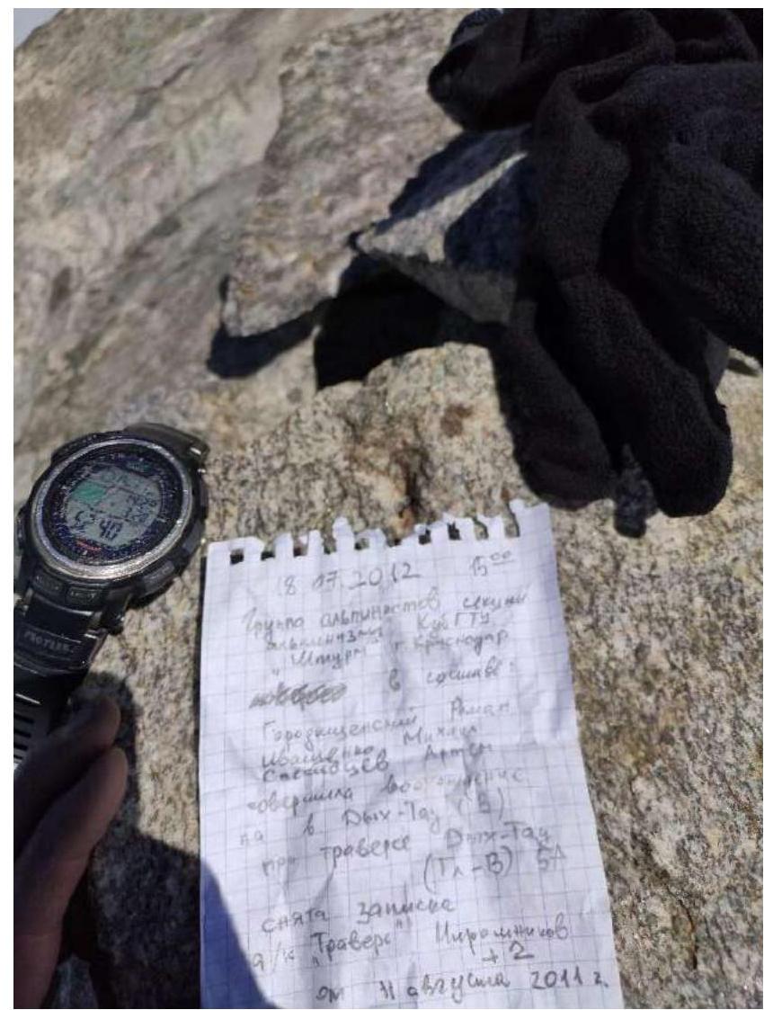
Photo #7. July 17, 2020. Note on Krumkol summit.
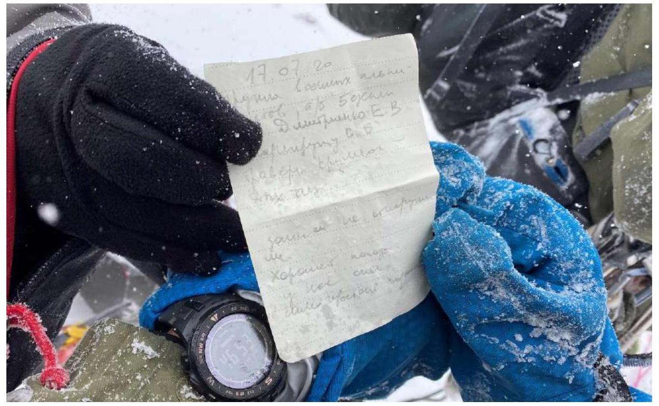
Photo #8. July 18, 2020. Rest day.
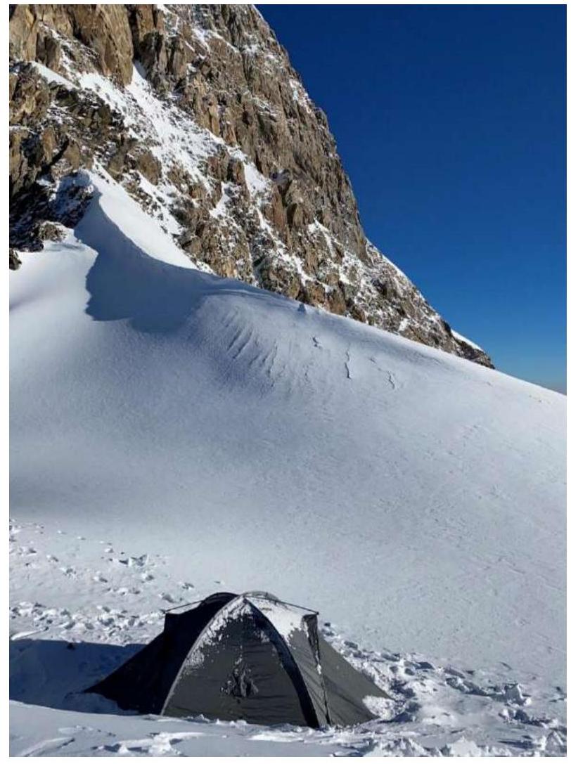
Photo #9. July 19, 2020.
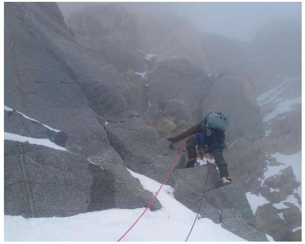
Photo #10. July 19, 2020. Approach to East Mizhirgi.
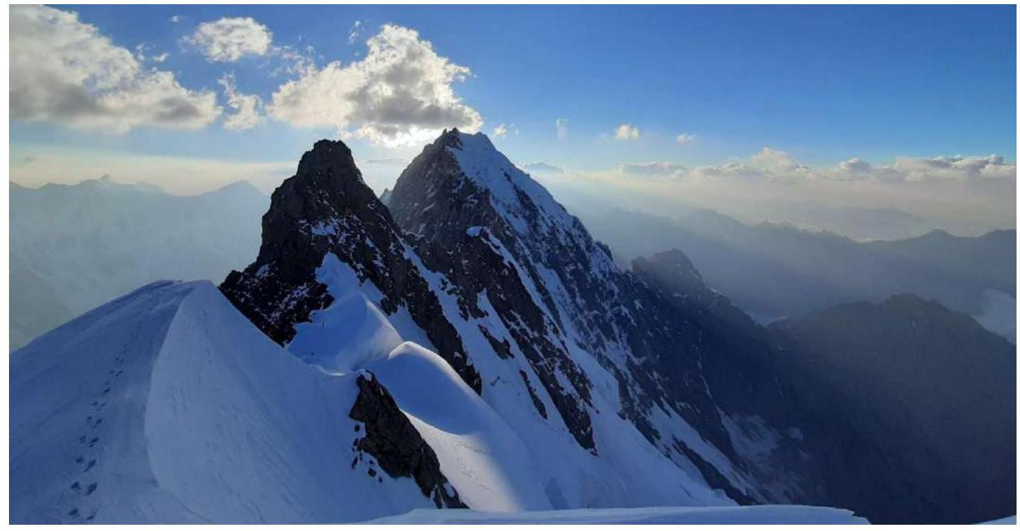
Photo #11. July 19, 2020. East Mizhirgi summit.
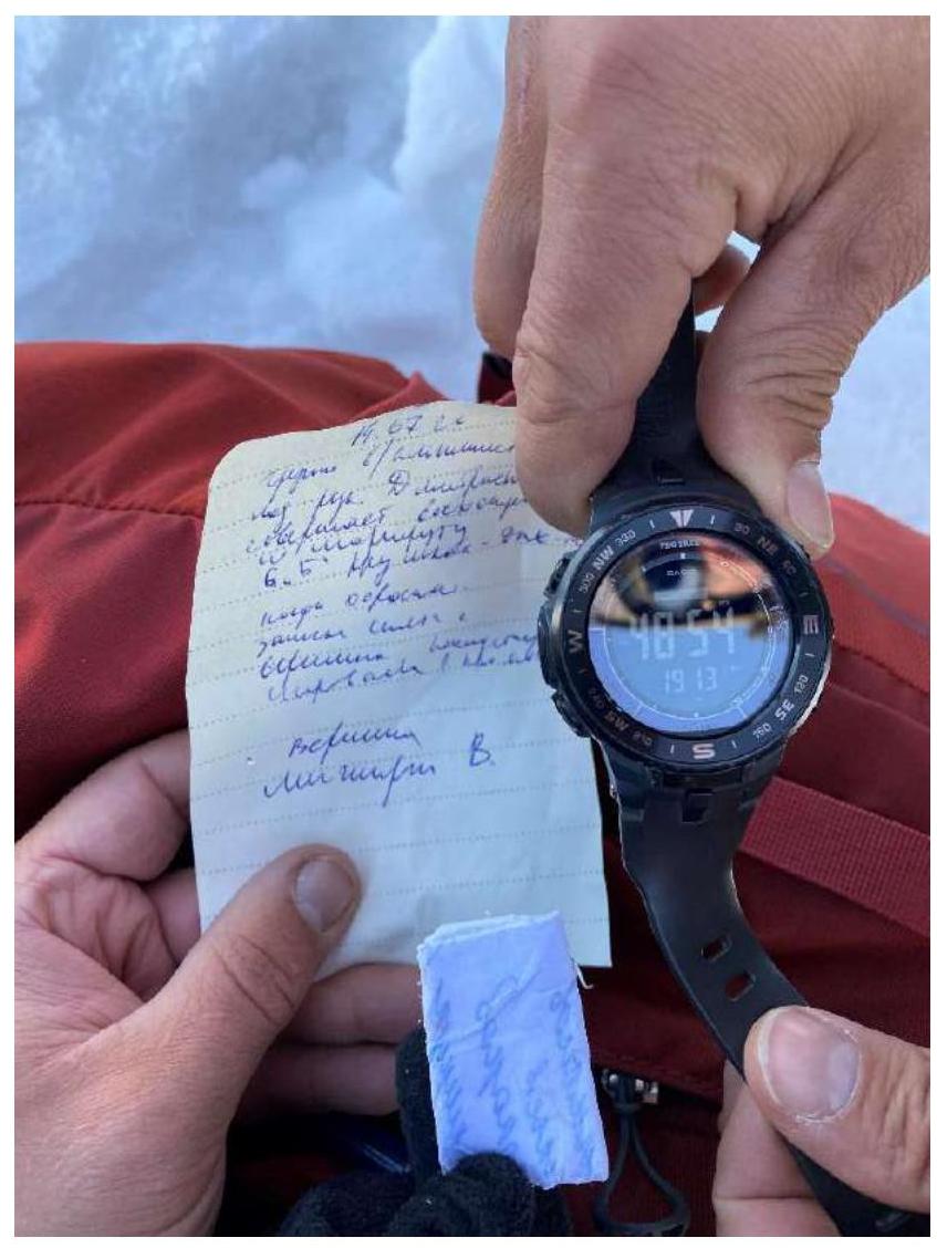
Photo #12. July 20, 2020. Ascent to West Mizhirgi.
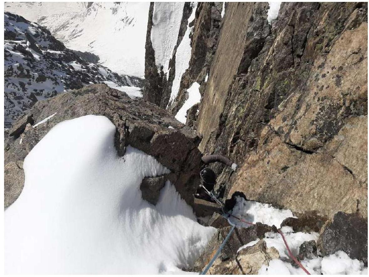
Photo #13. July 20, 2020. West Mizhirgi summit.
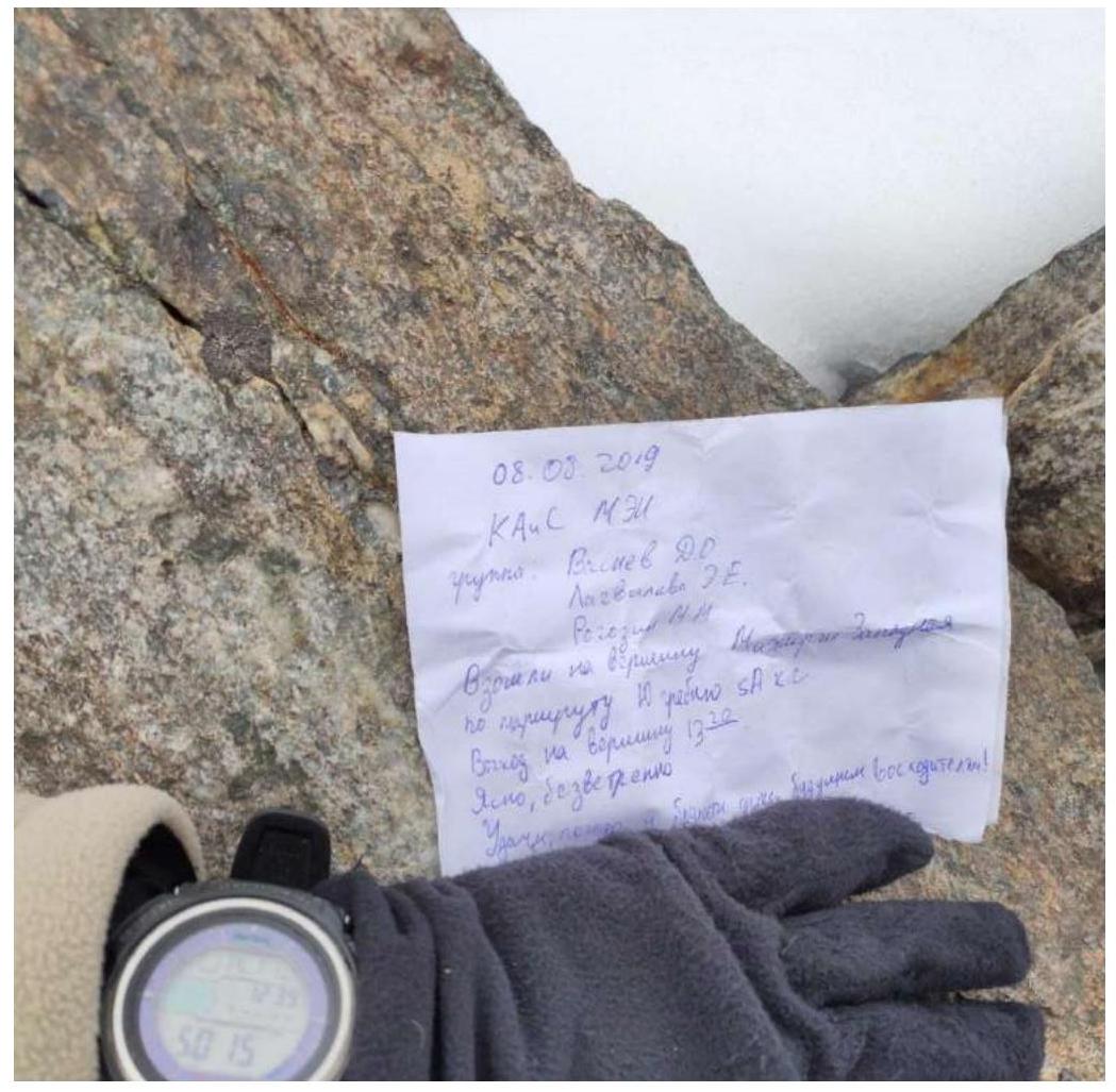
Photo #14. July 20, 2020. Moving towards Borovikova Peak.
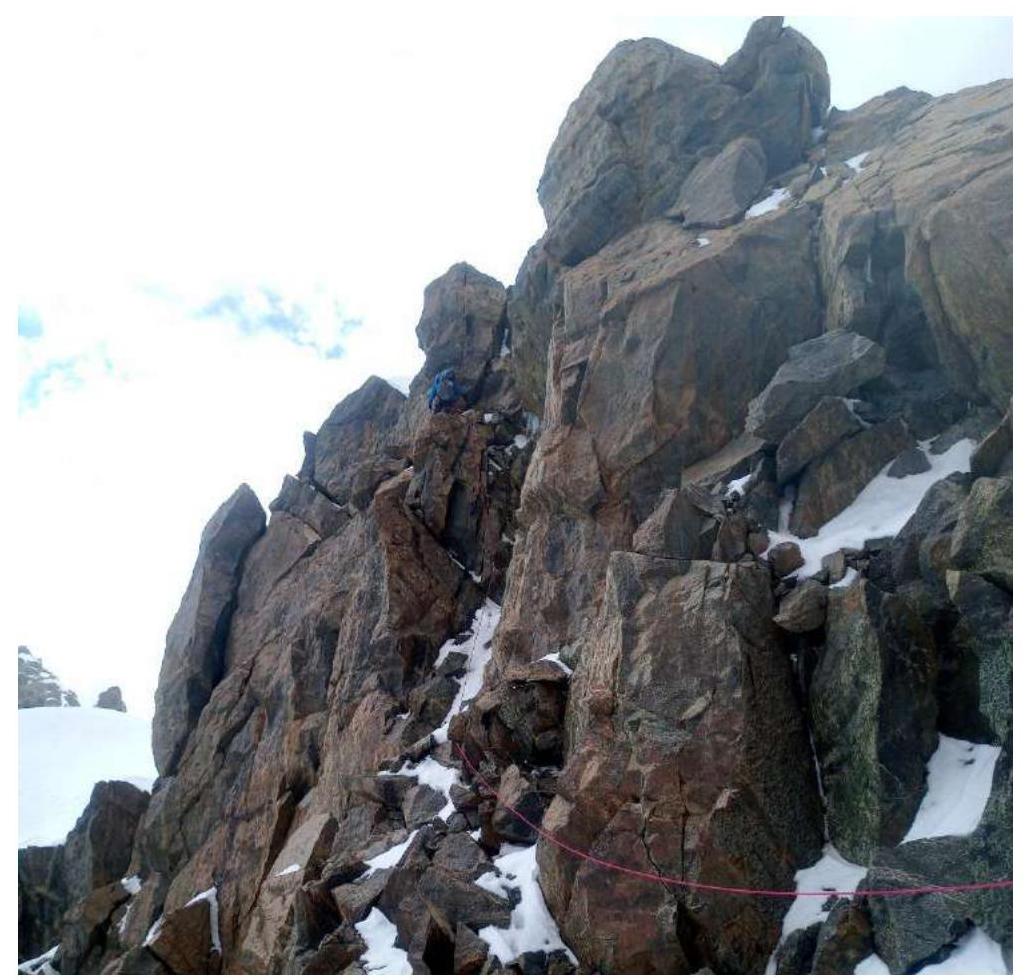
Photo #15. July 20, 2020. Borovikova Peak summit.
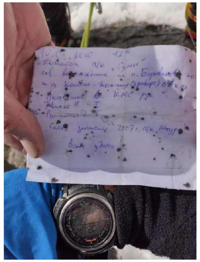
Photo #16. July 21, 2020. Traverse from Borovikova Peak towards Pushkin Peak.
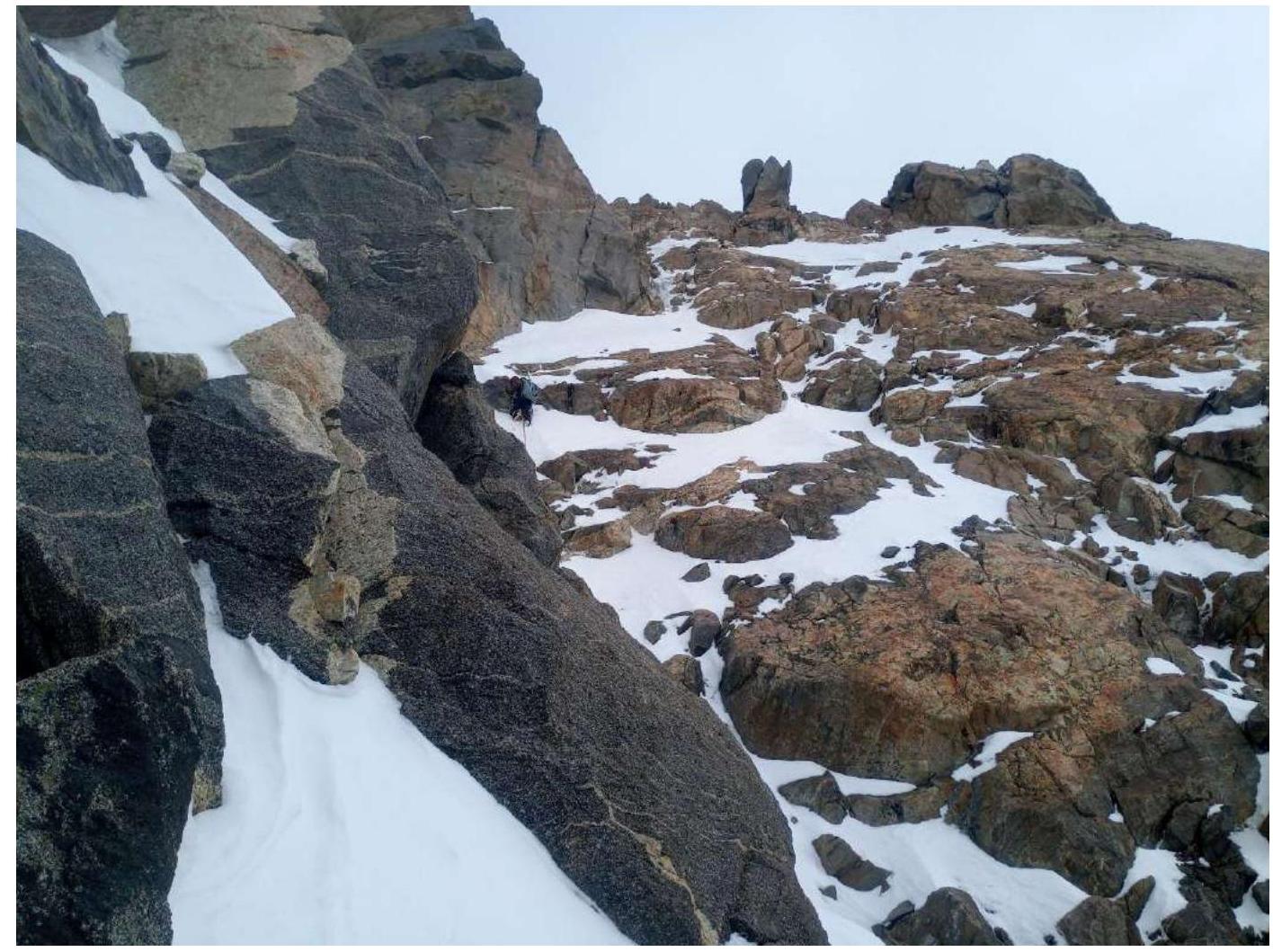
Photo #17. July 21, 2020.
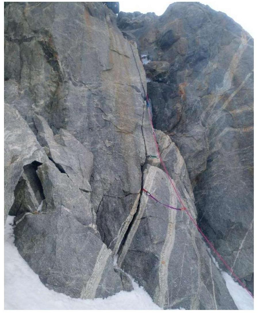
Photo #18. July 22, 2020. Saddle between Pushkin Peak and East Dykhtau.
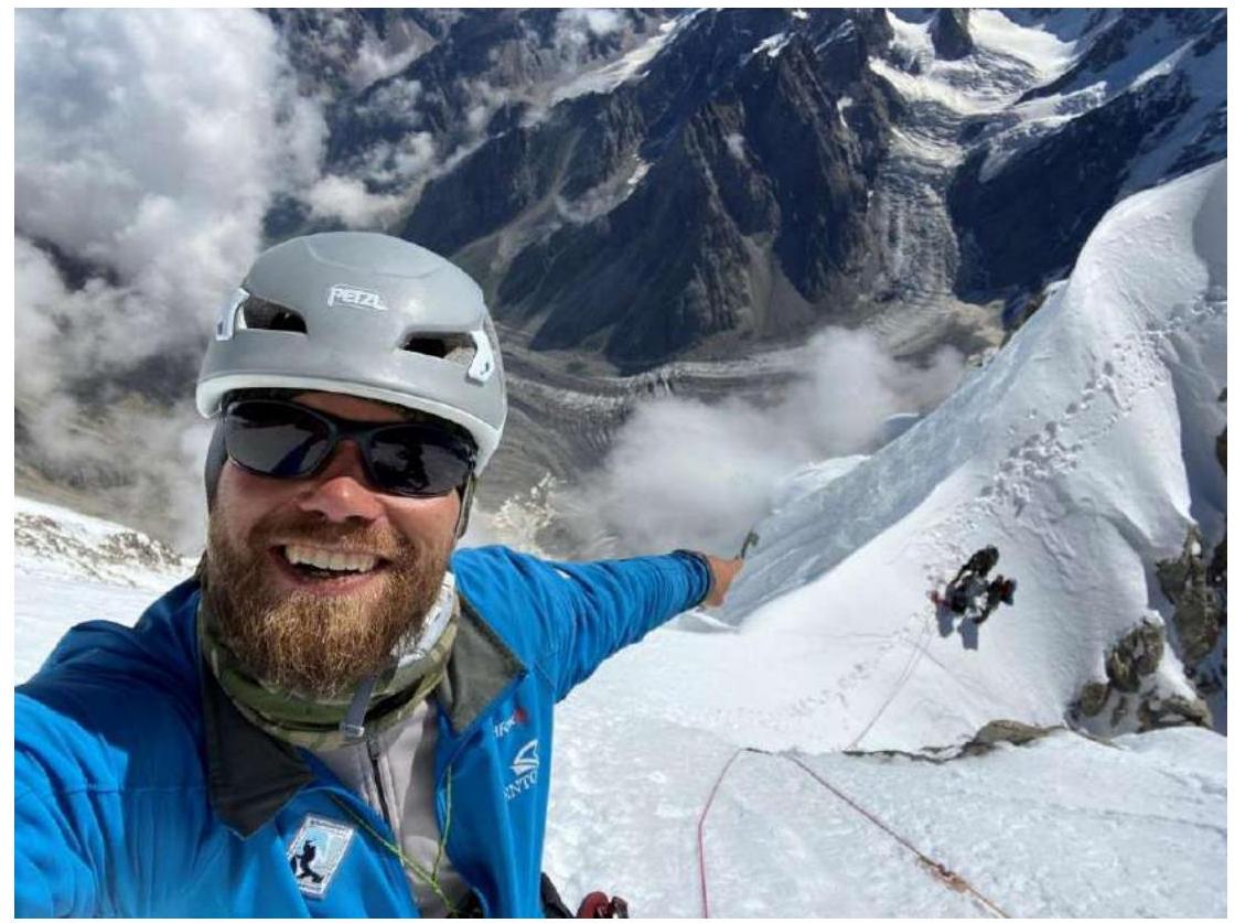
Photo #19. July 22, 2020. On Dykhtau summit.
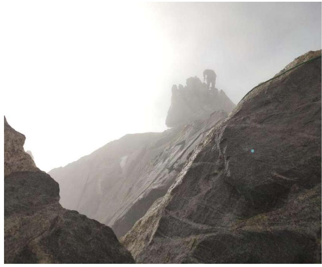
Photo #20. July 22, 2020.
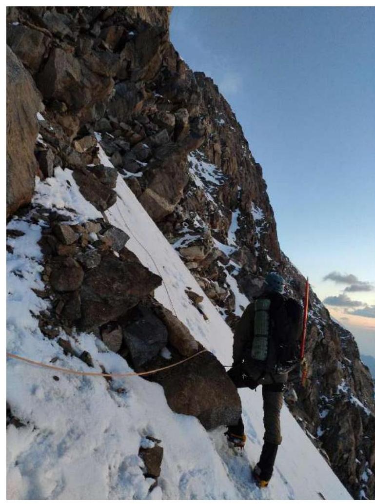
Photo #21. July 22, 2020. Dykhtau summit.
Comments
Sign in to leave a comment