Report
on the ascent to the summit of Ural (V) (4273 m), via the Southwest wall, first ascent, approximately 5A category of difficulty, by the team Сборная ФАСПб from July 9 to July 9, 2022.
Team coach: Timoshenko T.I.
Team members:
- Bolyachkin D.L. — 1st sports category
- Matinyan A.A. — Master of Sports
- Trikozov V.M. — Master of Sports
1. Ascent Passport
| 1. General Information | ||
|---|---|---|
| 1.1 | Team Leader | Bolyachkin Denis Leonidovich, 1st sports category |
| 1.2 | Team Members | Matinyan Artur Armenovich, Master of Sports, Trikozov Viktor Mikhailovich, Master of Sports |
| 1.3 | Coach's Full Name | Timoshenko T.I. |
| 1.4 | Organization | FASPb |
| 2. Characteristics of the Ascent Object | ||
| 2.1 | Region | Caucasus |
| 2.2 | Area | From the Kitlod pass to the Gezhevsak pass (north of the Main Caucasian Range) |
| 2.3 | Number of section according to the 2013 classification table | 2.5 |
| 2.4 | Name and height of the summit | Ural Vostochnaya (4273 m) |
| 3. Route Characteristics | ||
| 3.1 | Route Name | Via the Southwest wall |
| 3.2 | Proposed category of difficulty | 5A |
| 3.3 | Route exploration degree | First ascent |
| 3.4 | Route terrain characteristics | Rock climbing |
| 3.5 | Route height difference | 600 m |
| 3.6 | Route length | 665 m |
| 3.7 | Technical elements of the route | III category of difficulty rocks – 50 m, IV category of difficulty rocks – 175 m, V category of difficulty rocks – 415 m, VI category of difficulty rocks – 25 m |
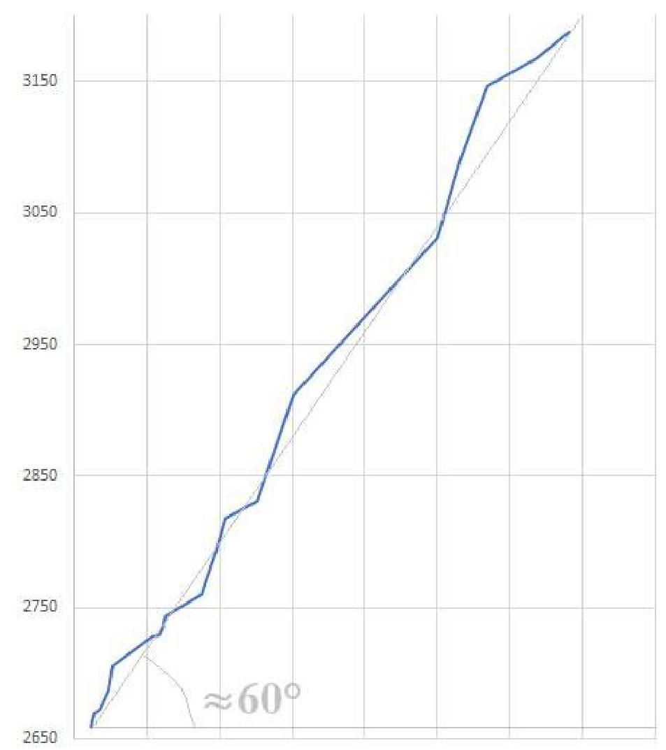
| 3.8 | Average steepness of the route, (°) | Entire route = approximately 60° |
| 3.9 | Average steepness of the wall part of the route, (°) | approximately 70° |
| 3.10 | Descent from the summit | Via the couloirs of the West wall |
| 3.11 | Additional route characteristics | |
| 4. Team Tactical Actions | ||
| 4.1 | Time in motion (in hours and days) | 9 hours 15 minutes, 1 day |
| 4.2 | Overnight stays | — |
| 4.3 | Route preparation time | without preparation |
| 4.4 | Route start | July 9, 2022, 4:45 |
| 4.5 | Summit attainment | July 9, 2022, 14:00 |
| 4.6 | Return to the base camp | July 9, 2022, 23:00 |
| 5. Team Technical Actions | ||
| 5.1 | Pitons left on the route | not left |
| 5.2 | Pitons used on the route: | |
| Stationary pitons | not used | |
| Removable pitons | not used | |
| for AID | 2 | |
| 5.3 | Number of protection points used: | 75 |
| Rock anchors | 13 | |
| Camalots | 62 | |
| 6. Weather Conditions | ||
| 6.1 | Temperature, °C | |
| 6.2 | Wind speed, m/s | moderate, 3–5 m/s |
| 6.3 | Precipitation | none |
| 6.4 | Visibility, m | good |
| 7.1 | Full Name, e-mail | Bolyachkin D.L. dlbolyachkin@gmail.com |
1.1 Characteristics of the Ascent Object
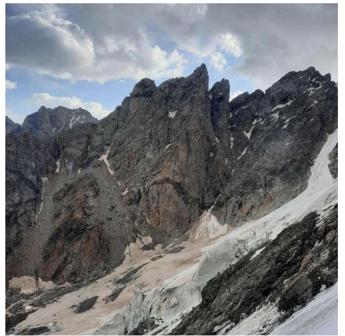
The Central Caucasus is the highest and most inaccessible part of the Greater Caucasus mountain system. The Bezengi area, which is part of this mountain system, occupies a relatively small section between the Tviber pass and the Digor spur. Nevertheless, the high concentration of peaks exceeding 5000 m above sea level and walls with a total height difference of 1500–2000 m makes this area one of the most unique mountain regions in the world.
To the north of the Central Range, north of the Bezengi glacier, lies the system of mountains of the Lateral Range. Six peaks in the area exceed 5000 m, with four of them located in this range. This is the main sports mountaineering massif of the area, forming a horseshoe-shaped cirque around the Mizhirgi glacier.
The walls of the area are sharply divided into northern and southern. The northern walls are typically:
- snow-ice and combined,
- with steep rock bastions,
- with ice falls,
- with snow cornices.
The southern walls are predominantly rocky.
1.1.1 General Photo of the Summit
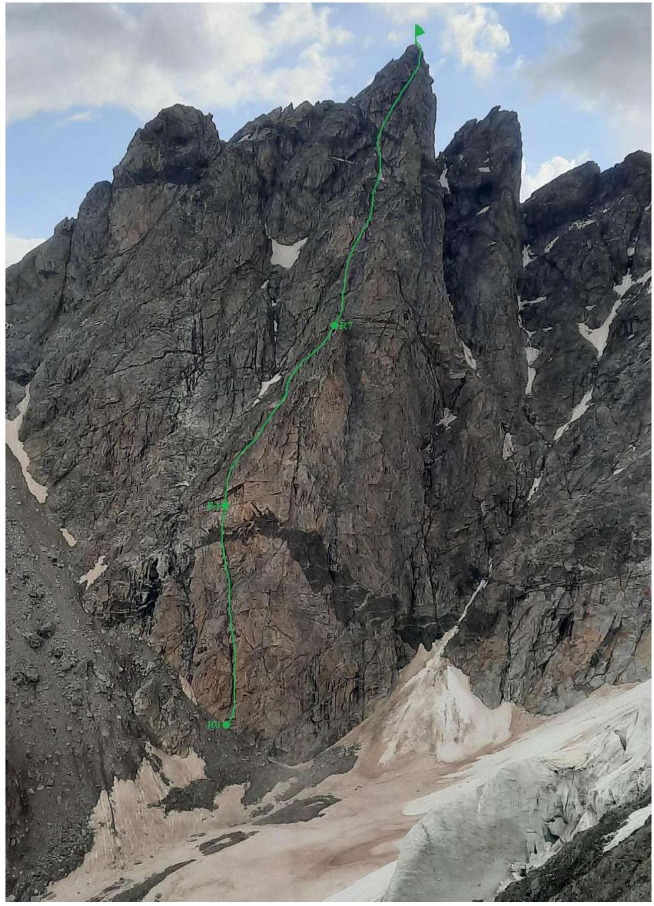
1.1.2 Photo of the Route Profile
Lower part of the wall up to
R5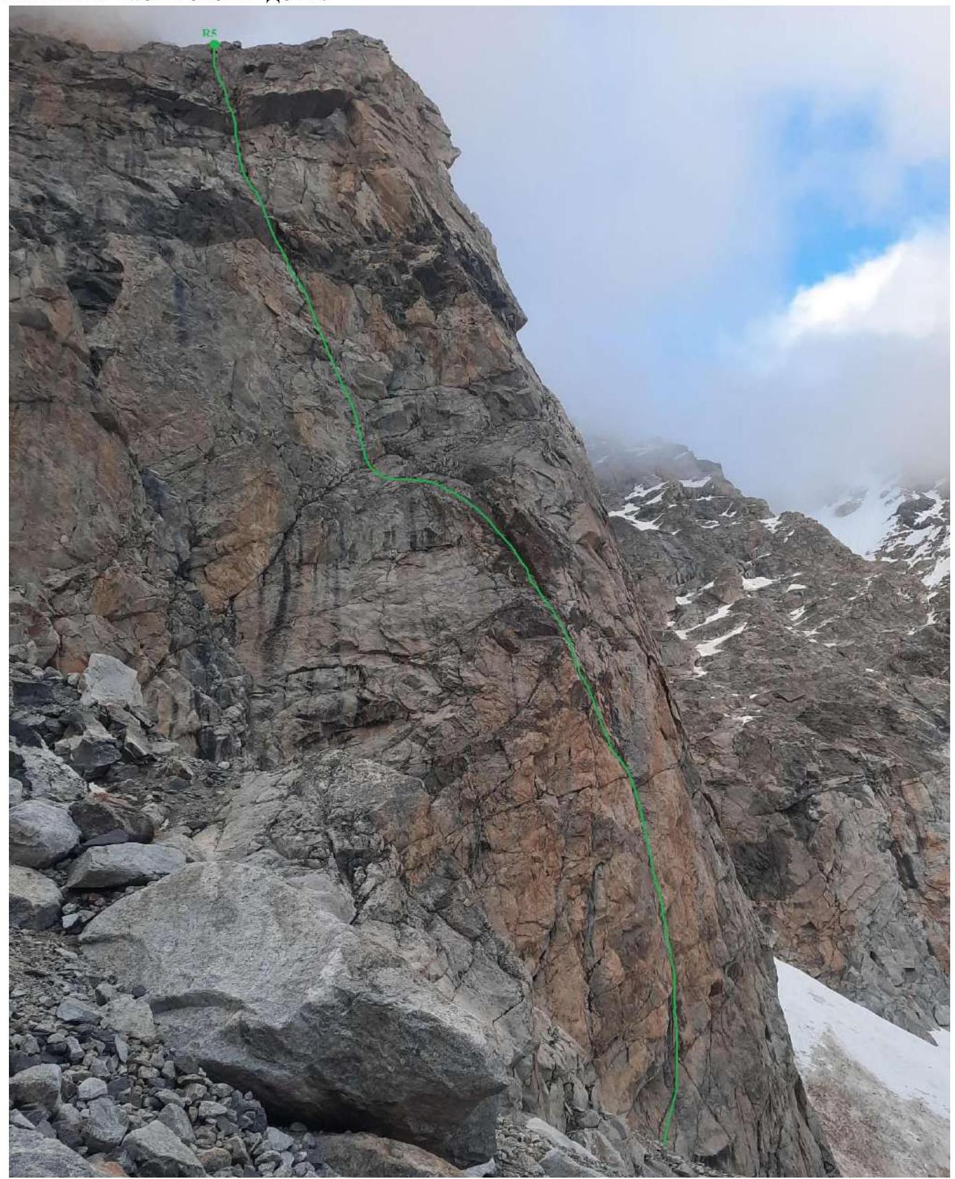
1.1.3 Drawn Route Profile
1.1.4 Photo of the Area Panorama
1.1.5 Map of the Area

1.2 Route Characteristics
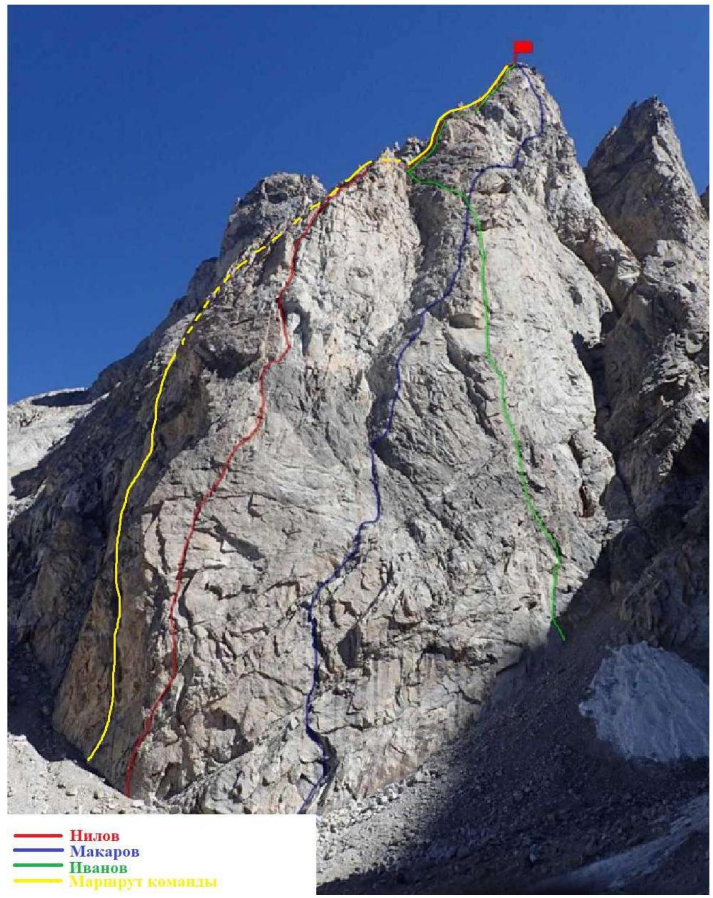
1.2.1 Technical Photograph of the Route with Sections
1.2.2 Route Description
The route starts about 50 m to the left of the Nilov route — a characteristic cleft going high up towards the summit, visible from the overnight camps. At the start of the route, a cairn was built.
R0–R1
Up the cleft to the right, then straight up the inner corner. 25 m.
R1–R2
Continue moving up the inner corner. 35 m.
R2–R3
Pass a small cornice and continue straight up the slabs. Station on a ledge below the yellow wall, below the black rock band. 45 m.
R3–R4
Left along the ledge and up the cleft. Then move towards the cornice along the slabs. Station under the large cornice. A control cairn was built under the cornice but left empty as there was no note. 40 m.
R4–R5
Pass the cornice in the center via a damaged cleft, on its left part, then up to a ledge on the shoulder. 35 m.
R5–R6
From the ledge, move up to the right, crossing a snow patch, wet rocks. 25 m.
R6–R7
Up the slab towards the ridge. Here the route joins the Nilov route. 25 m.
R7–R8
Up along good, solid rocks, staying on the left side of the ridge, towards the summit. 85 m.
R8–R9
Continue moving along the ridge. Occasionally, there are small walls and ledges, but all lead back to the ridge, which is sometimes quite wide. 155 m.
R9–R10
Cross the upper part of the couloir on the left side of the ridge and return to the ridge. 60 m.
R10–R11
Up the wall and then up the inner corner. 60 m.
R11–R12
Up the wall to the flattening before the summit. 40 m.
R12–R13
Up simple rocks through a large crack to the summit. 30 m.
1.2.3 Route Diagram in UIAA Symbols
| Section | Protection Elements | Length, m | Steepness, ° | Difficulty | |
|---|---|---|---|---|---|
| R12–R13 | 2 camalots | 30 m | 30° | III | |
| R11–R12 | 4 camalots | 40 m | 45° | IV | |
| R10–R11 | 1 anchor 6 camalots | 60 m | 60° | V | |
| R9–R10 | 5 camalots | 60 m | 50° | IV | |
| R8–R9 | 3 anchors 10 camalots | 155 m | 55° | V | |
| R7–R8 | 2 anchors 4 camalots | 85 m | 60° | V | |
| R6–R7 | 3 camalots | 25 m | 55–60° | III–IV | |
| R5–R6 | 1 anchor 4 camalots | 25 m | 50° | IV–V | |
| R4–R5 | 2 anchors 5 camalots | 5 m 30 m | 85–90° 60° | VI A1 IV | |
| R3–R4 | 2 anchors 6 camalots | 10 m 30 m | 50° 65–70° | III IV–V | |
| R2–R3 | 5 camalots | 35 m 5 m 5 m | 70° 80° 60° | V VI IV | |
| R1–R2 | 1 anchor 3 camalots | 15 m 15 m 5 m | 75° 85° 85° | V+ V+ VI | |
| R0–R1 | 1 anchor 5 camalots | 15 m 10 m 5 m | 70° 85° 70° | V VI V+ |
1.3 Characteristics of the Team's Actions
1.3.1 Tactical Actions of the Team
Before attempting the route, the team went on acclimatization overnight stays at "3200" and "3900". Igor Kananykhin suggested the route line. They looked at photos, planned the line, and on July 8, 2022, they set out on the approach. They reached the overnight camps under the walls of Ural and Uluauz, in a safe place on a rock, reviewed the route line, which looked very logical, and were surprised that no one had climbed it before.
They worked in a simultaneous scheme. Bolyachkin D.L. climbed the wall part up to R7. Matinyan A.A. climbed the ridge part after joining the Nilov route.
July 9 Chronology:
| 4:00 | left the overnight camp for the route |
|---|---|
| 4:45 | started working on the route |
| 14:00 | reached the summit |
| 14:30 | started descending from the summit |
| 19:00 | descended to the overnight camp under the route |
| 23:00 | returned to the Bezengi base camp |
| Time on the route 9 hours 15 minutes |
1.3.2 Comments on the Route
The route line is clearly visible from the overnight camps and follows a characteristic cleft going from the base towards the summit. Navigation on the route should not be difficult as the terrain leads along a very logical line. Above the wall part, on the ridge, the route coincides with the Nilov route. The route is pleasant to climb, with the most challenging part being the cornice on the R4–R5 section, which can be passed either by climbing or using AID. On the ridge part, there is also a significant amount of climbing of IV–V category difficulty.
The descent from the route is via the couloirs of the West wall, starting about 30 m from the summit, with many stations with loops visible, some stations on pitons. Approximately 10–11 rappels.
List of equipment used by the team:
- 8 anchors,
- 15 loops 60 cm
- one and a half sets of camalots
- two fiffies
- two 60 m ropes (dynamic and static)
1.3.3 Photos of Route Sections
R0–R1
View from the start of the route to the first two
sections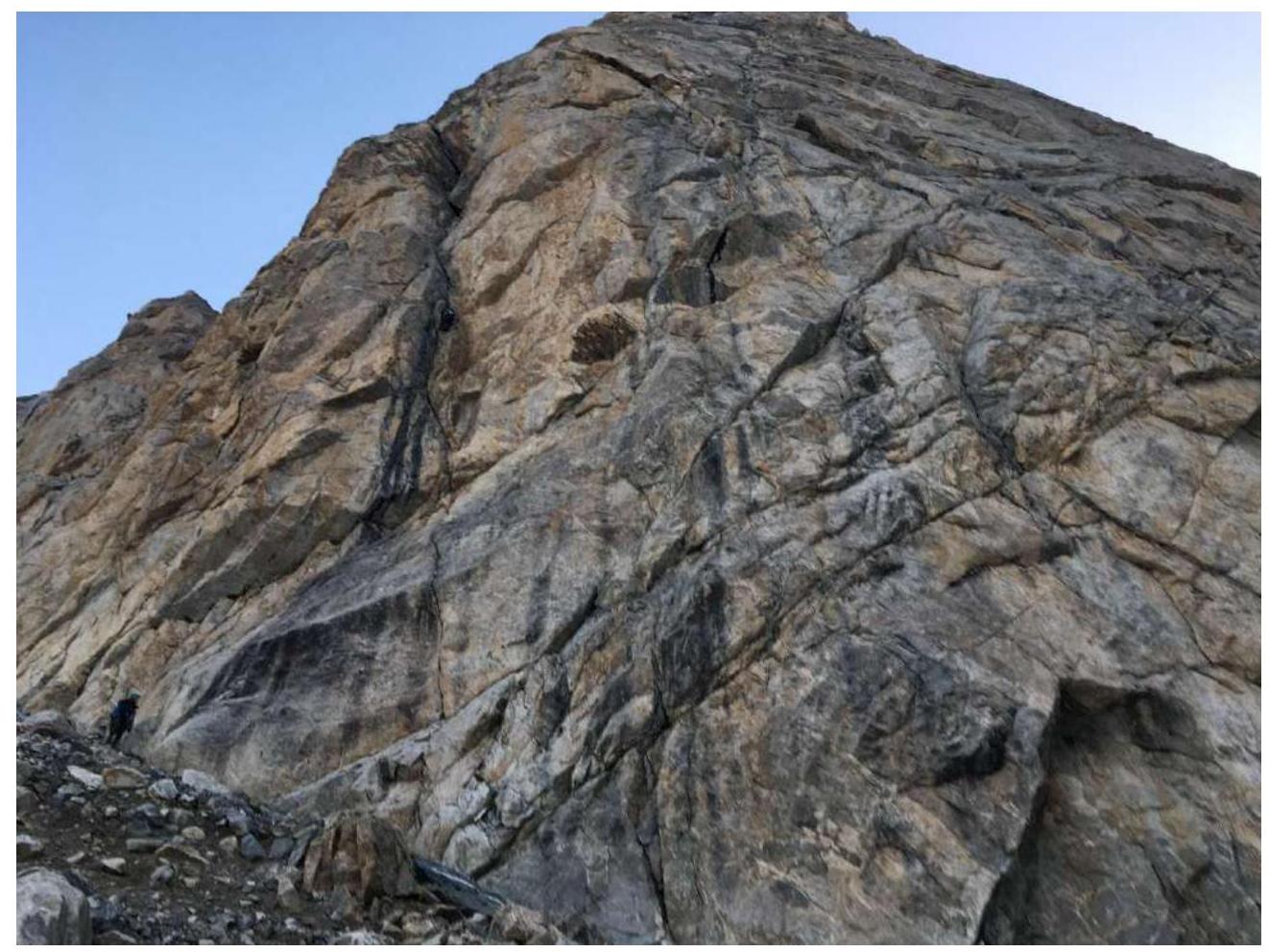
View down to section
R0–R1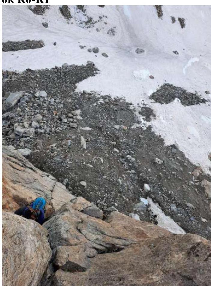
R1–R2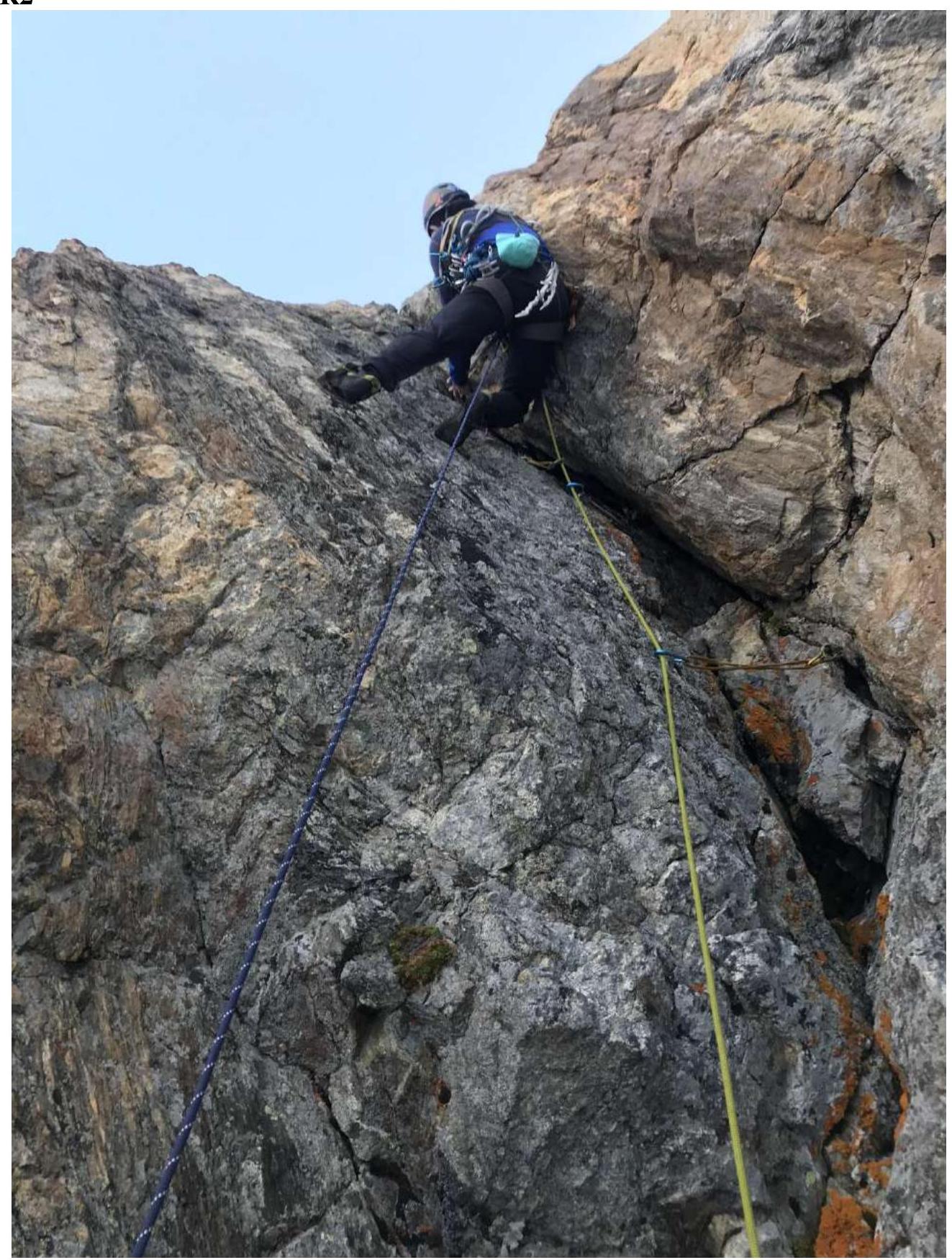
R3–R4 (view of the
cornice)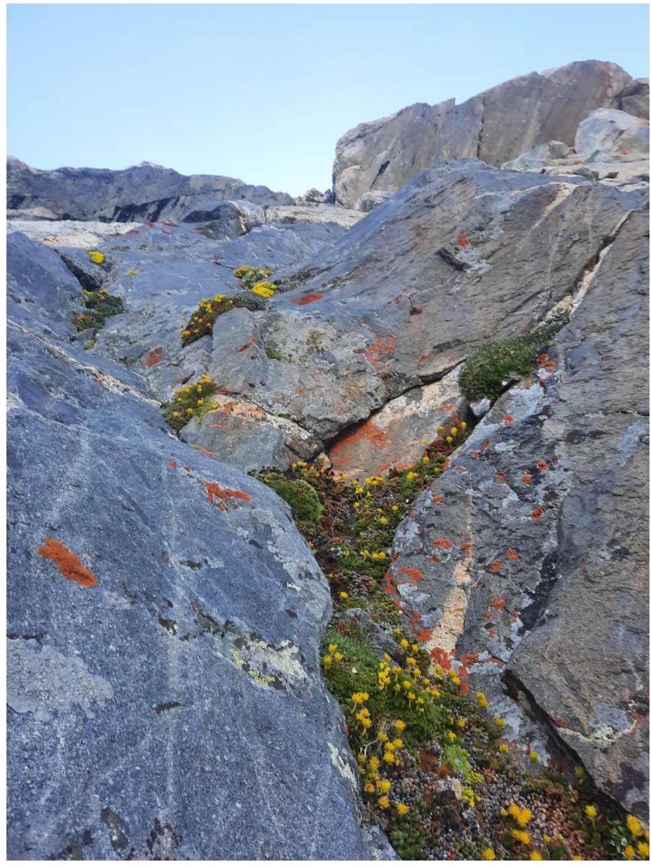
R4–R5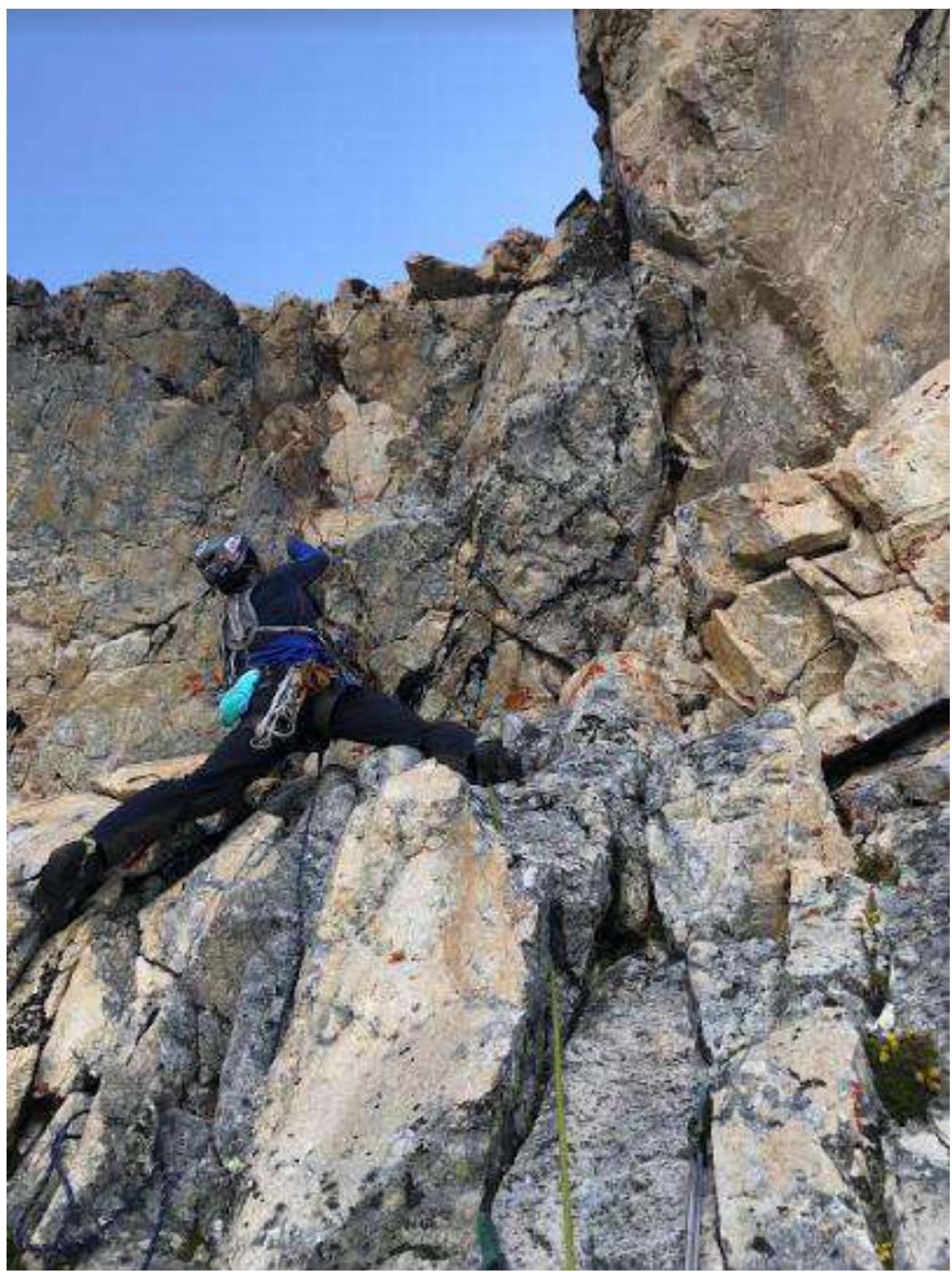
View of the cornice R4–R5 from the descent
couloir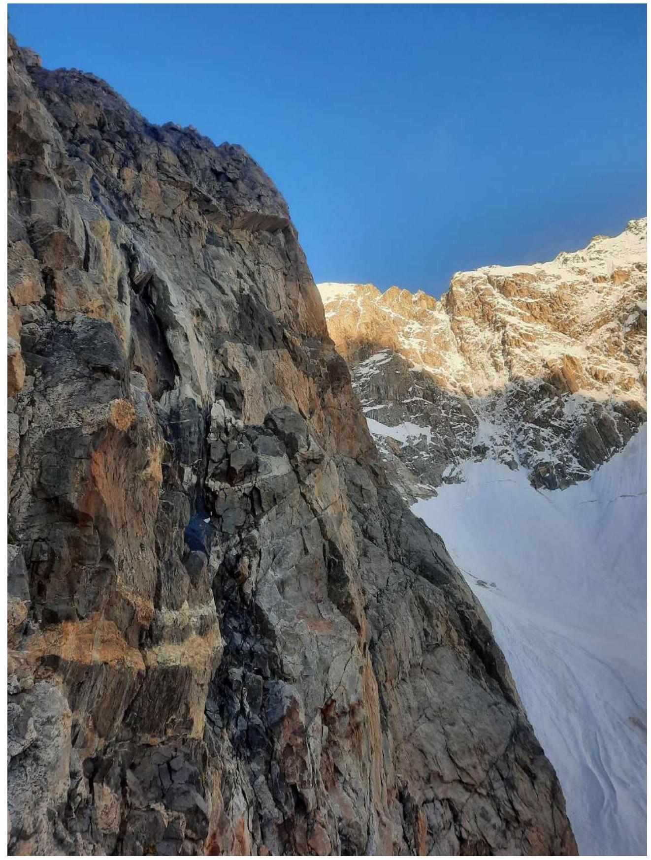
View down from station
R5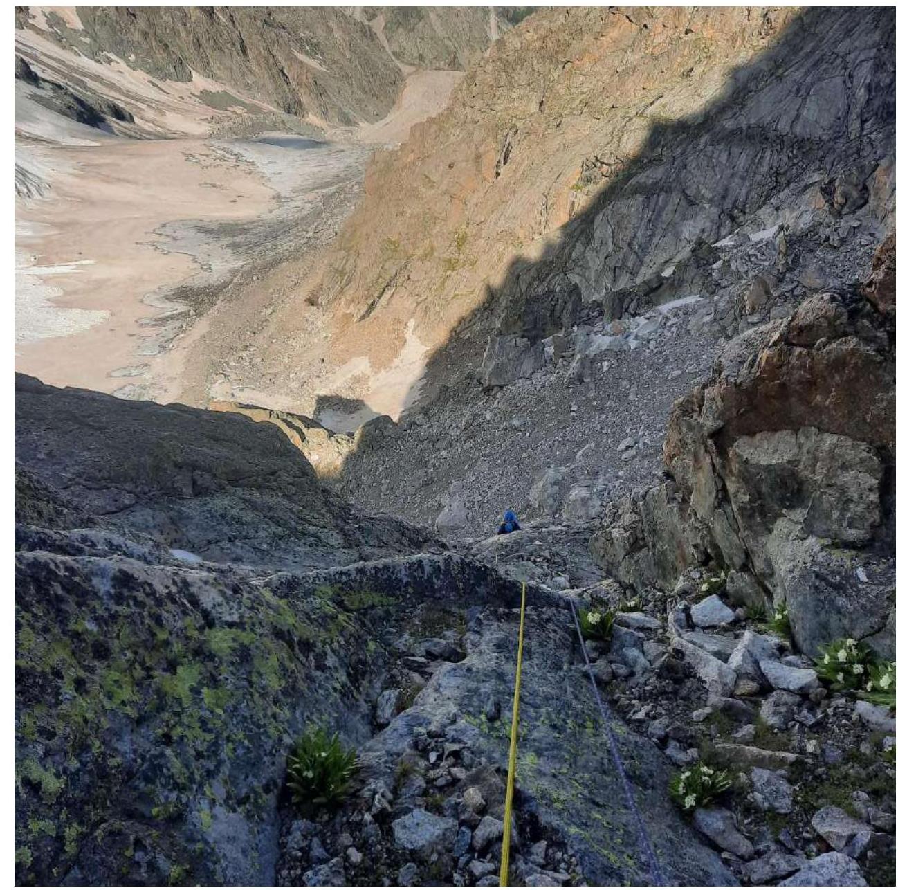
R5–R6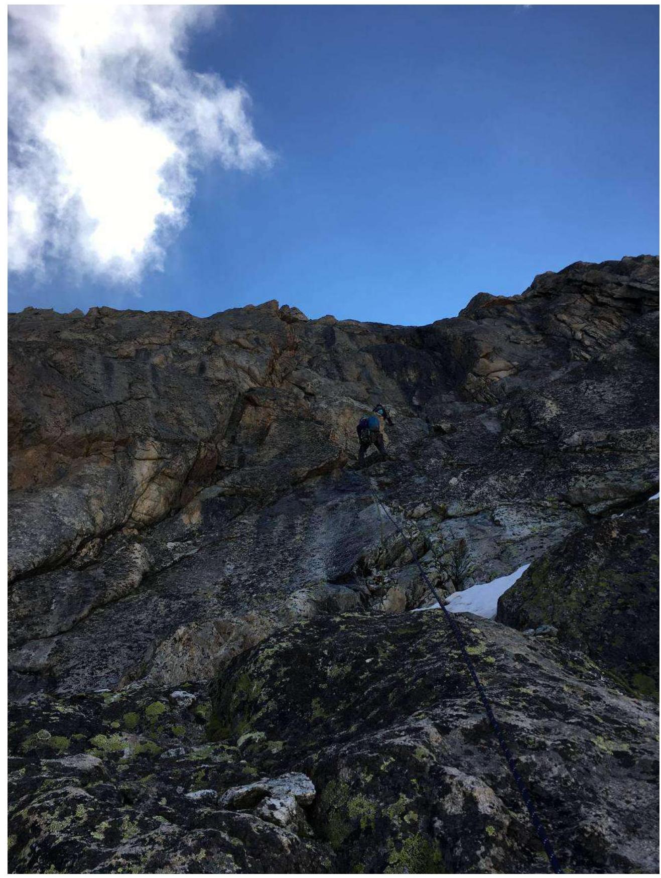
R8–R9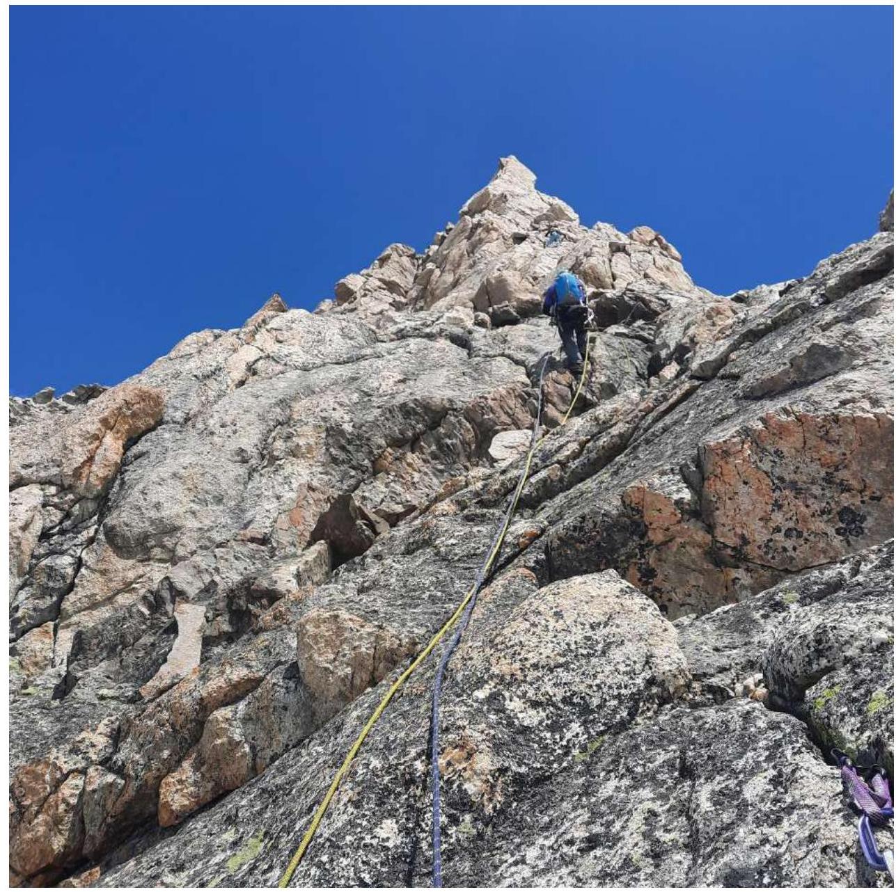
R11–R12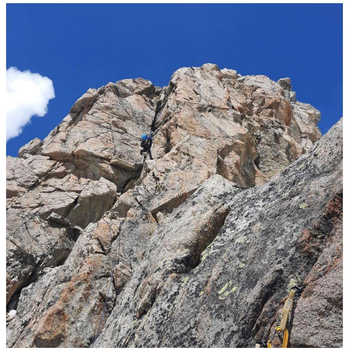
R12–R13 — reaching the
summit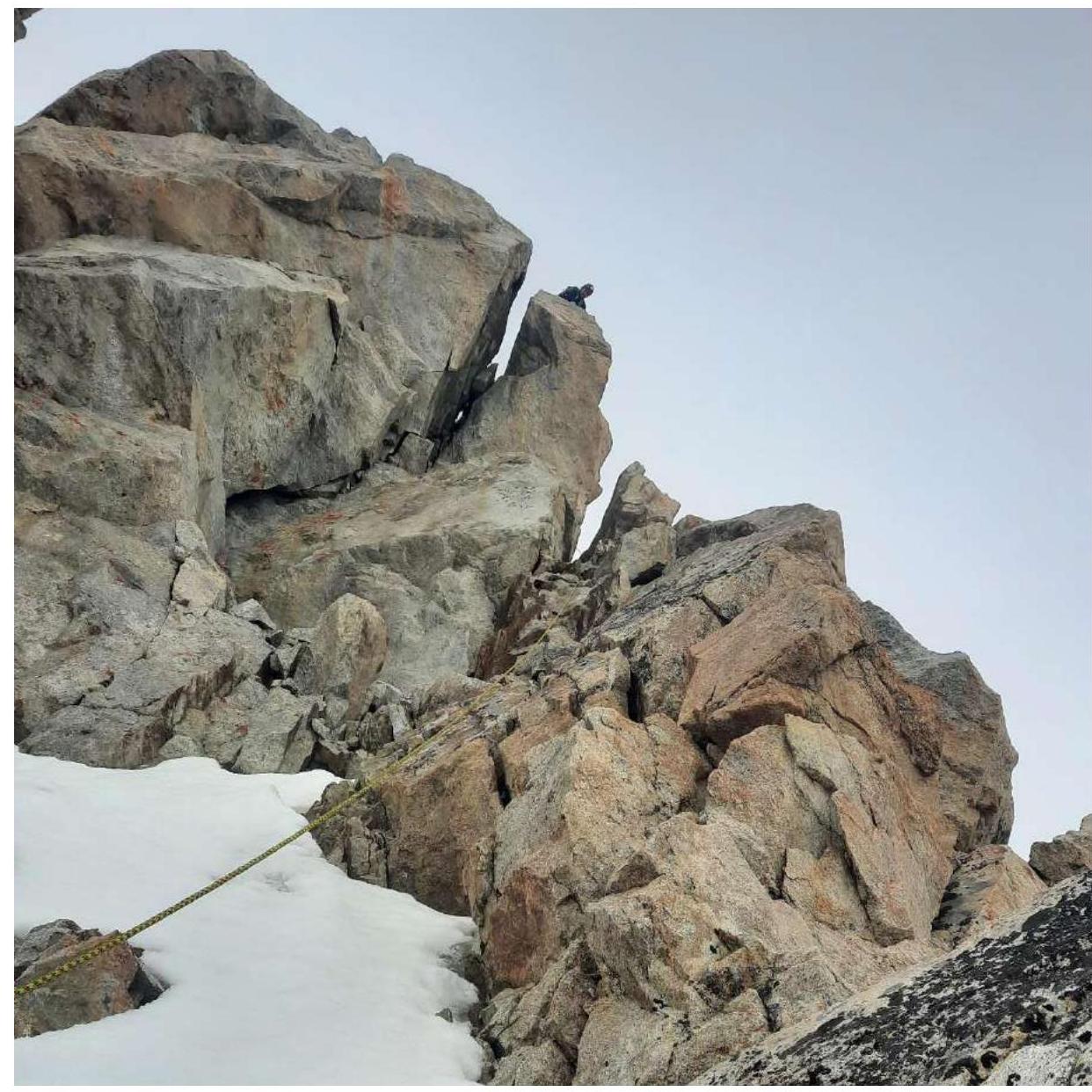
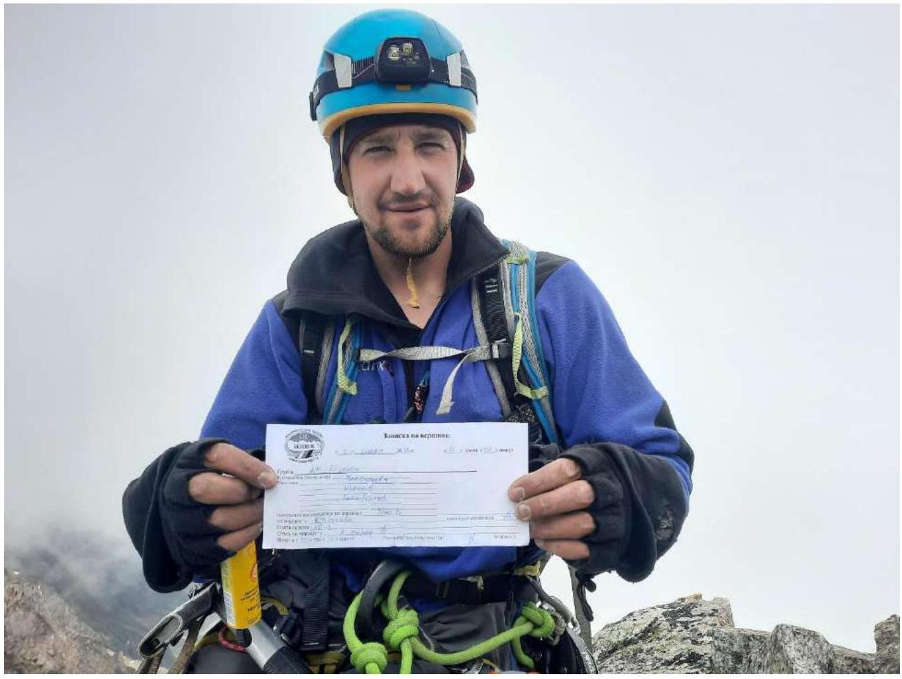
Team on the
summit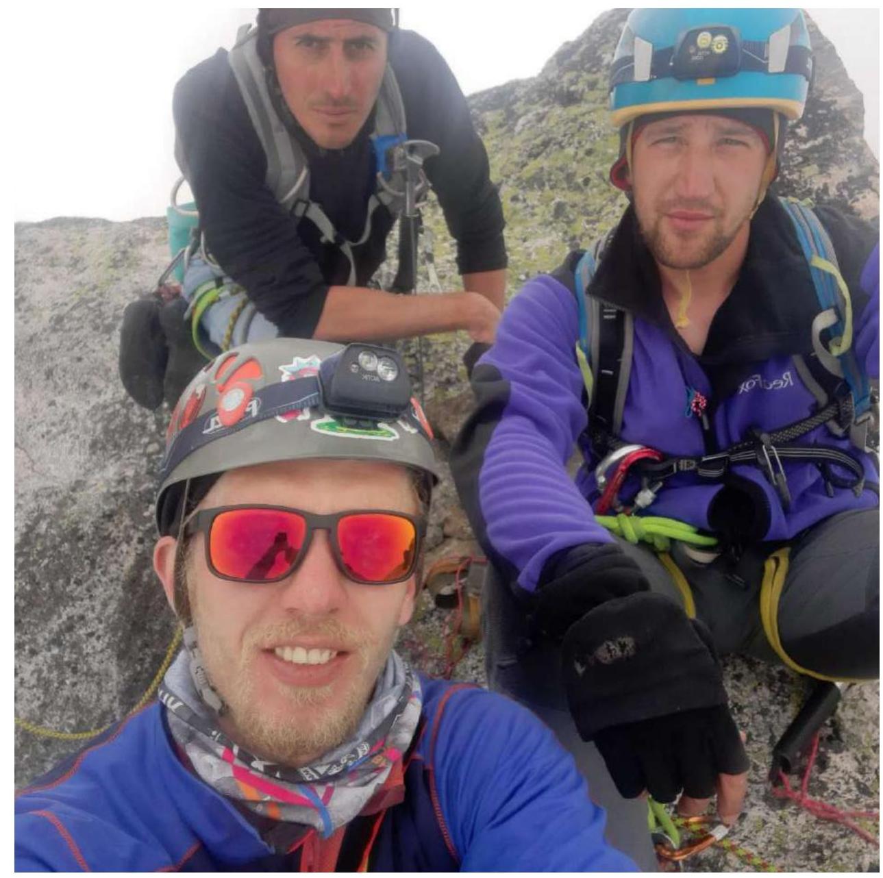
Note from the
summit