Ascent Passport
-
Caucasus, Bezengi area, Ukyu gorge. Section 2.5 according to the 2013 classification table.
-
To Mt. Malaya Ukyu, height 4240 m, via the couloir and the northwest ridge.
-
Proposed category: 1B, first ascent.
-
The route is combined.
-
Height difference: 800 m.
-
2 rappel loops left on the route.
-
Moving time: 8 hours.
-
Leader: Slotyuk A.A., CMS (Candidate for Master of Sports), participants: Ryabov I.V., MSIC (Master of Sports of International Class), Ryabov S.I., III sports category.
-
Coach: Slotyuk A.A.
-
Departure to the route from the bivouac at 3450 m in the Ukyu gorge. "Golubyatnya" (warm corner) at 5:00 AM on August 12, 2013. Reached the summit at 10:30 AM on August 12, 2013.
| Section # | Length | Steepness | Character of Relief | Category of Difficulty | Number of Pitons |
|---|---|---|---|---|---|
| 1 | 900 m | 30°–40° — ascent to the ridge | debris couloir; snow in the upper part; ice at the exit to the ridge | 1Б | |
| 2 | 300 m | 45° | combined: snow, snow-covered rocks | 2А | pitons on stations; 1 ice screw, 2 chocks |
Return to the bivouac at 1:00 PM on August 12, 2013. Descent via the ascent route.
-
The ascent was part of the ongoing alpine event "Bezengi" by AUSB (Alpine Union of Sports Badges).
-
Responsible for the report: Slotyuk A.A.
Email: mosfais@yandex.ru
The route starts from the "Golubyatnya" bivouac in the Ukyu gorge, in the "Warm Corner" of the Bezengi area.
Section 1. Follow the couloir descending from the saddle between the gendarme on the Gidan ridge — Mt. Ukyu, closest to Mt. Malaya Ukyu, keeping to the left side of the couloir as you ascend. In the upper part of the couloir, snow begins, turning into firn and ice. Crampons are mandatory. If necessary, and to speed up the passage of the upper part, a fixed rope can be set up to the saddle.
Section 2. From the saddle, follow the gentle snow slope towards the nearest rocks, in the direction of the summit, along the center — belay using outcrops. Then, moving to the right, along the firn and ice between the rocks — belay using outcrops, stations for organizing fixed ropes on loops. In the upper part, before the rock wall, move to the right — belay using an ice screw. On the rocks, there are good cracks for belay using chocks. A cairn on the summit. Two loops left on the descent. Organization of a sport descent is possible. From the saddle, descend via the couloir — preferably without stops and in a single group.
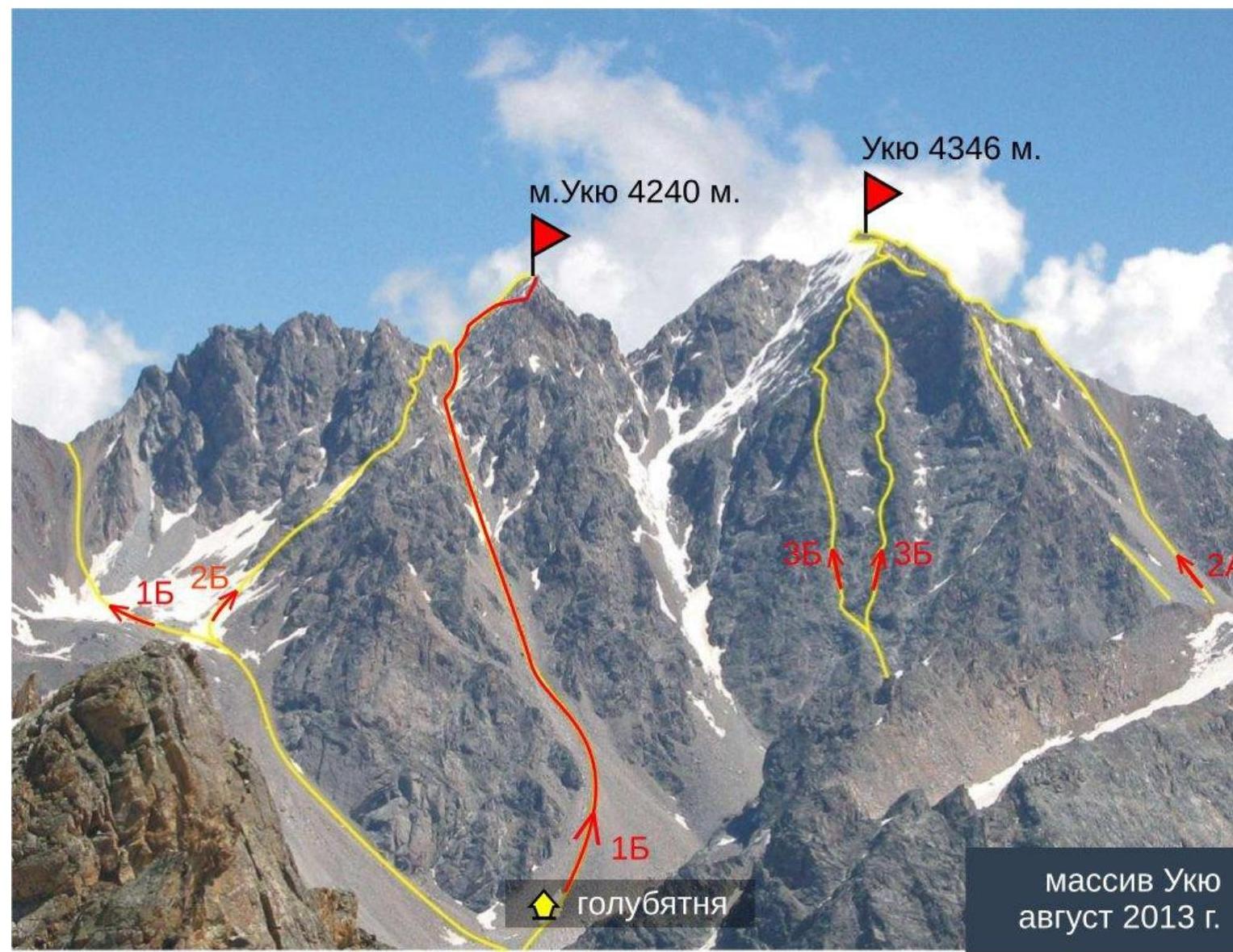
Ukyu massif, August 2013.