Ascent Passport
- Ascent class — rock-ice (combined)
- Ascent region — Bezengi region, Kargashil ridge
- Peak — Maly Salynan, height 4050 m
- Ascent route — via the North Counterfort
- Estimated difficulty category — 3B
- Height difference — 720 m, length — 570 m, average slope — 40°
- Pitons driven: rock — 10/0, ice — 17/0, chocks — 7/0
- Number of travel hours — 13
- Number of nights — route is one-day
- Leader — Sharapov N.A., CMS;
participants:
- Zavalko V.V., 2nd sports category
- Nesteruk N.Yu., 2nd sports category
- Kapyrulin I.V., 2nd sports category
- Porovsky N.I., 2nd sports category
- Chornopysky I.M., 2nd sports category
- Team coach — Belousov E.B., CMS
- Exit to the route — August 3, 1986, return — August 3, 1986
- Ascent organized by the training department of the Bezengi alpine base and KSP of the Bezengi region.
Route diagram in UIAA symbols
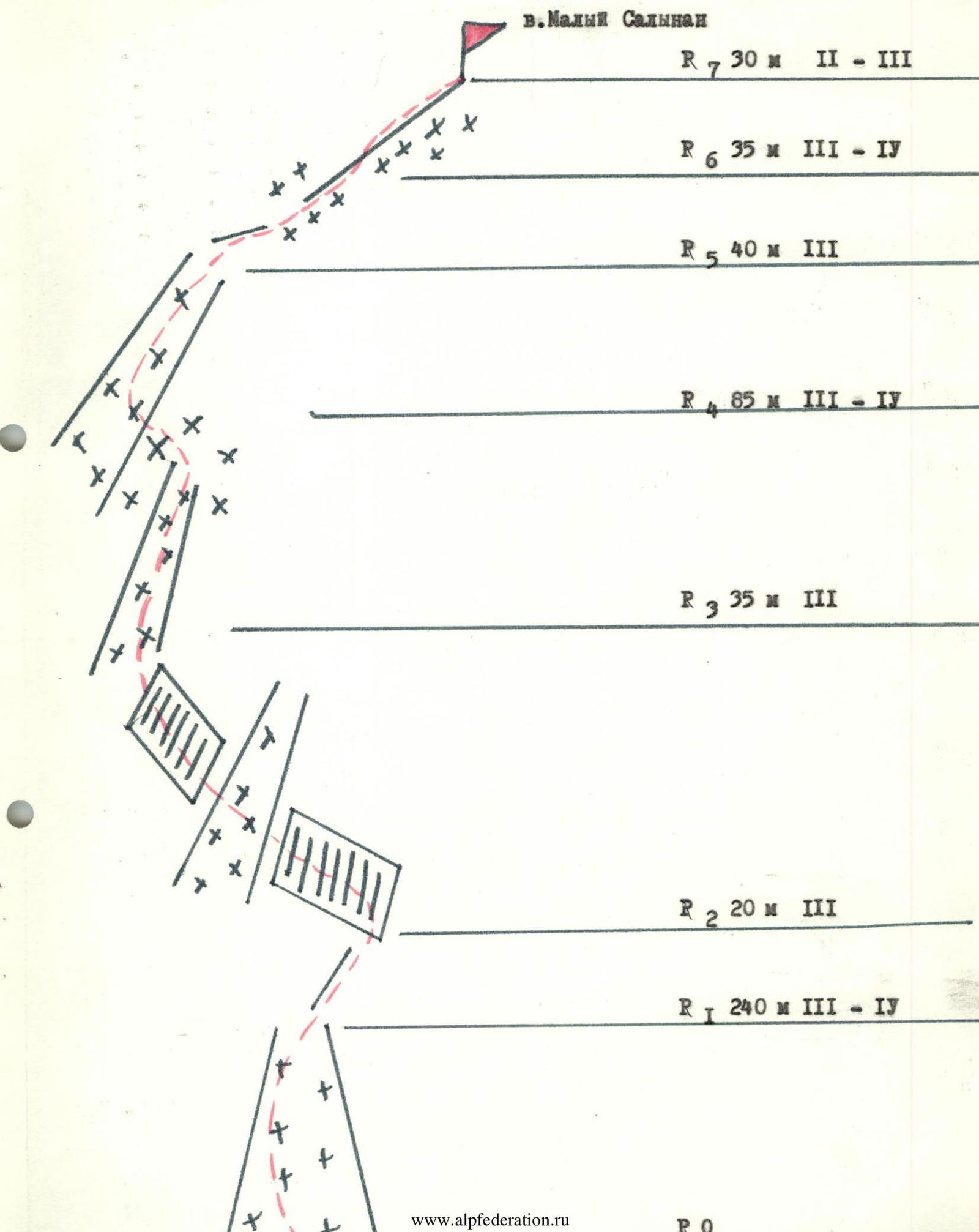
Route description to the peak Maly Salynan via the North Counterfort
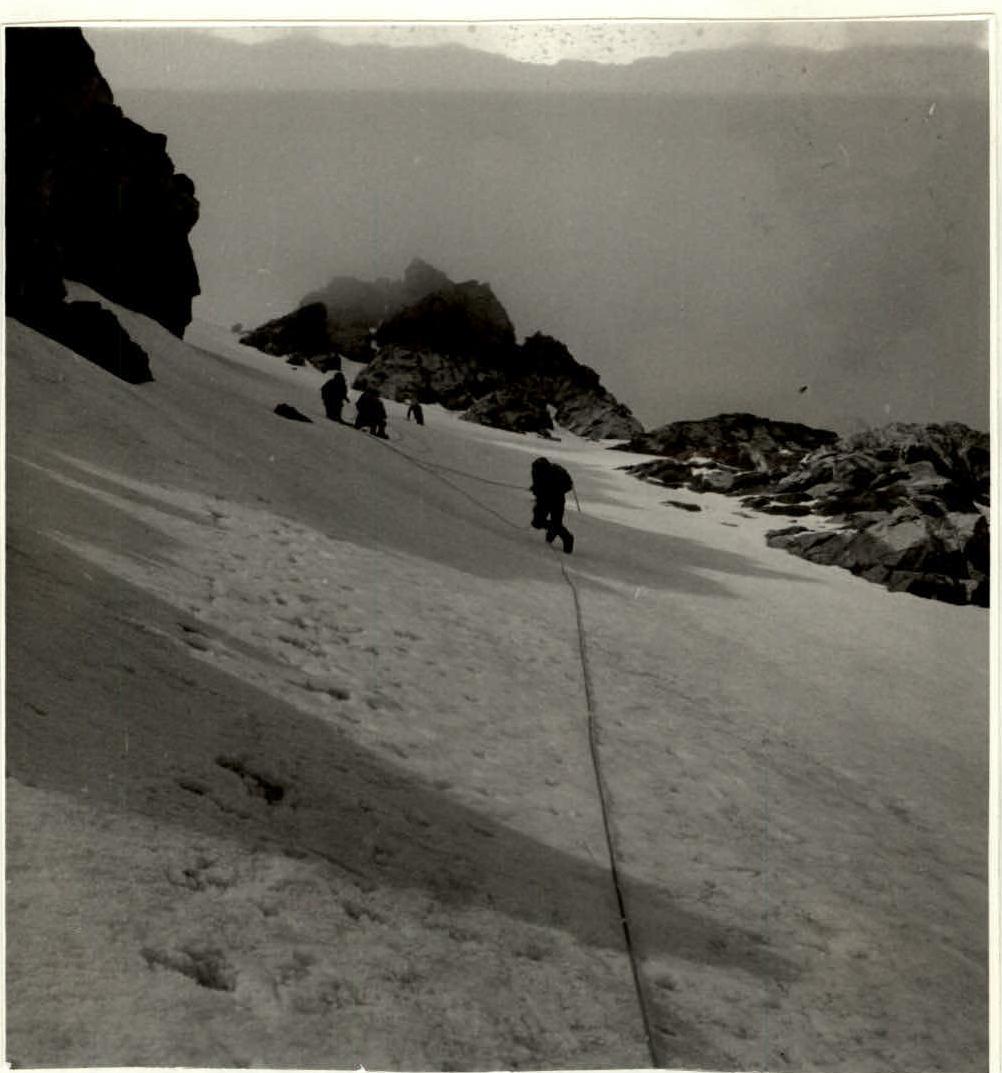
From the initial bivouac, having overcome the second step of the Salynan glacier icefall on the right side, along the slopes of the peak Shaurtu, reach the plateau. Cross the plateau diagonally (hidden crevasses, belay) towards the couloir between the North Counterfort on the left and the hanging glacier on the right. Here is the start of the route. 1.5–2.0 hours from the initial bivouac.
Having overcome the bergschrund (belay), along the rocks of the North Counterfort, on the ice slope, belay through ice screws, 240 m up (slope 50°–55°) to the exit to the rock ridge of the North Counterfort. Here is a control cairn. From the control cairn on the ridge, 20 m left — up the destroyed rocks of average difficulty (pitons belay), and then 35 m, crossing the ice-snow couloir and along the rock ledges, exit to a narrow ice-snow couloir bounded by difficult rocks. Up the ice couloir 60 m (belay through ice screws), and then 20–30 m left, to exit to the next ice-snow couloir, leading to the saddle between the gendarme (on the left) and the pre-summit ridge of the peak Maly Salynan. Average slope 35°–40°. From the saddle to the right, along the ice-snow ridge (40°), and then along the destroyed rocks of average difficulty (pitons belay) to the summit. 8–9 hours from the initial bivouac.
Descent via the ascent route. Descent variant — via the East Ridge (difficulty category 2A).