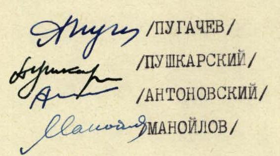
Between July 30 and August 7, 1966, the LOS DSO "Trud" team (team of the A. N. Krylov CRI) consisting of:
- PUGACHEV A. D. — Master of Sports, leader
- PUSHKARSKY V. I. — 1st sports category, participant
- ANTONOVSKY D. I. —
- MANOILOV Yu. S. —
completed the traverse of p. Pushkin — East Mijirgi. On p. Pushkin, the group ascended for the first time via the left counterfort of the southern wall.
Peak Pushkin (5100 m) is a small gendarme in the Northern spur of the Main Caucasian Range between the peaks Zapadnaya Mijirgi (4922 m) and Dykh-Tau (5198 m). Its southern side is a ruined rocky massif intersected by deep snow-and-ice couloirs. The presence of counterforts and sheer sections allows for interesting and logical ascent routes to any part of the Dykh-Tau — Mijirgi ridge, including Peak Pushkin.
The difficulty of the proposed routes from the south to p. Pushkin, according to the participants of this traverse, lies within 4B–5B category. It should be noted that there are existing classified routes of 5A category to Dykh-Tau and Zapadnaya Mijirgi from the south. The proximity to these most popular peaks and, perhaps, the difficulty of the descent may explain the lack of ascent routes to p. Pushkin until recently.
Although the southern wall of p. Pushkin has been featured several times as an ascent object in the USSR alpine climbing championships (e.g., in 1962, the LOS DSO "Trud" team submitted one of the ascent options to p. Pushkin from the south), the first route to this peak was only completed in July 1966 by Gorevsky's team (LOS DSO "Trud"). The ascent to p. Pushkin from the south via the left counterfort, made during this traverse, is the second such route. Below is a description of the ascent route to p. Pushkin.
Tactical plan and organization of the ascent
The group chose the ascent route from the south to p. Pushkin during ice training and a training ascent. It was decided to reach the Dykh-Tau — Mijirgi ridge as close as possible to p. Pushkin, and two ascent options were planned (one was later completed by Gorevsky's team). The other route went along the left counterfort along the ice couloir between V. Dykh-Tau and p. Pushkin. The lower part of the planned route is a rocky wall with a series of talus shelves. It is possible to bypass this part of the route to the left along the couloir and then exit onto the wall, which significantly speeds up the ascent and increases its safety. The couloir becomes rockfall-prone after 8:00–9:00 when the sun starts illuminating the upper areas of the wall, so climbers should exit onto the wall by 7:00–8:00.
The further ascent was not considered hazardous and could be done at any time. The first bivouac was planned on a shelf under a large gendarme; above, no suitable places for good bivouacs were visible.
From the bivouac under the wall, the route:
- initially goes along the glacier,
- then along the avalanche debris, bounded on the right by rocky talus,
- further along the snow-and-ice slope to the base of the couloir.
To the left of the couloir mouth:
- along smooth rocks of medium difficulty (section R0–R1),
- crossing the ice-filled couloir (R1–R2), we exit onto a rocky shelf.
Protection — pitons and rock features. Above — approximately three rope lengths of steep rocks resembling slabs, alternating with shelves (2–3). There are many "live" rocks on the shelves. This is a good spot for a tent.
Above, the route goes:
- along a rocky wall (10 m) with a small overhanging section and small holds (3–4),
- then along an inside corner (4–5).
Climbing is difficult, protection via pitons and rock features. Rocks are monolithic, slab-like. From here — one rope length along ruined rocks to the base of the large gendarme (5–6). This is the best spot for bivouacs for 2–3 tents.
The gendarme (6–8) is overcome directly. It is possible to bypass it to the left along the couloir on ice.
Above, the route follows a not-very-pronounced counterfort consisting of rocks resembling large boulders (8–9):
- climbing is of medium difficulty,
- protection via rock features,
- there are "live" rocks.
After about 5 rope lengths, the rocks become more monolithic, partially snow-covered, leading to a large snow patch with a rocky outcrop (9–10). In some places, a thin layer of ice is possible.
Along ruined rocks to the left of the snow patch (R10–R11), a snow ridge (R11–R12), we exit again onto snow-covered slabs (R12–R13). Climbing is mostly of medium difficulty, protection via pitons, rock features, and ice axe.
In the second half of summer, crampons may be necessary here and above.
Another rope length along a steep snow-and-ice slope (R13–R14), and we are under the ridge's rocky outcrop (R14–R17).
We overcome it:
- initially directly along an ice-filled inside corner,
- then up to the right along rocks alongside a snow slope.
Climbing is difficult and very difficult, protection via pitons and rock features. The last 2–3 rope lengths along snow-covered rocks and slabs (R16–R17) — and we exit onto the ridge to the west of the summit of p. Pushkin.
From here to the summit is 100 m along an easy, rocky-snowy ridge (cornices to the north).
There is also a bivouac spot here.
Additional information about the route
For future climbers, several recommendations can be made:
- The route is less hazardous in the first half of summer than in the second.
- The most hazardous section of the route is R1–R4. It should be overcome in the early hours, no later than 8:00–9:00 am.
- The number of participants in the group (2–8 people) does not significantly affect the speed of overcoming the route.
- The route does not require specialized rock climbing equipment.
- The height difference (R0–R18) is 1180 m.
| Of which | ||
|---|---|---|
| easy sections | — 200 m | |
| sections of medium difficulty | — 480 m | |
| difficult sections | — 430 m | |
| very difficult sections | — 70 m | |
| overall slope | — 55° |
The ascent took 11 hours 30 minutes of climbing time and 26 rock pitons were hammered in.
For comparison, it should be noted that a similar group, on their first training ascent, climbed V. Janghi-Tau via the normal route in 9 hours.
The descent from p. Pushkin can be done either via the ascent route or, after traversing to V. Dykh-Tau, via the couloir between Main and Eastern Dykh-Tau. According to the group members, the ascent to p. Pushkin via the left counterfort of the southern wall is rated 4B category.