Central Federal District Alpine Championship
Report on the Ascent of Misses-Tau Peak
via the right buttress of the eastern wall (Yu. Shevchenko route, 1976) Category 5B
Team from Kubinka (Moscow Region)
Team Captain (Leader) — Sergey A. Truntov
Ascent Passport
- Ascent class — technical.
- Ascent area — Central Caucasus, Bezengi Valley, Bezengi alpine camp.
- Ascent route — Misses-Tau (4420 m) via the right buttress of the eastern wall, Category 5B.
- Ascent description: 4.1. route length 1850 m; 4.2. height difference 1000 m; 4.3. average steepness: 4.3.1. route — 53°; 4.3.2. wall sections — 70°.
- Length of sections with IV–V+ category difficulty — 750 m.
- Equipment used on the route: 6.1. anchor hooks: — 20; 6.2. camalots: — 15; 6.3. stoppers: — 12; 6.4. artificial support points (ASPs): 0.
- Team's total climbing hours: 32 hours 00 minutes, 3 days.
- Leader: Truntov Sergey Alekseyevich, 1st sports category. 8.1. Participants: * 8.1.1. Nemtsev Dmitry Borisovich, 2nd sports category; * 8.1.2. Paksyaev Ivan Nikolayevich, 2nd sports category.
- Departure to the route: 4:00, July 18, 2020.
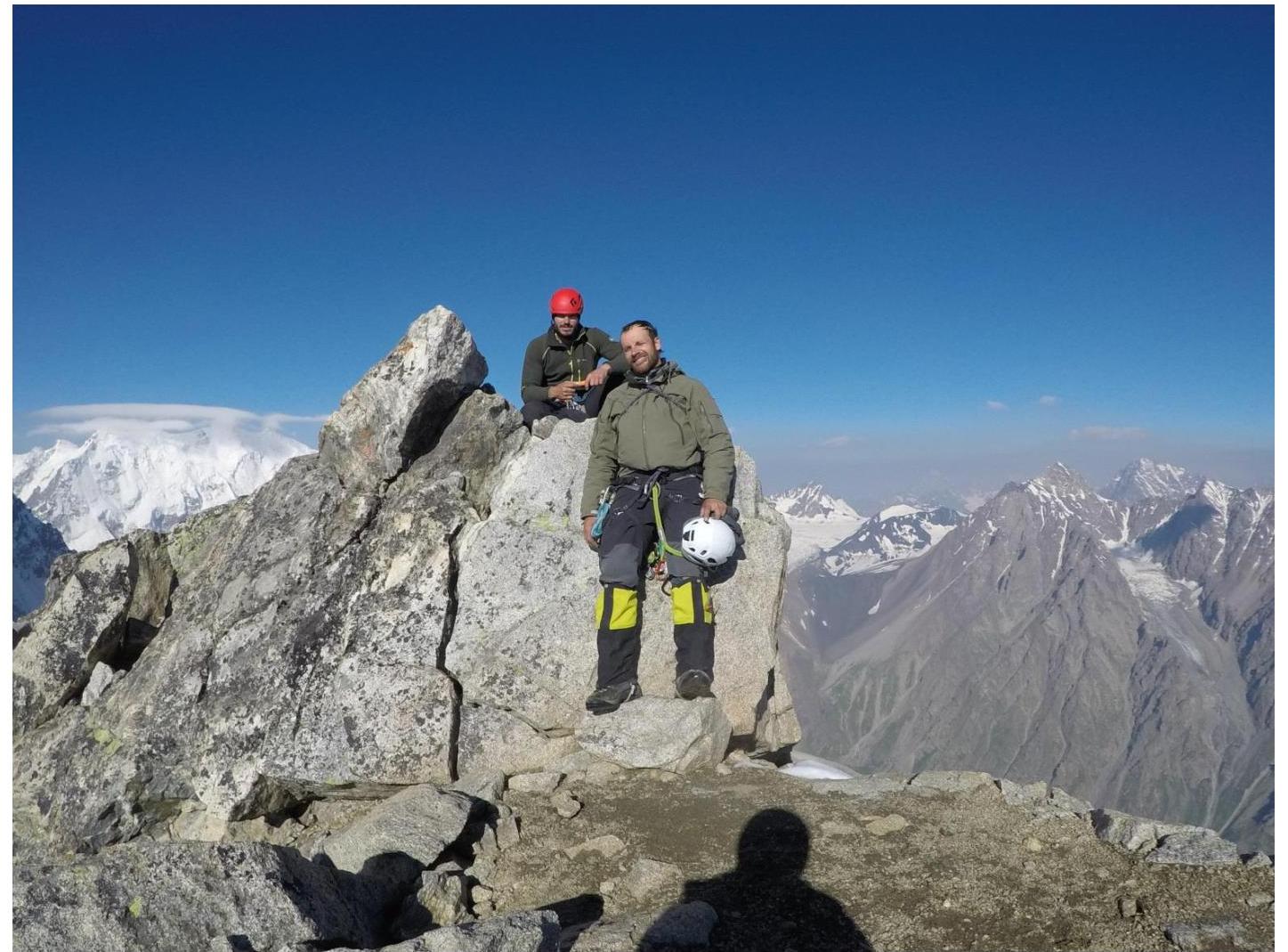
- Arrival at the summit: 7:30, July 20, 2020.
- Return to the alpine camp: 18:00, July 20, 2020.
Area Description
The Central Caucasus is the highest and most inaccessible part of the Greater Caucasus mountain system. The Bezengi area, part of this mountain system, occupies a relatively small section between the Tviber pass and the Digor spur. Nevertheless, the high density of peaks exceeding 5000 m above sea level and walls with a total height difference of 1500–2000 m makes this area one of the most unique mountain regions in the world. Climbers call this area the "Caucasian Himalayas".
To the north of the Central Ridge, north of the Bezengi Glacier, lies the system of the Lateral Ridge, with six peaks exceeding 5000 m above sea level, four of which are in this ridge. This is the main sports mountaineering massif of the area, forming a horseshoe around the Mizhirgi glacier cirque.
The walls of the area are sharply divided into northern and southern. The northern walls are typically:
- snow and ice, and combined;
- with steep rocky bastions;
- ice falls;
- snow cornices.
The southern walls are predominantly rocky.
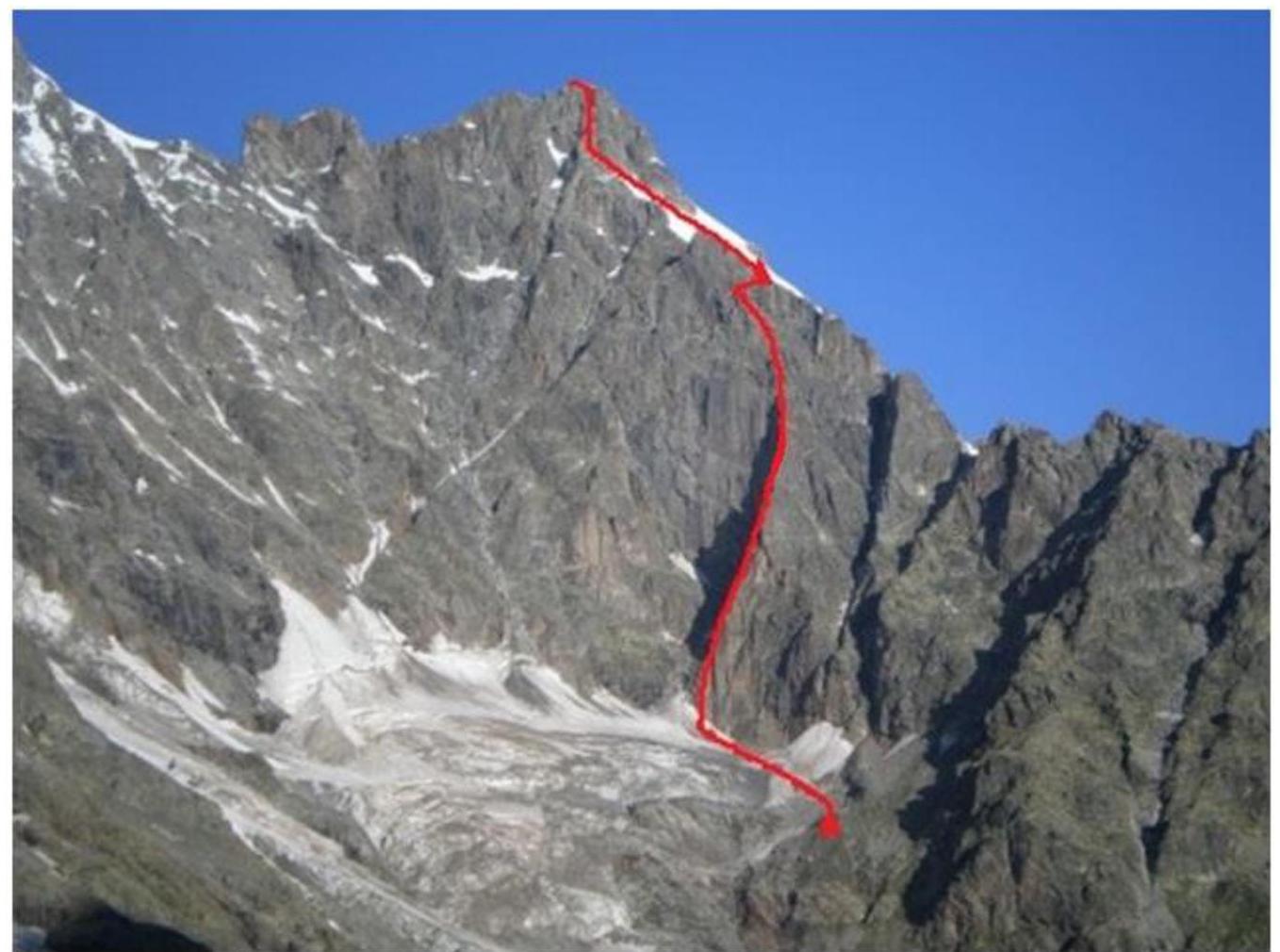
The Misses-Tau peak is located in the spur of the Northern massif, near the Mizhirgi glacier. The Misses-Tau peak (4427 m) faces the Mizhirgi glacier with its almost 500-meter wall.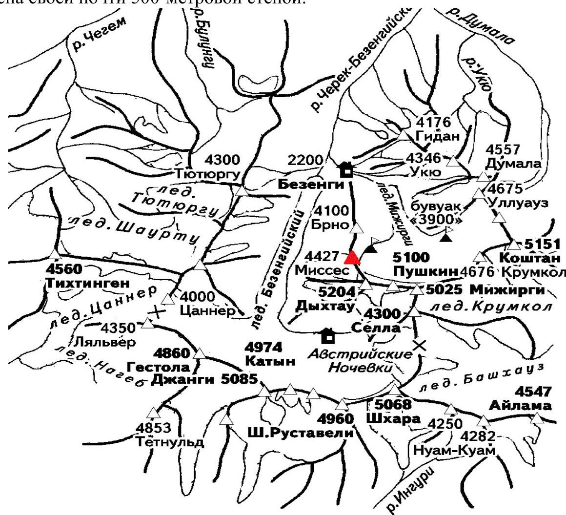
General Photograph of the Peak
Team's Tactical Actions
On July 17, 2020, we arrived at the initial bivouac under the wall of the route. We did not take a tent with us on the route as we had left it on the snow shoulder after ascending Misses-Tau via the 5A category route on July 16, 2020. We departed at 4:00. The weather was good. The first 4 ropes were climbed on smoothed "ram's foreheads" with grass and few holds and cracks for placing protection points, and by 9:00 we reached the green ledge under the overhanging cornice.
We then passed:
- the cornice;
- an internal corner and reached a ledge under the vertical rocky "foreheads" by 12:00.
Then:
- we reached a ledge under the wall;
- traversed diagonally to the right and upwards along a discontinuous ledge;
- bypassed an external corner to the left and upwards and ascended to the col under the "Rooster" gendarme by 18:00 and set up a bivouac.
At 4:00 on August 19, 2020, we:
- climbed the ridge;
- passed a rocky table (2 × 2 m);
- climbed an internal corner and reached a ledge with a control cairn by 9:00.
By 12:00, we approached the gendarme-"forehead". At 15:00, we reached the ledges above the "mirror". At 18:30, we reached the snow shoulder and set up a bivouac.
At 2:00 on July 20, 2020, we began moving towards the summit and reached it by 7:30. At 7:40, we started descending from the summit to the Judges' bivouac via the 4B category route. At 14:30, we descended to the Judges' bivouac, packed up, and headed to the Bezengi alpine base.
On July 20, 2020, at 18:30, we descended to the Bezengi Alpine Base.
Route Description
From the base to the platforms at the turn of the glacier under the base of the southeastern ridge of Peak Brno — 2.5–3 hours.
Then:
- Along the edge of the western branch of the Mizhirgi Glacier (Cheget-Mizhirgi) to the icefall.
- Ascend to the upper cirque via "ram's foreheads" and moraine slopes to the right of the streams.
- On the crest of the moraine of the upper cirque — the initial bivouac site, from the turn — 1.5–2 hours.
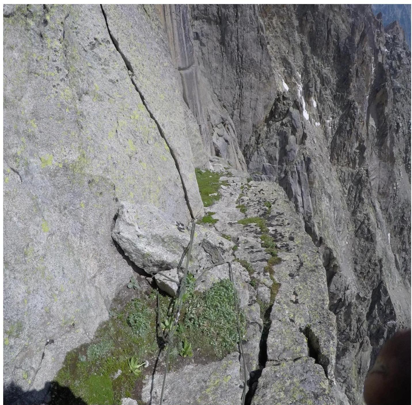
From the bivouac, ascend the moraine slope and snow (ice) to the plateau of the glacier under the eastern wall. Across the plateau to the left along the rocks to the talus cone between the left and right buttresses of the eastern wall. Up the avalanche cone to the throat of the couloir. Via "ram's foreheads" to the right, 15 m under the wall — a shelter. 65–75 m upwards and to the right across smoothed, местами grassy, fairly difficult rocks, under an overhanging wall to the right of water runoffs. Traverse left (12–20 m) and then circumvent the overhangs to reach a wide green ledge under the wide wall blocking the ascent path. From the start of the rocks to this point — 130 m.
The wall to the right is cut by a vertical internal corner. For this part of the ascent and further, it is convenient for the first climber to wear galoshes. 50 m upwards via the internal corner of medium and then high difficulty under an overhang to the right of the cornice. Exit through the overhang into the corner (very difficult), formed by a vertical wall to the right and a slab. The first climber's backpack is pulled up. Ahead, the path is blocked by a powerful cornice, so:
- via slabs, местами via small ledges, move right and upwards to a convenient ledge (30–40 m);
- around the corner, 20 m upwards via a wide internal corner-chimney with a 3–4-meter overhanging very difficult wall (pulling up the first climber's backpack);
- exit onto a ledge with snow, under a belt of vertical rocks with water runoffs.
Further:
- traverse left 20 m, then upwards 20 m via a difficult wall;
- the external corner is circumvented to the left and upwards (25 m);
- the path upwards to the ridge is blocked by absolutely smooth rocks, and it is necessary to move left, crossing a complex steep snow and ice couloir (15 m);
- exit into the col of the "Rooster's ridge" buttress onto a snow saddle.
This is a convenient place for an overnight bivouac. There are many bivouac sites on the buttress, especially sitting ones.
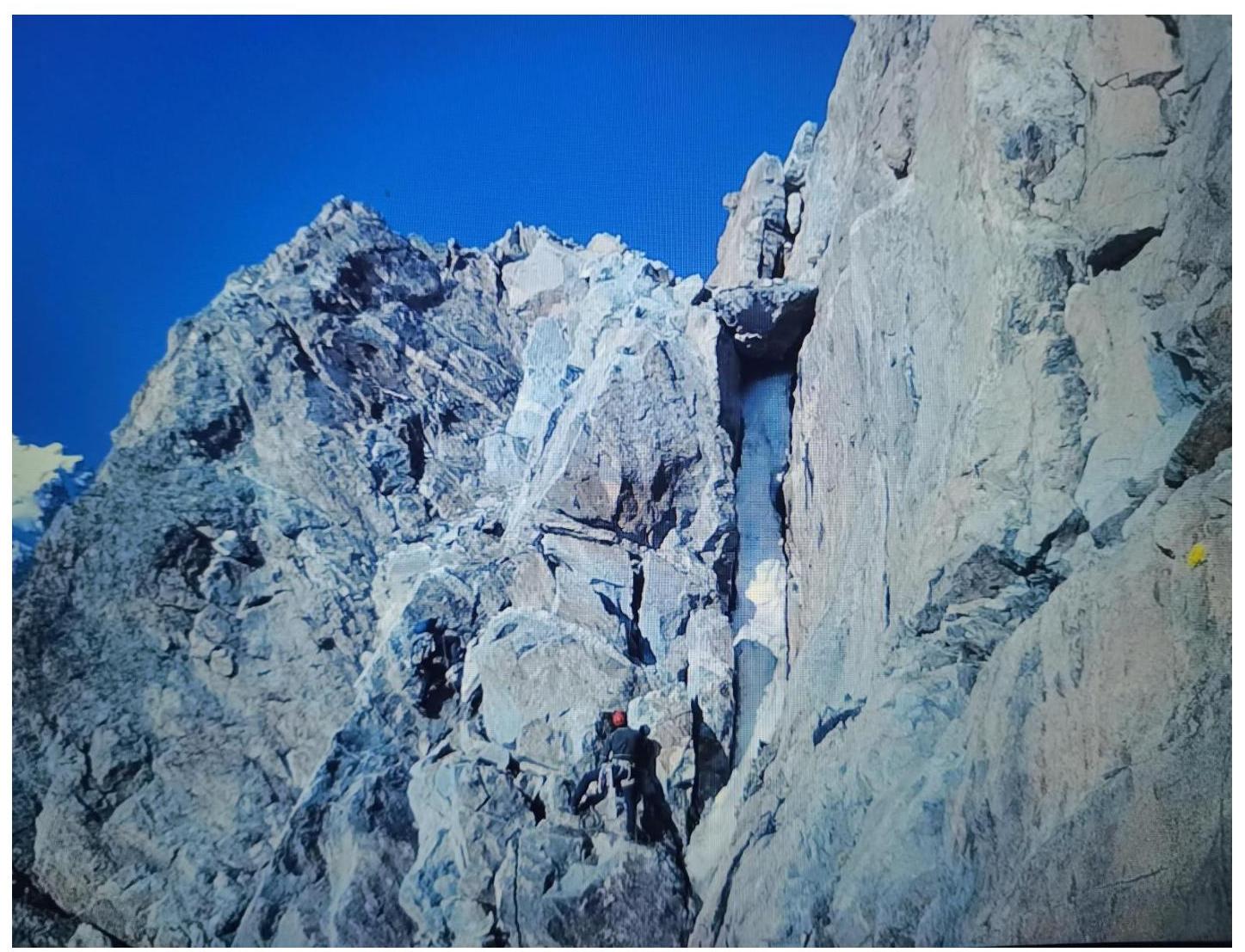
From the col, the route passes along an even more complex part of the ridge. 35 m of very difficult climbing directly upwards via smooth steep slabs-walls. Exit onto a rocky table (2 × 2 m) on the ridge. Traverse 5 m to the right along a good ledge to a 20-meter internal corner with a steepness of up to 80–85° with sections of growing grass at the bottom. Its smooth sides, particularly the overhanging right edge in the middle and upper parts, are very difficult. The first climber goes without a backpack. 6–8 m after exiting onto the ridge — a convenient ledge for belaying. Here is a control cairn.
15–20 m higher, the ridge is blocked by a cornice with an overhang of about 3 m. It is circumvented by complex climbing as follows:
- Upwards about 3 m.
- Traverse to the right behind the wall (the first climber goes without a backpack).
- Then upwards about 15 m.
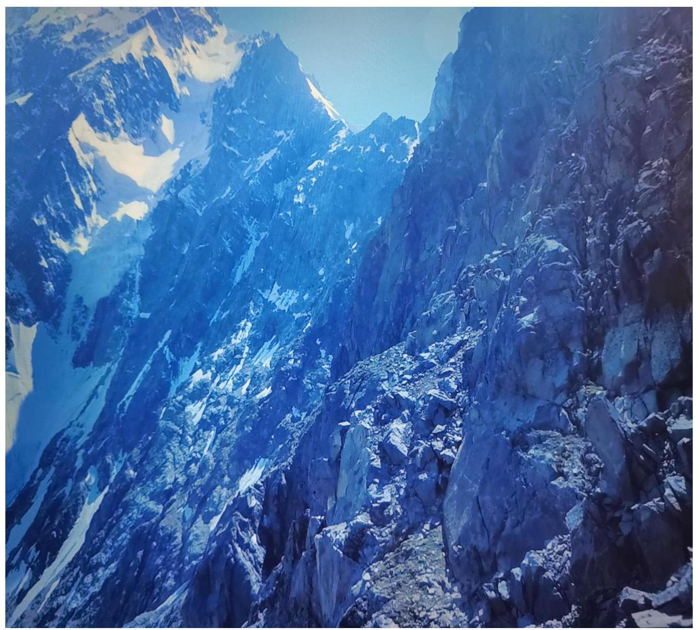
Exit onto a wide ledge sloping to the right and downwards, along it about 20 m under a vertical internal corner-chimney with living rocks. 25 m of the complex climbing upwards, then 15 m of easier rocks. Further there are 80–100 m of rocks of medium difficulty, interrupted by snow patches. The route becomes easier and turns left (from above over the "mirror"), approaching the wall of the northeastern buttress. At the same time, moving to the right is blocked by a steep and very dangerous couloir, looking complex. Movement along the ridge via difficult, smooth, almost crack-free rocks is complicated by snow. About 60 m further, the path is blocked by a gendarme, which can be bypassed to the right (40 m) by traversing the wall, then along a lateral steep ice couloir (80°), covered with snow overhangs, crossing a vertical snow ridge-blade dividing the couloir into two parts along, and further via sheer rocks upwards onto the "forehead". Technically and psychologically very complex section, one of the key places of the route. Backpacks were pulled up. Then 60 m along the ridge, across rocks and snowfields under a new ascent. About 60–70 m of complex rocks, after which there is a series of easy ledges leading left and upwards, circumventing the wall of the northeastern buttress (160–200 m). Further — 140 m of rocks of medium complexity, местами complex. This section is characterized by the presence of living slabs, нередко quite large, and requires special attention when passing.
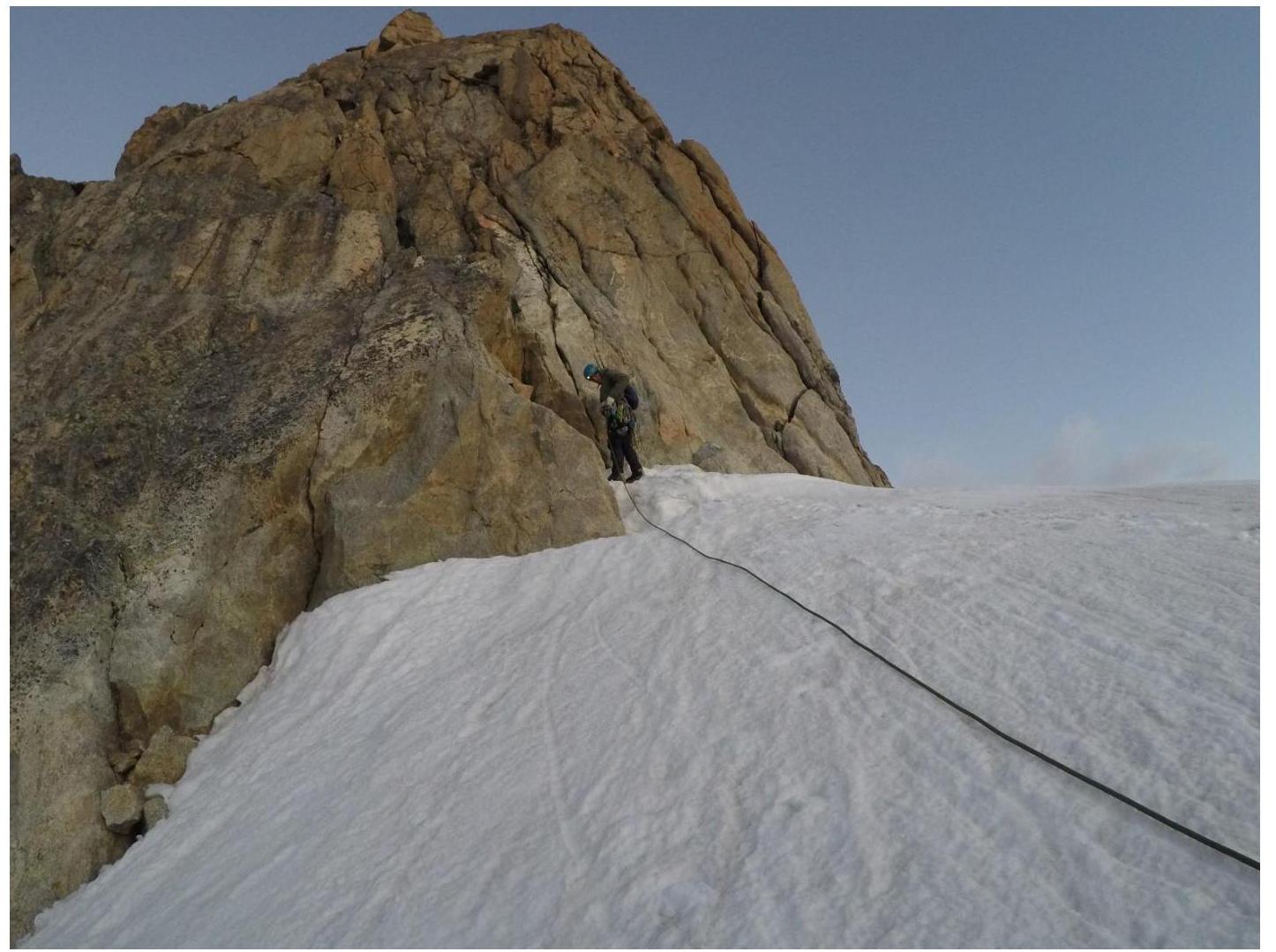
On the snow shoulder before exiting onto the 100-meter snow ascent leading to the ridge of the northeastern buttress, the group set up an overnight bivouac. The 100-meter snow ascent leading to the ridge of the buttress is essentially the right side of a wide snow and ice couloir descending onto the Mizhirgi glacier.
From the saddle under the rocky island. The island is circumvented to the left along the path, exiting onto a snow ridge abutting the rocks of the summit tower. From here:
- upwards via rocks 40 m;
- then along a ledge to the left along the eastern side;
- at the end of the ledge — via a crack;
- then via a rocky couloir upwards onto the northern ridge.
50–60 m of rocky, then snowy ridge lead to the summit.
The route passed can be logically divided into the following sections:
- R0–R1: inclined slab 50 m, 85°, IV–V category difficulty.
- R1–R2: via smoothed rocks to a wide green ledge about 80 m, 40°, III category difficulty.
- R2–R3: along the green ledge to the right, under the internal corner.
- R3–R4: via the internal corner and complex wall 45 m, 80–90°, IV–V category difficulty.
- R4–R5: difficult internal corner 15 m, 90°, V+ category difficulty, then along an inclined ledge 25 m, 80°, V category difficulty.
- R5–R6: internal corner turning into a wall 35 m, 70°, V category difficulty.
- R6–R7: traverse along a ledge to the left 20 m, then via a difficult internal corner 40 m, 80–90°, IV–V category difficulty.
- R7–R8: inclined ledge with increasing steepness, then via a steep couloir into the col of the "Rooster's ridge" 50 m, 45–70°, IV category difficulty.
- R8–R9: steep slab of complex climbing 35 m, 90°, V+ category difficulty, exit onto the "table" gendarme.
- R9–R10: traverse along a ledge 5 m to the right, then via a vertical slab and complex internal corner 40 m, 70–80°, IV–V category difficulty.
- R10–R11: complex cornice 3 m, 100°, V+–VI category difficulty, then traverse to the right and upwards via a slab 15 m, 85°, V category difficulty, and along a wide ledge traverse to the right 20 m.
- R11–R12: vertical internal corner-chimney 25 m, 100°, V–V+ category difficulty, via easier rocks 15 m, 80°, IV+ category difficulty, exit onto good bivouac sites.
- R12–R14: rocks of medium difficulty, 100 m, 70–80°, IV–V category difficulty.
- R14–R17: traverse to the left and upwards via relatively easy rocks, above the "mirror" of the eastern wall, 180 m, 45°, III category difficulty.
- R17–R18: traverse to the right circumventing the gendarme, 30 m, 30°, II category difficulty.
- R18–R19: via the internal corner-couloir 40 m, 75°, IV category difficulty.
- R19–R20: easy vertical slab, then internal corner, 80 m, 75°, III category difficulty.
- R20–R21: rocks 30 m, 75°, III category difficulty, then traverse to the left, difficult internal corner 10 m, 90°, V+ category difficulty.
- R21–R22: traverse to the right, 50 m, 35°, II category difficulty.
- R22–R23: series of easy ledges, 50 m, 65°, III category difficulty.
- R23–R24: exit onto a snow shoulder, 100 m, 15°; on the snow shoulder — a site for a tent, overnight bivouac.
- R24–R25: snow and ice ascent, 250 m, 50°, exit onto the summit of the rocky island.
- R25–R26: 50 m via a crack 70°, IV category difficulty.
- R26–R27: traverse to the left 5 m via easy rocks, 30 m, 30°, III category difficulty.
- R27–R28: via a couloir turning into an internal corner-chimney, 50 m, 70°, then 90°, IV–V category difficulty, exit onto the ridge.
- R28–R29: via a snowy, then rocky ridge, 70 m, 30°, II–III category difficulty to the summit.
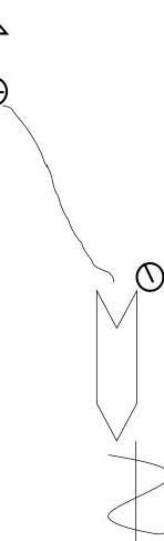
| ROUTE SCHEME IN UIAA SYMBOLS (sheet 1) | Length | Steepness | Difficulty |
|---|---|---|---|
| R10 | 40 m | 70–80° | IV–V |
| Gendarme table R9 | 35 m | 90° | V+ |
| R8 | 50 m | 45–70° | IV |
| R7 | 40 m | 80–90° | IV–V |
| R6 | 35 m | 70° | V |
| R5 | 25 m | 80° | V |
| R4 | 15 m | 90° | V+ |
| R3 | 45 m | 80–90° | IV–V |
| R2 | 50 m | 15° | I |
| R1 | 80 m | 40° | III |
| R0 | 50 m | 85° | IV–V |
| 25 m | 45° |
| ROUTE SCHEME IN UIAA SYMBOLS (sheet 2) | Length | Steepness | Difficulty |
|---|---|---|---|
| R24 | 100 m | 15° | |
| R23 | 50 m | 65° | III |
| R22 | 50 m | 35° | II |
| R21 | 10 m | 90° | V+ |
| R20 | 30 m | 75° | III |
| R19 | 50 m | 75° | III |
| R18 | 40 m | 75° | IV |
| R17 | 30 m | 30° | II |
| R16 | 60 m | 45° | III |
| R15 | 50 m | 45° | III |
| R14 | 40 m | 45° | III |
| R13 | 50 m | 79–80° | IV |
| R12 | 50 m | 70–80° | IV |
| R11 | 15 m | 80° | IV+ |
| R11 | 25 m | 100° | V–V+ |
| R11 | 15 m | 85° | V |
| R10 | 3 m | 100° | V+–VI |
| ROUTE SCHEME IN UIAA SYMBOLS (sheet 2) | Length | Steepness | Difficulty |
|---|---|---|---|
| R29 | 70 m | 30° | II–III |
| R28 | 50 m | 70–90° | IV–V |
| R27 | 30 m | 30° | III |
| R26 | 50 m | 70° | IV |
| R25 | 250 m | 50° |
Snowy-icy slope
SECTION R2–R3 "Green ledge"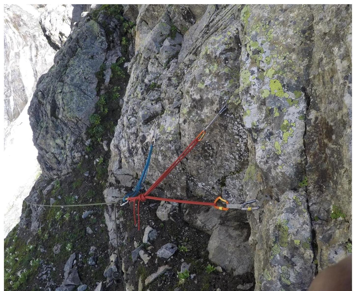
SECTION R7–R8. EXIT INTO THE COL OF "ROOSTER'S RIDGE"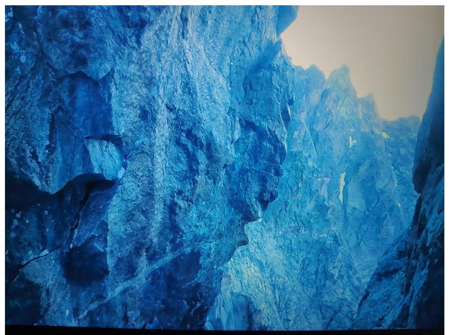
R8–R9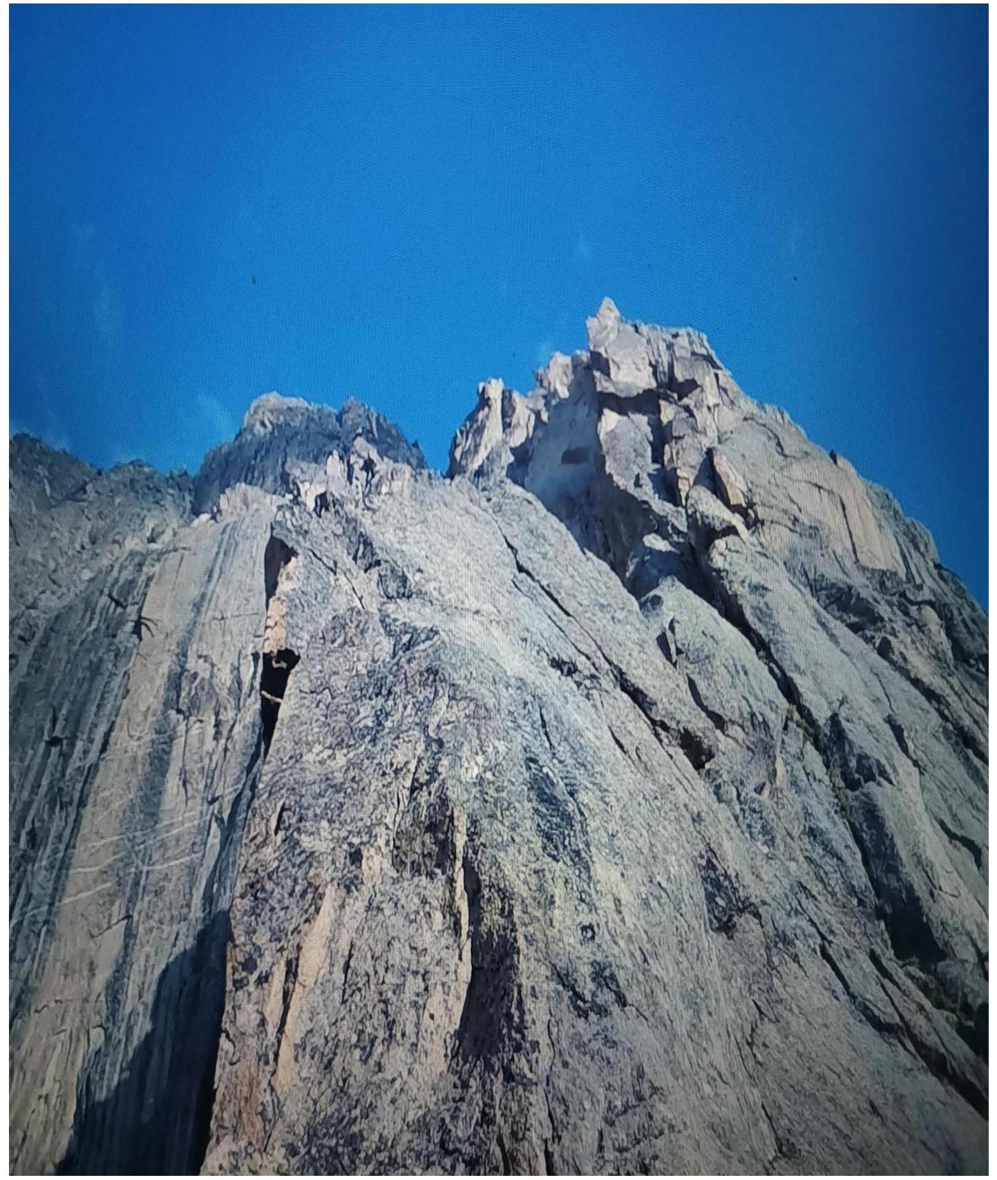
R9–R10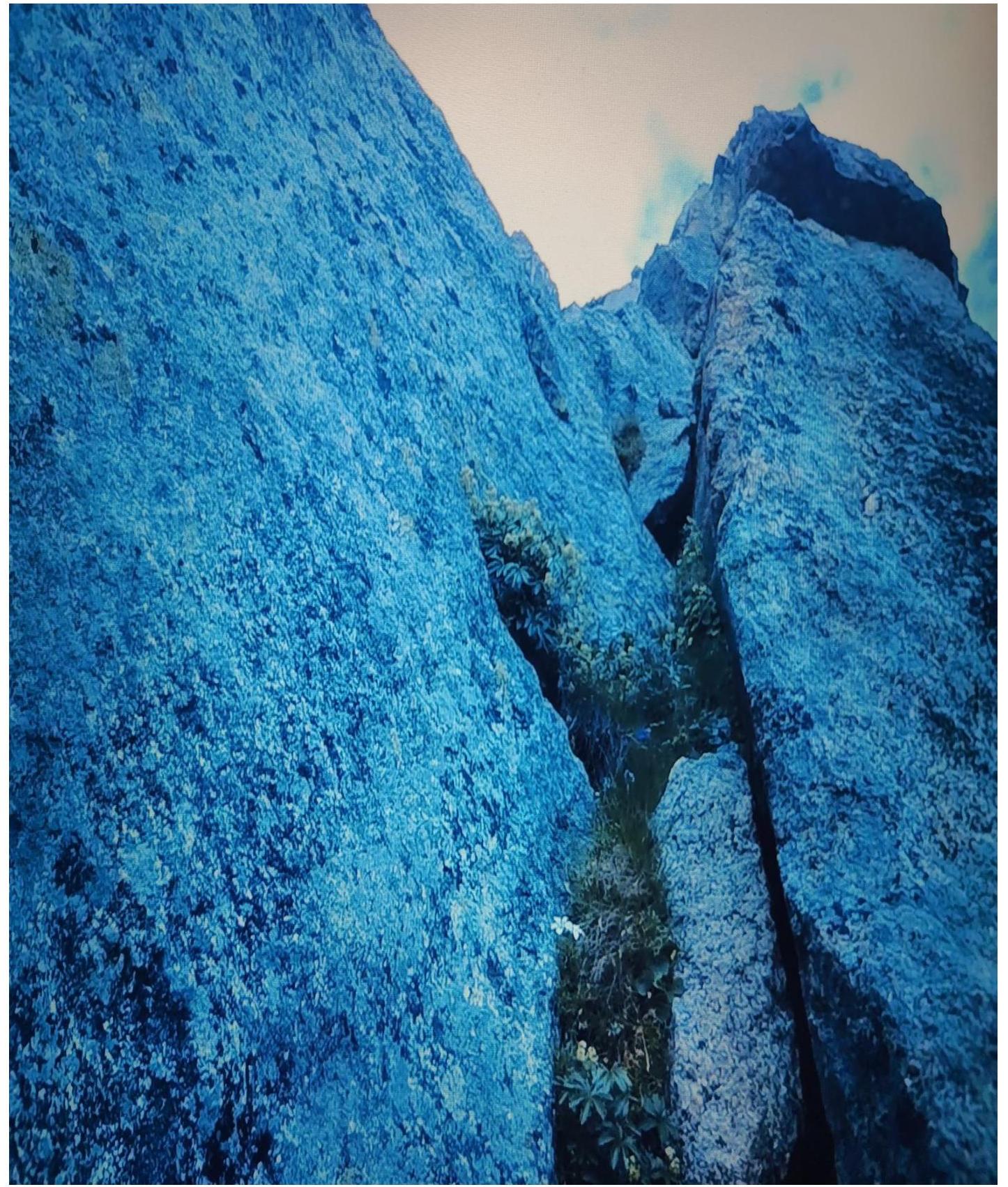
R10–R11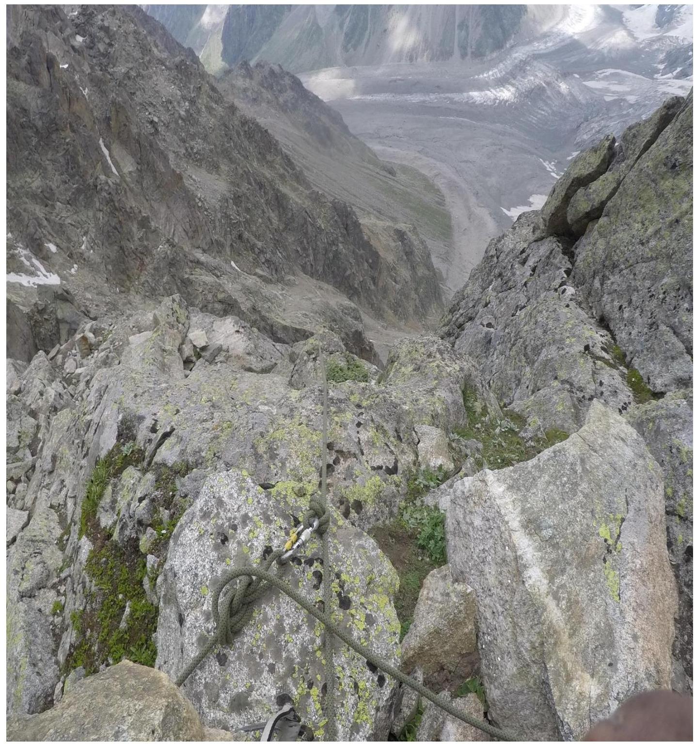
R13–R14
R17–R18
R19–R20
R20–R21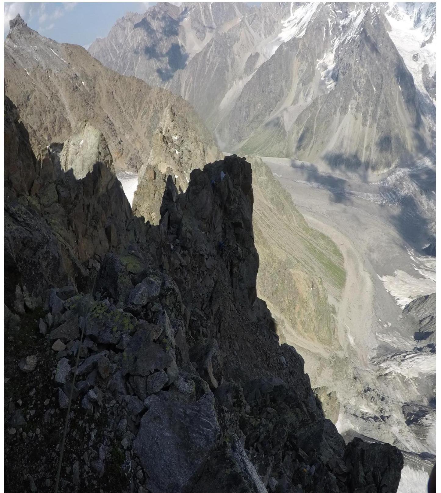
R23–R24
R24–R26
R27–R28 Summit