
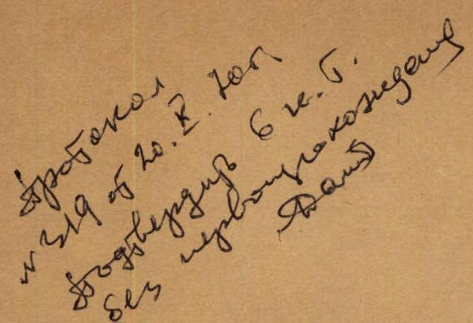
REPORT
on the ascent to the summit KRUMKOL, category 6B, by the group from Taganrog and Rostov-on-Don, under the guidance of Ruzhevsky V.V.
TAGANROG 1970
II. The composition of the group from Taganrog and Rostov-on-Don, that made the ascent to the summit Krumkol via the junction of the north-eastern and north-western walls, category 6B, from July 13 to 19, 1970.
| № | Full Name | Year of Birth | City | Sports Society | Sports Rank | Notable Climbs | | :---: | :---: | :---: | :---: |: | :------------: | :--------------------------------------------: | | 1. | Ruzhevsky Vaclav Vitoldovich | 1935 | Khimki | TRUD | Master of Sports | 1965 — Chatyn, north wall, 1968 — Kirpich, north wall | | 2. | Lankin Viktor Efimovich | 1939 | Taganrog | TRUD | Candidate for Master of Sports | 1968 — Kirpich, north wall, 1969 — 2nd peak Engels, north-east wall | | 3. | Zadorozhny Anatoly Ivanovich | 1940 | Taganrog | TRUD | Candidate for Master of Sports | 1968 — Kirpich, north wall, 1969 — peak Engels, north-east wall | | 4. | Khokhlov Evgeny Pavlovich | 1938 | Taganrog | TRUD | Candidate for Master of Sports | 1968 — Kirpich, north wall | | 5. | Cherendnichenko Dmitry Ivanovich | 1937 | Taganrog | TRUD | Candidate for Master of Sports | 1968 — Ushba, north-east wall, 1969 — peak Engels, north-east wall | | 6. | Raspopov Sergey Alekseevich | 1930 | Rostov-on-Don | TRUD | Candidate for Master of Sports | 1968 — Kirpich, north wall |
Observation group:
- Fedorov A.I. — Master of Sports, Rostov-on-Don
- Meretsky E.L. — 1st sports rank, Rostov-on-Don
- Lipen Z.B. — Candidate for Master of Sports, junior doctor
- Shooov N.V. — Instructor, 100102
The group has been climbing together since 1967 and has completed a number of interesting climbs of various difficulty levels. Preparation for the 1970 season included year-round training in general physical and special technical conditioning at their place of residence and a training cycle on rocks, snow, and ice in the Ullu-Tau alpine camp immediately before the climb. This cycle also included acclimatization climbs of category 1 and 2 in the Adyr-Su region.
The group's work in the Ullu-Tau alpine camp was organized in the form of сборов (training camps) for Rostov-on-Don and Taganrog, sanctioned by the Central Council of the TRUD Sports Society. The training camps were led by Lankin Viktor Efimovich, with Ruzhevsky Vaclav Vitoldovich as the senior coach.
The group's ascent to peak Krumkol was authorized by Zak P.S., representative of the USSR Alpine Federation. The control time was set by Levin A.S., head of the rescue team at the Bezengi alpine camp.
The group received consultation on the route from Timofeev and Levin at the Bezengi alpine camp.
III. Brief description of the route to peak Krumkol via the junction of the north-western and north-eastern walls, category 6B.
The route description is given in sections, as shown on the photograph and profile image at the end of the report. The section numbering starts from the bottom and begins at zero (0).
I. Height difference — 300 m. Route length — ~400 m. Average slope — 40°.
A relatively simple snow-ice slope with a slope angle of 30° to 45°, bypassing the first wall section of Krumkol. The route exits to the right onto a snow-ice ridge above the wall. Belaying in the lower part of the slope is done through an ice axe, and further, at the boundary between ice and rock, through rock pitons.
II. Height difference — ~200 m, length — ~350–400 m, average slope 40–45°.
The rocks are mostly of medium difficulty to challenging, with monolithic slabs and ledges, along which the route goes up to the right towards an internal corner about 65 meters long (1). The corner is very challenging but is climbed using free climbing. Further, the route goes up to the left along slabs and ledges, aiming for the inflection between the north-eastern and north-western walls. The bivouac site (2) is characterized by an apparent ease of exit and proximity to the inflection. The ascent to the bivouac goes up to the left along challenging slabs (60 m) towards two large rock separations. The route is climbed using free climbing, with piton and protrusion belays.
III. Height difference — ~200 m, length 300–350 m. Average slope of the section 50–55°.
The rocks are challenging to very challenging. Free climbing is used. From the bivouac, the route goes up to the right along rocky ledges, bypassing the hanging walls of the inflection to the right. ~85–90 meters towards an internal corner (3) with a plug. The corner is complex and hazardous due to a large number of loose rocks. After a snowy ledge, the corner turns up to the left — challenging climbing and further up to the right towards a bifurcated snow patch, clearly visible in the route photograph. Above the snow patch is a large separation with a horizontal ledge. Control cairn!
IV. Height difference — 90 m, length — 100–110 m, average slope — up to 60°.
Very challenging rocks. From the ledge with the control cairn, the route goes up to the left along a slab-like wall (4) to a horizontal ledge under hanging rocks. The ledge is straightforward and leads to the inflection. Here, under the hanging wall, there is a possible bivouac site for two tents, which is safe.
V. Height difference — ~100 m, length about 110 m, average slope — 80°.
A rock wall requiring very challenging climbing, with two sections where platforms and ladders are hung, and bolt pitons are used. The wall leads to a snow-ice slope with a slope angle of up to 60°, along which the route goes up to the right, passing two rock outcrops to the inflection in the ridge. Here, under a hanging rock pinnacle, there is a possible bivouac site for two tents (6).
VI. Height difference — 60 m, route length — 90 m, average slope — 50°.
A snow-ice slope with a rock outcrop, through which the route lies towards the left, ice-filled couloir, intersecting the 4th rock belt of Krumkol.
VII. Height difference — 110 m, route length about 120 m, average slope up to 80°.
The most secure of all the ice couloirs in this section. The passage is assisted by ladders and screw-in ice pitons. Belaying is done through bolt pitons in the rocks and ice pitons.
VIII. Height difference — ~500 m, route length about 650 m, average slope 50°.
A rock ridge above the average difficulty level. It represents an alternation of inclined ledges with challenging walls, 10–12 meters high. The route goes upwards, sticking to the inflection of the ridge. From the bivouac (8) — to the left of the inflection, then along the inflection to the bivouac (9). Belaying is done through pitons and protrusions.
IX. Route length — ~350 m, height difference — 100 m, average slope 20–25°.
The pre-summit ridge — snowy with two rock pinnacles, the second of which is bypassed along a ledge to the left and upwards, with an exit to its summit.
Thus, with a route length of over two kilometers, the length of the most challenging sections of very difficult climbing is about 350 meters. The remaining terrain corresponds to a climb of category 5. The terrain is very diverse and requires the use of almost the entire arsenal of rock and ice climbing techniques.
IV. Tactical plan and its implementation. Route evaluation.
Following consultation with the leader of the first ascent group, Timofeev, and the participants of Kudinov's group, the tactical plan of Kudinov's group was adopted as the basis: time allocation, passage of individual route sections, organization of bivouacs, selection of equipment and supplies. Some adjustments were made to increase the time for the passage due to the larger number of participants in the group (6 people) and an emergency reserve of supplies and fuel due to the relatively early start of the route (early July) and bad weather. As it turned out later, these measures were justified. Note: the planned movement schedule is shown in the route sheet at the end of the report.
Implementation of the tactical plan.
July 13. Weather: poor, dense fog, snow with rain, weak wind. Departure from the bivouac at 4:00. Sections I and II were completed. Stop for the night at 15:30. Platforms for 2 tents were prepared in a snowy ridge between rock outcrops under a hanging wall. Number of climbing hours — 11.5. Number of rock pitons hammered — 26.
July 14. Weather: in the first half — wet snow, fog; from 13:00 — cloudy, no precipitation. Departure from the bivouac by the first rope team Ruzhevsky — Lankin at 6:30. Sections III–IV were completed. Stop for the night at 14:00.
Organization of the bivouac:
- For 2 tents
- On inclined ledges under a hanging wall
The duo Zadorozhny — Khokhlov processed 60 meters of a very complex wall (5) during this time. Number of climbing hours with processing — 13.5 hours. Number of rock pitons hammered on the route — 44.
July 15. Weather: excellent, slight cloudiness, sun. Departure from the bivouac at 5:30. Section V was completed. The duo Zadorozhny — Lankin processed the snow-ice slope to the foot of the couloir in the 4th rock belt. Number of climbing hours with processing — 14 hours. Number of pitons hammered:
- Rock pitons — 17
- Bolt pitons — 4
July 16. Weather: excellent, clear. Departure from the bivouac at 4:00 to complete the hazardous ice couloir in the 4th belt. Sections VI and VII were completed. Stop for the night at 16:30.
- Number of climbing hours — 12.5
Number of pitons hammered:
- Rock pitons — 12
- Bolt pitons — 4
- Ice pitons (including those for ladders) — 24
July 17. Weather: excellent. Departure from the bivouac at 5:30. The ridge — section VIII — was completed. Stopped for the night at 17:00. The rope team Lankin — Ruzhevsky processed 40 meters to the exit to the pre-summit ridge. Bivouac — 3 people in a tent, three — lying on a platform in the open air due to good weather. Number of climbing hours with processing — 12.5 hours. Number of pitons hammered:
- Rock pitons — 27
- Bolt pitons — 3
- Ice pitons — 4
July 18. Weather: excellent. Departure from the bivouac at 5:00.
At 9:00, they reached the summit, completing the pre-summit ridge IX. Descent via the route of category 3B until 17:30. Rest until 21:00, then return to the Bezengi alpine camp via the Spartak pass and Bashkhauz on July 19 at 16:00. Climbing hours, not counting rest after descent, — 29.5 hours. Number of pitons hammered on the ascent to the summit — 11 rock pitons.
Thus, the passage of the route took the group (excluding descent) five climbing days; the total number of climbing hours to the summit — 55.5 hours (excluding descent).
Number of pitons hammered on the route:
- Rock pitons — 126
- Ice pitons — 28
- Bolt pitons — 10
Now, while writing the route description, the group can compare the difficulty of the ascent to peak Krumkol with ascents of category 6 difficulty to peaks Chatyn and Chanchaхи. Although a comparison with the north wall of Chatyn is quite conditional due to the specificity of the technical and moral aspects of the latter, the general opinion of the group is that the route via the junction of the north-eastern and north-western walls of Krumkol is undoubtedly a route of category 6B due to its technical complexity and length.
V. Overall assessment of the participants' actions during the ascent.
As mentioned above, the group consisted of 6 participants, five of whom completed a joint ascent to peak Kirpich in 1968 as part of the USSR Championship. The entire group and the training camp as a whole were in the south-western Pamir region in 1969 and completed a number of interesting and challenging climbs. Most of the group members have been closely connected by friendship over the past 10 years and have trained together in Taganrog and Rostov. These facts explain that the technical cohesion, mutual understanding, and mutual assistance within the group are close to ideal. In terms of technical and physical preparation, the group members are roughly equal, differing only in character and some specificity of climbing techniques, which only contributes to the successful passage of the route.
During the ascent to peak Krumkol, all participants worked with great dedication and demonstrated their ability to solve the most complex mountaineering tasks.
VI. Additional information on the route characteristics.
The most suitable time for completing the route is mid-July to the end of August, as the northern exposure and relative height of the route create a risk of icing on the rocks in the early and later summer periods; this significantly complicates the route.
The route is objectively safe, but certain sections contain many "live" stones that are not prone to spontaneous falling but are hazardous when the group is moving. In this regard, it is not recommended to complete the route with a group of more than 6 people; the optimal group size is 4 people.
The time required to complete the route by a group of 6 people: minimum — 4 days, optimal — 5 days.
The route requires a set of medium and large rock pitons and up to 8 screw-in ice pitons.