- Altitude-technical class.
- Caucasus, Bezengi, Northern array, section 25 p. 92 according to the classification table 2001
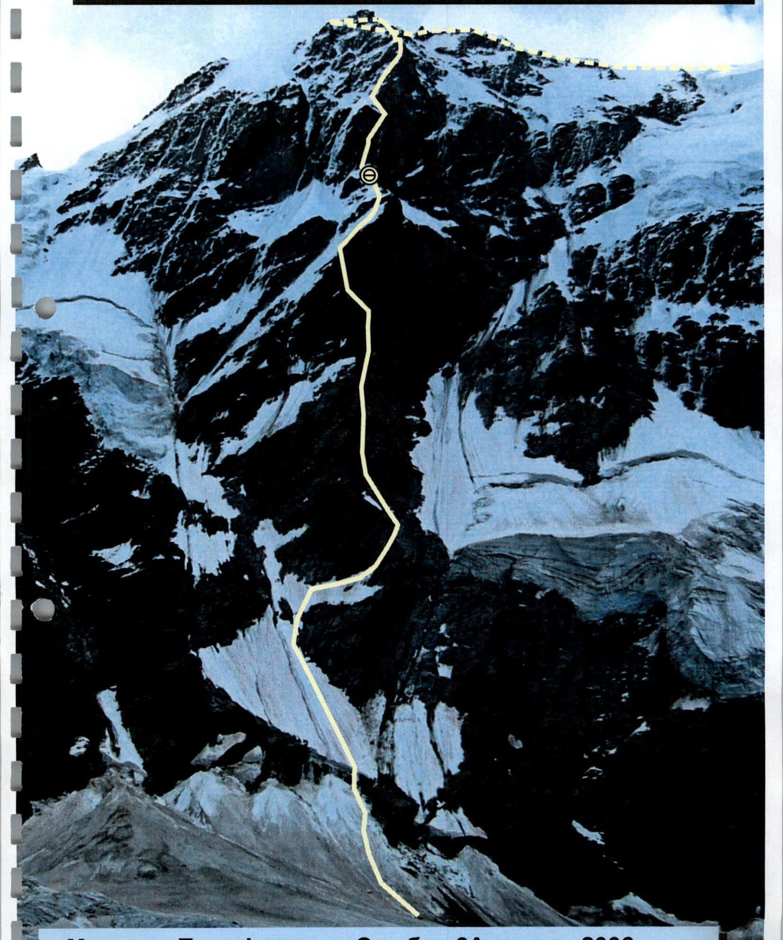
- Krumkol, via C rib 6A (Timofeev's route) 4676 m
- The route is combined.
- Height difference of the route: 1576 m. Route length: 1735 m. Length of sections: V–VI cat. diff. 1400 m. Average steepness: 70°.
- Team's walking hours: 30 hours, 2 days.
- Leader: Viktor Yu. Kramarenko CMS (Kharkov). Participants: Dmitry N. Podlesny CMS (Taganrog), born 1979. Alexander V. Gudzinsky CMS (Uzhgorod).
- Coach: Valentina T. Orekhova, CMS, 1st category alpinism instructor-methodologist, cert. #550 (Taganrog);
- Departure to the route: 5:00 04.08.2006
Ascent to the summit: 19:00 05.08.2006
Return to Base Camp: 21:00 06.08.2006
Krumkol 4676 m
| Date | Section # | Route profile | L, m | γ° | cat. diff. |
|---|---|---|---|---|---|
| 05.08.2006 | 30–31 | 4600 m | 70 | 55° | 4 |
| 29–30 | 50 | 70° | 4 | ||
| 28–29 | 50 | 70° | 4 | ||
| 27–28 | 50 | 85° | 5 | ||
| 26–27 | 50 | 90° | 5 | ||
| 25–26 | 30 | 40° | 3 | ||
| 24–25 | 70 | 30° | 2 | ||
| 23–24 | 50 | 85° | 5 | ||
| 22–23 | 50 | 70° | 5 | ||
| 21–22 | 50 | 60° | 5 | ||
| 20–21 | 30 | 60° | 4 | ||
| 19–20 | 30 | 85° | 6 | ||
| 18–19 | 50 | 85° | 6 | ||
| 17–18 | 50 | 90° | 6 | ||
| 16–17 | 50 | 60° | 4 | ||
| 04.08.2006 | 15–16 | overnight stay 3998 m | 40 | 70° | 4 |
| 14–15 | 50 | 70° | 5 | ||
| 13–14 | 50 | 65° | 5 | ||
| 12–13 | 50 | 65° | 5 | ||
| 11–12 | 50 | 60° | 5 | ||
| 10–11 | 45 | 90° | 6 | ||
| 9–10 | 120 | 70° | 4 | ||
| 8–9 | 50 | 85° | 5 | ||
| 7–8 | 100 | 30° | 2 | ||
| 6–7 | 100 | 65° | 4 | ||
| 5–6 | 100 | 65° | 4 | ||
| 4–5 | 50 | 60° | 4 | ||
| 3–4 | 50 | 60° | 4 | ||
| 2–3 | 50 | 75° | 4 | ||
| 1–2 | 50 | 70° | 4 | ||
| 0–1 | 3075 m | 50 | 55° | 5 |
| Section # | UIAA scheme | L, m | γ° | cat. diff. |
|---|---|---|---|---|
| 30–31 | 70 | 55° | 4 | |
| 29–30 | 50 | 70° | 4 | |
| 28–29 | 50 | 70° | 4 | |
| 27–28 | 50 | 85° | 5 | |
| 26–27 | 50 | 90° | 5 | |
| 25–26 | 30 | 40° | 3 | |
| 24–25 | 70 | 30° | 2 | |
| 23–24 | 50 | 85° | 5 | |
| 22–23 | 50 | 70° | 5 | |
| 21–22 | 50 | 60° | 5 | |
| 20–21 | 30 | 60° | 4 | |
| 19–20 | 30 | 85° | 6 | |
| 18–19 | 50 | 85° | 6 | |
| 17–18 | 50 | 90° | 6 | |
| 16–17 | 50 | 60° | 4 | |
| 15–16 | 40 | 70° | 4 | |
| 14–15 | 50 | 70° | 5 | |
| 13–14 | 50 | 65° | 5 | |
| 12–13 | 50 | 65° | 5 | |
| 11–12 | 50 | 60° | 5 | |
| 10–11 | 45 | 90° | 6 | |
| 9–10 | 120 | 70° | 4 | |
| 8–9 | 50 | 85° | 5 | |
| 7–8 | 100 | 30° | 2 | |
| 6–7 | 100 | 65° | 4 | |
| 5–6 | 100 | 65° | 4 | |
| 4–5 | 50 | 60° | 4 | |
| 3–4 | 50 | 60° | 4 | |
| 2–3 | 50 | 75° | 4 | |
| 1–2 | 50 | 70° | 4 | |
| 0–1 | 50 | 55° | 5 |
Route scheme in UIAA symbols
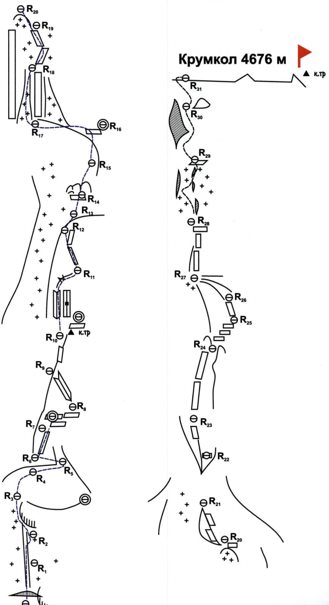
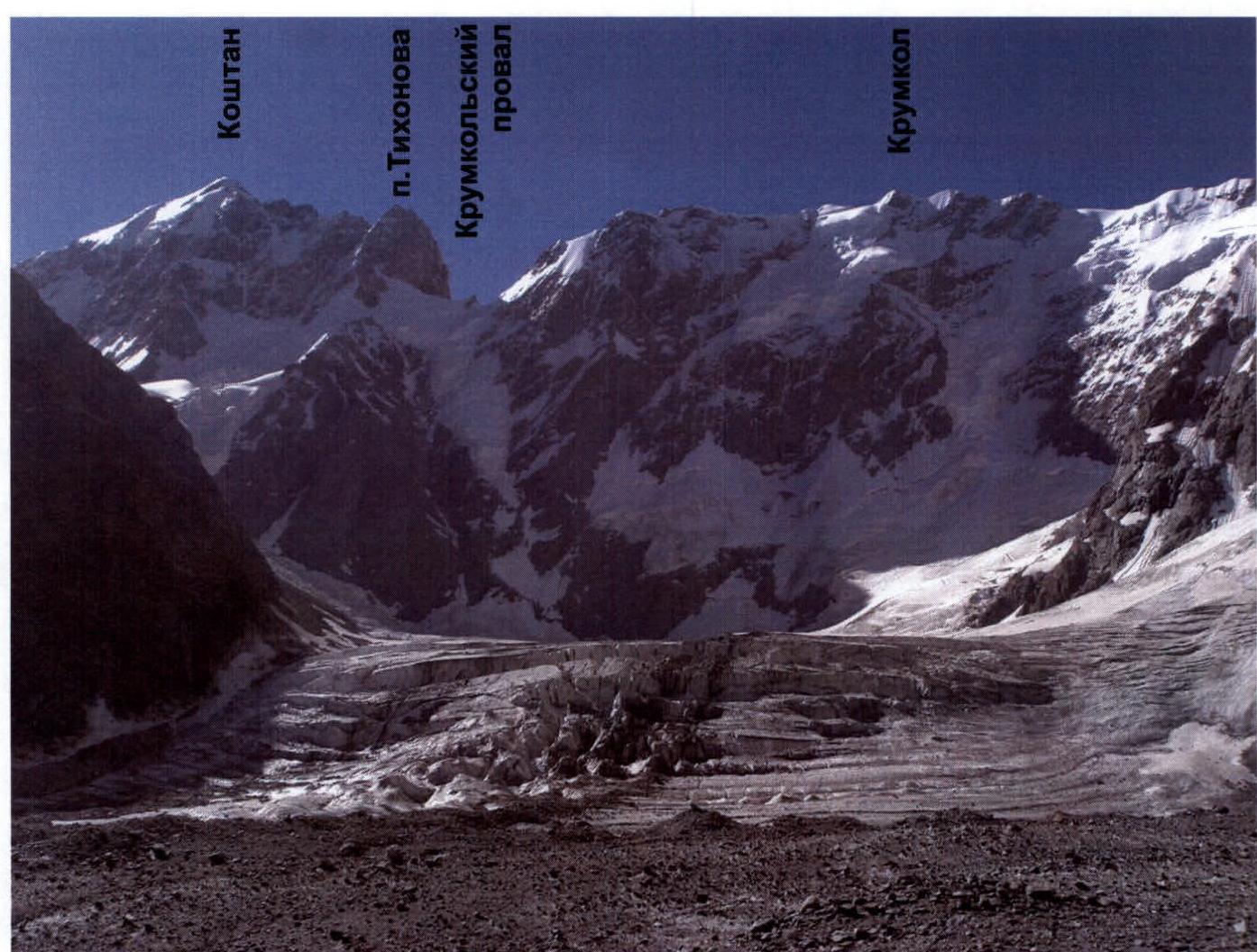
Photo panorama of the area

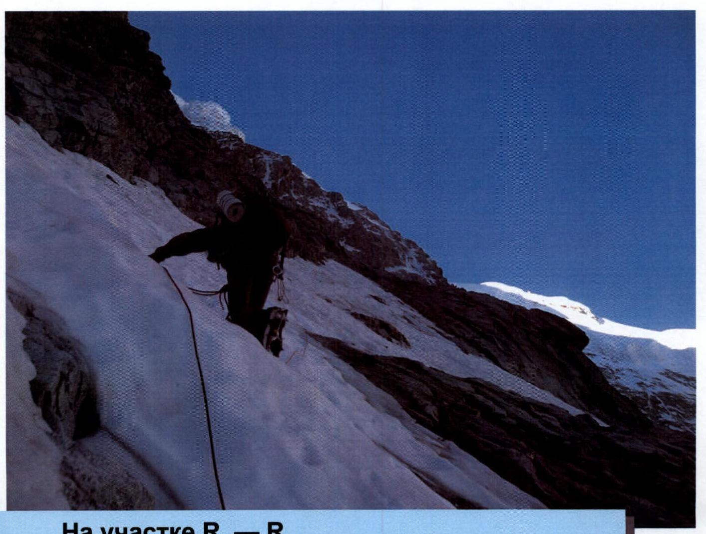
On section R0–R1 — avalanche chute
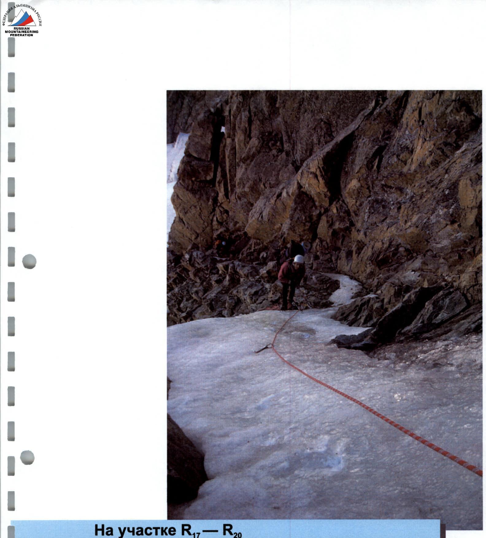
On section R17–R20
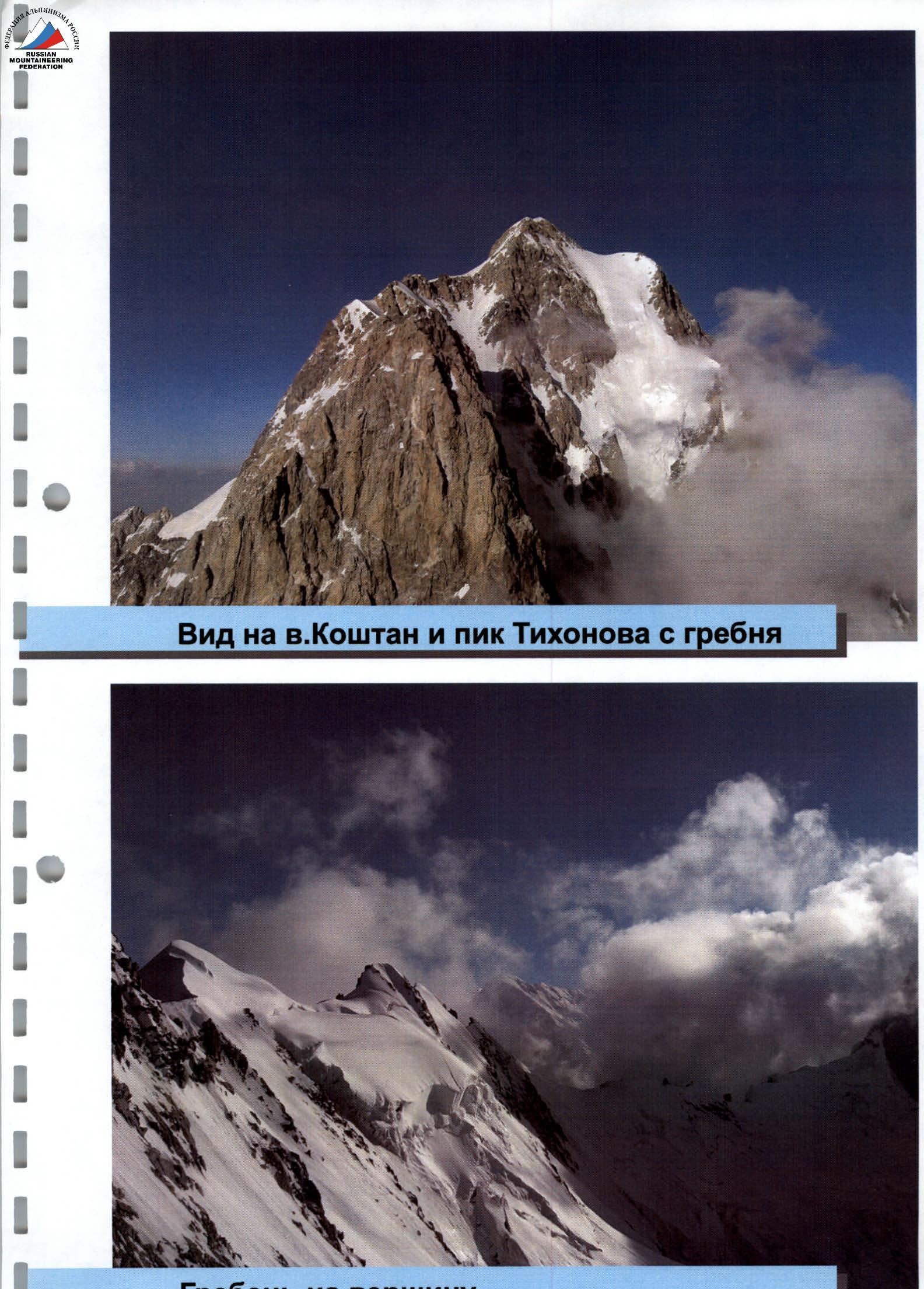
Ridge to the summit
Comments
- We believe that the route corresponds to 6A category of difficulty.
- The approach to the start of the route nowadays does not correspond to the existing description of the route, as the glacier has retreated and a bergschrund has appeared before the start of the route.
- We consider it necessary to note that the first two ropes of the route pass through an avalanche-prone chute and are objectively prone to rockfall. We recommend passing them early in the morning.
- We believe that the route passed significantly enriched our mountaineering experience, as it belongs to the category of classic 6B routes.