MOSCOW ALPINISM AND ROCK CLIMBING FEDERATION
Report
On the ascent of the Demchenko named CSKA team
To the summit of Prividenie (Ghost) 3809 m
Central Caucasus, Koshtan-Krest ridge (43° 2′ 37,71″ N 43° 16′ 25,86″ E) via the Northern slope First ascent, presumably 2B category of complexity
Zaryaev V. V. — Galimzyanov T. R.
Ascent participants
-
Leader — Zaryaev Vladimir Valerievich¹, 2nd sports category.
Address: 117465, Moscow, Profsoyuznaya st., 156, b. 1, ap. 384. VVZaryaev@yandex.ru, +7 903 105 81 48
-
Galimzyanov Timur Ravilievich, 2nd sports category.
Coach: Kuznetsova E. V.
2B route to the summit of Prividenie via the Northern slope
Ascent passport
-
Central Caucasus, Koshtan-Krest ridge area, Gerty glacier, section of the classifier: 2.5.
-
Prividenie 3809 m (43° 2′ 37,71″ N 43° 16′ 25,86″ E) via the Northern slope.
-
Proposed — 2B category of complexity, first ascent.
-
Route type: combined.
-
Route elevation gain: 310 m (according to Google-Earth image).
Route length: 900 m. Average slope: 20°. main part of the route — 20°; entire route — 20°.
-
Hooks left on the route: total — 0; including pitons — 0.
-
Team's travel time: 1.5 h (excluding descent and approach to the route), 1 day.
-
Leader: Zaryaev V. V., 2nd sports category.
Participants: Galimzyanov T. R., 2nd sports category.
-
Coach: Kuznetsova E. V.
-
Approach to the route from overnight stays on Gerty glacier: 05:30 August 4, 2016.
Route started: 06:30 August 4, 2016. Summit reached: 08:00 August 4, 2016. Return to the base camp: 11:30 August 4, 2016. Descent from the summit: via the ascent route.
-
Organisations: Moscow Alpinism and Rock Climbing Federation, Demchenko named CSKA.
-
Person responsible for the report — Zaryaev Vladimir Valerievich. VVZaryaev@yandex.ru, +7 903 105 81 48.
Overall photograph of the summit
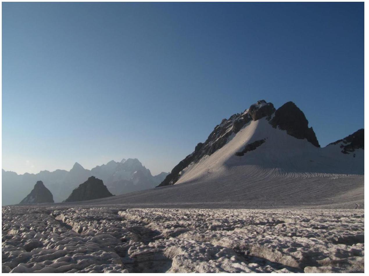
Fig. 1. Prividenie summit from Gerty glacier.
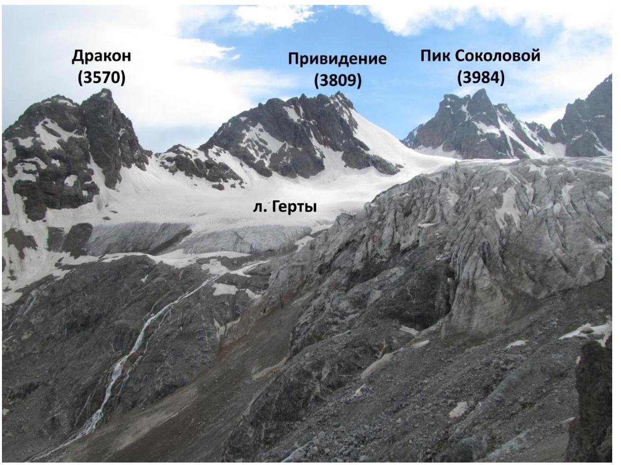
Fig. 2. Photograph of Prividenie summit in the context of the area. Overview photo taken from Shesti pass to the south.
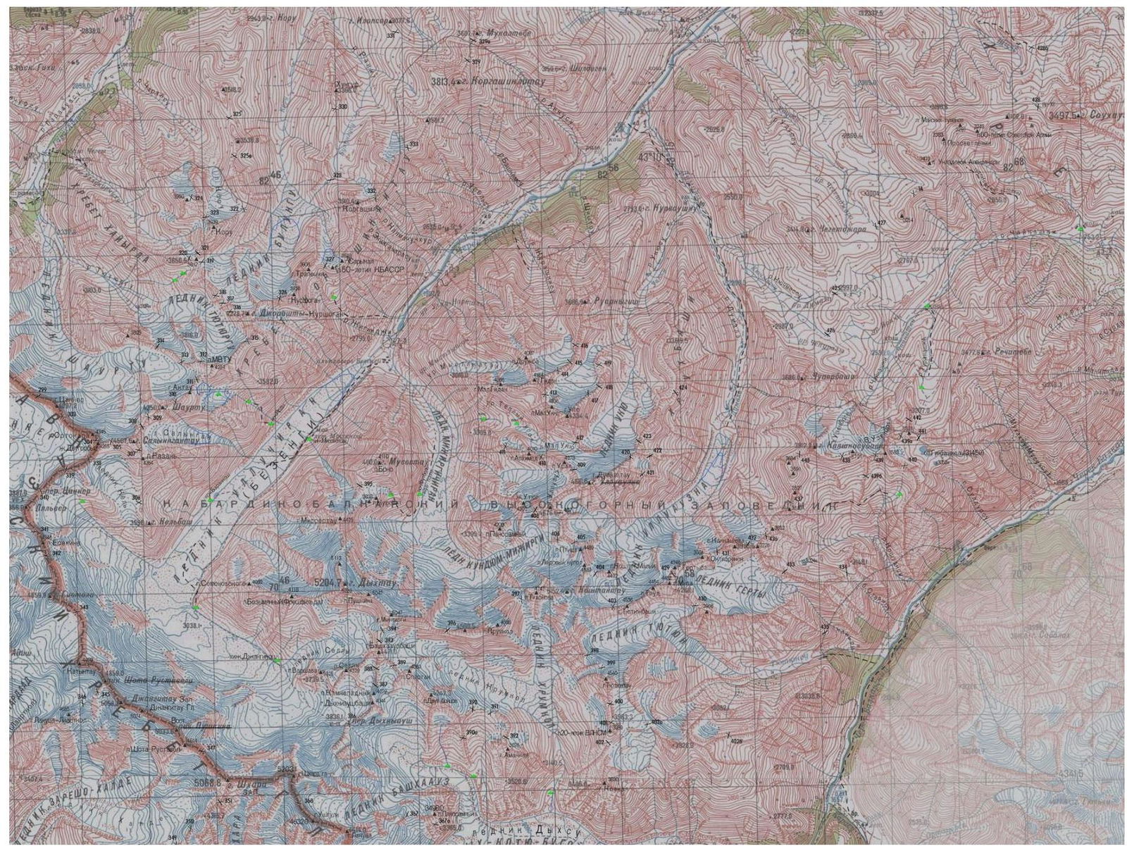
Fig. 3. Map of the area.
Central Caucasus, Koshtan-Krest ridge, Gerty glacier
Brief description of the area
"The Koshtan-Krest ridge is located to the east of the summit of Koshtantau and is a continuation of its Eastern ridge in the neighboring Mizhirgi and Bezengi valleys, Dumala. The ridge closes the Dumala valley from the east and south, and the Tyutyun and Gerty valleys from the north and west.
The western part of the ridge lies between the Ullu-Auz and Trud passes with an average height of 4400 m. To the east from the peak Mira, a long, heavily serrated ridge descends with several nameless summits. The eastern part of the ridge, with a height of 3900–4000 m, stretches from the Trud pass to the east to the summit of Kayashkisubashi.
Climbers rarely visit the summits of the ridge, as the approach to them from the Bezengi alpine camp takes 1–2 days. All the Northern and Southern walls and counterforts of the ridge, with routes from 3A to 5B category of complexity, are still waiting for their conquerors. The ascent to the peak Mira via the long, with several rocky ascents and nameless summits, Eastern ridge is very interesting, with a route classified as 5B category of complexity."
Description on the website http://www.kmvline.ru/lib/center/25.php↗
Approach
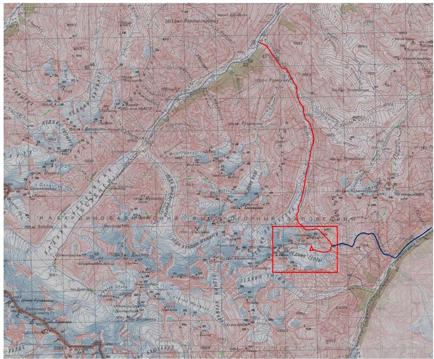
Fig. 4. Route map from the Bezengi and Verkhnyaya Balkaria valleys to the Gerty glacier. The climbing area is marked.
Overnight stays
We did not find any comfortable warm overnight stays on the scree. The base camp was set up on the glacier, in its orographic left part, near a stream.
Supplement
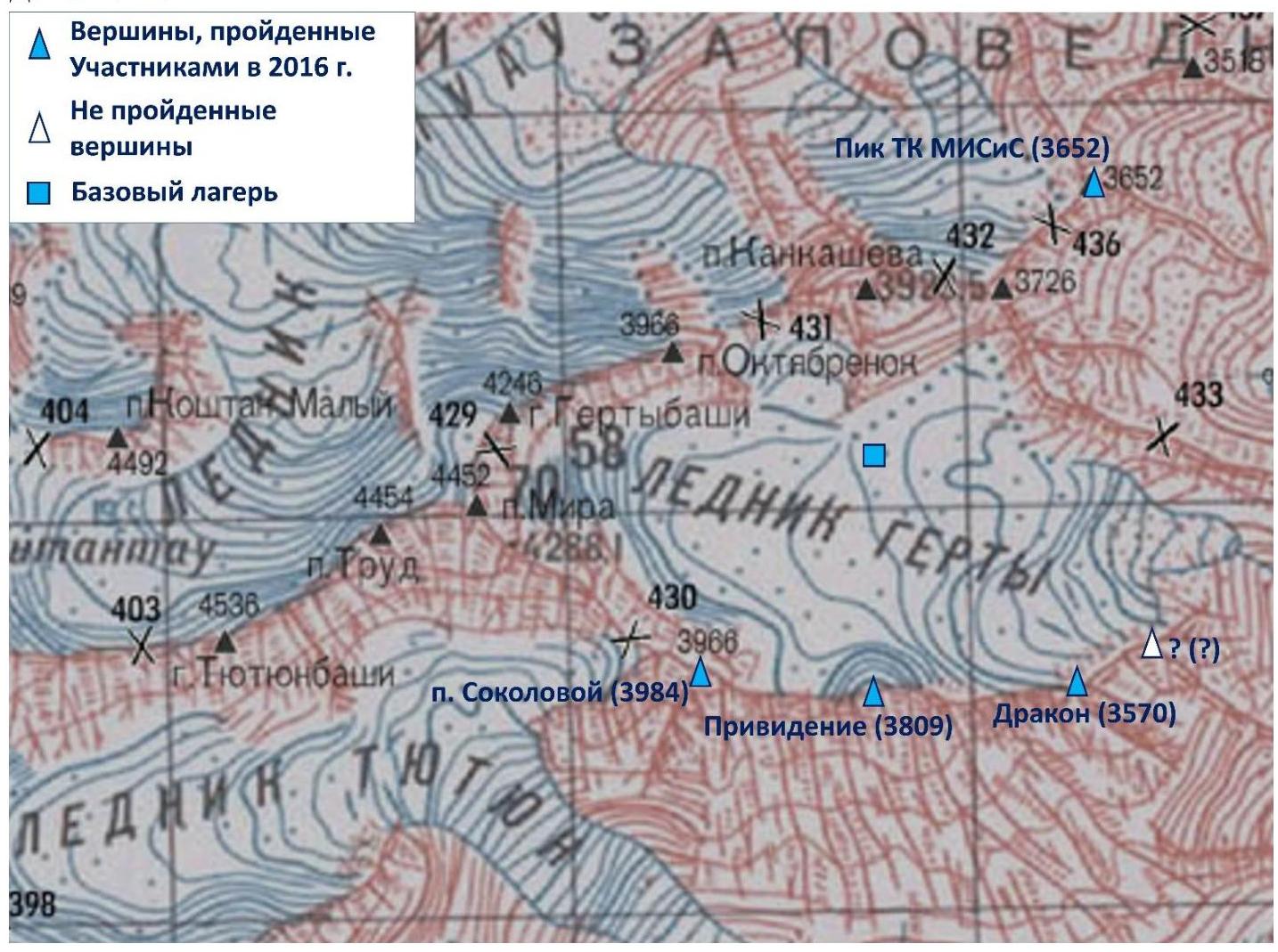
Fig. 5. Summits climbed during the 2016 trip. Also marked is a summit that was not attempted (see report on the ascent to the Dragon summit).
Photograph of the route profile.
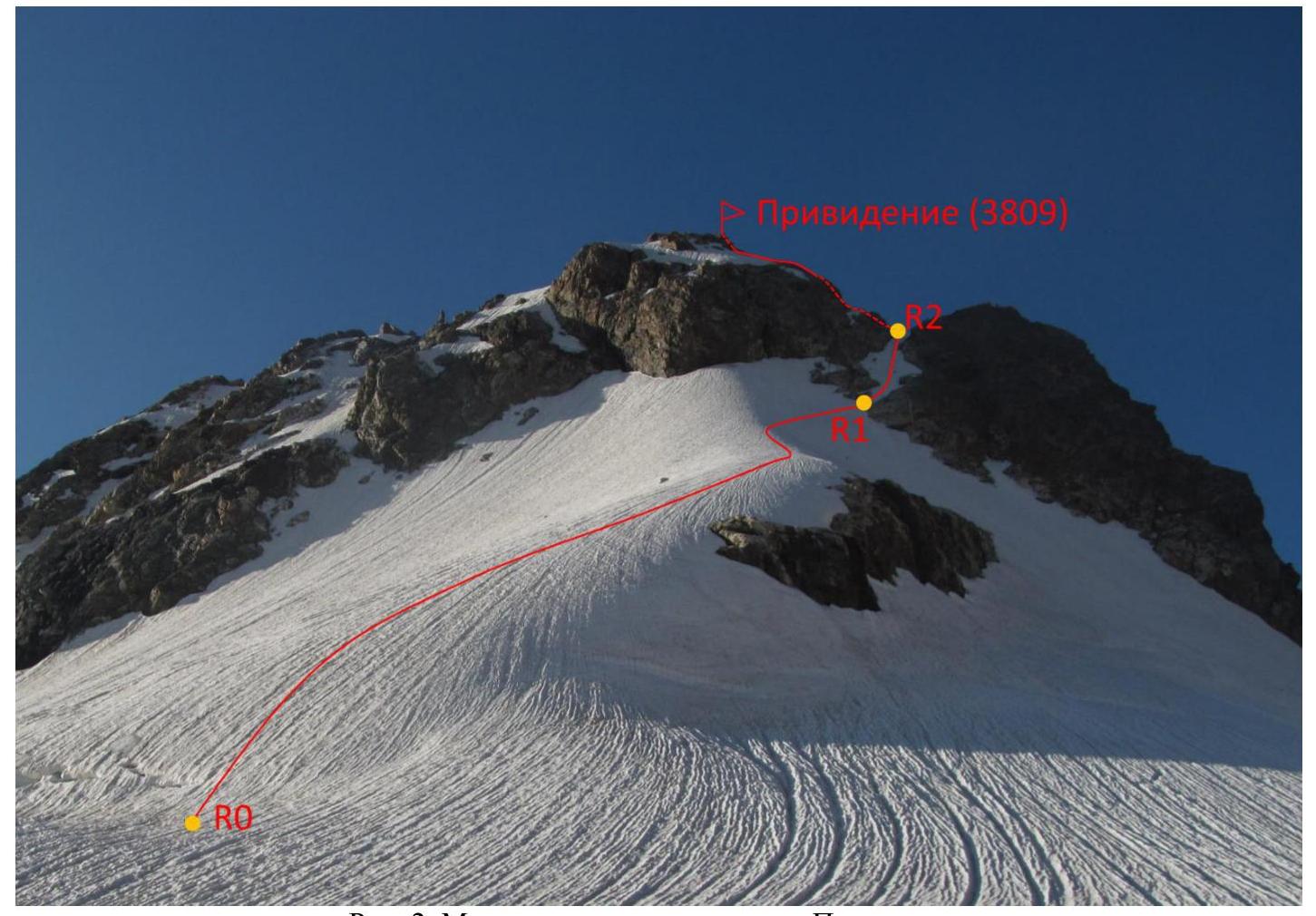
Fig. 2. Ascent route to the Prividenie summit.
Description of the route sections' complexity
| Section | Length | Steepness | Terrain character | Cat. of complexity |
|---|---|---|---|---|
| R0–R1 | 600 m | 20–30° | Snow-ice slope | 2 |
| R1–R2 | 100 m | 30–40° | Ice couloir | 3 |
| R2 – summit | 200 m | 0–40° | Destroyed rocks | 2–3 |
Brief description of the route passage by sections
Approach to the start of the route — via Gerty glacier in rope teams. R0–R1. Ascent up the snow-ice slope along a weakly expressed ridge. Then traverse right under the ice couloir². If necessary, belay through ice axes. Snow hooks may be needed. Belaying through ice screws is practically impossible. 2, 20°–30°, 600 m. R1–R2. Up the ice couloir to reach the ridge. Movement is possible to the left along the boundary between rocks and ice. Belay through ice screws. On the ridge above the couloir, there is a convenient pocket for rest. 3, 30–40°, 100 m. R2 – summit. Along the rocky ridge to the left, ascend to the summit. Climbing is easy, but the rocks are heavily destroyed, and belaying is difficult. 2–3, 0–40°, 200 m.
Descent
Descent from the route is done via the ascent route.
Route recommendations
The route is short but quite tense. According to our observations, there is no rockfall hazard. However, the third section of the route is dangerous due to the lack of belaying opportunities. Therefore, an ascent via the opposite, longer Eastern ridge is interesting.
Route length 900 m, elevation gain 310 m.
Photo illustrations of the report
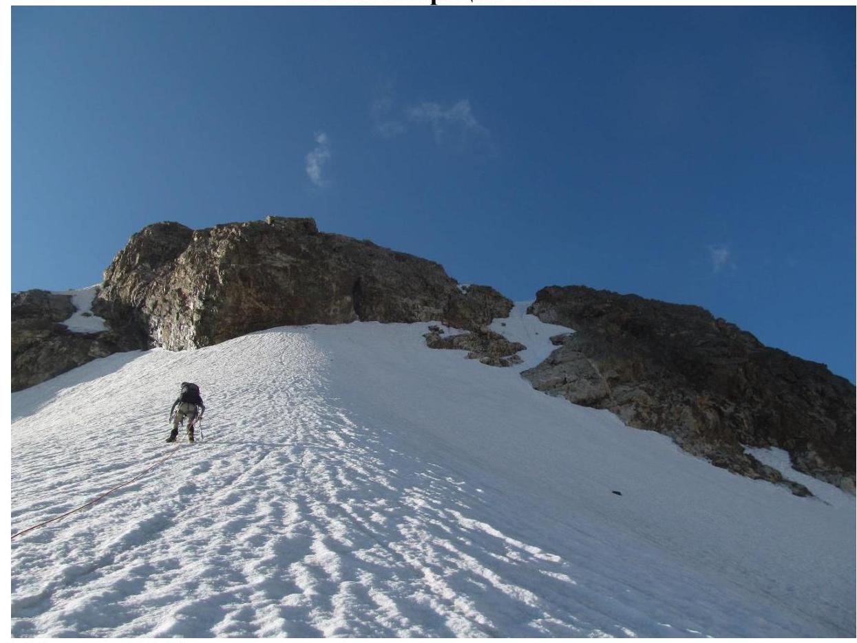
Fig. 6. Section R0–R1.
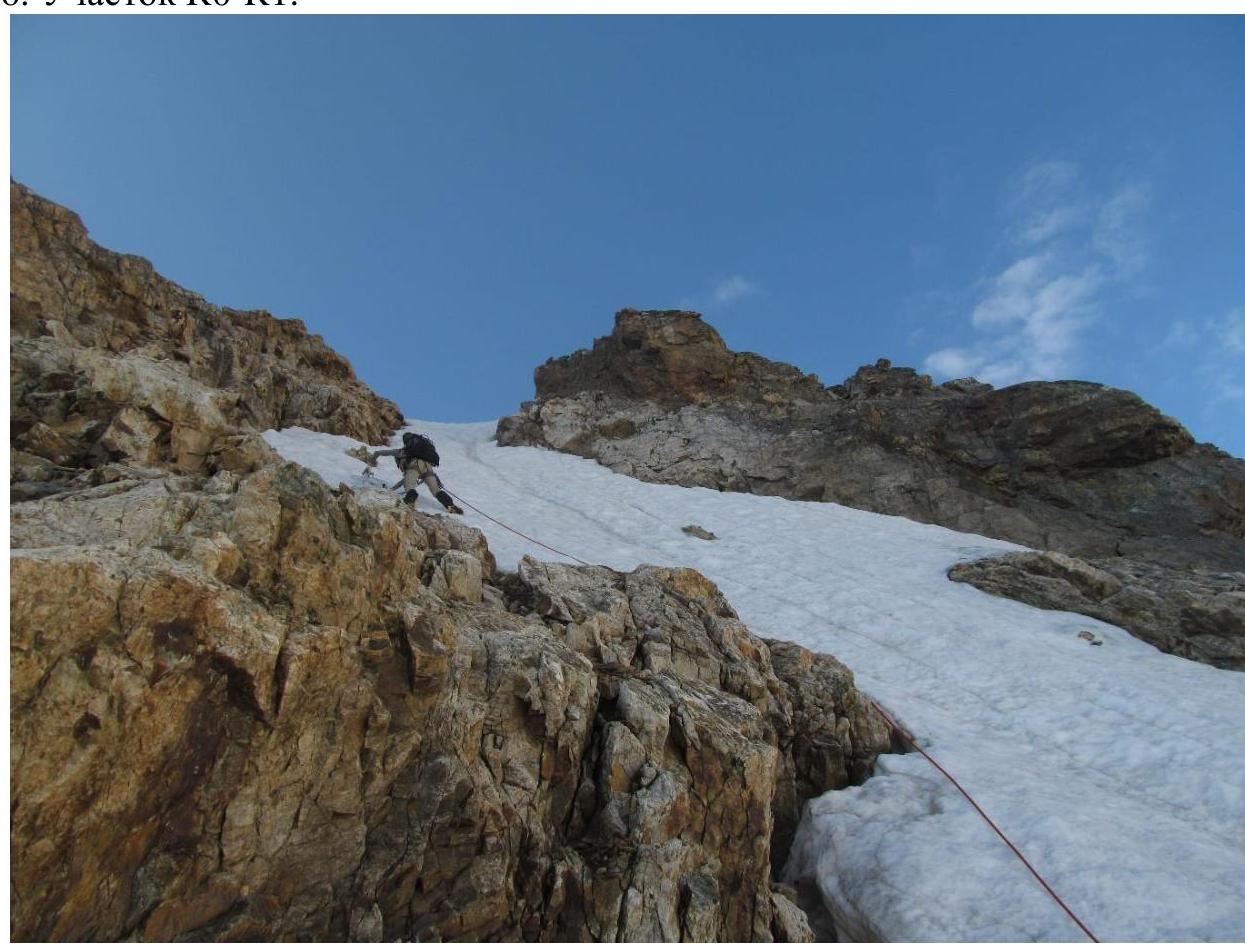
Fig. 7. Passage of the ice couloir (section R1–R2).
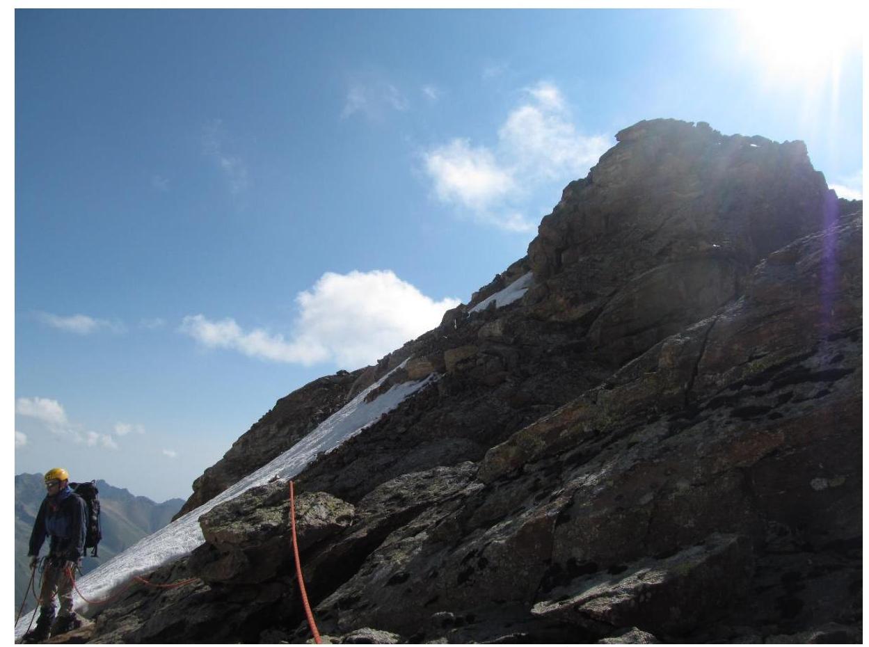
Fig. 8. Passage of the third section (descent). View of the summit.
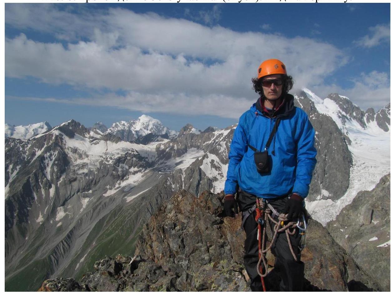
Fig. 9. Participant Galimzyanov T. R. on the summit.
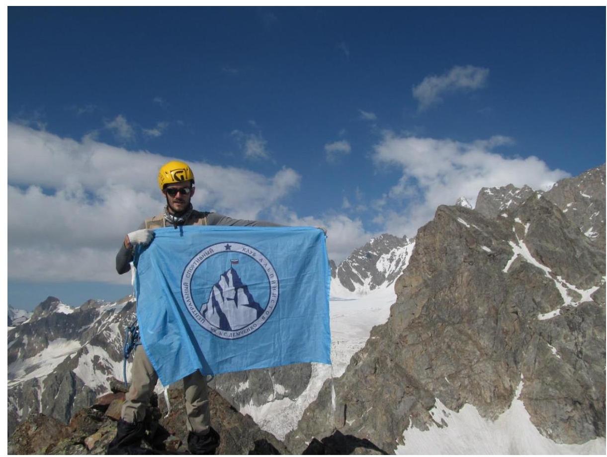
Fig. 10. Flag of the Demchenko named CSKA on the summit (and participant Zaryaev V. V.).
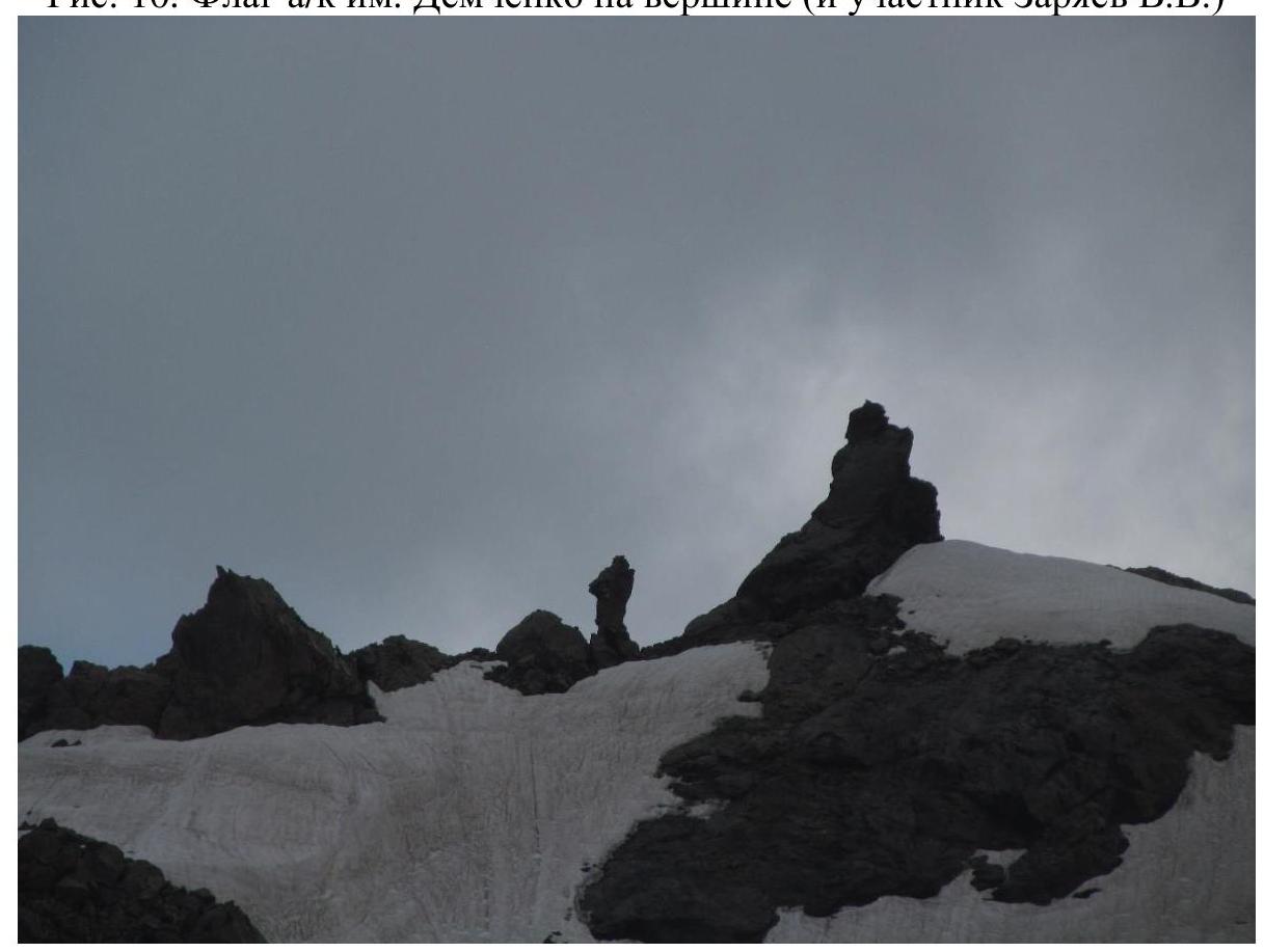
Fig. 11. Rock to the left of the Prividenie summit, creating an illusion of a moving person. This phenomenon suggested the name, reflecting the atmosphere of the glacier.