MOSCOW ALPINISM AND ROCK CLIMBING FEDERATION
Report
On the ascent of the CSKA Demchenko team
To the peak Dragon (3570 m)
Central Caucasus, Koshtan-krest ridge (43°02′37.87″ N, 43°17′10.62″ E)
via the western ridge. First ascent. Presumably 3B category of difficulty.
Galimzyanov T.R. — Zaryaev V.V.
Participants of the ascent
-
Team leader — Galimzyanov Timur Ravilievich. 2nd sports category
Coach: Kuznetsova E.V. Address: 115193, Moscow, Leninsky pr-t, 35, apt. 33. Contacts:
- gal_timur@yahoo.com
- +7 916 433 9820
-
Zaryaev Vladimir Valerievich1. 2nd sports category
Route 3B to the peak Dragon via the western ridge
Ascent passport
-
Central Caucasus, Koshtan-krest ridge, classifier section: 2.5.
-
Peak Dragon 3570 m (43°02′37.87″ N, 43°17′10.62″ E) via the western ridge
-
Proposed category of difficulty — 3B, first ascent
-
Route type: rock
-
Height difference: 240 m
Route length: 800 m. Average slope:
- main part of the route — 20 degrees
- entire route — 30 degrees
-
Number of pitons left on the route:
total — 0; including bolted pitons — 0.
-
Team's total climbing time: 2 hours 30 minutes (excluding descent and approach), 1 day
-
Team leader: Galimzyanov T.R., 2nd sports category
Participants: Zaryaev V.V., 2nd sports category
-
Coach: Kuznetsova E.V.
-
Departure from the overnight stay on the Gertsy glacier: 05:40, August 6, 2016. Route started: 06:30, August 6, 2016. Summit reached: 09:00, August 6, 2016. Return to the base camp: 12:40, August 6, 2016. Descent from the summit: via the ascent route.
-
Organization: Moscow Alpinism and Rock Climbing Federation, CSKA named after Demchenko
-
Person responsible for the report: Galimzyanov Timur Ravilievich. gal_timur@yahoo.com, +7 916 433 9820
General photograph of the summit
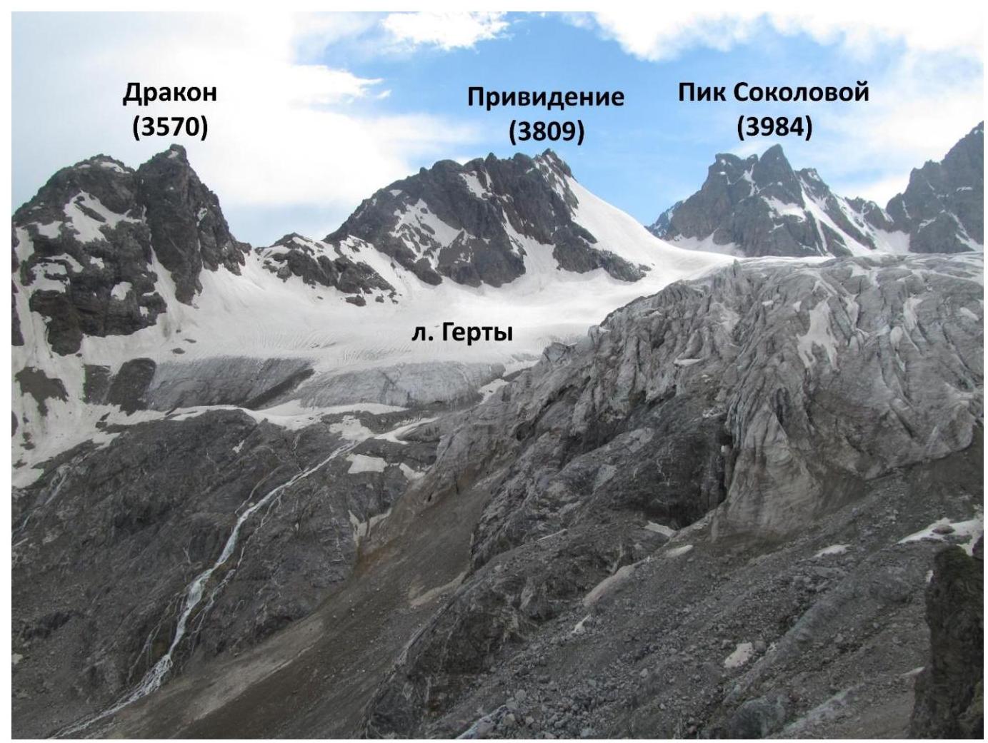
Figure 1. General photograph of the summit in the context of the area. Overview photo taken from the Shesti pass to the south.
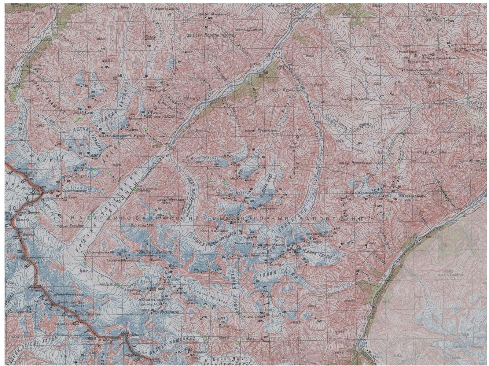
Figure 2. Map of the area.
Central Caucasus, Koshtan-krest ridge, Gertsy glacier
Brief characteristics of the area
"The Koshtan-krest ridge is located east of the peak Koshtantau and is a continuation of its Eastern ridge in the neighboring Mijirgi and Bezengi valleys, Dumala. The ridge closes the Dumala valley from the east and south, and the Tyutyun and Gertsy valleys from the north and west. The western part of the ridge lies between the Ullu-Auz and Trud passes with an average height of 4400 m. To the east of the peak Mira, a long, heavily serrated ridge descends with several unnamed peaks. The eastern part of the ridge, 3900–4000 m high, stretches from the Trud pass eastward to the peak Kayashkisubashi. Climbers rarely visit the peaks of this ridge, as the approach from the Bezengi alpine camp takes 1–2 days. All North and South walls and counterforts of the ridge, routes from 3B to 5B category of difficulty — are still waiting for their conquerors. The ascent to the peak Mira via the long, with several rock rises and unnamed peaks, Eastern ridge is very interesting, and the route is classified as 5B category of difficulty." The description from the site (http://www.kmvline.ru/lib/center/25.php↗) is used.
Approach
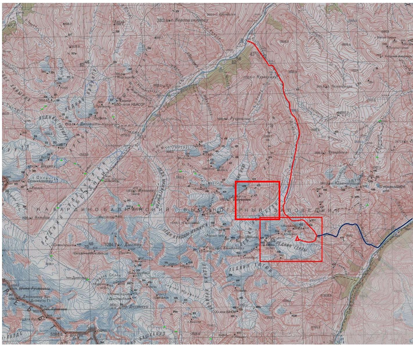
Figure 3. Route map from the Bezengi and Verkhnyaya Balkaria valleys to the Gertsy glacier. The climbing area is marked. There are two main paths leading to the Gertsy glacier:
- From the Bezengi valley up the Dumala valley, then through the Koshtan pass (1B) and the Shesti pass (1B) (the path is marked with a red line in Fig. 5). The path from the beginning of the Dumala valley to the overnight stay under the Koshtan pass takes 1 climbing day. The path from the overnight stay under the Koshtan pass through this pass, and then through the Shesti pass to the overnight stay on the Gertsy glacier takes 8–9 hours. In total, the approach to the base camp along this path takes 2 climbing days. This approach is the most logical.
- From the Verkhnyaya Balkaria valley along the Stoyansu river canyon through the Additional pass (1A), then through the Shesti pass. This route was taken by us on the descent in 1–1.5 climbing days. The ascent is estimated to take 1.5 climbing days from the beginning of the Stoyansu river canyon. It should be noted that this path is considered by us as the most logical in this direction due to the high labor intensity of the Additional pass. The descent initially went along scree and snowy couloirs, and then along steep grassy slopes; no overnight stay locations were noticed, so this canyon should be traversed in one day.
Overnight stays
No warm overnight stays on the scree were found. The base camp was set up on the glacier, in its orographically left part, near a stream.
Supplement
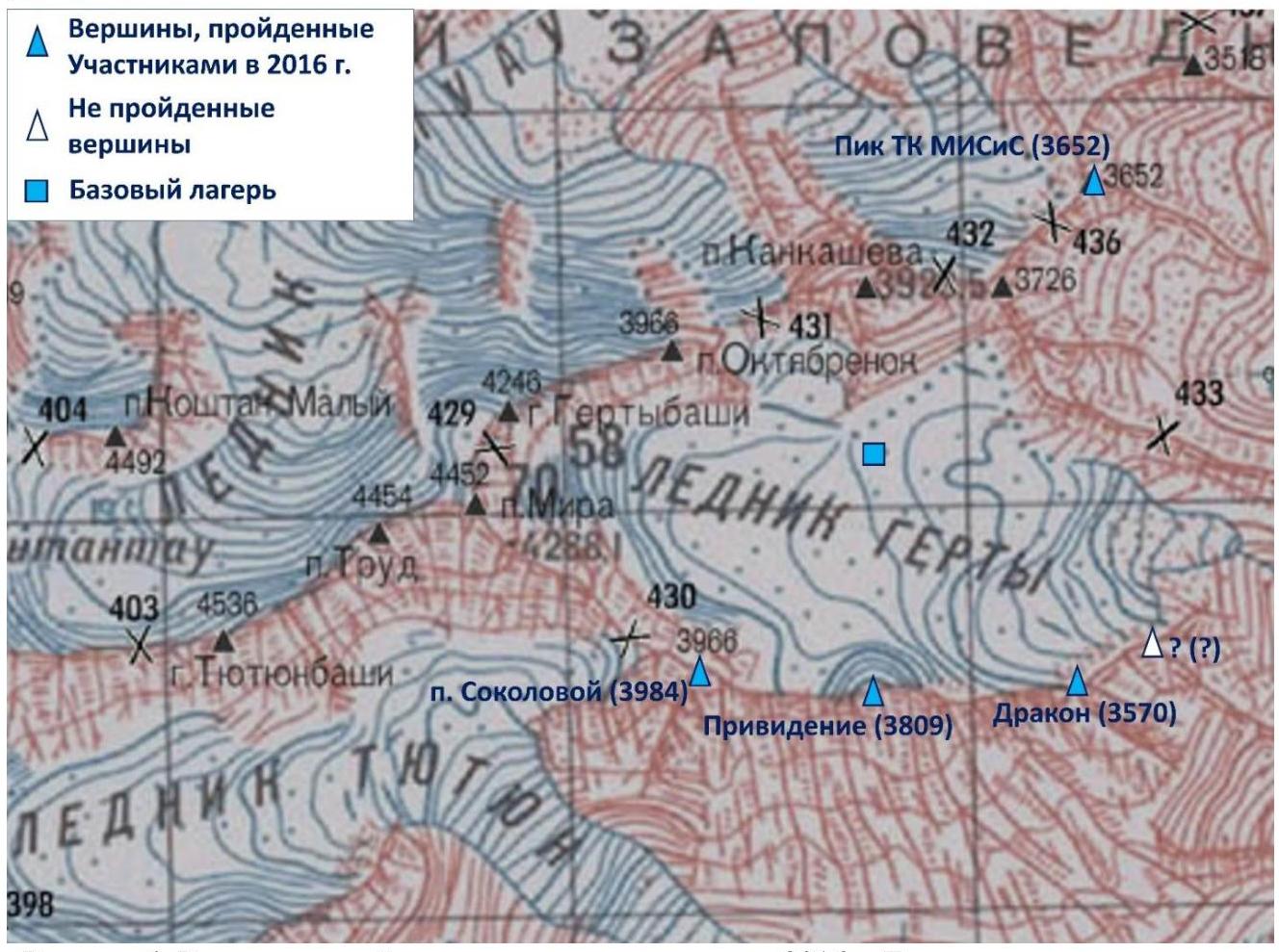
Figure 4. Peaks climbed during the 2016 trip. The peak that was not climbed is also marked (see the report on the ascent to the peak Dragon).
Photograph of the route profile
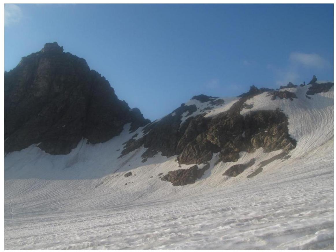
Figure 5. Peak Dragon. Photo from the Gertsy glacier, taken on August 6, 2016. Route via the 3rd ridge (3B).
Technical photograph of the summit
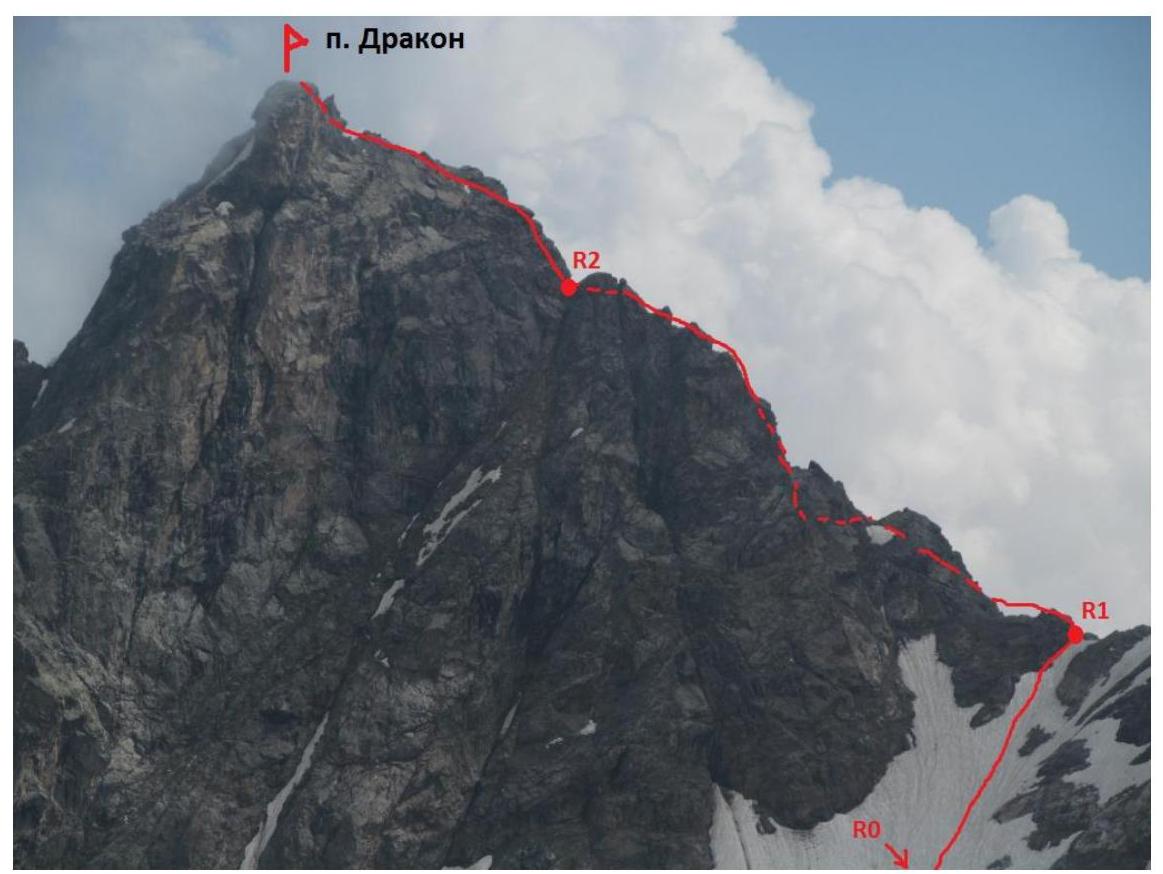
Figure 6. Peak Dragon. Photo from the Gertsy glacier, taken on August 6, 2016. Route via the 3rd ridge (3B).
Description of the route's difficulty sections
| Section | Length | Steepness | Terrain character | Category of difficulty | Number of pitons |
|---|---|---|---|---|---|
| R0–R1 | 200 m | 20–30 deg | Snow slope | II | 0 |
| R1–R2 | 400 m | 45 deg | Rocky ridge | III–V | 0 |
| R2–R3 | 200 m | 50 deg | Rocky ridge | III–V | 0 |
Brief description of the route passage by sections
From the overnight stay on the Gertsy glacier, approach the snow slope leading to a depression in the slope to the right of the peak Dragon (about 1500 m). R0–R1 Snow slope leading to a depression in the ridge. II 20°–30° 200 m. R1–R2 From the depression, start moving left along the rocky ridge towards the summit. Passing a small couloir on the right side of the ridge leads to a gendarme, which is tackled head-on (IV, 30 m). In dry weather, there may be a bypass to the left. After 50 m, the ridge becomes sharp and steep. This section is bypassed via a couloir and then along a rocky wall (V, 80°, 40 m, the first critical section, pleasant and interesting friction climbing), leading to the ridge. Further along a moderately complex rocky ridge to a saddle. III–V 40° 600 m. R2–R3 From the saddle, straight up (V, 30 m, the second critical section, overcoming a cornice may require IT). Belaying after the first rope is difficult. Further along a scree ridge to another saddle and, bypassing the pre-summit gendarme on the right, reach the summit. III–V 40° 200 m.
Descent
The descent from the route is made along the ascent path.
Recommendations for the route
The route can be assessed as interesting and relatively safe. Belaying is organized without particular problems, except for the first rope of the R2–R3 section. There are two critical sections:
- Both are rocky walls of above-average complexity.
- It is recommended to take rock shoes at least for the leader: the rocks are covered with moss and are quite slippery, the first key requires friction climbing.
Hazardous moments on the route:
- There are loose rocks, be careful.
Route length 800 m, height difference 250 m.
Photo illustration of the report

Figure 7. The ascent path is marked with a red line.
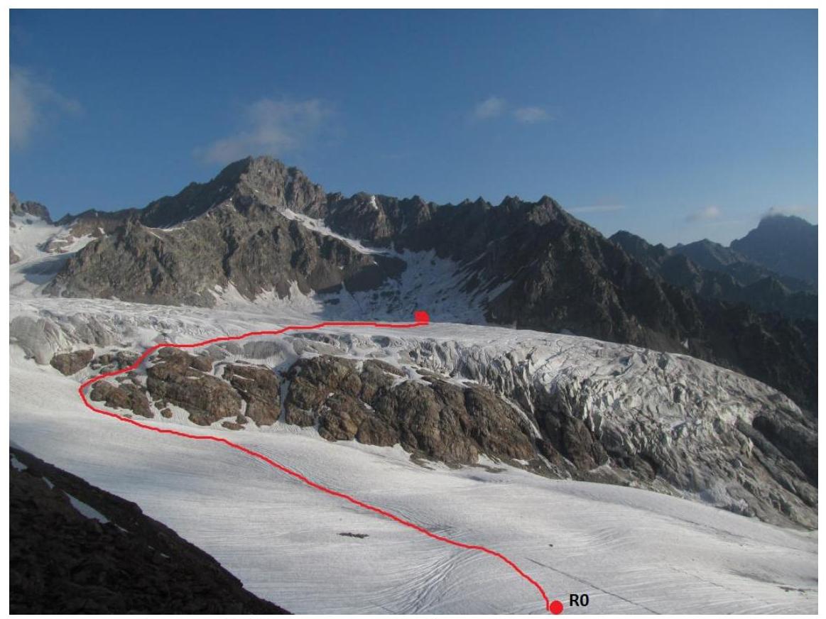
Figure 8. Path from the overnight stay location to the start of the route.

Figure 9. Saddle R1. Passage through the snowy couloir.
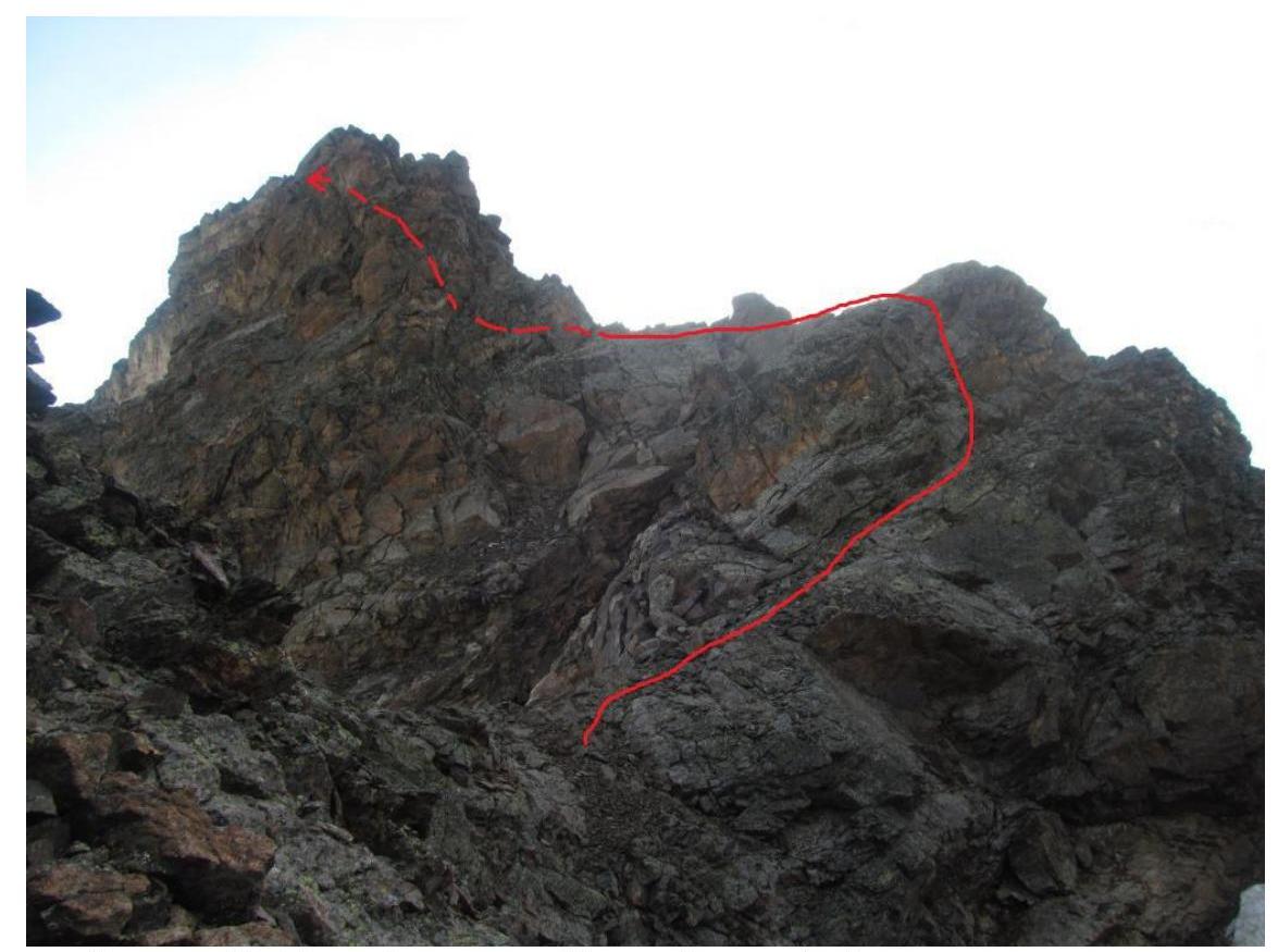
Figure 10. The first gendarme. The path is marked with a red line.
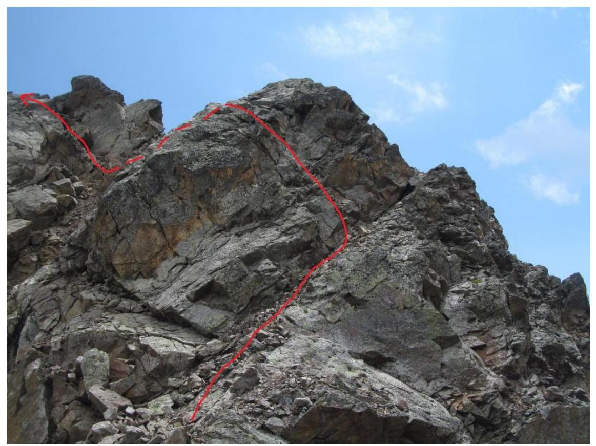
Figure 11. The first gendarme, closer view. The path is marked with a red line.
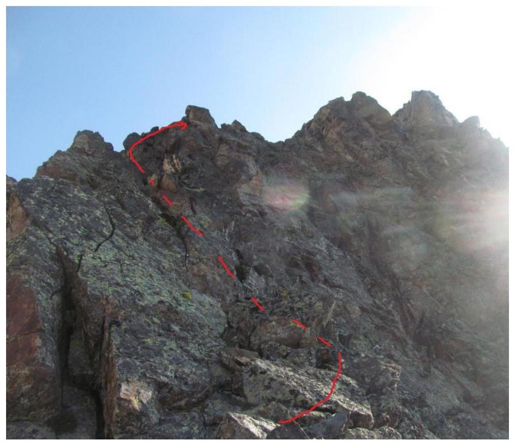
Figure 12. Direction of movement after reaching the ridge after passing the first gendarme.
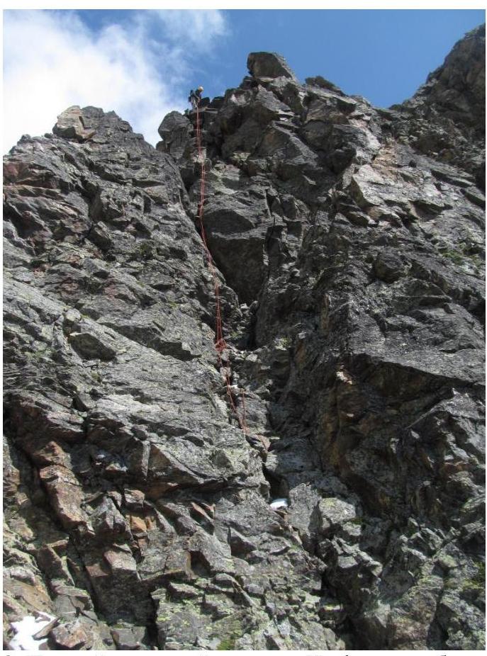
Figure 13. The first critical section. The photo shows work on the descent.
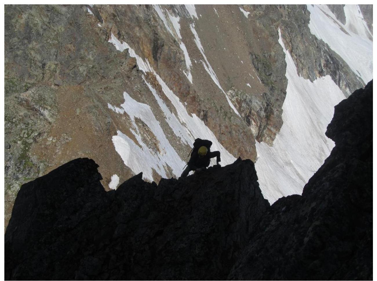
Figure 14. Passage of the first critical section by the second participant.
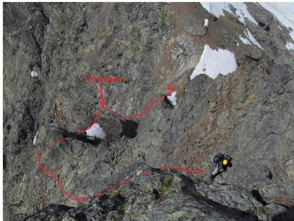
Figure 15. Beginning of the ridge after passing the first critical section. The first gendarme is visible.
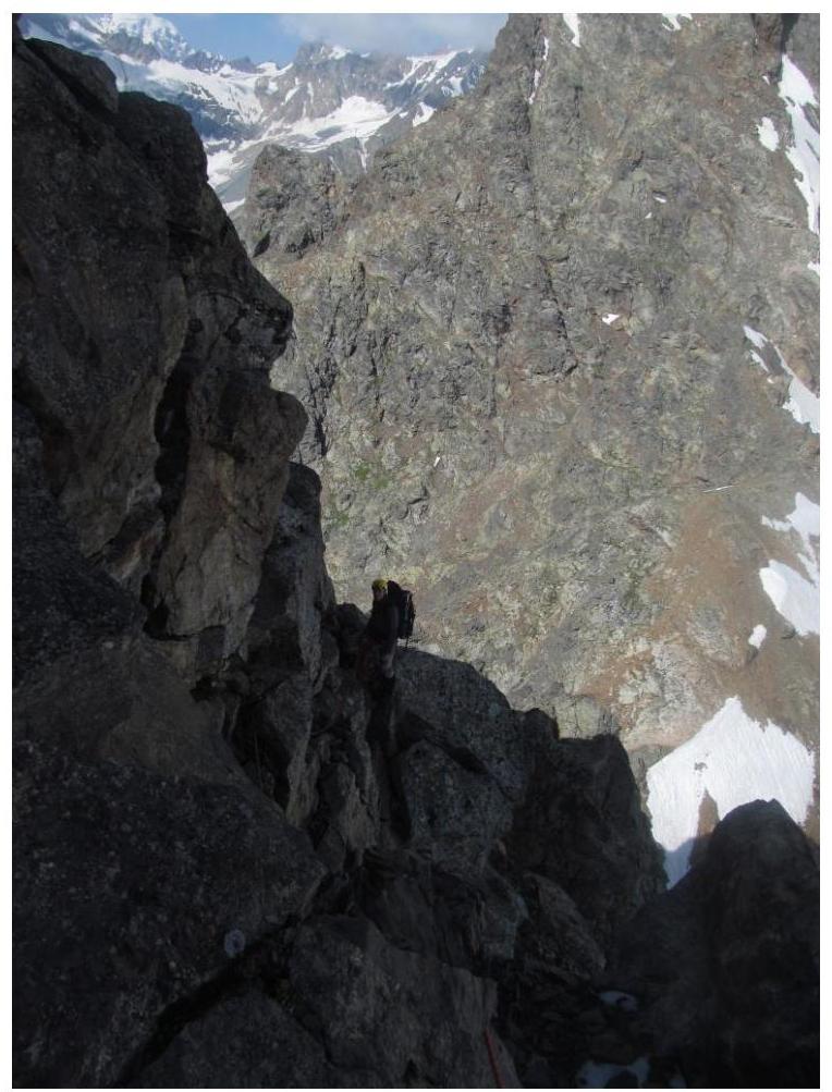
Figure 16. Passage of the second part of the ridge.
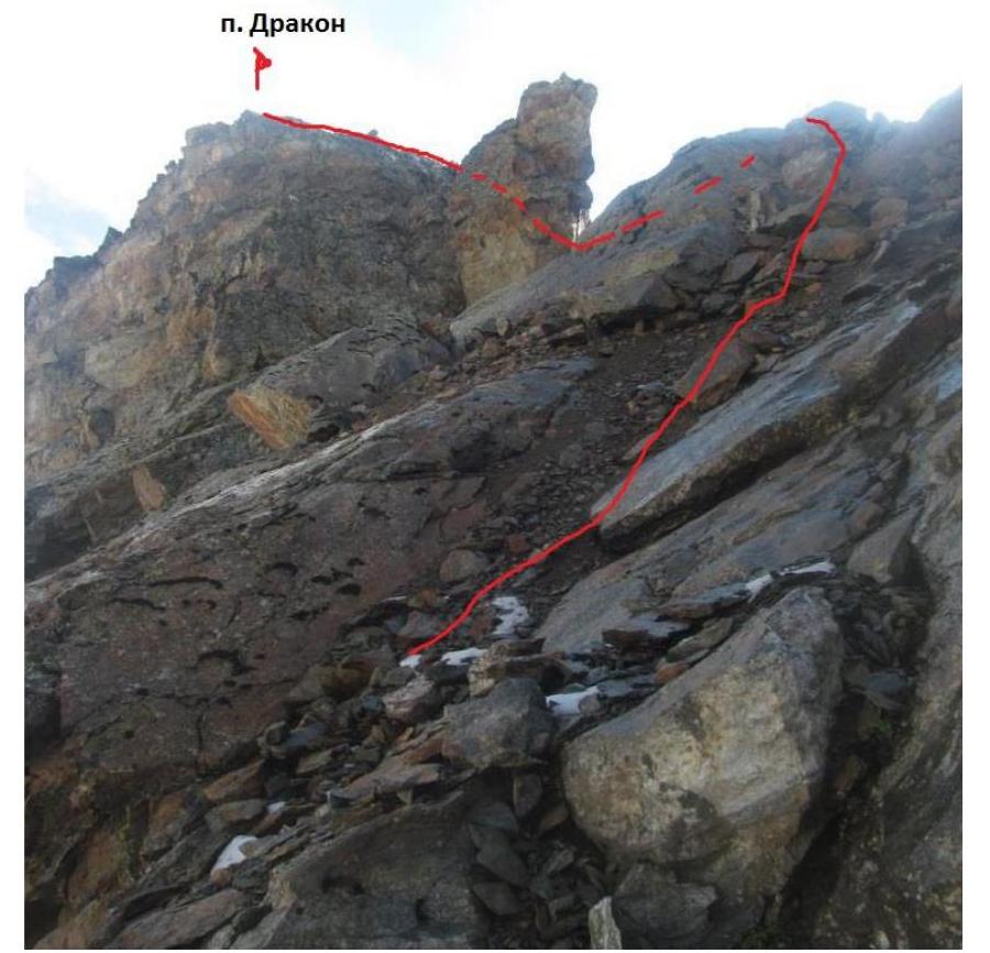
Figure 17. Pre-summit section of the ridge.
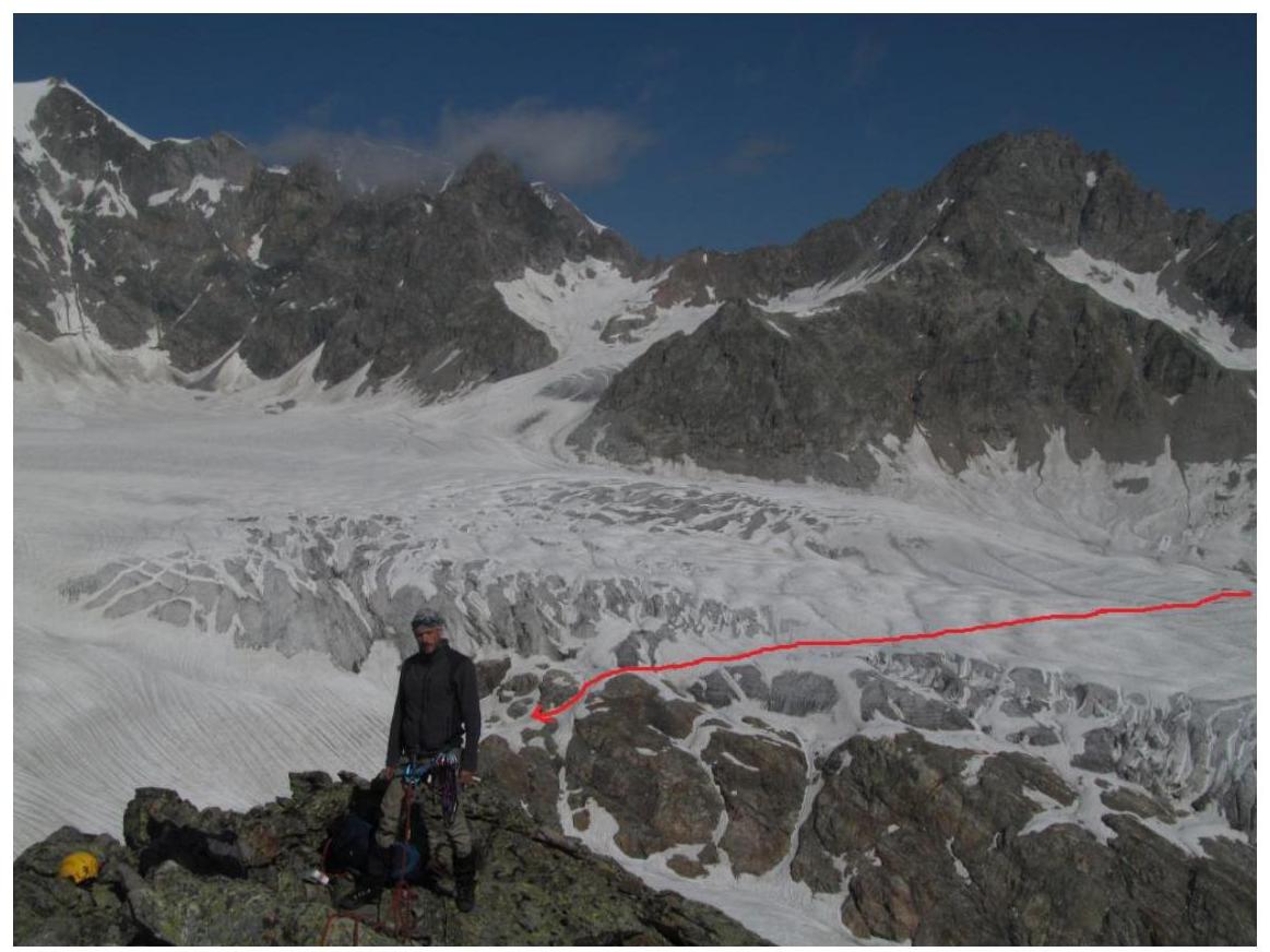
Figure 18. V.V. Zaryaev on peak Dragon. The path from the overnight stay to the start of the route is marked with a red line.
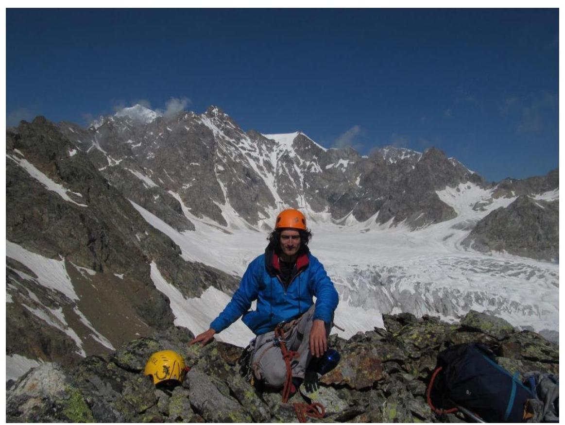
Figure 19. T. Galimzyanov on peak Dragon. View towards the Gertsy glacier.
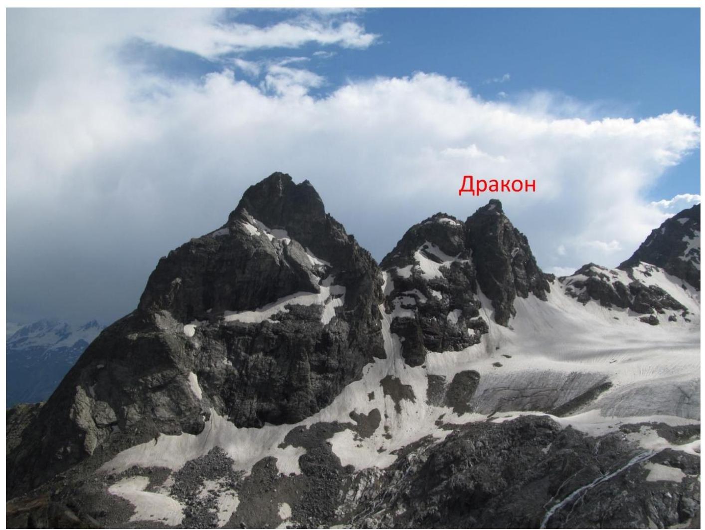
Figure 20. Peak Dragon from the Shesti pass. The peak to the left awaits its first ascenders (estimated category of difficulty of the simplest route — 3B–4A).
Footnotes
-
¹ Real full name — Nikitin Vladimir Valerievich ("Zaryaev" — a pen name) ↩