MOSCOW ALPINISM AND ROCK CLIMBING FEDERATION
Report
On the ascent of the CSKA team named after Demchenko
To V. 3984 m. Working name — Pik Sokolovoy (Sokolova) Central Caucasus, Koshtan-krest ridge (43°02′42.23″ N. 43°15′46.61″ E)
via the Western ridge First ascent presumably 3A category of difficulty
Zaryaev V.V. — Galimzyanov T.R.
Dedicated to Ekaterina Sokolova (1984–2014)
Participants of the ascent
- Leader — Zaryaev Vladimir Valerievich¹. 1st sports category
Address: 117465, Moscow, Profsoyuznaya st., 156, b. 1, apt. 384. VVZaryaev@yandex.ru, +7 903 105 81 48
- Galimzyanov Timur Ravilievich. 2nd sports category
Coach: Kuznetsova E.V.
Route 3A to the summit 3984 via the Western ridge
Ascent passport
- Central Caucasus, Koshtan-krest ridge area, Gerty glacier, classifier section: 2.5.
- 3984 m (43°02′42.23″ N. 43°15′46.61″ E) via the Western ridge
- Proposed — 3A category of difficulty, first ascent
- Route type: combined
- Route elevation gain: 450 m (according to Google Earth)
Route length: 1100 m. Average steepness: — main part of the route — 30°; — entire route — 30°.
- "Hooks" left on the route:
total — 0; including bolted hooks — 0.
- Team's travel hours: 4 hours (excluding descent and approach), 1 day
- Leader: Zaryaev V.V., 2nd sports category
Participants: Galimzyanov T.R., 2nd sports category
- Coach: Kuznetsova E.V.
- Departure to the route from overnight stays on the Gerty glacier: 5:10, August 5, 2016
Route started: 6:10, August 5, 2016 Summit reached: 10:20, August 5, 2016 Return to the base camp: 14:40, August 5, 2016 Descent from the summit: via the ascent route.
-
Organizations: Moscow Alpinism and Rock Climbing Federation, CSKA named after Demchenko
-
Responsible for the report — Zaryaev Vladimir Valerievich. VVZaryaev@yandex.ru, +7 903 105 81 48
General photograph of the summit
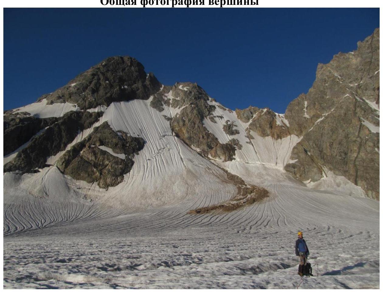
Fig. 1. 3984 m from the Gerty glacier. Overview photograph
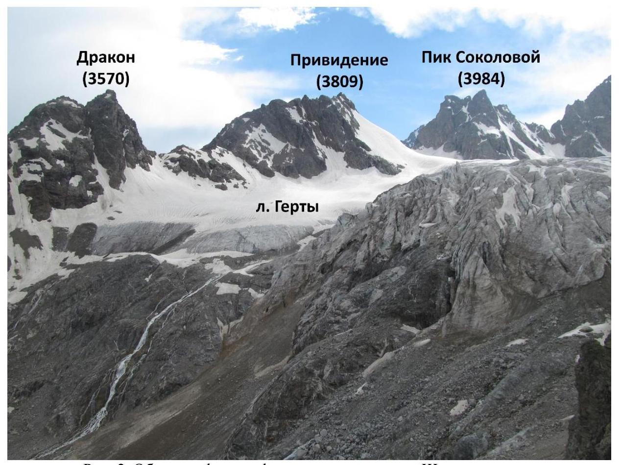
Fig. 2. Overview photograph taken from the Shesti pass to the south.
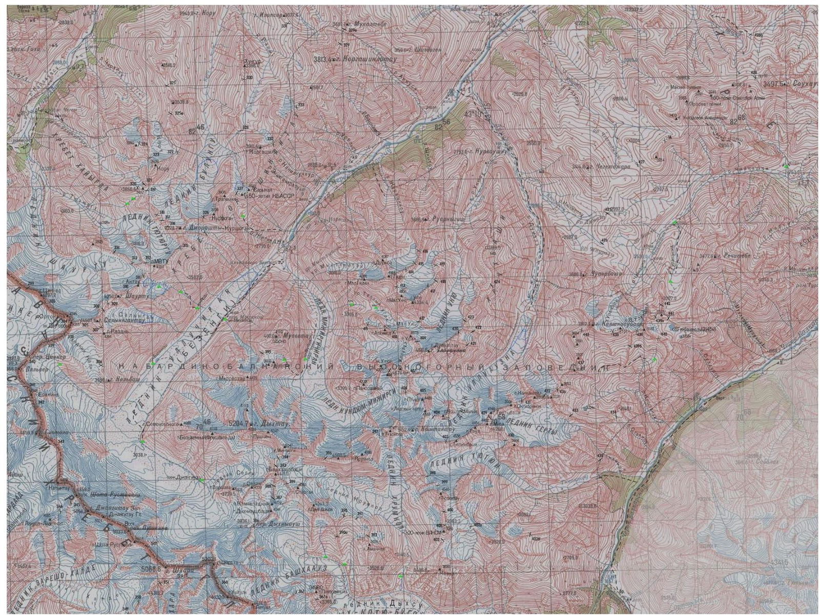
Fig. 3. Map of the area.
Central Caucasus, Koshtan-krest ridge, Gerty glacier.
Brief characteristics of the area
"The Koshtan-krest ridge is located to the east of the Koshtantau peak and is a continuation of its Eastern ridge in the neighboring Dumala valley, between the Mizhirgi and Bezengi valleys. The ridge closes the Dumala valley from the east and south, and the Tyutyun and Gerty valleys from the north and west.
The western part of the ridge lies between the Ullu-Auz and Trud passes with an average height of 4400 m. To the east from the Pik Mira peak, a long, heavily serrated ridge descends with several unnamed peaks. The eastern part of the ridge, 3900–4000 m high, stretches from the Trud pass eastward to the Kayashkisubashi peak.
Climbers rarely visit the peaks of this ridge, as the approach to them from the Bezengi alpine camp takes 1–2 days. All the northern and southern walls and counterforts of the ridge, with routes from 3rd to 5th category of difficulty, are still waiting for their conquerors. The ascent to Pik Mira via the long Eastern ridge, with several rocky ascents and unnamed peaks, is very interesting, and the route is classified as 5th category of difficulty."
The description is taken from the website (http://www.kmvline.ru/lib/center/25.php↗)
Approach
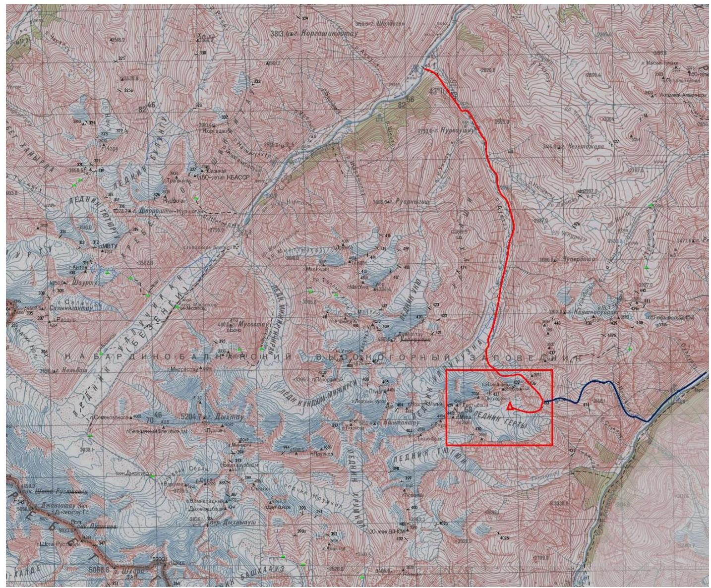
Fig. 4. Route map from the Bezengi and Verkhnyaya Balkaria valleys to the Gerty glacier. The climbing area is marked. There are two main paths to the Gerty glacier:
— Through the Kotur-Tau pass (4150 m) and the Kotur-Tau glacier; — Through the Kangur pass (4200 m) and the Kangur glacier.
- From the Bezengi valley up the Dumala valley, then through the Koshtan pass (1B) and the Shesti pass (1B) (the path is marked with a red line on Fig. 5). The path from the beginning of the Dumala valley to the overnight stay under the Koshtan pass takes 1 travel day. The path from the overnight stay under the Koshtan pass through this pass, and then through the Shesti pass to the overnight stay on the Gerty glacier takes 8–9 hours. In total, the approach to the base camp along this path takes 2 travel days. This approach is the most logical.
- From the Verkhnyaya Balkaria valley along the Stoyansu river canyon through the Additional pass (1A), then through the Shesti pass. This route was taken by us on the descent in 1–1.5 travel days. The ascent is estimated to take 1.5 travel days from the beginning of the Stoyansu river canyon. It should be noted that this path is considered by us as the most logical in this direction due to the high labor intensity of the Additional pass. The descent initially followed scree and snowy couloirs, and then steep grassy slopes. No overnight stays were observed, so this canyon must be traversed in one day.
Overnight stays
No warm and suitable overnight stays were found on the scree. The base camp was set up on the glacier, on its orographic left side, near a stream.
Supplement
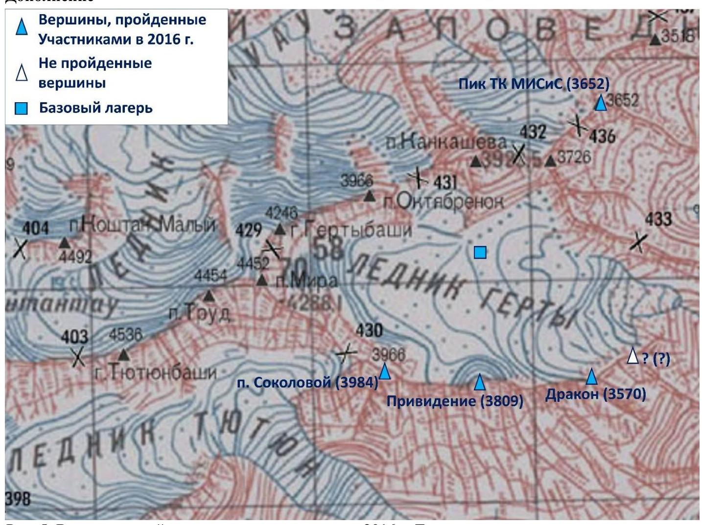
Fig. 5. Peaks climbed during the 2016 trip. The peak that was not climbed is also marked (see the report on the ascent to the Dragon peak). Photograph of the route profile.

Fig. 6. Route of the ascent to peak 3984. Description of the complexity of the route sections
| Section | Length | Steepness | Relief characteristics | Category of difficulty |
|---|---|---|---|---|
| R0–R1 | 600 m | 30° | Snow-ice slope | 2 |
| R1–R2 | 300 m | 30–50° | Rocky ridge | 3 |
| R2–Summit | 200 m | 40–50° | Destroyed rocks | 3 |
Brief description of the route passage by sections
The approach along the glacier from the overnight stay on the orographic left side of the Gerty glacier takes about 1 hour (1500 m, rope teams).
R0–R1. Ascent up the snow-ice slope to the saddle to the left of the ROM pass. The bergschrund at the beginning of the slope is bypassed to the right, then traverse to the left under the ice couloir². Movement with alternate insurance using ice axes. Category of difficulty: 2, 30°, 600 m.
R1–R2. Move to the right along the ridge towards the summit. Before the first gendarme, move to the right and pass along its right edge (see Fig. 9), then climb up the destroyed rocks to gendarme 1. Then move along the ridge to gendarme 1a (see Fig. 7). Bypass it to the right and reach the scree saddle. Insurance — simultaneous, using rocky outcrops and large stones. If necessary, there is a possibility to place friends and nuts. Category of difficulty: 3, 30–50°, 300 m.
R2–Summit. From the saddle, ascend directly up the destroyed rocks first to gendarme 2, and then to the summit. Insurance with nuts and friends. Category of difficulty: 3, 40–50°, 200 m.
Descent
The descent from the route is made via the ascent path.
Route recommendations
The route is relatively long and labor-intensive. The complexity of the sections is uniform, with no pronounced crux. Hazards on the route are associated with destroyed rocks on the ridge (many loose stones). Additionally, the snowy slope is somewhat rockfall-prone on the descent: it is advisable to traverse as quickly as possible to the orographic left part of the slope (Fig. 14).
Route length 1100 m, elevation gain 450 m.
Photo illustration of the report
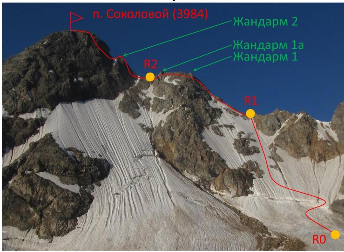
Fig. 7. Main relief elements on the route
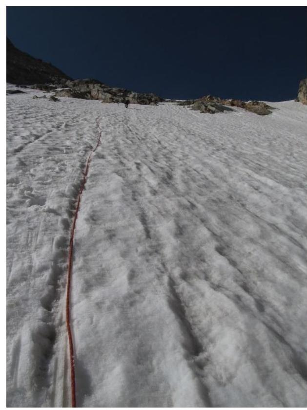
Fig. 8. Passage of section R0–R1

Fig. 9. Passage of the 1st gendarme
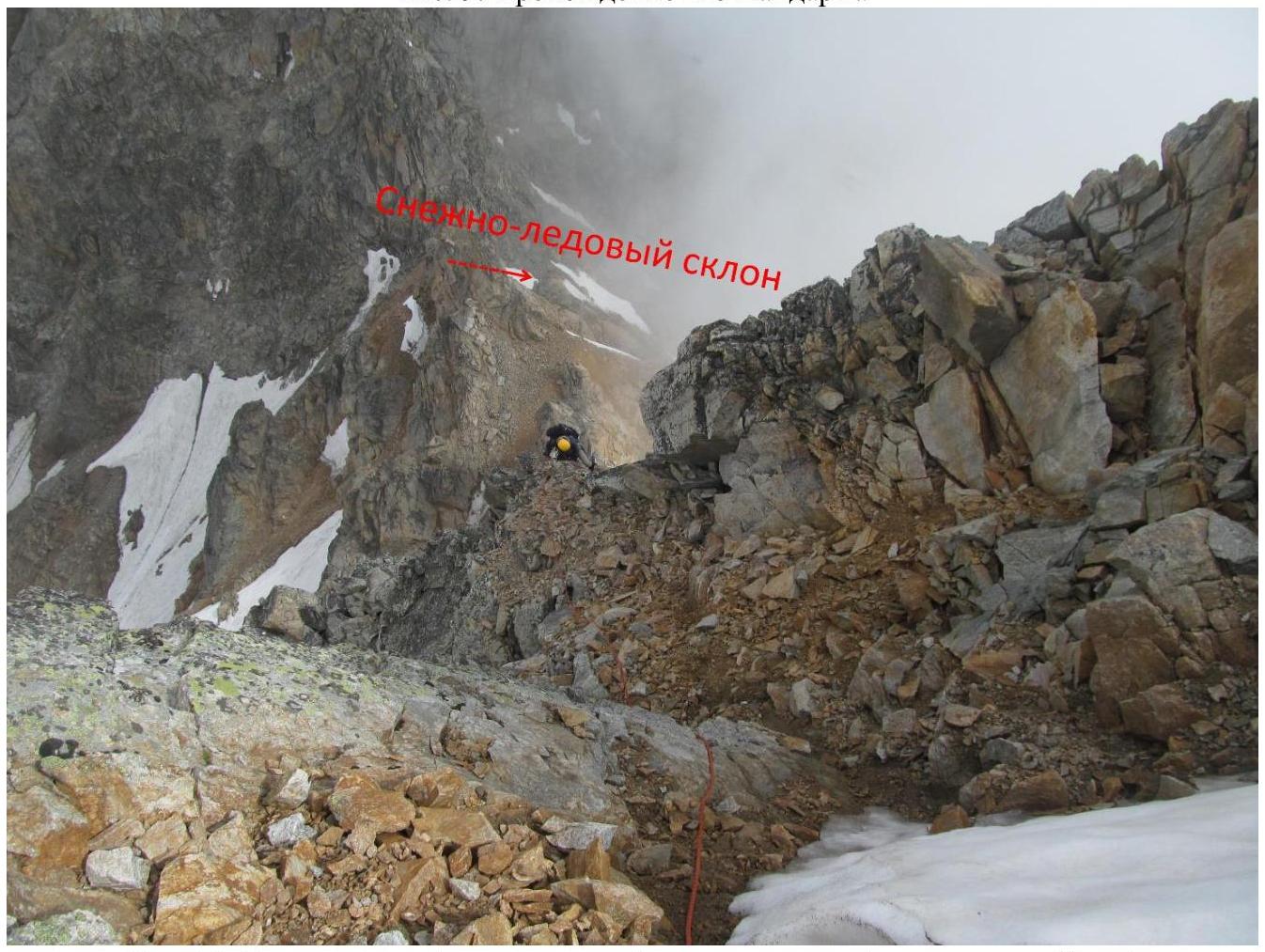
Fig. 10. Passage of the 1st gendarme (view from gendarme 1 towards Pik Mira)
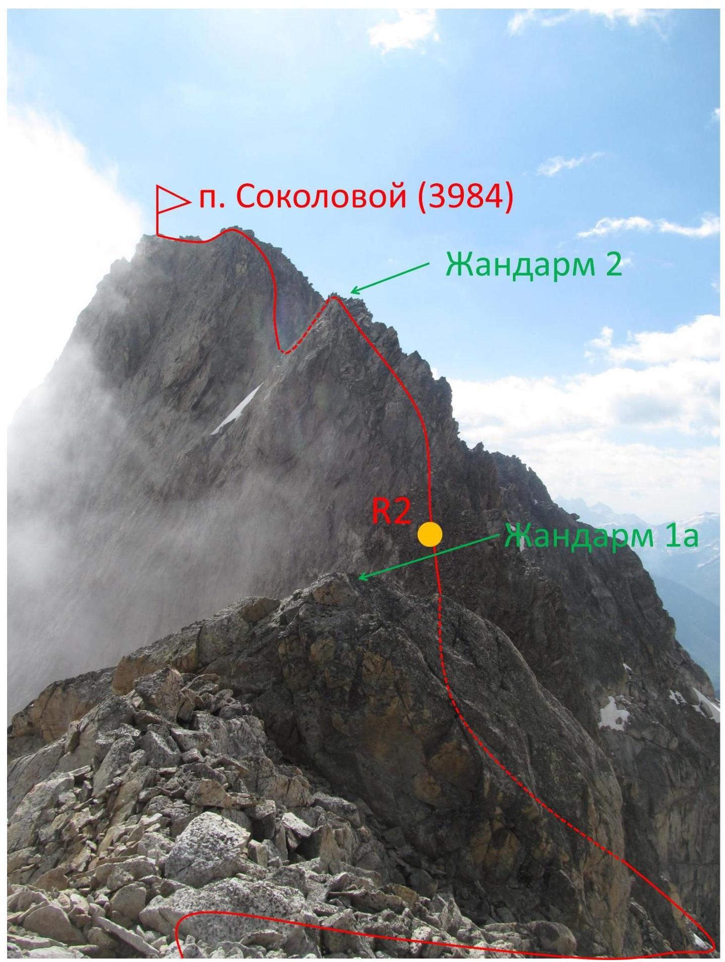
Fig. 11. Bypass of gendarme 1a and passage of section R2–Summit.
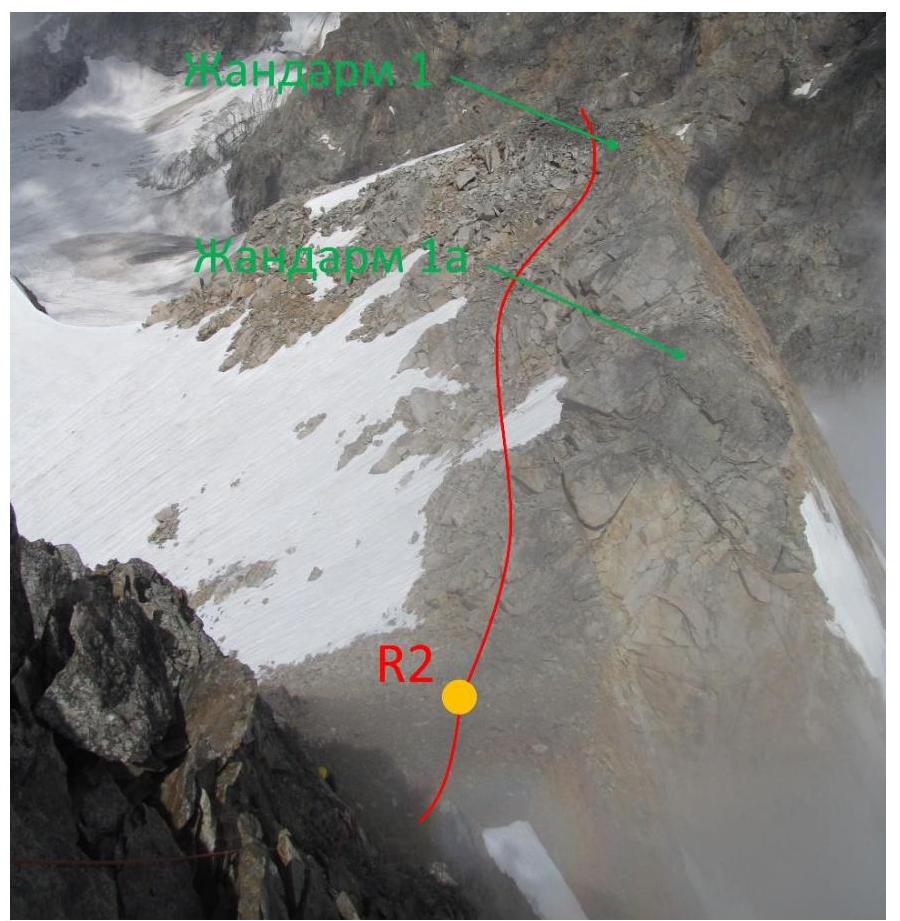
Fig. 12. Passage of the 2nd gendarme by the 2nd participant (view from the 2nd gendarme)
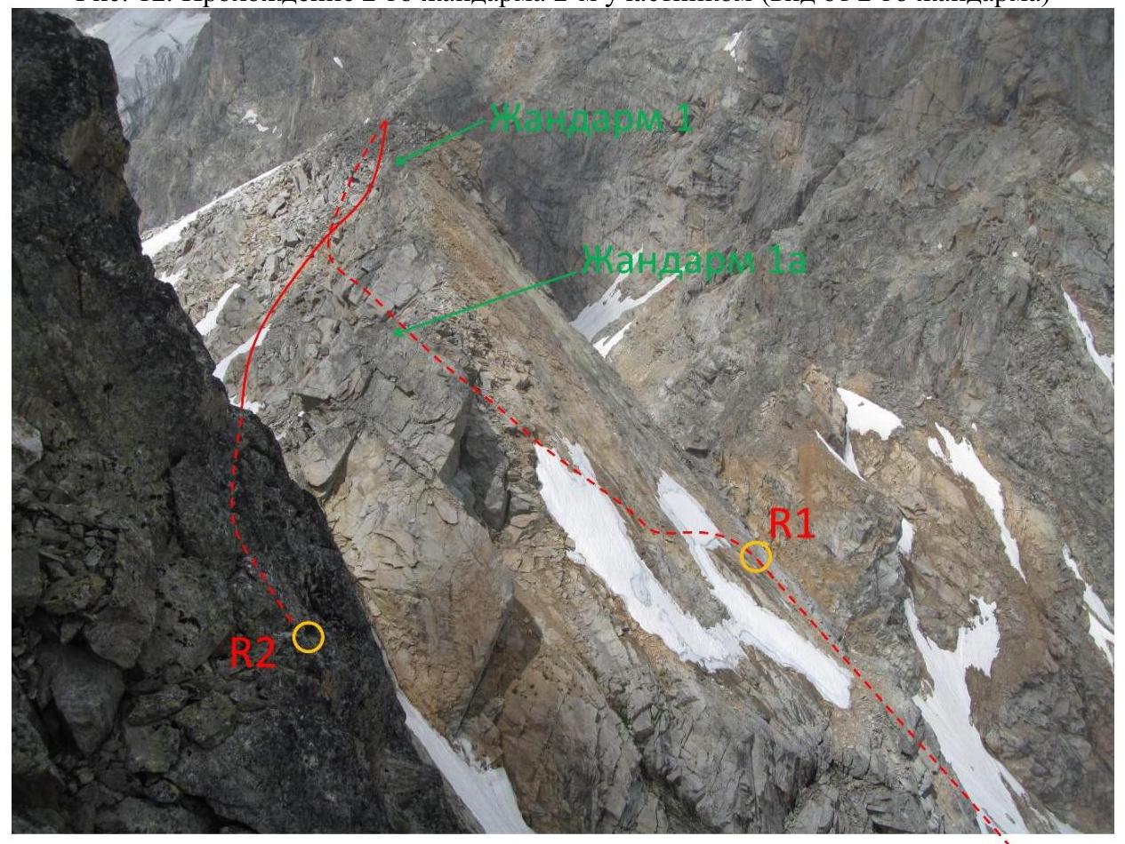
Fig. 13. Section R1–R2. View from the 2nd gendarme
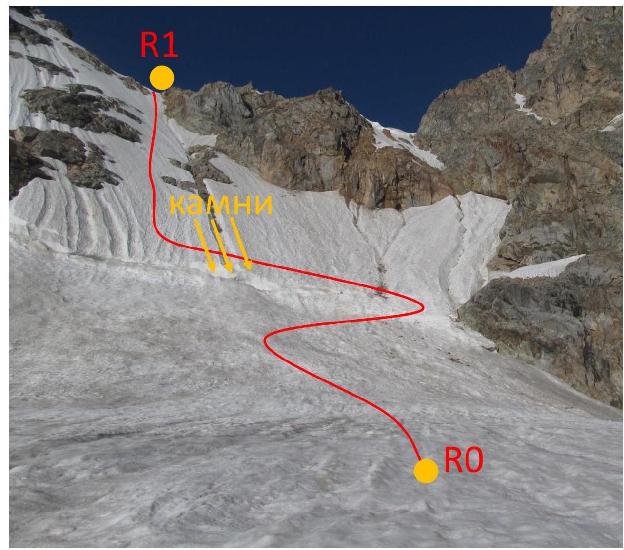
Fig. 14. Rockfall-prone section of the route on the descent
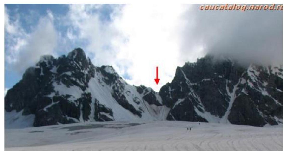
Fig. 15. Peak 3984 (left). Photo from Nikiforov K.V.'s report on a 4th category difficulty trip.
http://www.mountain.ru/article/article_display1.php?article_id=3667↗
Dedicated to Ekaterina Sokolova (1984–2014)
Footnotes
-
¹ Actual full name: Nikitin Vladimir Valerievich (Zaryaev — pen name) ↩