Fig. 3.
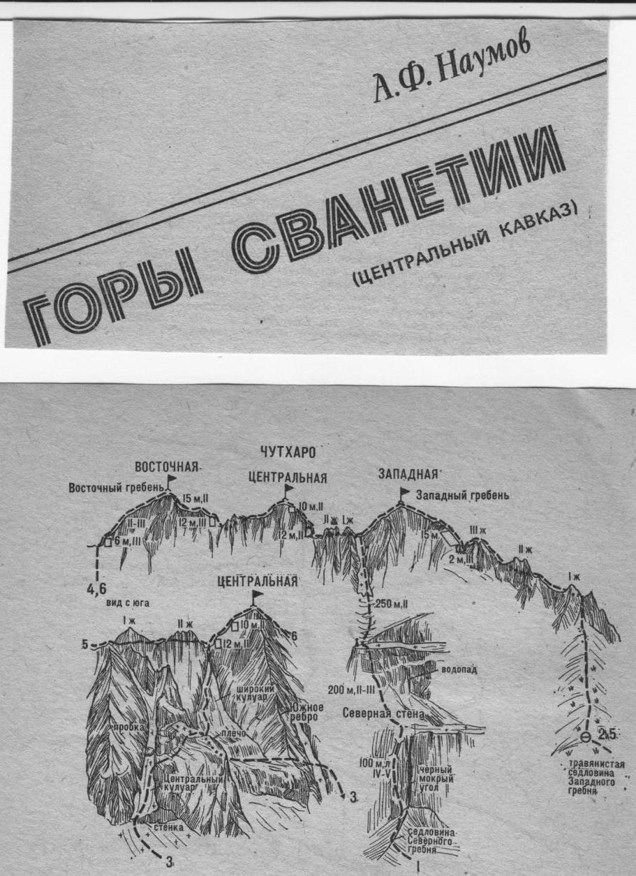
5. Chutaro Zapadnaya — Vostochnaya
(a rock route, A. Naumova, 3B cat. diff., fig. 2, 3). From Chutaro Zapadnaya (point 2) descend via a wide easy 100–120-meter rocky Vostochny ridge. Then, bypassing the I and II gendarmes of the saddle from the right along the ledges and easy crumbling rocks, approach the 10–12-meter wall at the base of the Zapadny ridge of Chutaro Tsentralnaya summit. Up the moderately difficult rocks of the wall (piton) straight up. Then ascend 50–60 m traversing steep moderately difficult rocks on the right side of the Zapadny ridge (protection) of Chutaro Tsentralnaya. Then, via talus, bypass the summit tower from the right, exiting onto its Vostochny ridge. Here, turn left and ascend the easy wide 60–80-meter Vostochny ridge to the summit of Chutaro Tsentralnaya. From Zapadnaya — 1–1.5 hours.
From Tsentralnaya, descend via the easy rocky Vostochny ridge. Further down the easy ridge, overcoming all low gendarmes in the zone, exit onto the saddle below the Zapadny ridge of Chutaro Vostochnaya. From the saddle, overcoming a 12–15-meter moderately difficult wall (piton) in the zone, ascend the easy 150–200-meter rocky Zapadny ridge to the foot of the ascent of Chutaro Vostochnaya. Up the steep rocks of the 15-meter ascent («live» rocks, protection) to the summit of Chutaro Vostochnaya. From Tsentralnaya — 1–1.5 hours.
A descent variation to the saddle is via the ascent route along the Zapadny ridge. From the saddle, descend left (south) initially along the left, then the right side of a wide rocky couloir (rocks, «live» rocks, protection), then via «ram’s foreheads», easy rocks, talus, and grassy slopes to the base camp.