Report
on the first ascent to the summit 3310 m (300 years of the RAS) via the Western slope, category 2A, by the group from the "Shkhelda" alpine camp on July 5, 2023
I. Climbing Report Form
| № | 1. General Information | |
|---|---|---|
| 1.1 | Full name, sports rank of the leader | Korolev Alexander Viktorovich, CMS |
| 1.2 | Full names, sports ranks of the participants | 1. Belousov Alexey Georgievich, 3rd sports rank 2. Nikitin Andrey Borisovich, CMS |
| 1.3 | Full name of the coach | Korolev Alexander Viktorovich |
| 1.4 | Organization | LLC "Shkhelda" (alpine camp "Shkhelda") |
| 2. Characteristics of the Climb | ||
| 2.1 | Region | Central Caucasus |
| 2.2 | Valley | Shkheldy (Adyl-Su) (Gaybaynu ridge) |
| 2.3 | Section number according to the 2020 classification table | 2.4 |
| 2.4 | Name and height of the summit | 3310 (300 years of the RAS) (Russian Academy of Sciences) |
| 2.5 | Geographic coordinates of the summit (latitude/longitude), GPS coordinates*(1) | 43.20542 42.67106 |
| 3. Route Characteristics | ||
| 3.1 | Route name | Via the Western slope |
| 3.2 | Proposed category of difficulty | 2A |
| 3.3 | Degree of route exploration | First ascent |
| 3.4 | Relief characteristics of the route | Rocky |
| 3.5 | Elevation gain of the route (altimeter or GPS data) | 560 m |
| 3.6 | Route length (in meters) | 1230 m |
| 3.7 | Technical elements of the route (total length of sections with different categories of difficulty, indicating the relief type) | 1B cat. diff. — 1110 m — rocky 2A cat. diff. — 90 m — rocky 3A cat. diff. — 30 m — rocky |
| 3.8 | Descent from the summit | Via the ascent route |
| 3.9 | Additional route characteristics | Periods: November to June, the route is snowy; June–October, rocky, waterless |
| 4. Characteristics of the Team's Actions | ||
| 4.1 | Time taken (team's walking hours, in hours and days) | 10 h, 1 day |
| 4.2 | Overnight stays | None |
| 4.3 | Start of the route | July 5, 2023 |
| 4.4 | Reaching the summit | July 5, 2023 |
| 4.5 | Return to the base camp | July 5, 2023 |
| 5. Person Responsible for the Report | ||
| 5.1 | Full name, e-mail | Korolev Alexander Viktorovich, aleksandrkdiver@mail.ru |
(1) — filled in only if the summit is not listed in the Electronic Russian Classifier of Routes to Mountain Summits.
1.1. General Photo
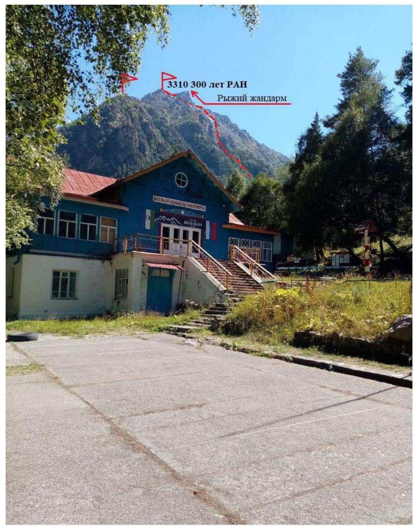
PHOTO 1: A. Korolev's route to the summit 3310 (300 years of the RAS) via the Western slope, category 2A. Taken on July 1, 2023. View from the "Shkhelda" alpine camp.
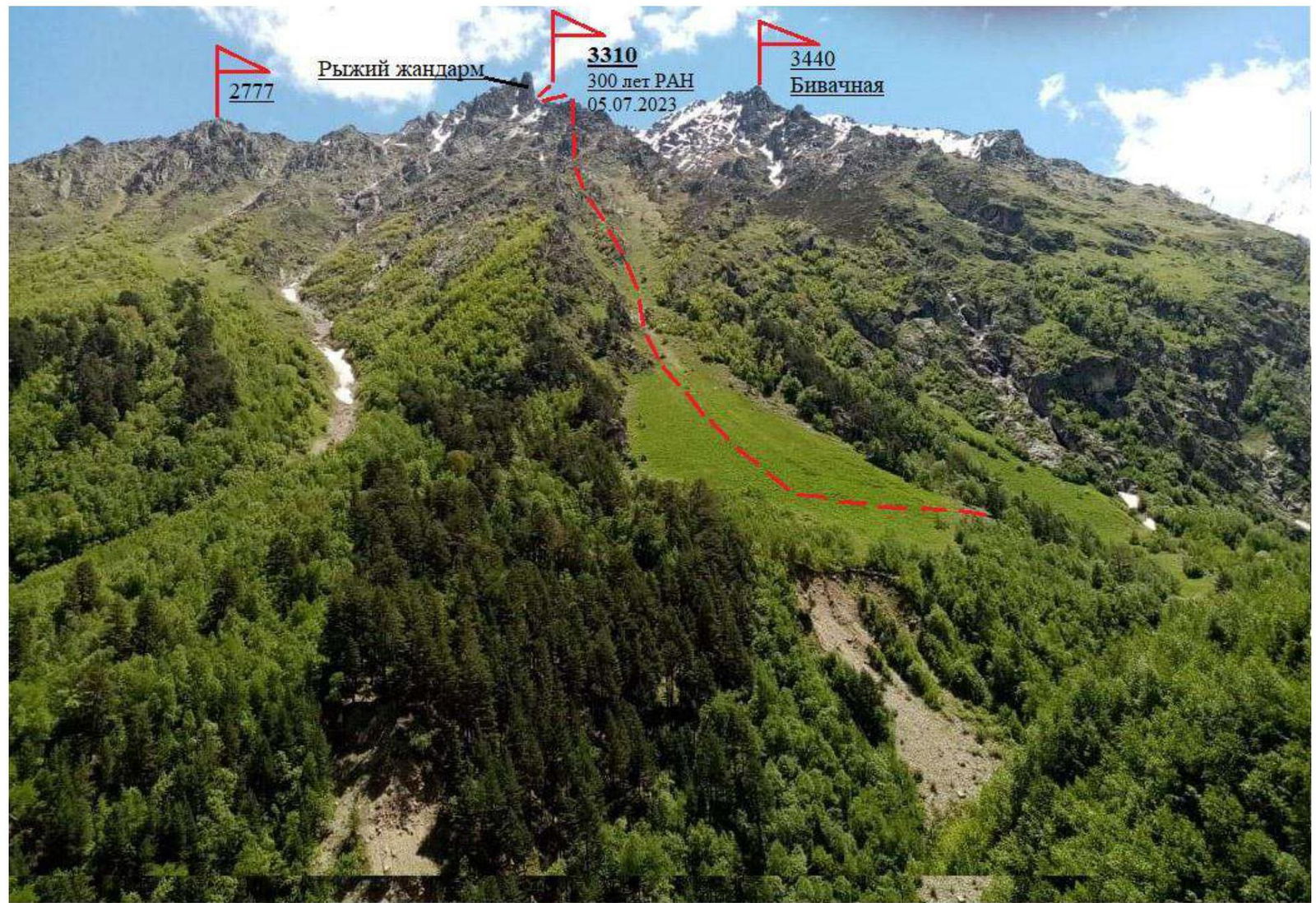
PHOTO 2: View of the Gaybaynu ridge from the Shkhelda river valley — A. Korolev's route to the summit 3310 (300 years of the RAS) via the Western slope, category 2A. Taken on July 1, 2023.
II. Description of the Ascent
1. Characteristics of the Object of the Ascent
Geographic Location of the Area
The object of the ascent, summit 3310 m, has coordinates: Lat. 43.20542 Long. 42.67106 located in the northern spur of the Main Caucasian Range, branching off from the peak Bzhedukh (4280), named the Gaybaynu ridge. This ridge has 5 summits, 3 of which were climbed in 2022. Summits 3310 and 2777 were unclimbed as of June 1, 2023. The Gaybaynu ridge is a watershed between the Kashkatash and Shkhelda valleys. The first ascent of summit 3310 was made by a group of climbers from the "Shkhelda" alpine camp on July 5, 2023. It is located near the "Shkhelda" alpine camp at the confluence of the Adyl-su and Shkhelda rivers, 3 kilometers from the Baksan valley (Elbrus settlement). The path leads along a trail into the Shkhelda valley to the "beach." Just above the "beach," a suspension bridge crosses to the right bank of the Shkhelda river (1 hour's walk). After 30–40 minutes of descent, the path exits into a wide, grassy couloir. Ascending its dry slope leads to the start of the rocky Western ridge. This is the beginning of the route. The ascent from the "Shkhelda" alpine camp takes 1.5–2 hours. The route to summit 3310 is west-facing and has a mixed character from November to mid-June. The route is a one-day climb. Climbers are treated to magnificent panoramas of the Shkhelda valley and the Kashkatash glacier.
Map-scheme of the area
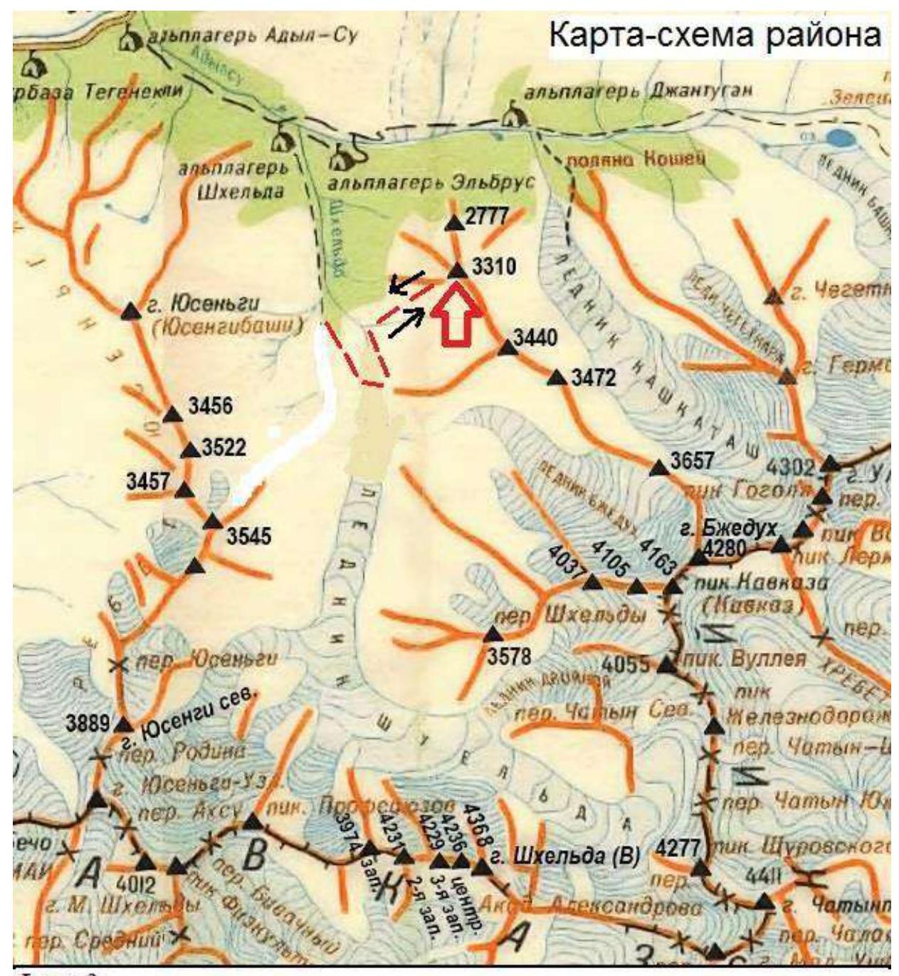
PHOTO 3: — The group's path
1.3. Photopanorama of the Area
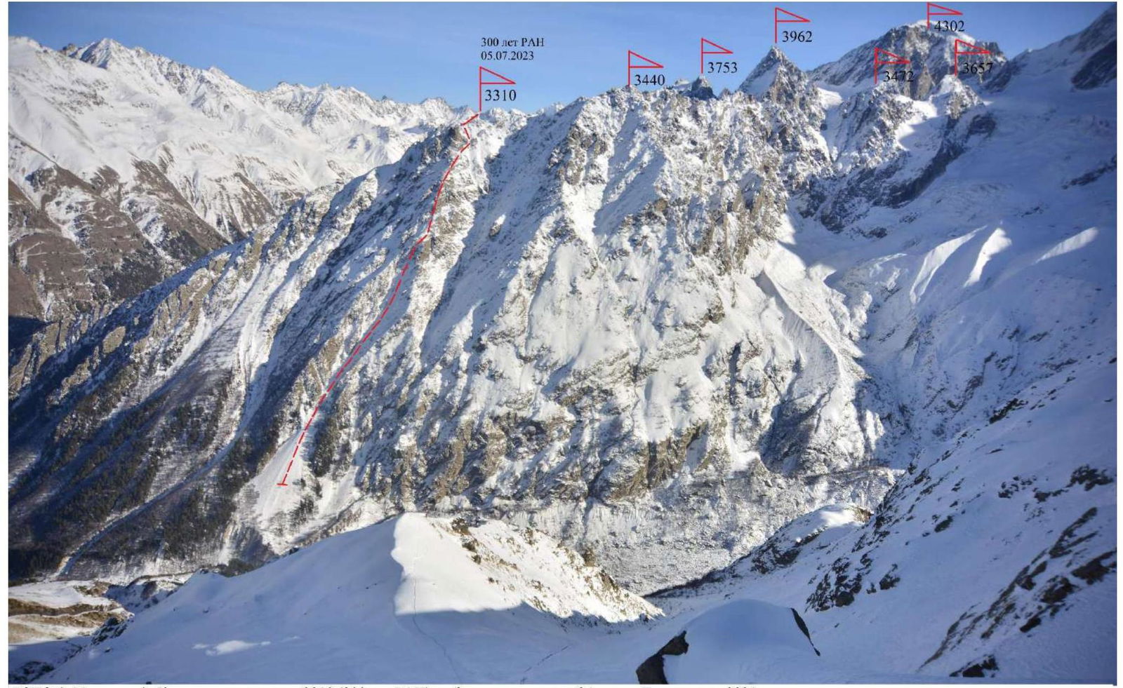
PHOTO 4: A. Korolev's route to summit 3310 m (300 years of the RAS) via the Western slope, category 2A. Taken in 2021.
1.2. Profile of the Route. View from the Left
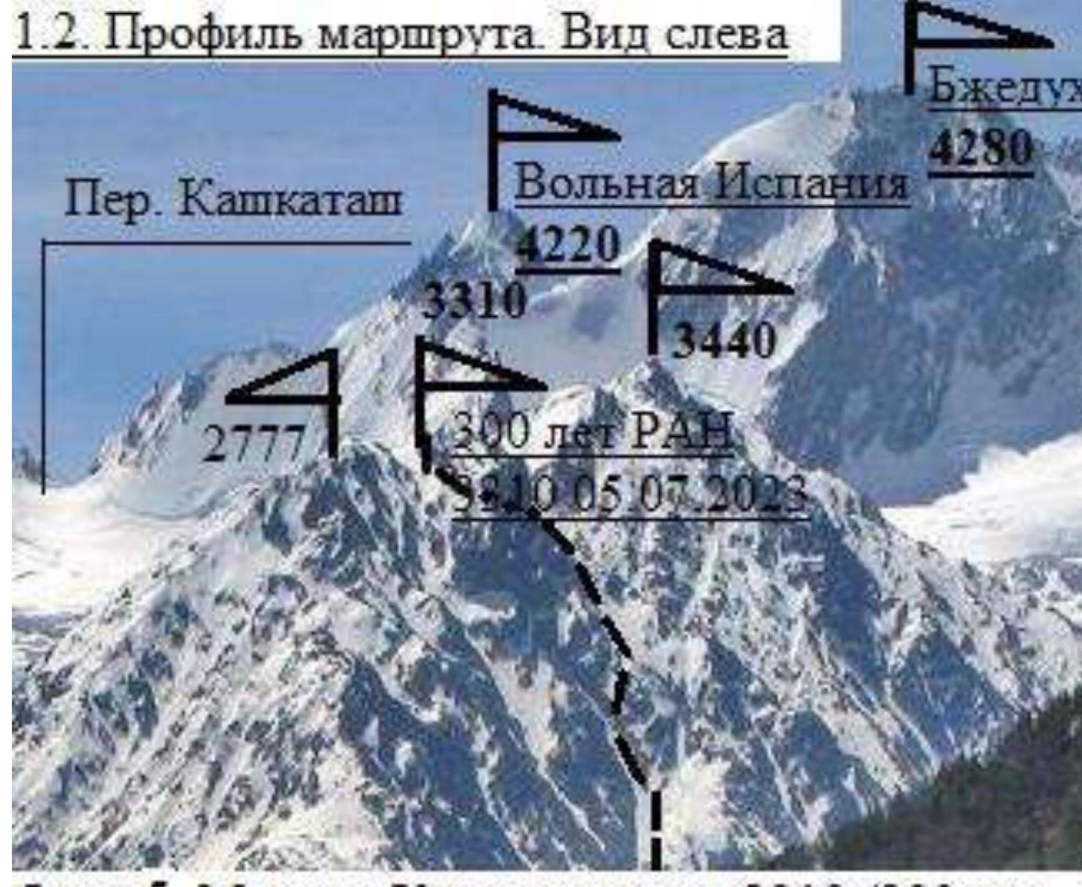
PHOTO 5: Korolev's route to summit 3310 m (300 years of the RAS) via the Western slope, category 2A. Taken in 1979.
2. Characteristics of the Route
2.1. Technical Photograph of the Route
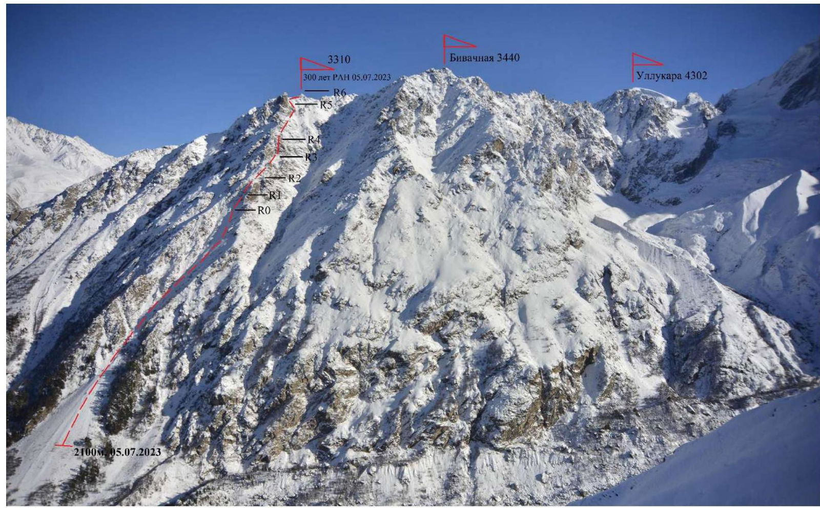
PHOTO 6: A. Korolev's route to summit 3310 (300 years of the RAS) via the Western slope, category 2A.
Route in UIAA Symbols
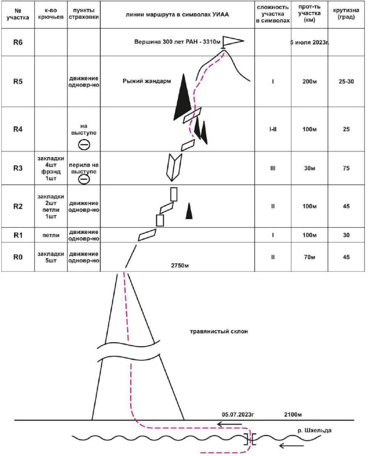
2.2. Technical Characteristics of Route Sections
| Section № | Relief Characteristics | Cat. diff. | Length | Type and number of protection points |
|---|---|---|---|---|
| From the Shkhelda alpine camp, ascend along a trail to the suspension bridge over the Shkhelda river (1.5 hours' walk) | ||||
| After the bridge, move down the right bank of the Shkhelda river, through the forest, bypassing the old frontal moraine on the left. Before a large scree slope, turn right and exit onto a grassy western slope. Ascend to the start of the Western ridge. (3.5–4 hours' walk) | ||||
| R0–R1 | Ascend rocky, grass-covered slopes to the right onto the ridge — to a large horizontal ledge | 2 | 70 m, 45° | 5 stoppers. Simultaneous movement |
| R1–R2 | Bypass a small gendarme on the left along ledges | 1 | 100 m, 30° | Loops. Simultaneous movement. |
| R2–R3 | Ascend along ledges and short walls to the base of an inner corner | 2 | 30 m, 45° | 2 stoppers, loop. |
| R3–R4 | Ascend the inner corner to a small ledge | 3 | 30 m, 75° | 4 stoppers, friend. Rappel, stance on a ledge |
| R4–R5 | From the ledge, bypass small gendarmes on the left, exit onto a large ledge under the "Red Finger" gendarme | 1–2 | 100 m, 25° | Simultaneous, protection on ledges. |
| R5–R6 | Bypass "Red Finger" on the right, ascend broken rocks and large scree to the summit. The summit is a rocky pyramid. No cairn; the team built one. | 1 | 200 m, 25–30° |
Descent follows the ascent route.
3. Characteristics of the Team's Actions
The team, departing at 5:00 from the "Shkhelda" alpine camp, reached the route by 7:00. The ascent along the grassy slope to the rocky ridge took 3 hours. From the ridge to the summit took 3 hours. The most challenging part of the route was section R3–R4, featuring steep rocky walls of II–III categories of difficulty. The rocks were partly unstable. Movement was in a rope team. No signs of previous human presence were found on the summit; the team built a cairn. The summit was named "300 years of the Russian Academy of Sciences." The route is considered relatively safe. Communication with the alpine camp was stable. This route, in terms of technical difficulty and length, corresponds to the route to Viatlou summit via the Northern ridge. The descent along the ascent route to the river took 4 hours. In summer, the route is rocky. Any snow sections encountered do not pose technical difficulties.

PHOTO 7: Section R0–R1
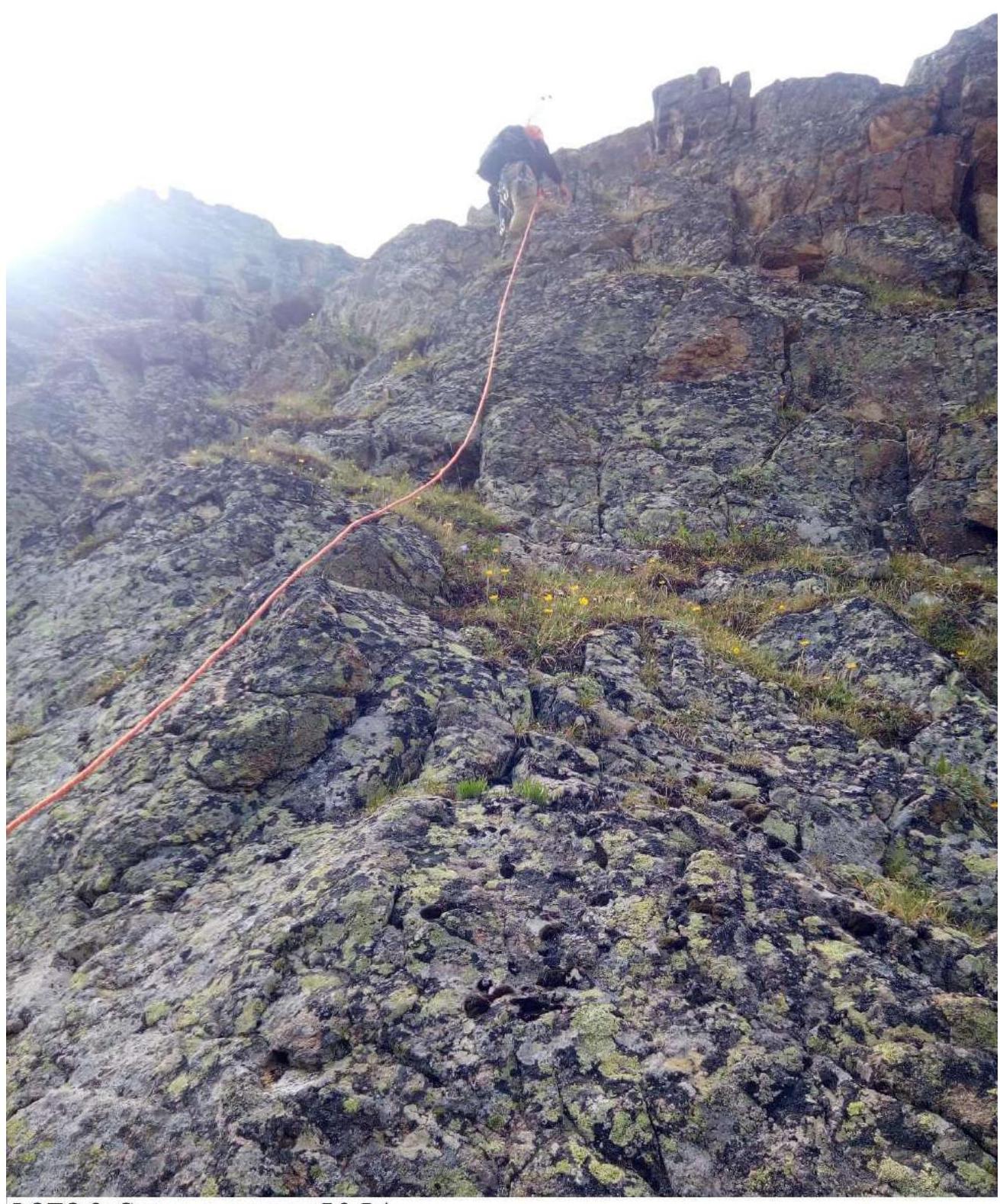
PHOTO 8: Rocks on section R3–R4
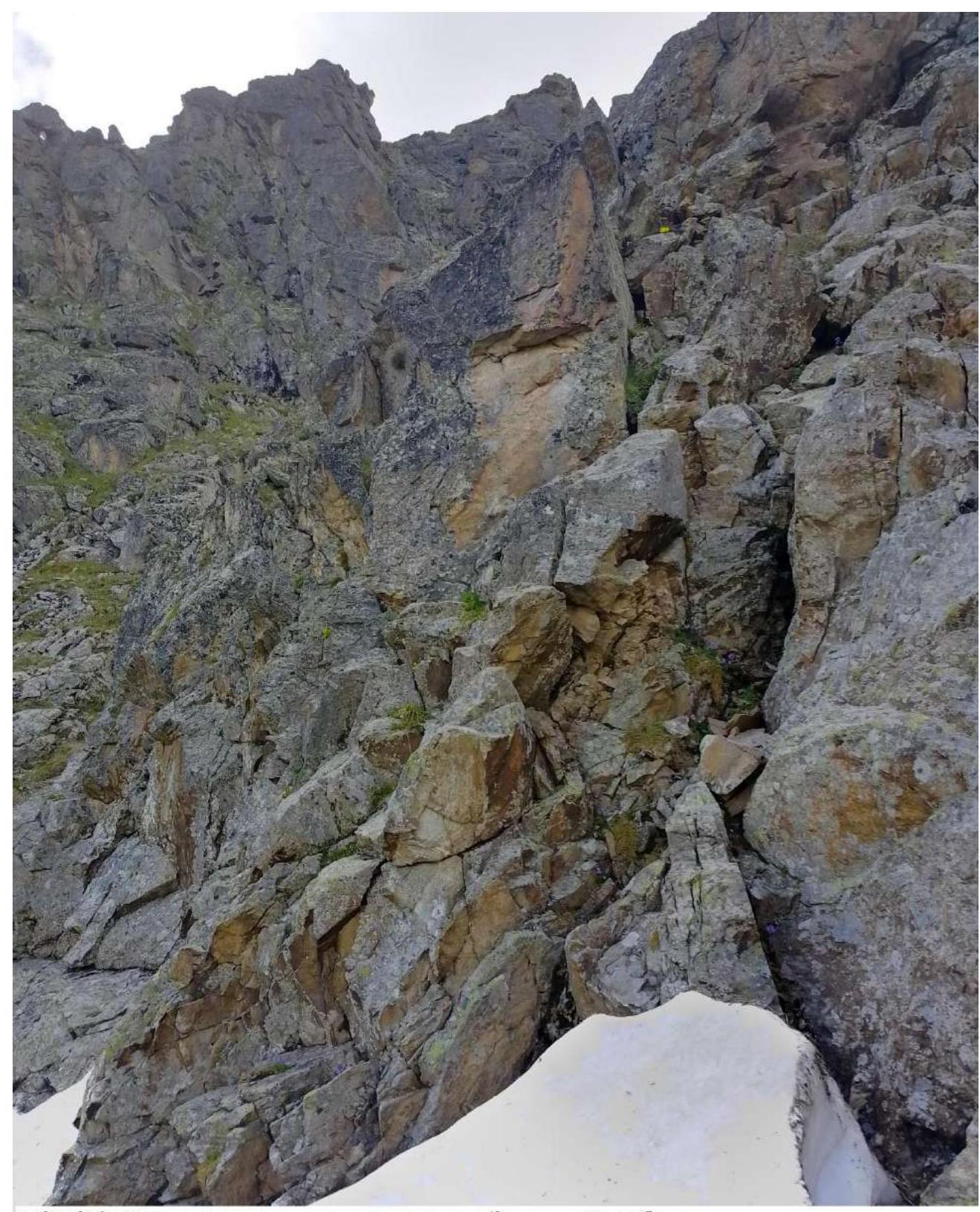
PHOTO 9: Character of rocks before reaching the Western ridge

PHOTO 10: Approach to the "Red" gendarme. Section R4–R5
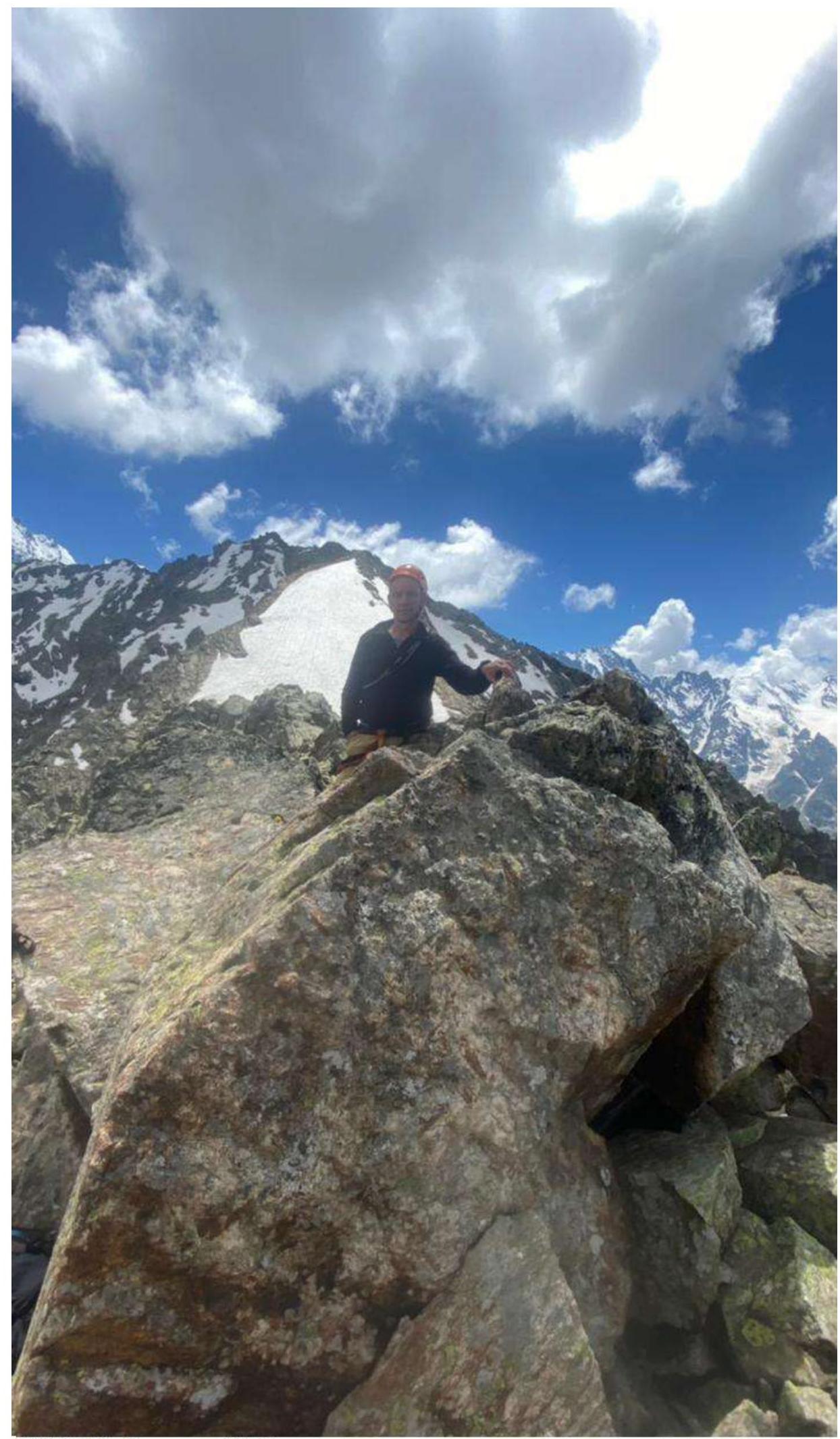
PHOTO 11: Summit 3310. In the background — Bivachnaya summit 3440