
Report
on the ascent to the summit of Pik Kavkaz Tsentralny (4105 m) - the first ascent of the route via the North slope, category 3B, by the team of alpine club "Tekhnolog" on August 2, 2019.
Participants:
- Barabashov A.A.
- Shabelnikov S.V.
St. Petersburg, 2020
I. Ascent Passport
| № | 1. General Information | |
|---|---|---|
| 1.1 | Full name, sports rank of the leader | Barabashov Anton Alekseevich, Master of Sports |
| 1.2 | Full name, sports rank of the participants | Shabelnikov Sergey Vladimirovich, Candidate Master of Sports |
| 1.3 | Full name of the coach | Bushmanov Yuri Dmitrievich, Master of Sports |
| 1.4 | Organization | Alpine club "Tekhnolog", St. Petersburg |
| 2. Characteristics of the ascent object | ||
| 2.1 | Region | Central Caucasus |
| 2.2 | Valley | Adyl-Su (Shkhelda) |
| 2.3 | Section number according to the 2013 classification table | 2.4 |
| 2.4 | Name and height of the summit | Pik Kavkaz Tsentralny |
| 2.5 | Geographical coordinates of the summit (latitude/longitude), GPS coordinates* (1) | According to WGS: Lat. 43°10′07.741″ N, Long. 42°39′89.733″ E |
| 3. Characteristics of the route | ||
| 3.1 | Name of the route | Via the North slope |
| 3.2 | Proposed category of difficulty | 3B |
| 3.3 | Degree of route exploration | First ascent |
| 3.4 | Character of the route terrain | Ice and snow |
| 3.5 | Height difference of the route (data from altimeter or GPS) | 1105 m |
| 3.6 | Length of the route (in meters) | 1380 m |
| 3.7 | Technical elements of the route (total length of sections of various difficulty categories with indication of terrain character: ice and snow, rock) | Category 2 - 500 m - ice and snow; Category 3 - 650 m - ice and snow; Category 4 - 200 m - ice and snow; Category 4 - 30 m - rock |
| 3.8 | Descent from the summit | Via the ascent route - rock, ice and snow |
| 3.9 | Additional characteristics of the route | The route is recommended for ascents during: June-September |
| 4. Characteristics of the team's actions | ||
| 4.1 | Time of movement (team's walking hours, in hours and days) | 5 hours 50 minutes, 1 day |
| 4.2 | Night halts | None |
| 4.3 | Departure for the route | August 2, 2019, 4:30 |
| 4.4 | Reach the summit | August 2, 2019, 10:20 |
| 4.5 | Return to the base camp | August 2, 2019, 16:30 |
| 5. Responsible for the report | ||
| 5.1 | Full name, e-mail | Barabashov Anton Alekseevich, phone +7 905 265-20-80 |
- (1) - filled in ONLY if the summit is not present in the Electronic Russian Classifier of mountain routes
II. Ascent Description
1. Characteristics of the Ascent Object
1.1. General Photo
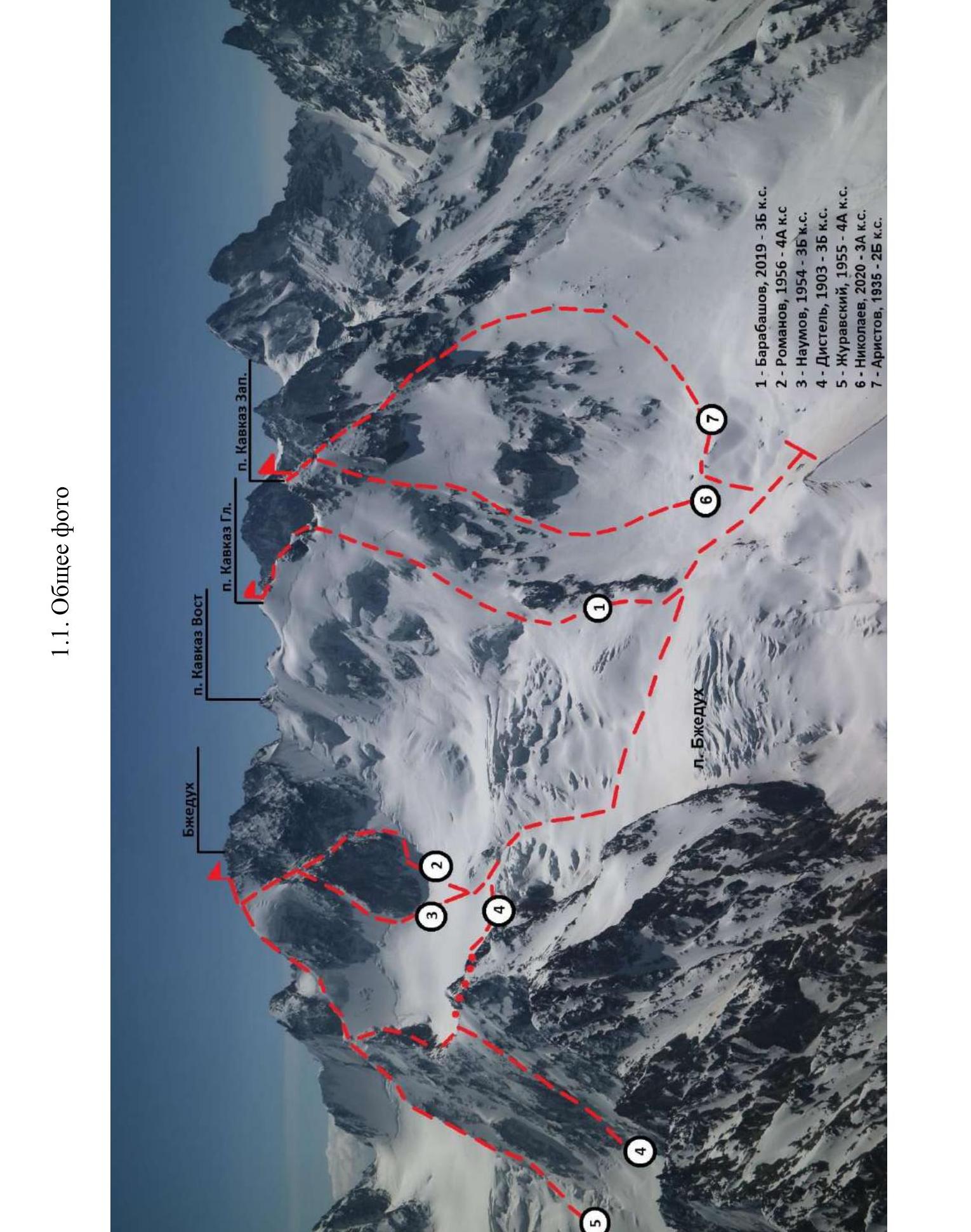
1 - Barabashov, 2019 - category 3B 2 - Romanov, 1956 - category 4A 3 - Naumov, 1954 - category 3B 4 - Distel, 1903 - category 3B 5 - Zhuravsky, 1955 - category 4A 6 - Nikolaev, 2020 - category 3A 7 - Aristov, 1935 - category 2B
Profile of the route to Pik Kavkaz (Ts) via the N slope
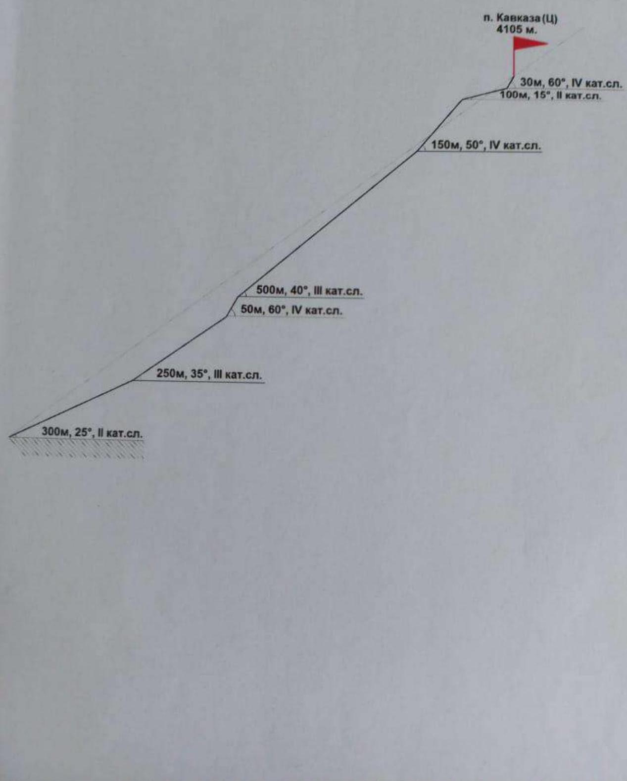
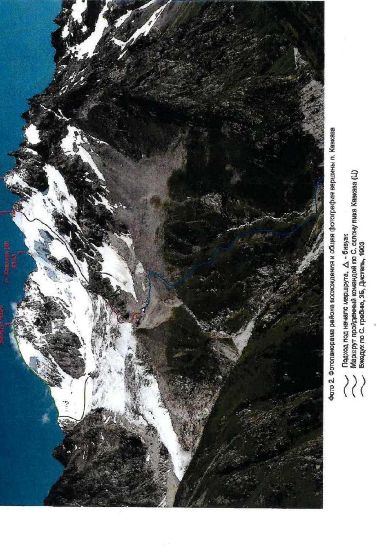
Photo 2. Photopanorama of the ascent area and general photo of the summit of Pik Kavkaz.
Approach to the start of the route, Δ - bivouac. Route taken by the team via the N slope of Pik Kavkaz (Ts). Bzhedukh via the N ridge, category 3B, Distel, 1903.
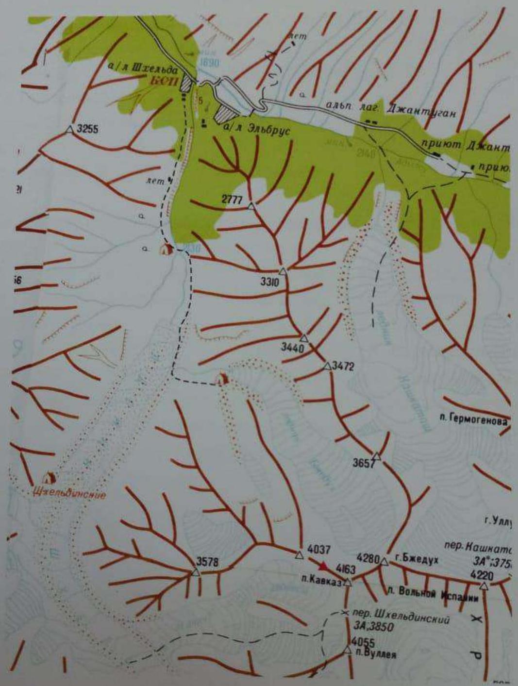
Photo 1. Map of the ascent area.
The dotted line shows the path to the route.
Geographical location of the area
The object of the ascent - Pik Kavkaz Tsentralny (Glavny, 4105 m) - is located in the northwestern spur of the Main Caucasian Range, branching off from the summit of Kavkaz Vostochny (4163 m).
The spur of Pik Kavkaz has 5 summits:
- Kavkaz Vostochny - 4163 m (on the Main Caucasian Range crest)
- Kavkaz 2nd Vostochny
- Kavkaz Glavny (Tsentralny) - 4105 m
- Kavkaz Zapadny - 4037 m
- Kavkaz Yugo-Zapadny - 3578 m
The first ascent of the Eastern summit was made by D. Kokkini in 1888.
As of 2021, the following routes have been traversed:
- Kavkaz Vostochny via the SW ridge - category 2A (H. Tomashek, 1929)
- Kavkaz Zapadny via the NW ridge - category 2B (O. Aristov, 1935)
- Kavkaz Gl (Ts) via the SE spur - category 4A (A. Chorap, 1980)
- Kavkaz Gl (Ts) via the N slope - category 3B (A. Barabashov, 2019)
- Kavkaz Zapadny via the NE wall - category 3A (Yu. Nikolaev, 2020)
The approach to all the summits of the spur goes from the valley of the Shkhelda river, which is a left-bank tributary of the Adyl-Su river. The starting point is the settlement of Elbrus. Further, bypassing the Adyl-Su alpine camp, at the confluence of the Baksan and Adyl-Su rivers, ascend to the Shkhelda alpine camp.
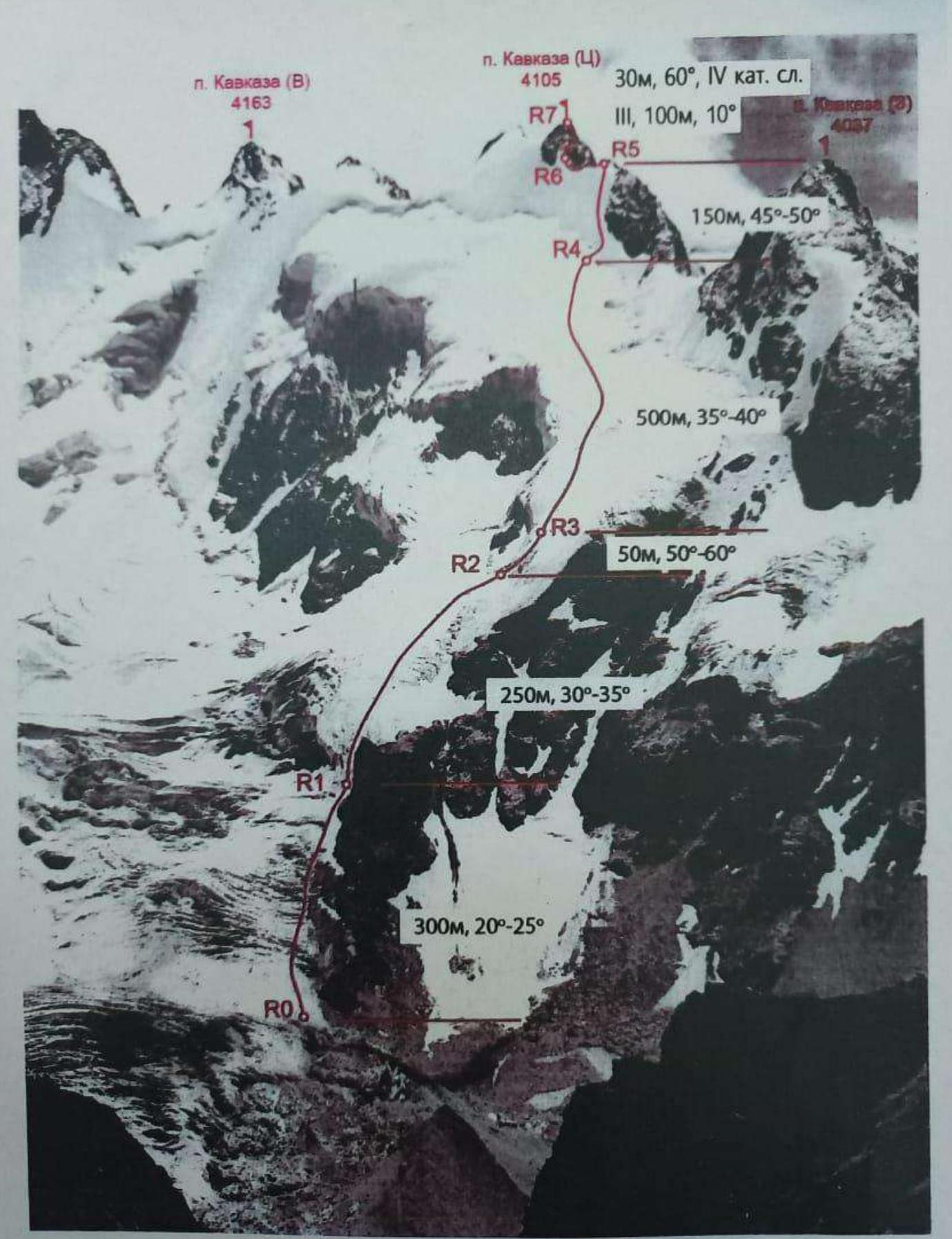
Photo 3. Technical photo of the route.
2.2. Technical characteristics of the route sections
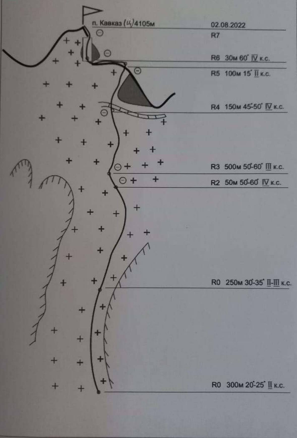
| Section № | Character of relief | Category of difficulty | Length, m | Type and number of anchors |
|---|---|---|---|---|
| From the night halts on the moraine descend to the base of the upper rock belt on the Bzhedukh glacier. Here is the start of the route. | ||||
| R0-R1 | Ascent along the ice slope along the upper rock belt. The glacier is partially broken | 2 | 300 m, 20°-25° | Simultaneous movement in rope teams, with crampons |
| R1-R2 | Ice-firn slope. Key section | 2-3 | 250 m, 30°-35° | Simultaneous movement in rope teams, with crampons. Belay via ice screws |
| R2-R3 | Steep ice pitch | 4 | 50 m, 50°-60° | Rope teams, crampons, belay via ice screws, ice axe required |
| R4-R5 | Steep firn slope with a bergschrund | 4 | 150 m, 45°-50° | Rope teams, crampons, ice screws, ice axe |
| R5-R6 | Gentle sharp ice-firn ridge | 2 | 100 m, 10°-15° | Rope teams, crampons, ice screws |
| R6-R7 | Steep rock pitch leading to the summit tower. Rocks are icy | 4 | 30 m, 60° | Rope teams, crampons, rock protection |
Descent. Descent via the ascent route.
Route diagram in UIAA symbols
3. Characteristics of the team's actions
Excerpt from the debriefing protocol
of the participants of the training camp of the St. Petersburg FA (alpine club "Tekhnolog") on Pik Kavkaz Glavny (Tsentralny) via the North slope (first ascent) category 3B, August 2, 2019.
Debriefing conducted by senior coach Bushmanov Yu.D.
Presented: Barabashov A.A. (team leader)
The object of the ascent was recommended to us by the training department of the Shkhelda alpine camp and was studied visually during a reconnaissance sortie. Considering the good form of the participants and high sports qualification, a tactical plan for a speed ascent in 1 day was drawn up. Since the route is mostly snow and ice, modern ice equipment was selected. Rocks are encountered only on the summit tower. The time to reach the summit took about 6 hours, the descent took just as long and followed the ascent route.
The route was traversed without stops, with simultaneous movement in a rope team. The leaders alternated as the reserve of anchors was depleted.
I have no complaints about my partner. Communication with the base was stable. In terms of technical complexity and length, the route corresponds to category 3B, similar to the best snow and ice routes in the Bezengi valley. For training groups, the ascent time will take 10-12 hours.
Shabelnikov S.V.
I've been climbing with my partner for a long time. On the route, there was complete mutual understanding.
Conclusion:
Bushmanov Yu.D.
The leaders of the training camp and the St. Petersburg team chose and traversed a beautiful route. Very quickly. The route corresponds to category 3B.
The ascent and leadership are to be counted. Compile a report and submit for classification.
Debriefing conducted by:
- Senior coach: Bushmanov Yu.D.
- Secretary: Nikolaev Yu.A.
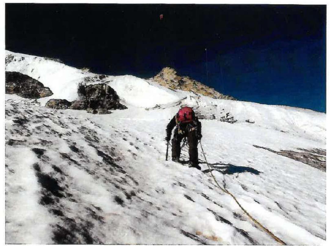
At the end of section R1-R2
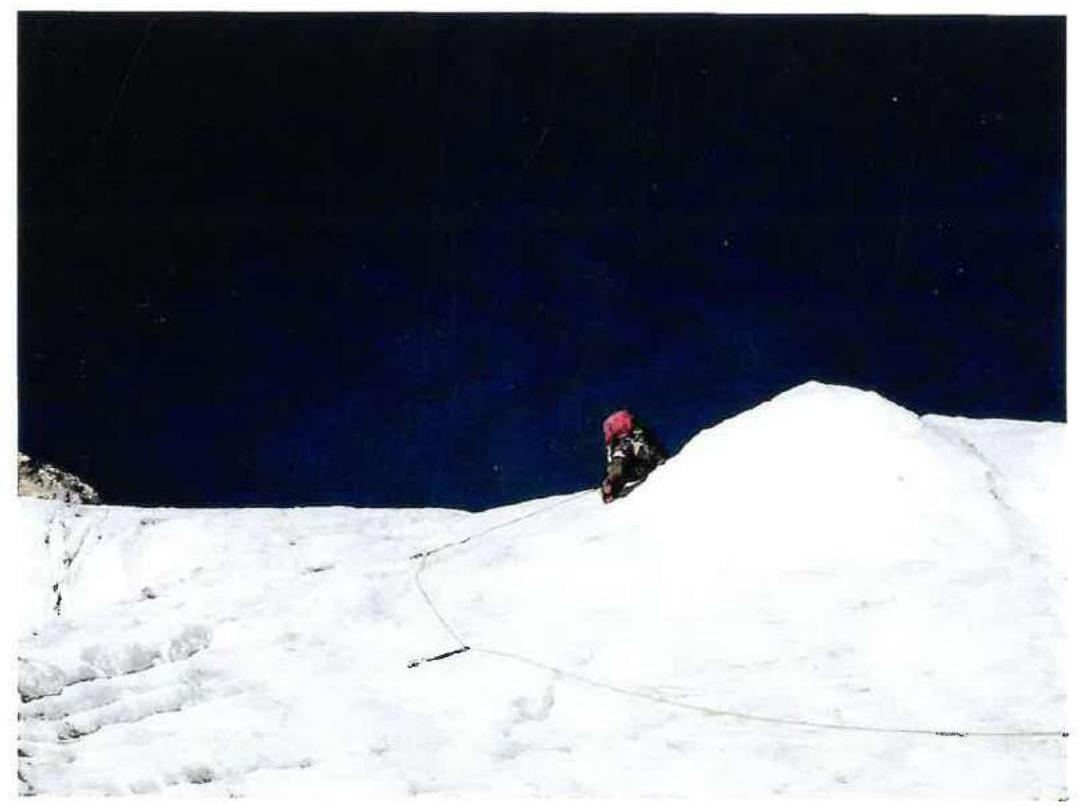
Overcoming the ice pitch R2-R3

At the start of section R3-R4
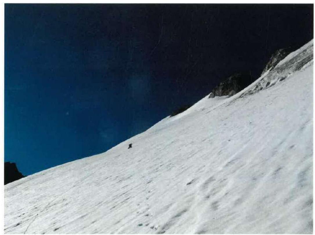
At the end of section R3-R4
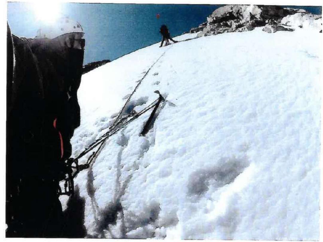
Section R4-R5 on descent
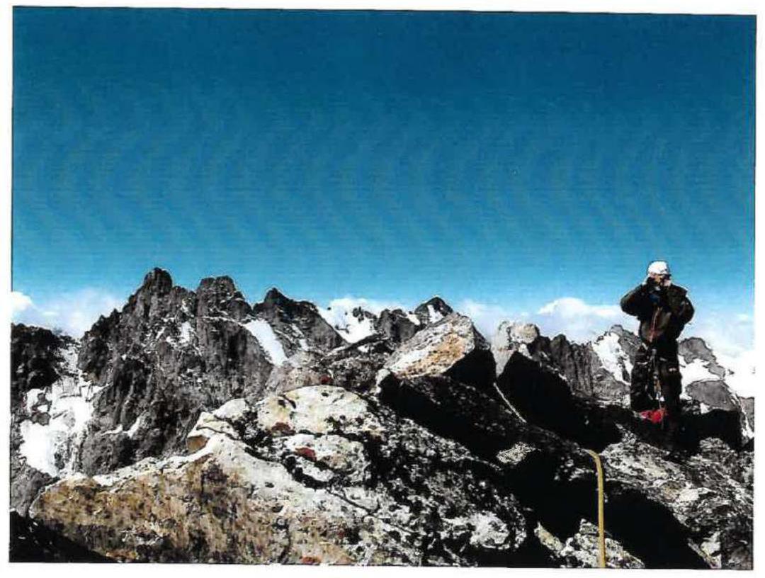
Photo from the summit
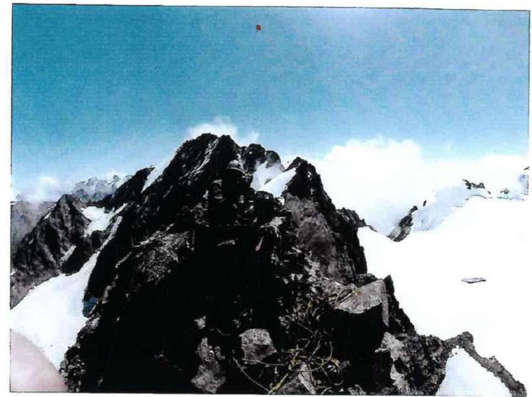
Photo from the summit
Comments
Sign in to leave a comment