Appendix No. 1 to the Unified Requirements for a Classification Report. Report Form for Routes 1B–3B Category of Difficulty.
REPORT ON THE FIRST ASCENT TO PEAK 3811 (NAKHODKA) VIA THE ROUTE 2B CATEGORY OF DIFFICULTY BY THE TEAM OF MAC "FREELINE", Pyatigorsk, September 20, 2020
I. Ascent Passport
| No. | 1. General Information | |
|---|---|---|
| 1.1 | Full Name, Sports Rank of the Leader | Popov M.L., CMS |
| 1.2 | Full Name, Sports Rank of the Participants | Konstantinov G.A., 2nd sports rank |
| 1.3 | Full Name of the Coach | Motienko N.I., CMS |
| 1.4 | Organization | MAC "Freeline"; AK "Maximum" |
| 2. Characteristics of the Ascent Object | ||
| 2.1 | Region | Caucasus, KBR |
| 2.2 | Valley | Kyrtyk River Valley |
| 2.3 | Section Number according to the 2013 Classification Table | 2.4 |
| 2.4 | Name and Height of the Peak | p. 3811 (Nakhodka) |
| 2.5 | Geographical Coordinates of the Peak (latitude/longitude), GPS Coordinates (1) | 43°19′712″ N 42°37′553″ E |
| 3. Route Characteristics | ||
| 3.1 | Route Name | p. 3811 (Nakhodka) via the southern ridge |
| 3.2 | Proposed Category of Difficulty | 2B |
| 3.3 | Degree of Route Exploration | First ascent |
| 3.4 | Relief Character of the Route | Rocky |
| 3.5 | Height Difference of the Route (altimeter or GPS data) | 520 m |
| 3.6 | Route Length (in meters) | 520 m |
| 3.7 | Technical Elements of the Route (total length of sections with different categories of difficulty, indicating the relief character) | I cat. diff. (rock) — 0 m. II cat. diff. (combination) — 140 m. III cat. diff. (rock) — 340 m. IV cat. diff. (rock) — 40 m. V cat. diff. — 0 m. Movement on a closed glacier — 1000 m. |
| 3.8 | Descent from the Peak | Down the couloir to the south onto the Mukal Glacier |
| 3.9 | Additional Route Characteristics | No water |
| 4. Characteristics of the Team's Actions | ||
| 4.1 | Time of Movement (team's walking hours, in hours and days) | 5 hours |
| 4.2 | Overnight Stays | No |
| 4.3 | Departure onto the Route | 7:00, September 20, 2020 |
| 4.4 | Arrival at the Peak | 12:00, September 20, 2020 |
| 4.5 | Return to the Base Camp | 14:00, September 20, 2020 |
| 5. Person Responsible for the Report | ||
| 5.1 | Full Name, e-mail | Popov Mikhail Lvovich mikl_popov@inbox.ru 89282657130 |
II. Characteristics of the Ascent Object
General photo of peak p. 3811 (Nakhodka) from the Mukal Glacier to the west 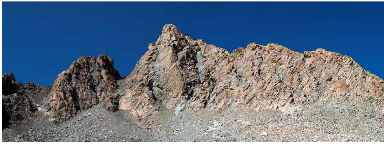
Yellow line — team's ascent route
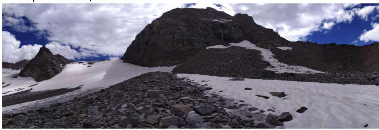
Photo of the mountain from overnight stays, from the southeast
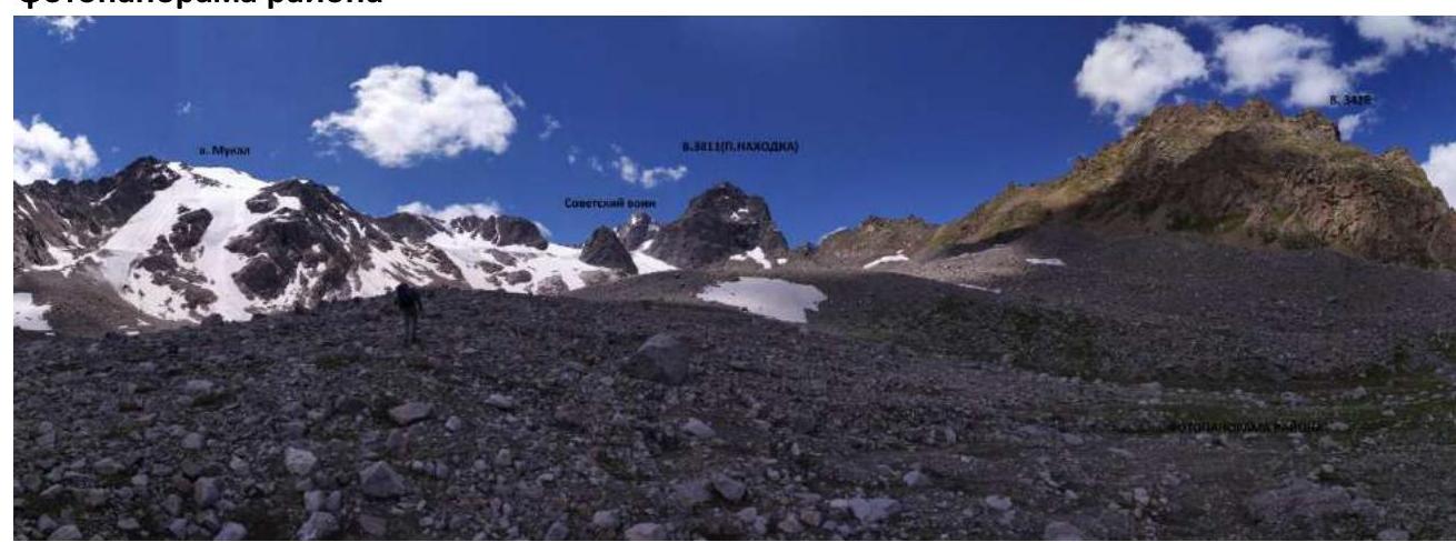
Photopanorama of the area
Brief overview of the ascent area and approach description
The ascent area is located in the part of the Lateral Ridge of the Central Caucasus, stretching from the peak Irik (4046 m) to the peak Mukal (3899 m). The object of ascent — peak 3811 m (Nakhodka) — is located in the ridge stretching 3 km northward from the peak Sovetsky Voyn (4012 m) to p. 3428 m. To the east lies the Mkara East Glacier, and to the west — the Mukal Glacier.
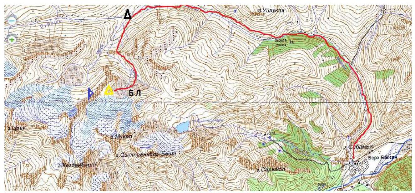
From the village Verkhny Baksan along a dirt road into the Kyrtyk River valley to the last koshi in the gorge at the confluence of the Kyrtyk and Mkara rivers (15 km). The road from Verkhny Baksan is passable for vehicles like Lada "Niva" and UAZ "Patriot".
Further:
- across the bridge over the Mkara River;
- along its orographic right bank, on a marked trail upwards to the edge of the "hanging valley" (3 km);
- left on the marked trail, bypassing p. 3428;
- at a convenient spot, cross the Mukal River and move upwards along the scree along the ridge connecting p. 3428 and p. Nakhodka.
After some time, the slope becomes gentler and transitions into wide sandy fields. We choose a clearing nearest to peak Nakhodka for a bivouac. From the cars — 2 hours.
There is no mobile connection in the gorge. Border permits are not required.
III. Route Characteristics
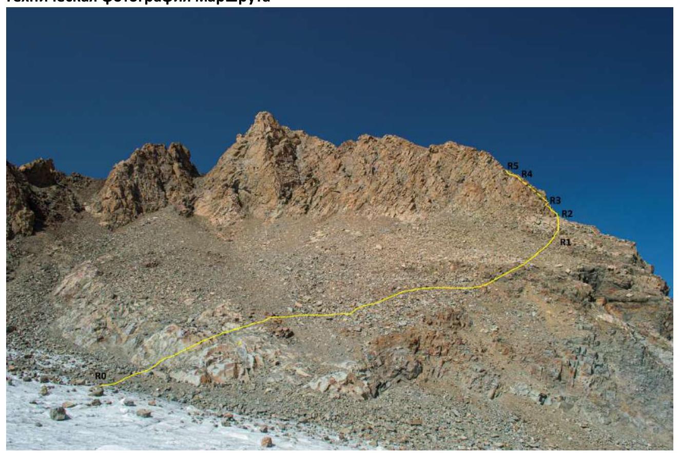
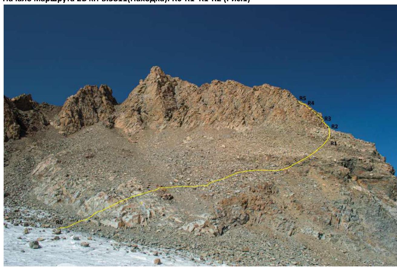
Technical photograph of the route
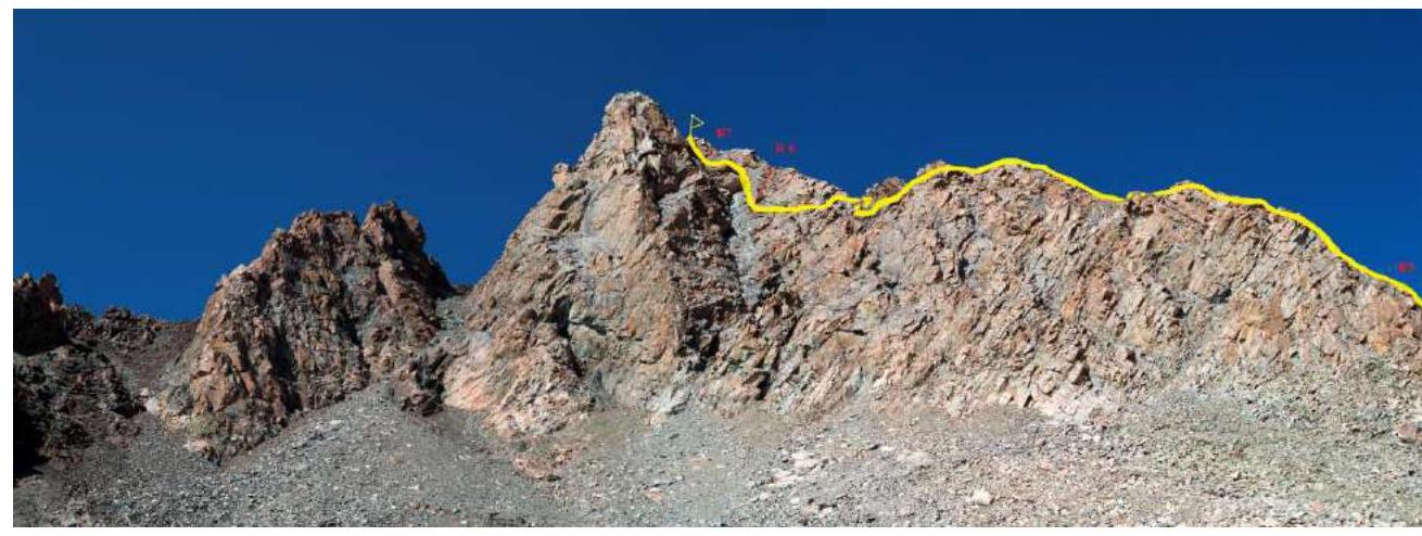
Continuation of the technical photograph
Technical characteristics of the route sections
| Section No. | Relief Character | Category of Difficulty | Length, m | Type and Number of Hooks |
|---|---|---|---|---|
| R0–R1 | Ram's foreheads. Scree | 3;2 | 140 | 0 |
| R1–R2 | Rocky wall, shelf | 3 | 15 | 0 |
| R2–R3 | Rocky wall, internal corner | 3;4 | 15; 30 | 4 |
| R3–R4 | Smoothed rocks | 3 | 60 | 0 |
| R4–R5 | Scree | 2 | 20 | 6 |
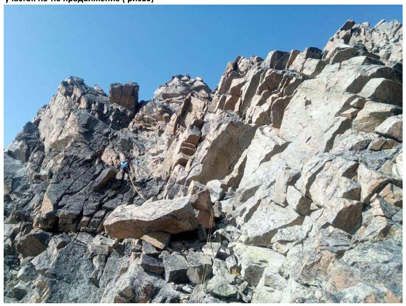
| R5–R6 | Rocky ridge | 3;3+ | 170 | 3 |
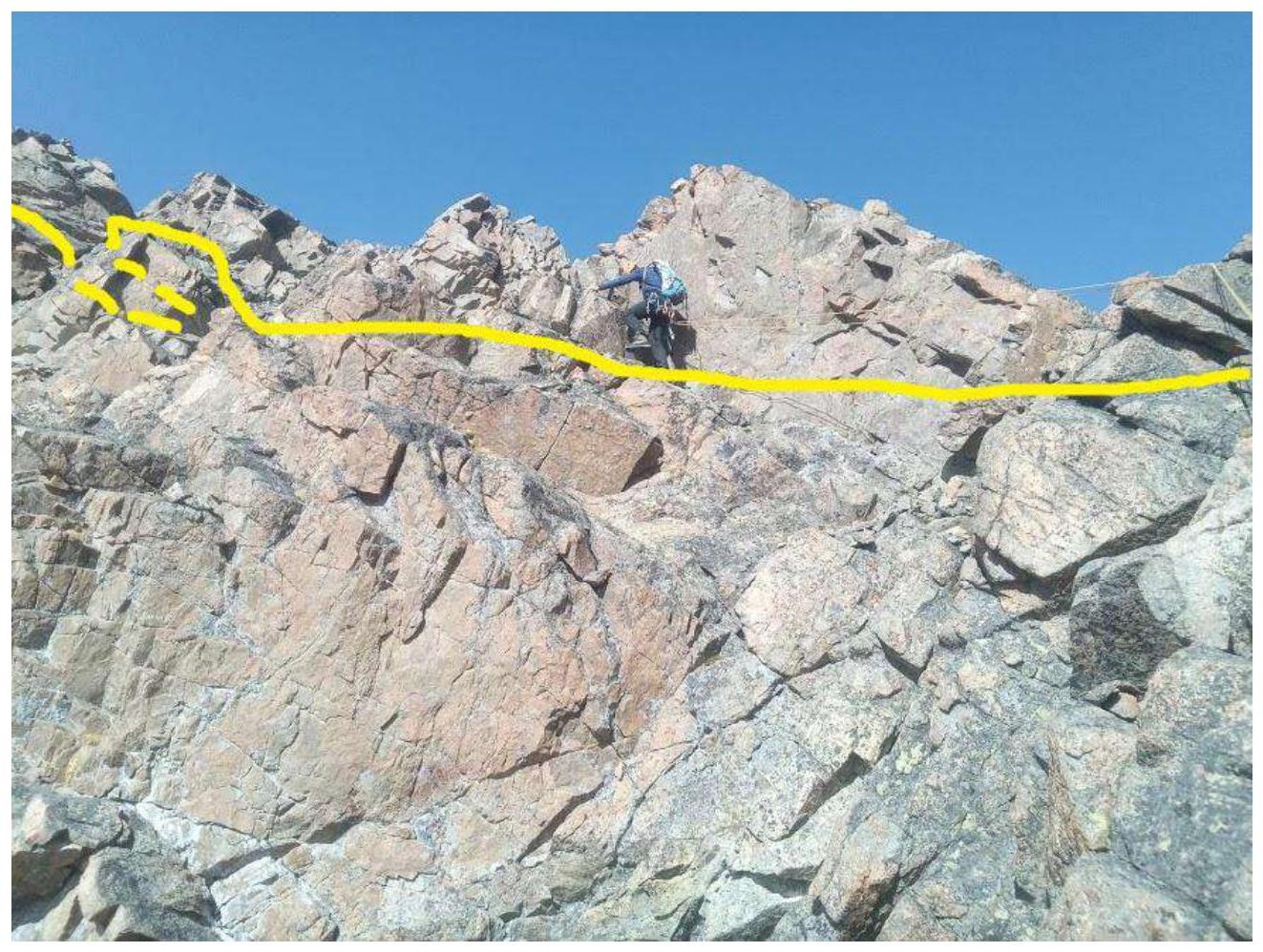
| R6–R7 | Monolithic wall | 4;3+ | 10; 30 | 2 |
| R7–R8 | Monolithic wall | 3+ | 30 | 2 |
IV. Characteristics of the Team's Actions
| Section No. | Description | Photo No. |
|---|---|---|
| R0–R1 | From the glacier along ram's foreheads 45° 3, 20 m and large-block scree 2, 30° upwards to the right in the direction of the start of the rocky ridge — total 140 m. | 1 |
| R1–R2 | Upwards to the right along the wall 3, 15 m to a col. | 1; 2 |
| R2–R3 | From it, upwards to the left to the start of an internal corner — 15 m. 3, along the internal corner 70° upwards 4, 20 m to a shelf. Then 10 m 4, traverse to the right onto a wide shelf. | 2 |
| R3–R4 | Further along a wide internal corner, sometimes the internal corner is intersected by shelves — 60 m 40° 3. | 3 |
| R4–R5 | The internal corner ends with a wide scree shelf 20 m 2. | |
| R5–R6 | From the shelf, upwards to the right onto the ridge. Along the ridge and its left side 170 m 3; 3+. The ridge abuts a wall. | 4; 5 |
| R6–R7 | Along the left part of the wall 65° 10 m 4 and 30 m 3+ to a shelf and a pre-summit tower. | 6 |
| R7–R8 | Along the wall 60° 3+ 30 m to the summit. |
Start of the 2B category route to p. 3811 (Nakhodka). R0–R1, R1–R2 (fig. 1)
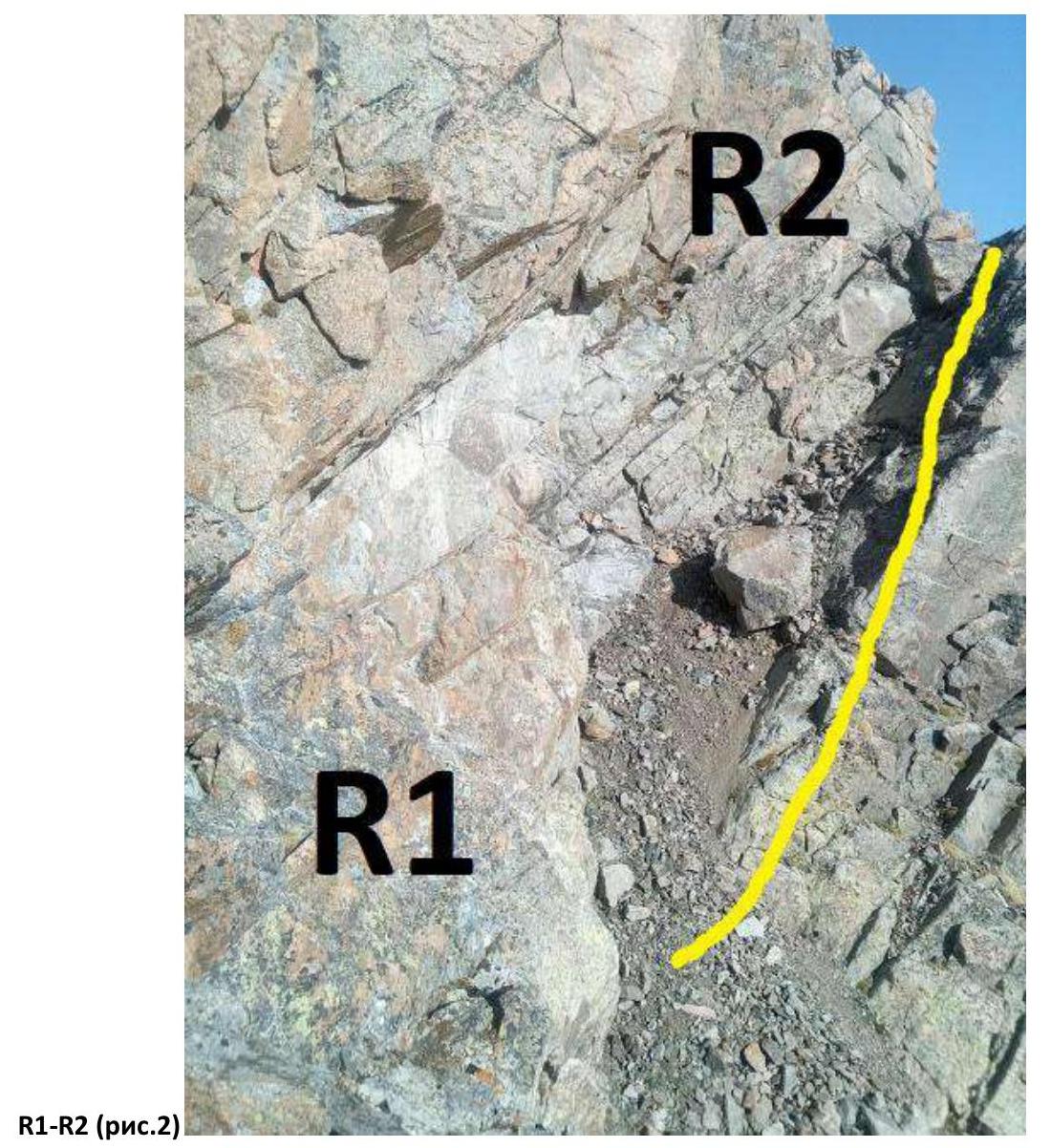
R1–R2 (fig. 2)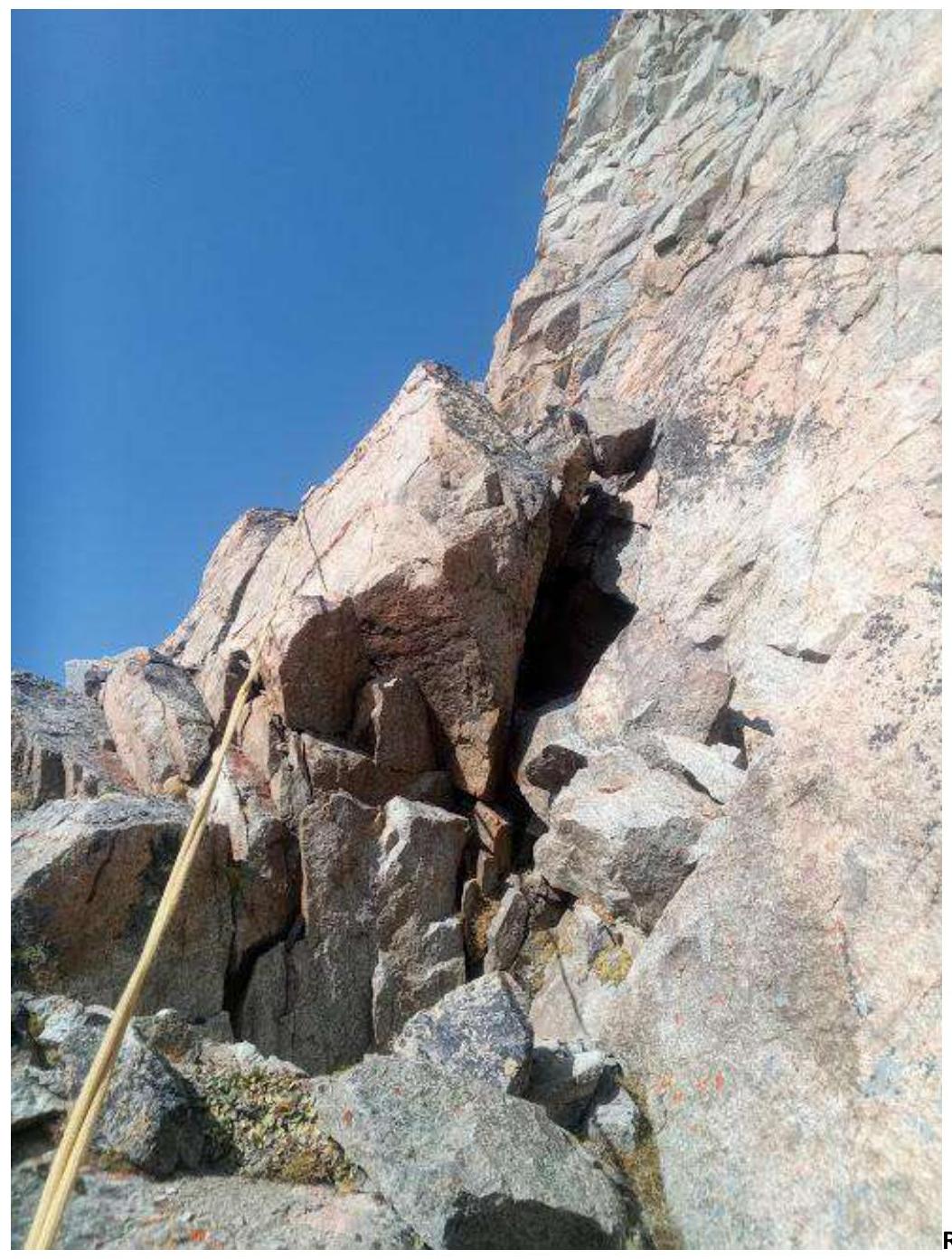
R2–R3 (fig. 3)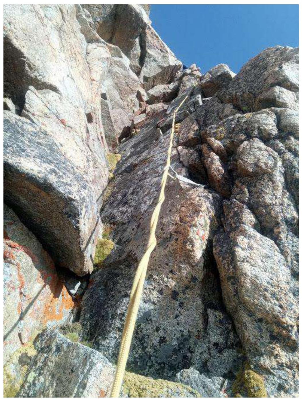
R2–R3 continuation (fig. 4), R2–R3 continuation (fig. 5)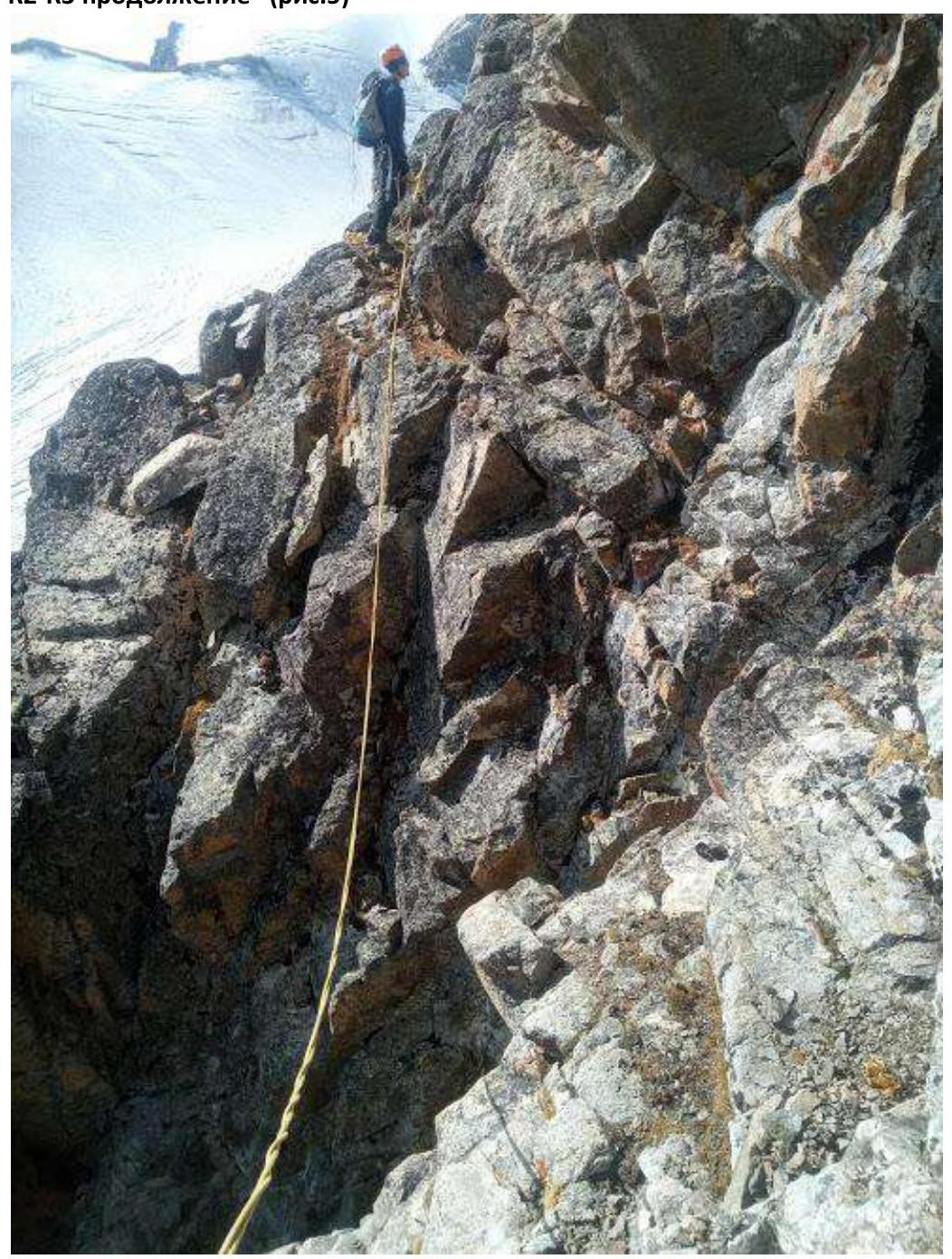
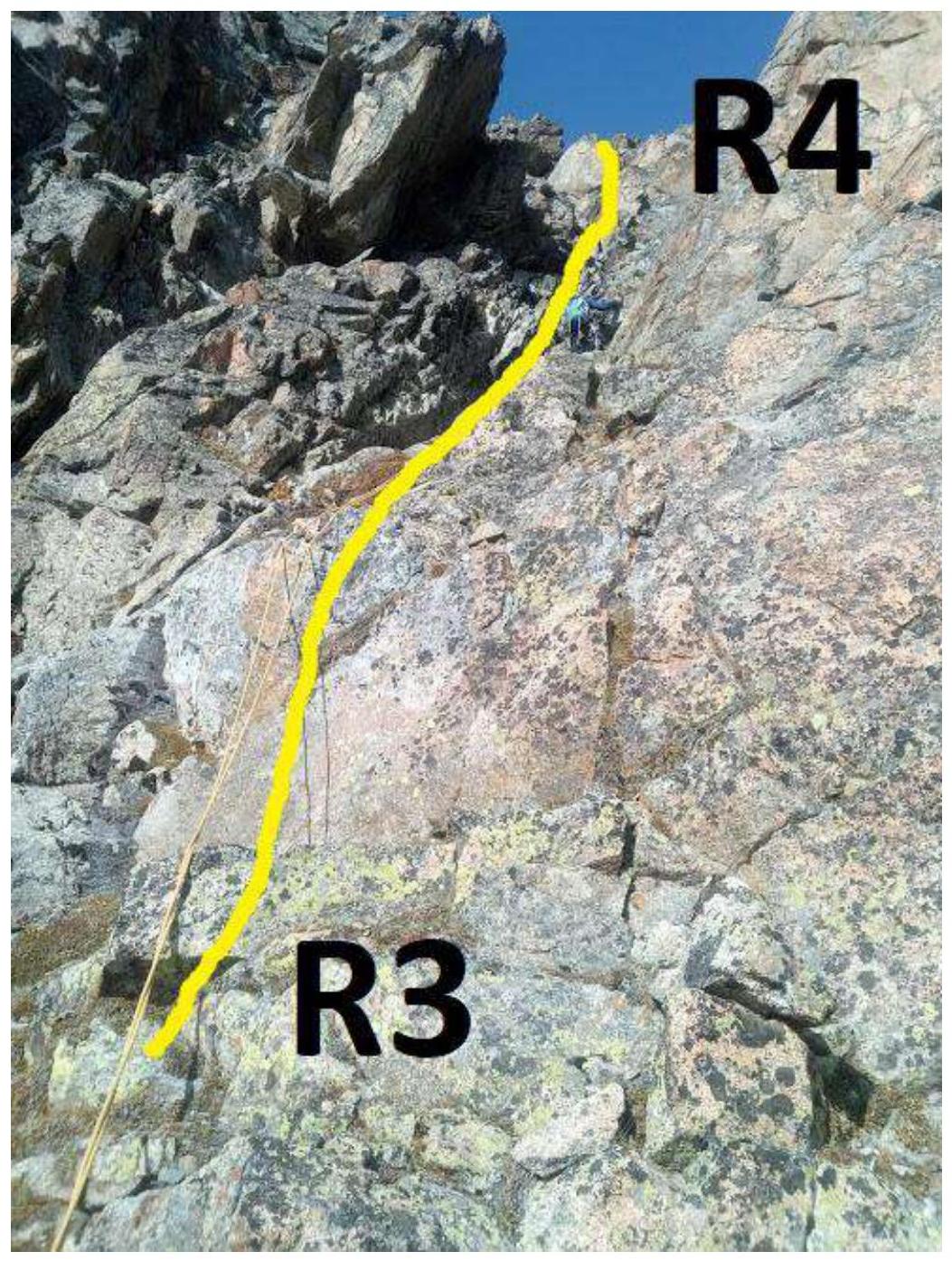
R3–R4 (fig. 6)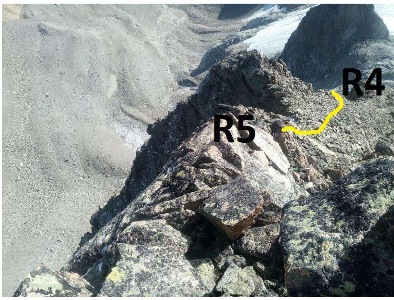
R4–R5 (fig. 7)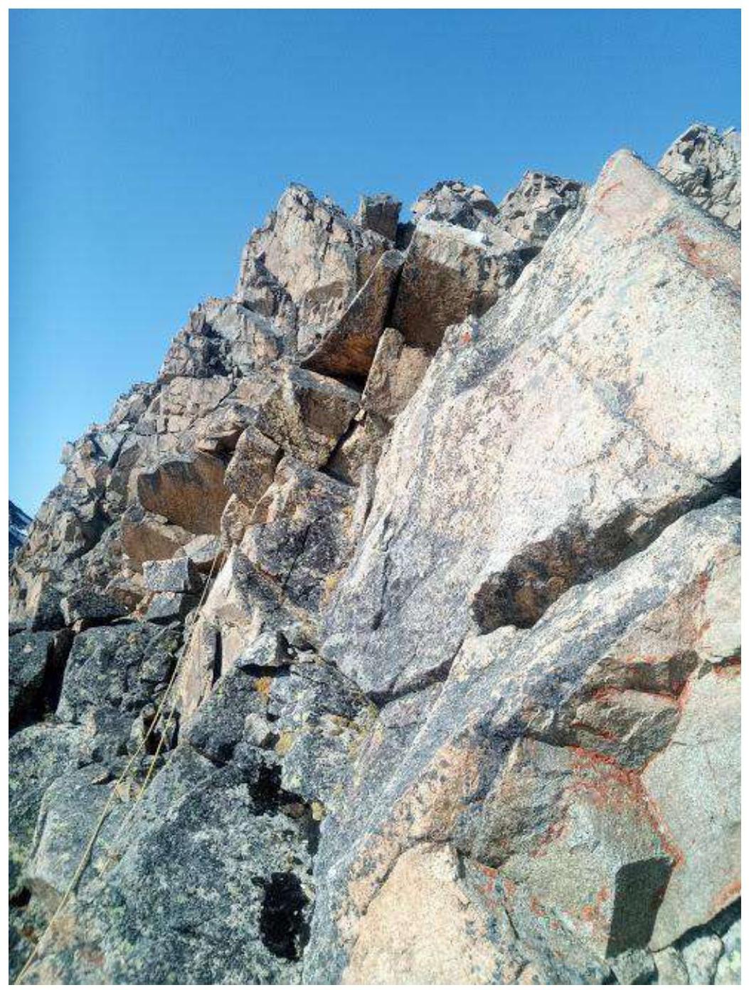
R5–R6 start (fig. 8)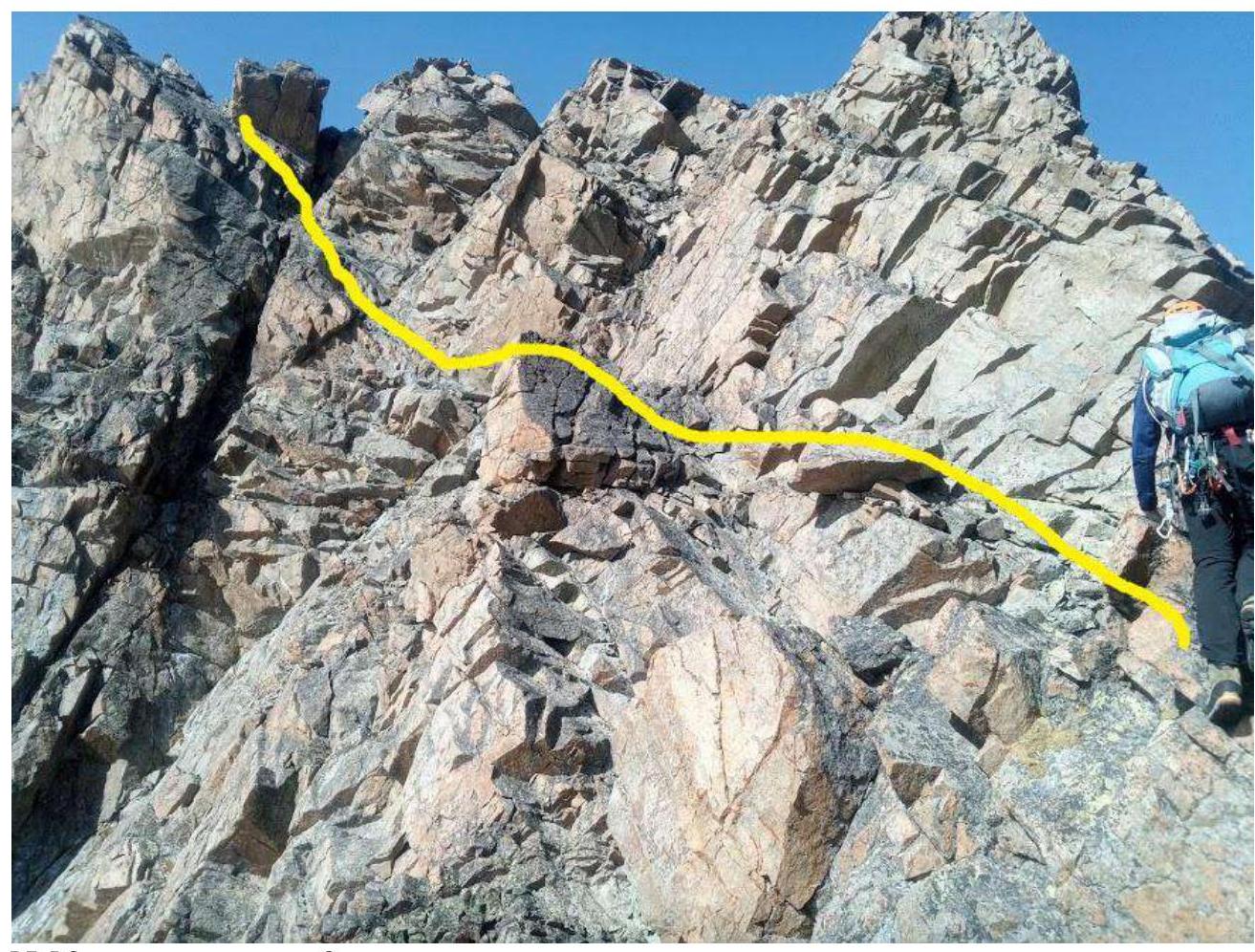
R5–R6 continuation (fig. 9), section R5–R6 continuation (fig. 10)
R5–R6 continuation (fig. 11)

R6–R7 (fig. 12)
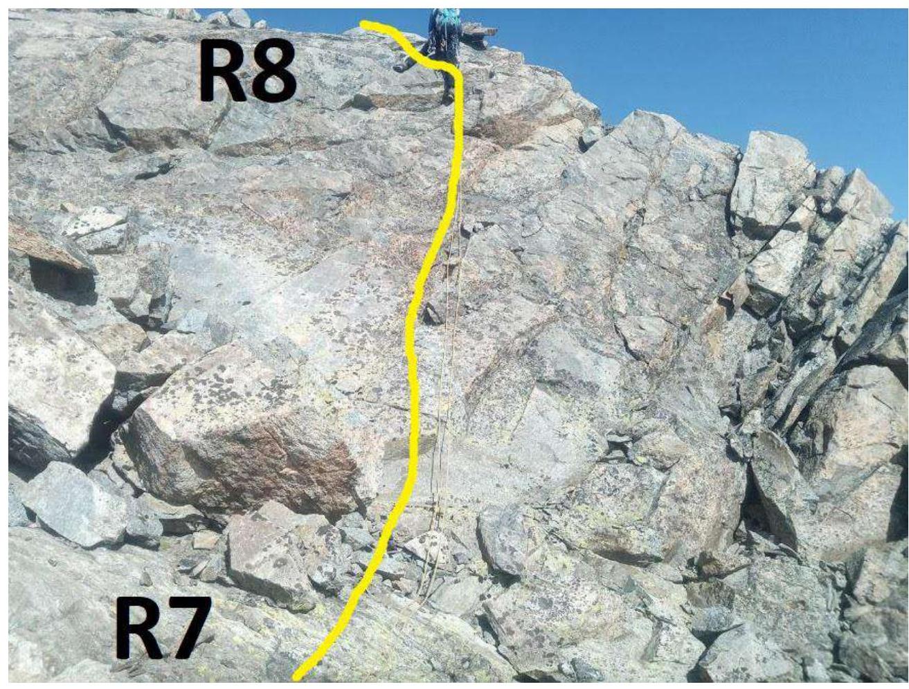
R7–R8 (fig. 13)
V. Conclusions and Recommendations
The route is logical and safe in terms of rockfall danger. In our opinion, it corresponds to category 2B. We compared it with a similar route to peak Kap, 2B category. It is quite monolithic. The relief is convenient for placing belay points. Recommended for educational and sports ascents by a group of 4–6 people.