Appendix No. 1 to the Unified Requirements for a Classification Report Report Form for Routes 1B–3B Category of Difficulty
REPORT ON THE FIRST ASCENT TO THE SUMMIT p. SOVETSKY VOIN VIA THE ROUTE OF 3B CATEGORY OF DIFFICULTY BY THE TEAM OF MAC "Freeline" Pyatigorsk on July 19, 2020
I. Climbing Passport
| No. | 1. General Information | |
|---|---|---|
| 1.1 | Full Name, Sports Rank of the Leader | Popov M.L. CMS |
| 1.2 | Full Name, Sports Rank of the Participants | Konstantinov G.A. 2nd sports rank, Klindukhov M.O. 2nd sports rank |
| 1.3 | Full Name of the Coach | Motienko N.I. CMS |
| 1.4 | Organization | MAC "Freeline"; AC "Maximum" |
| 2. Characteristics of the Climbing Object | ||
| 2.1 | Region | Caucasus, Kabardino-Balkaria |
| 2.2 | Valley | Kyrtyk River valley |
| 2.3 | Section Number according to the 2013 Classification Table | 2.4 |
| 2.4 | Name and Height of the Summit | p. Sovetsky Voin 4012 |
| 2.5 | Geographical Coordinates of the Summit (latitude/longitude), GPS Coordinates *(1) | 43°19′330″ N 42°37′277″ E |
| 3. Characteristics of the Route | ||
| 3.1 | Name of the Route | p. Sovetsky Voin via the northern ridge |
| 3.2 | Proposed Category of Difficulty | 3B |
| 3.3 | Degree of Route Exploration | First ascent |
| 3.4 | Relief Character of the Route | Combined |
| 3.5 | Height Difference of the Route (altimeter or GPS data) | 351 m |
| 3.6 | Length of the Route (in meters) | 715 |
| 3.7 | Technical Elements of the Route (total length of sections of various difficulty categories with relief character indication) | Category I (rock) — 0 m. Category II combination — 200 m. Category III rock — 285 m. Category IV rock — 210 m. Category V — 20 m. Movement on a closed glacier — 1000 m |
| 3.8 | Descent from the Summit | Via the eastern ridge 150 m and down the southern wall to the Mukal Glacier |
| 3.9 | Additional Characteristics of the Route | |
| 4. Characteristics of the Team's Actions | ||
| 4.1 | Time of Movement (team's walking hours, in hours and days) | 11.5 hours |
| 4.2 | Overnight Stays | No |
| 4.3 | Departure to the Route | 8:00 July 19, 2020 |
| 4.4 | Reaching the Summit | 14:00 July 19, 2020 |
| 4.5 | Return to the Base Camp | 17:30 July 19, 2020 |
| 5. Person Responsible for the Report | ||
| 5.1 | Full Name, e-mail | Popov Mikhail Lvovich mikl_popov@inbox.ru 89282657130 |
1. Characteristics of the Climbing Object
General photo of the summit Sovetsky Voin from p. 3811 (Nakhodka)
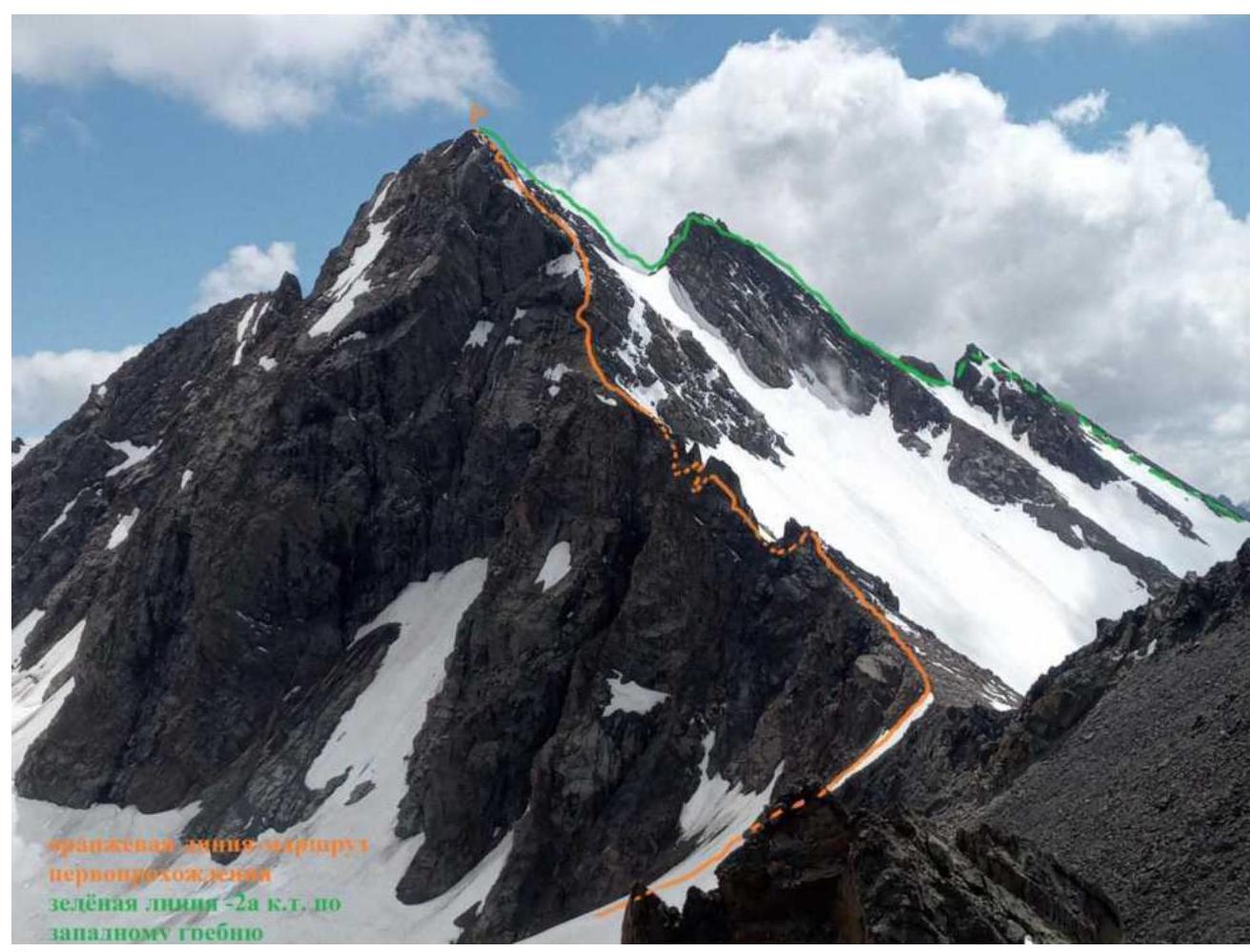
Orange line — the team's ascent route
Green — the route of 2A category via the Western ridge
Profile photo of the route

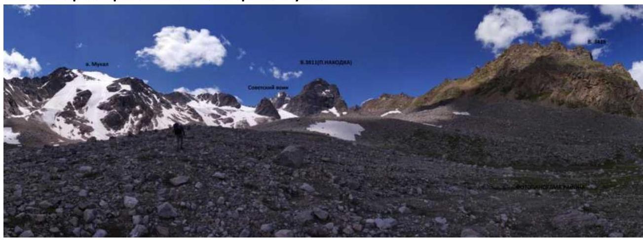
Photopanorama of the area. Shot from the Mukal River
Brief overview of the climbing area and approach description
The climbing area is located in the part of the Lateral Ridge of the Central Caucasus, stretching from the summit Irik (4046 m) to the summit Mukal (3899 m). The object of ascent — the summit Sovetsky Voin — is located in the ridge between the summits Kezgen and Irikchat.
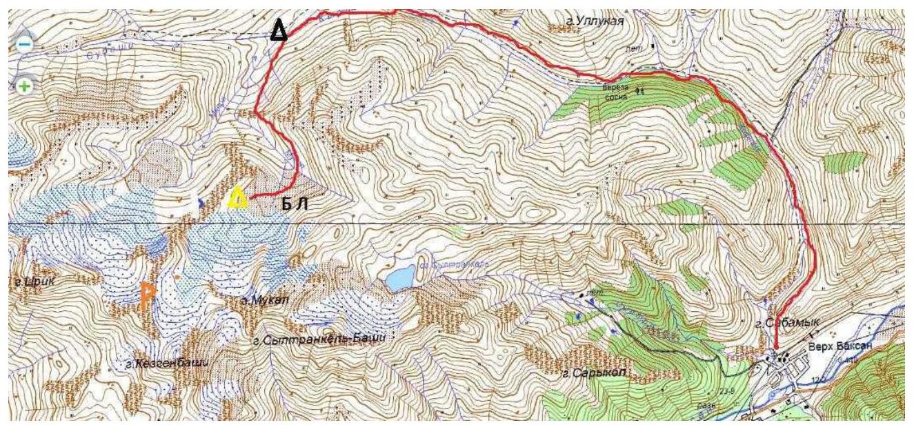
From the village Verkhny Baksan along a dirt road to the valley of the Kyrtyk River to the last koshi in the gorge at the confluence of the Kyrtyk and Mkara rivers (15 km). The road from the village Verkhny Baksan is passable for vehicles like Lada "Niva" and UAZ "Patriot".
Further:
- Across the bridge over the Mkara River.
- Along its orographic right bank, along a marked trail up to the edge of the "hanging valley" (3 km).
- Then to the left along a marked trail, bypassing p. 3428.
- In a convenient place, cross the Mukal River.
- Move up along the talus along the ridge connecting v. 3428 and p. Nakhodka.
After some time, the slope becomes more gentle and turns into wide sandy fields. At the beginning of the glacier — a lake, here are overnight stays. From the cars — 2 hours.
There is no mobile connection in the gorge. Border permits are not required.
2. Characteristics of the Route
Technical photo of the route

Technical characteristics of the route sections of 3B category
| Section No. | Relief Character | Category of Difficulty | Length, m | Type and Number of Hooks |
|---|---|---|---|---|
| R0–R1 | Snow slope | 2 | 70 | 0 |
| R1–R2 | Talus, destroyed rocks | 2–3 | 50; 40 | 2 |
| R2–R3 | Rappelling | 3 | 20 | 0 |
| R3–R4 | Wall; rock ledge | 4; 3; 4+ | 5; 25; 15 | 6 |
| R4–R5 | Descent, traverse of the ridge along the ledge and ascent along the wall | 4 | 50 | 4 |
| R5–R6 | Talus, destroyed rocks | 2+ | 40 | 0 |
| R6–R7 | Snow-ice slope | 4 | 100 | 8 |
| R7–R8 | Rocky ridge | 3 | 50 | 3 |
| R8–R9 | Wall of smooth rock | 3+; 4 | 50; 40 | 8 |
| R9–R10 | Wet rocks | 5 | 20 | 4 |
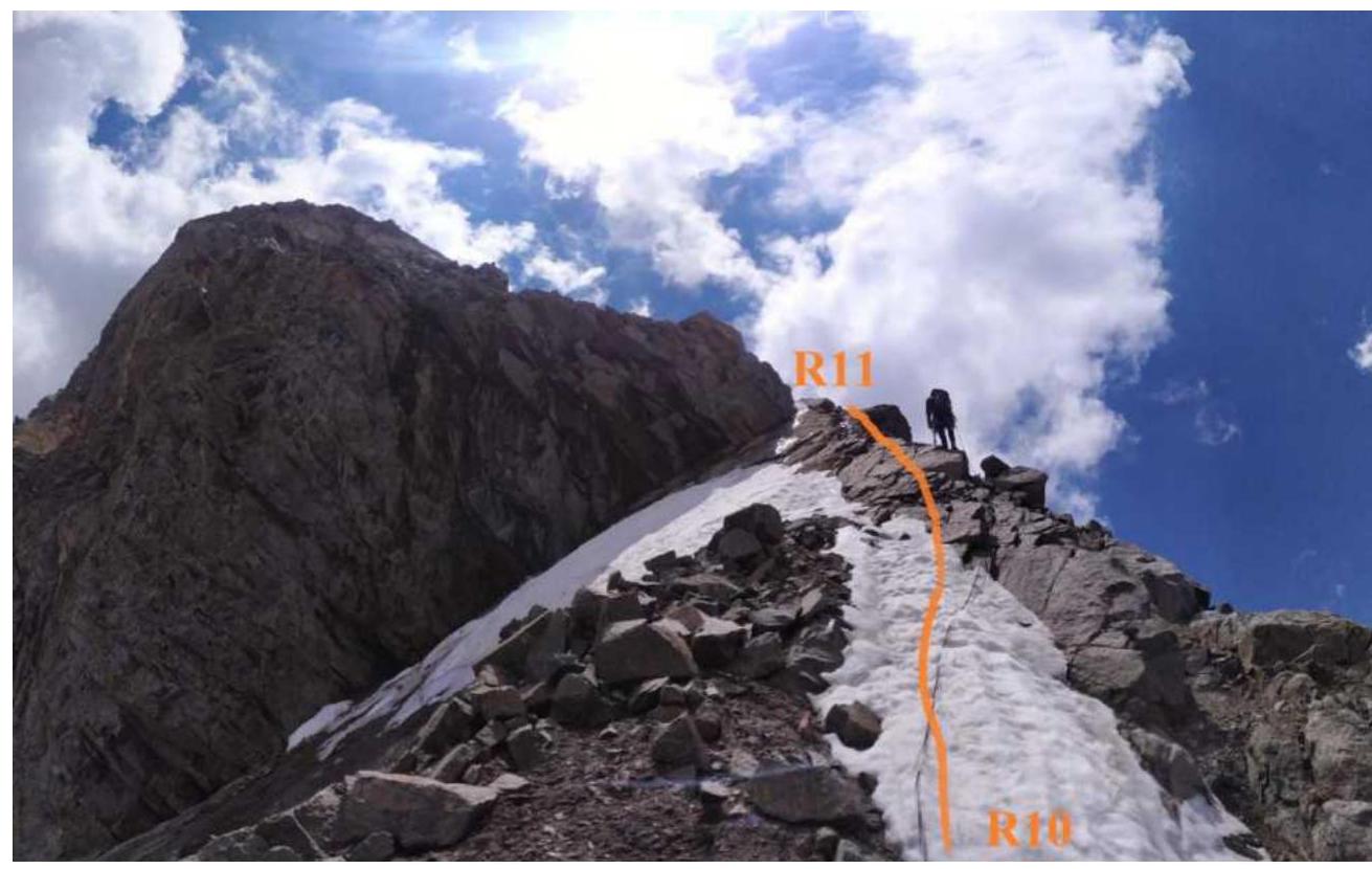
| R10–R11 | Rocky ridge | 3 | 50 | 3 |
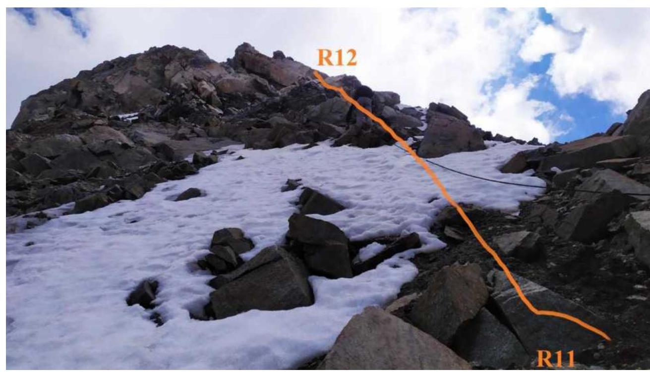
| R11–R12 | Monolithic rocks | 3+ | 50 | 3 |
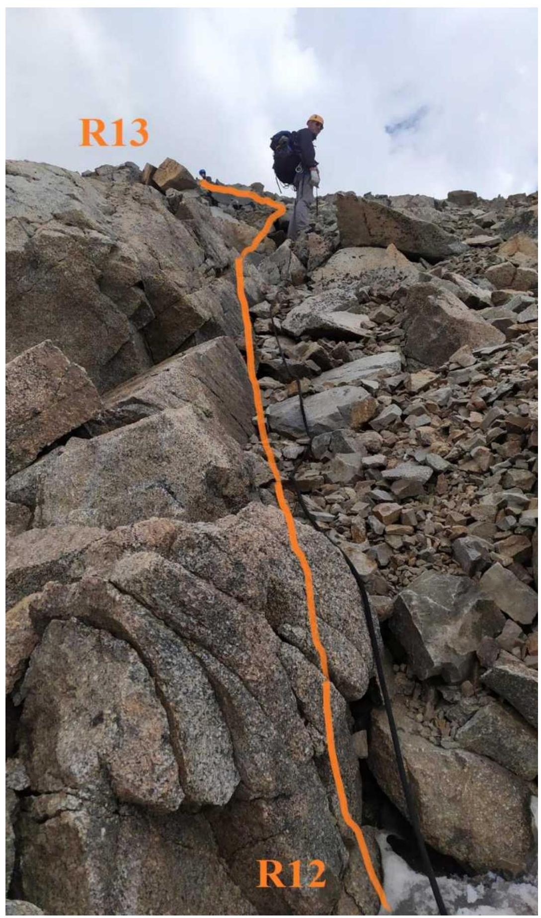
| R12–R13 | Talus slope | 2 | 40 | 0 |
3. Characteristics of the Team's Actions
| Section No. | Description | Photo No. |
|---|---|---|
| R0–R1 | Up the snowfield 30–35° category 2 difficulty 70 m to the pass | 1 |
| R1–R2 | To the left along the talus ridge 20° 50 m category 2 difficulty and further along the rocks category 3 difficulty 40 m to the gendarme. Bypass to the right. | 2 |
| R2–R3 | Immediately after the gendarme, a rappel 20 m. | 3 |
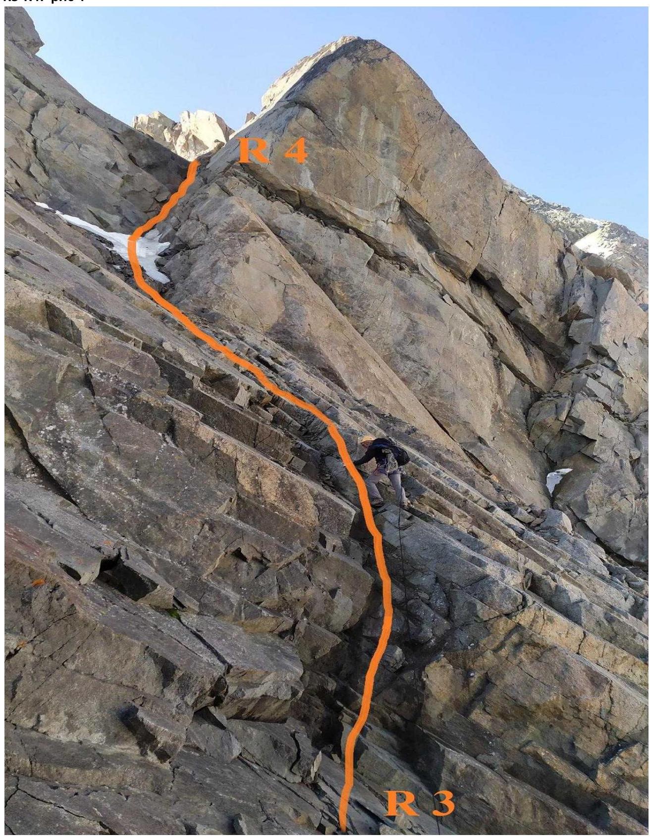
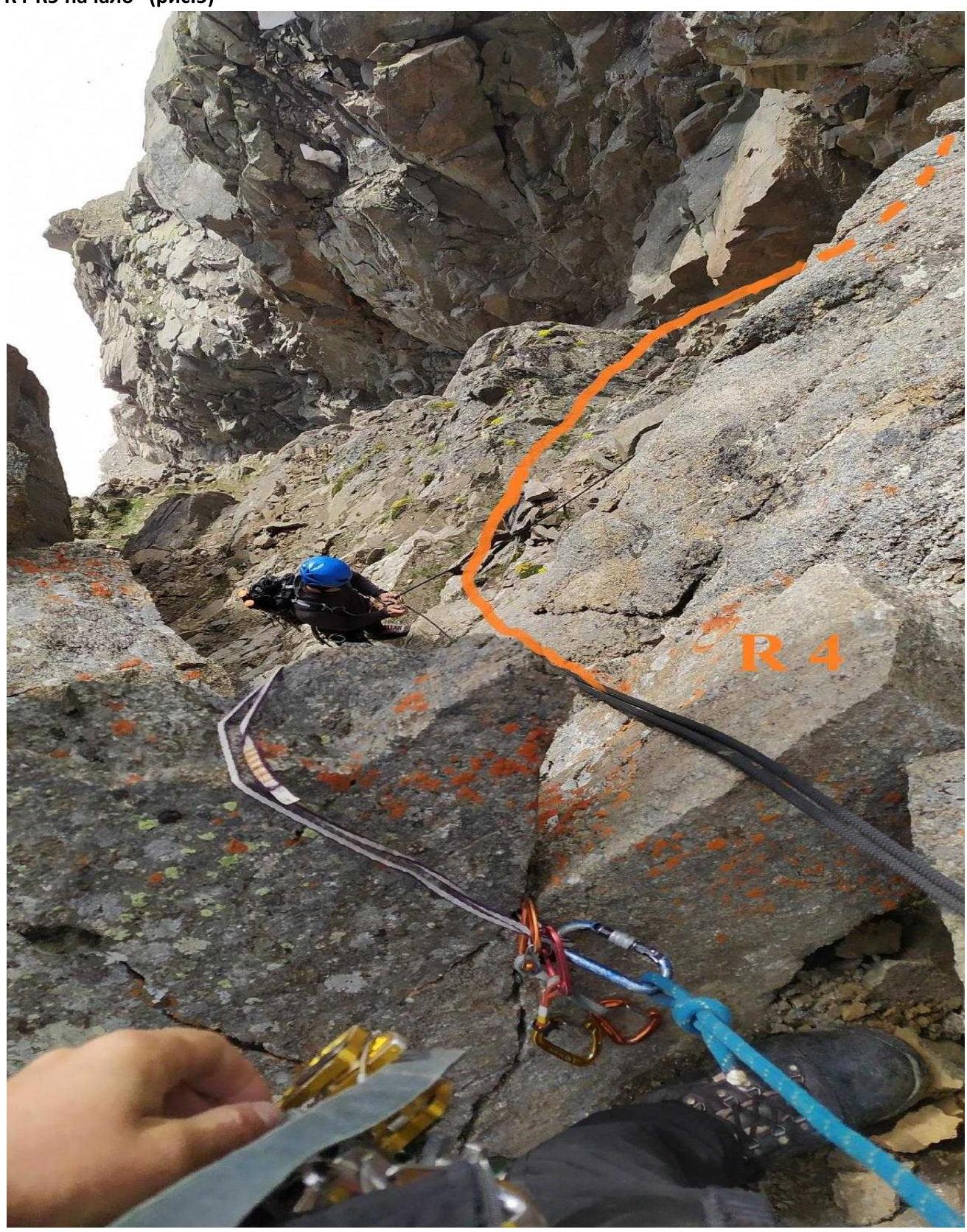
| R3–R4 | Along a small wet inner corner 5 m, 75° category 4 difficulty, then along the crevice 40° 25 m category 3+ difficulty to a large inner corner, along it 15 m, 65° category 4+ difficulty to the saddle. | 3; 4 |
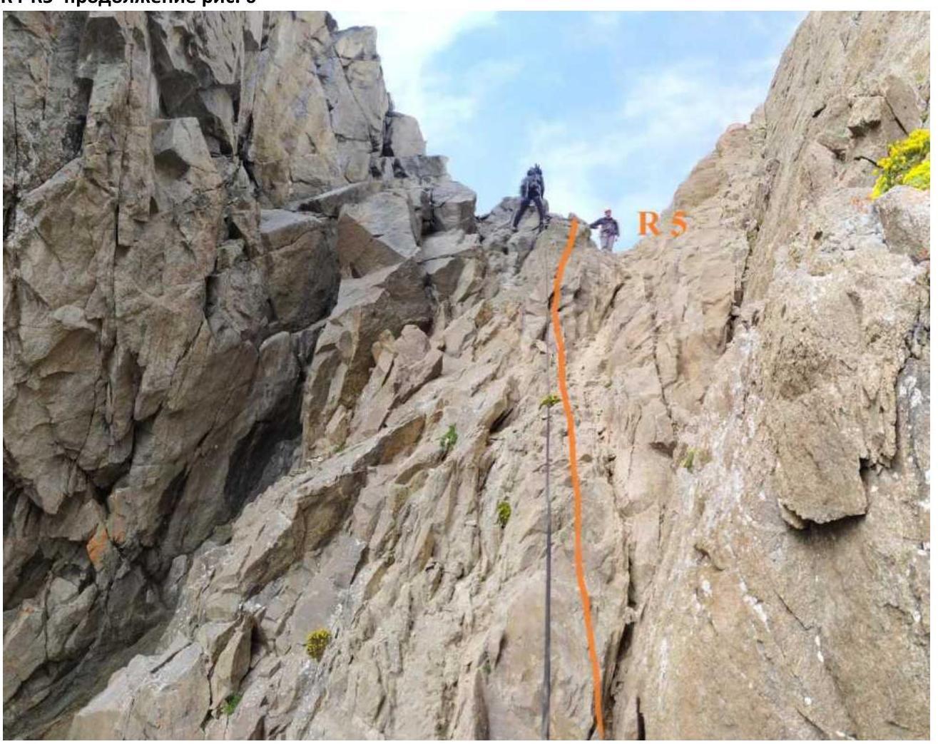
| R4–R5 | From the saddle, descend 7 m down and along the ledge approach the wall 60° 20 m. Along it, reach the second saddle. The entire section is 50 m category 4 difficulty. | 5; 6 |
| R5–R6 | From the saddle down to the right side of the ridge along the talus slope category 2+ difficulty 40 m to the glacier. | 7 |
| R6–R7 | At first along the edge of the ice, then, traversing the glacier to the right upwards 100 m 45° category 4 difficulty, exit to the snow saddle of the ridge. | 7 |
| R7–R8 | Along the ridge and its right side to the next saddle 50 m category 3 difficulty. Further along the smoothed wall 45° category 3+ difficulty 50 m upwards. | 8 |
| R8–R9 | The steepness of the slope increases to 60° 40 m category 4 difficulty to the ledge under the overhang. | 9; 10 |
| R9–R10 | A small overhang is passed head-on 3 m category 5 difficulty, further up the wall 65° category 5 difficulty 17 m to the site. | 9; 10 |
| R10–R11 | Along the monolithic rocks of the ridge category 3 difficulty upwards to the turn of the ridge to the left 50 m 40° | 11 |
| R11–R12 | Along the monolithic rocks category 3+ difficulty 40° 50 m to a simple talus slope | 12 |
| R12–R13 | Along a simple talus slope 40 m, 25° category 2 difficulty to the summit | 13 |
R0–R1. Fig. No. 1
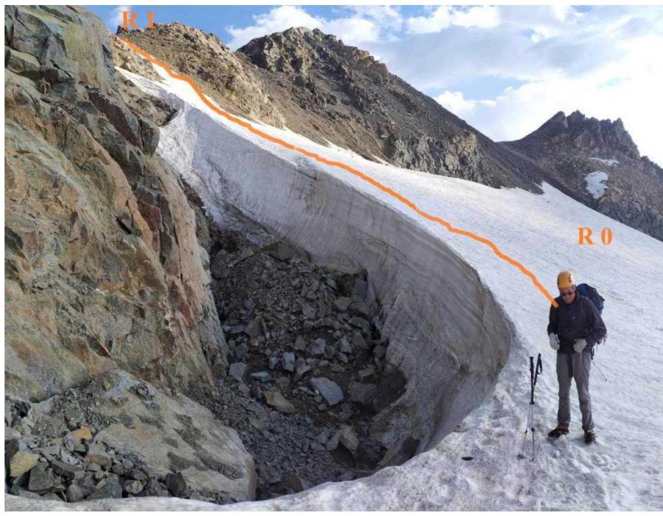
Photo No. 2 R1–R2
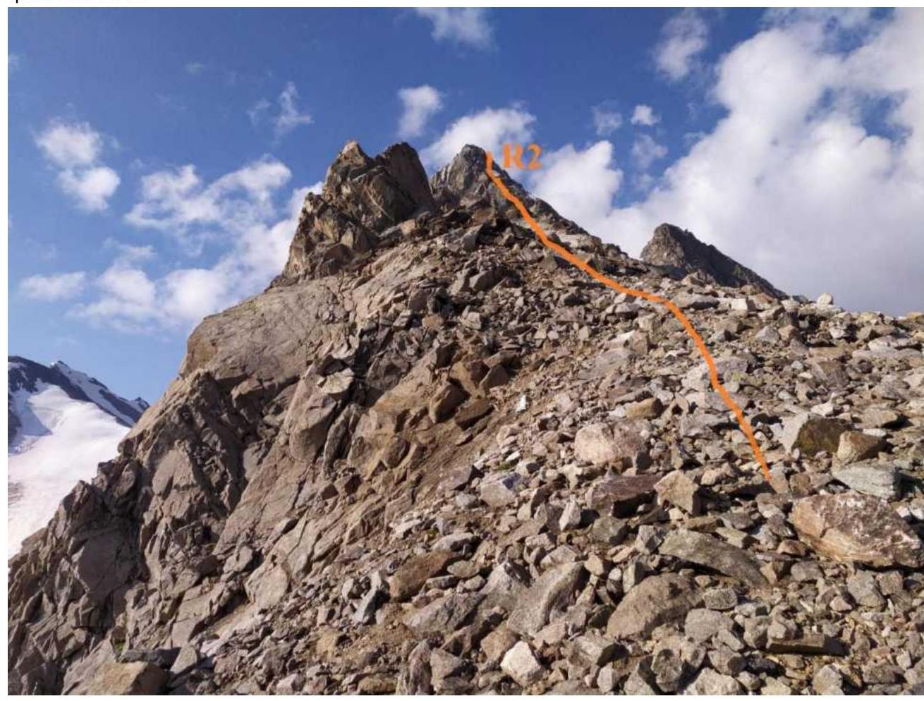
R2–R3. R3–R4. Fig. No. 3
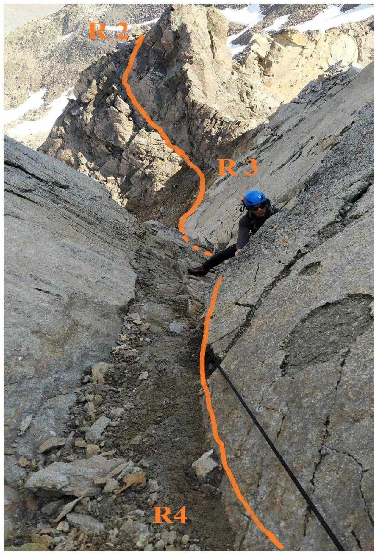
R3–R4. Fig. 4
R4–R5 start (Fig. 5)
R4–R5 continuation Fig. 6
R5–R6; R6–R7. Fig. 7

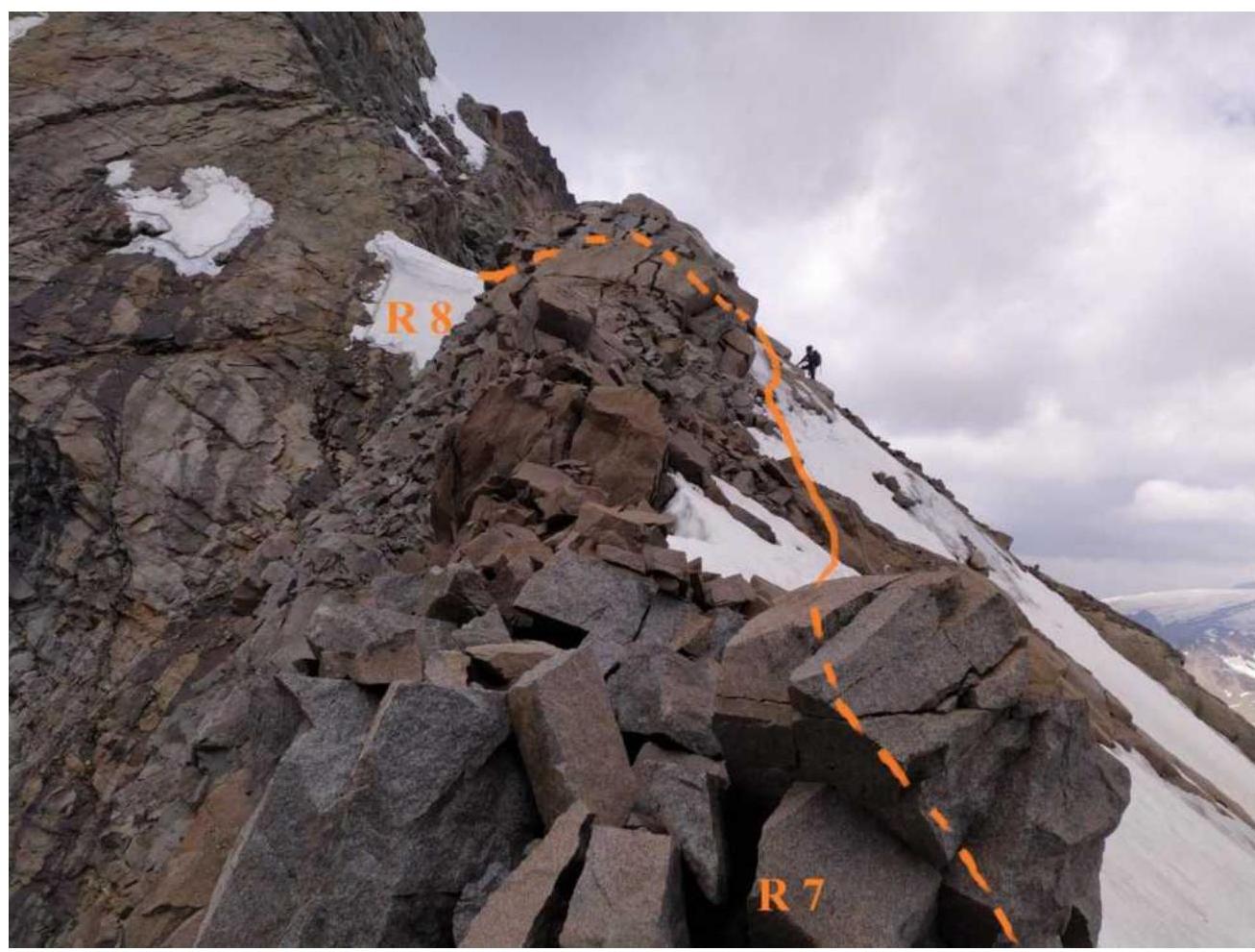
R7–R8. Fig. 8
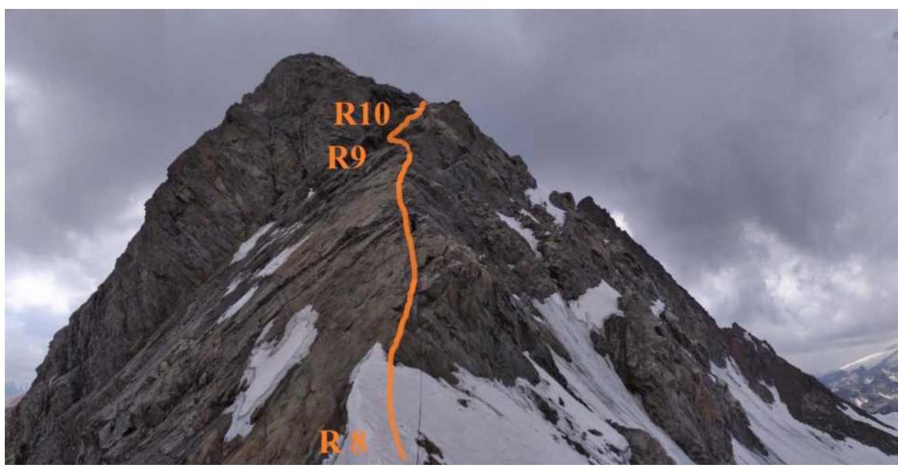
R8–R9. Fig. 9
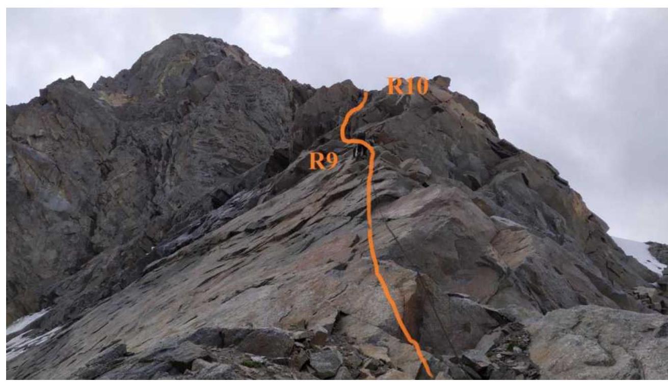
R8–R9. R9–R10. Fig. 10
R10–R11. Fig. 11
R11–R12. Fig. 12
R12–R13. Fig. 13
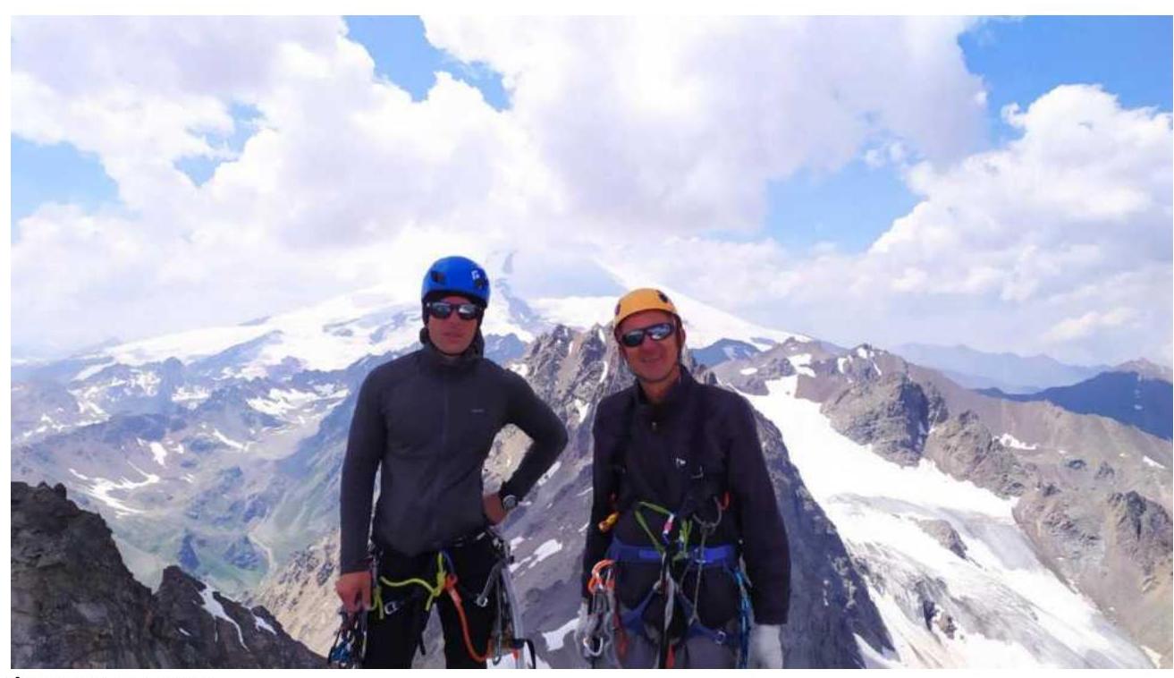
Photo at the summit
Conclusions and Recommendations
The route is logical and safe from the point of view of rockfall hazard. In our opinion, it corresponds to a strong 3B category. We compared it with a similar route to the summit Cheget-tau of 3B category.
Two descents on the route can be made both by climbing and rappelling. The relief is convenient for setting up belay points. For belaying, medium and large cams, hexes, friend medium, anchors, and drill bits were used.
In the first half of the summer, sections R3–R4, R9–R10 will be filled with ice. In this case, we recommend dividing the first section into two parts and making a station on a snow ledge to the left of the inner corner.
Descent along the eastern ridge towards v. Kezgen — 150 m until the ridge drops. Then down the southern wall along a large couloir on the right side — two rappels. Continue descending on foot along rock ledges category 3 difficulty to the drop-offs. Another rappel to the right — to the beginning of the couloir on the glacier.
Recommended for educational and sports ascents by a group of 2–4 people.