Appendix No. 1 to the Unified Requirements for a Classification Report
Report Form for Routes 1B–3B Category of Difficulty
Report
ON THE FIRST ASCENT TO THE SUMMIT 3811 («NAHODKA») VIA THE ROUTE OF 3B CATEGORY OF DIFFICULTY BY THE TEAM OF MAC «Freeline» Pyatigorsk on July 7, 2019
I. Ascent Passport
| No. | 1. General Information | |
|---|---|---|
| 1.1 | Full Name, Sports Rank of the Leader | Popov M.L. CMS |
| 1.2 | Full Name, Sports Rank of Participants | Konstantinov G.A. 2nd sports rank |
| 1.3 | Full Name of Coach | Motienko N.I. CMS |
| 1.4 | Organization | MAC «Freeline»; AK «Maximum» |
| 2. Characteristics of the Ascent Object | ||
| 2.1 | Region | Caucasus, KBR |
| 2.2 | Gorge | Kyrtyk River Gorge |
| 2.3 | Section Number according to the 2013 Classification Table | 2.4 |
| 2.4 | Name and Height of the Summit | p. 3811 («Nahodka») |
| 2.5 | Geographical Coordinates of the Summit (latitude/longitude), GPS coordinates (1) | 43°19′712″ N 42°37′553″ E |
| 3. Characteristics of the Route | ||
| 3.1 | Name of the Route | p. 3811 («Nahodka») via the north-eastern ridge |
| 3.2 | Proposed Category of Difficulty | 3B |
| 3.3 | Degree of Route Exploration | First Ascent |
| 3.4 | Relief Character of the Route | Rocky |
| 3.5 | Height Difference of the Route (altimeter or GPS data) | 520 m |
| 3.6 | Route Length (in meters) | 775 m |
| 3.7 | Technical Elements of the Route (total length of sections of various difficulty categories with indication of relief character (ice-snow, rocky)) | I cat. dif. (rocky) – 0 m. II cat. dif. combination – 205 m. III cat. dif. rocky – 425 m. IV cat. dif. rocky – 140 m. V cat. dif. – 5 m. Movement on a closed glacier – 200 m |
| 3.8 | Descent from the Summit | Via the couloir to the south onto the Mukal glacier |
| 3.9 | Additional Route Characteristics | No water |
| 4. Characteristics of Team Actions | ||
| 4.1 | Time of Movement (team's walking hours, in hours and days) | none |
| 4.2 | Overnights | none |
| 4.3 | Exit to the Route | 8:00 July 7, 2019 |
| 4.4 | Reach the Summit | 14:00 July 7, 2019 |
| 4.5 | Return to the Base Camp | 16:00 July 7, 2019 |
| 5. Responsible for the Report | ||
| 5.1 | Full Name, e-mail | Popov Mikhail Lvovich mikl_popov@inbox.ru 89282657130 |
1. Characteristics of the Ascent Object
General photo of the summit p. 3811 («Nahodka»)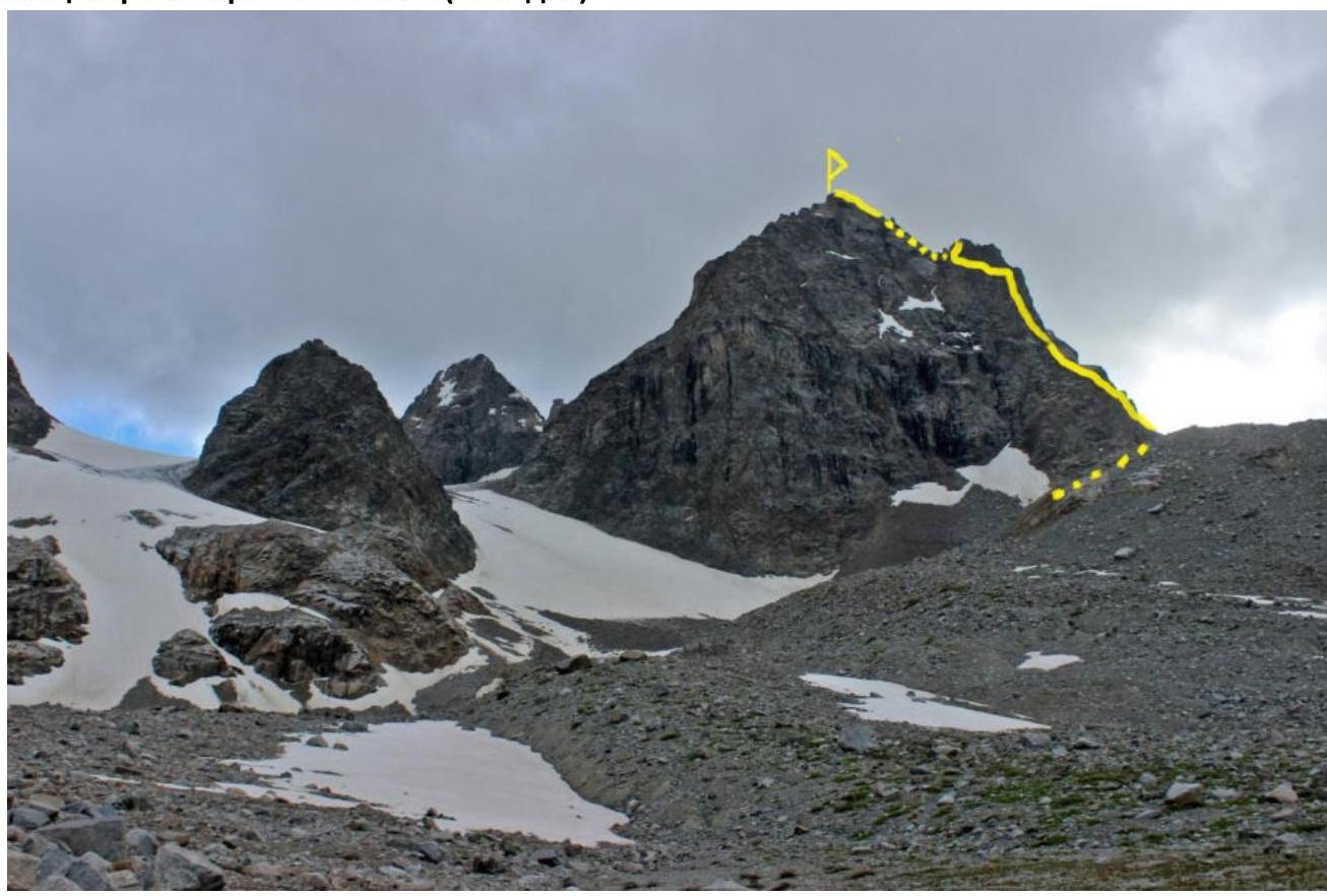
Yellow line — the team's ascent route. No other routes to the summit have been laid out.
Photo of the route profile
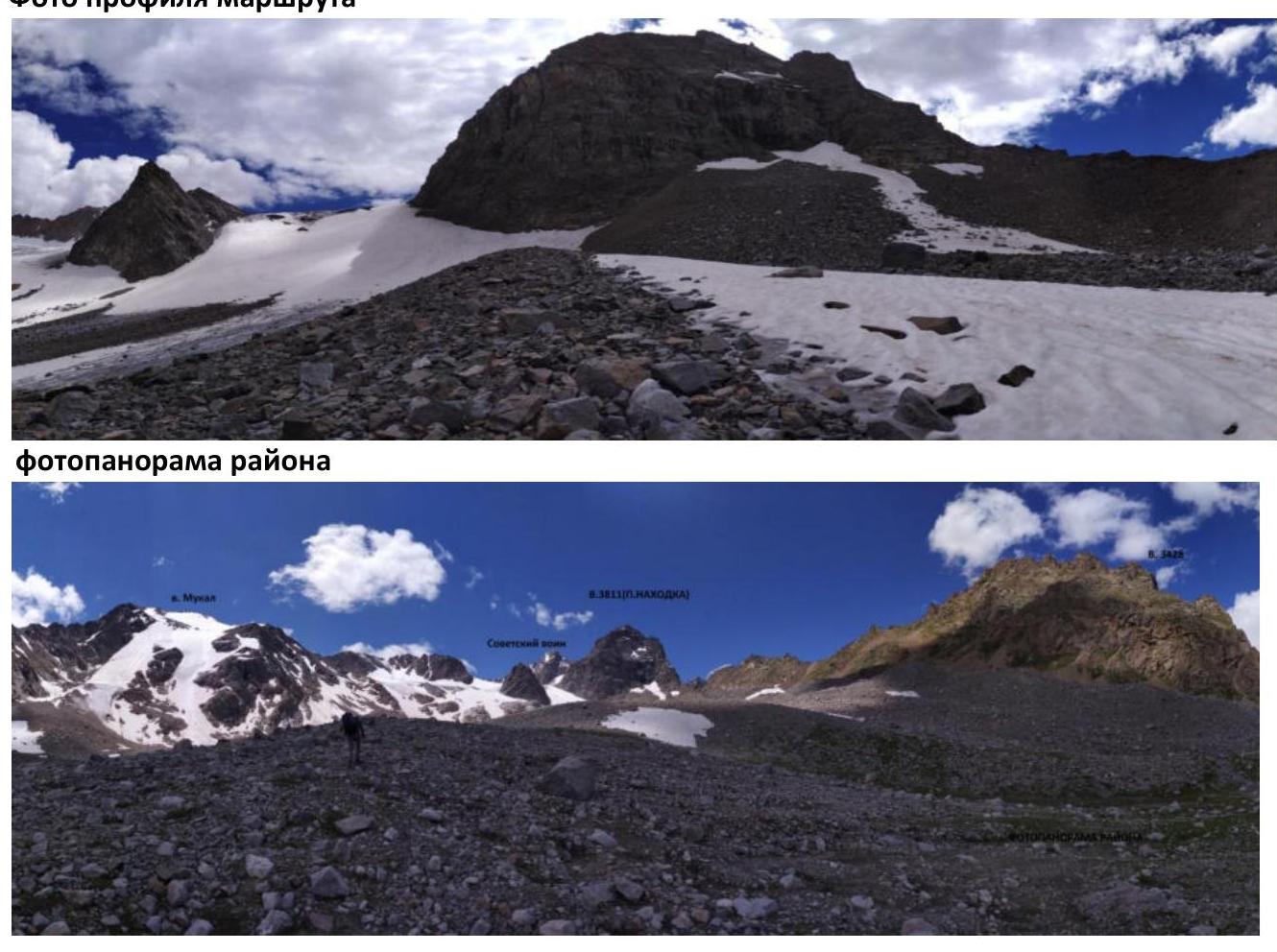
Photopanorama of the Area
Brief overview of the ascent area and description of the approach
The ascent area is located in the part of the Lateral Ridge of the Central Caucasus, stretching from the summit Irik (4046 m) to the summit Mukal (3899 m). The object of the ascent — summit 3811 m («Nahodka») is located in the ridge, stretching for three kilometers in the northern direction from the summit Sovetsky Voin (4012 m), to the summit 3428 m.
To the west lies the eastern Mkyaara glacier, to the east — the Mukal glacier.
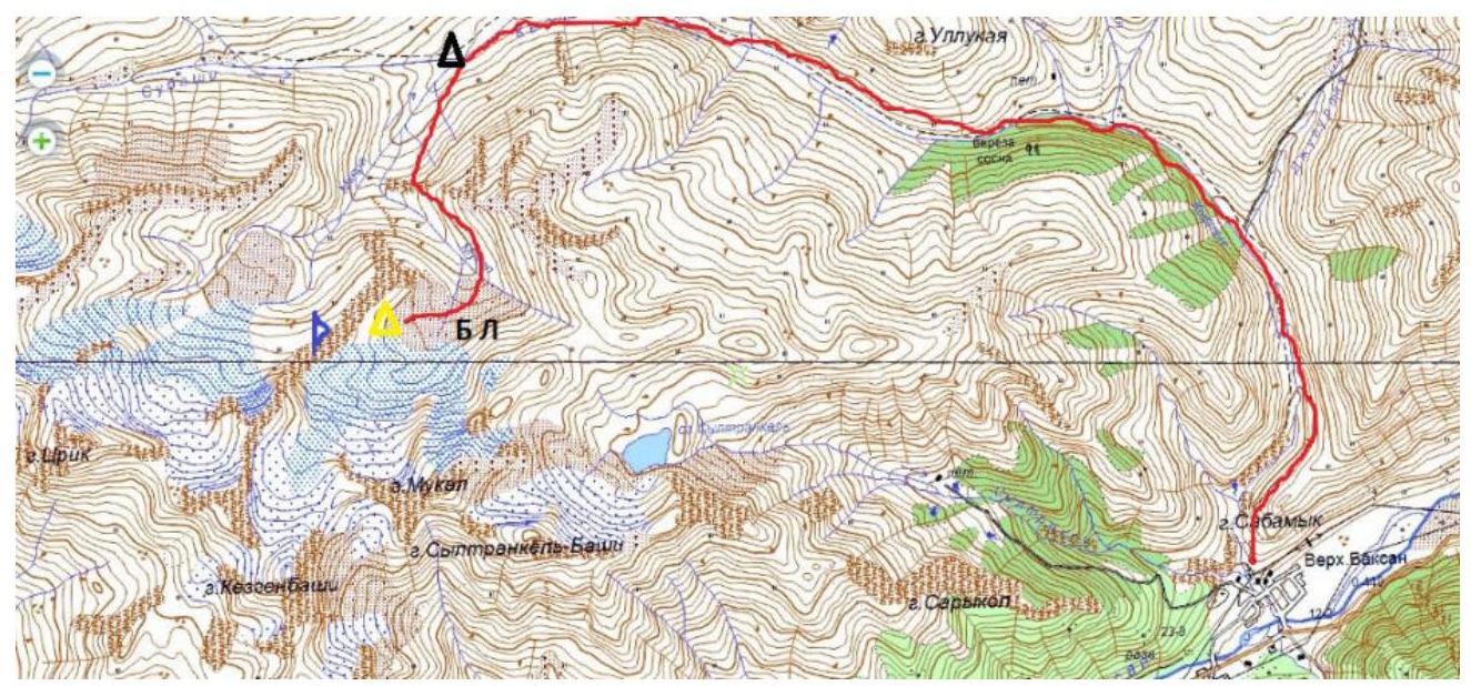
From the village Verkhny Baksan along a dirt road to the valley of the Kyrtyk River to the last koshi in the gorge at the confluence of the Kyrtyk and Mkyaara rivers (15 km). The road from the village Verkhny Baksan is passable for vehicles like Lada «Niva» and UAZ «Patriot».
Further:
- across the bridge over the Mkyaara River;
- along its orographic right bank, on a marked trail upwards to the edge of the «hanging valley» (3 km);
- then left on a marked trail, bypassing p. 3428. In a convenient place, cross the Mkyaara River and move upwards along the talus along the ridge connecting v. 3428 and p. Nahodka.
After some time, the slope becomes more gentle and turns into wide sandy fields. We choose a clearing, the closest to the summit Nahodka, for a bivouac site. From the cars — 2 hours.
There is no mobile connection in the gorge.
Border permits are not required.
2. Characteristics of the Route
Technical photograph of the route
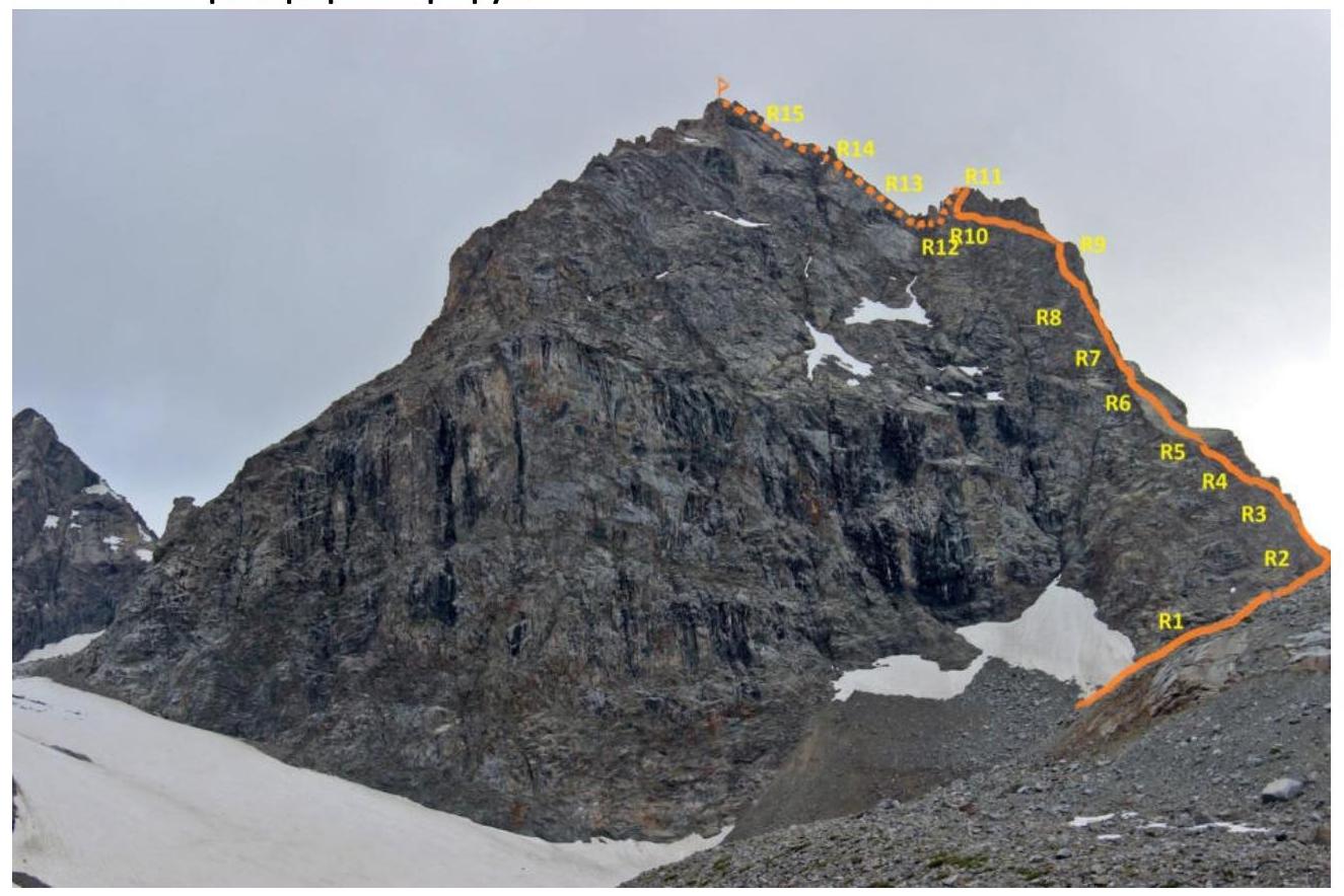
Technical characteristics of the route sections 3B cat. dif.
| Section No. | Relief Character | Category of Difficulty | Length, m | Type and Number of Hooks |
|---|---|---|---|---|
| R0–R1 | Talus, snow slope | 2 | 100 | 0 |
| R1–R2 | Talus, destroyed rocks | 2+ | 50 | 0 |
| R2–R3 | Destroyed ridge | 3 | 40 | 2 |
| R3–R4 | Wall; rocky shelf | 4; 2+ | 20; 15 | 4 |
| R4–R5 | Wall | 4+ | 20 | 3 |
| R5–R6 | Smooth wall | 3 | 45 | 4 |
| R6–R7 | Wall, shelves | 5; 3 | 5; 20 | 4 |
| R7–R8 | Wall, left slope of the ridge | 3 | 30 | 3 |
| R8–R9 | Wall, left slope of the ridge | 4 | 40 | 4 |
| R9–R10 | Smoothed rocks | 3+ | 120 | 6 |
| R10–R11 | Monolithic wall | 4 | 60 | 7 |
| R11–R12 | Monolithic rocks | 3 | 20 | 0 |
| R12–R13 | Monolithic rocks | 3 | 45 | 4 |
| R13–R14 | Inner corner, destroyed wall | 3 | 80 | 5 |
| R14–R15 | Simple ridge, monolith | 2+ | 40 | 2 |
| R15–R16 | Smooth wall | 3+ | 25 | 2 |
3. Characteristics of Team Actions
| Section No. | Description | Photo Number |
|---|---|---|
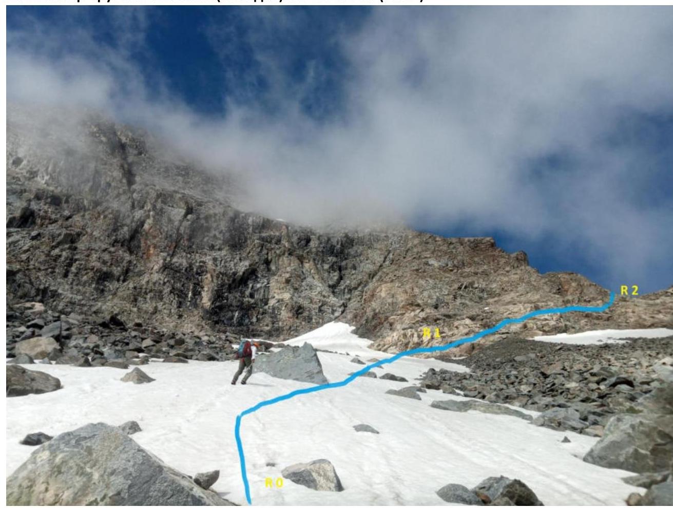
| R0–R1 | On the snowfield 35–40°, upwards to the right 2 cat. dif., 100 m; to the right upwards on destroyed rocks and talus 40–45°, 2+ cat. dif., 50 m to the ridge saddle; along the ridge 40–50°, upwards 3 cat. dif., 40 m. | 1 |
| R1–R2 | To the right upwards on destroyed rocks and talus 40–45°, 2+ cat. dif., 50 m to the ridge saddle. | 1; 2 |
| R2–R3 | Along the ridge 40–50°, upwards 3 cat. dif., 40 m. | 2 |
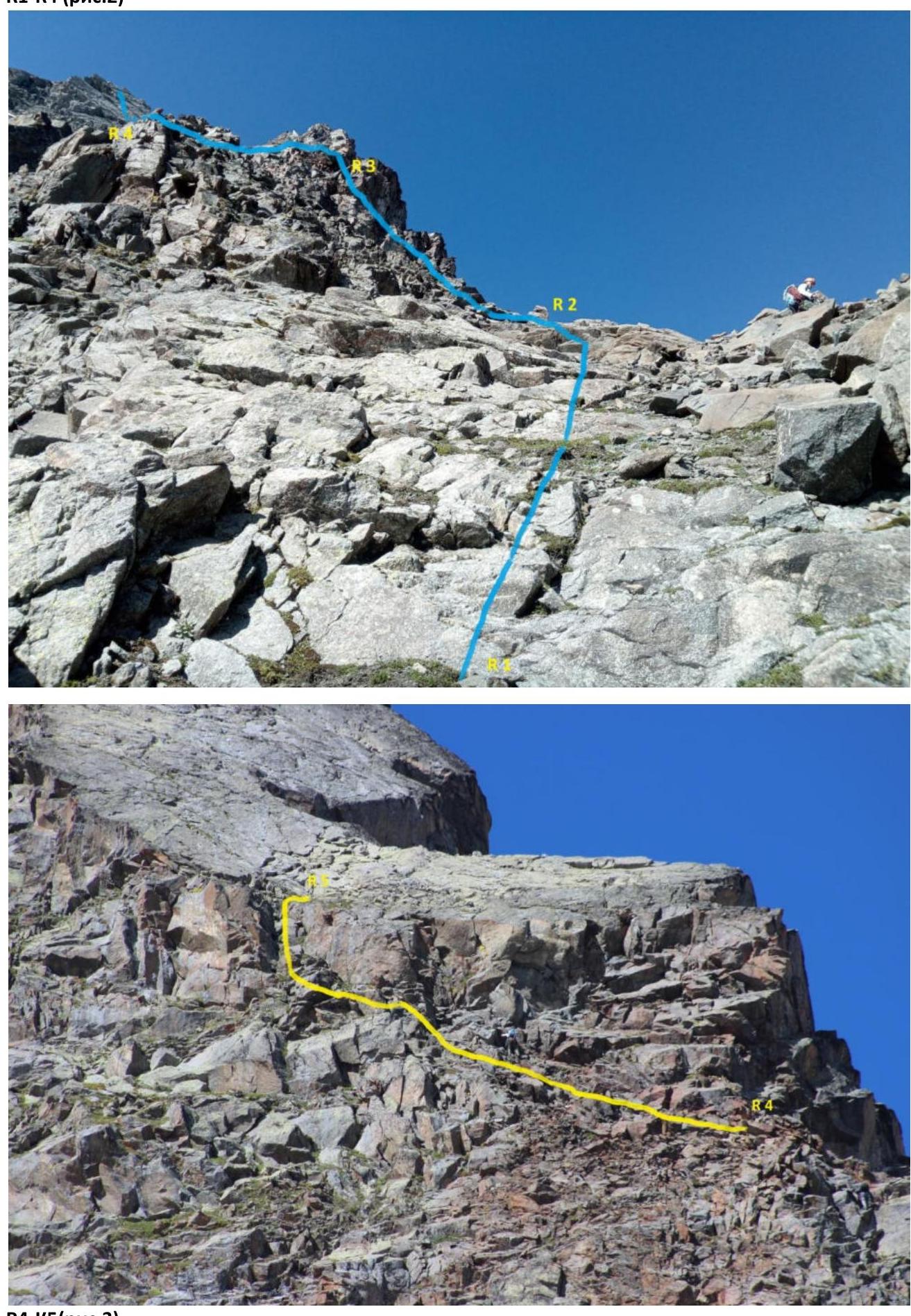
| R3–R4 | Steepness of the ridge increases to 60°. 20 m 4 cat. dif. and 15 m on a simple shelf 2+ cat. dif. under an overhanging wall. | 2 |
| R4–R5 | The wall is bypassed on the left along the wall 65°. 4+ cat. dif. 20 m. Exit to a wide shelf before the start of a huge smooth slab. | 3 |
| R5–R6 | From the shelf upwards along the slab 40°. 3 cat. dif. 45 m to the left part of the slab. | 4; 5 |
| R6–R7 | Steepness of the slab increases to 65°. On the left side of the slab, a complex exit 5 cat. dif. 5 m. Then 20 m upwards to the end of the slab 45°. 3 cat. dif. The complex exit can be bypassed along the center of the slab 10 m 4 cat. dif. provided there is no snow and moisture on the rocks. | 6 |
| R7–R8 | Along the ridge and its left side to the shelf 50°. 3 cat. dif. 30 m. | 5; 6 |
| R8–R9 | Further along the left side of the ridge along grassy shelves and walls 60°. 3+; 4 cat. dif. 40 m to a small saddle in the ridge. | 5 |
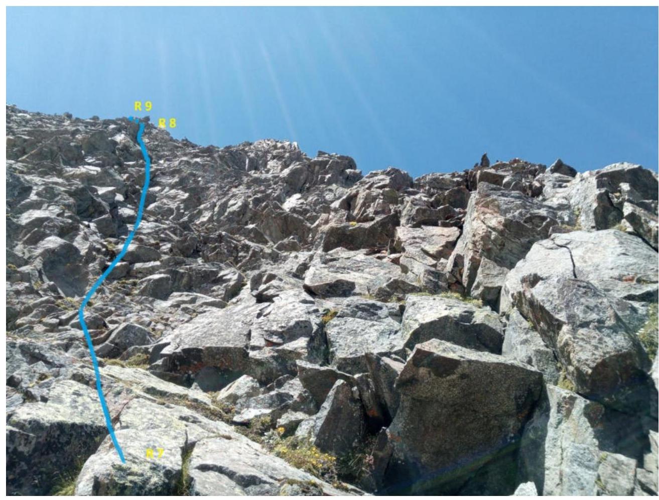
| R9–R10 | From the saddle along the left side of the ridge along smoothed shelves, traverse the slope of the ridge to the left upwards 3+ cat. dif. 120 m to a large couloir leading to the saddle. | 7; 8 |
| R10–R11 | Upwards along the wall 65°. 4 cat. dif. 60 m to the exit to the ridge. | 8; 9 |
| R11–R12 | From the ridge descend 20 m down by rappel. | 11 |
| R12–R13 | Traverse the ridge on the right side 30°. 3 cat. dif. After 45 m, we exit again to the ridge at the base of the pre-summit tower. | 11 |
| R13–R14 | Along the inner corner 20 m and wall 60 m 40°. 3 cat. dif. upwards to the saddle. | 10; 11 |
| R14–R15 | Along the right side of a small ridge 20°. 2+ cat. dif. 40 m to smoothed slabs. | 12 |
| R15–R16 | Along the slabs 50°. 3+ cat. dif. 25 m to the summit. | 12 |
Start of the route 3B cat. dif. to v. 3811 («Nahodka»).
- R0–R1
- R1–R2 (fig. 1)
- R1–R4 (fig. 2)
R4–R5 (fig. 3)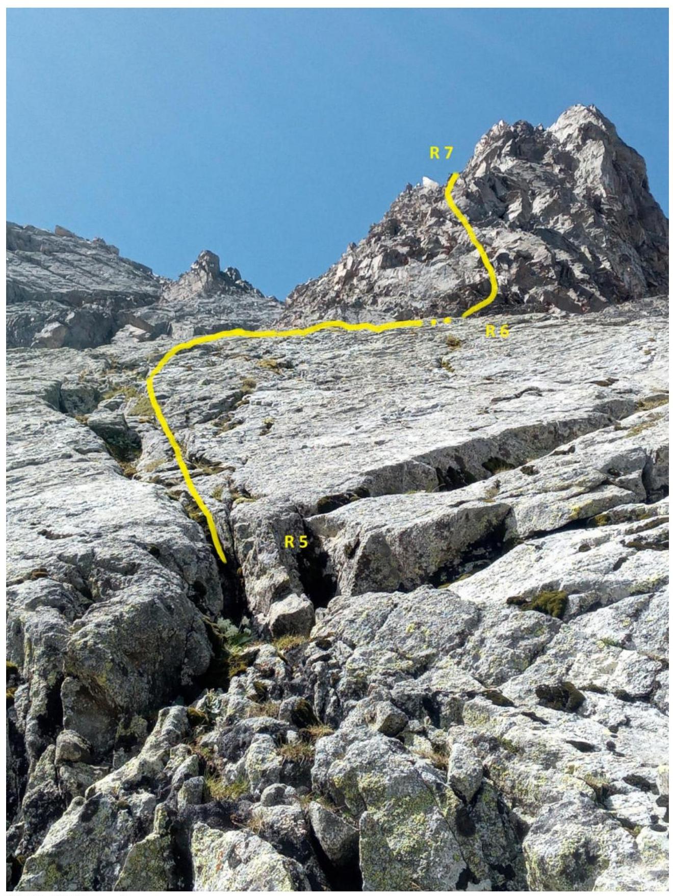
R5–R6. R6–R7 (fig. 4). R5–R9 (fig. 5)
R7–R8 (fig. 6)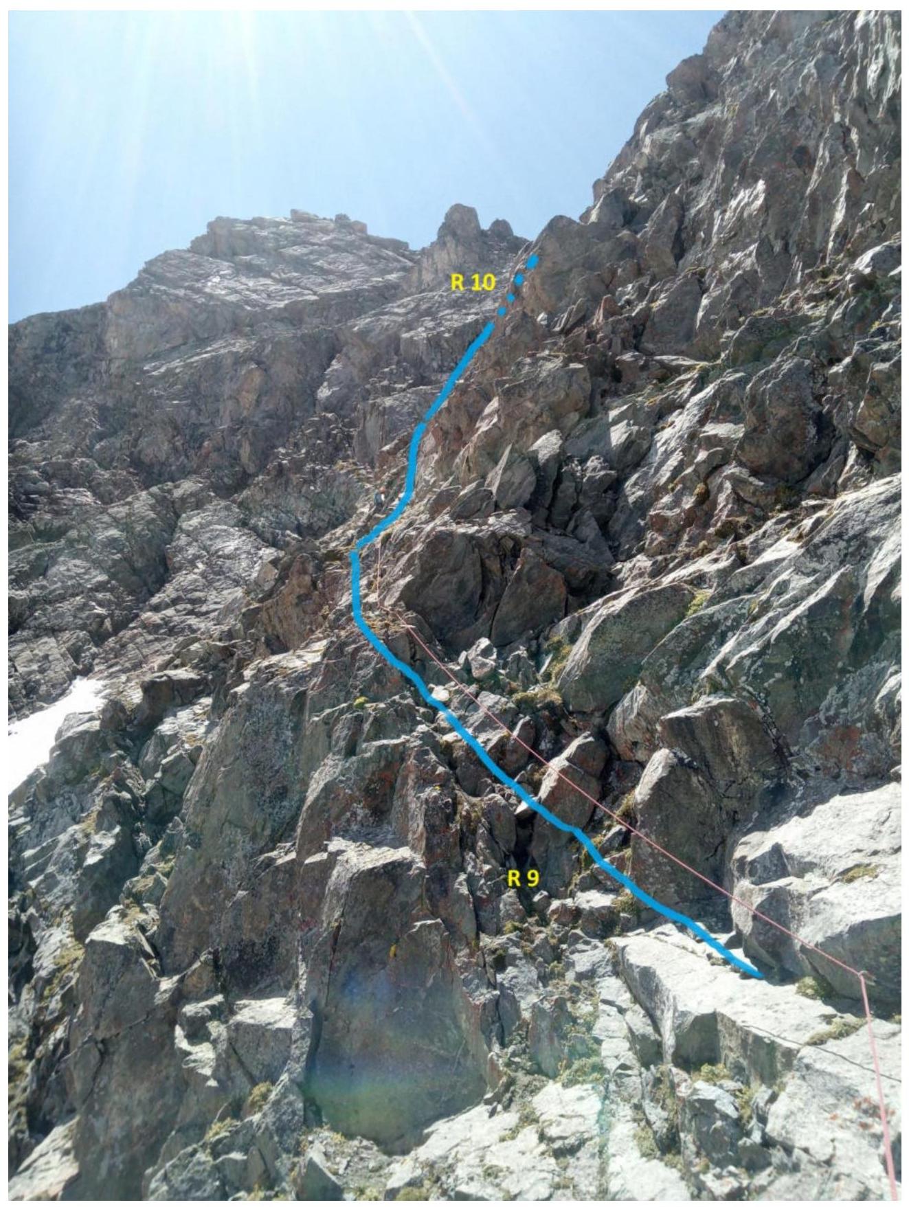
R9–R10 (fig. 7)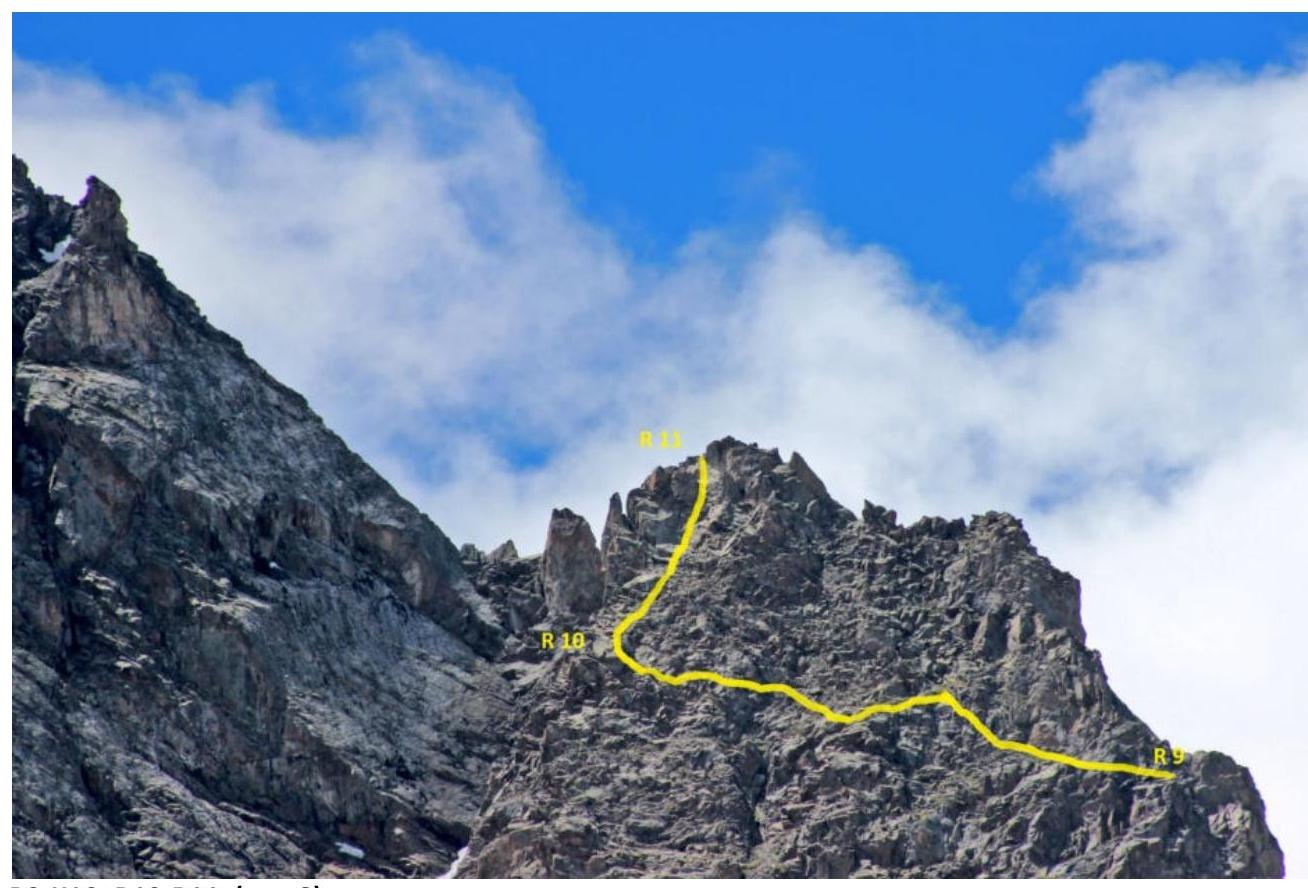
R9–R10; R10–R11 (fig. 8)
R10–R11 (fig. 9). Section R13–R14 (fig. 10)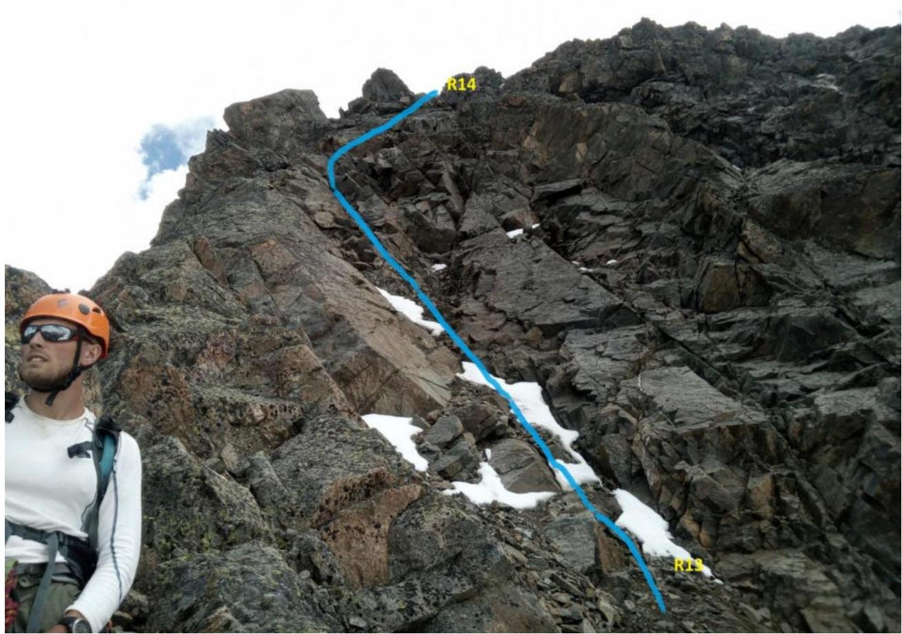
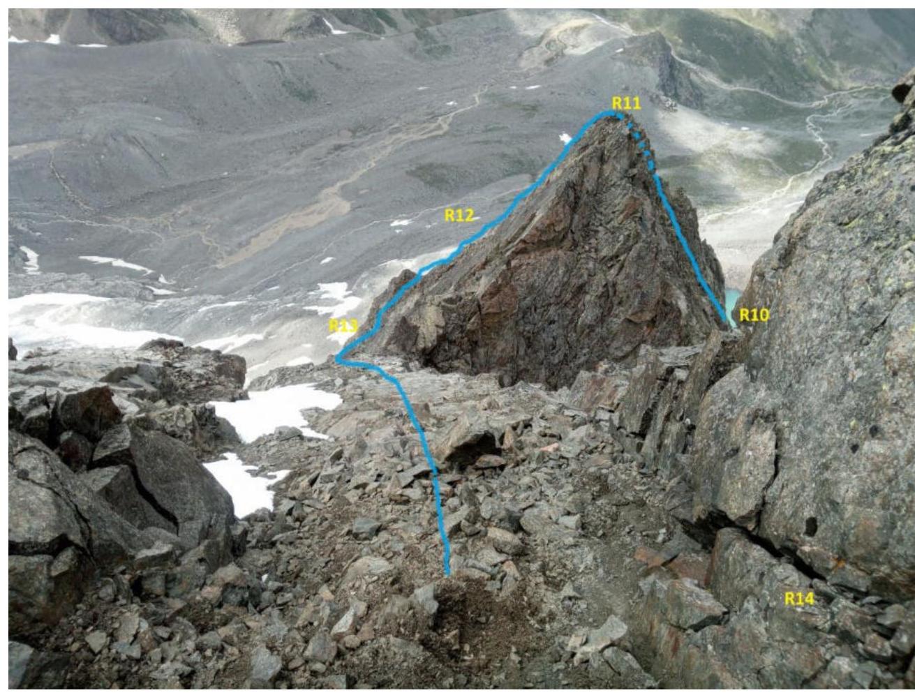
R11–R12. R12–R13 (fig. 11)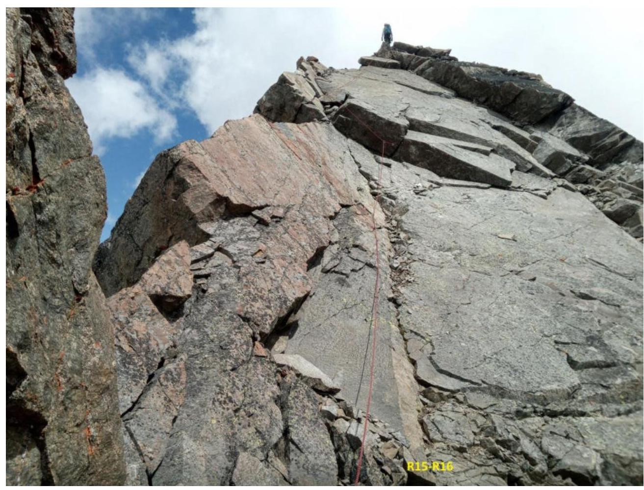
R15–R16 Summit (fig. 12)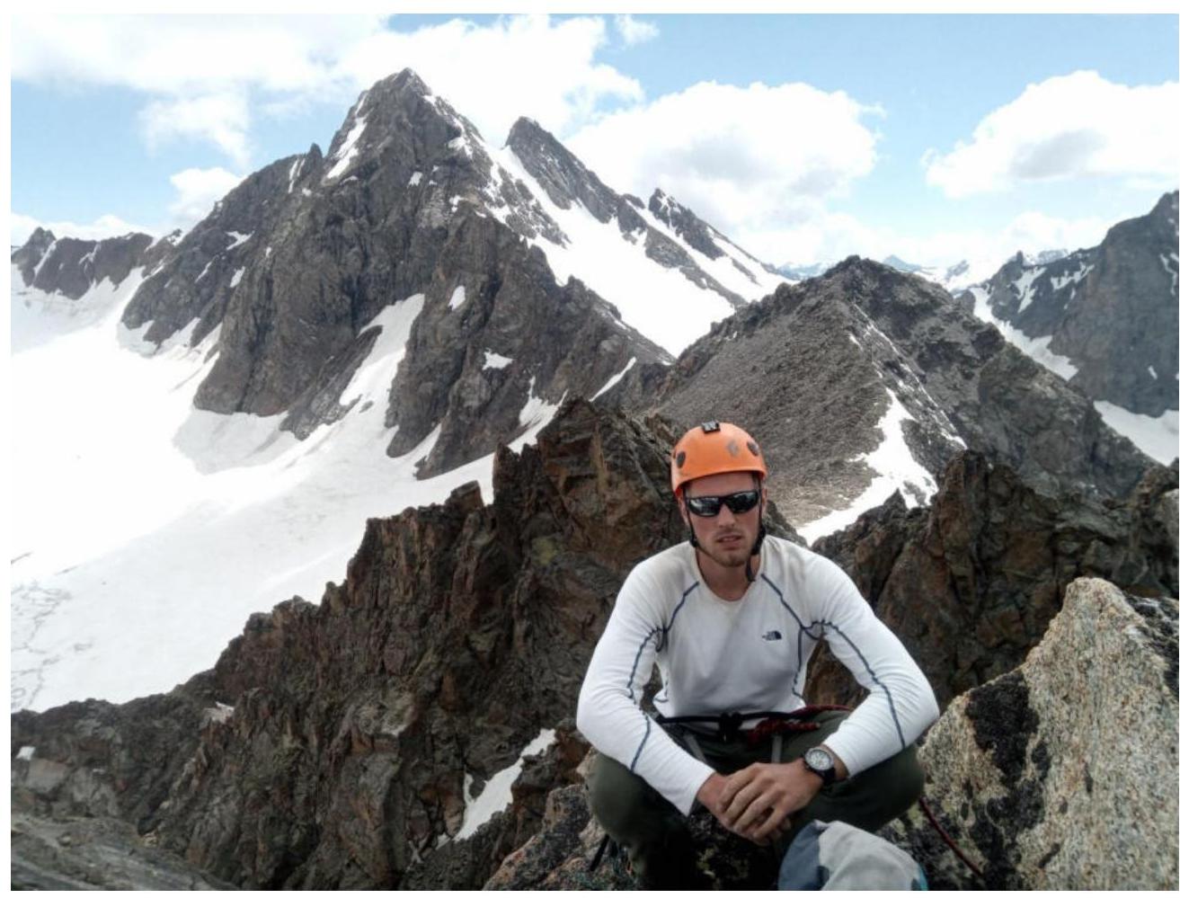
Photo at the summit
Conclusions and Recommendations
The route is logical and safe in terms of rockfall danger. In our opinion, it corresponds to a strong 3B cat. dif. We compared it with a similar route on v. Belalakaya 3B cat. dif. In the lower part, it is destroyed, in the upper part — monolithic. The relief is convenient for setting insurance points, except for R9–R10.
For insurance, the following were used:
- medium and large stoppers,
- hexes,
- medium friends.
Hooks and anchors were not used.
Recommended for educational and sports ascents by a group of 2–4 people.
During the study of the route at the foot of the mountain, we discovered the remains of a camp, apparently swept away by an avalanche. Details at https://www.risk.ru/blog/216943#comments↗. We decided to propose to name the summit peak «Nahodka».