
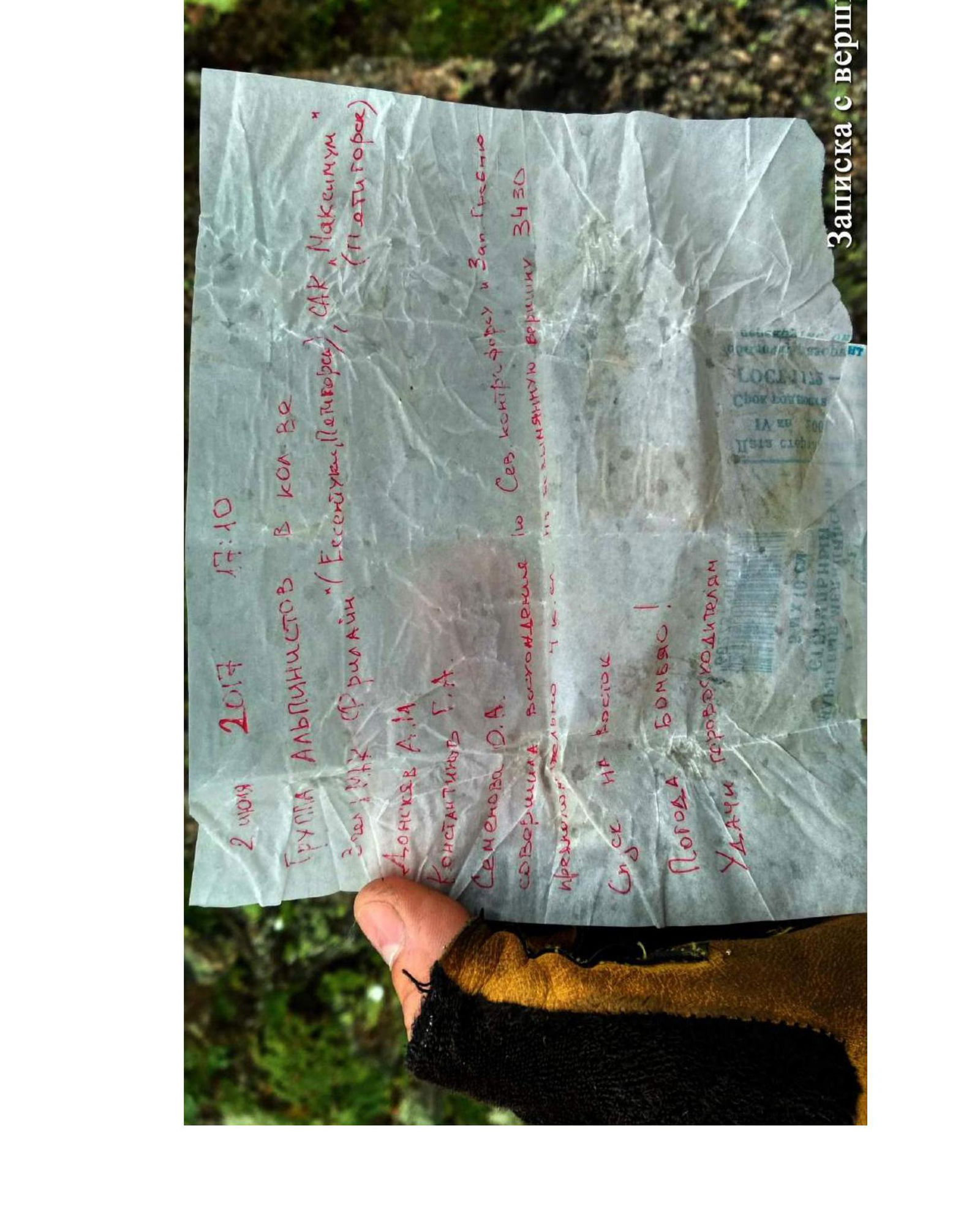
Report on the First Ascent to the Peak 3428 m via the Northwest Ridge, Presumably Category 1B, by the Team of the "Freeline" Multidisciplinary Mountaineering Club from Essentuki, July 14-15, 2018
Climbing Report Form
| № p.p. | 1. General Information | |
|---|---|---|
| 1.1 | Full Name, Sports Rank of the Leader | Semenova Olesya Artemovna, 1st sports rank |
| 1.2 | Full Name, Sports Rank of the Participants | Popov M.L., CMS; Donskov A.M., 1st sports rank; Ivanov R.I., 2nd sports rank; Shchedrin G.A., 2nd sports rank; Konstantinov G.A., 2nd sports rank; Kovalev R.A., 3rd sports rank; Shevchuk E.S., 3rd sports rank; Gyulushanyan R.S., badge; Ivashchenko S.V., badge |
| 1.3 | Full Name of the Coach | Motienko N.I. |
| 1.4 | Organization | "Freeline" Mountaineering Club, Essentuki |
| 2. Characteristics of the Climbing Object | ||
| 2.1 | Region | Caucasus, Kabardino-Balkaria, Elbrus region |
| 2.2 | Valley | Baksan, Kyrtik, Mukal |
| 2.3 | Number of the Section According to the 2013 Classification Table | From the Chiperaza Pass to the Gumači Peak |
| 2.4 | Name and Height of the Peak | 3428 m |
| 2.5 | Geographical Coordinates of the Peak | 43°20′27.30″ N 42°38′26.36″ E |
| 3. Characteristics of the Route | ||
| 3.1 | Route Name | Northwest Ridge |
| 3.2 | Proposed Category of Difficulty | 1B |
| 3.3 | Degree of Route Exploration | First Ascent |
| 3.4 | Relief Character of the Route | Rocky |
| 3.5 | Height Difference of the Route (according to altimeter or GPS data) | 458 m |
| 3.6 | Route Length (in meters) | 1000 m |
| 3.7 | Technical Elements of the Route | I cat. diff. rocks – 550 m. II cat. diff. rocks – 420 m. III cat. diff. rocks – 30 m |
| 3.8 | Descent from the Summit | Down the southern slope to the Mukal Glacier |
| 3.9 | Additional Route Characteristics | Water in the form of snow in winter and the first half of summer |
| 4. Characteristics of the Team's Actions | ||
| 4.1 | Movement Time | 8 h 30 min |
| 4.2 | Overnight Stays | - |
| 4.3 | Start of the Route | 7:15, 15.07.2018 |
| 4.4 | Reaching the Summit | 10:15, 15.07.2018 |
| 4.5 | Return to the Base Camp | 13:55, 15.07.2018 |
| 5. Person Responsible for the Report | ||
| 5.1 | Full Name, Phone, e-mail | Semenova Olesya Artemovna, +7-928-252-58-92, olesya.semenova301@mail.ru |
Description of the Ascent
1. Characteristics of the Climbing Object
General photo
of the peak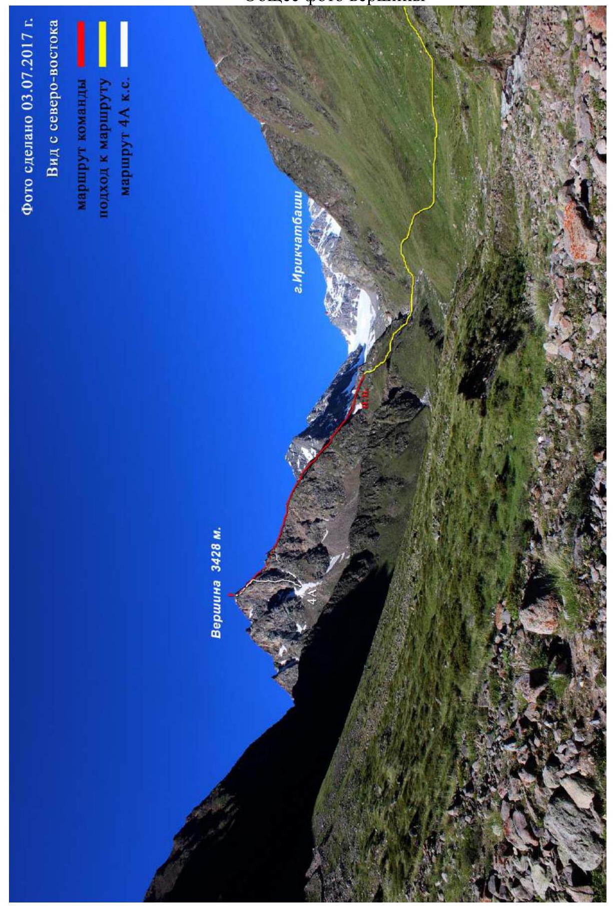
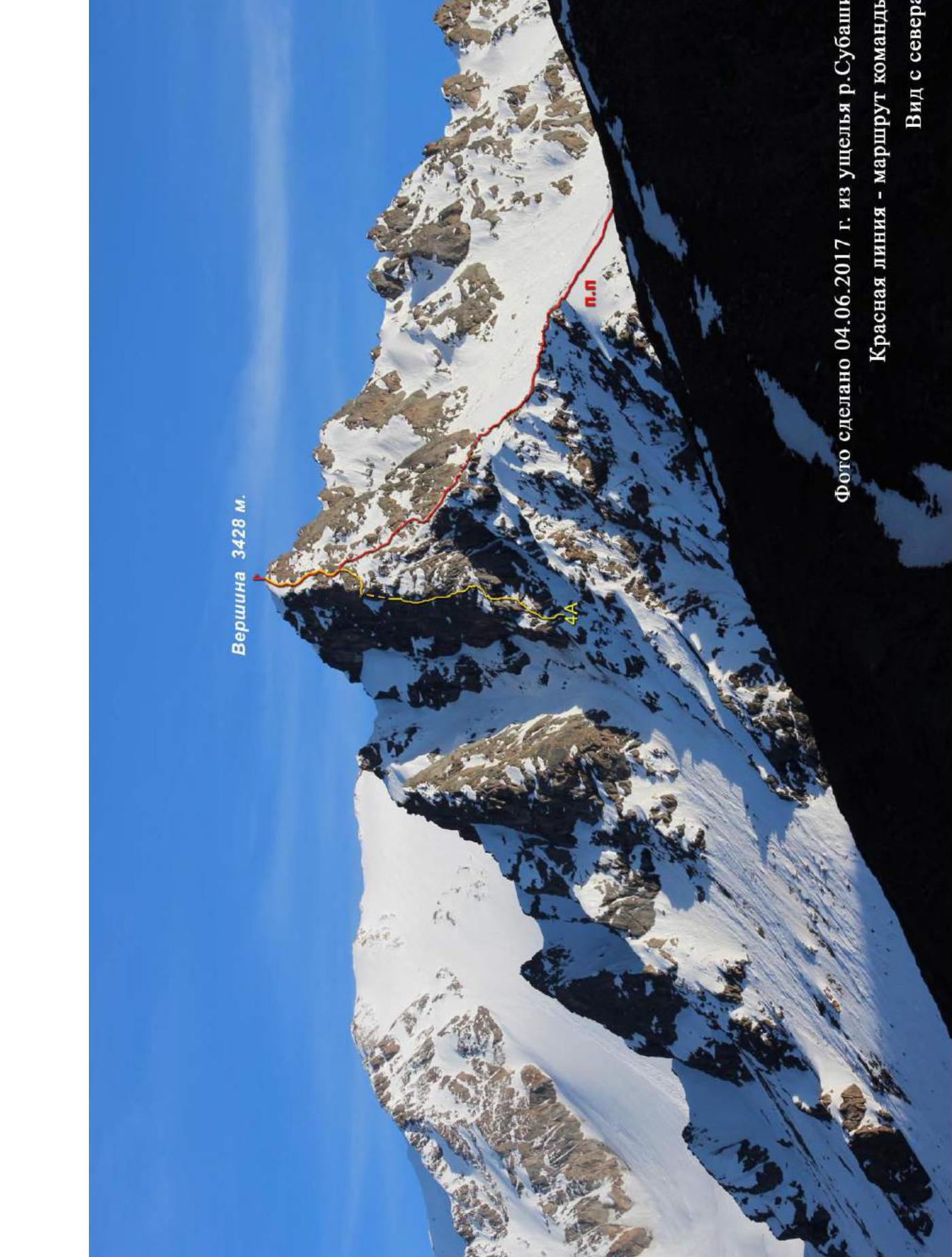
The photo was taken on 04.06.2017 from the Subashi river valley. The red line indicates the team's route. View from the north
Profile photo
of the route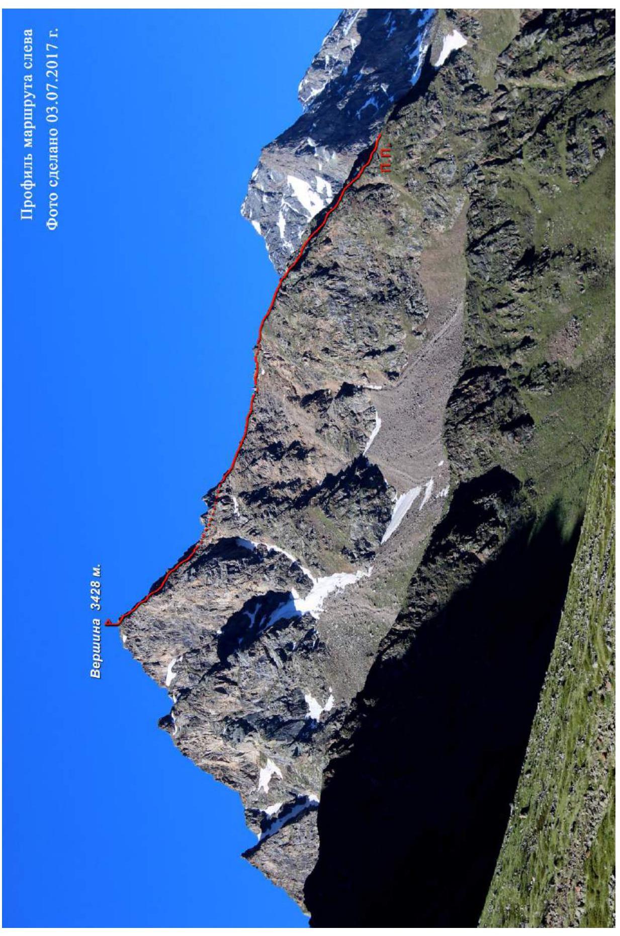
Photopanorama
of the area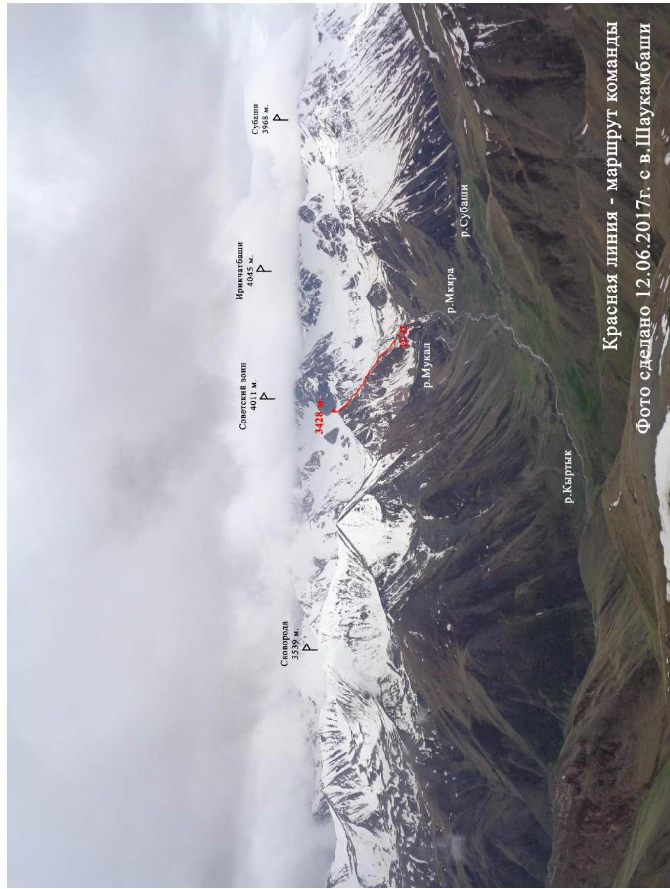
Map
of the area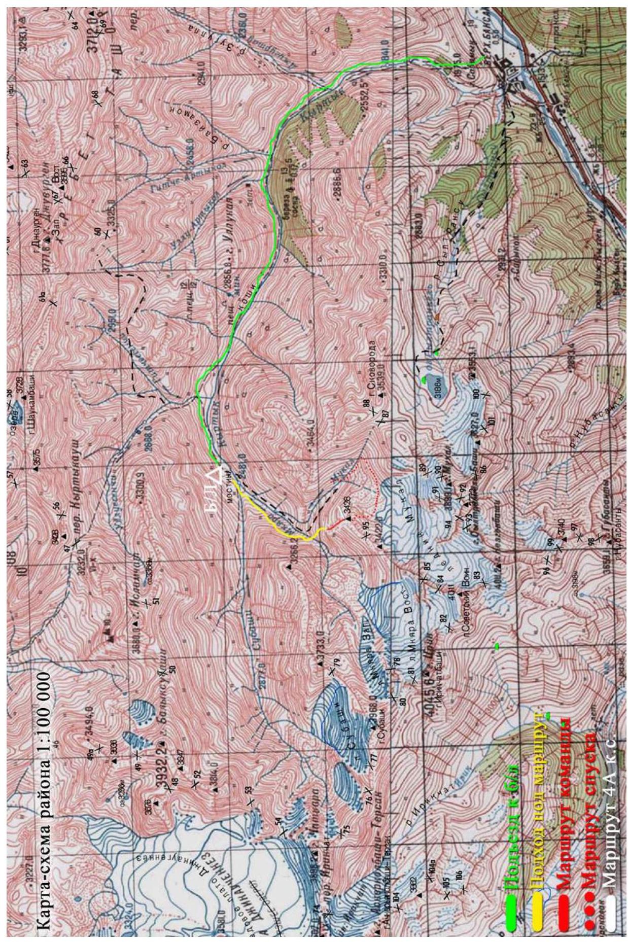
Brief overview of the climbing area
The climbing area is located in the part of the Lateral Ridge of the Central Caucasus, stretching from the Irikchatbashi peak (4046 m) to the Mukal peak (3899 m). The object of the ascent – the 3428 m peak, closes the ridge stretching for three kilometers in the northern direction from the Sovetsky Voín peak (4012 m). It is washed from the east by the Mukal river, and from the west by the waters of the Mkara river, which is a tributary of the Kyrtik river. Geographical coordinates of the peak: 43°20′27.30″ N 42°38′26.36″ E.
Description of the Approach
From the village of Verkhny Baksan along a dirt road into the valley of the Kyrtik river to the last koshe in the gorge at the confluence of the Kyrtik and Mkara rivers (15 km). Here is the end of the road and a good place for a base camp. The road from the village of Verkhny Baksan is passable for off-road vehicles. The bridge indicated on the map was washed away in June 2018, so continue driving to the confluence of the Subashi and Mkara rivers, ford the Subabashi river, and then move up along the left (orographic) bank of the Mkara river. Cross the Mkara river at the base of the NW ridge of the peak (3 km). There is no mobile communication in the gorge. Border permits are not required.
2. Characteristics of the Route
Technical photo
of the route
Technical characteristics of the route sections
| Section № | Relief Character | Category of Difficulty | Length, m | Type and Number of Hooks |
|---|---|---|---|---|
| R0–R1 | Grassy slope, rocks | 1 | 550 | - |
| R1–R2 | rocks | 2 | 150 | - |
| R2–R3 | rocks | 2+ | 270 | - |
| R3–R4 | rocks | 3 | 30 | 3 |
3. Characteristics of the Team's Actions
| Section № | Description | Photo № |
|---|---|---|
| R0–R1 | The route begins with a grassy shoulder and a 30° slope of the northwest ridge. Then, up to the right along a stony slope between rocky outcrops, exit to a clearly defined ridge. | 1 |
| R1–R2 | Bypassing the complex rocky ridge and gendarmes on the right, continue moving along the destroyed stony relief in the direction of the pre-summit tower. | 2 |
| R2–R3 | Along 35° destroyed rocks and inclined shelves upwards, moving to the right of the northwest ridge. The relief is moderately destroyed, climbing is not complicated. Be cautious of loose stones. The section abuts the summit tower. | 3 |
| R3–R4 | Along large-block rocky relief (45°–50°) up to the left and then up a steep inclined slab with a small amount of relief, exit to the "roof" (key section), then along simple rocks to the summit. Ropes. Station on the summit on a rocky ledge. | 4-6 |
Photo №1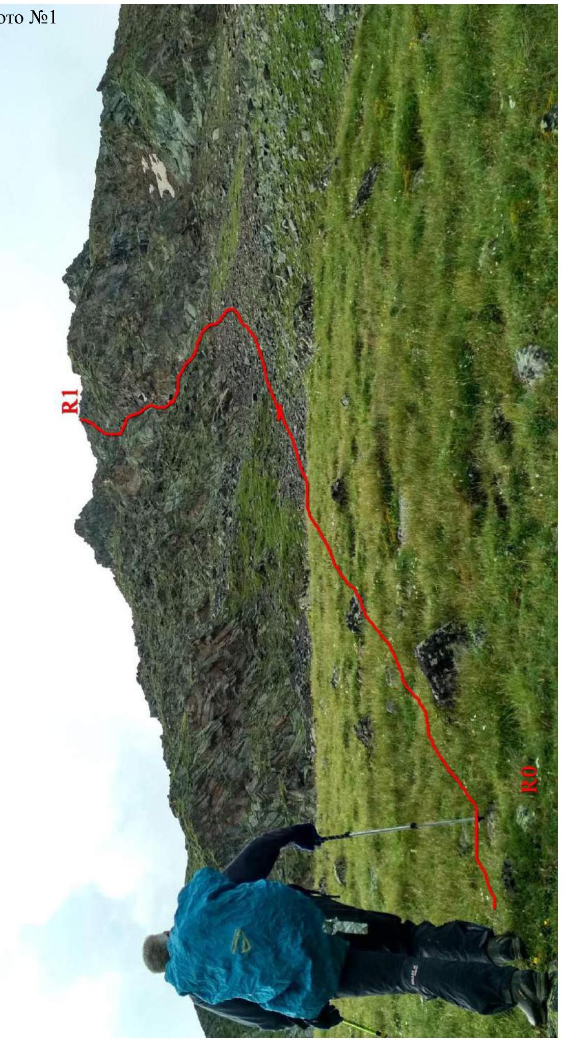
Team movement
Photo №2. Bypassing
option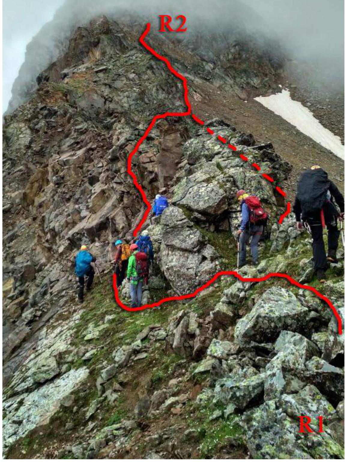
Photo №3
Photo №4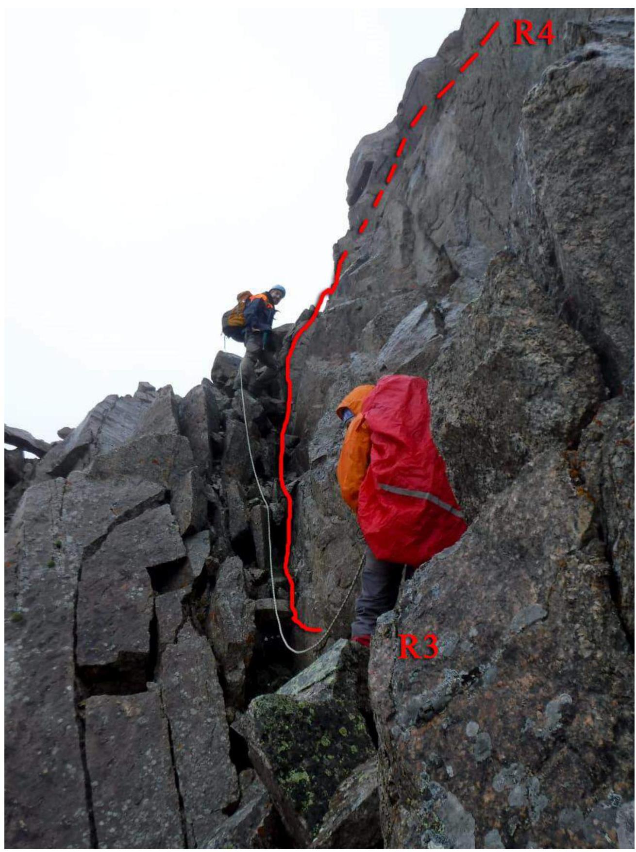
Photo №5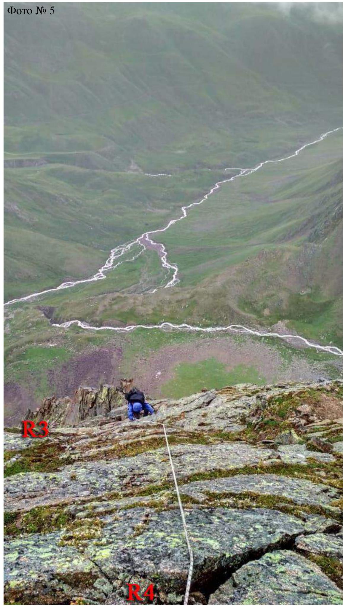
Photo №6. Station on the
summit
Photo on the
summit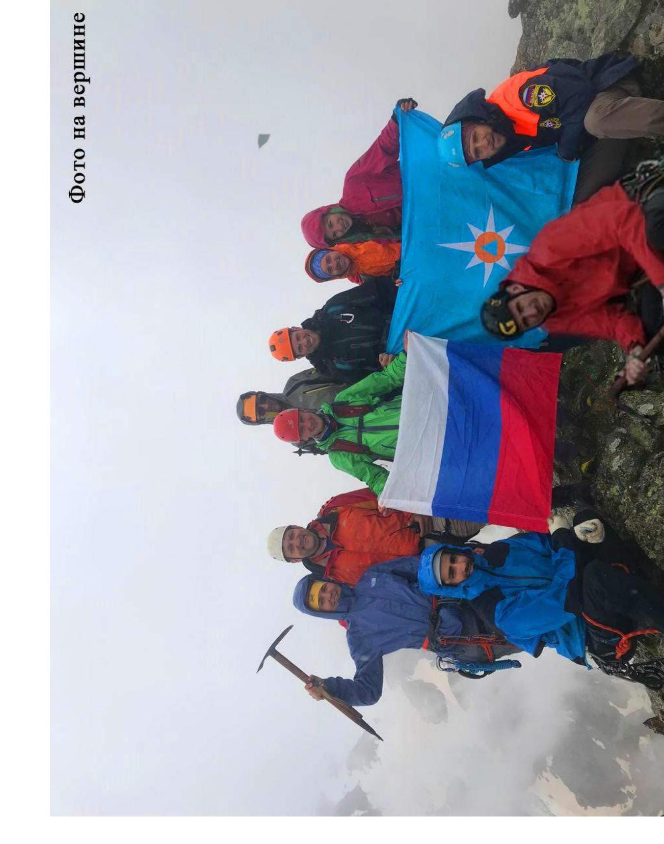
Descent from the Summit
Conclusions and Recommendations
A logical and simple line for ascending to the 3428 m peak. There are many loose stones on the route. Descent from the summit along a simple scree slope to the south in the direction of the Mukal Glacier. The route corresponds to the declared difficulty category. Cellular communication is absent on the route. Water on the route is available in the form of snow in winter and the first half of summer.
Comments
Sign in to leave a comment