
PASSPORT
- Class — technical;
- Central Caucasus, Main Caucasian Range;
- Peak Shurovskogo 4295 m, via the Western wall through "Surok";
- Cat. diff. — 5B;
- Height difference — 959 m.
Route length — 1804 m. Length of sections with 5–6 cat. diff. 375 m; Average steepness 64°, steepness of sections with 5–6 cat. diff. 72°.
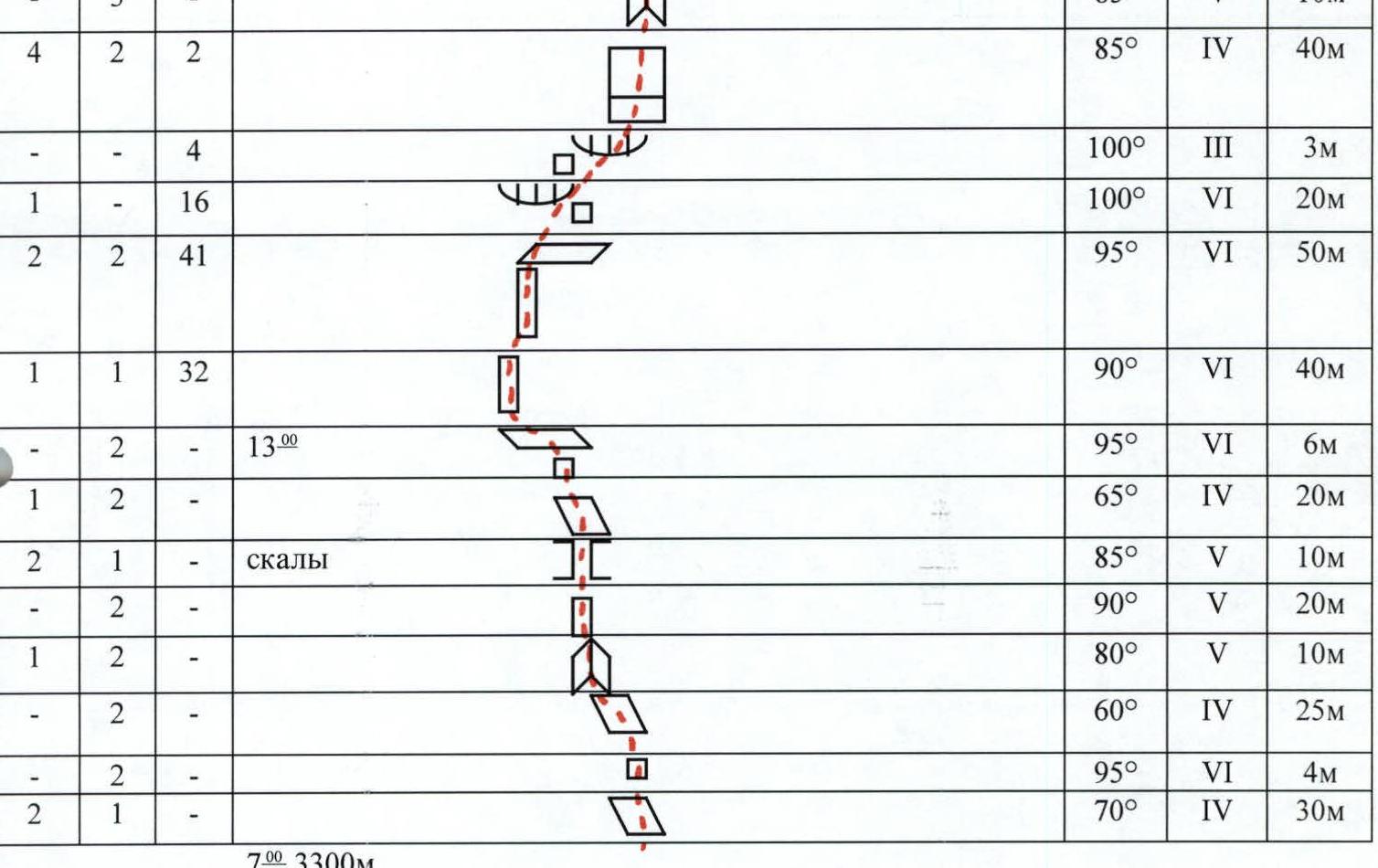
- Pitons driven
| Rock pitons | Nuts | Bolts |
|---|---|---|
| 28 | 80 | 75 |
| 1 | 7 | 30 |
-
Team's travel hours: 30 Days: 3
-
Leader: Miervaldis Bush Participants: Normunds Reinbergs, Kaspars Klapkalns, Regimants Baranovskis, Rolands Laganovskis
-
Approach to the route July 24, 1997 Summit August 26, 1997 Return to base camp August 26, 1997
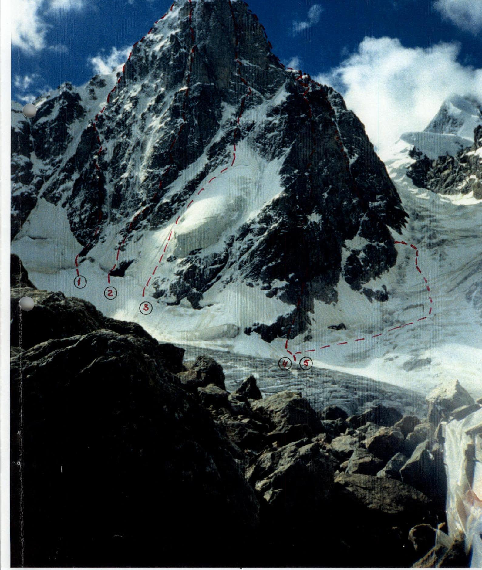
Team's travel hours: 30 (13 + 12 + 5) Height difference — 959 m. Length of sections with 5–6 cat. diff. — 375 m. Average steepness — 64°, steepness of sections with 5–6 cat. diff. — 72°. Total route length: 1804 m. Cat. diff. of the route: 5B. Ascent to Peak Shurovskogo 4259 m.
| Rock pitons | Nuts | Bolts | Description of section | Steepness | Cat. diff. | Length |
|---|---|---|---|---|---|---|
| 1 | — | — | snow ridge | 50° | 3 | 30 m |
| — | 4 | — | 80° | 5 | 60 m | |
| — | 2 | — | snow ridge | 75° | 4 | 30 m |
| 1 | 4 | — | 50° | 3 | 120 m | |
| 2 | 5 | — | 7:00 20:00 | 60° | 4 | 110 m |
| — | 6 | — | 70° | 4 | 60 m | |
| — | 4 | — | 17:00 snow | 50° | 5 | 100 m |
| 1 | 2 | 1 | ice-covered rocks | 85° | 5 | 15 m |
| 1 | 2 | 2 | ice-covered rocks | 90° | 6 | 10 m |
| 2 | 2 | 2 | ice-covered rocks | 90° | 6 | 12 m |
| — | 4 | 2 | ice-covered rocks 12:00 | 90° | 6 | 25 m |
| 1 | 8 | — | ice-covered rocks | 40° | 4 | 100 m |
| 1 | 6 | 3 | 90° | 4 | 40 m | |
| 4 | 3 | — | ice-covered rocks | 50° | 4 | 100 m |
| 1 | 8 | — | 8:00 20:30 | 60° | 4 | 90 m |
| 4 | 2 | — | "Surok" | 70° | 4 | 30 m |
| — | 3 | — | 85° | 5 | 10 m | |
| 4 | 2 | 2 | 85° | 4 | 40 m | |
| — | — | 4 | 100° | 3 | 3 m | |
| 1 | — | 16 | 100° | 6 | 20 m | |
| 2 | 2 | 41 | 95° | 6 | 50 m | |
| 1 | 1 | 32 | 90° | 6 | 40 m | |
| — | 2 | — | 13:00 | 95° | 6 | 6 m |
| 1 | 2 | — | 65° | 4 | 20 m | |
| 2 | 1 | — | rocks | 85° | 5 | 10 m |
| — | 2 | — | 90° | 5 | 20 m | |
| — | 1 | — | 80° | 5 | 10 m | |
| 2 | — | — | 60° | 4 | 25 m | |
| — | 2 | — | 95° | 6 | 4 m | |
| 2 | 1 | — | 70° | 4 | 30 m |
Total length of sections: 3300 m.
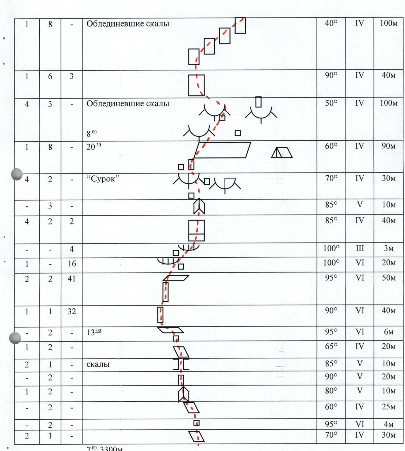
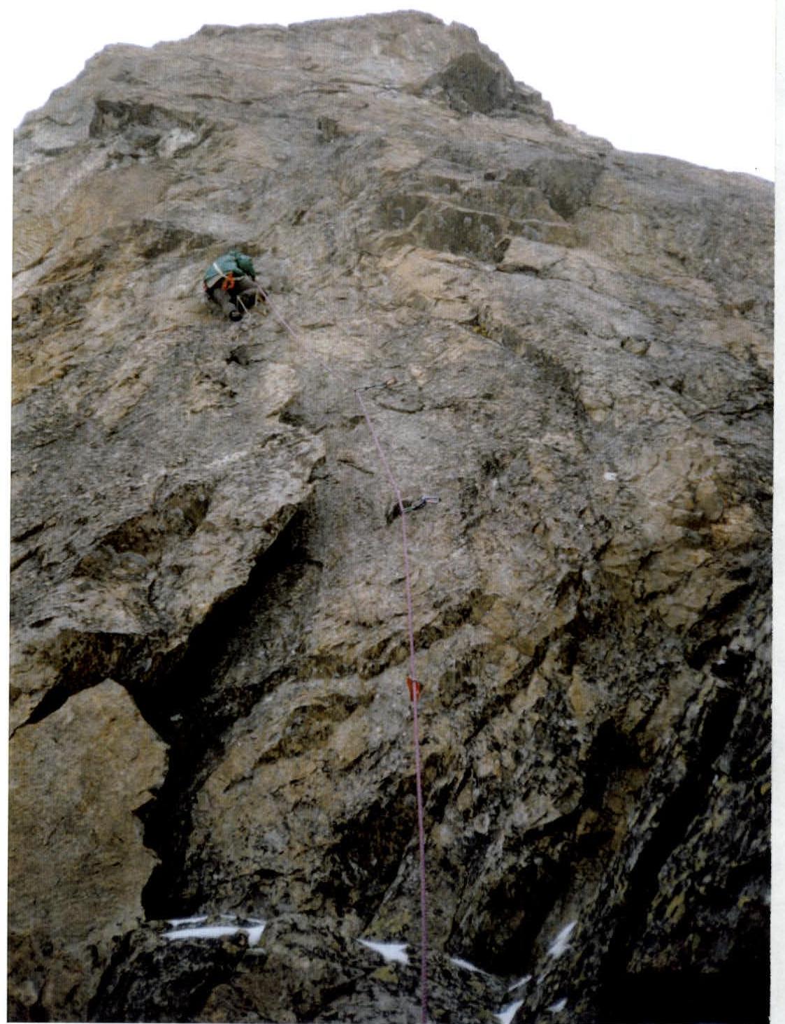
Photo № 3. Section of the route R8–R9
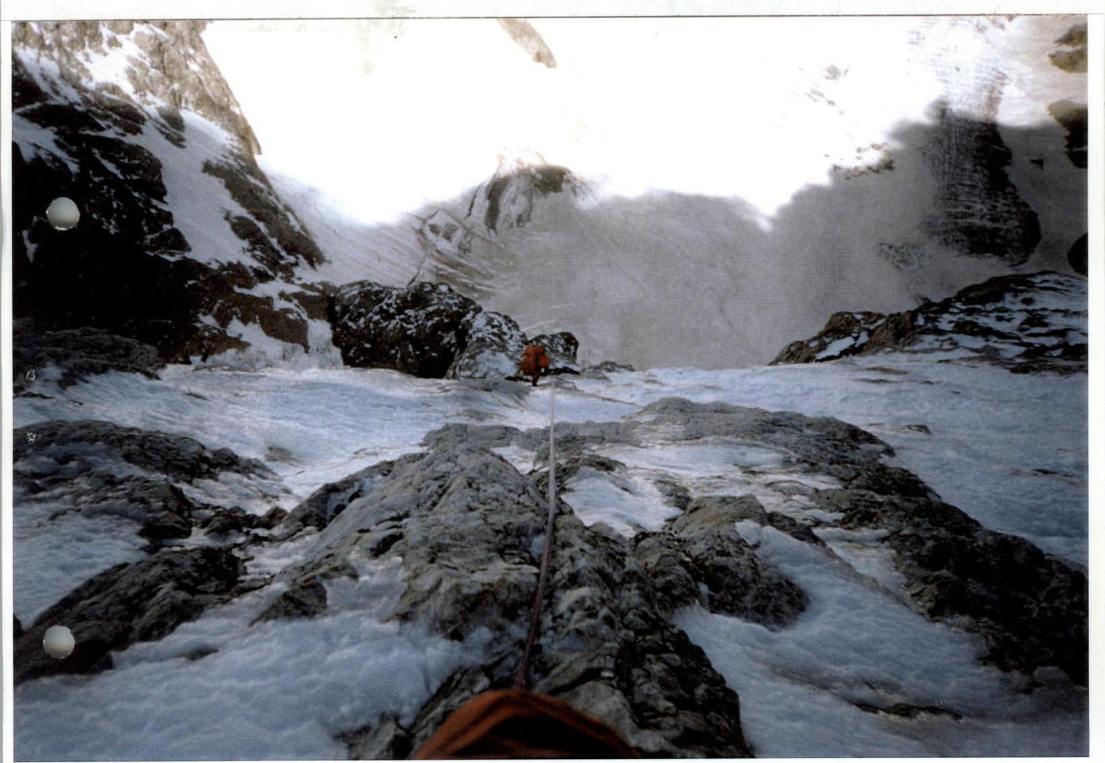 Photo № 4. Section of the route R16–R17
Comments
Sign in to leave a comment