4.
Description of the route to Peak P — 10 "Zapadnaya" from the 1018 Shhelda shelter and Kursantov Pass
cat. diff. 3–6, peak height 4310 m
(4) (4) (4) (4) (4) (4) (4) (4) (4) (4)
From the "Spartak" camp, we head out on a trail that leads along the slope of the Shhelda valley to the Arnstov hut. The journey from the camp to the Arnstov hut takes 3–5 hours; there are convenient areas for overnight stays and water. From the Arnstov hut, the trail leads to a steep ascent to the moraine, then crosses a stream flowing from a hanging glacier, and continues straight in the direction of Melkaya Shhelda. In the upper part (to the right of the path), there is a rocky massif with good areas for overnight stays. The journey from the "Spartak" camp to the overnight stay takes 6–8 hours.
The further path goes in the direction of Pass O through the middle part of the glacier, and in case of little snow — slightly to the right of the peak along a steep snow-ice slope, the path to Sredniy Pass.
From Sredniy Pass to Kursantov Pass, it's a short but longer path; descent along the southwestern slope from Sredniy Pass. After this roughness from Sredniy Pass, we ascend to the ridge col leading to Peak Pyatikulturny, and from there, along the marginal ridge, we descend to Kursant Pass.
The transition from the overnight stay to Kursantov Pass takes 5–8 hours. From Kursantov Pass, we descend to Mzhno-Shheldinsky and approach a large couloir descending from the western summit of 1st Zapadnaya Shhelda. We cross the couloir upwards, to the right, and exit onto destroyed rocks, bypassing the talus massif of 1st Zapadnaya Shhelda, and along the couloir descending east of it, we exit onto the main Shheldinsky ridge. The time taken is 3–5.6 hours.
The path from Kursantov Pass to the ridge takes 2 hours. The further path to 2nd Zapadnaya Shhelda goes along a slippery ridge. Bypassing a series of ledges to the right, we exit onto areas for overnight stays. Further ascent goes along a destroyed rocky ridge. At the same time, we stick to the right side of the ridge. Beyond the ridge, a small snowfield begins, followed by rocks of medium difficulty to the right. After passing these rocks, we exit onto a small snowy saddle, beyond which the main facet of the massif of 2nd Zapadnaya Shhelda begins.
From the start of the rocks, we bear to the right along the path and along an inclined ledge exit onto rocks of medium difficulty and ascend upwards, to the left side, to the ridge. Further along easy rocks, we approach a rock wall, which ends in formed ice. We cross the ice.
Difficulties:
- Formed ice is overcome with cutting 5–7 steps
- Protection through a hook or a ledge
The path from the saddle between 1st and 2nd Zapadnaya Shhelda — ascent and approximately 9–10 hours (to the saddle).
Along the ledge, we exit onto rocks of medium difficulty. After passing, we exit onto a more gentle area, along which we reach the summit.
The path to the summit from the saddle between 1st and 2nd Zapadnaya Shhelda takes 4–5 hours. Descent is along the ascent path.

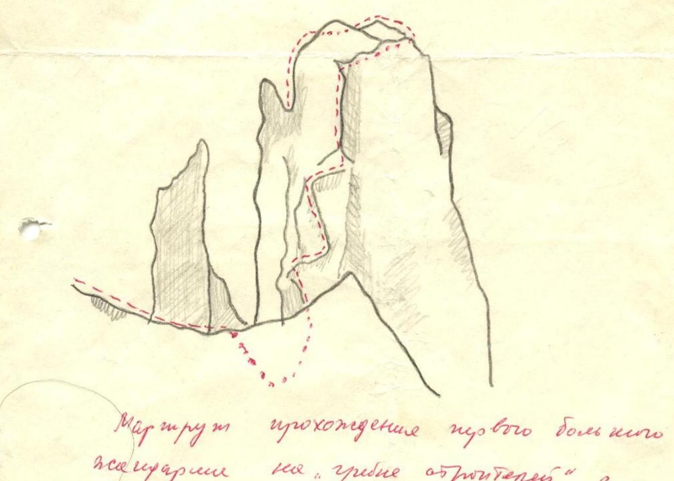
refure
Route from the hut to the foot
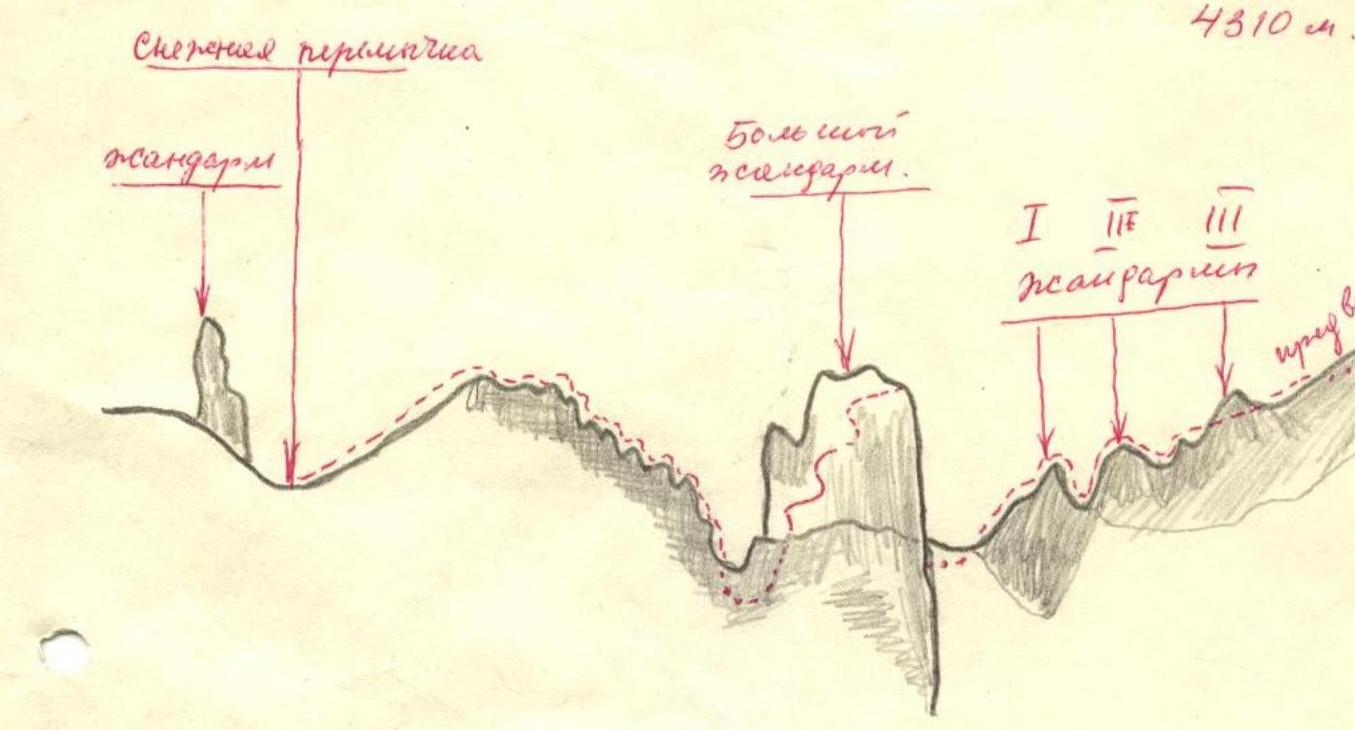
I
II
III