Ascent Passport
-
Central Caucasus, Baksan Valley, Main Caucasian Range, Donguzorun valley cirque. 2 Peak 3650 m (Stalingrad Battle), via the North Ridge.
-
Proposed — 2A cat. dif., first ascent.
-
The route is ice-snow.
-
Height difference of the route:
- from the Bezymyanny pass — 400 m;
- from the bottom of the valley — 900 m;
Route length — 900 m; Average steepness of the route — 30°;
-
Ice screws used — 3 pcs.
-
Team's travel time — 10 hours.
-
Leader — Vladislav Budko, 1st sports category. Members: Sergey Sokolenko, 1st sports category. Yuri Lebedchenko, 1st sports category. Konstantin Gaiduk, 1st sports category.
-
Coach — Vladislav Budko.
-
Departure to the route July 28, 2002. Summit reached July 28, 2002. Return to base camp July 29, 2002.
-
Volgograd Alpinism Federation.
Peak 3650 m (60th Anniversary of Stalingrad Victory), Bezymyanny pass 3260 m.
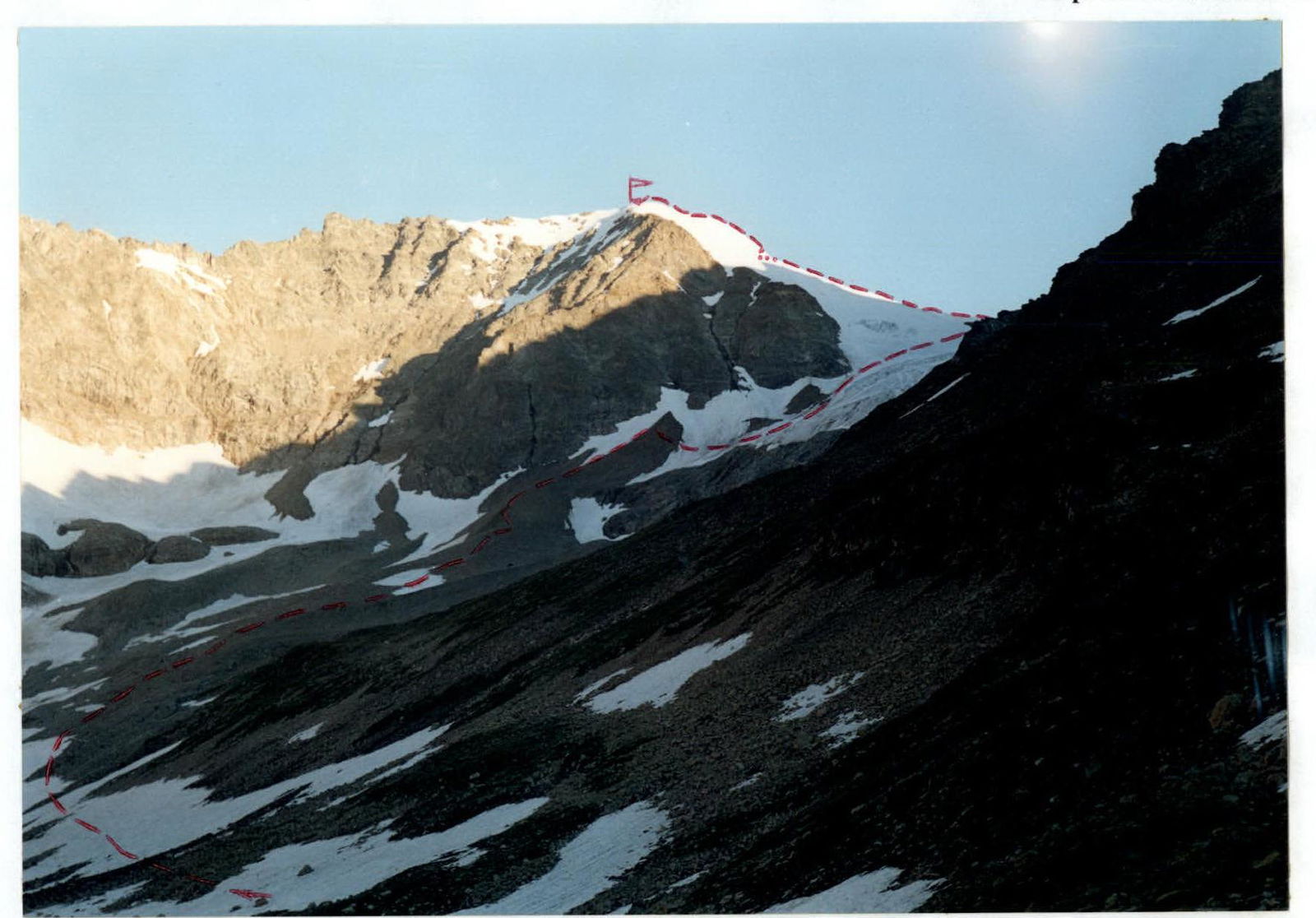
View of Peak 3650 m (60th Anniversary of Stalingrad Victory) from the upper Donguzorun lake.

Peak 3650 m (60th Anniversary of Stalingrad Victory).
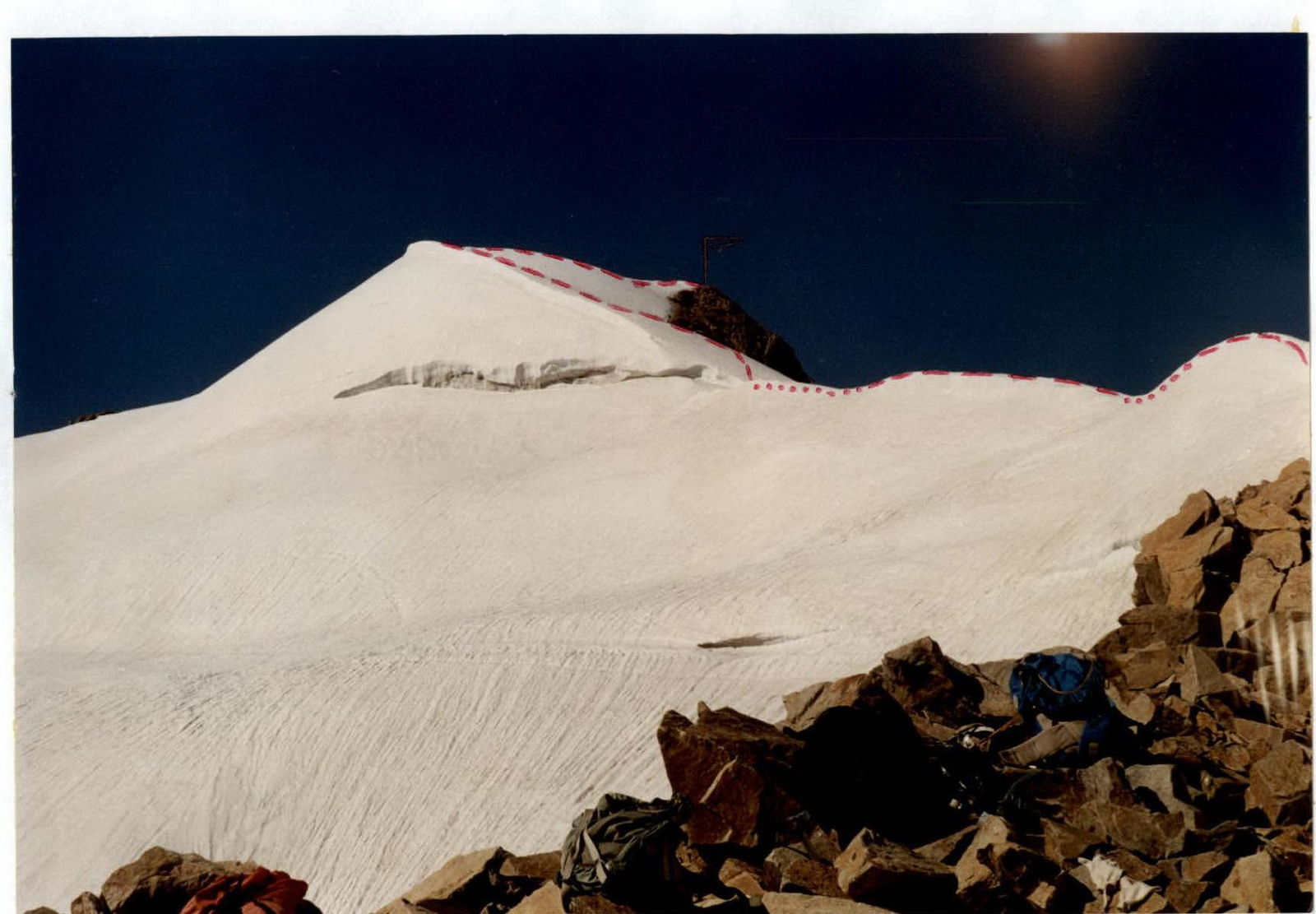
Bezymyanny pass 3260 m. View on Peak 3650 m (60th Anniversary of Stalingrad Victory) from the Bezymyanny pass.
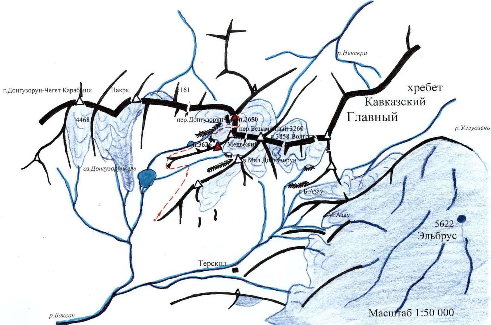
Climbing Area Map
Approach to the Route
From the lower station of the Cheget cable car, move along the trail of the Donguzorun valley to the border post at the Medvezhiy stream (2700 m). Above the post, cross the stream via the avalanche bridge and continue moving along the main valley trail to the second lake in the Western Donguzorun glacier cirque (3 hours from the "Cheget" meadow).
From the lake (the peak 3650 m is visible ahead, to the left of it is the saddle of the Bezymyanny pass 3260 m), move towards the right-bank moraine of the glacier occupying the northwestern corner of the cirque. Bypass the step of "ram foreheads" along the moraine ridge to the left of them, then to the right from the moraine, and via a snow-covered couloir, exit onto the covered glacier (2 hours from the second lake).
Route Description
On the covered glacier (rope teams), ascend to the saddle of the Bezymyanny pass (R1–R2), then from the pass, up and left, via snow-covered rocks, onto the North Ridge of peak 3650 m (R2–R3). Along the sharp snowy ridge, approach the right edge of the bergschrund crossing the entire northern slope (R3–R4). Cross the crevasses below the bergschrund (belay) and, moving right onto the western slope, ascend via a steep snow-ice slope (belay) to continue along the northern ridge above the bergschrund (R4–R5). On the right side of the poorly defined ridge (left side has cornices), cross the northern slope (R5–R6–R7) and, via a relatively gentle snow-ice ridge (R7–R8), exit onto rocks, then continue to the summit via rocks (R8–R9).
(Total time from the pass is 3–4 hours).
Descend via the ascent route.
Route Diagram
Peak 3650 m (60th Anniversary of Stalingrad Victory)

R1–200 m, 30°, 1 R2–200 m, 10°, 1 R3–20 m, 40°, 2 R4–200 m, 20°, 1 R5–20 m, 45°, 3 R6–100 m, 35°, 2 R7–50 m, 20°, 1 R8–100 m, 10°, 1 R9–20 m, 20°, 1