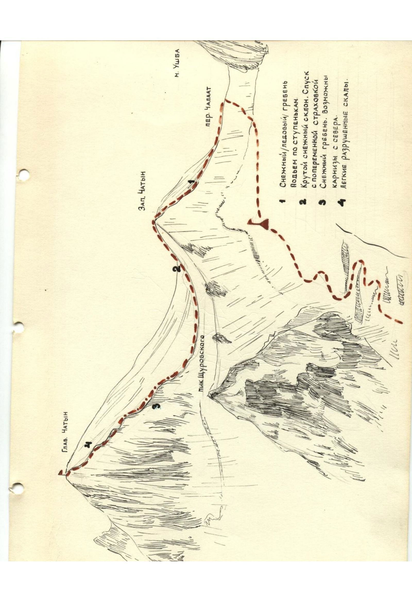
- Steep snowy slope. Descent with alternating belay
- Snow ridge. Cornices possible from the north.
- Easy destroyed rocks.
CHATYN-TAU — Category 3A. Height 4368 m.
The summit of Chatyn-Tau is located in the Uzhba group area and is directly adjacent to the Uzhba Plateau. To the north of the summit is the peak Shchurovskogo, to the east is the Dolla-Kora ridge, and to the southwest are the summits:
- Malaya Uzhba
- Severная Uzhba (North Uzhba)
- Yuzhnaya Uzhba (South Uzhba).
To the southeast of the summit flows the powerful Chalaatsky glacier.
The first Soviet ascent to Chatyn-Tau was made in 1937 by a group:
- Aristov,
- Mauer,
- Meerovich
from the Uzhba Plateau along the western ridge of the summit.
The path to the Uzhba Plateau from the Spartak camp passes along the ascent route to peak Shchurovskogo (see description of peak Shchurovskogo).
The ascent to the summit is made directly from the Uzhba Plateau along the northern or western ridge. The time for ascent and descent from the summit to the plateau takes 5-6 hours.
From the overnight stay on the plateau (snow overnight) between Malaya Uzhba and Chatyn-Tau, the ascent path passes along the western snow ridge (which connects via a saddle with Malaya Uzhba) to the sub-summit (Malaya Chatyn). From Malaya Chatyn, the path to the main summit passes along the ridge. Initially, a descent from Malaya Chatyn of 15-16 meters to the ridge leading to the main summit.
The most technically difficult and dangerous place is this descent. The descent must be made with very good belay.
From the descent point, the path further passes along the ice-snow ridge, extremely dangerous, with step-cutting in some places to the first rocks on the ridge.
Huge snow cornices hang from the ridge. Snow lies on an icy base in some places on the ridge slope.
Movement along the ridge is done from the southern side with crampons and thorough belay on pitons. From the first rocks on the ridge to the summit, the path is less dangerous and technically easier, but requires great attention. The ridge drops steeply on both sides.
Descent:
- Passes along the ascent route
- Takes as much time as the ascent
Equipment should be calculated as for an ice route. It is necessary to have:
- Rock pitons 2-3 pcs
- Ice axes 5-6 pcs
- Crampons
- Ice axes
- Rope
- Tent
- Warm clothing
- Storm suits
Footnotes
-
- Snow (ice): ridge. Climb the steps