
North Caucasus Regional
SEARCH AND RESCUE TEAM OF EMERCOM OF RUSSIA
Report
On the first ascent of the right part of the northern slope of the Chatkara peak 3898 m.
Presumably 2B category of difficulty.
Leader: Donskov Andrey Mikhailovich Coach: Motienko Nikolai Ilyich
Zheleznovodsk
2016
Addresses:
357433, Stavropol Krai, Zheleznovodsk, pos. Inozemtsevo, ul. Promyshlennaya, d. 7
North Caucasus Regional Search and Rescue Team of EMERCOM of Russia
tel./fax: +7-8793-405364
357500, Stavropol Krai, Pyatigorsk, ul. Mira, d. 19, kv. 22
Donskov A.M.
tel.: +7-962-017-82-09
email: donskov91@mail.ru
357500, Stavropol Krai, Pyatigorsk, ul. Sovetskaya, d. 137
Motienko N.I. tel. +7-928-361-90-66 nik-motienko@mail.ru
Ascent Passport
- Caucasus, KBR, Zolsky district, section 2.4.
From Chiperezao pass to Gumachi peak
- Peak: Chatkara (3898 m)
- Proposed: 2B category of difficulty, first ascent
- Character of the route: ice and snow
- Route length: 990 m
Height difference: 470 m (by GPS) Length of sections: I category of difficulty — 290 m, II category of difficulty — 550 m, III category of difficulty — 150 m, IV category of difficulty — 0 m, V category of difficulty — 0 m, VI category of difficulty — 0 m. Average steepness: key part of the route — 50°.
- Use of belay points: no
- Walking hours:
3 hours, 1 day
- Leader: Donskov Andrey Mikhailovich 1st sports category
- Coach: Motienko Nikolai Ilyich CMS, instructor 1st category, certificate No. 754
- Route started: 11:00 August 31, 2016
Exit to the summit: 14:00 August 31, 2016 Descent from the summit: to Irikchat pass
- North Caucasus Regional Search and Rescue Team of EMERCOM of Russia
- Responsible for the report: Donskov A.M. tel. +7-962-017-82-09
donskov91@mail.ru
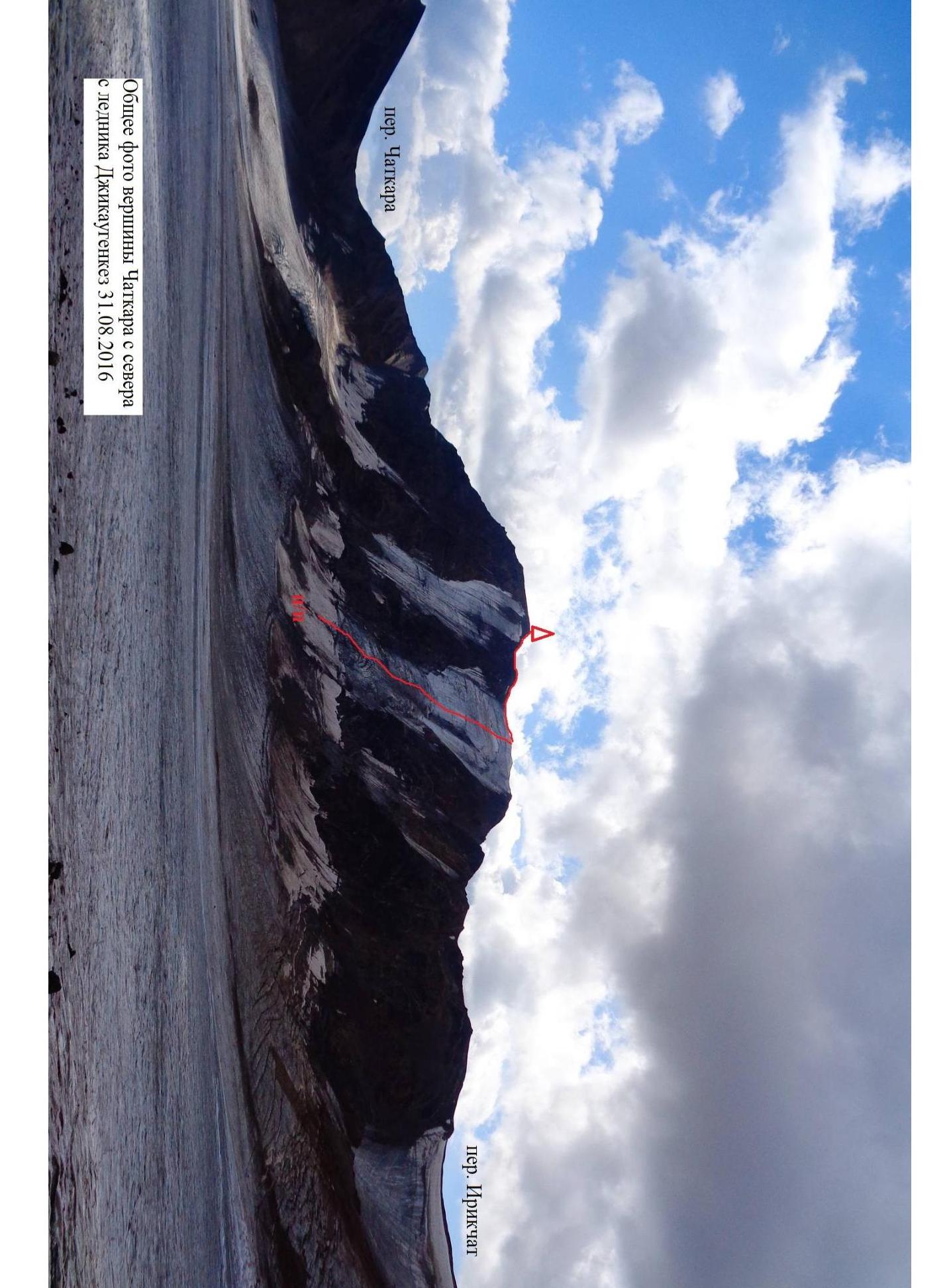
Photo of Chatkara peak from the north zelinka Dzhikaugengkez August 31, 2016
g.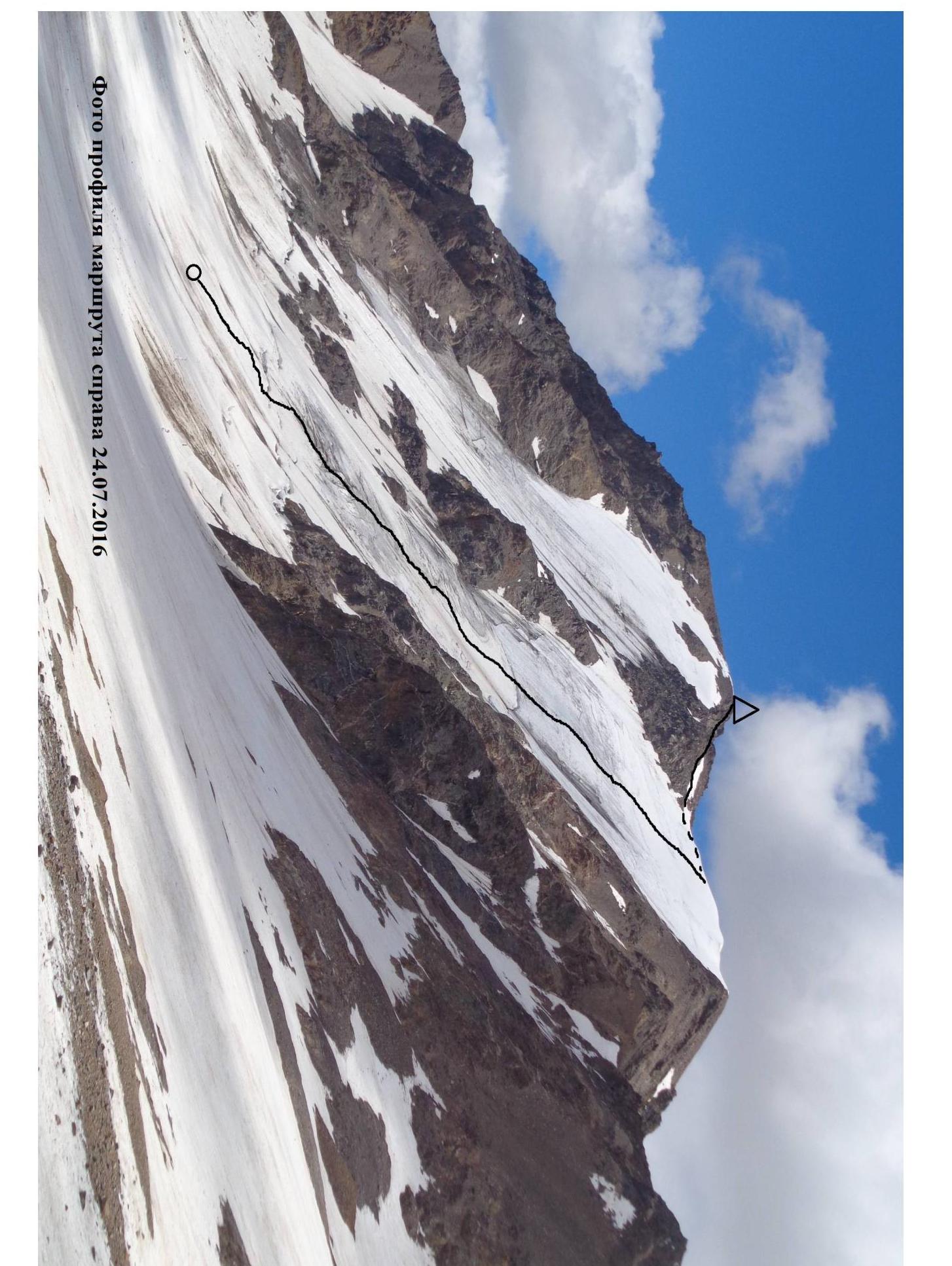
Photo of the route profile from the right July 24, 2016
g.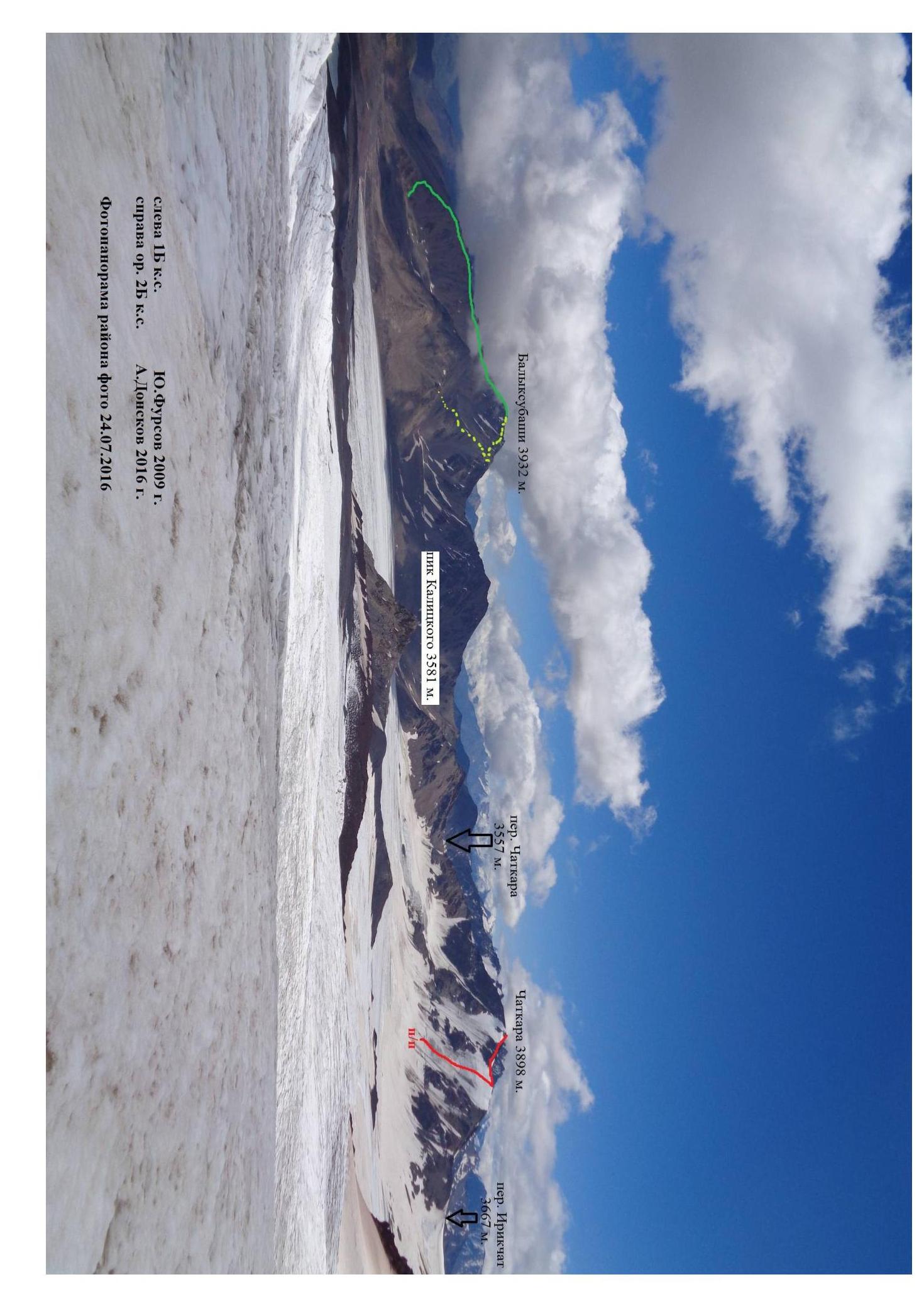
**Left 1B category of difficulty.**10. Furson 2009
**Right, new route, 2B category of difficulty.**A. Donskov 2016
Photo-panorama of the area, July 24, 2016
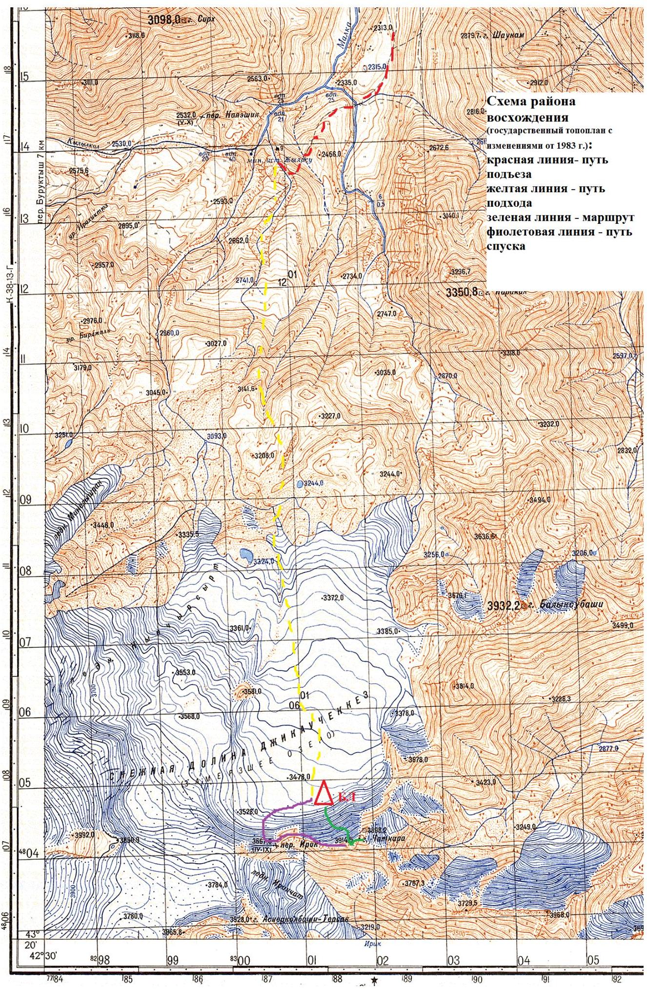
Fig. 8.
Overview of the ascent area
Chatkara peak 3898 m. is highlighted on the official topographic map of the General Staff of the USSR M 1:100000 (K-38-14, Tyrnyauz, 1983) as an independent peak in the ridge descending from the eastern slopes of Elbrus peak (5642 m.), and further, after Chatkara peak, continuing to the northeast ridge to the peaks:
- Subashi (3968 m.),
- Balyksubashi (3932 m.)
Ascent via the main ridges (eastern, western) to Chatkara peak is not complicated and can be accomplished without the use of special technical means. The southern slopes of the peak are talus, with a slope steepness of up to 45°. The northern slope of the peak has an average steepness of 50°, in its left part — rocky, with a strongly destroyed relief, in the right part, from the beginning of the ascent to the western ridge — ice.
It is possible to reach the mineral springs "Dzhilysuu" by car, from where to follow on foot in the direction of the peak via one of the numerous trails (3–4 hours).
The camp should be located so that the time to approach the route is minimal. Start working on the route before it is illuminated by the sun (!) to avoid excessive rockfall danger.
Mobile communication in the area of Chatkara peak is available with Megafon operator.
Radio communication with the operational duty officer of the North Caucasus Regional
Search and Rescue Team of EMERCOM of Russia (call sign "Baza Mashuk") on frequency
164.475 MHz (constantly on standby).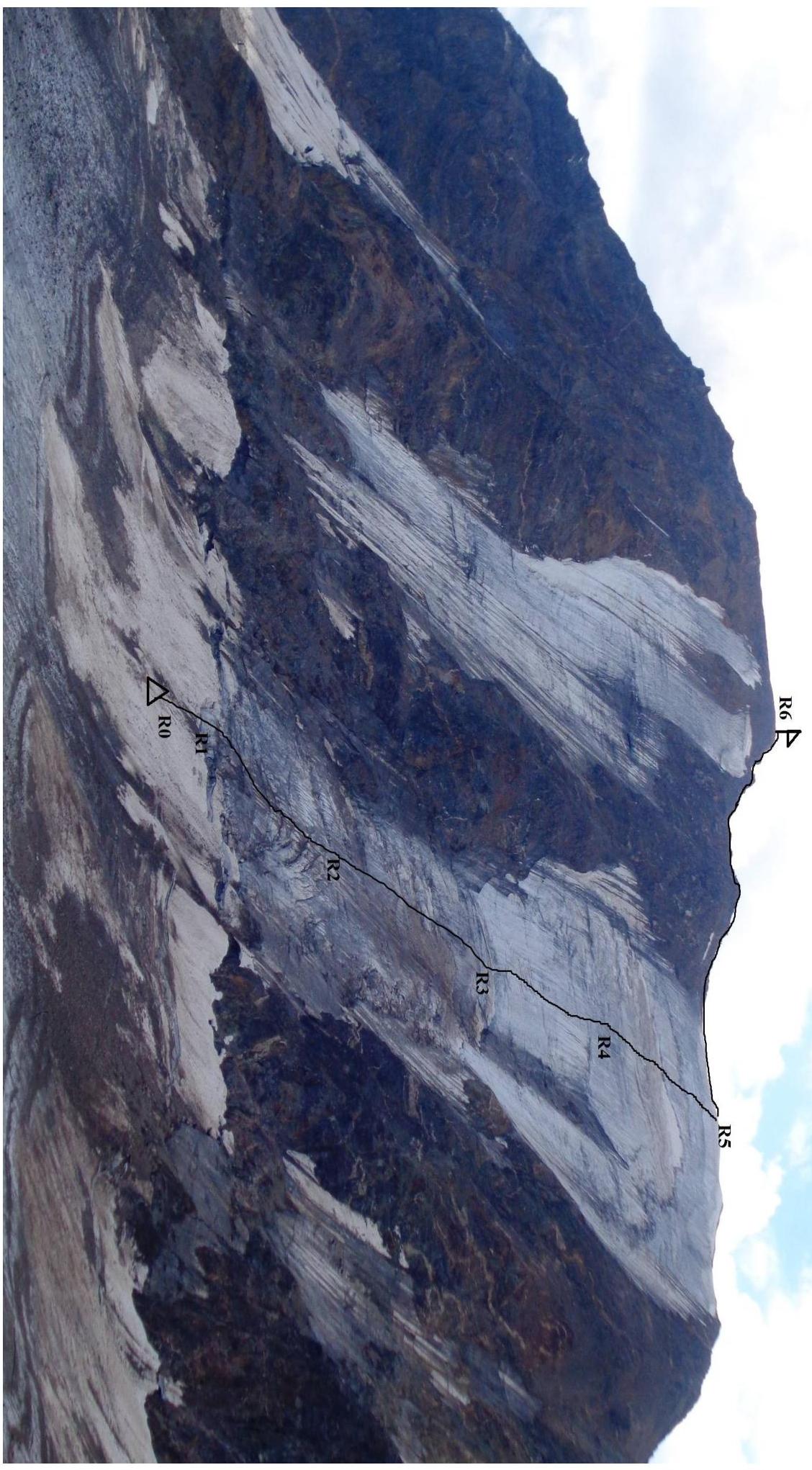
Route description
R0–R1. Movement on snow under the start of the ascent. 70 m. category of difficulty I, 35°.
R1–R2. From the start of the ascent, bypassing small crevices in the ice slope, move strictly in the center between the rocks adjacent to the ice field on the left and the "rocky outcrop" visible above on the right (!). Movement close to the left edge of the ice field and under the "rocky outcrop" is extremely rockfall-prone (!). 150 m. II+ category of difficulty, 40–45°.
R2–R3. Continuing to move straight up, reach the crevice breaking the ice slope. 200 m. II+ category of difficulty, 45°.
R3–R4. Straight up through the crevice (in August — October, complex climbing is possible up to 6 m, V category of difficulty, 85°) and further through the "bulge", bypassing on the left — "rocky outcrop". 150 m, III category of difficulty, 50–55°
R4–R5. Exit to the western ridge. 200 m, II+ category of difficulty, 45°
R5–R6. Along the gentle ridge to the summit. 220 m, I category of difficulty, 15°
| Section | Length | Steepness | Character of relief | Category of difficulty |
|---|---|---|---|---|
| R0–R1 | 70 | 35 | Snow slope | I |
| R1–R2 | 150 | 40-45 | Ice | II+ |
| R2–R3 | 200 | 45 | Ice | II+ |
| R3–R4 | 150 | 50-55 | Ice | III |
| R4–R5 | 200 | 45 | Ice | II+ |
| R5–R6 | 220 | 15 | Talus ridge | I |
Conclusions and recommendations for the route
Ice or snow and ice route (depending on the month of ascent). In the second half of the day, the lower third of the route is rockfall-prone. In poor weather conditions, ascent to the summit is not recommended due to the possible risk of being struck by a static electric discharge or lightning. A simple descent from the summit allows using this route for ascents of training and training groups. The considerable length of the ice section allows:
- to prepare climbers for more complex ice routes.
The route corresponds to the specified half-category of difficulty. Crevice in the center of the route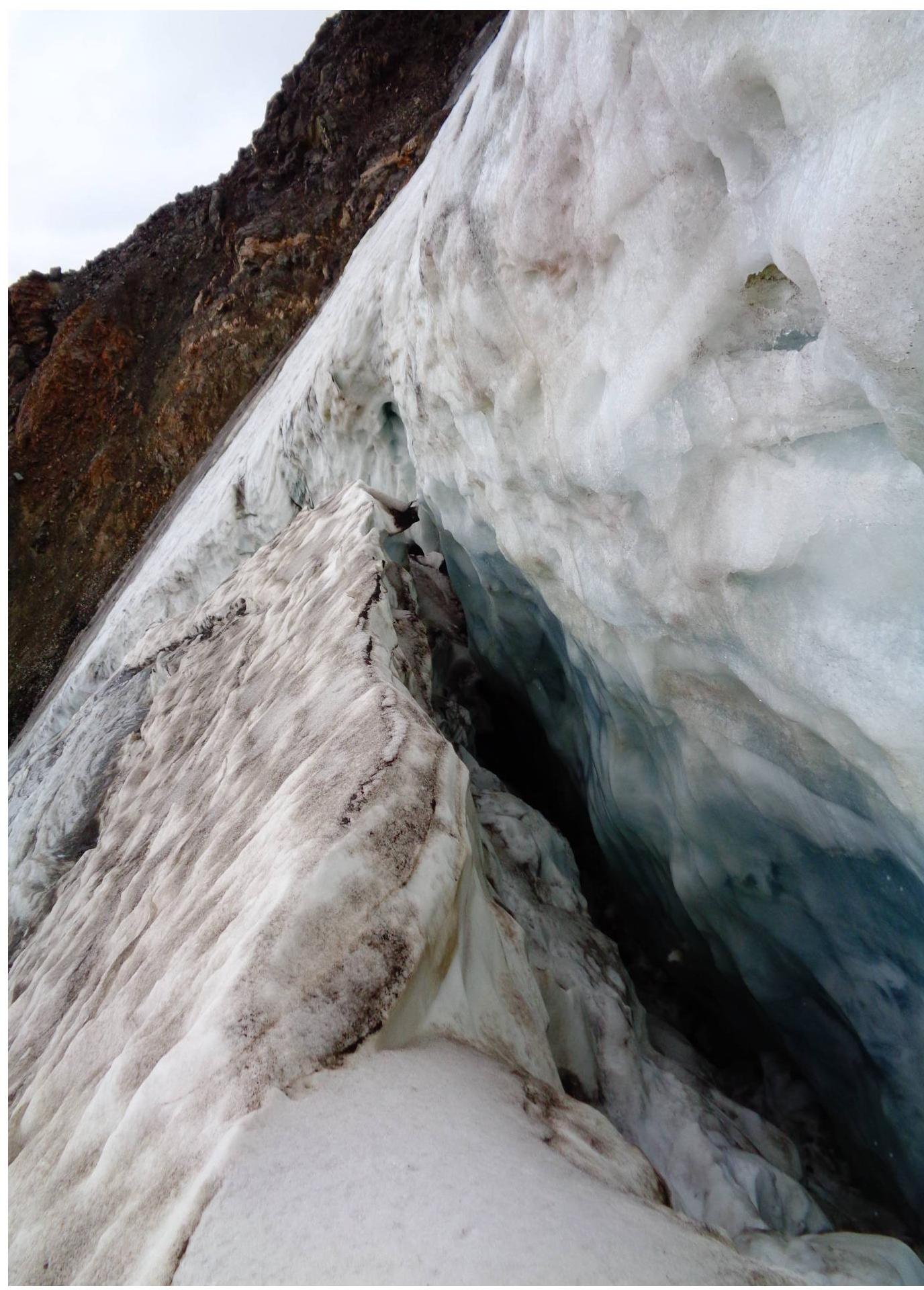
View of the start of the route from the ice
"bulge"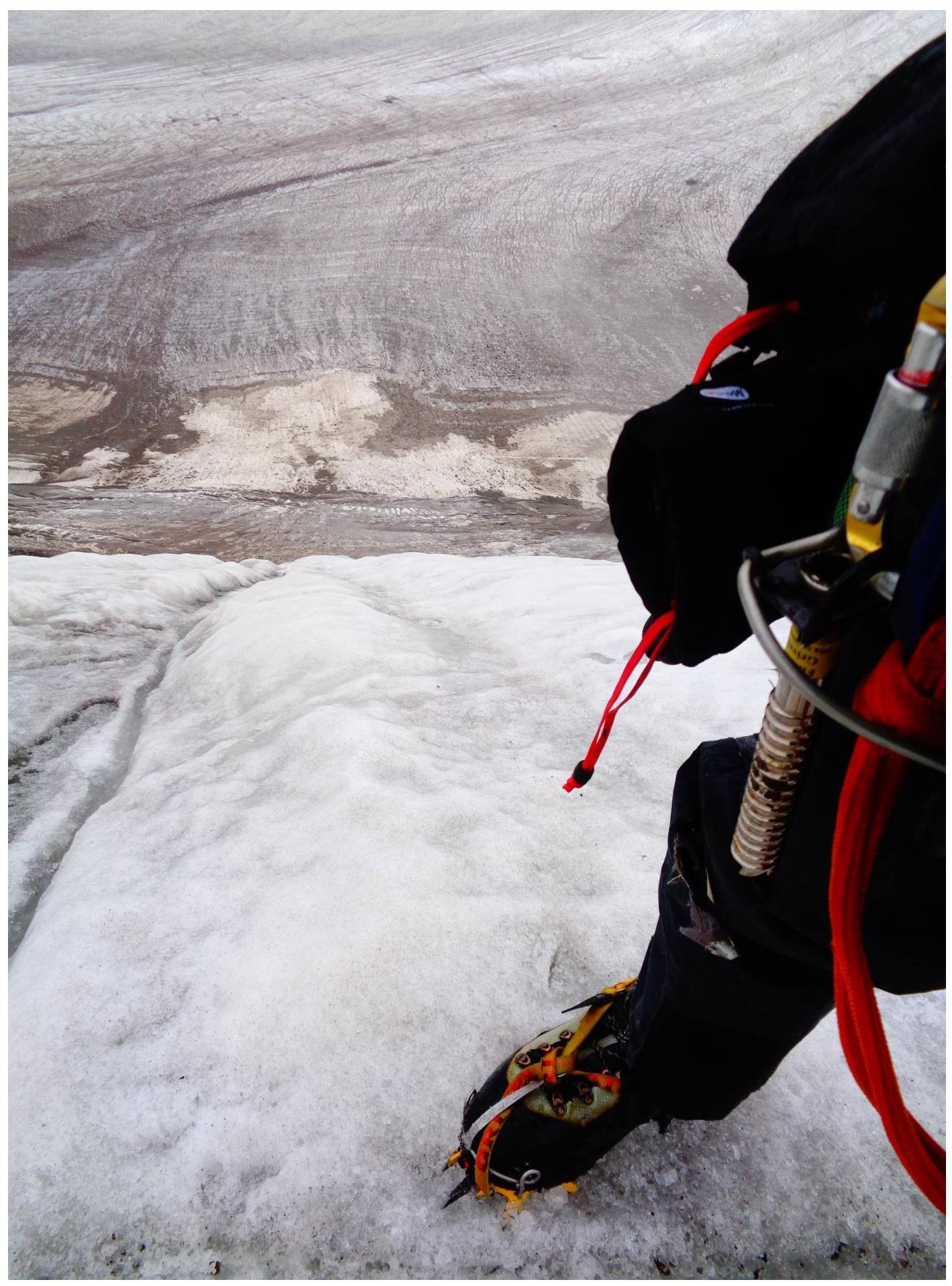
Note on the
summit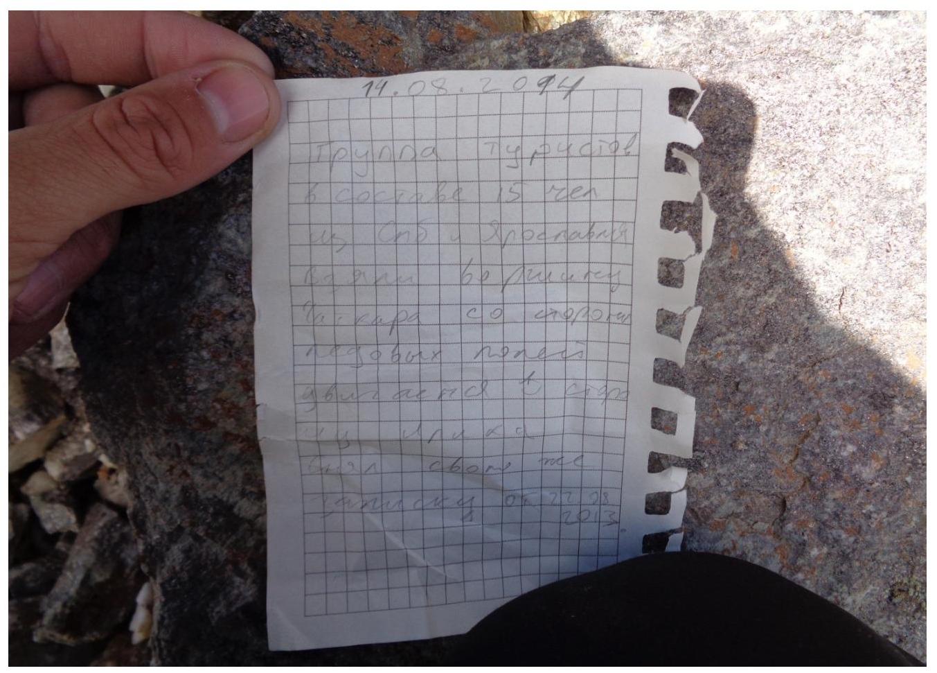
Photo on the
summit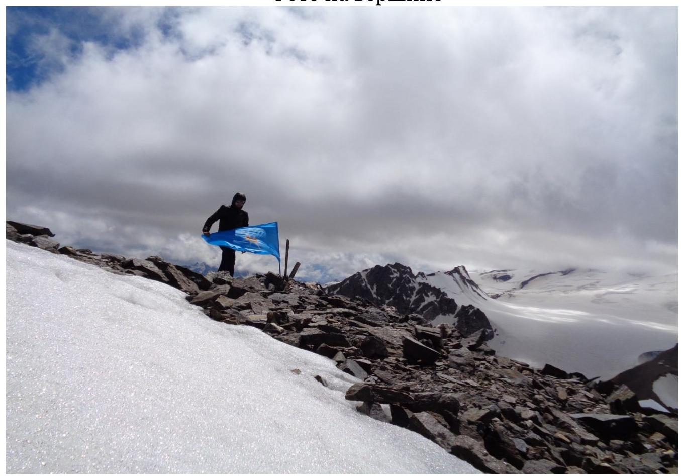
Comments
Sign in to leave a comment