REPORT
ON CROSSING THE TRAVERSE SOUTH USHBA – NORTH USHBA 6A category of complexity BY THE TEAM OF NIU MGSU FOR THE PERIOD from August 28 to September 2, 2023
Route "Krasivyy" 2023
1. Ascent Passport
| 1. General Information | ||
|---|---|---|
| 1.1 | Full name, sports rank of the leader | Prostakishin Dmitry Aleksandrovich |
| 1.2 | Full name, sports rank of participants | Zherdev Kirill Valerievich; Komarov Pavel Fedorovich; Sayfullin Ildar Rufatovich. |
| 1.3 | Full name of coach | |
| 1.4 | Organization | NIU MGSU |
| 2. Characteristics of the ascent object | ||
| 2.1 | Region | Central Caucasus. Svaneti. Georgia |
| 2.2 | Name and height of the peak | Ushba South 4710 m a.s.l.; Ushba North 4690 m a.s.l. |
| 3. Characteristics of the route | ||
| 3.1 | Name of the route | Route "Krasivyy". Traverse of peaks: Ushba South. Along the left part of the Southwest wall (L. Myshlyaev, 1960) 4710 m – Ushba North 4690 m. |
| 3.2 | Proposed category of complexity | 6A |
| 3.3 | Degree of route exploration | - |
| 3.4 | Nature of the route terrain | Combined |
| 3.5 | Altitude difference of the route (according to altimeter or GPS data) | 2000 m. Glacier — South Ushba peak 1700 m, North Ushba 300 m. |
| 3.6 | Route length (in meters) | 4910 m. Glacier – South Ushba peak: total 2910 m, wall part 1310 m. South Ushba – North Ushba: 2000 m. |
| 3.7 | Technical elements of the route | Length of sections with 5–6 category of complexity – 650 m. |
| 3.8 | Average steepness of the route, (°) *(2) | 75° |
| 3.9 | Descent from the peak | Via 4A category of complexity through the Ushba Cushion |
| 3.10 | Additional characteristics of the route | Georgian shelf — water was absent, in other places snow was present. |
| 4. Characteristics of the team's actions | ||
| 4.1 | Travel time (team's walking hours, indicated in hours and days) | 5 days |
| 4.2 | Overnights | Bivouacs |
| 4.3 | Time spent on route processing *(3) | - |
| 4.4 | Departure to the route | 5 h 17 min August 28, 2023 |
| 4.5 | Arrival at the peak | South Ushba – 7 h 50 min August 31, 2023; North Ushba – 8 h 10 min September 1, 2023 |
| 4.6 | Return to the base camp | 11 h 20 min September 2, 2023 |
| 5. Person responsible for the report | ||
| 5.1 | Full name, e-mail | Zherdev Kirill Valerievich, PPE_EXPERT@MAIL.RU |
II. Ascent Description
1. Characteristics of the Ascent Object
1.1. General photo of the peak
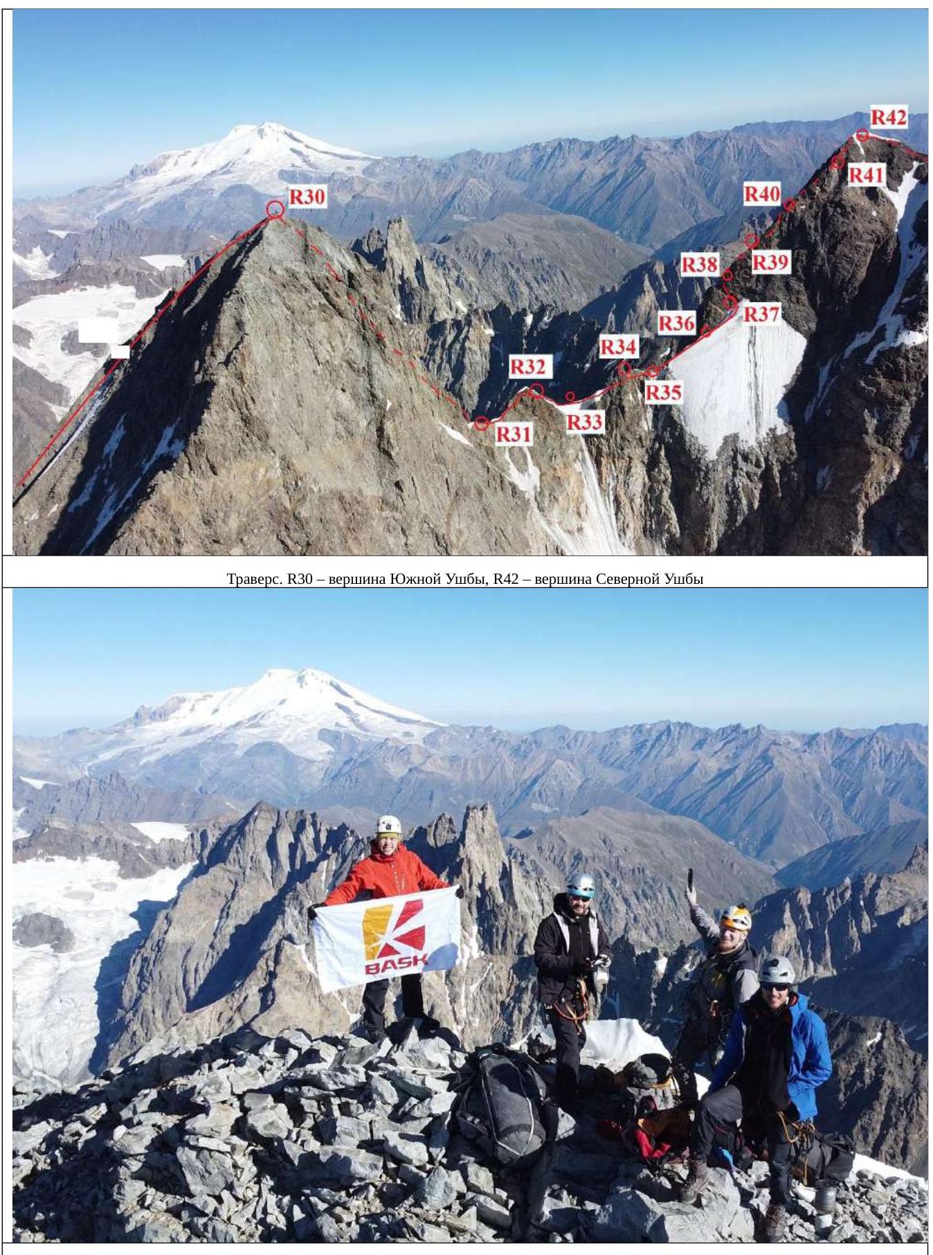
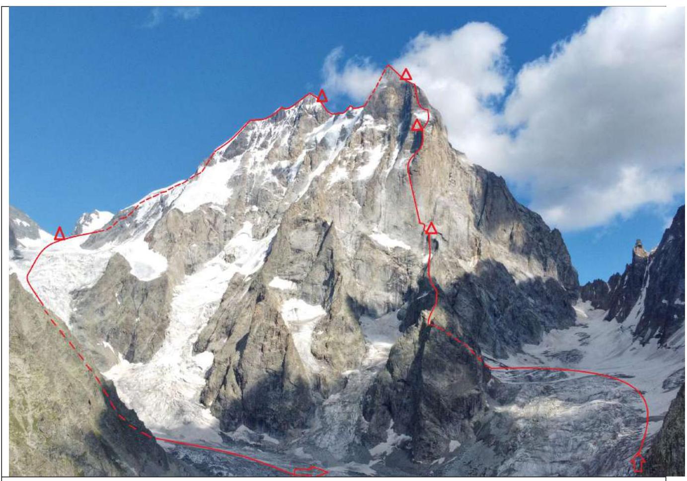 Figure 1. Route line. Start along the left part of the Southwest wall (L. Myshlyaev, 1960) 4710 m – then traverse to South Ushba via the saddle and descent via the classic route 4A category of complexity.
1.2. Photo of the route profile
 Figure 2. Half-profile with technical designations of sections of the route to the peak of South Ushba 4710 m (photo taken from the report of FAiS Kiev and modified).
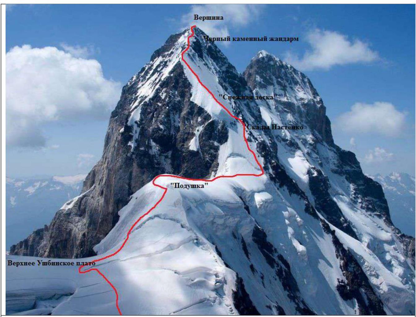 Figure 3. Photo of the route with description of main sections on North Ushba (photo taken from Risk.ru).
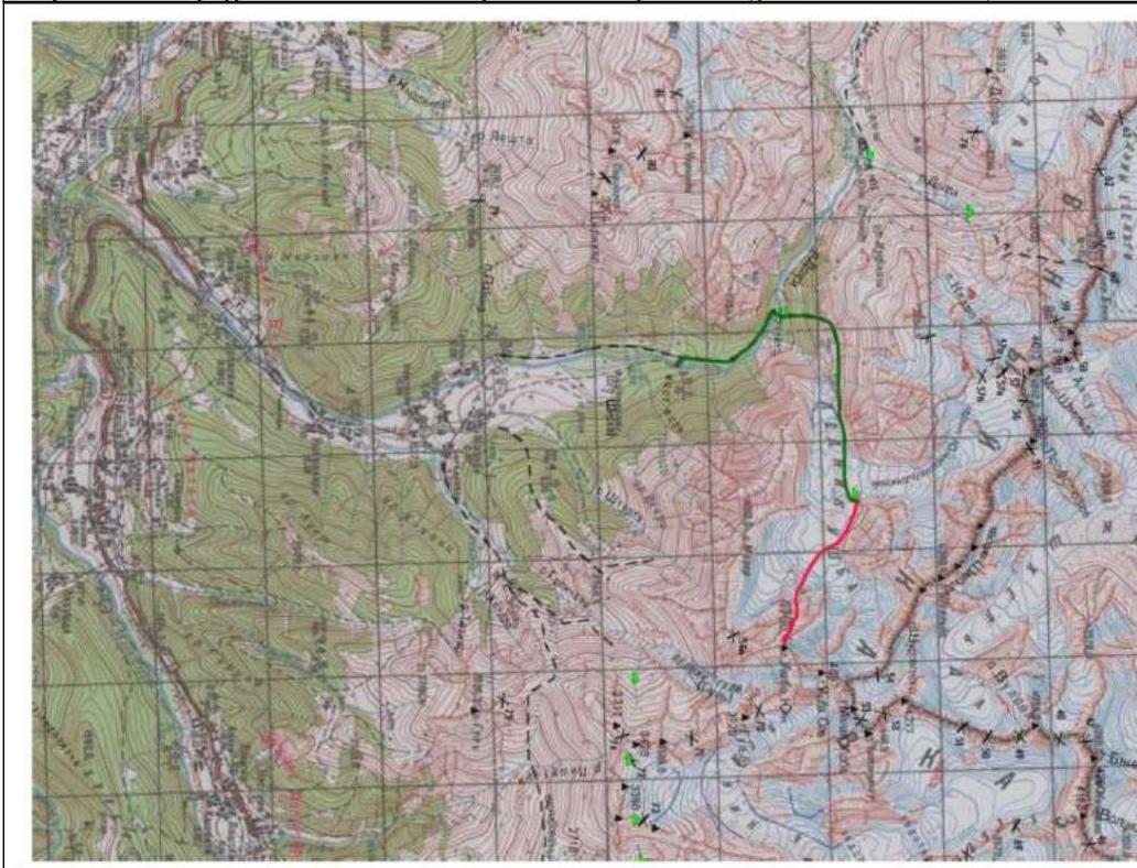 Figure 4. Topographic map of the area.
2. Characteristics of the Route
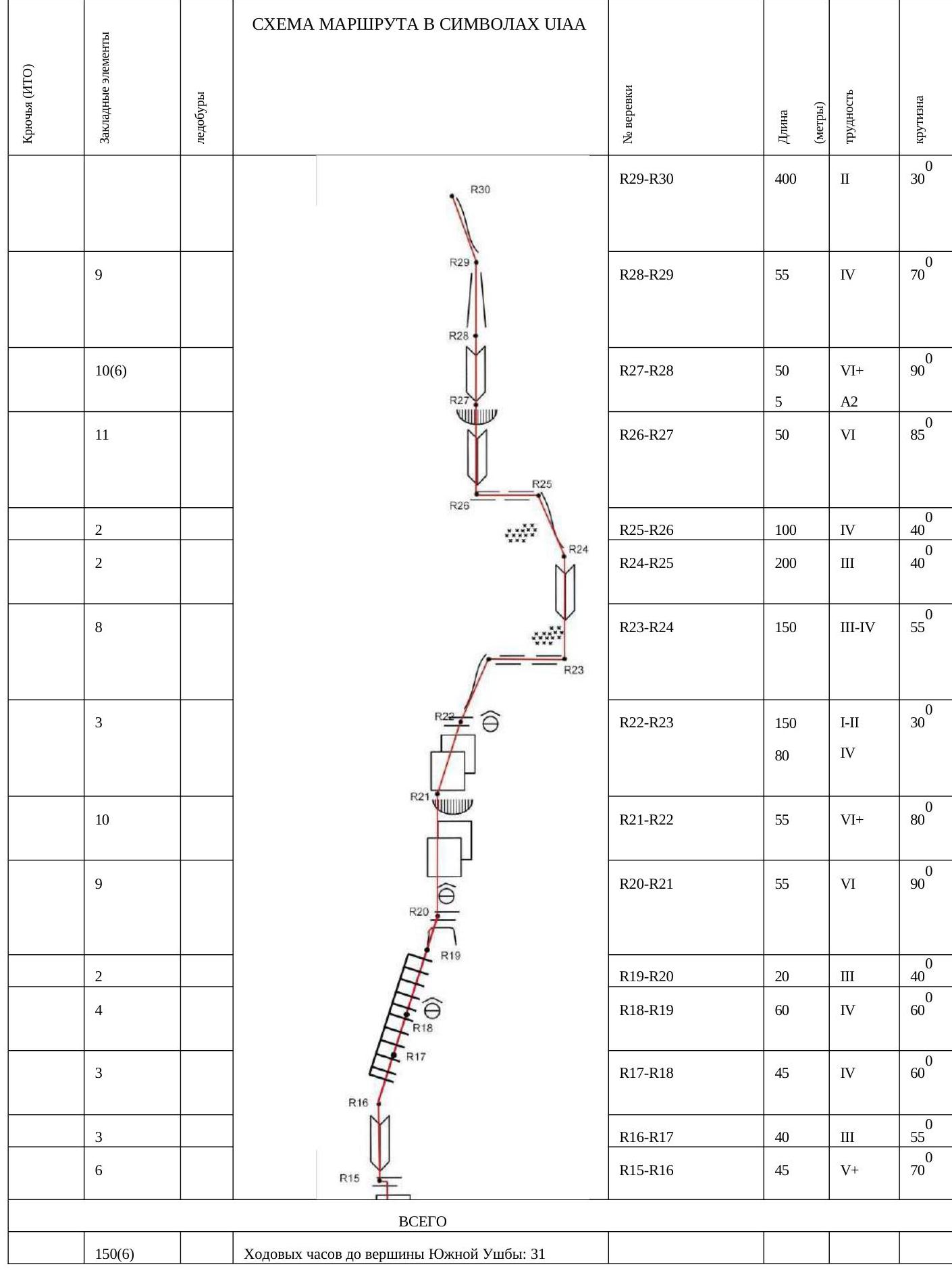
2.1. Diagram of the main complexity part of the route in UIAA symbols
2.2. Description of the route by sections
Approach to BC: From Mazeri village along a good dirt road to the bridge over the Dolra River. Behind the bridge is a border outpost. A permit is required, which is obtained in Becho. From the outpost along a marked trail through the forest and meadows to reach the tongue of the Ushba glacier. Along large scree and moraines, sticking to the right side, turn towards the Mazer Zazubrina and reach the snow plateau of the glacier descending between Mt. Mazeri and South Ushba. There, you can set up a BC and store excess equipment. Approach to the start of the route: From the BC bivouac, cross the glacier along the Mazer Zazubrina towards the Southwest ridge. The location is chosen depending on the situation. Possible dangers and features:
- Abundant rockfalls are possible from the slopes of Mazeri.
- From the snow plateau of the glacier, approach the destroyed slope of the Southwest ridge.
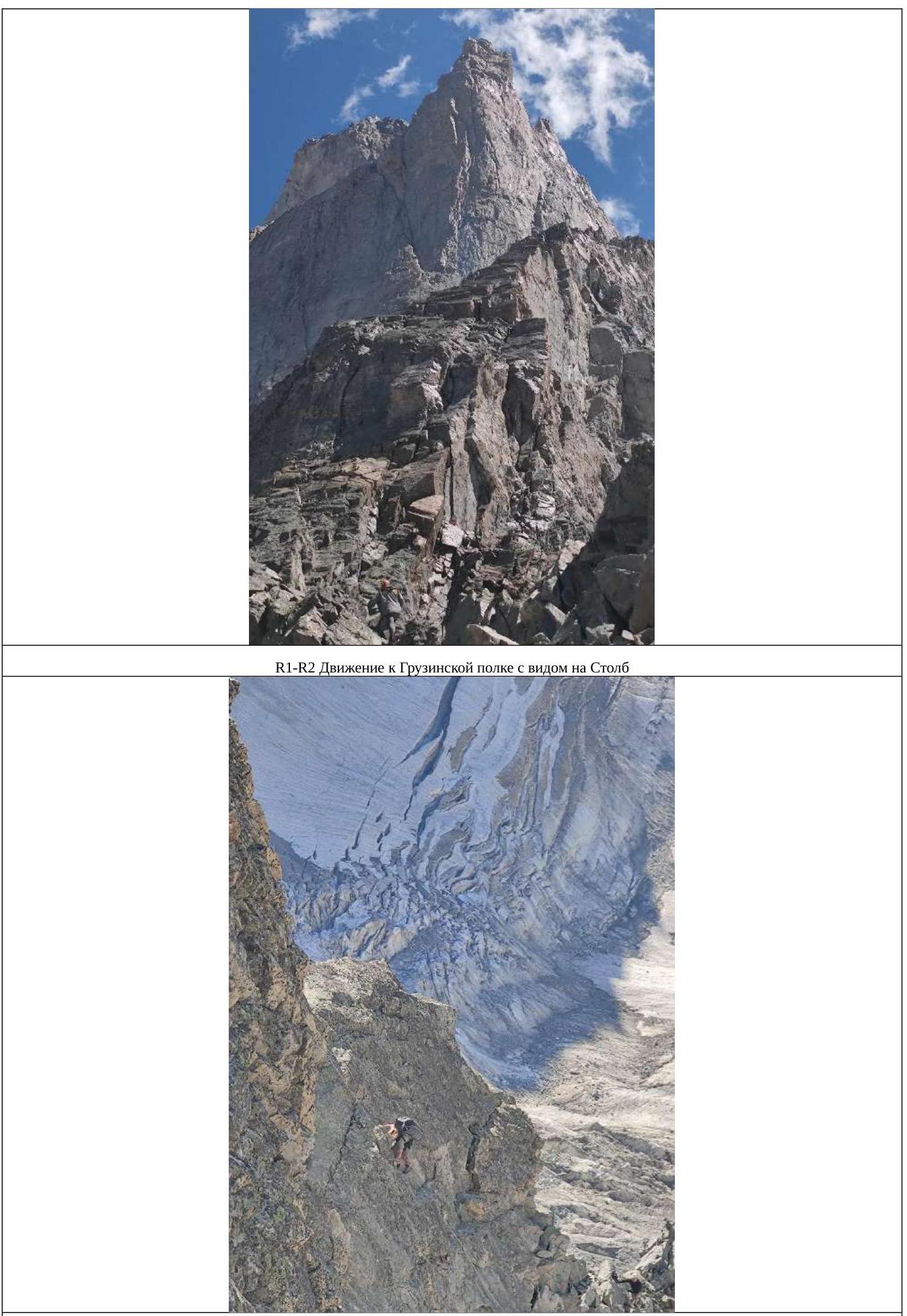
R0–R1. Move up along scree and simple rocks to the ridge. 250 m, 2, 30°. R1–R2. Turn right and move along simple rocks towards the Pillar. 300 m, 2, 30°. R2–R3. Through an internal corner along simple rocks. 200 m, 2–3, 40°. R3–R4. Along rocks of medium complexity, leading to the top of the ascent. There is old hardware. 50 m, 4, 60°. R4–R5. Moving along simple rocks, reach a simple descent to a snowfield. There is a place for a bivouac. 120 m, 4, 55°. R5–R6. Further along simple rocks and slabs, approach a sheer rock section 10 meters high. 100 m, 2, 35°. R6–R7. Climb the rock to a sharp ridge (there are railings), transitioning to an expansion on a platform "Georgian shelf" (hereafter GS). There is a place for a bivouac. Not affected by rockfall. Having climbed another 20 meters along simple rocks, there is another platform, but it is more dangerous due to rocks. Water is located to the right of GS, depending on the season, it may not be present. 80 m, 4, 70°. R7–R8. Along simple rocks, reach the beginning of a grotto. 100 m, 2, 25°. R8–R9. By passing the grotto on the right and choosing an optimal ascent route, climb to a convenient shelf with a memorial plaque. There are many drilled holes and remnants of rappel loops. The condition is satisfactory. 50 m, 5, 65°. R9–R10. Descend 8 meters from the plaque and traverse along simple rocks to the beginning of the Myshlyaev Corner. 40 m, 2, 60°. R10–R11. Climb up the corner. There are places for reliable belays. 50 m, 5, 70°. R11–R12. Further along the corner. 40 m, 6, 80°. R12–R13. Overcoming a small overhang, climb to a convenient location for a station. 45 m, 6, 85°. R13–R14. Along the corner to the place where the crack branches and a mini-grotto forms. Move along the left side of the crack, to the overhang and a slanting shelf. There is a station. There may be rime ice. 50 m, 6, 85°. R14–R15. Up a wet chimney. Steep rocks. Depending on weather conditions, it may be filled with water or have rime ice. 50 m, 6, 90°. R15–R16. Through an internal corner and a wide chimney, reach flat slabs. Depending on weather conditions, it may be filled with water or have rime ice. 45 m, 5, 70°. R16–R17. Initially along slabs, moving slightly left. 40 m, 3, 55°. R17–R18. Along destroyed rocks, traverse to the right to a supposed bivouac location. Highly destroyed. Affected by rockfall from above. 45 m, 4, 60°. R18–R19. Up and to the right along destroyed rocks to a shelf. There are remnants of a station. 60 m, 4, 60°. R19–R20. Along the shelf and destroyed rocks, move towards a bivouac platform located under the peak of the Pillar. There is mobile phone coverage. Water from snow. 20 m, 3, 40°. R20–R21. From the platform straight up along sheer rocks and an overhang. There are old pitons. 55 m, 6, 90°. R21–R22. Along complex rocks to the peak of the Pillar. There is a place for a bivouac. 55 m, 6, 80°. R22–R23. Along a sharp ridge, reach an osypnaya shelf. Traverse to the right to the beginning of a rock rib leading to the Red Corner. Depending on weather conditions, there may be snow. 200 m, 1–4, 30°. R23–R24. Along destroyed and icy rocks of medium complexity, move along the rock rib until it levels out. 150 m, 3–4, 55°. R24–R25. Along inclined slabs, reach and approach the base of a bastion. 200 m, 3, 40°. R25–R26. Traverse left to the base of an internal corner. 100 m, 4. R26–R27. Up the corner. 50 m, 6, 85°. R27–R28. Up the corner, bypassing an overhang on the left, move along an internal steep corner to a control cairn. Many old pitons. Possibly, rocks will be in rime ice and filled with water. 50 m (5 m), 6 (A2), 90°. R28–R29. Along destroyed rocks of a couloir to a shelf on the pre-summit ridge. Destroyed, possibly affected by rockfall, not a reliable place. On the pre-summit ridge, there are places for a bivouac. 55 m, 4, 70°. R29–R30. Along simple, destroyed rocks to the peak. 400 m, 2, 30°. R30–R31. Descent to the saddle between South Ushba and North Ushba.
- 5 rappels of 50–60 m.
- 4 rappels along rocky terrain, 1 rappel in the lower part along snow-ice terrain.
- Slopes are loose, местами камнеопасные with an incline of 70–80°.
- 2nd rappel — 10 m of unsupported space. 300 m. R31–R32. Movement along the saddle up to a gendarme in a rope team. Crampons. Belays on rocks. 50 m, 3. R32–R33. Descent to the icy part of the saddle, station on ice screws. 50 m. R33–R34. Movement traversing along inclined ice 40 meters to the side of rocks, belays on ice screws, then up and to the left along rocks 20 m, 4, 70°. R34–R35. Movement along rocks towards a snowfield. 40 m, 3. R35–R36. Descend to inclined ice, then reach a snowfield and further along it 50 m. R36–R37. Along the snowfield to an internal corner, station on rocks. To the right and above, 30 meters away, there are places for an overnight stay for 2–3 people. 40 m. R37–R38. From the station up along simple rocks 15 meters, then move left and reach the rib of the summit tower of North Ushba. 50 m, 3, 70°. R38–R39. Further up along the rib. 50 m, 4, 70°. R39–R40. Continue ascent along the rib. 50 m, 4, 70°. R40–R41. Ascent up along the rib, sticking to the right part, at the end of the rope, there is a place for a small tent. It is better to set it up while on belay. 50 m, 3, 70°. R41–R42. Ascent to the peak along simple rocks, crampons in the upper part. On the peak, there are snow drifts. 50 m, 3, 70°. R42–R43. Movement along a snow-ice ridge in a rope team, belays on ice screws and snow anchors. Move to a лопатообразный slope. 300 m. R43–R44. Descent along an icy slope (along the Snow Board) (depending on the season and weather, it may be snowy). 5 rappels of 60 meters, 45°, to the rocks of Nastenko. R44–R45. Descent from Nastenko's rocks to a flattening, overcome a bergschrund. 3 rappels of 60 meters, 45°. R45–R46. Crossing the Ushba Cushion in a rope team 500 m. R46–R47. Descent in a rope team from the Ushba Cushion, first down, then after 50 meters sharply to the right 150–200 meters, bypassing ice crevasses. 250 m. R47–R48. Movement along the glacier in a rope team, on the pass, there are places for tents, from here, they usually start the ascent to North Ushba via route 4A category of complexity. 500 m. R48–R49. Descent along a dissected glacier in a rope team, crevasses, rocks may fall from Shkhara. After 2 km, the glacier gives way to an osypnoy slope, along which another 700 m to a snowfield, at the end of the osypnoye slopes — baran'i lby. R49–R50. Move to the snowfield and descend down to the flattening of the glacier. 200 m. Further to BC, through the moraine and glacier, reach the trekking trail, through the border outpost to Mazeri village.
3. Characteristics of Team Actions
The basis of the route is a line of ascent to South Ushba along the left part of the Southwest wall (L. Myshlyaev, 1960) 4710 m, after which the route continues to traverse through the saddle to North Ushba 4690 m with a subsequent descent via the classic route 4A category of complexity. The choice of route was based on:
- Safe, accident-free passage;
- Stability of the terrain;
- Interesting and adventurous nature of the event;
- Logical continuation of the route with an ascent to North Ushba peak. However, it cannot be considered completely safe. Also, due to the considerable size of the team, emphasis was placed on the adventurous nature of the event, which served as a logical continuation of the route with a further ascent to North Ushba peak. Characteristics of the terrain and overnight stays during the ascent via Lev Myshlyaev's route to South Ushba were known to us due to the presence of reports; the further traverse of peaks represented a small intrigue, which fueled the climbers' interest. Ease and style of ascent, absence of IT sections, and a friendly atmosphere in the team made the ascent pleasant and memorable. For four people, we took:
- 2 sleeping bags;
- 3 sleeping pads. Walking poles and unnecessary items were left in the base camp; the supply of food and gas allowed us to stay for two additional days on the mountain in case of worsening weather, which we expected during the ascent. From old supplies, we took a snow anchor, which pleasantly surprised us during the traverse and descent from the route, and the charge of optimism was enough to continue the traverse somewhere else. In our opinion, this traverse of South and North Ushba peaks is the most logistically convenient due to the start and finish at the same point, allowing us to set up a base camp and leave some things there.
3.1. August 27, 2023
On August 27, 2023, with heroic efforts, we carried our bags and reached the base camp in 3 hours. Realizing that we needed to lighten our load, by decision of the weight reduction committee, the following were eliminated:
- Personal hygiene items;
- Spare clothing;
- One rope;
- Several placing elements;
- One sleeping bag. After a control weighing, the drone (just over 2 kg) was spared, but another sleeping bag was eliminated as non-essential equipment for the August–September period. The drone, in turn, had immunity and was taken along. Using it, without leaving the base camp, we conducted a reconnaissance of the approach to the start of the route. Unnecessary items were hidden, and the rest were packed for a quick start.
3.2. August 28
At 5:17 AM, we set out towards the route, traversed the moraine along the left part, then climbed onto the glacier and, bypassing crevasses, approached the start of the route. After removing crampons, we began our ascent. The rocks were not complicated, and initially, we were able to move using personal equipment; later, we retrieved the ropes. By 4:00 PM, we were on the Georgian shelf and processed two sections on the "Pillar" for the next day. There was no water on the shelf, so we had to descend to the snowfield and collect a bag of snow. The shelf had to be expanded due to the considerable size of the tent.
3.3. August 29
We started on the route at 7:00 AM, passed the first two processed sections, and worked further at a steady pace until we reached the flattening; closer to it, sections of rocks with ice and icicles began to appear. The sun at this time of year illuminates this part of the wall approximately from 2:00 PM. We passed the flattening, hauling our bags and bivouac equipment on ourselves. We decided not to stop at the lower bivouacs and continued further to the upper ones, setting up camp there at 7:30 PM, near a snowfield where we could collect snow and ice. The platform had to be expanded to fit the not-so-small tent.
3.4. August 30
We started at 8:00 AM, passed the icy part of the route using ice screws, and reached the pre-summit tower. We tried to find the Samara collection variant described in the report but couldn't. Cloud cover rolled in, and we decided to proceed along the red wall, the internal corner of which turned into a huge chimney, or rather, a canyon 4–5 meters wide. The location was hazardous:
- We set up a station further away.
- While the first and second participants overcame this section, we set up bags as barriers against rocks, which proved to be a very good decision.
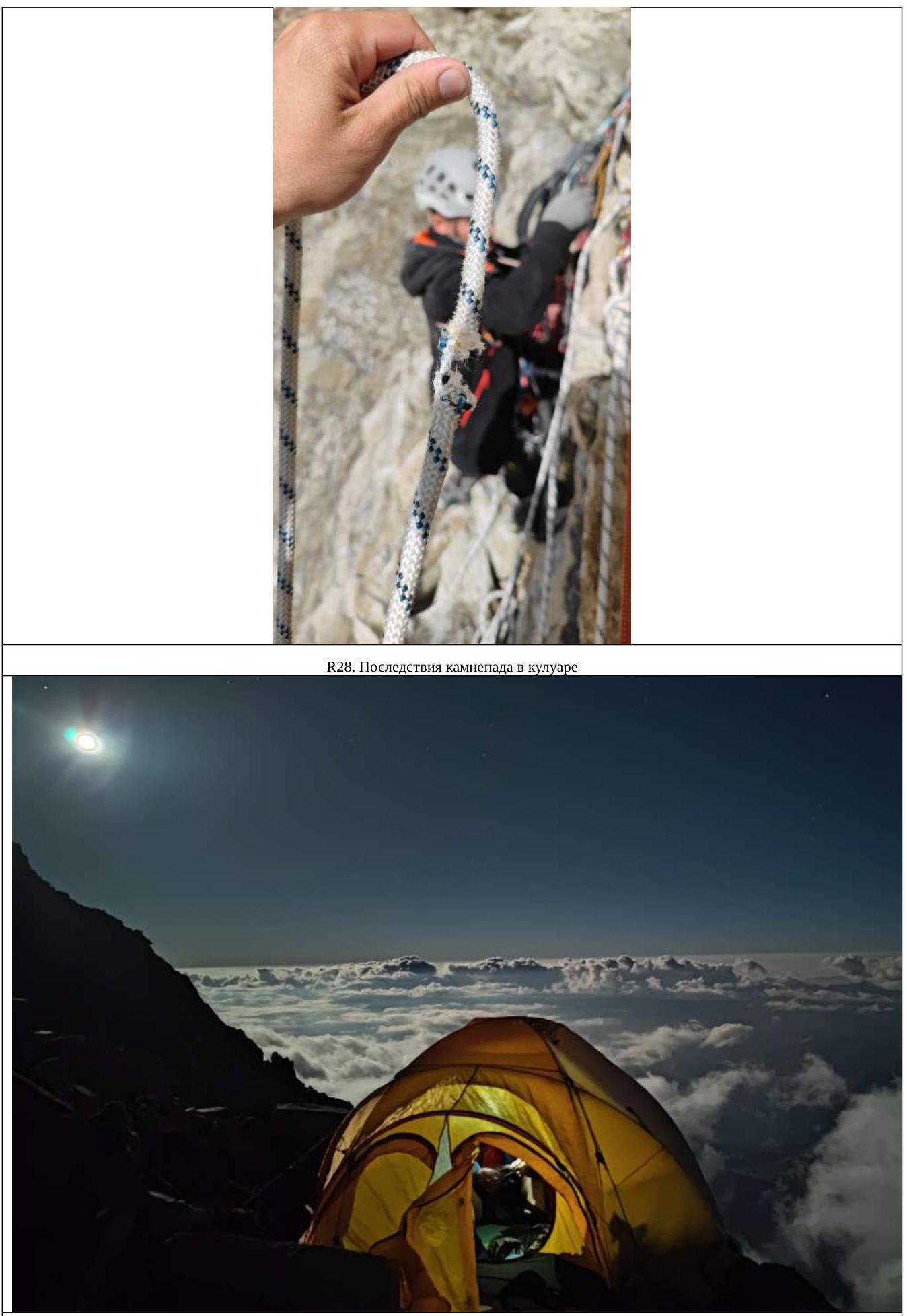
- The rock is very loose, and rocks were breaking off. As a result of the ascent, on the last meter, near the station, a huge block broke off from under the second participant, causing everything to come down:
- About 2 tons of rocks were dislodged.
- A bag was torn.
- Two of the three ropes were damaged (fortunately, the third was in the bag). The participants were not injured due to the competent organization of the station and their presence on it, but it was unpleasant. We continued with the remaining intact rope, tied the two damaged ones together (one was damaged in one place, the other in two), climbed higher along a pedestrian slope, and set up a tent after preparing a platform for about 1 hour.
3.5. August 31
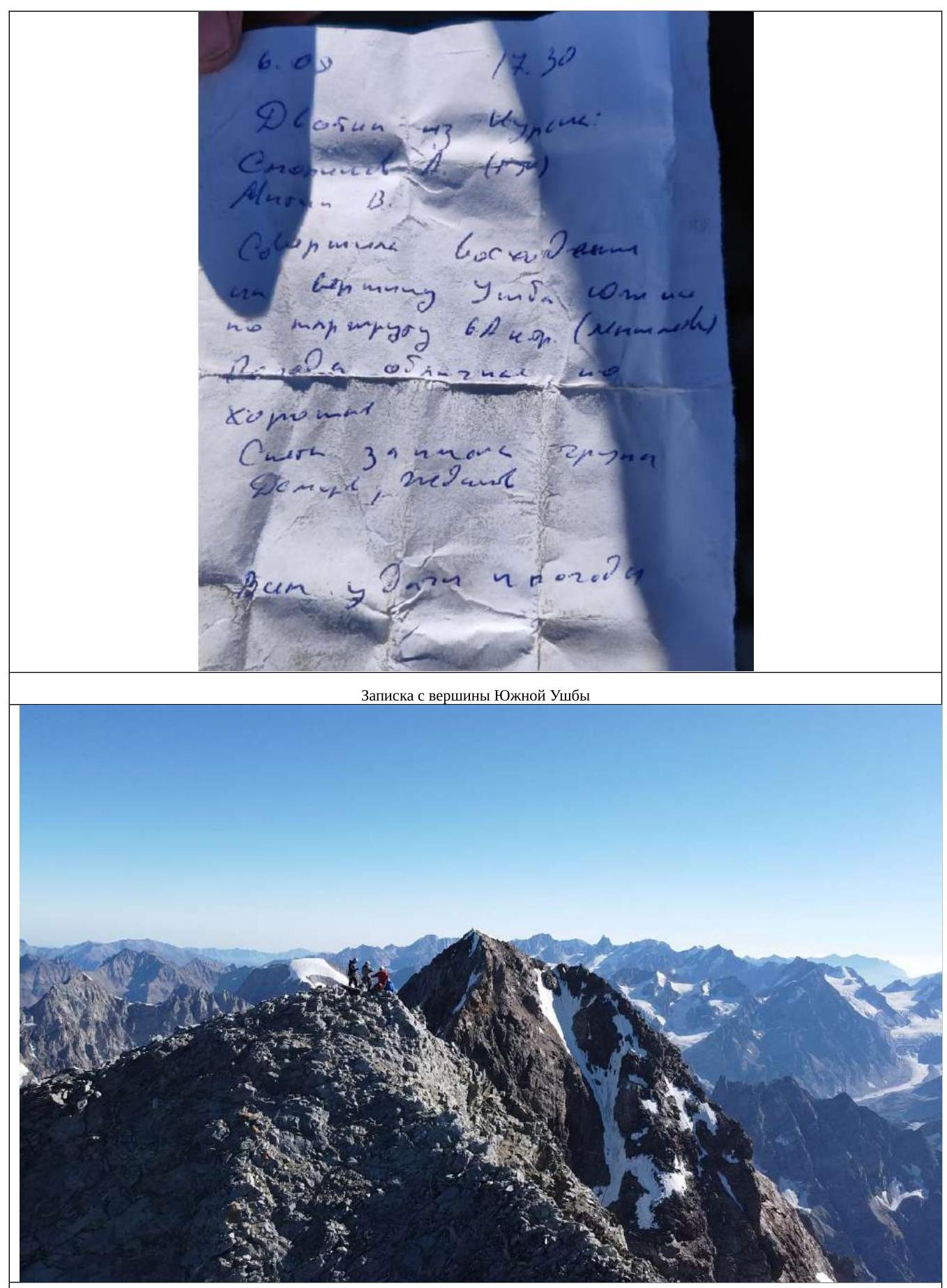
We set out at 6:50 AM, and the ascent was easy and pleasant; in the upper part, we retrieved ropes for belays. We reached the summit at 7:50 AM. We found a note from the Kursk team Smolnov–Mitin, who completed the ascent via Myshlyaev's route 6A category of complexity. We left the note as we had nothing to write with. After a snack and photo shoot, we began our descent to the saddle. Rappels were complicated by having only one intact rope; we had to constantly switch through knots on damaged sections, in unsupported space, and with a bag — not a pleasant experience:
- 4 rappels along rocky, partially osypnoy terrain;
- One diagonal rappel along snow-ice terrain to the saddle. Movement along the saddle was initially along rocks, then along inclined ice, descending down — ice screws were needed; traversing the top was not possible due to cornices. Then, again, a rocky section and an ascent along a snowfield to the pre-summit tower. Further climbing presented no particular difficulty; after 5 ropes from the snowfield, we found a spot suitable for half a tent. Through construction and installation work with a bias towards stone masonry, we increased the tent's coverage area to 2/3. We expanded the shelf while on belay, with cliffs on the sides.
3.6. September 1
At 7:40 AM, we set out on the route and reached the summit at 8:05 AM; we didn't find any notes or a cairn, and we didn't build one either — we had nothing to write with. We took photos, had tea, admired the views, and at 9:20 AM, we moved on. We traversed in a rope team simultaneously, with belays on ice screws and a snow anchor. We reached the descent point, initially planning to rappel with the last person climbing, but the slope was pure ice, so we decided against it and rappelled with a pull-through via an Abalakov loop. We completed:
- 5 rappels before reaching Nastenko's rocks;
- Then, we shortened the section and passed through hanging ice, completing another 3 rappels to the flattening and the Ushba Cushion. After that, we walked in a rope team through the Ushba Cushion, bypassing crevasses, and admired the Ushba Mirror, reaching the pass and overnight stays. We didn't descend further, found leftover sublimates, and decided to enjoy the remaining day in the mountains. On the pass, Russian cellular coverage was available, the weather was promising to remain good, and we were looking forward to heading home, visiting a sauna, and celebrating Shafutinov Day. In the evening, avalanches came down from North Ushba.
3.7. September 2
We set out at 8:00 AM. We traversed the glacier in a rope team, searched for paths, crossed snow bridges, and jumped over crevasses. We stayed between the middle and the right part of the glacier, adjacent to the Shkhara massif, but closer to Shkhara, although we didn't want to due to possible rockfalls. We reached the baran'i lby and switched from them to a snowfield, descending down to the glacier. On the glacier, remnants of a destroyed bivouac were often encountered:
- Torn sleeping bags and down jackets;
- Broken helmets;
- Other equipment. Making a detour through the center of the glacier, we descended down and enjoyed sunbathing and swimming in the pools formed on the glacier. We reached the base camp, retrieved previously hidden items, ate heartily, rested, took a nap, and decided to descend further. At 2:00 PM, we began our descent to Hikers Inn (café, sauna, guest house), where we stayed for the night.
4. Photos from the Route
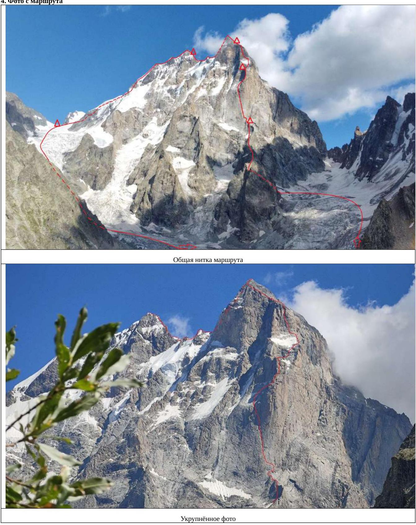 General route line.
 Enlarged photo.
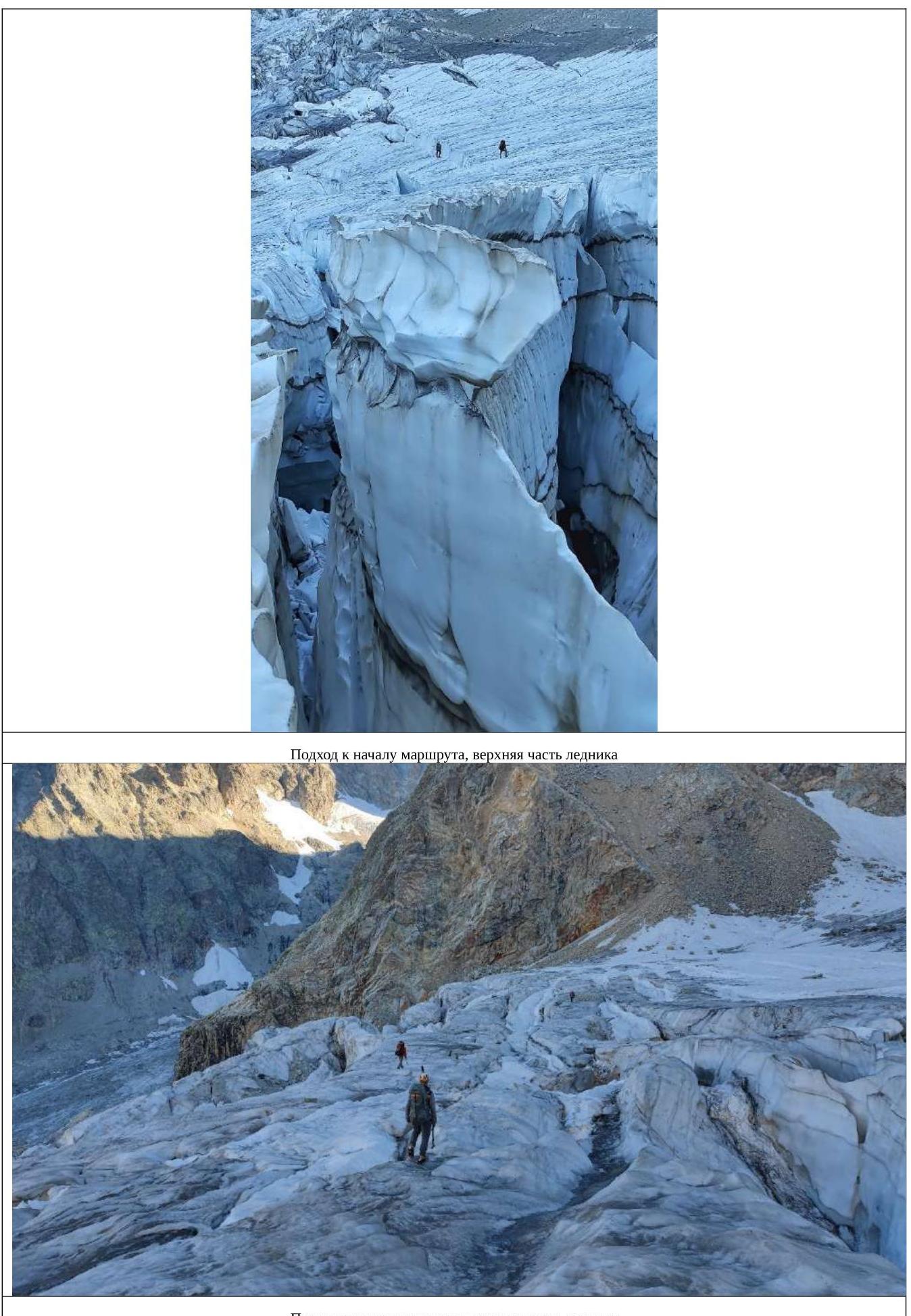
Approach to the start of the route, upper part of the glacier.
R5–R6.
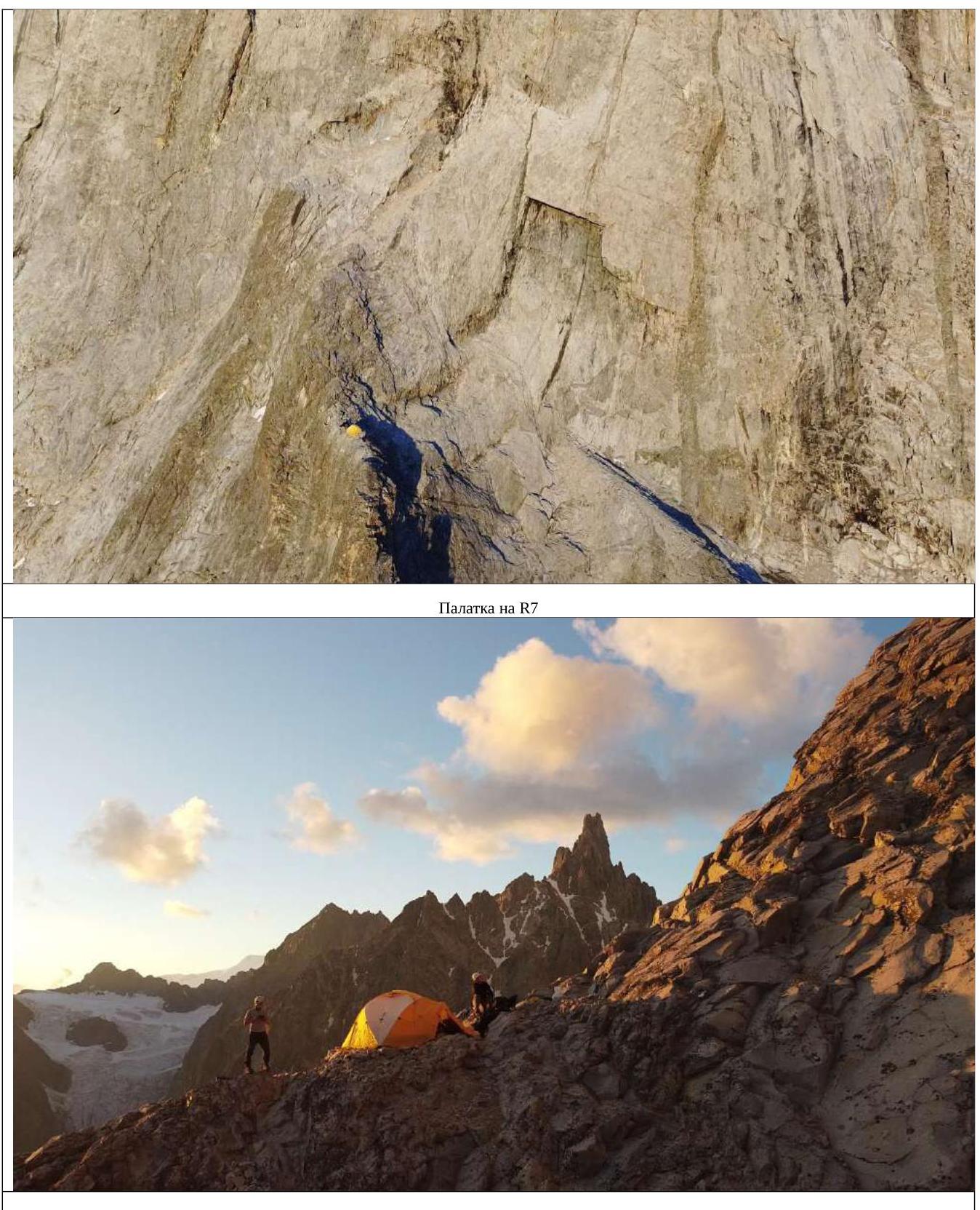
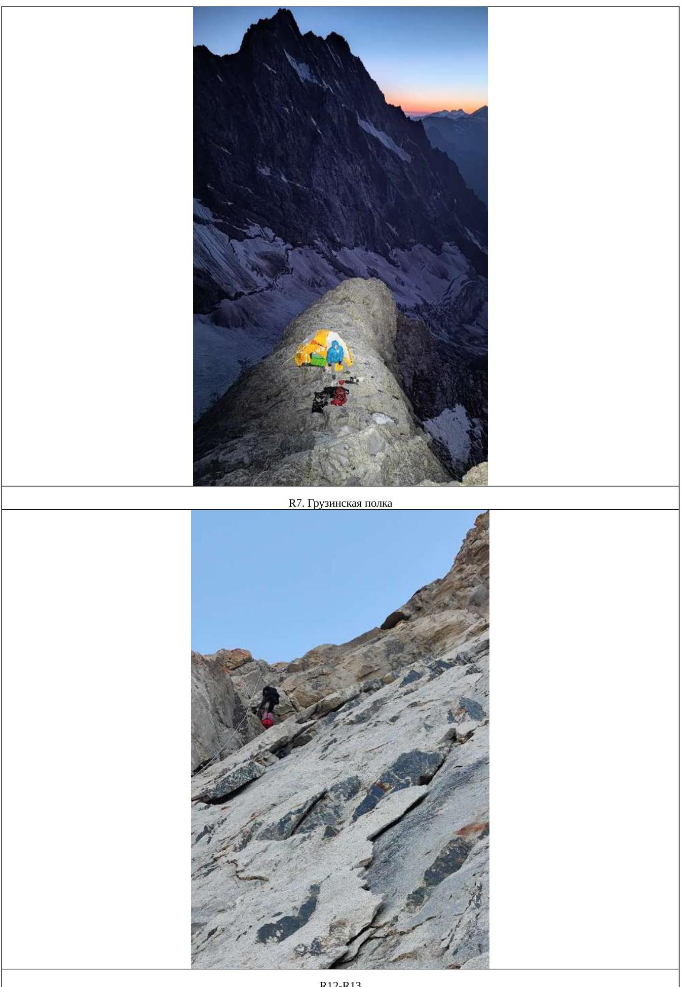
Tent on R7.
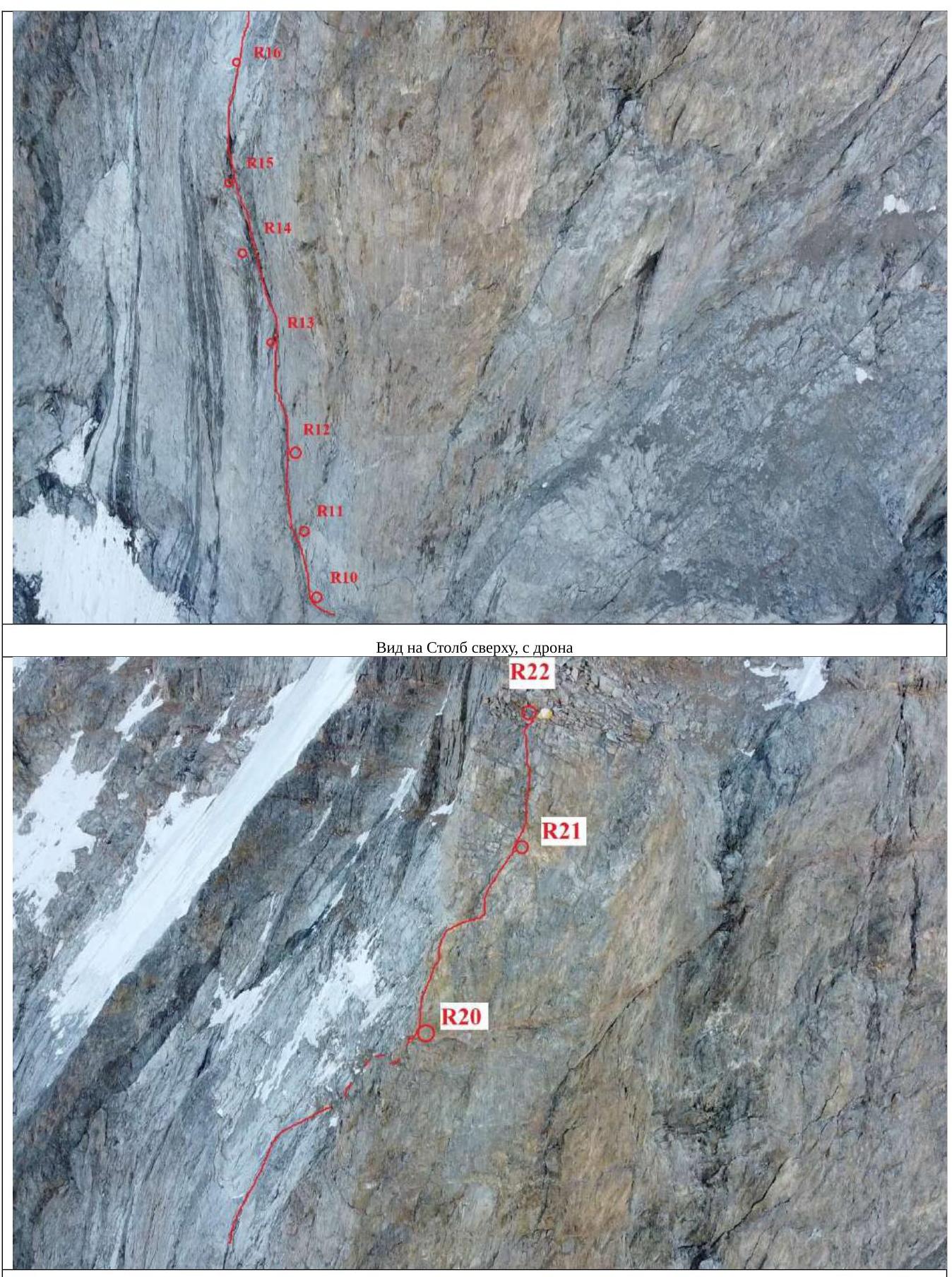
R12–R13.
View of the upper part of the Pillar from the drone. Tent on R22.
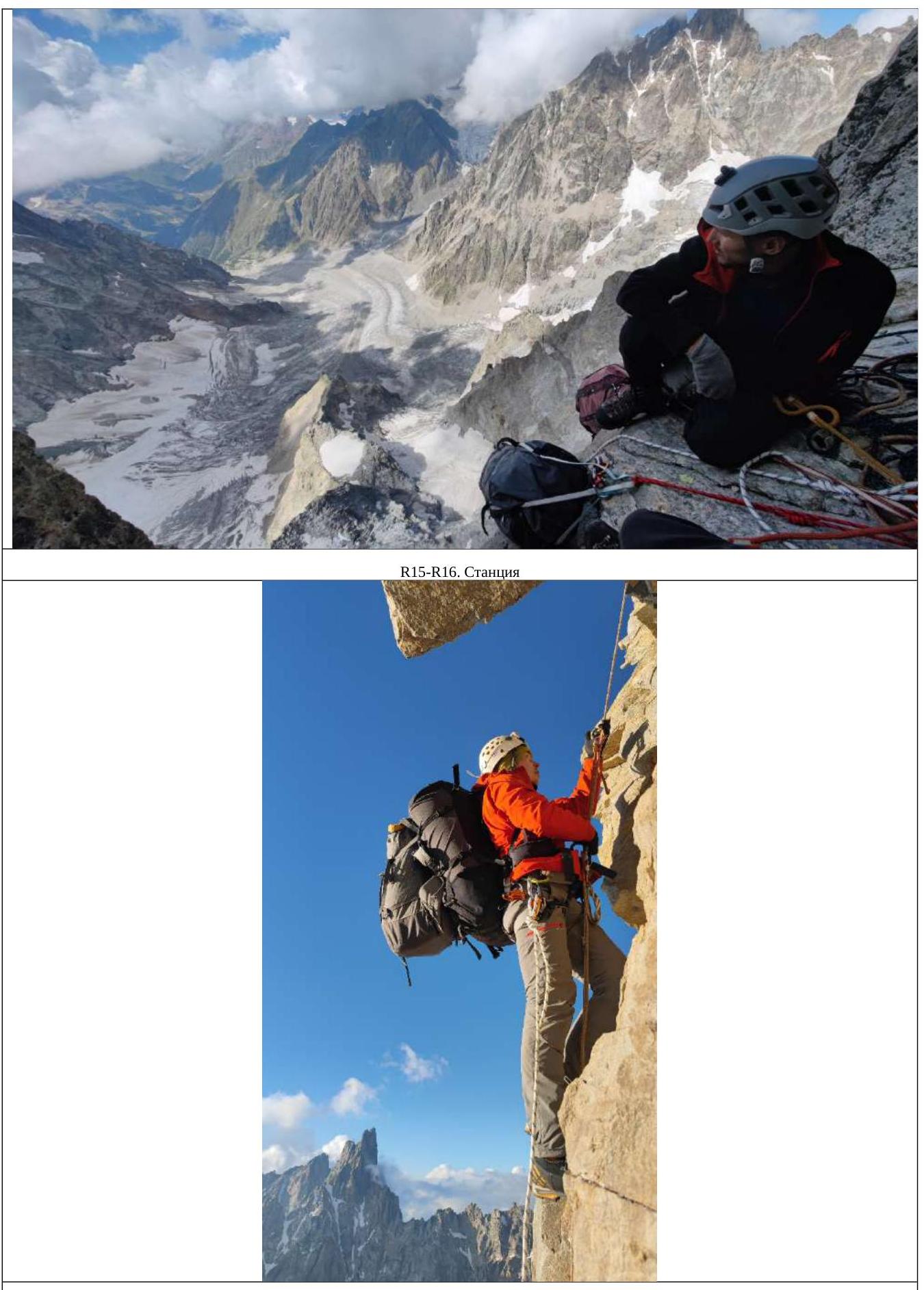
R20–R21. Up from the platform.
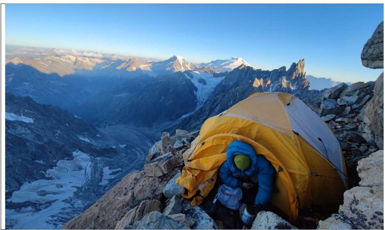
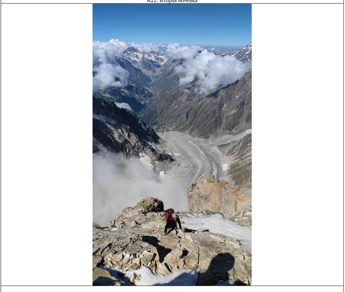
R22. Second overnight stay.
View from the drone.
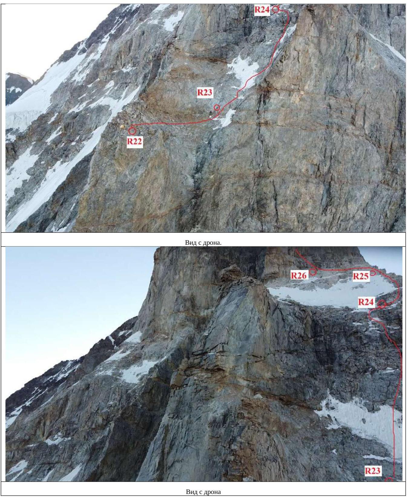
View from the drone.
Overnight stay on R30.
South Ushba peak 4710 m.
Team on the summit of South Ushba 4710 m, left to right:
- Prostakishin Dmitry;
- Zherdev Kirill;
- Komarov Pavel;
- Sayfullin Ildar.
R35–R36. Reaching the snowfield.
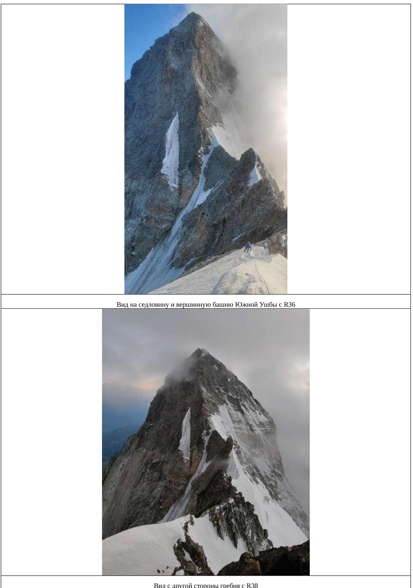
View from the other side of the ridge with R38.
R41. Station.
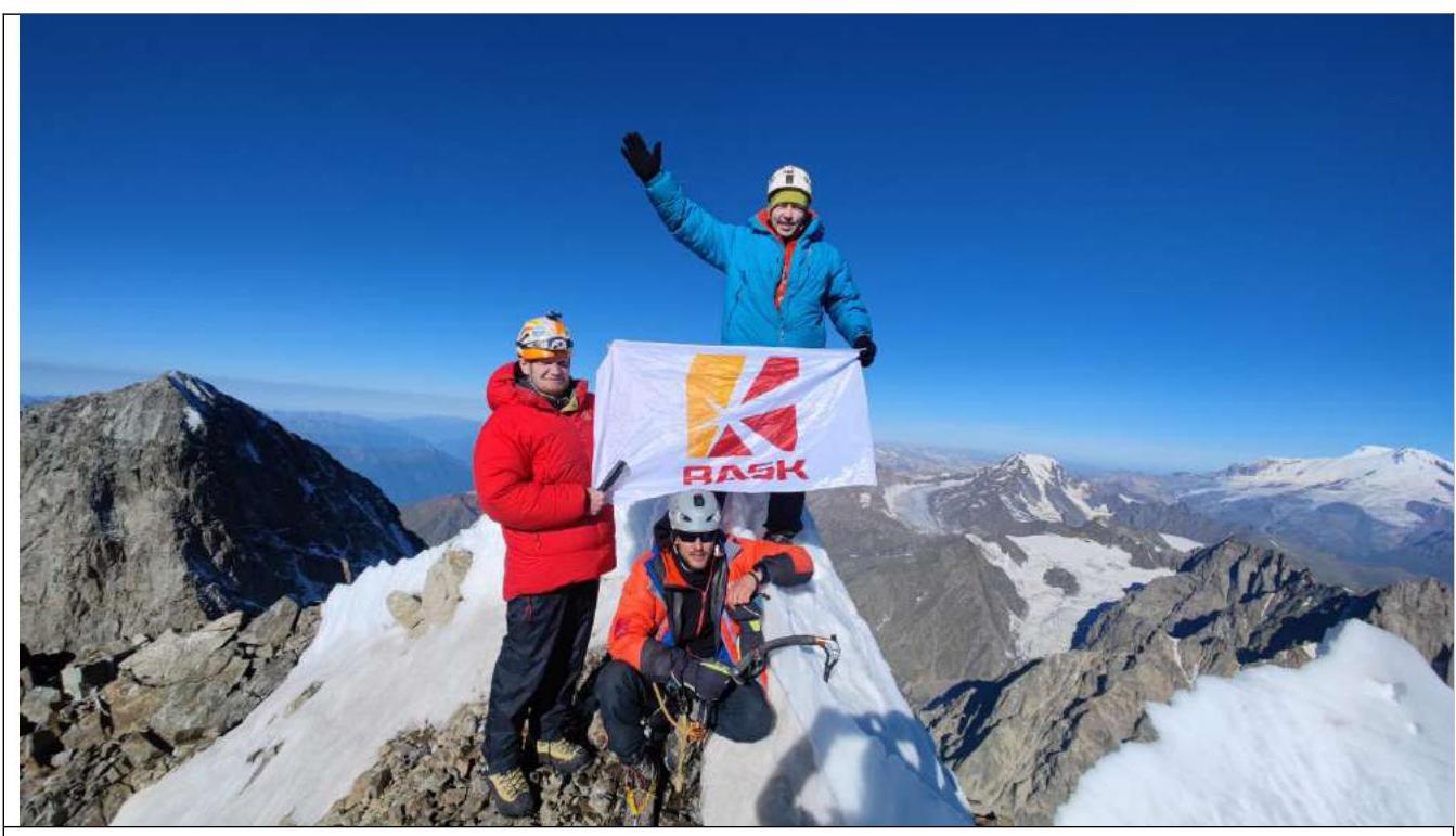
North Ushba peak 4690 m, left to right:
- Komarov Pavel;
- Sayfullin Ildar (sitting);
- Prostakishin Dmitry;
- Zherdev Kirill taking a photo.
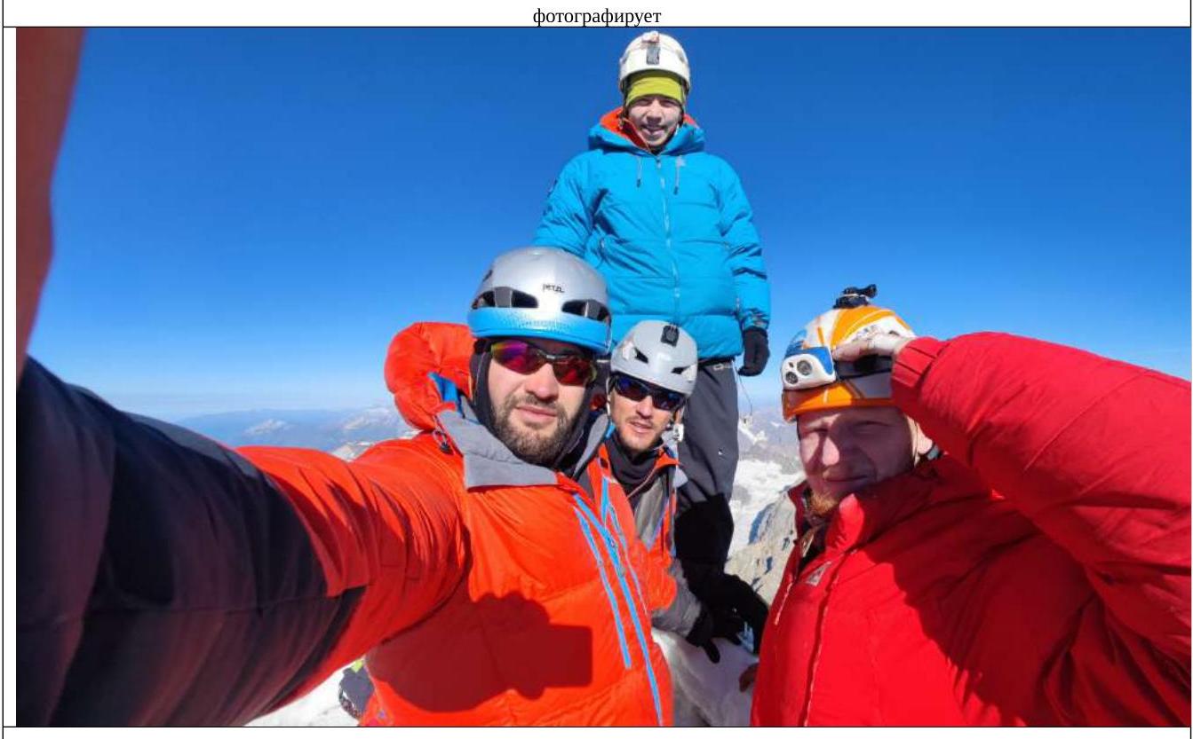
Left to right: Zherdev Kirill, Sayfullin Ildar, Prostakishin Dmitry, Komarov Pavel.
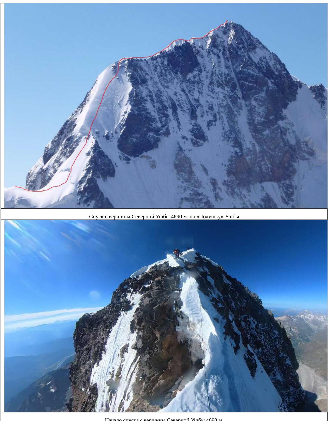
Start of descent from North Ushba peak 4690 m.
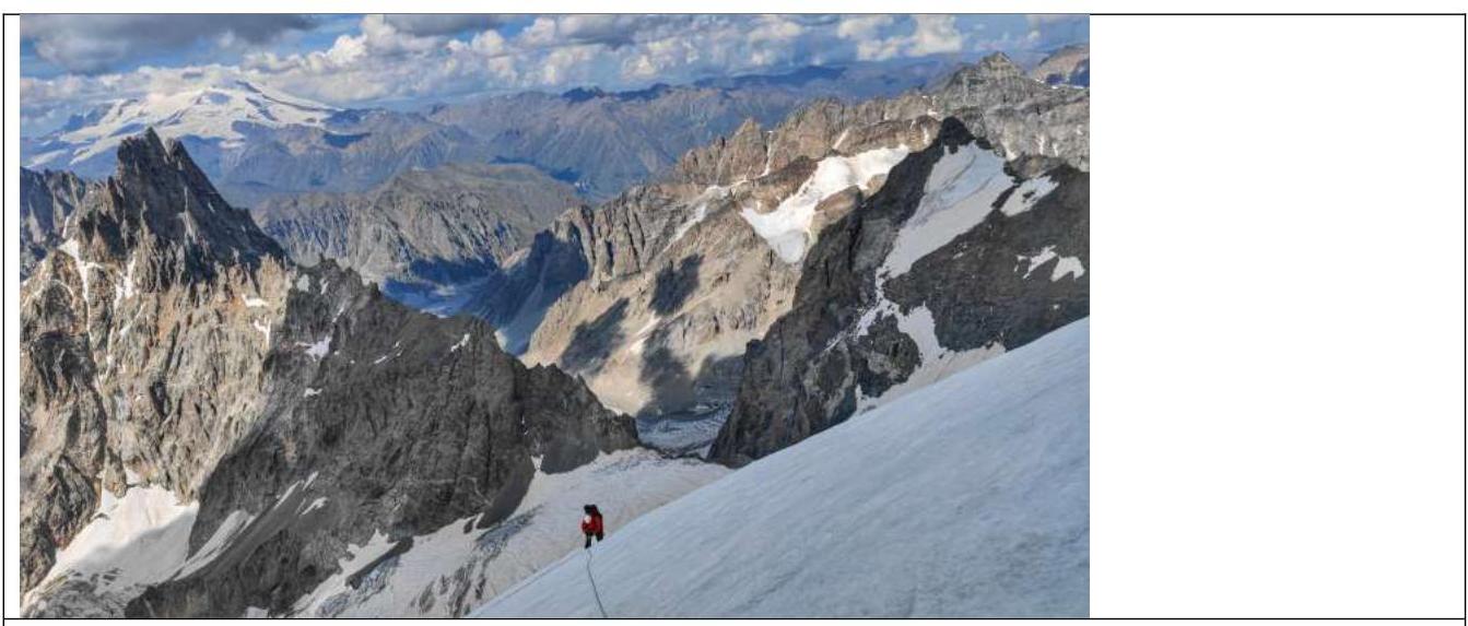
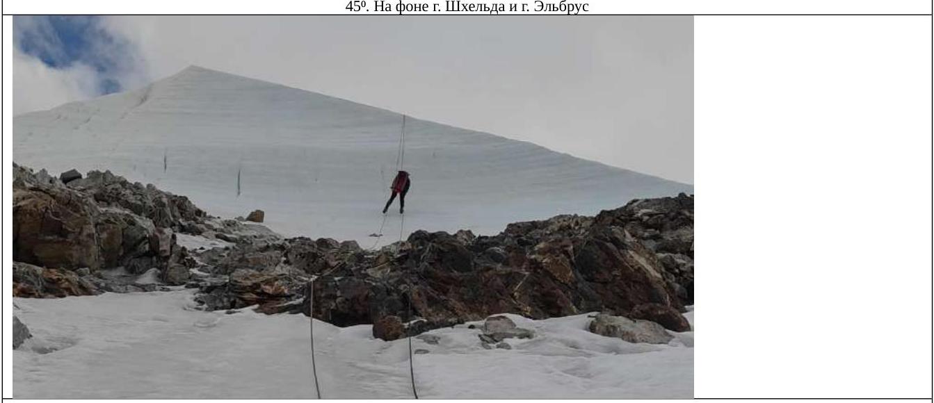
Descent along an icy slope (along the Snow Board) (depending on the season and weather, it may be snowy). 5 rappels of 60 meters, 45°. In the background, Mt. Shkhara and Mt. Elbrus.
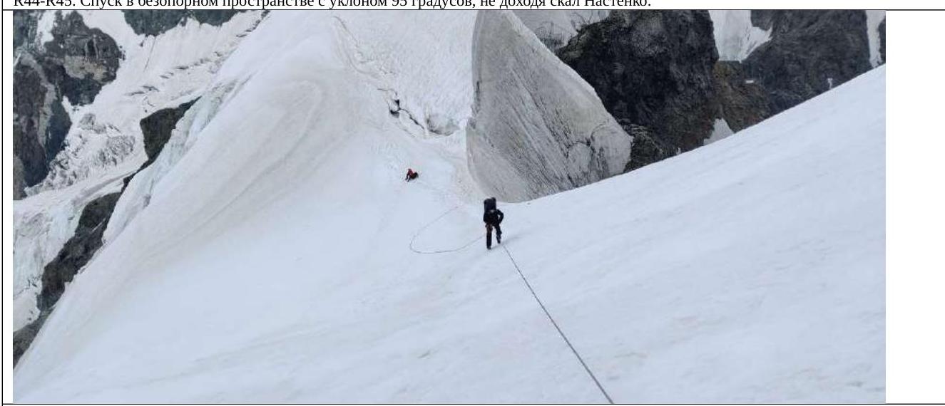
R44–R45. Descent in unsupported space with an incline of 95°, not reaching Nastenko's rocks.
Descent to the Ushba Cushion. ![img-27.jpeg]({"width":1343,"height":1609,"format":"Jpeg","uri":"https://summitx.info/media/1/ofmgrDw3KcbDk1gmSUbAQSokfm4ES↗