Gennady Starikov, Moscow (Author's photo) Trapecija 2A, Ascent Passport
-
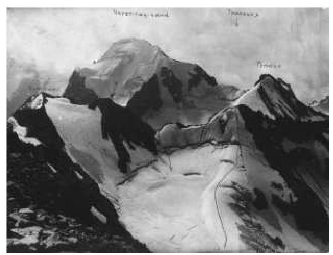
Region — Caucasus, valley — Adylsu. (table — 2008, p. 42, item 171a) Peak name — Trapecija (3697), NW edge.
-
2A category of difficulty (first ascent)
-
Nature of the route — snow-ice.
-
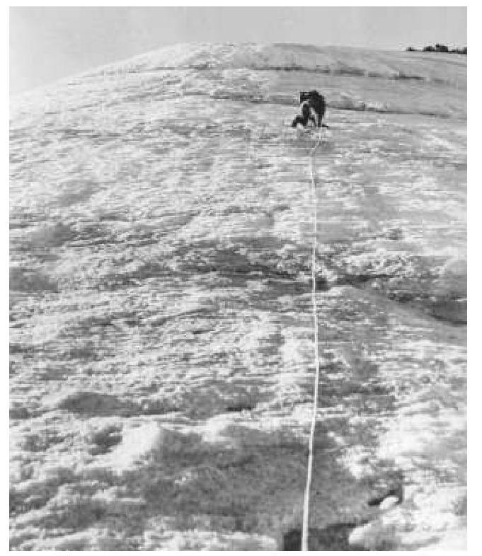
Height difference from the glacier — 300 m Length of ice sections of 3rd category of difficulty — 180 m Average steepness of the main part of the route — 45°.

-
view from the valley — Adylsu
-
view from the summit VIA-tau
-
Total ice pitons used on the route — 17 pcs. When approaching the ice ascent, running belay via ice axe.
-
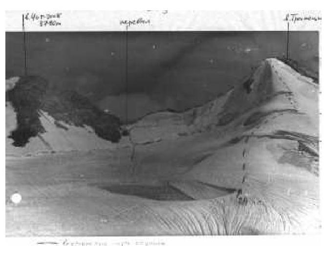
Total hours from the bivouac at Zelenaia Gostinitsa to the summit — 7 hours, steep descent to the saddle of v. Chotchat, then to the glacier under the climbed route, avoiding 1-2 bergschrunds (belay!). See five photos.
-
Group was training: leader — Starikov G.A. — Candidate Master of Sports, instructor 1st category, coach, participants: Aksenov N.V., Bulatova M., Kostin V.S., Lozovoi S.M., Fomin A.G. (all — 3rd sports category).
-
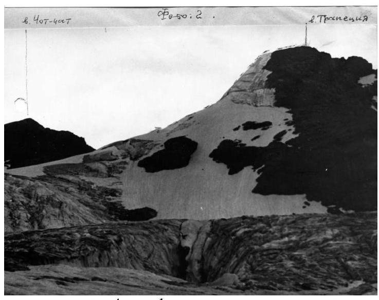
view from the glacier
-
route profile
-
first rope out of four and a half
-
Coach: Laptev A.L. — Candidate Master of Sports.
-
Departure and return: August 16, 1981.
-
Organization — alplager "Dzhantugan".
Recommendations
- Crampons for all
- Ice screws — 8-10 pcs.
- Ice axes — 2 pcs.
Note
The route itself is logical — 180 m of ice (total 4.5 ropes), goes straight up from the last bergschrund, it is not allowed to exit to the destroyed rocky ridge to the right (see Accident Report 1991 — death of 4 people from alplager "Adylsu").