
Report
on the ascents to peak 3930 (Paton Peak) in the Caucasus, made by participants of the Ukrainian scientific-sports expedition
-
Organizing Body
Ukrainian Mountaineering and Rock Climbing Federation
-
Location
Russia, Caucasus, Prielbrusye
-
Period
from August 4 to August 23, 2004
-
Leader
Simonenko V.K. — senior coach, Gorbienko M.M.
-
Participants
5 people
-
Information about the ascents:
| # | Date of reaching the summit | Summit and route | Category of difficulty | Leader, participants |
|---|---|---|---|---|
| 1 | August 14, 2004 | Via SE slope, partial traverse | 1B | Simonenko V.K. — leader, Shumikhin V.S., Lebedenko V.S., Ovcharenko V.D., Slavinsky P.S. |
| 2 | August 15, 2004 | Via S ridge, partial traverse | 1B | Ovcharenko V.D. — leader, Bakay A.S. |
| 3 | August 15, 2004 | Via N ridge of W ridge, partial traverse | 2A | Gorbienko M.M. — leader, Shumikhin V.S. |
- Qualification standards were not expected to be met
- There were no injuries or accidents
Expedition leader V.K. Simonenko
Senior coach M.M. Gorbienko
Brief overview of the ascent area
The Irikchat gorge has long been known to mountaineers and hikers for its peaks Irikchat, Kezgenbashi, Soviet Warrior, Irikchat and Chat passes, and, of course, Elbrus towering above all and closing the gorge.
In the southeastern ridge of Elbrus with the peak Askerkolbashi, which separates the basins of the Irik and Irikchat rivers, there is a key unnamed peak 3930. From it to the east goes a short ridge with an effective rocky group of peaks — gendarmes.
Under them in a picturesque green valley of Irikchat there is a convenient place for a base camp (altitude 2900 m).
To the left and right of the eastern ridge there is a small glaciation. In the summer of 2004 (July-August) peak 3930 was heavily snowed.
The approach from the Elbrus settlement along the Irikchat gorge to the bivouac is described in "Baksan Valley" by A. Naumov. From the mountaineering camps under peak Irikchat to the base camp it is necessary to pass another 1.5 hours in the direction of the Irikchat pass.
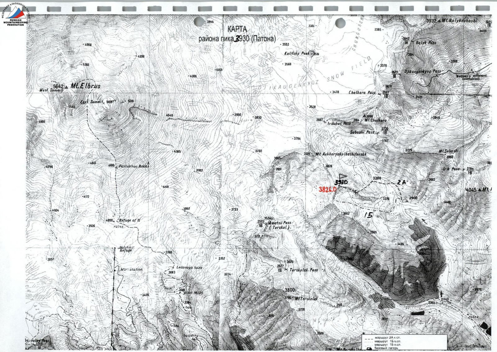
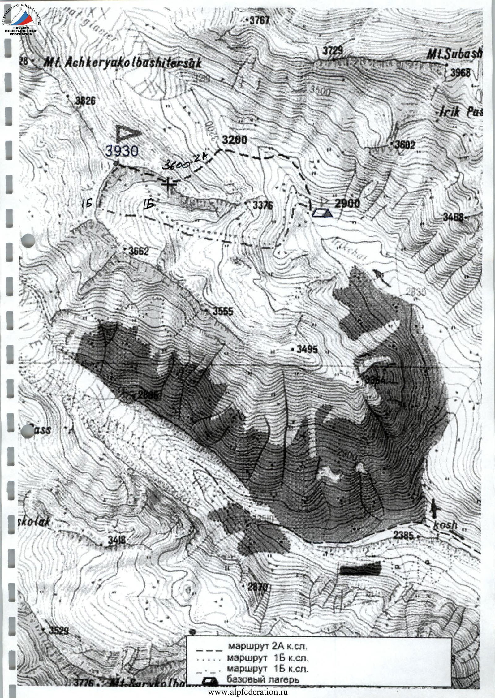
2A category route, 1B category route, 1B category route.
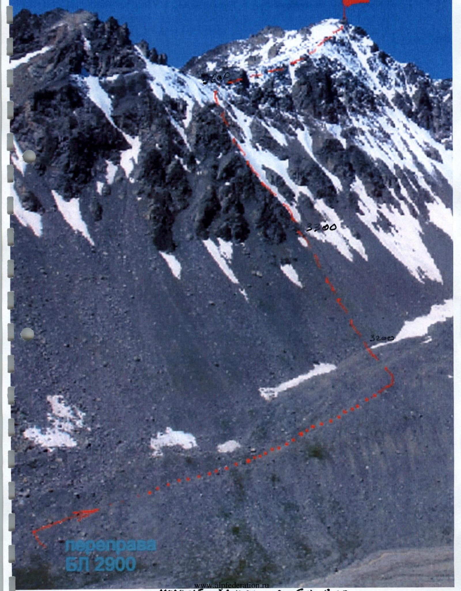
Route scheme
to peak 3930 (Paton) via the Southern ridge and SE slope
Ascent passport
| 1. | Ascent area | Caucasus, Irikchat gorge |
|---|---|---|
| 2. | Peak | 3930 m (Paton Peak) via SE slope |
| 3. | Category of difficulty | 1B, partial traverse |
| 4. | Characteristics of the route: — Height difference | 600 m |
| — Average steepness of the ridge | 25° | |
| 5. | Pitons driven: | |
| — Rock | --- | |
| — Ice | --- | |
| 6. | Time en route | 5 hours |
| 7. | Overnight stays | --- |
| 8. | Participants | V.K. Simonenko — Master of Sports, leader; V.S. Shumikhin — Master of Sports; V.S. Lebedenko — 1st sports category; V.D. Ovcharenko — Master of Sports; P.S. Slavinsky — Master of Sports |
| 9. | Coach | V.K. Simonenko, Honored Coach of Ukraine |
| 10. | Summit arrival | August 14, 2004 |
| Return to BC | August 14, 2004 | |
| 11. | Organizing body | Ukrainian Mountaineering and Rock Climbing Federation |
Brief description of the route passage
to peak 3930 (Paton Peak) 1B category via SE slope
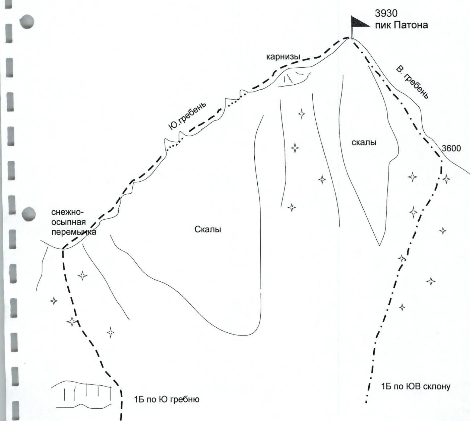
The approach to the route from the bivouac takes two hours. Crossing the Irikchat river 200 m above the bivouac. Then to the left along the gentle snowfield and along it — the approach to the "sheep's foreheads". Up the steep grassy slope from left to right — ascent to the upper snow-covered cirque. From here the entire route to peak 3930 along the southern slope opens up.
Along a gentle snowy slope, ascent in the direction of the saddle (3600 m) between the peak and the rocky massif of the eastern ridge. The main difficulty is traversing the not very deep snow and then from the saddle to the left along the eastern ridge along snow-covered scree rocks for 1 hour to the summit. To the summit tower (rocky tooth) — a 15-meter ascent from the left.
Descent along the ascent route.
The route is recommended for beginner mountaineers when performing norms for the "Mountaineer of Ukraine" ("Mountaineer of Russia") badge.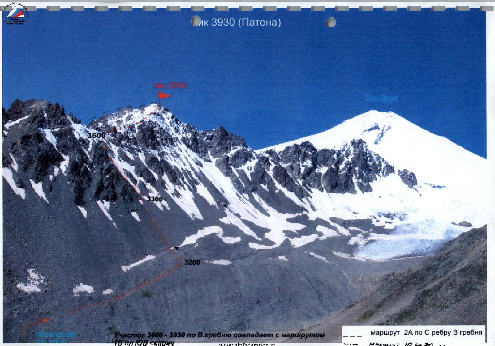
Section 3600–3930 along the E ridge coincides with the 1B route via SE slope to peak 3930
Paton Peak. View when approaching the BC along the Irikchat valley, to the left — 1B category routes along the S ridge and SE slope. In the foreground — the eastern ridge leading to Paton Peak. To the right — the approach along the valley to the 2A category route.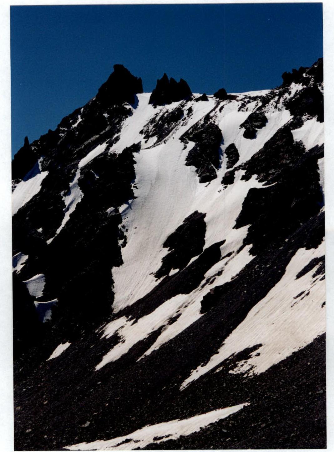
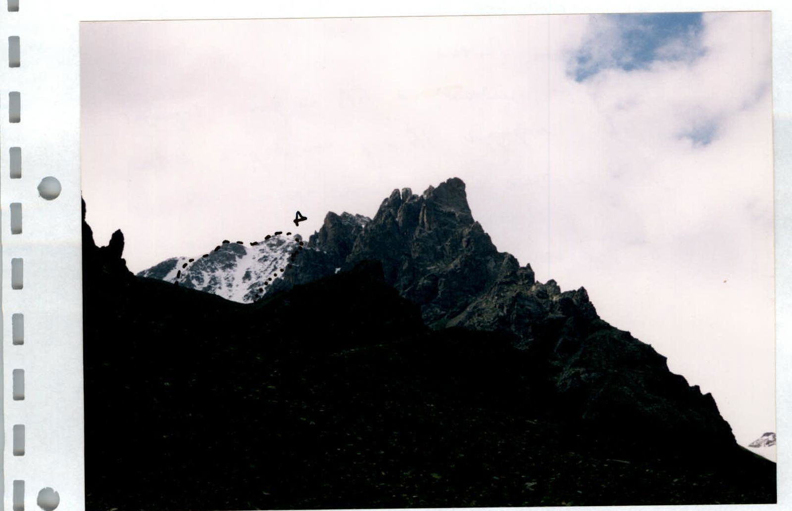
Northern ridge and 2A category route.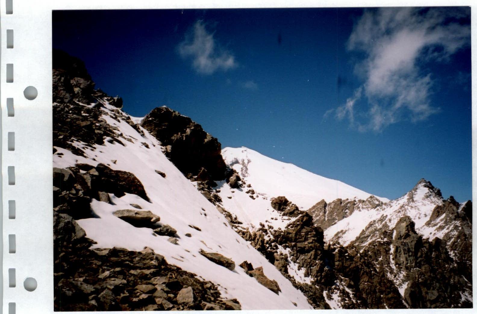
Ascent along the Northern ridge (2A) to the 3600 m saddle.
Passing the summit tower.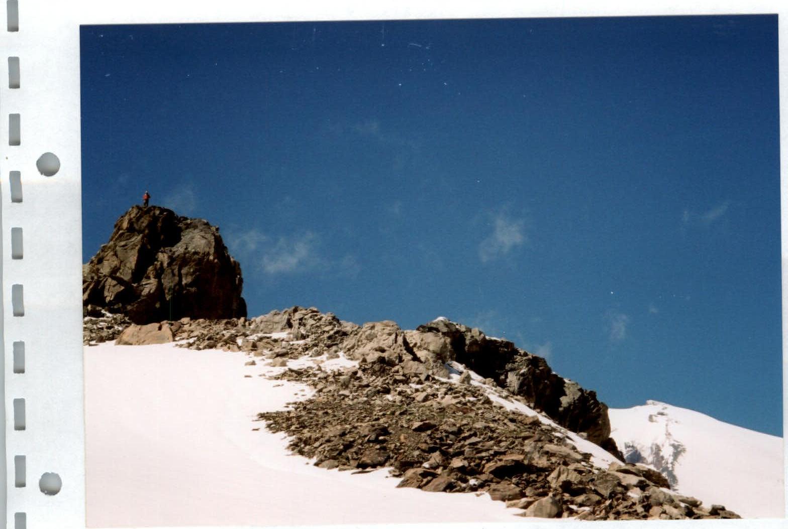
Summit tower of Paton Peak.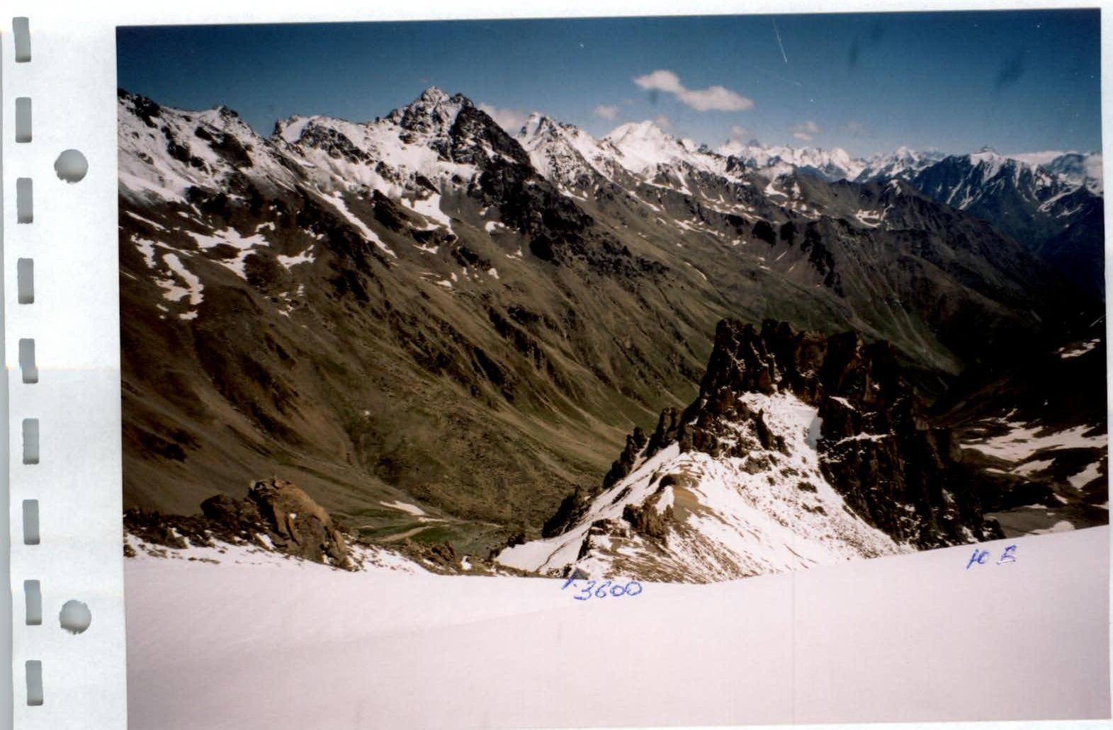
View from the summit 3930 m (Paton) down to the SE snowy slope (1B) and the Irikchat river valley. In the background — peaks: Irikchat, Kezgen, Soviet Warrior (from left to right).